
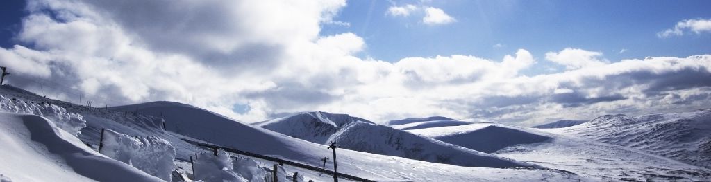
Mountain weather
South Grampian and Southeast Highlands Mountain weather forecast table
Confidence
High confidence for settled conditions, with light winds and sunshine for many, remaining for the weekend and early next week, the main uncertainties in the forecasts are about low cloud which looks likely to affect the eastern hills at times over the weekend. The other uncertainty is shower development however central Scotland looks most at risk on Saturday.
Mountain weather hazards
Hazards apply at or above 300m, reflecting the more severe conditions which can occur at altitude.
 Blizzards
Blizzards and whiteouts present challenging and serious conditions due to a combination of falling or blowing snow, strong winds and cold temperatures. They can be highly disorientating, often resulting in near-zero visibility with limited or no visual references and no distinction between ground and sky. Cliff edges and cornices may not be apparent, even close up. These conditions require very good navigational skills.
Strong Sunlight
Harmful UV levels from sunlight increase with altitude giving a greater risk of sunburn and eye damage, even on some overcast days. On breezy days, the cooling effect of wind on exposed skin may disguise any feeling of sunburn until it is too late. If there is snow cover, glare increases the effect of UV rays especially on the eyes. It is advisable to wear sun block, protective clothing such as a long-sleeved top and hat and have good quality eye protection.
Thunderstorms
Lightning is a significant mountain hazard which can result in serious injury or death. Mountain terrain often leaves one highly exposed to lightning strikes. Hail may give unpleasant conditions with torrential rain and localised flash flooding also possible, mainly in Summer months.
Mountain weather forecast
A largely dry and bright day with sunshine for many, a scattering of afternoon showers, mainly over the Cairngorms. Light winds.
| 06:00 | 09:00 | 12:00 | 15:00 | 18:00 | 21:00 | |
|---|---|---|---|---|---|---|
Weather (at 800m) |
|
|
|
|
|
|
Chance of precipitation (at 800m) |
<05% | <05% | 10% | 30% | 30% | 20% |
Wind direction and speed (mph)
Altitude above mean sea level
| 06:00 | 09:00 | 12:00 | 15:00 | 18:00 | 21:00 | |
|---|---|---|---|---|---|---|
| 1100m |
E
4
|
NE
5
|
SE
10
|
E
8
|
SE
6
|
SE
5
|
| 900m |
E
2
|
NE
5
|
SE
8
|
E
7
|
SE
5
|
SE
2
|
| 600m |
N
1
|
NE
4
|
SE
7
|
E
6
|
SE
4
|
E
3
|
| 300m |
N
1
|
E
4
|
SE
7
|
E
8
|
E
6
|
E
4
|
| Glen |
W
1
|
E
4
|
E
8
|
E
8
|
E
6
|
E
4
|
Wind gust (mph)
Altitude above mean sea level
| 06:00 | 09:00 | 12:00 | 15:00 | 18:00 | 21:00 | |
|---|---|---|---|---|---|---|
| 1100m | 5 | 8 | 15 | 13 | 8 | 7 |
| 900m | 3 | 8 | 13 | 12 | 8 | 5 |
| 600m | 3 | 7 | 13 | 11 | 8 | 4 |
| 300m | 3 | 6 | 13 | 15 | 10 | 8 |
| Glen | 4 | 6 | 14 | 16 | 11 | 9 |
Altitude above mean sea level
| 06:00 | 09:00 | 12:00 | 15:00 | 18:00 | 21:00 | |
|---|---|---|---|---|---|---|
| 1100m |
12°
|
11°
|
13°
|
12°
|
10°
|
9°
|
| 900m |
12°
|
13°
|
15°
|
14°
|
12°
|
10°
|
| 600m |
13°
|
16°
|
18°
|
16°
|
14°
|
12°
|
| 300m |
13°
|
18°
|
20°
|
18°
|
15°
|
12°
|
| Glen |
13°
|
19°
|
21°
|
17°
|
15°
|
13°
|
| Freezing Level |
2,100m
|
2,100m
|
2,400m
|
2,600m
|
2,700m
|
2,700m
|
Altitude above mean sea level
| 06:00 | 09:00 | 12:00 | 15:00 | 18:00 | 21:00 | |
|---|---|---|---|---|---|---|
| 1100m |
11°
|
10°
|
11°
|
10°
|
9°
|
8°
|
| 900m |
12°
|
12°
|
14°
|
12°
|
11°
|
10°
|
| 600m |
13°
|
16°
|
16°
|
15°
|
13°
|
12°
|
| 300m |
13°
|
18°
|
19°
|
16°
|
15°
|
12°
|
| Glen |
14°
|
18°
|
19°
|
16°
|
15°
|
12°
|
Additional weather information
Met Office Aberdeen meteorologist's view
Light winds and strong sunshine at times.
Weather
Some cloud around in the east for the start of the day but this should burn back to the coast. Otherwise a sunny morning, the warmth will trigger a few showers during the afternoon, these may be heavy and thundery at times and are likely to be restricted to the Cairngorm ranges, but it's probably worth preparing for a shower anywhere. Showers dying out in the evening with cloud likely to spread across the hills from the east during the evening.
Chance of cloud-free hill tops
80% in the east with the chance of low cloud from east affecting hill tops at first, closer to 90% further west.
Low cloud and visibility
Lower cloud in the early morning and later in the evening is likely to spread across eastern hills but will burn back early in the morning. Otherwise most summits will be clear for much of the day with very good visibility, although in a heavier shower cloud bases may drop to 700m temporarily as the shower moves through. Visibility in a shower may drop to moderate for a time.
Mountain weather information
Weather
Mostly dry on Sunday but perhaps more in the way of cloud around the hills, cloud perhaps thick enough to give some drizzle in the morning, especially around the Loch Muick, Angus Glens in the morning, best of the brighter conditions further South and West towards the likes of the Ochils, Glen Lyon and Loch Tay. Brighter spells developing in the afternoon.
Chance of cloud-free hill tops
50%, cloudy at times for summits further east, the best chances in the south and west.
Maximum wind speed expected
Northeasterly becoming southeasterly 5 mph.
Temperature
- At 800m Plus 6 rising to 10 Celsius
- Glen Plus 10 rising to 18 Celsius.
- Freezing level Above all summits.
Low cloud and visibility
Scattered layers of cloud above 600m in the east, further west cloud will be patchy above 700m. Visibility poor at times in the east. Good or very good in the west.
Mountain weather information
Mon 20 May
Sunrise:
Sunset:
Remaining settled for the early part of next week with plenty of sunshine and light southeasterly winds. Some low cloud in places but keep following the latest forecasts for details.
Tue 21 May
Sunrise:
Sunset:
Cloudier morning, then dry and bright at times but some showers possible in the afternoon, winds remaining light and from a southeasterly direction.
Wed 22 May
Sunrise:
Sunset:
Cloudy but dry start, brighter afternoon with showers or perhaps longer spells of rain later.
Updated at:
Summit specific forecast
Mountain summit forecast map
Loading map…
Key
Including South and East Cairngorms National Park, Aberdeenshire and Angus Hills, Ben Vrackie, Ben Lawers, Loch Tay and Ochils
For snow and avalanche hazard forecasts please visit Scottish Avalanche Information Service