High pressure gives way to unsettled weather
Author: Press Office
12:35 (UTC+1) on Mon 23 Sep 2019
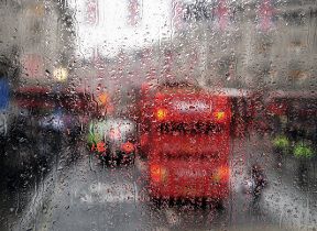
After last week’s sunny and settled weather, this week low pressure is in control bringing spells of wet and windy weather to many across the UK.
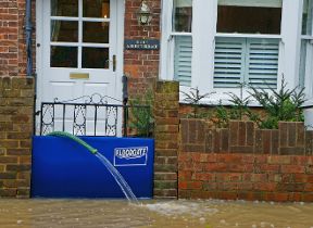
Met Office has issued a yellow weather warning that is currently in force, as a deep area of low pressure brings spells of very heavy rain to much of England and Wales.
Chief Meteorologist, Neil Armstrong, said: “Many people will have noticed a big change in the weather this week, as last week’s warm and sunny weather has given way to spells of heavy rain and strong winds mixed with some drier, brighter spells.
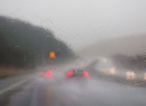
“Tuesday will be wet across much of the UK, particularly England and Wales, where heavy rain could see 30-50mm falling in a short time and up to 70mm in some isolated spots. The heavy rain will be accompanied by hail, thunderstorms and gusty winds, leading to flooding and difficult driving conditions.”
Tuesday’s low-pressure system contains the remnants of Hurricane Humberto, bringing with it warm and humid air. This system will clear eastwards later on Tuesday, however low-pressure will stay in charge for the rest of the week, with largely bright and breezy weather and some showers or longer spells of rain at times."
Looking further ahead to the weekend, Neil Armstrong continued: “It’ll be an unsettled weekend as low pressure remains in charge – there are some early signals for another deep area of low pressure forming on Sunday – this in combination with high Spring tides means could bring another spell of severe weather and risk of flooding.
“Sunday’s system has yet to develop however and there are uncertainties about the exact impacts this far ahead - we’ll keep people updated throughout the week.”
You can find the latest Met Office forecast on our forecast pages and by following us on Twitter and Facebook, as well as using our mobile app which is available for iPhone from the App store and for Android from the Google Play store.
Updated at 12:35 (UTC+1) on Mon 23 Sep 2019