Will Hurricane Lorenzo affect the UK?
Author: Press Office
10:57 (UTC+1) on Tue 1 Oct 2019
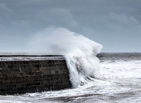
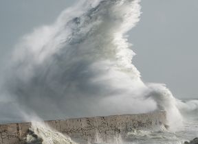
Lorenzo will arrive in the UK and Ireland as an ex-hurricane later this week, bringing very strong winds and heavy rain to western areas of the UK.
Currently to the southwest of the Azores, Lorenzo is the strongest hurricane to have been recorded so far east in the Atlantic. Lorenzo is expected to maintain Category 2 (105mph) winds as it passes close to the Azores today and Wednesday, before transitioning into a deep low pressure system as it follows a north-easterly track towards the UK and Ireland.
Chief Meteorologist at the Met Office, Dan Suri said: “There has been considerable uncertainty over the potential track of Lorenzo after it passes The Azores. However we are now increasingly confident the remnants of Lorenzo will move towards the UK, bringing a spell of wet and very windy weather to western parts on Thursday and Friday.
“At the moment the strongest winds are expected in western Ireland, with a risk of coastal gales developing in Northern Ireland and western Scotland on Thursday and Wales and south-west England on Friday. Ex-Lorenzo will also bring spells of heavy rain to north-western parts of the UK through Thursday and Friday, particularly in Northern Ireland, western Scotland, central England and Wales.
“Our advice is to pay close attention to the weather forecast over the next couple of days and to keep an eye out for any weather warnings that may be issued in your area.”
Deputy Chief Meteorologist, Tony Wardle said: “The remnants of ex-Hurricane Lorenzo will gradually pull away from the UK later on Friday, though it’ll remain unsettled with further spells of wet and windy weather as we head into the weekend.”
You can get the most accurate and up to date forecast for your area using our forecast pages and by following us on Twitter and Facebook, as well as using our mobile app which is available for iPhone from the App store and for Android from the Google Play store.