Prolonged rain triggers series of rainfall warnings
Author: Press Office
15:06 (UTC) on Fri 19 Feb 2021
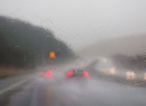
The UK’s weather over the next few days has a strong southerly influence, bringing higher temperatures but also considerable rainfall in the west.
Steve Willington is a Chief Forecaster with the Met Office. He said: “Mild air - from much further south in the Atlantic - is being directed towards the UK. Although this will keep temperatures much higher than average, the main focus should be on the heavy and prolonged rainfall. There are a number of Yellow national severe weather warnings for rain currently in force and with the prolonged rainfall we have a pattern of Yellow warnings in operation until Sunday.
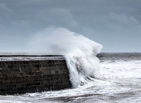
“Of most concern is rainfall in South Wales and here an Amber warning for rain for part of the region is in force from 8pm this evening (Friday) until 6pm* on Saturday In parts of the warning area we could see some locations receiving around 200mm of rain during the warning period. This is a considerable amount of rain in a short period, so people need to be aware of the risk of localised flooding, especially surface-water impacts. Additionally strong to gale force winds will be an additional hazard.”
With numerous weather warnings issued for heavy #rain over the coming days, here is a closer look at the rainfall forecast for today and Saturday
— Met Office (@metoffice) February 19, 2021
Stay #WeatherAware pic.twitter.com/70WTa6S7IN
At this time of year it is more usual to witness weather systems arriving from a southwesterly direction. Steve Willington added: “With the prolonged rainfall approaching from the south rather than the southwest, there may be some differences in the usual pattern of rainfall. Many of the areas covered by the warnings usually experience heavy rain, but with the rain coming from a less typical direction some of the impacts may be vary accordingly as different areas may experience higher than usual volumes of rain.”
The southerly flow will keep temperatures across the UK much higher than average over the weekend, especially across parts of eastern and southern England. There is potential for sheltered locations north of London to even reach 17.0 C over the weekend.
The higher temperatures are expected to remain into next week, but these will be accompanied by unsettled conditions with further periods of heavy rain.
Dr Mark McCarthy is the head of the Met Office’s National Climate Information Centre. He commented: “With temperatures potentially in the upper teens this weekend the lowest and highest temperature of this winter could have occurred within 10 days of each other with almost a 40C difference between the two extremes. The lowest temperature so far this year (-23.0 C) was recorded at Braemar on 11 February. This was the lowest daily minimum in the UK since 1995.”
Keep up to date with the latest forecast for your area using our forecast pages and by following us on Twitter and Facebook, as well as using our mobile app which is available for iPhone from the App store and for Android from the Google Play store.
* Following a forecast update the end period of the Amber warning for rain in south Wales was shortened by two hours. It ended at 4pm, instead of 6pm.