Remaining cold with potential further rain – Jan '21
Author: Press Office
14:10 (UTC) on Fri 22 Jan 2021
The colder conditions following Storm Christoph will remain until early next week, when conditions are due to become more unsettled once more
Colder conditions
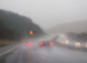
With an emphasis on rainfall over the last few days, the focus for the UK forecast for the weekend and the early part of next is colder conditions and associated wintry hazards.
National Severe Weather Warning
A number of National Severe Weather Warnings are in place over the weekend for ice and snow across swathes of the UK.
Steve Willington is a Chief Forecaster for the Met Office. He said: “The exit of Storm Christoph – which brought the heavy rain to a central band of the UK – has established a flow of colder air from Iceland and the Arctic. And this is bringing a mix of wintry hazards across the UK.
“In clearer conditions, overnight ice will remain a hazard, while a band of snow is likely to bring falls of 1-3cm quite widely across central areas of the UK, particularly the Cotswolds and higher ground in the East Midlands on Sunday. But snow outside these areas is also a potential hazard.”
Atlantic-dominated weather
Chris Tubbs is a Deputy Chief Forecaster for the Met Office. He added: “The cold conditions are forecast to remain across the UK until Tuesday, when more Atlantic-dominated weather is due to exert an influence, gradually bringing milder, but wetter conditions to the UK once more, although this may take a while to reach the north-east of the UK. Once the certainty increases about which areas are most likely to be affected by potentially heavy rain, we may need to issue further warnings, especially if next week’s rainfall is likely to compound the impacts from this week.”
Environment Agency
Dr Kate Marks, Flood Duty Manager at the Environment Agency, said: “Our thoughts are with anyone who has been affected, and our teams are working round the clock, deploying temporary flood defences and closing flood barriers, and so far have protected over 27,000 properties.
"River levels remain exceptionally high in parts of northern and central England as a result of this week’s rain from Storm Christoph. It could bring flooding to some areas, particularly along parts of the River Severn today and Saturday, with a risk of damage to buildings in some communities. There’s also a chance of localised flooding of land and roads across parts of the North West of England on Tuesday due to further rain.
Flood risk
"We urge people to keep away from swollen rivers and not to drive through flood water – it is often deeper than it looks and just 30cm of flowing water is enough to float your car. People should check their flood risk, sign up for free flood warnings and keep up to date with the latest situation at via Gov.uk or follow @EnvAgency on Twitter for the latest flood updates.”
Stay connected
Keep up to date with the latest weather warnings and the forecast for your area using our warning and forecast pages on our website. You can also follow us on Twitter and Facebook, as well as using our mobile app which is available for iPhone from the App store and for Android from the Google Play store.