Christmas weather forecast
Author: Press Office
14:22 (UTC) on Fri 22 Dec 2023
It’ll be a wet and windy run-up to Christmas for many, with a number of weather warnings in force.
Low pressure is the dominant force for the UK weather in the run-up to Christmas, bringing periods of strong winds and heavy rain for some, which has the potential to be impactful.
With rain warnings in force on Saturday into Sunday, the highest accumulations will initially fall in the west of Scotland, before shifting to Wales and northwest England early on Sunday.
Warnings for wind have been issued for Sunday and into the early hours of Christmas Day, focusing on the north of Scotland and the northeast of England. To the east of the Pennines, gusts could be in excess of 60mph for a time, which has the potential to disrupt transport networks.
In addition, Yellow warnings for snow and ice have been issued for Shetland and northeastern parts of Scotland during the weekend. For Shetland, 2-5 cm of snow is possible in a few places from frequent showers on Friday into Saturday, which could lead to some travel disruption.
There are currently yellow weather warnings out for rain, wind and snow & ice which may cause some travel disruption during the Christmas period ⚠️
— Met Office (@metoffice) December 22, 2023
Latest info 👉 https://t.co/QwDLMfRBfs
Take a look below for a summary of the warnings currently in place 👇 pic.twitter.com/qoVkdNlJ43
Met Office Deputy Chief Meteorologist Steven Keates said: “It’s a windy weekend for many, with some heavy rain expected too, especially in the west, with a number of weather warnings in force.
“Low pressure to the north of the UK is chiefly responsible for this period of unsettled weather, with a number of weather fronts bringing periods of heavy and persistent rain, particularly in western Scotland and Wales through Saturday and into Sunday.
“Those further east will generally see drier conditions through the weekend, though even here will see some showers at times. Temperatures in the south will be very mild for the time of year, likely peaking at around 15°C in the far southeast on Saturday.”
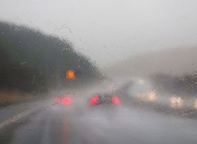
RAC Breakdown Spokesperson Rod Dennis said: “With this latest weather warning affecting a large area of Scotland and parts of northern England, there is the chance travellers’ last-minute getaway trips could be disrupted. If trains are significantly delayed people are more likely to shift to the roads which could add to already exceptionally high traffic volumes. Nationally, we expect around 3.2m separate getaway journeys to be made today by car.
“For this reason, we urge drivers to be on their guard for debris in the road, including branches and possibly even trees, especially along more rural routes. Gusty conditions can also make driving more difficult, so it’s advisable drivers reduce their speed and stay focused on the road ahead.”
Christmas Day
A wet start to Christmas Day is likely for many in the south of the UK, with some further rain also likely in parts of western and southern Scotland and Northern Ireland.
The rain in the south is likely to gradually move to the south and east through the day, with the far southeast likely to hang on to the rain the longest through the day.
A White Christmas – which is defined by the Met Office as a single snowflake falling on Christmas Day – is likely, with some snow falling over the mountains of central and northern Scotland, with the possibility of some flakes at lower ground in this area for a short period.
Steven continued: “It’ll be a damp start to Christmas Day for many, though the best of any drier weather is likely in the afternoon as weather fronts gradually move to the south and east. However, the far southeast may hold on to the persistent rain the longest through the day.”
Further ahead
Looking towards the New Year, despite a drier interlude for many on Boxing Day, the weather will remain unsettled with low pressure bringing breezy and wet conditions for many through the week.
You can keep up to date with the latest forecast on our website, by following us on Twitter and Facebook, as well as on our mobile app which is available for iPhone from the App store and for Android from the Google Play store.