More rain to come
Author: Press Office
11:29 (UTC) on Wed 3 Jan 2024
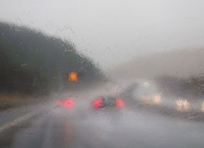
It remains unsettled for much of England with a band of rain moving northeast across south and east England.
A yellow National Severe Weather Warning for rain has been issued running from 12 noon to the early hours of Friday morning.
⚠️ Yellow weather warning UPDATED ⚠️
— Met Office (@metoffice) January 4, 2024
Rain across parts of southern and eastern England
Thursday 1200 – Friday 0300
Latest info 👉 https://t.co/QwDLMfRBfs
Stay #WeatherAware⚠️ pic.twitter.com/BNF625117R
Met Office Chief Meteorologist Matthew Lehnert said: “The track of the heaviest rain remains a little uncertain, but 10 to 20 mm of rain is likely to fall in a 6-to-9-hour period across much of the warning area, with a few places seeing as much as 30-40 mm. These higher accumulations more likely across central southern England.
“Much of this rain is falling on already wet ground and therefore, impacts are more likely. Strong winds may also accompany this heavy rain across southern and particularly southeast England this evening and overnight. Meanwhile, a weather front will continue to bring rain and showers across the northeast.”
Further ahead
The weather patterns are changing. Drier, calmer and also colder weather is on the way for the weekend and beyond.
— Met Office (@metoffice) January 3, 2024
Watch the full 10 day trend here 👉 https://t.co/R1ZLItxWOh pic.twitter.com/nSD5EVDgP9
The rain or showers will then ease with many regions becoming fine and dry over the weekend as high pressure looks likely to become established either over the UK or just to the north of the country, marking a change in weather with a move to a colder, drier and settled period for most.
It will become rather cold next week with lower-than-average temperatures across much of the country. Frost is likely overnight and, given the ground moisture, calm conditions, and long nights, there is also a risk of fog and icy conditions.
UK Health Security Agency has issued a cold weather alert covering the whole of England valid from 9am on 6th January to 12 noon on 9th January. Temperatures likely to be below average especially overnight with much more overnight frost than of late. Ice is likely to be an issue given the very wet ground in most areas.
You can keep up to date with the latest forecast on our website, by following us on Twitter and Facebook, as well as on our mobile app which is available for iPhone from the App store and for Android from the Google Play store.

Updated at 11:33 (UTC) on Thu 4 Jan 2024