Rain, wind and winter hazards in the forecast for the week ahead
Author: Met Office
13:41 (UTC) on Mon 16 Feb 2026
Unsettled weather continues for the UK this week, with rain, wind, snow and ice in the forecast bringing the potential for disruption.
Tuesday will be a dry and bright day for many, albeit remaining cool with wintry showers for the Northern Isles and along some eastern coasts. Rain may spread into the far southwest during the afternoon.
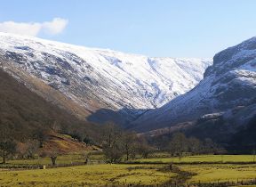
Winter hazards possible
With cold air in position over the UK, further winter hazards are possible on Wednesday. Low pressure from the west and southwest brings the possibility of rain, sleet and snow for parts of England and Wales. A Yellow warning for rain has been issued for much of southern England, with a Yellow warning for snow for much of Wales and parts of the Midlands.
⚠️ Yellow weather warning issued ⚠️
— Met Office (@metoffice) February 17, 2026
Snow across parts of Wales and central England
Wednesday 1600 – Thursday 0600
Latest info 👉 https://t.co/QwDLMfRBfs
Stay #WeatherAware⚠️ pic.twitter.com/LHNfg2iPdj
Met Office Deputy Chief Forecaster Steven Keates explained the outlook: “On Wednesday, weather fronts are expected to move in from the Atlantic into some western, southern and central areas of the UK. As they bump into the cold air already in place, we are likely to see some snow developing, although there is still some uncertainty around the details.
“Initially, we may see some snow over the highest parts of southern England, such as Dartmoor, but the main chance of snow will be across higher parts of the Midlands and mid and southeast Wales. Above 150 to 200 metres, 2–5 cm of snow may accumulate, with a few places-most likely above 300 metres-possibly seeing 10 cm or more.
“Some small accumulations are also likely over the Chilterns and perhaps Salisbury Plain. Falling snow to lower elevations in this general area is possible too, though accumulating snow is less likely.
“Across southern England, rain will be the main focus, with 10 to 20 mm falling quite widely during Wednesday and into early Thursday, and a few spots, such as Dartmoor, quite possibly seeing double that amount. Strong east to northeast winds will accompany the wet weather.
“Temperatures will be around 3 to 5 °C for much of the UK on Wednesday (away from the far southwest). A sharp frost is likely across parts of Scotland into Wednesday morning, with some further frost and ice in places overnight into Thursday.”
READ MORE: How far ahead can snow be forecast in the UK?
You can find the latest forecast on our website, on YouTube, by following us on X and Facebook, as well as on our mobile app which is available for iPhone from the App store and for Android from the Google Play store.

Updated at 10:46 (UTC) on Tue 17 Feb 2026