Building capacity and improving climate resilience in the Philippines
Improving resilience to weather and climate extremes
Typhoon Haiyan (locally named Yolanda) struck the Philippines in November 2013, causing significant damage and loss of life. In response, the UK Department for International Development (DFID) pledged support for the recovery and reconstruction effort. DFID is funding the Met Office, in partnership with the Philippine Atmospheric, Geophysical and Astronomical Services Administration (PAGASA), to help strengthen PAGASA's technical capabilities as well as provide state-of-the-art information to guide decisions and build resilience to future climate-related risks.
Project summary
The partnership is focused around:
- Developing regional climate model simulations to assess the impacts of climate change on future tropical cyclone activity; and
- Building capacity to utilise existing / future climate information, through provision of training activities (inc. secondments) for PAGASA and through working with local government to develop processes to inform local planning and decision making.
A comprehensive review on the issues around the current provision of climate hazard and risk information (Spring 2015), involving consultation with over 300 stakeholders, identified a number of barriers and opportunities. These included a large volume of under-utilised historical climate risk information, a lack of capacity at the local government unit (LGU) level to translate existing information, issues related to the complexity of currently available information, and access to information by end-users.
Following recommendations, two LGU “pilots” (Three Cities within the Metropolitan Manila Area, and Salcedo, Eastern Samar) were developed to help improve the current situation. Pilots focused on selected climate sensitive sectors (e.g. agriculture, health, livelihoods) across the “supply chain” of climate information, covering information production, translation into risks and impacts, and communicating risk information to end-users. The pilots (Jan–Oct 2016) adopted a novel user-needs based approach involving multiple interactive workshops to ensure the process was a collaborative effort between both the producers and users of climate information. The pilots included local planners, people working in disaster risk reduction and the health sector, housing officers and community level (Barangay) officers. Outputs included the provision of training to over 100 local community members on how to use climate information, and development of a clear process to integrate climate information into local and sectoral planning and decision making.
Above: Photo of the DFID Philippines Manila Three Cities stakeholders.
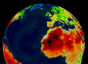
Given the motivation to inform resilience building following Typhoon Haiyan, the project also generated valuable new information on future tropical cyclone risks in the Philippines region, strengthening collaboration between scientists in the UK and the Philippines. This involved the generation and analysis of high resolution future climate simulations, using a regional climate model (HadGEM3-RA) developed at the Met Office Hadley Centre. PAGASA also produced new simulations, using a consistent methodology and the latest version of the regional climate modelling system PRECIS. Analysis of complimentary simulations using the RegCM4 and CCAM models also provides additional information. The modelling methods and results of the simulations are described in a technical report, a synthesis report, and a summary “information brief” (see outputs below). The results provide insight into the variable and changing nature of tropical cyclones and climate extremes in the Philippines.
In addition to the climate model simulation work, an international workshop, jointly facilitated by the Met Office and PAGASA, was held in Manila in February 2016. This event brought providers together with researchers from multiple institutions and practitioners to compare modelling approaches. This event, and the output of the project modelling work, have contributed to PAGASA’s new national climate projections.
Above: PRECIS installation on new PAGASA computer cluster.
A final component of the project focused on the development of regional sea level projections using a tool developed by the Met Office Hadley Centre and collaboration with PAGASA scientists through secondments to the UK. The approach advances on the available global projections of sea level change over the next century, provided by the Intergovernmental Panel on Climate Change (IPCC), to estimate different contributions to regional sea level rise in the Philippines - e.g. from melting glacier ice, gravitational effects, and ocean dynamics. The projections are available for different regions of the Philippines and they build on current knowledge, providing a first step towards more localised sea level projections to inform long-term coastal planning decisions.
Learning across the project has informed the development of a supporting “enabling roadmap” and action plan identifying what is required to mainstream climate information into national to local planning and decision-making over the short to medium term (2017-2022 - i.e. next five years). The roadmap is expected to provide a number of benefits by: i) Providing a common understanding of opportunities, barriers and actions required to improve climate-related risk information delivery by PAGASA and uptake at various levels; and ii) Paving the way for strengthening collaborations between PAGASA and different government departments, to improve resilience and ultimately benefit the Philippines society.
For more information on the project, please contact the Met Office using the contact names provided at the bottom of this page.
Project outputs
Literature and stakeholder review
- Assessment of current understanding of risks: Executive Summary
- Synthesis of literature and available climate information to support resilience-building following Typhoon Haiyan (Yolanda) in the Philippines: Summary for Policymakers
- Synthesis of literature and available climate information to support resilience-building following Typhoon Haiyan (Yolanda) in the Philippines: Summary for Scientists
- Improving resilience to severe weather and climate change in the Philippines (PAGASA) - extended case study
Climate science reports
- Information brief: Future tropical cyclone risk in the Philippines
- Technical Report: Methodological approach and results for HadGEM3-RA climate projections
- Synthesis Report: Key Findings from Climate Model Projections
- February 2016 workshop report: reviewing available methods and climate data for use in climate projections for the Philippines
- Projections of mean sea level change for the Philippines
Pilots to improve uptake of climate information
Enabling roadmap and action plan
Contacts
Project manager: David Corbelli
Science lead: Joseph Daron