Click on the name of the tropical cyclone to see a chart of the observed track and forecast tracks from the Met Office global model. Verification statistics on each tropical cyclone are available upon request from [email protected]. At the end of the season a verification report on the performance of the Met Office global model will be published.
North-west Pacific
| Name & ID |
Start & end dates |
1-/10-minute MSW |
Comments on Met Office global model forecasts |
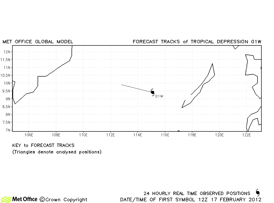
| 01W |
17-18 February |
25/30 knots |
01W did not attain tropical storm status and no forecasts were verified. |
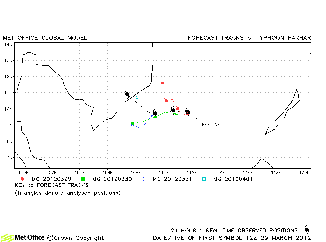
| Pakhar (02W) |
29 March-01 April |
65/40 knots |
Track forecast errors were low for this storm, although landfall was not predicted. |
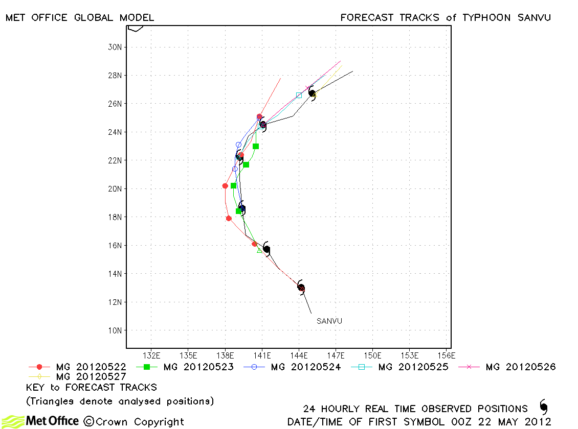
| Sanvu (03W) |
21-27 May |
80/60 knots |
Short lead time forecasts had small errors, but at longer lead times there was a slow bias resulting in errors larger than last season's average. |
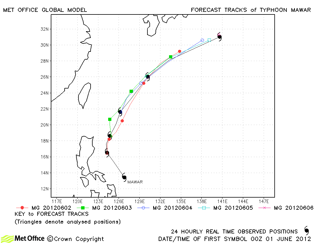
| Mawar (04W) |
31 May-06 June |
100/75 knots |
Track forecast errors were below last season's average and skill scores against CLIPER were high. |
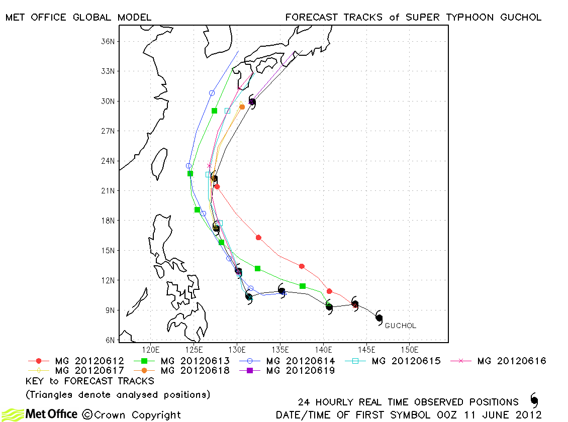
| Guchol (05W) |
11-19 June |
130/100 knots |
Track forecast errors were lower than last season's average at some lead times, but higher at others. Skill scores were high. Recurvature was successfully predicted, but some of the track detail was in error. |
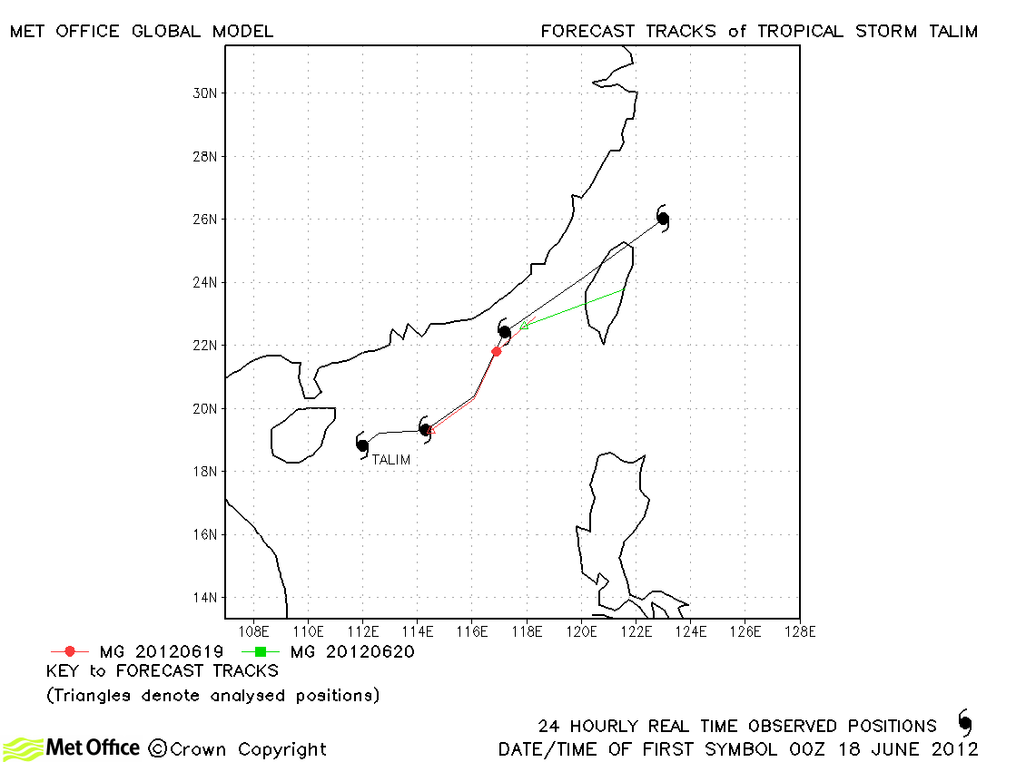
| Talim (06W) |
17-21 June |
50/50 knots |
The direction of motion was well predicted, but the predicted speed of motion was a little low. |
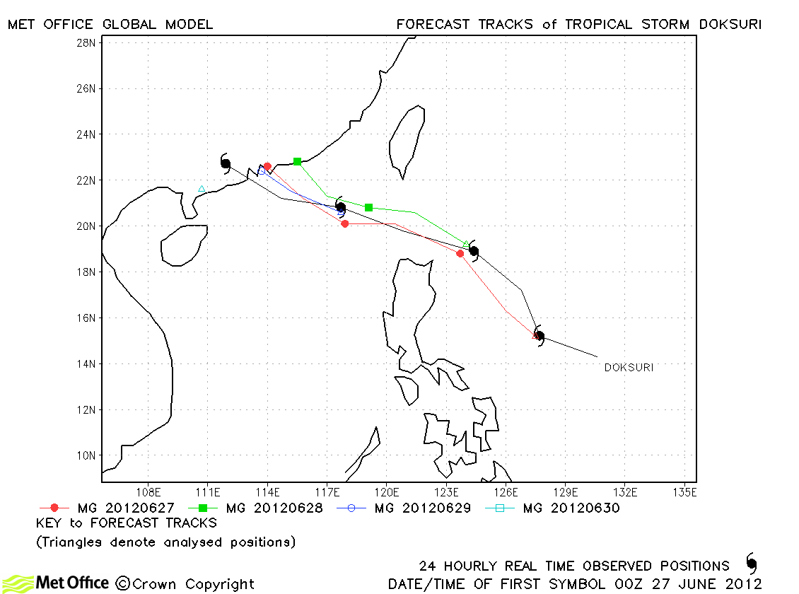
| Doksuri (07W) |
26-30 June |
50/40 knots |
The track and landfall of Guchol was generally well predicted. |
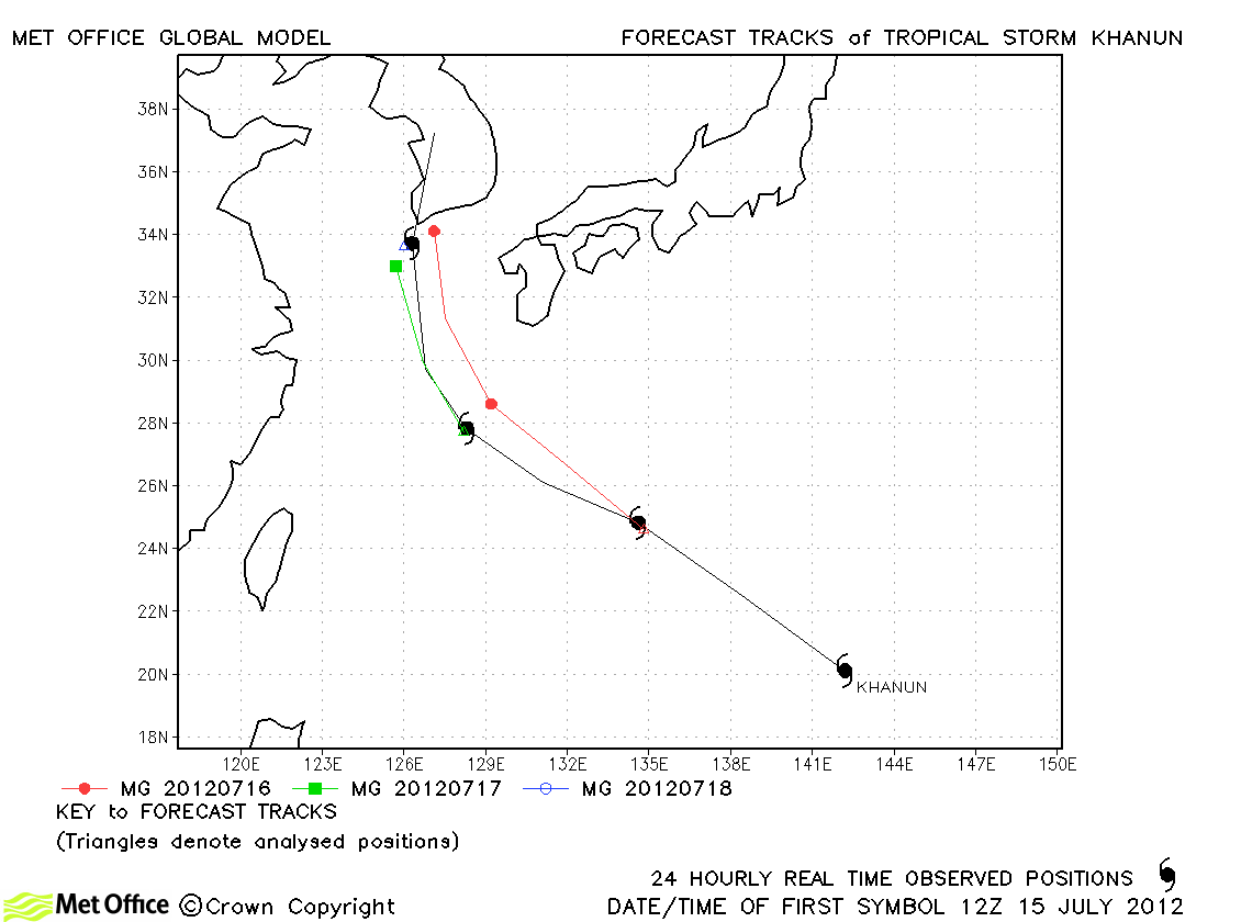
| Khanun (08W) |
15-19 July |
50/50 knots |
Track forecast errors were near to or below last season's average for this storm. |
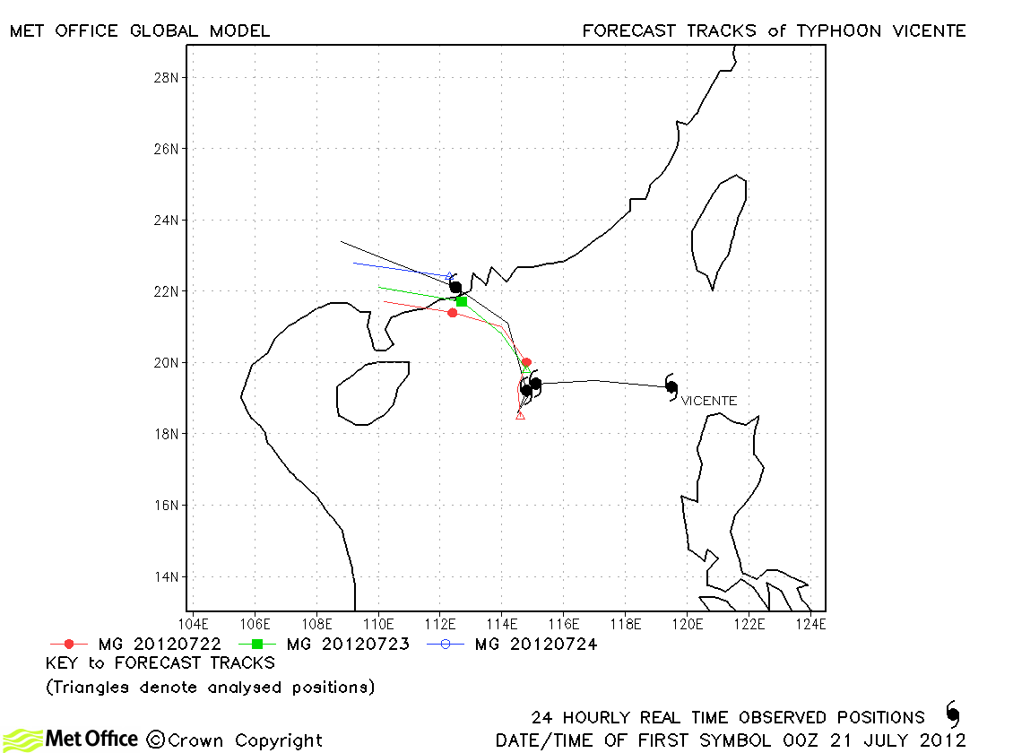
| Vicente (09W) |
20-24 July |
115/80 knots |
Track errors were low and skill scores high for this storm. |
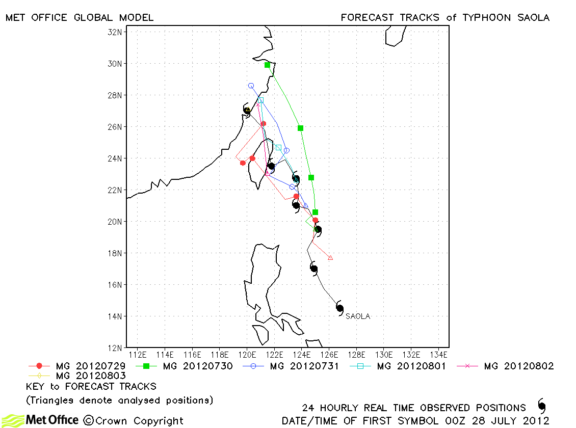
| Saola (10W) |
28 July-03 August |
90/70 knots |
| Track forecast errors were below last season's average and skill scores high for this typhoon. |
|
|
|
|
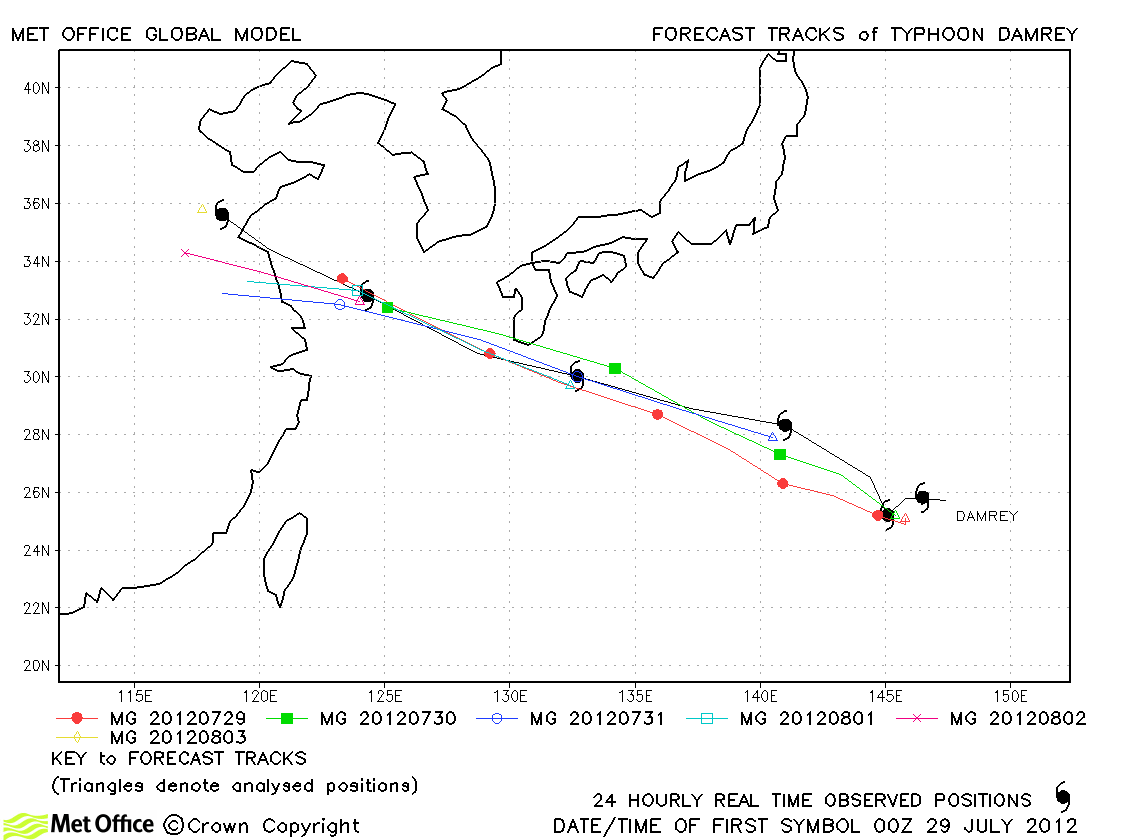
| Damrey (11W) |
28 July-03 August |
75/70 knots |
Track forecast errors were mostly low and skills cores high for this typhoon. A few longer lead times forecasts were larger with a slow bias. |
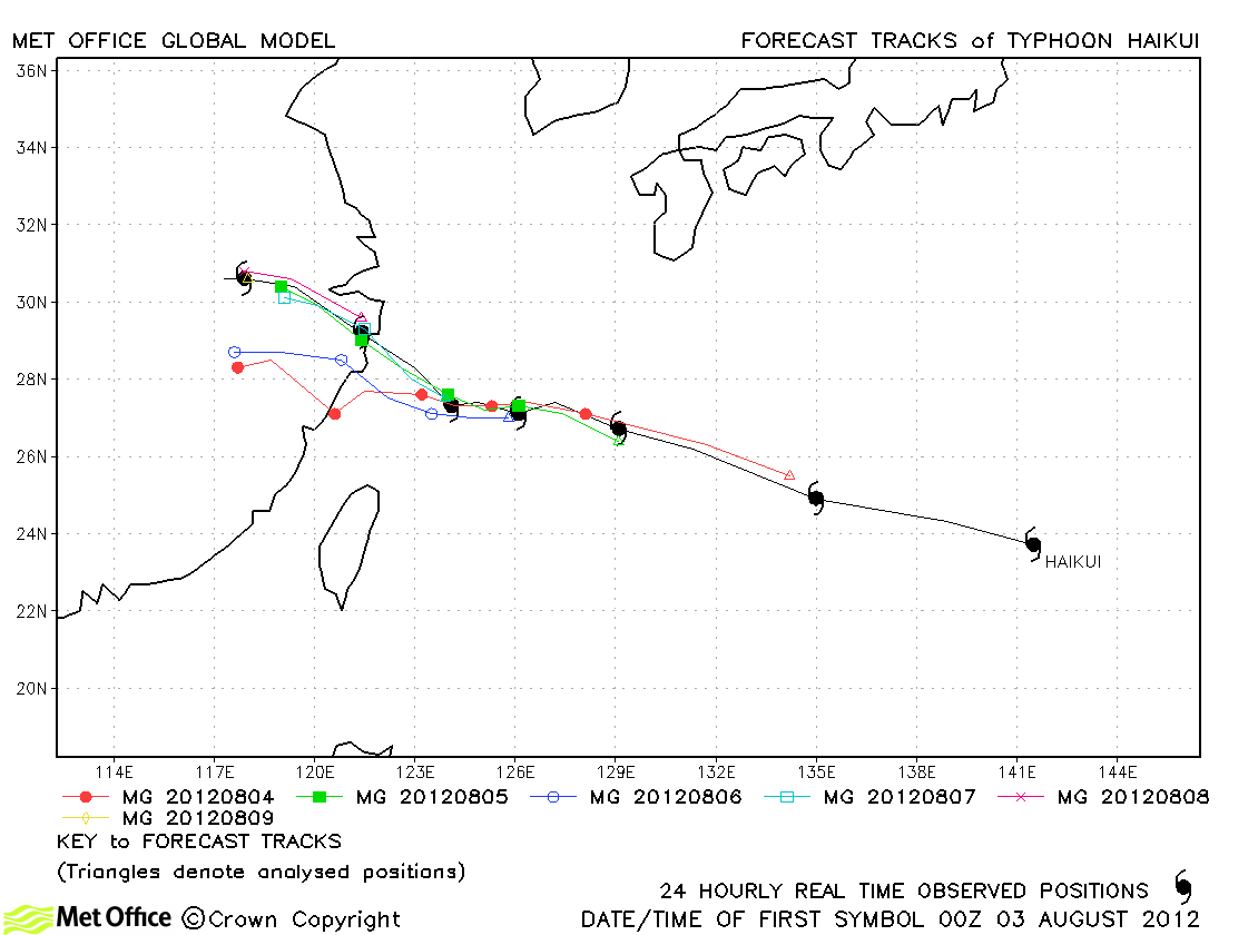
| Haikui (12W) |
02-09 August |
65/65 knots |
| Track forecast errors were low and skill scores high for this typhoon. |
|
|
|
|
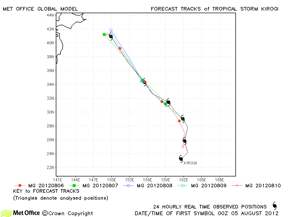
| Kirogi (13W) |
04-10 August |
45/50 knots |
| Apart from the first forecast for this storm, track forecast errors were very low and skill scores very high. |
|
|
|
|
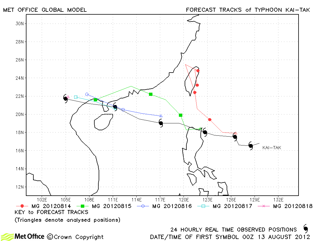
| Kai-tak (14W) |
12-18 August |
70/65 knots |
| The model had a marked right-of-track bias early on for this typhoon resulting in some larger than average track forecast errors and low skill scores. |
|
|
|
|
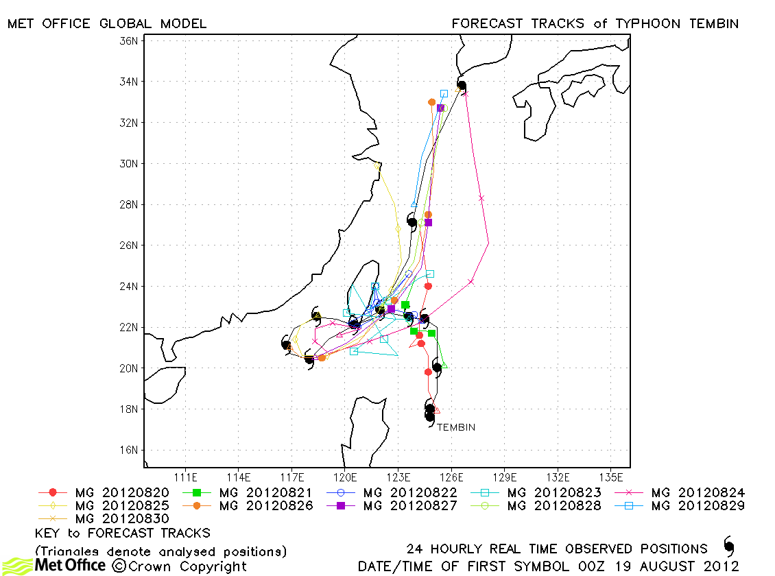
| Tembin (15W) |
19-30 August |
115/90 knots |
Track forecast errors were low and skill scores high for this typhoon. The first landfall on Taiwan and the subsequent reversal in direction were well predicted. The only poor aspect of forecasts was a few runs which merged Tembin with Bolaven instead of keeping them as separate entities. |
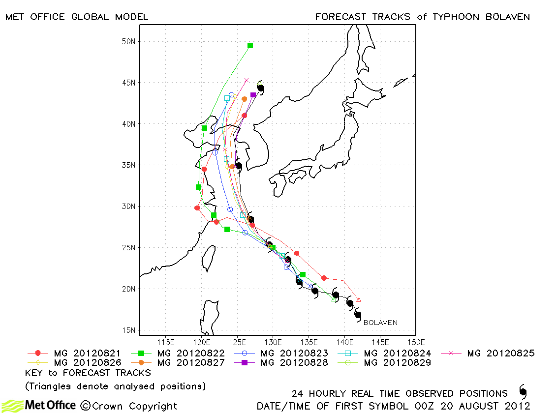
| Bolaven (16W) |
20-29 August |
125/100 knots |
Some early forecasts had a fast bias and some forecasts showed an erroneous interaction with Tembin resulting in a left-of-track bias. Thus track forecast errors were mostly larger than average. |
| Sanba (17W) |
10-17 September |
150/110 knots |
Short lead time track forecast errors were low, but longer range errors high due to a slow bias. Skill scores against CLIPER were high. |
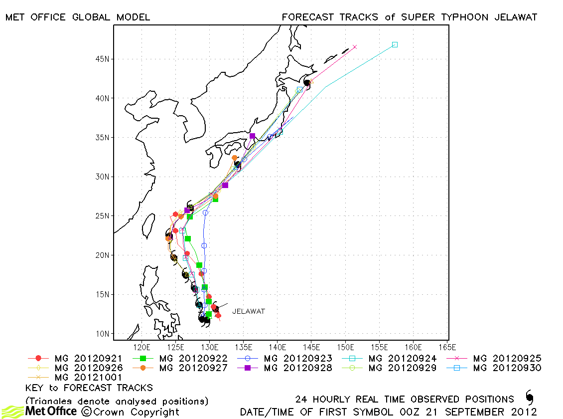
| Jelawat (18W) |
20 September-01 October |
140/110 knots |
Track forecast errors were near to or above last season's average. there was a right-of-track bias. Skill scores against CLIPER were high. |
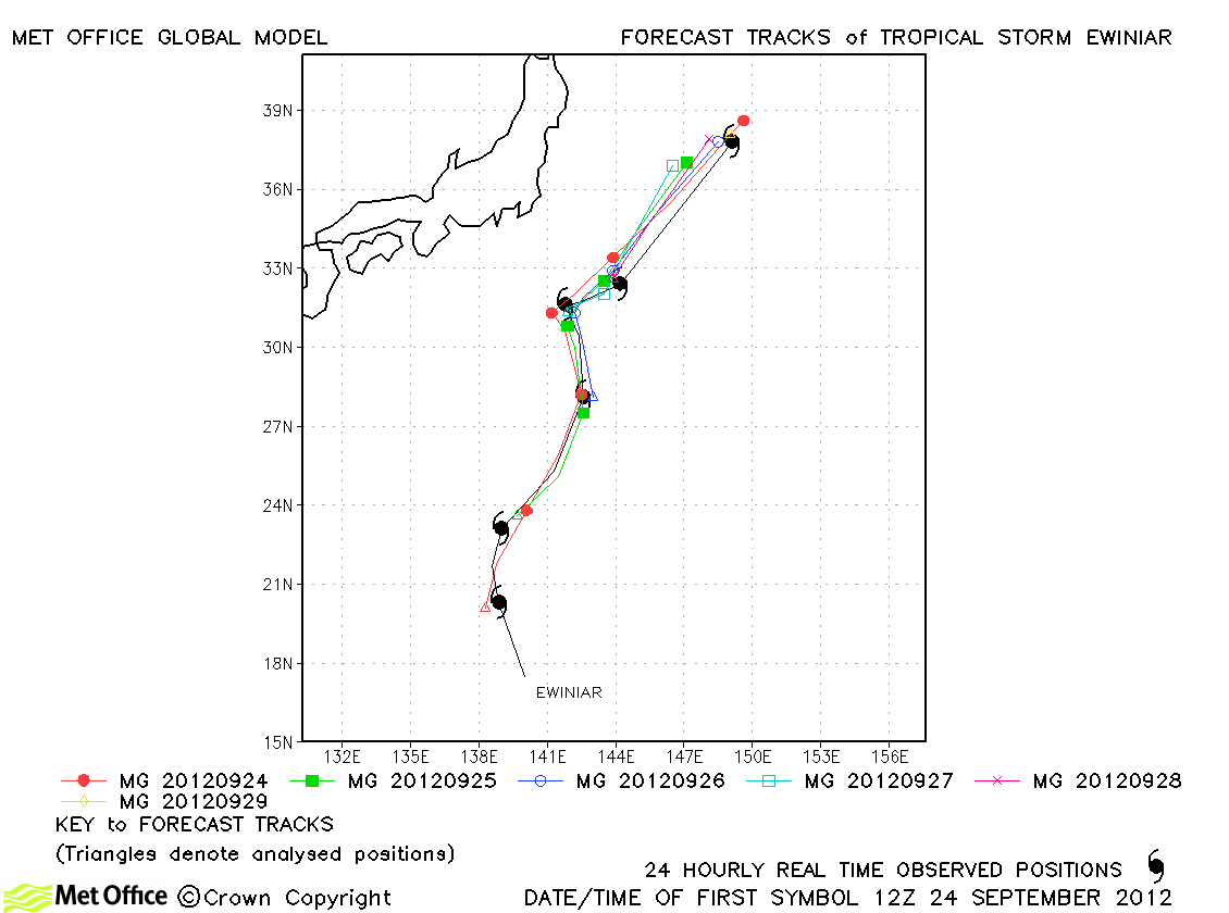
| Ewiniar (19W) |
24-29 September |
55/50 knots |
Ewiniar was exceptionally well forecast by the model. Skill scores were very high and track forecast errors low. |
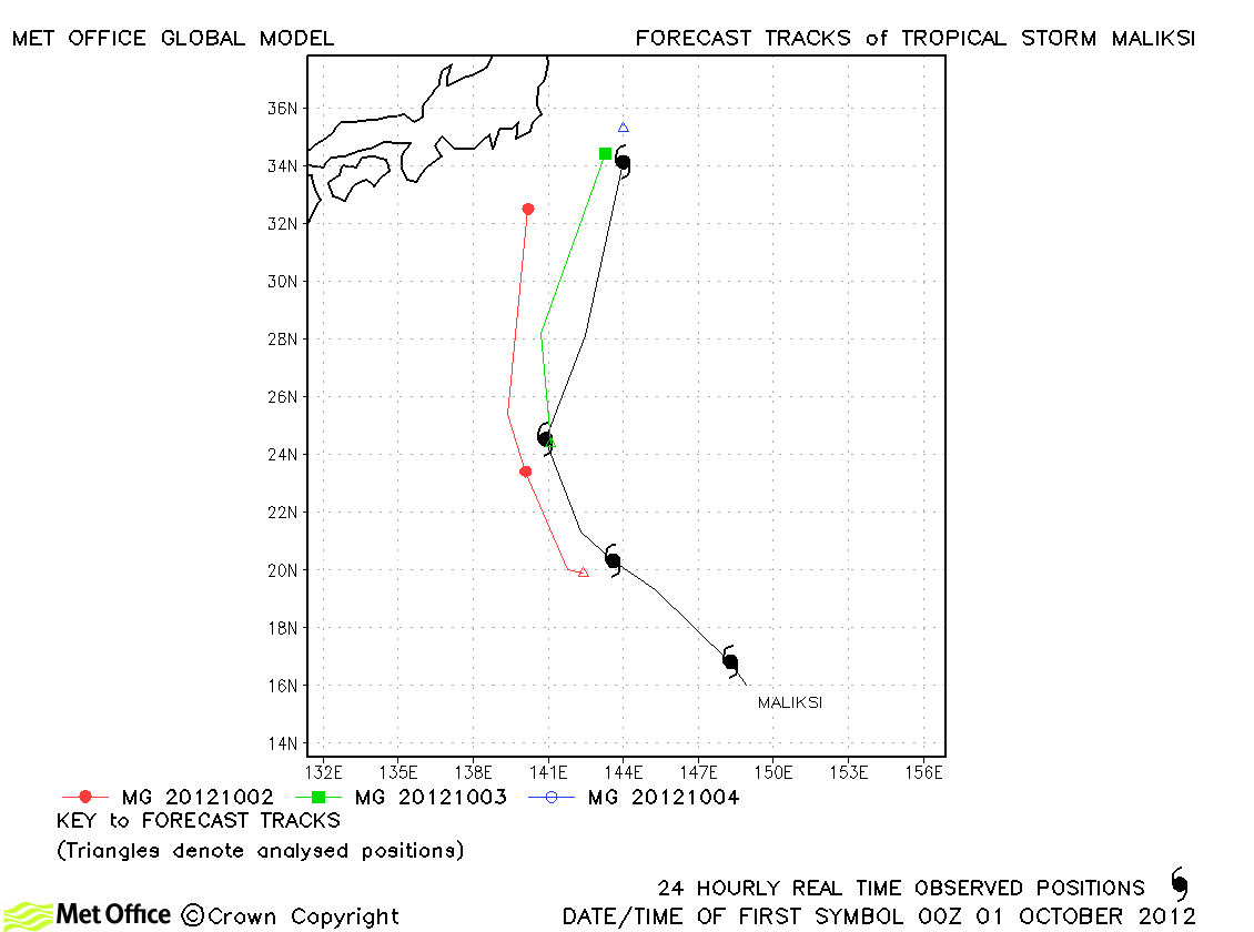
| Maliksi (20W) |
30 September-04 October |
45/50 knots |
| Forecasts had a left-of-track bias resulting in high track forecast errors. |
|
| Gaemi (21W) |
01-06 October |
55/50 knots |
The reversal in direction of Gaemi was well predicted, but landfall predictions were slow resulting in some large longer lead time errors. |
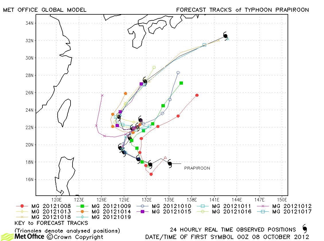
| Prapiroon (22W) |
07-19 October |
100/90 knots |
Track forecast errors were below last season's average and skill scores very high. The temporary slow down and reversal in direction was well predicted from three days in advance. |
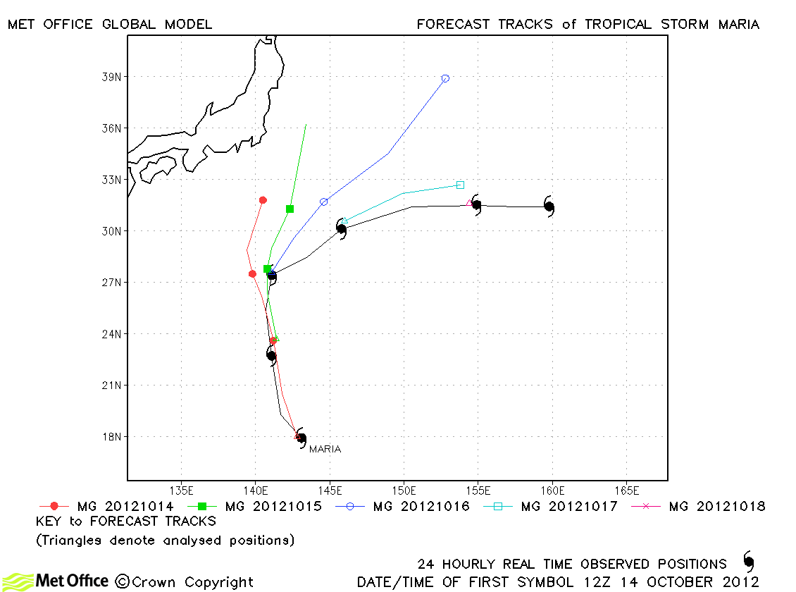
| Maria (23W) |
14-19 October |
55/50 knots |
The sharp right turn of Maria was poorly predicted resulting in some large track forecast errors. |
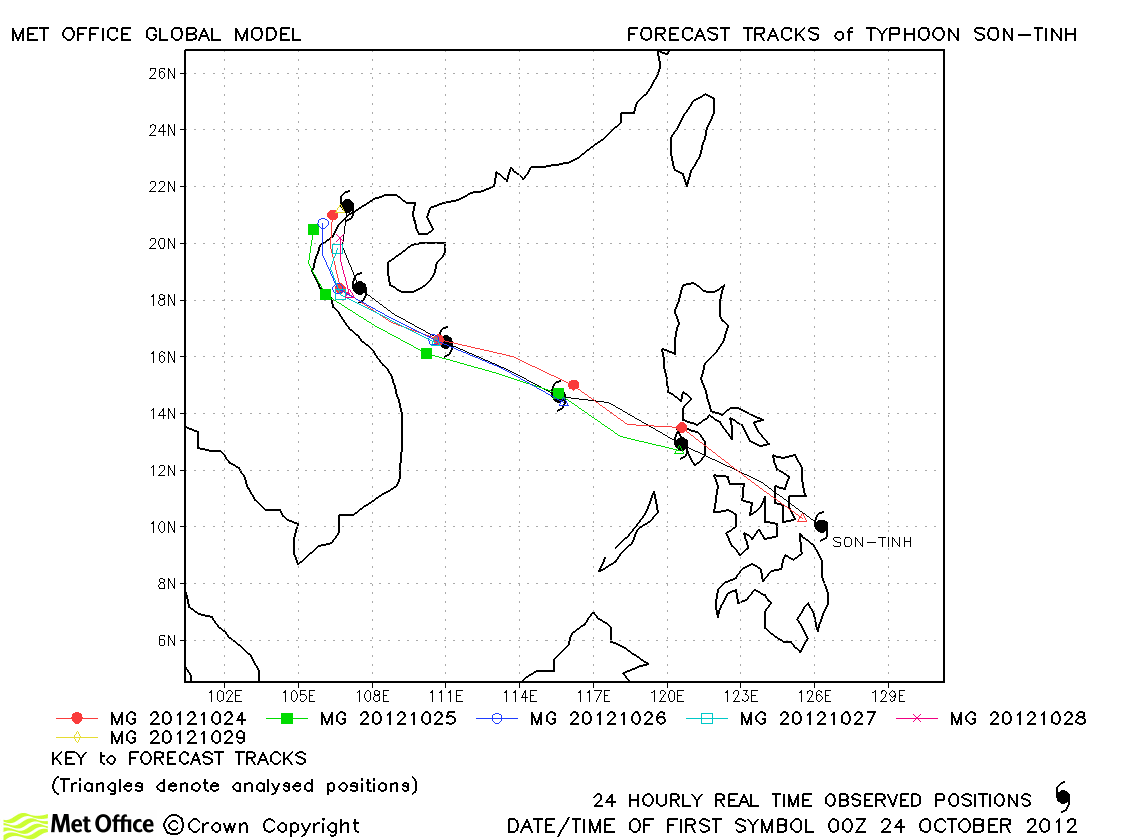
| Son-tinh (24W) |
23-29 October |
110/85 knots |
Track forecasts for this typhoon were excellent in all respects. Errors were low, skill scores high and the landfall very well predicted. |
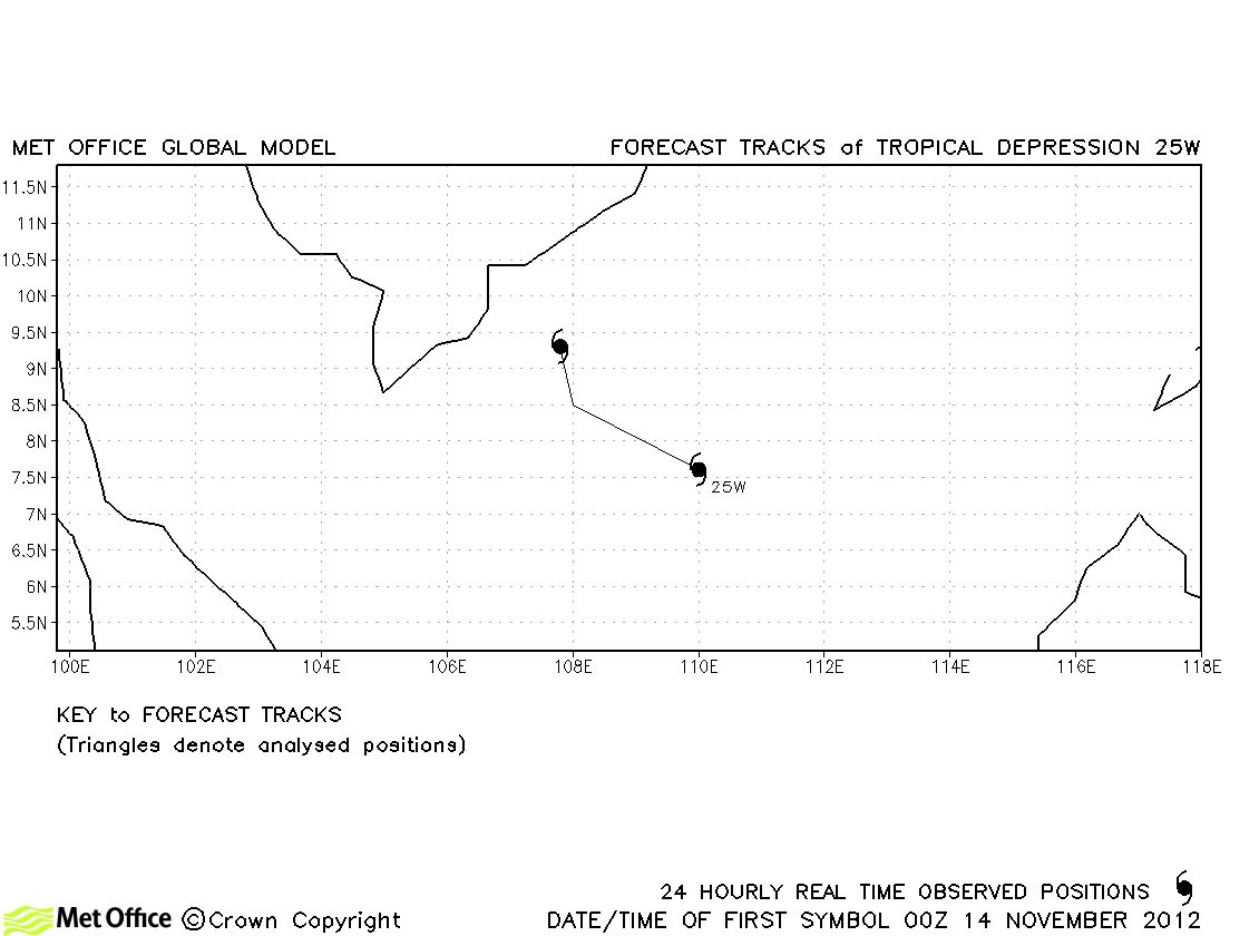
| 25W |
14-15 November |
25/30 knots |
25W did not attain tropical storm status and no forecasts were verified. |
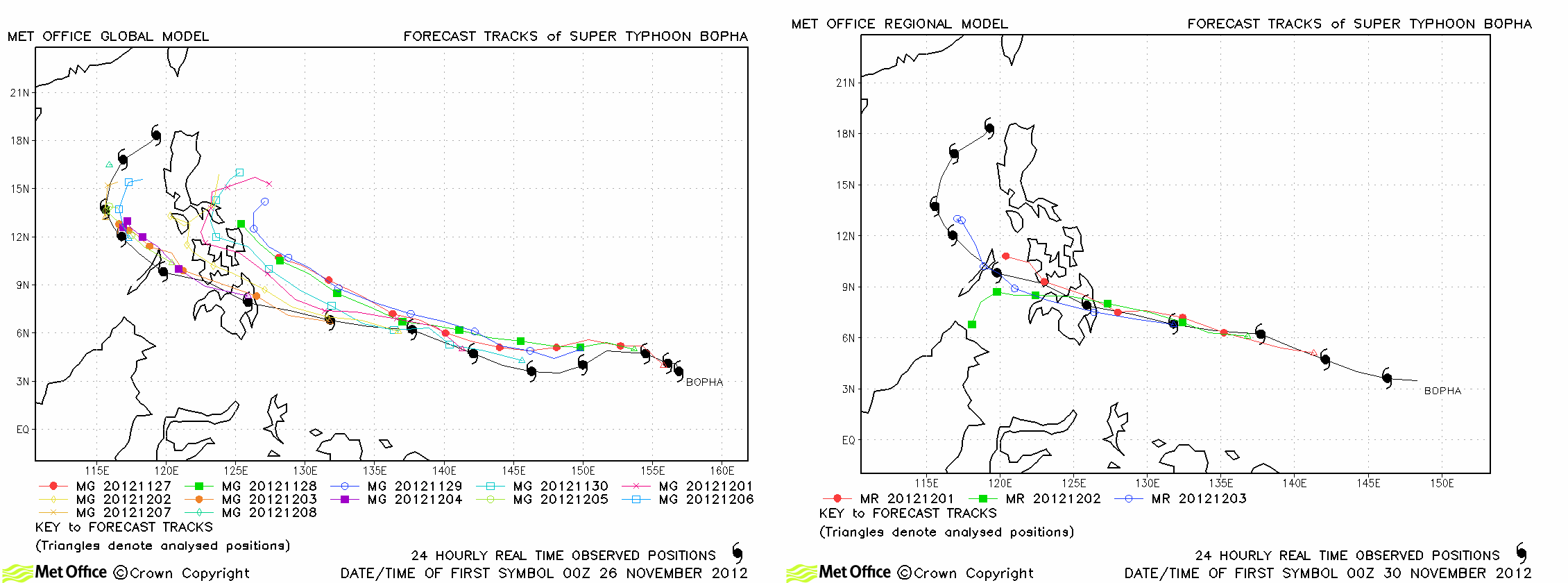
| Bopha (26W) |
25 November-09 December |
140/100 knots |
The formation of Bopha was well predicted by the model. The global model had a right-of-track bias, but still had track errors near to or below last season's average. A 4km resolution regional model run at the time (right-hand frame) gave better predictions of landfall location than the global model. |
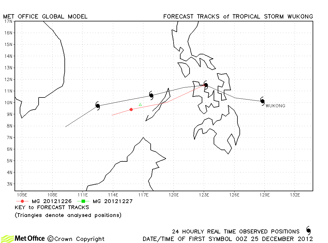
| Wukong (27W) |
24-28 December |
35/40 knots |
Track forecast errors were above last season's average for this storm due to a fast bias. |
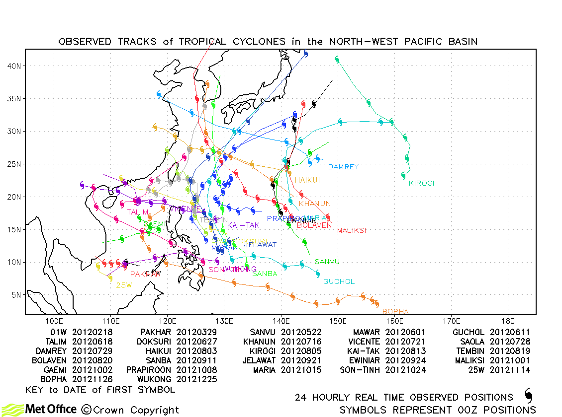
North-west Pacific observed tracks in 2012
North-West Pacific tropical cyclone names
North-east Pacific
| Name & ID |
Start & end dates |
1-minute MSW |
Comments on Met Office global model forecasts |
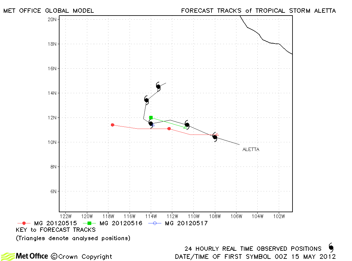
| Aletta (01E) |
14-19 May |
45 knots |
Track forecast errors were a little larger than average due to the failure to predict the sharp turn north as the storm weakened. |
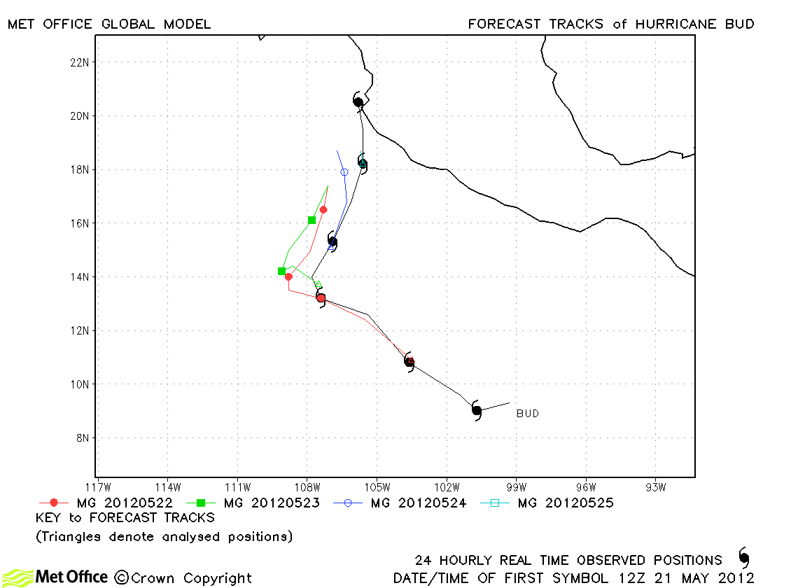
| Bud (02E) |
21-26 May |
100 knots |
The change in direction of this storm were well predicted although there was a slow bias resulting in track forecast errors above last season's average. |
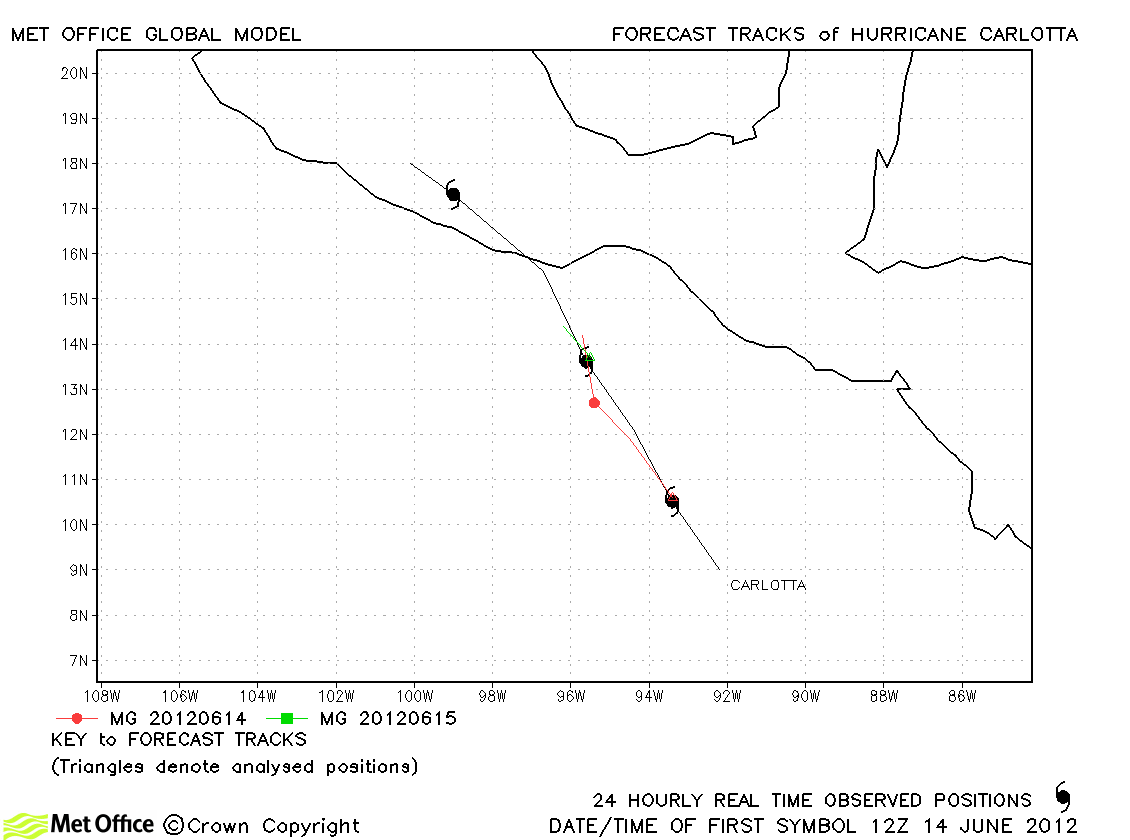
| Carlotta (03E) |
14-17 June |
95 knots |
The prediction of landfall was a little slow for this storm. |
| Daniel (04E) |
04-12 July |
100 knots |
Track forecast errors were low and skill scores high for this storm. |
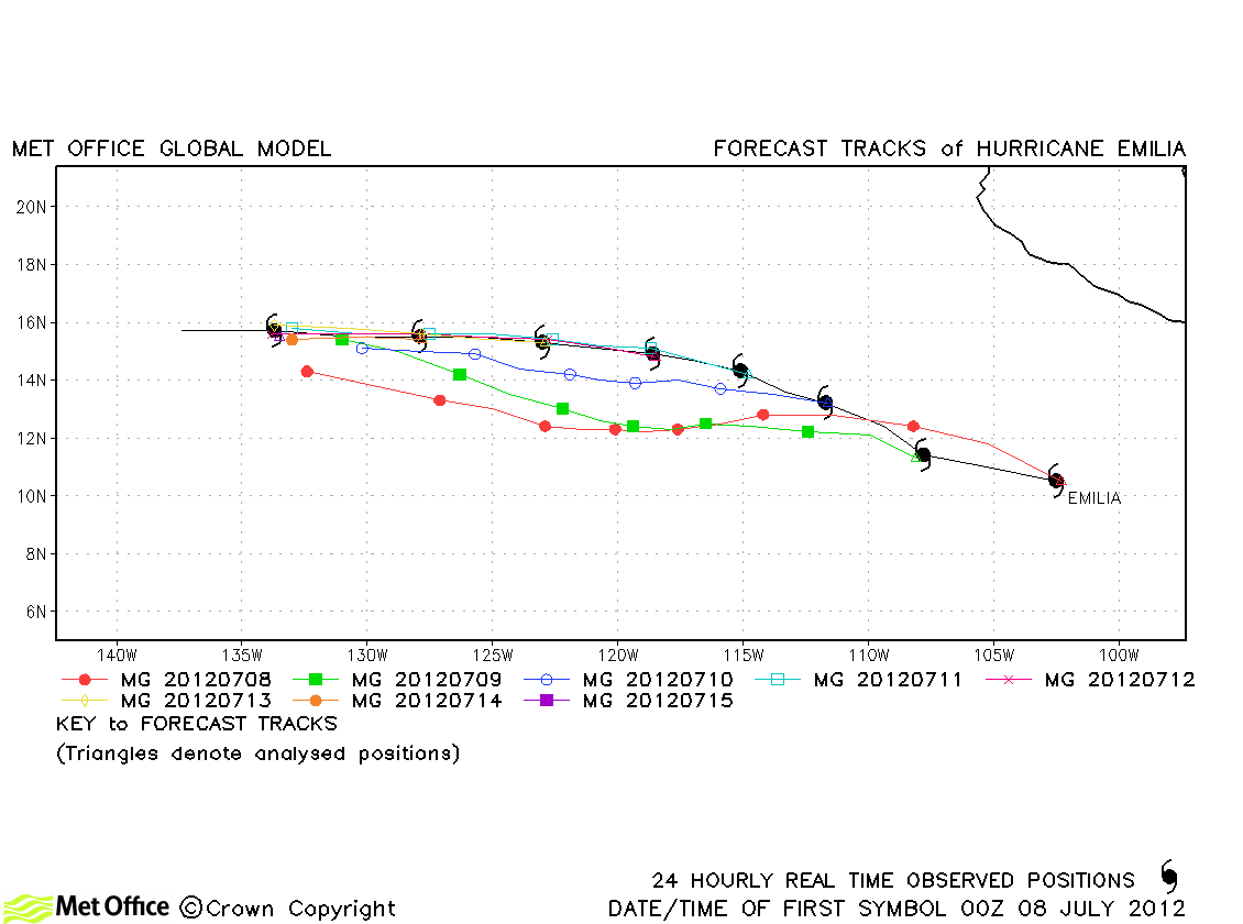
| Emilia (05E) |
07-15 July |
120 knots |
Despite a slight southward bias, track forecast errors were low and skill scores high for this storm. |
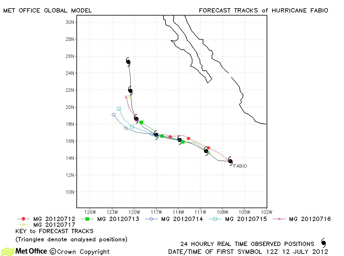
| Fabio (06E) |
12-18 July |
95 knots |
Track forecast errors were near to last season's average. There was a slight left-of-track bias during recurvature and the model tended to weaken the storm too soon. |
| Gilma (07E) |
07-11 August |
70 knots |
Track forecast errors were low and skill scores high for this hurricane. |
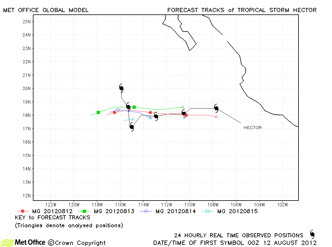
| Hector (08E) |
11-17 August |
45 knots |
Track forecast errors were low for this storm, although the model failed to predict the sharp northward turn later in its lifetime. |
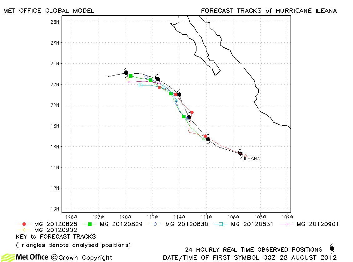
| Ileana (09E) |
27 August-02 September |
75 knots |
Track forecast errors were well below last season's average for this storm. |
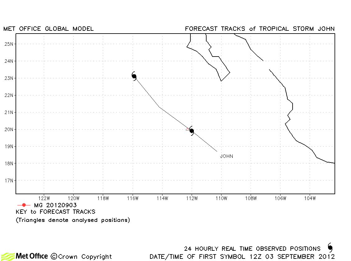
| John (10E) |
02-04 September |
40 knots |
John was only briefly a tropical storm and no forecasts were verified. |
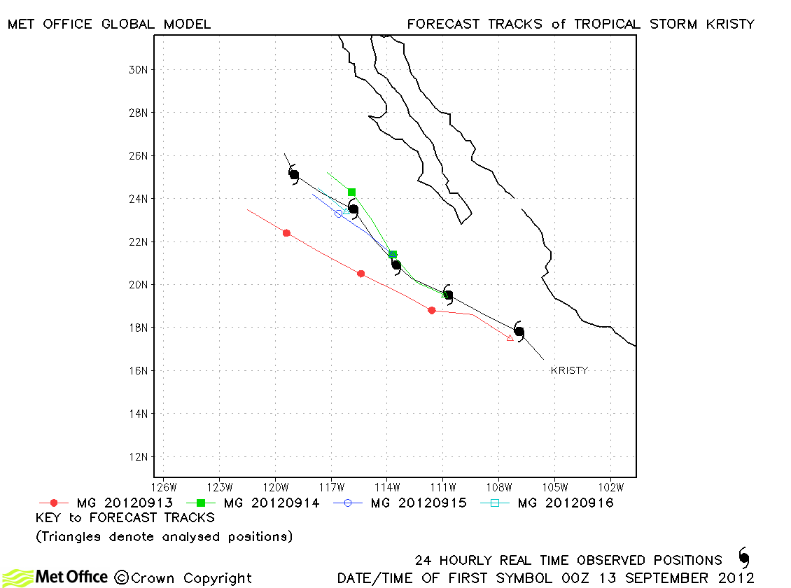
| Kristy (11E) |
12-17 September |
50 knots |
Track forecast errors were near to last season's average. Forecasts had a slight fast bias. |
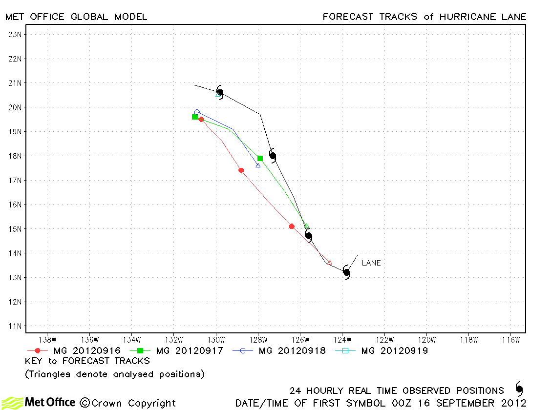
| Lane (12E) |
15-19 September |
75 knots |
Forecasts had a left-of-track bias, but errors were below last season's average. |
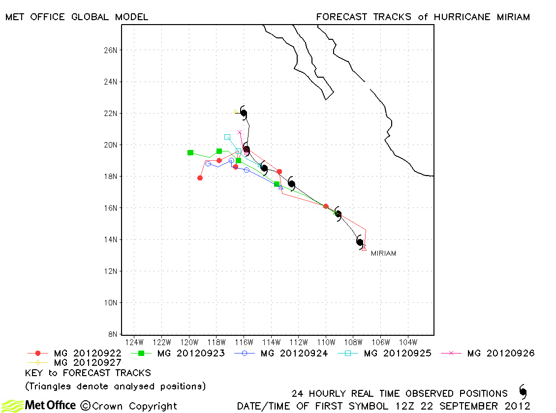
| Miriam (13E) |
22-28 September |
105 knots |
Track forecast errors were near to last season's average. |
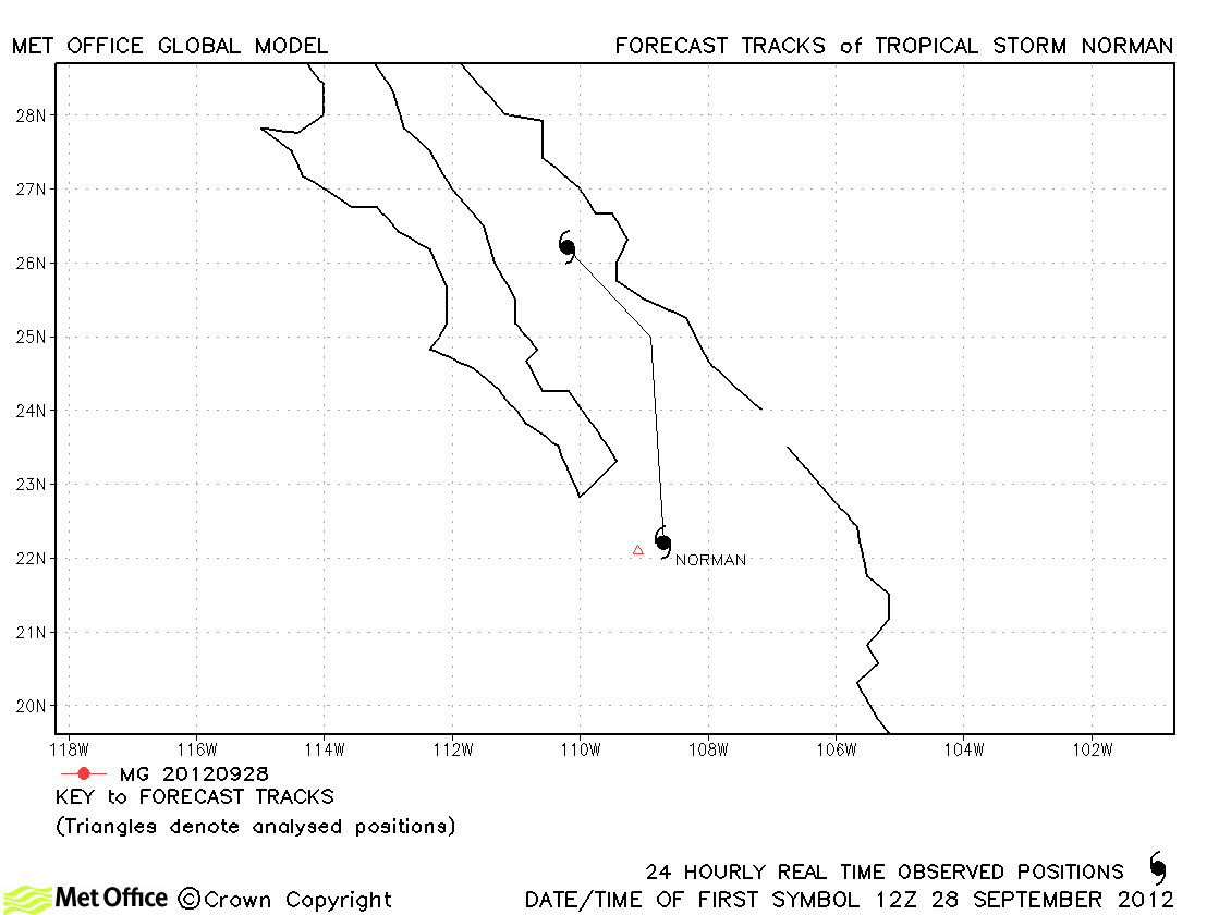
| Norman (14E) |
28-29 September |
45 knots |
Norman was only briefly a tropical storm and no forecasts were verified. |
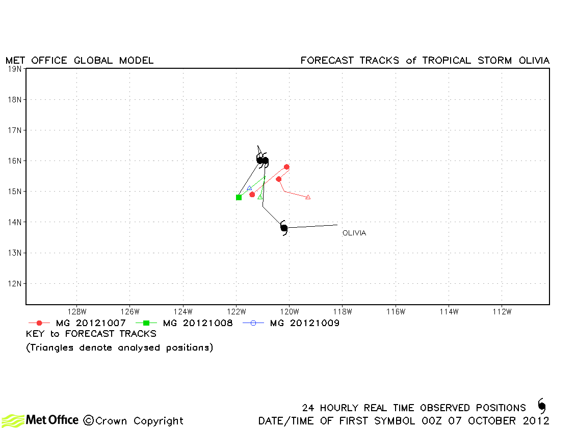
| Olivia (15E) |
06-09 October |
50 knots |
| Track forecast errors were mostly below last season's average for this storm. |
|
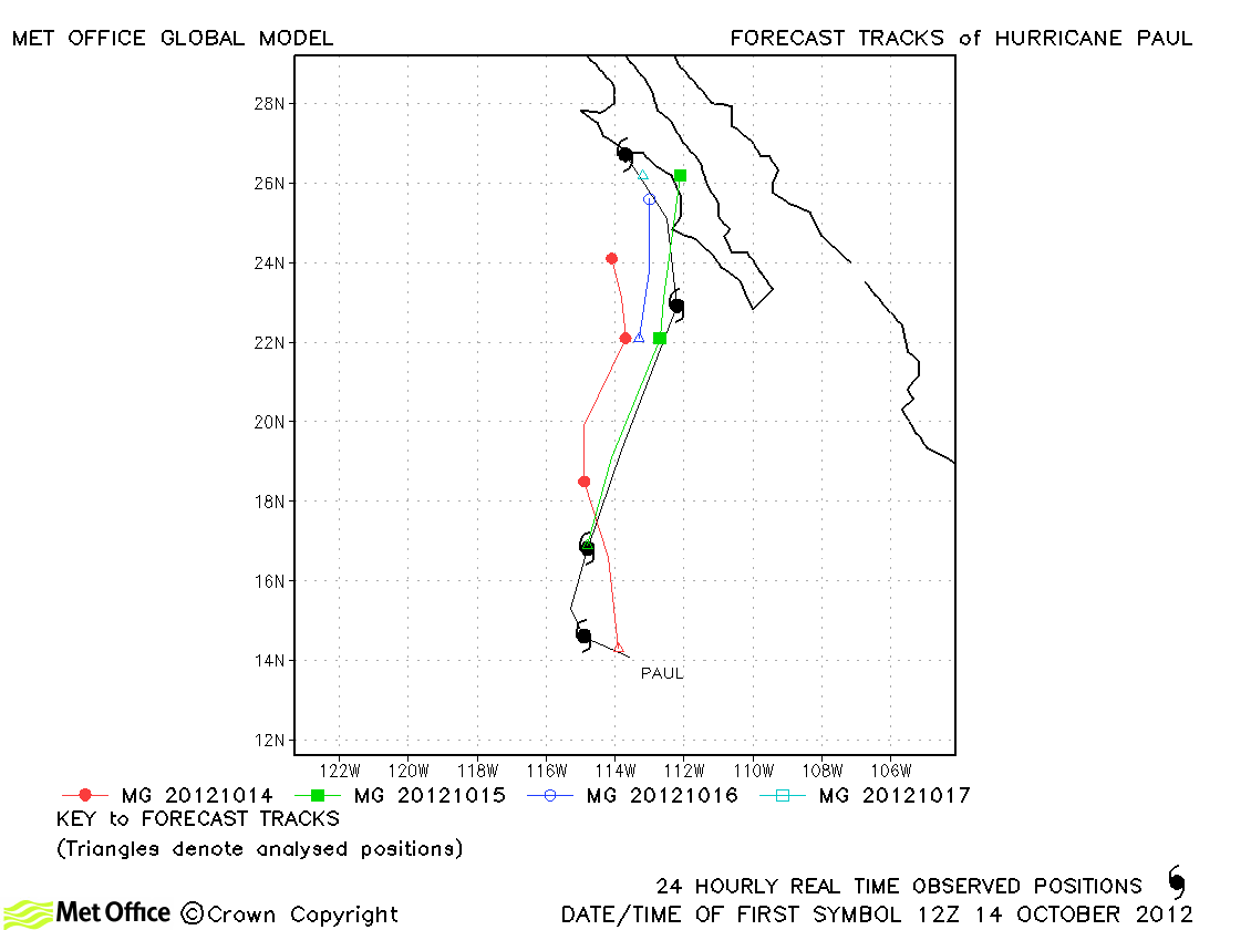
| Paul (16E) |
13-17 October |
105 knots |
Track forecast errors were mixed for this storm. Skill scores were high at 24 hours onwards. |
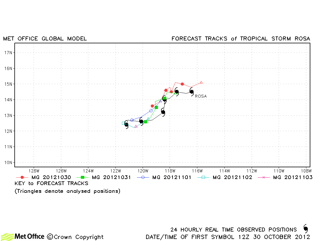
| Rosa (17E) |
30 October-04 November |
45 knots |
Rosa took an unusual south-westwards track, but was well predicted by the model with low track forecast errors and very high skill scores. |
Central North Pacific
| Name & ID |
Start & end dates |
1-minute MSW |
Comments on Met Office global model forecasts |
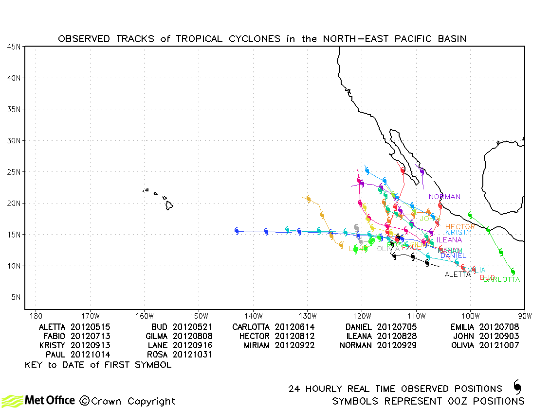
North-east and Central North Pacific observed tracks in 2012
North-east Pacific tropical cyclone names
Central North Pacific tropical cyclone names
North Atlantic
| Name & ID |
Start & end dates |
1-minute MSW |
Comments on Met Office global model forecasts |
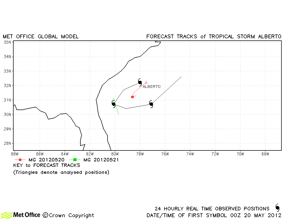
| Alberto (01L) |
19-22 May |
50 knots |
Alberto was short lived, but well predicted. |
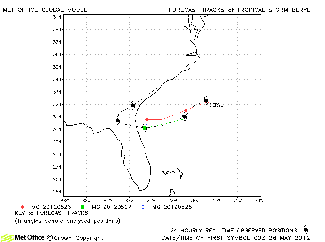
| Beryl (02L) |
26-30 May |
60 knots |
The model did very well in predicting the formation and the track and landfall of Beryl. Forecast errors were low and skill scores very high. |
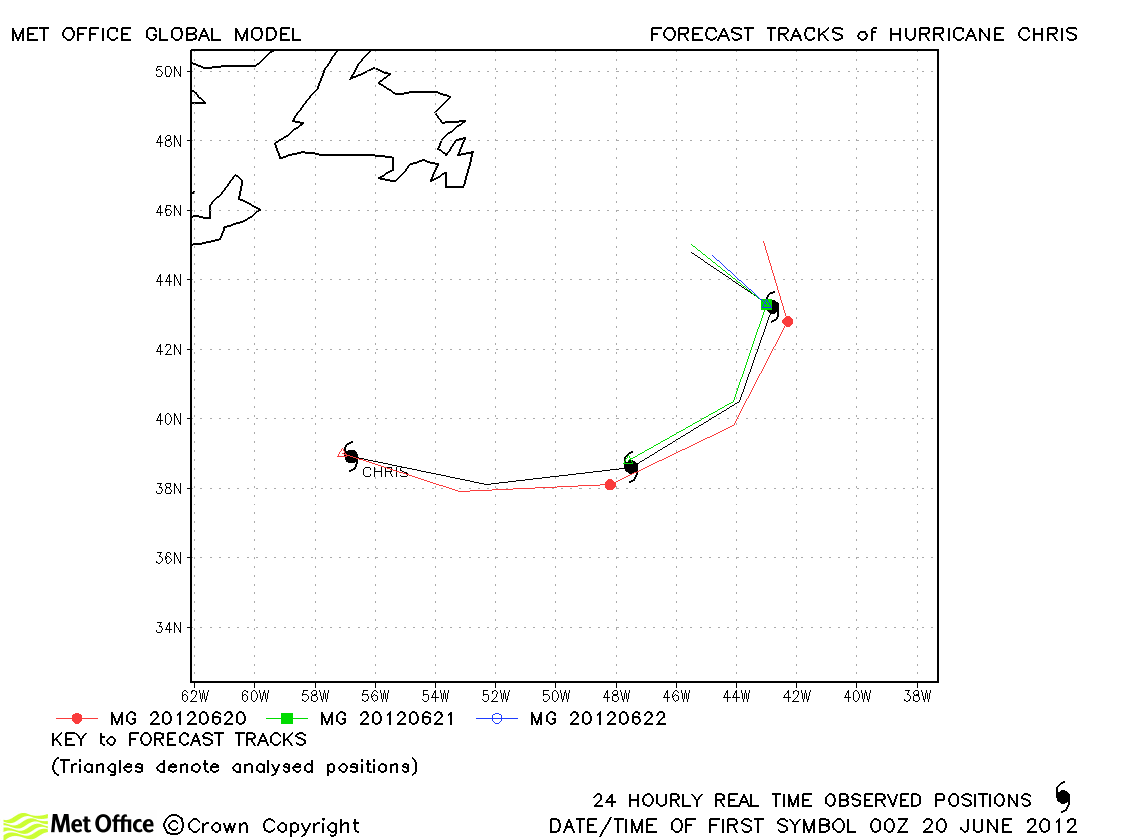
| Chris (03L) |
19-22 June |
75 knots |
Chris was very well predicted by the model with low errors and high skill scores. |
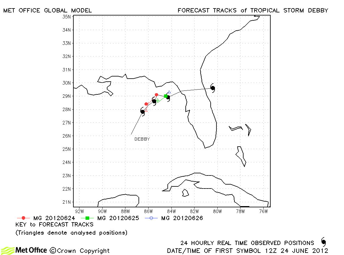
| Debby (04L) |
23-27 June |
55 knots |
Short range forecasts were good, but the acceleration across Florida was not well handled. |
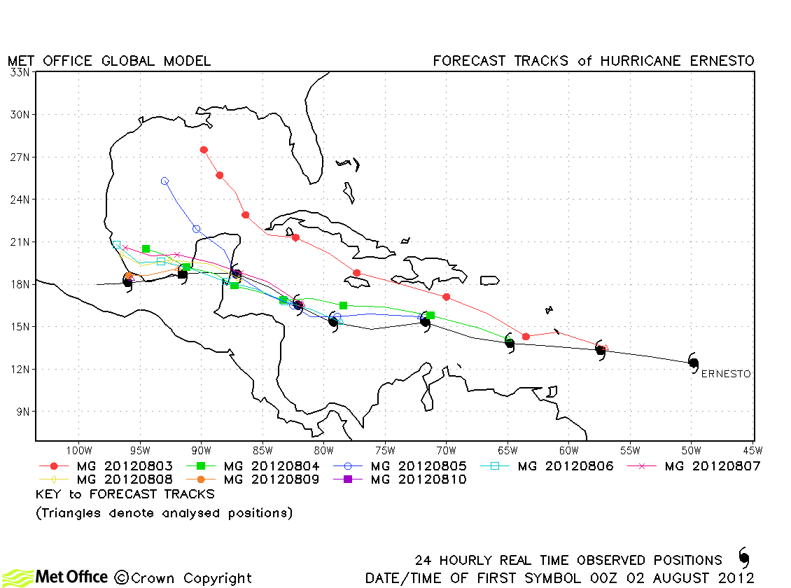
| Ernesto (05L) |
01-10 August |
85 knots |
Track forecast errors were mostly low and skill scores high for this hurricane. Only a few long lead time errors were somewhat larger with an incorrect forecast track into the central Gulf of Mexico. |
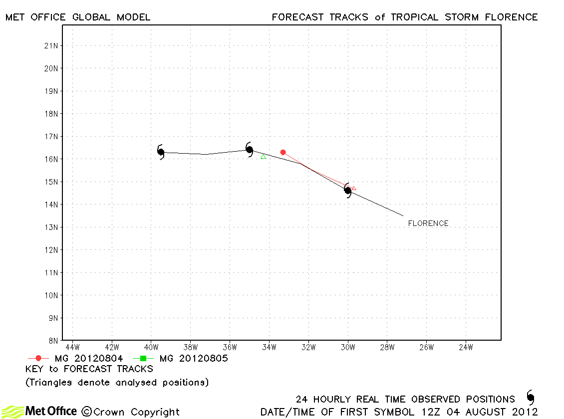
| Florence (06L) |
04-06 August |
50 knots |
| Florence was short-lived and very few forecasts verified. |
|
|
|
|
| Gordon (08L) |
15-20 August |
95 knots |
| Short range track forecast errors were low and skill scores high. There was a slow bias in longer lead time forecasts resulting in higher errors. |
|
|
|
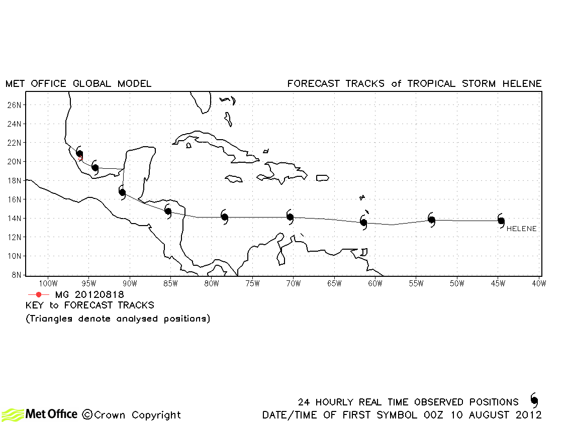
| Helene (07L) |
09-19 August |
40 knots |
After being a tropical depression for most of its lifetime, Helene was only a tropical storm briefly before landfall and no forecasts were verified. |
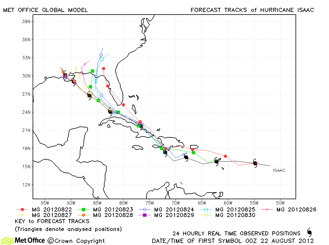
| Isaac (09L) |
21-30 August |
70 knots |
Track forecast errors were mostly low and skill scores high for this hurricane. Some longer lead time forecasts had a right-of-track bias resulting in landfall further east than occurred. The slow down in forward motion at landfall was well predicted. |
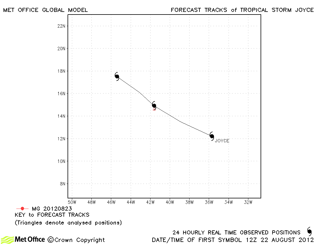
| Joyce (10L) |
22-21 August |
35 knots |
Joyce was only briefly a tropical storm and no forecasts were verified. |
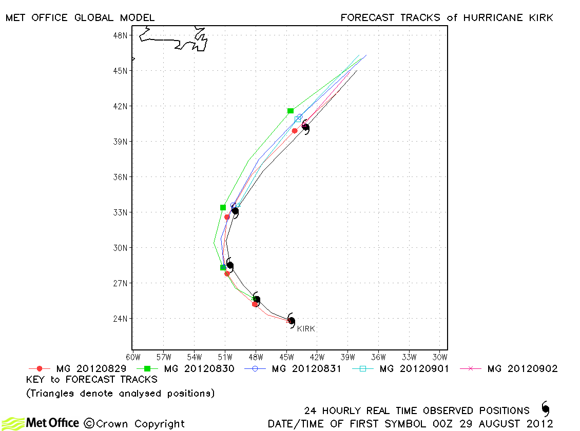
| Kirk (11L) |
28 August-02 September |
90 knots |
Track forecast errors were low and skill scores high for this storm whose track was very well predicted. |
| Leslie (12L) |
30 August-11 September |
70 knots |
Track forecast errors were close to last season's average, although skill scores were very high. Some forecasts failed to predict the storm's slow down, but others predicted this movement very well. |
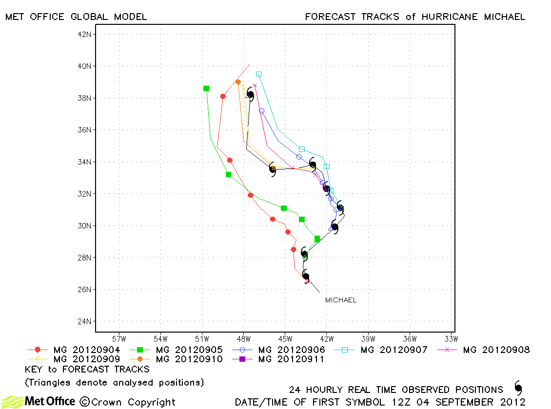
| Michael (13L) |
03-11 September |
100 knots |
Despite a left-of-track bias, track forecast errors were generally below last season's average (particularly at longer lead times) and skill scores high for this storm. |
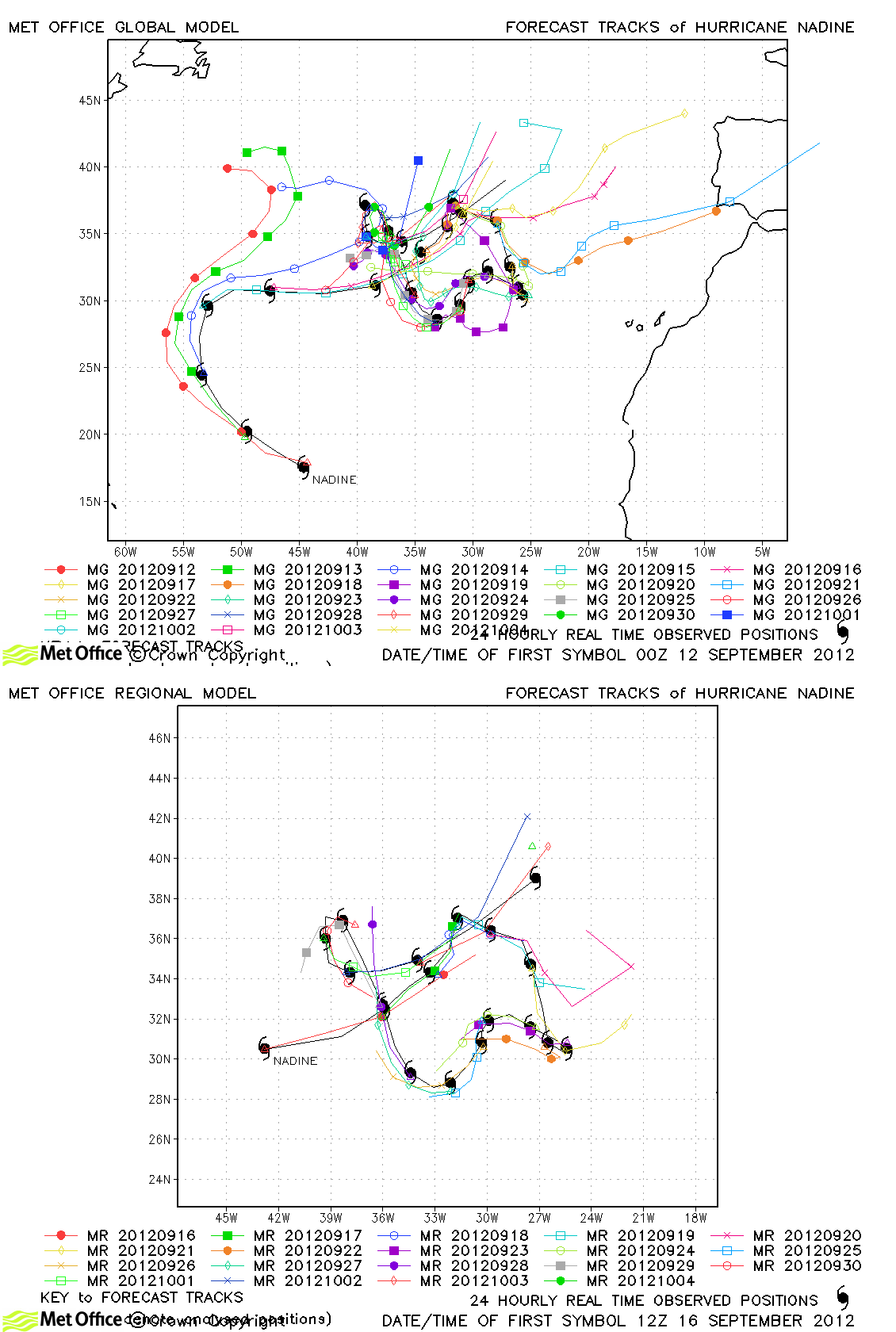
| Nadine (14L) |
11 September-04 October |
80 knots |
Nadine was one of the longest-lived Atlantic tropical storms on record. Overall, track forecast errors were near to last season's average and skill scores high for this unusual storm. There were periods when track errors were very large - e.g. early on when a left turn towards Newfoundland was predicted and mid-life when a track towards western Europe was predicted. However, these large errors were offset by some excellent forecasts as the storm made its slow clockwise loop in the eastern Atlantic. During this period forecast errors were exceptionally low. |
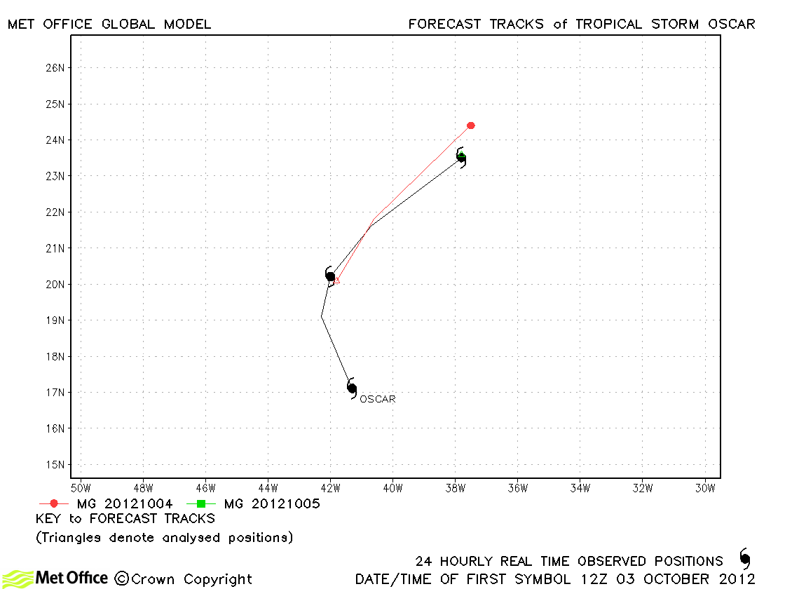
| Oscar (15L) |
03-05 October |
45 knots |
| Oscar was short lived, but forecasts were good. |
|
|
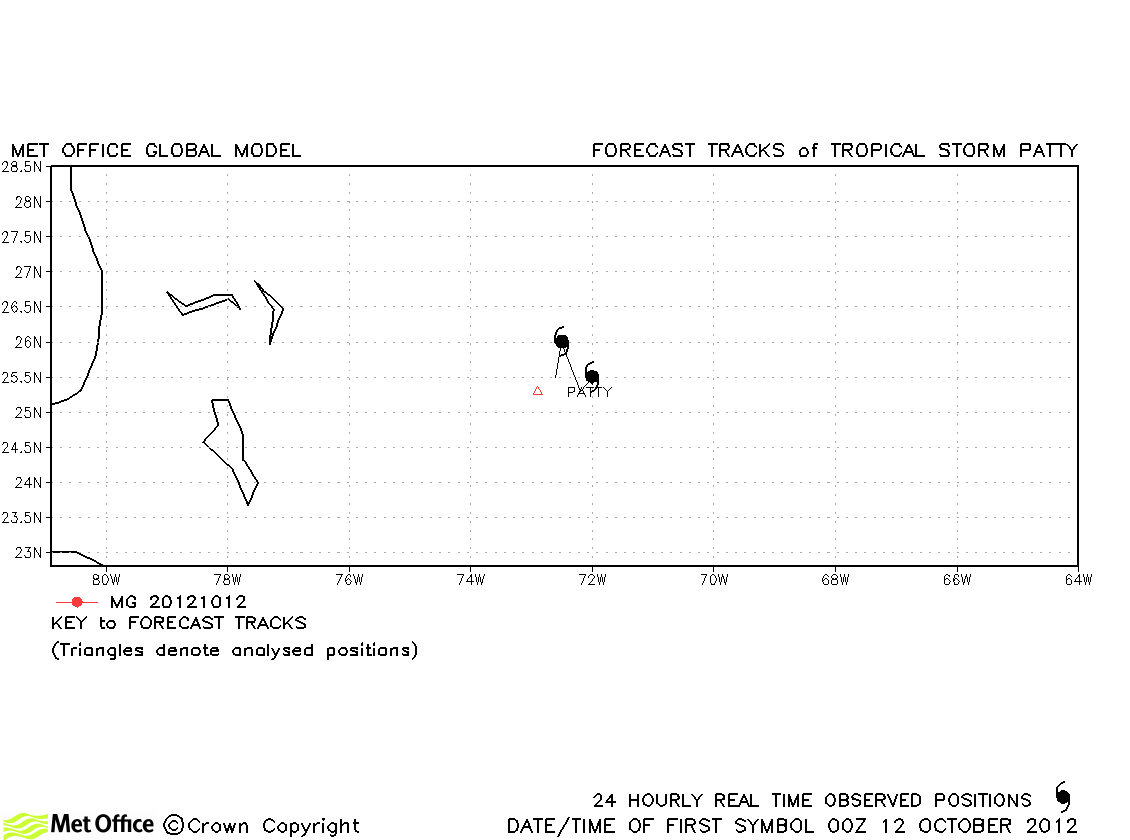
| Patty (16L) |
11-13 October |
40 knots |
Patty was very short-lived and no forecasts were verified. |
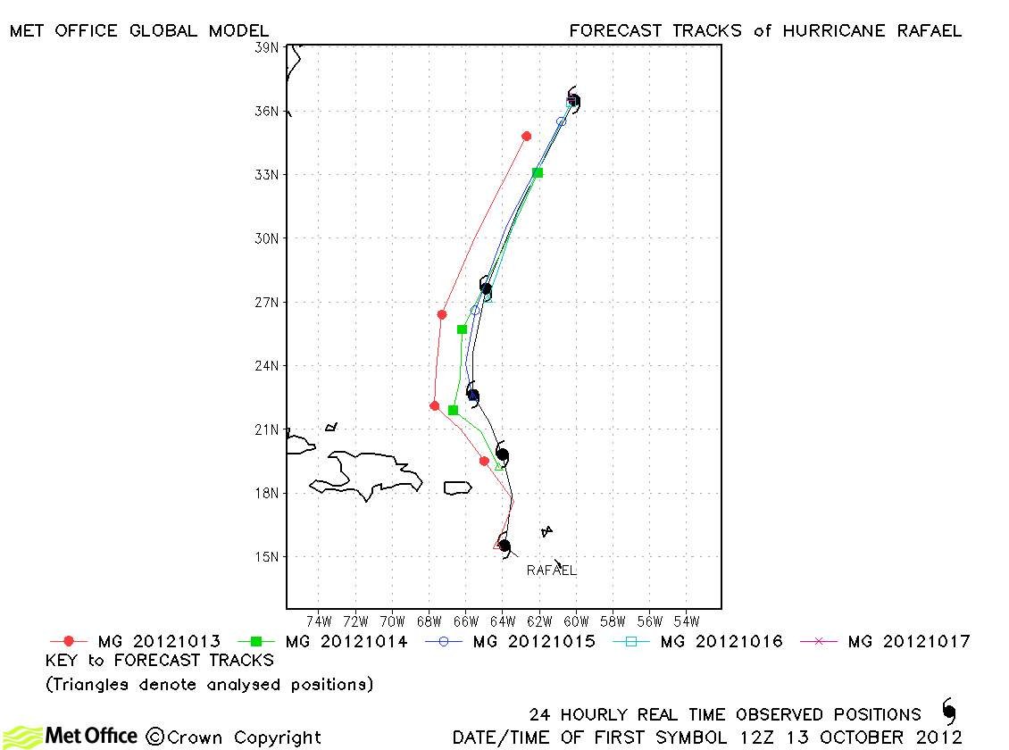
| Rafael (17L) |
13-17 October |
80 knots |
| Track forecast errors were near to or slightly above last season's average. However, skill scores were high. |
|
|
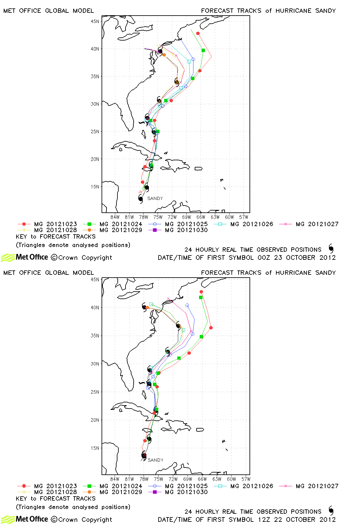
| Sandy (18L) |
22-30 October |
100 knots |
Track forecast errors were lower than last season's average at all lead times except 168 hours. Skill scores were also very high. This is probably due to the unusual turn westwards towards landfall over the USA. This turn was predicted by all runs of the model, but the sharpness and speed of the turn were generally underpredicted. This resulted in longer lead time forecasts predicting landfall too late and too far north. It should be noted that Met Office ensemble predictions (not shown) gave a very good indication of the left turn and landfall over the USA up to a week ahead of the event. The majority of Met Office model predictions gave a good indication of the intensity and size of the storm as it approached US landfall. |
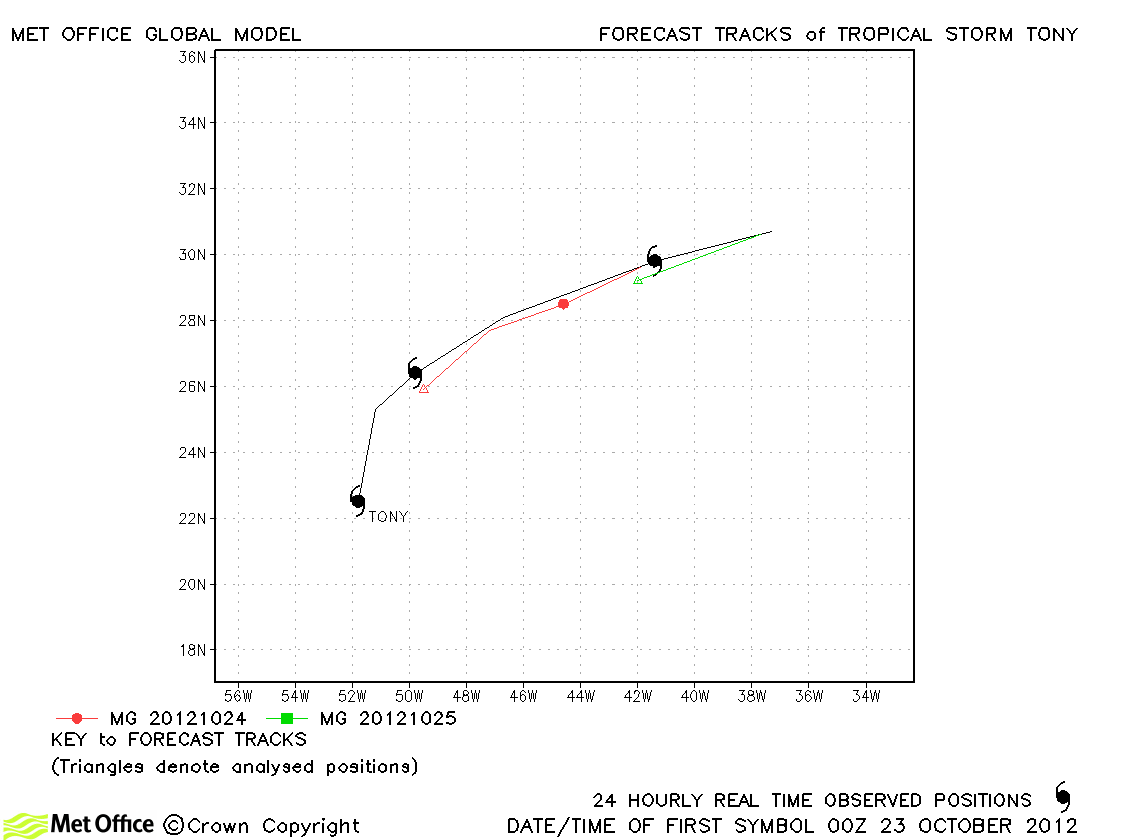
| Tony (19L) |
22-25 October |
45 knots |
| Track forecasts were a little slow for this short-lived storm. |
|
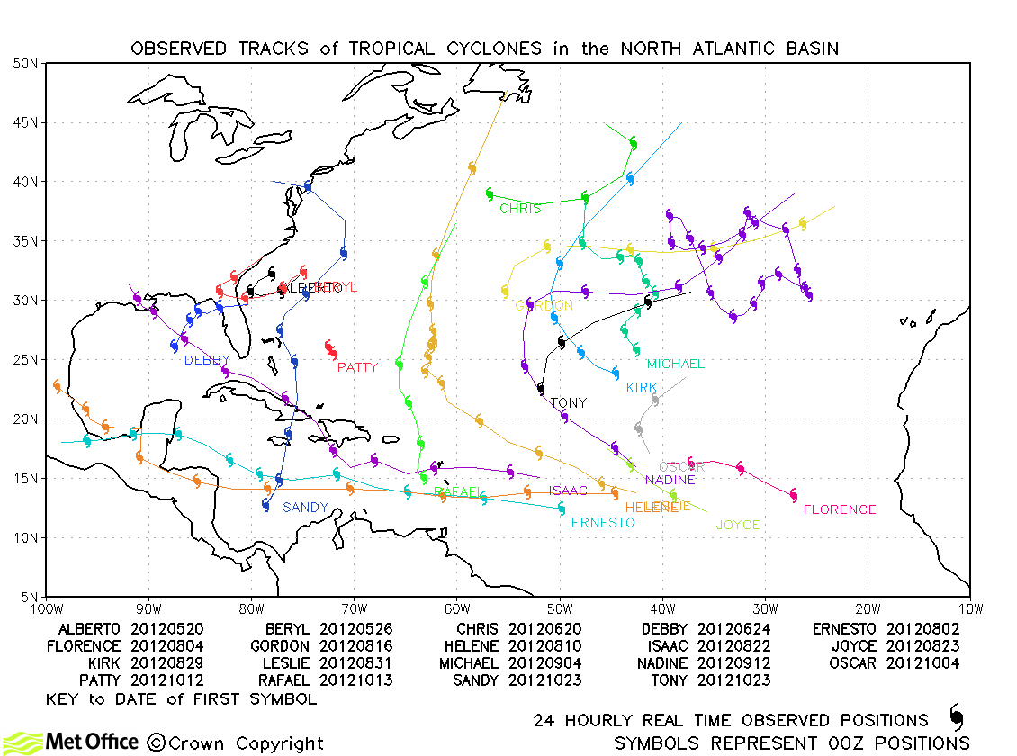
North Atlantic observed tracks in 2012
North Atlantic tropical cyclone names
North Indian
(forecast track charts for Global and South Asia models shown)
| Name & ID |
Start & end dates |
1-/10-minute MSW |
Comments on Met Office global model forecasts |
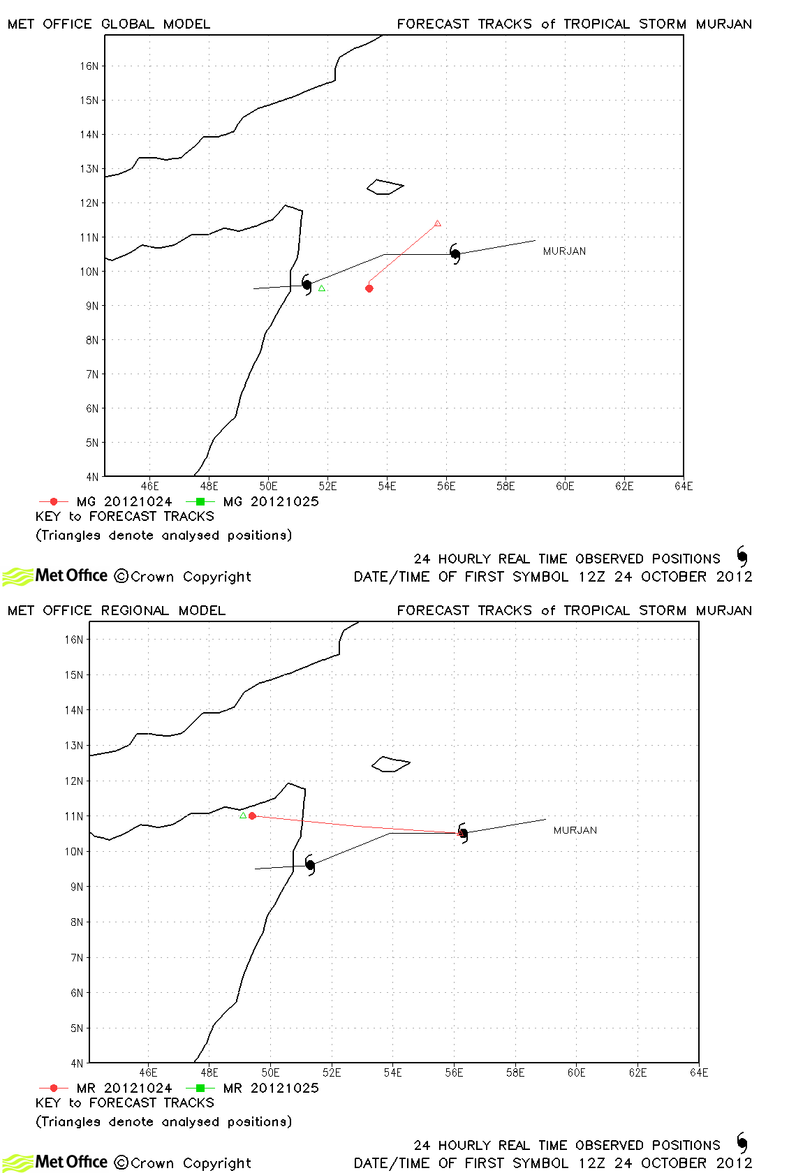
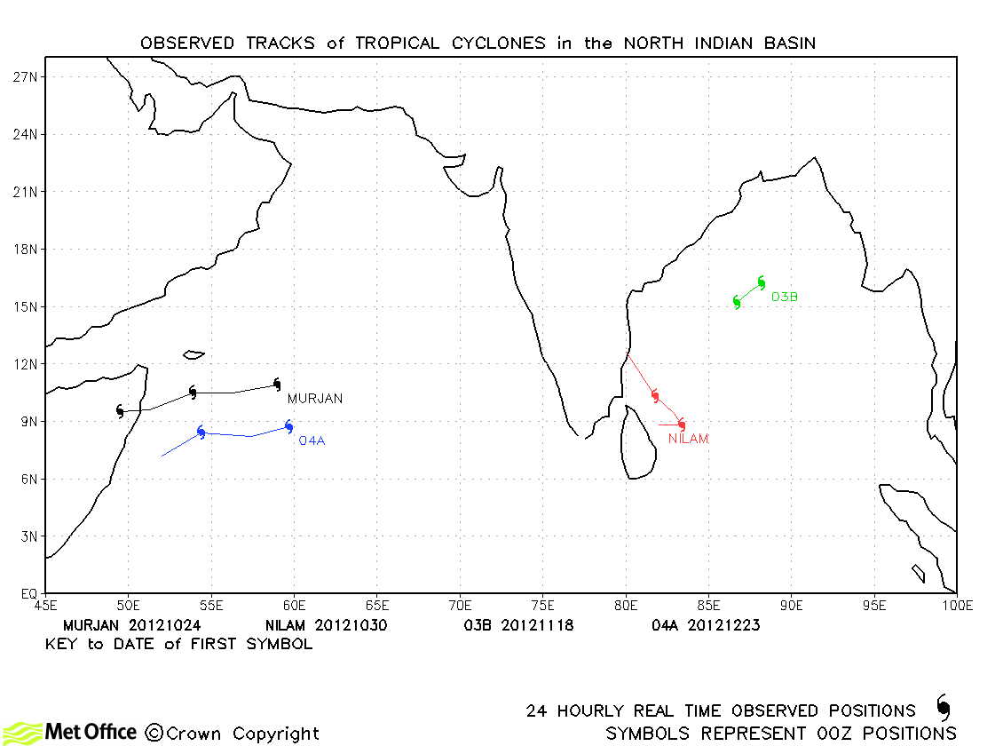
| Murjan (01A) |
23-26 October |
35/35 knots |
Track forecasts were a little slow for this storm. |
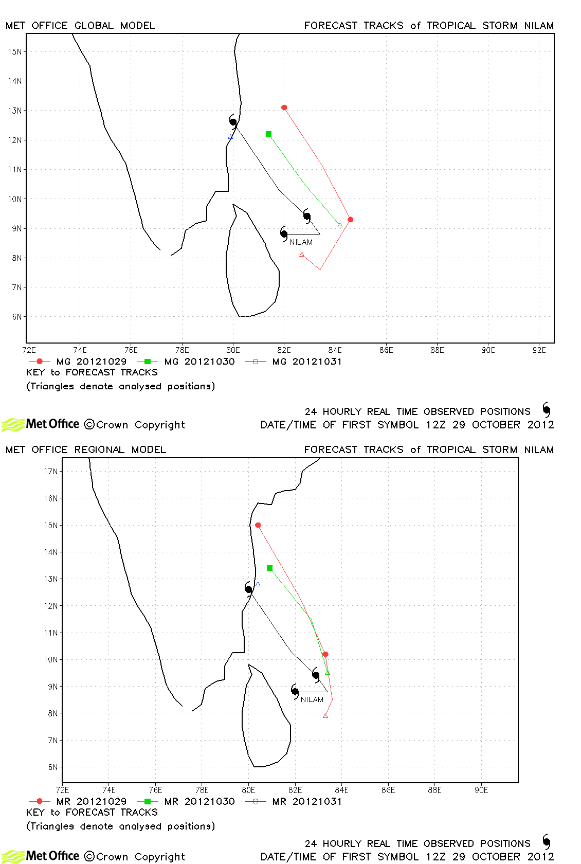
| Nilam (02B) |
29-31 October |
55/45 knots |
There was a right-of-track bias for forecasts for this storm. |
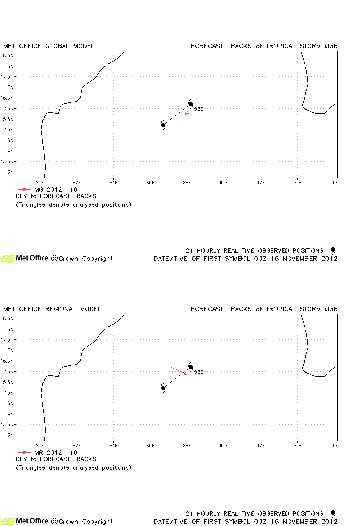
| 03B |
17-19 November |
35/30 knots |
Only JTWC designated 03B as a tropical storm and it was very short-lived. |
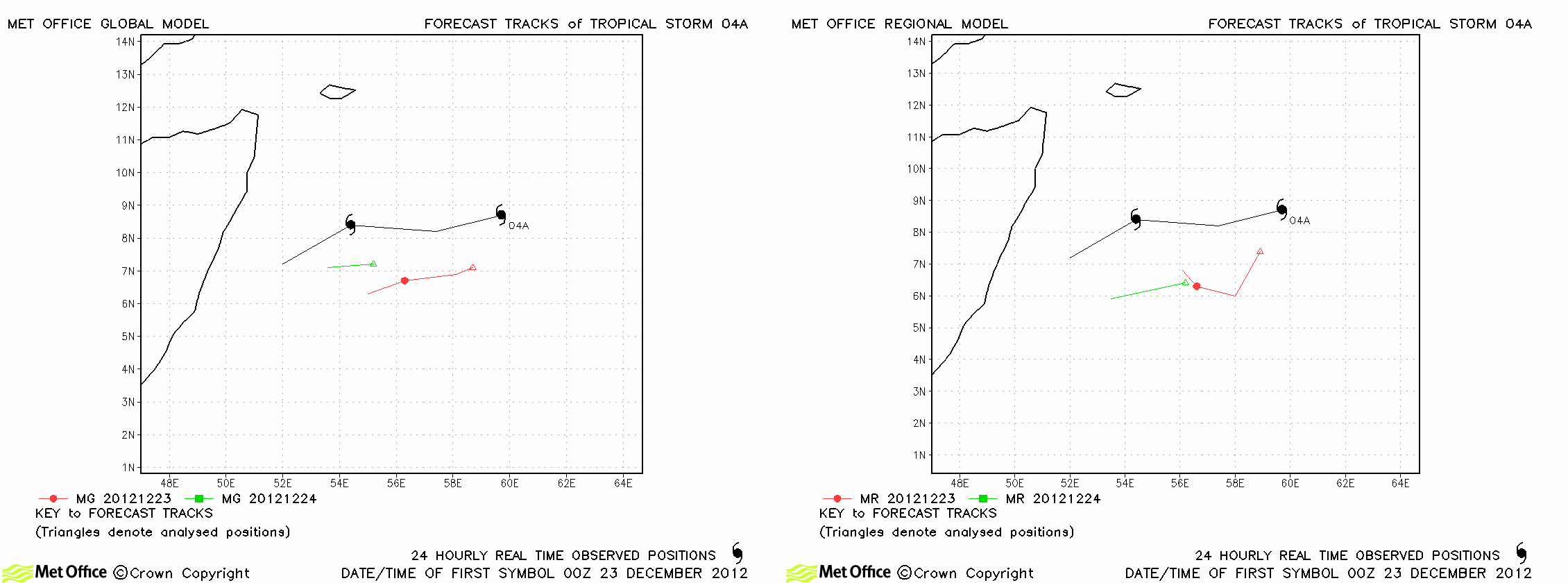
| 04A |
23-24 December |
40/30 knots |
04A was poorly analysed by the global model and forecast errors were also large. The higher resolution South Asia Model (right-hand frame) fared little better. |
North Indian observed tracks in 2012
North Indian tropical cyclone names
Note on estimated wind speeds
1-minute MSW: Maximum sustained wind (knots) averaged over 1 minute (JTWC Hawaii, NHC Miami, CPHC Hawaii)
10-minute MSW: Maximum sustained wind (knots) averaged over 10 minutes (JMA Japan, IMD New Delhi)
Note: Although 1-minute average winds should be stronger than 10-minute average, this may not be the case here since estimates are obtained from different warning centres.


