

Observed and forecast tracks: northern hemisphere 2015
All tropical cyclones in the northern hemisphere season in 2015 are listed below including details of their start and end dates, lowest central pressure and maximum sustained wind (MSW).
Click on the name of the tropical cyclone to see a chart of the observed track and forecast tracks from the Met Office global model. Verification statistics on each tropical cyclone are available upon request from [email protected]. At the end of the season a verification report on the performance of the Met Office global model will be published.
| Name & ID | Start & end dates | Central pressure, 1-/10-minute MSW | Comments on Met Office global model forecasts |
|---|---|---|---|
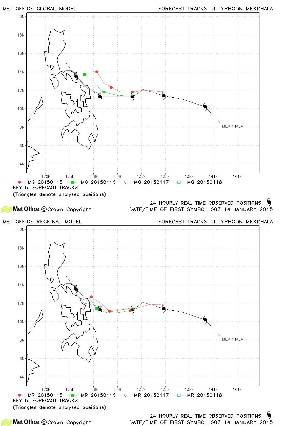
| Mekkhala (01W) | 13-18 January | 965 mb, 70/70 knots | Track errors were slightly above the average for last season due to a right-of-track bias |
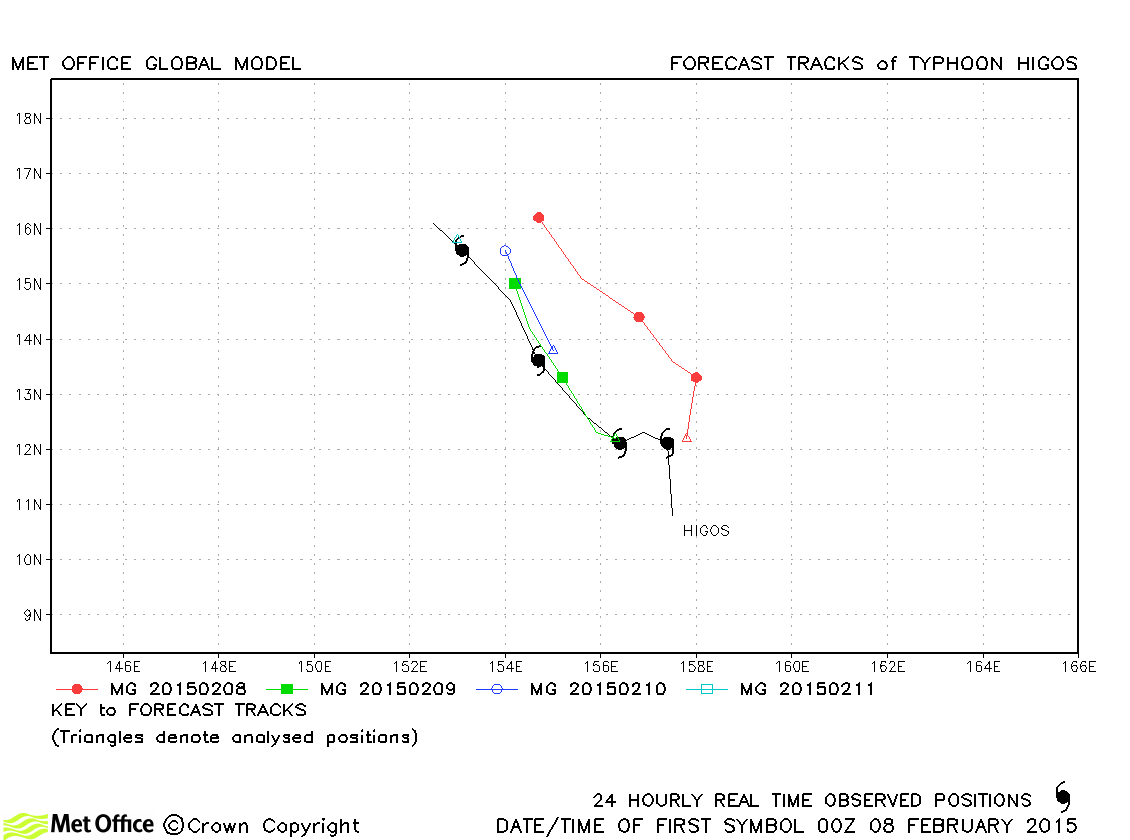
| Higos (02W) | 07-11 February | 935 mb, 115/95 knots | There was a slight slow and right-of-track bias in forecasts resulting in track errors above last year's average at some lead times. However, skill scores were high at some lead times. |
| Bavi (03W) | 11-18 March | 990 mb, 50/45 knots | Track forecast errors were close to or above last season's average due to a northwards bias. However, skill scores against CLIPER were high. |
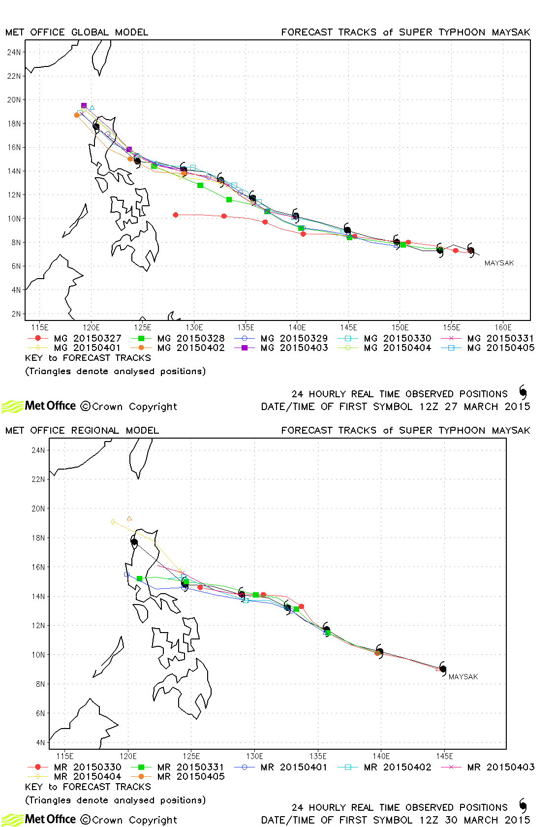
| Maysak (04W) | 27 March-05 April | 905 mb, 140/115 knots | Track forecasts were mostly very good with errors below last season's average and positive skill scores. |
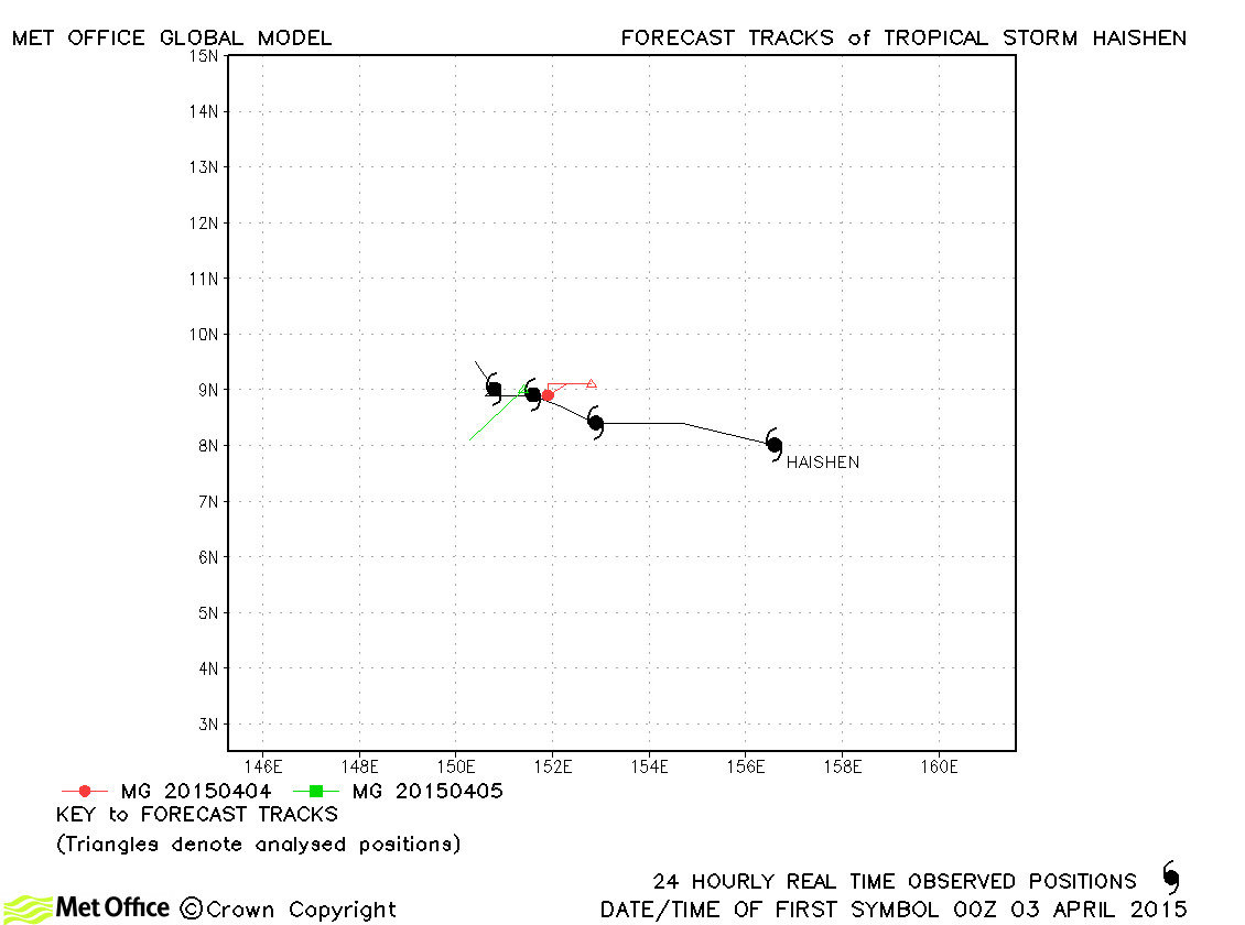
| Haishen (05W) | 03-06 April | 998 mb, 45/35 knots | Haishen was a relatively short-lived storm with only a few forecasts verified. |
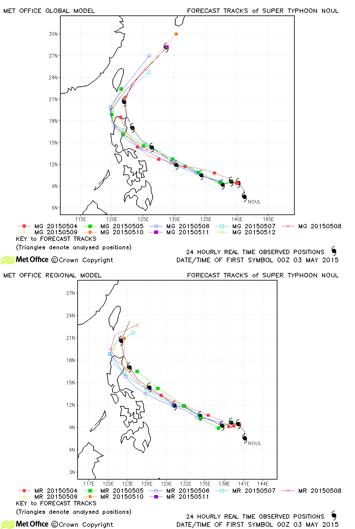
| Noul (06W) | 03-12 May | 915 mb, 140/105 knots | Track forecast errors were near to or lower than last season's average. Recurvature occurred sooner than in most forecasts. |
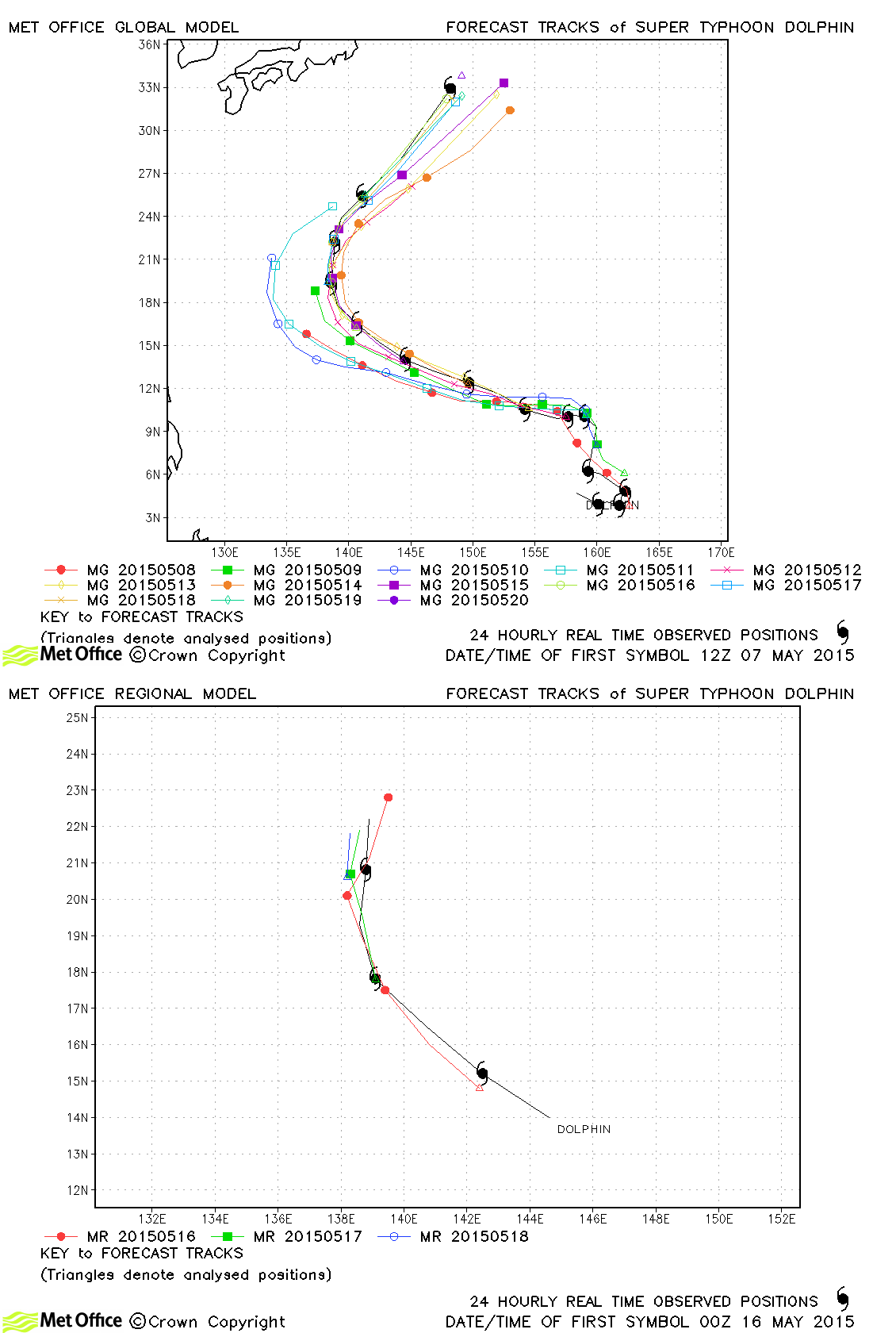
| Dolphin (07W) | 06-20 May | 925 mb, 140/100 knots | Track forecast errors were near to or higher than last season's average. Recurvature occurred sooner than in some early forecasts. |
| Kujira (08W) | 20-24 June | 985 mb, 45/40 knots | Track forecast errors were near to or below last season's average. |
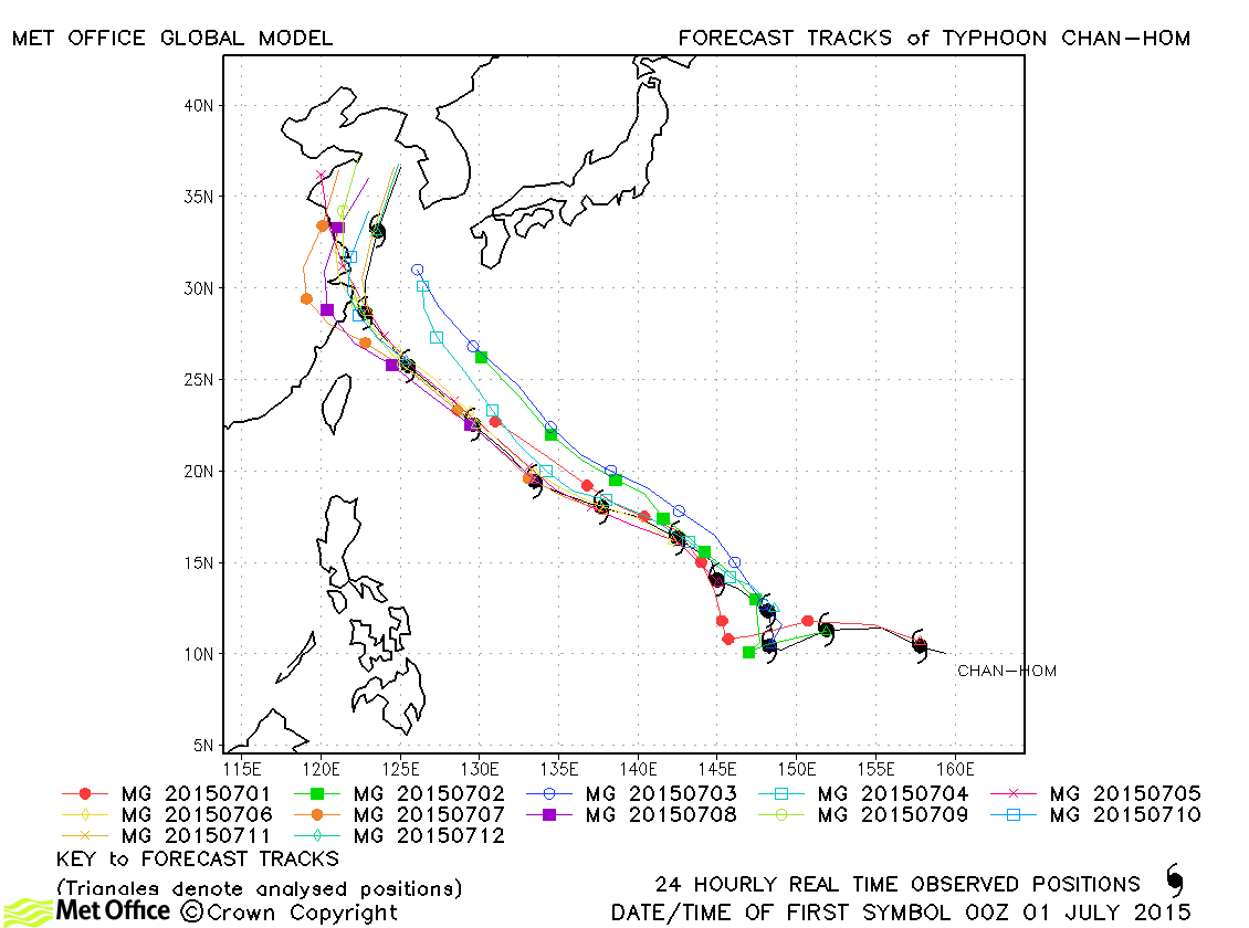
| Chan-hom (09W) | 30 June - 12 July | 935 mb, 120/90 knots | Track forecast errors were mostly below last season's average. Skill scores against CLIPER were high. There was an overdeepening bias overall. |
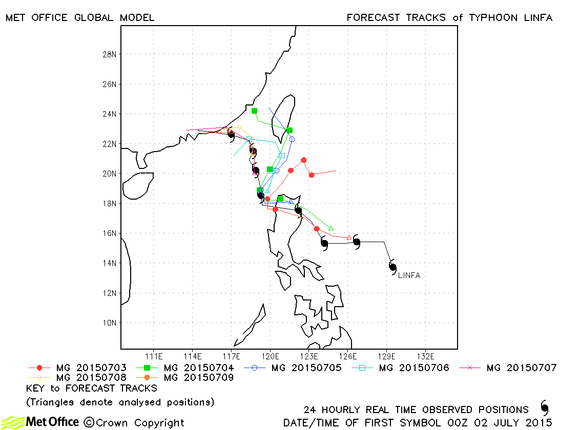
| Linfa (10W) | 02-09 July | 975 mb, 65/55 knots | Track forecast errors were mixed, although large at long lead times due to an eastwards bias. |
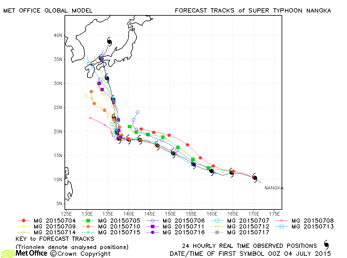
| Nangka (11W) | 03-18 July | 925 mb, 135/100 knots | Track forecast errors were below last season's average at lead times up to 120 hours, but larger at longer lead times. This was due to recurvature being predicted too soon in early forecasts and a left-of-track bias in later forecasts. There was an overdeepening bias later in Nangka's life as it approached landfall. |
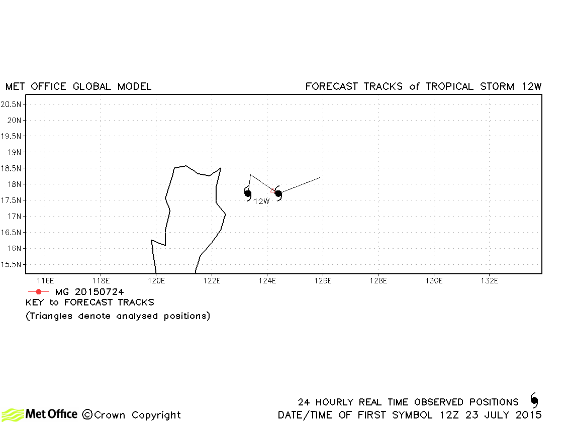
| 12W | 23-25 July | 993 mb, 40/30 knots | 12W was only briefly a tropical storm according to JTWC and no forecasts were verified. |
| Soudelor (13W) | 30 July - 09 August | 900 mb, 155/115 knots | Track forecast errors were well below last season's average for this typhoon. |
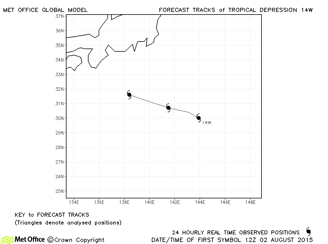
| 14W | 02-04 August | 1000 mb, 30/- knots | No forecasts were verified for this tropical depression. |
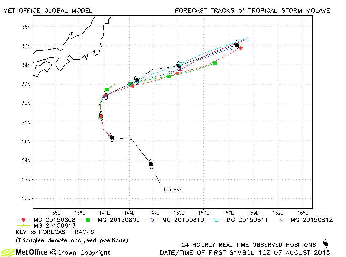
| Molave (15W) | 07-13 August | 990 mb, 50/45 knots | Track forecast errors were low and skill scores high for this storm. The recurvature was well predicted. |
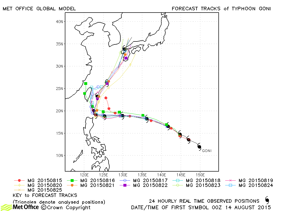
| Goni (16W) | 14-18 August | 935 mb, 115/95 knots | The acceleration north-eastwards was not predicted at longer lead times, but at all shorter lead times track forecast errors were low. |
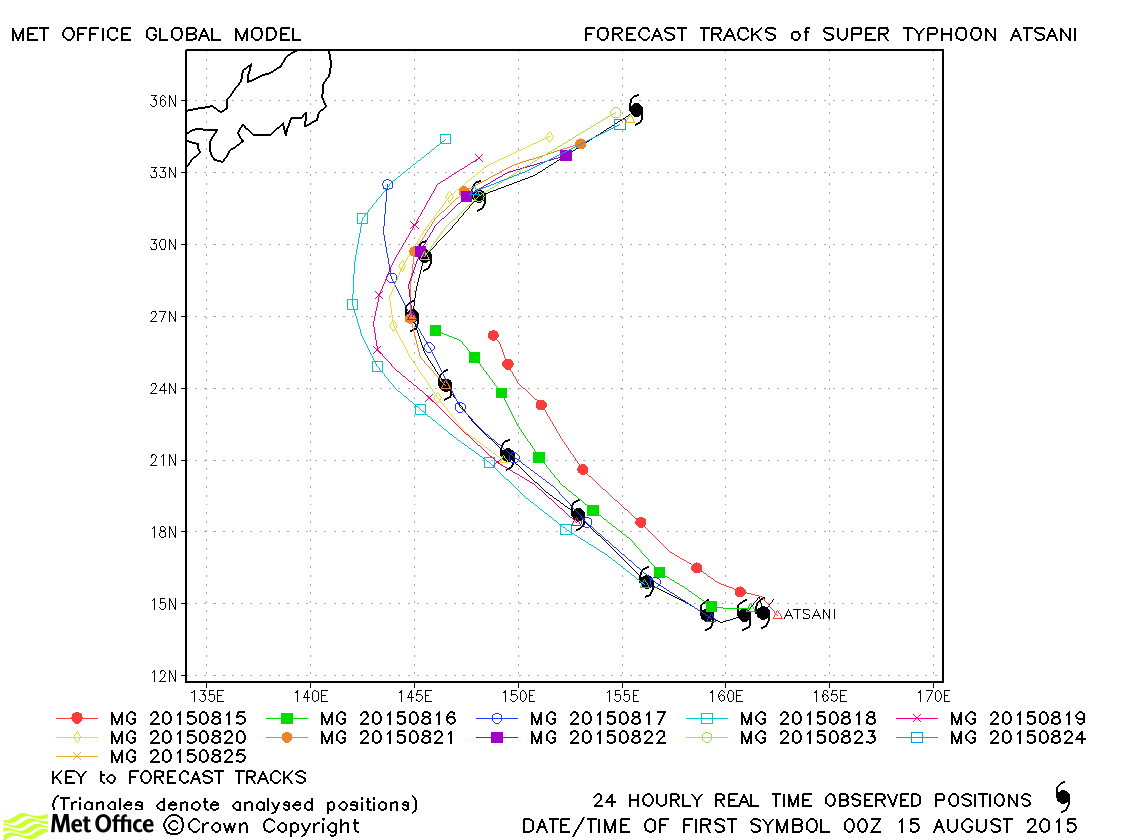
| Atsani (17W) | 14-25 August | 925 mb, 140/100 knots | Track forecast errors were below last season's average and skill scores high for this typhoon. |
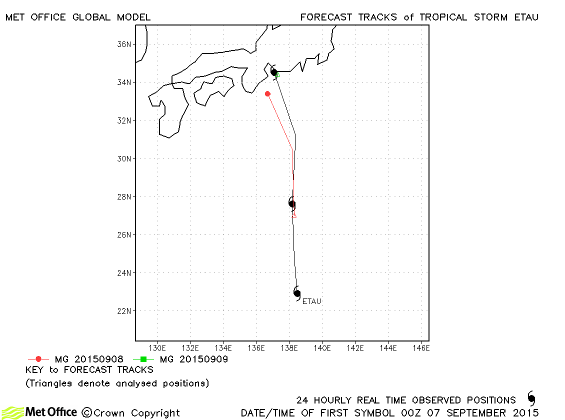
| Etau (18W) | 06-09 September | 985 mb, 60/50 knots | Etau was a relatively short-lived storm. Track forecasts had a slow bias. |
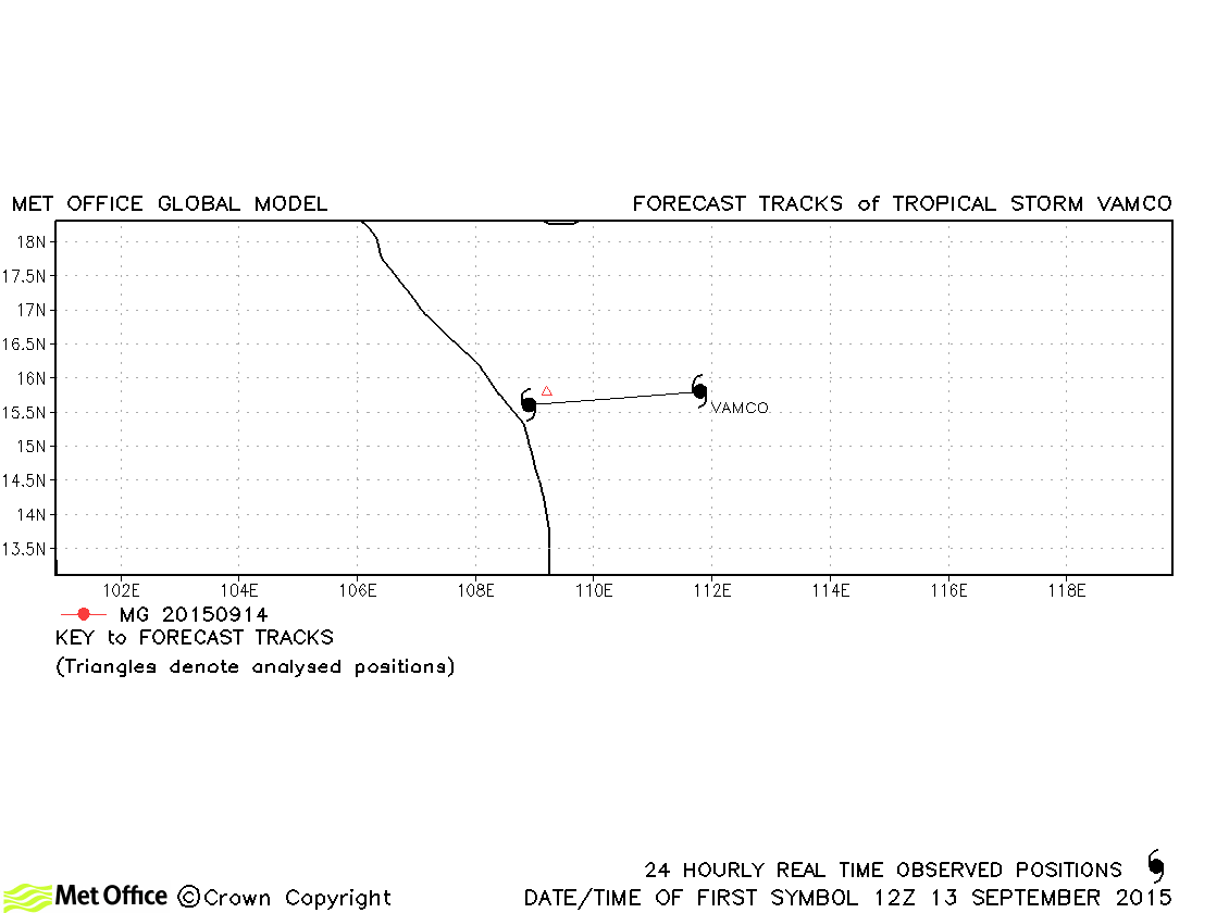
| Vamco (19W) | 13-14 September | 996 mb, 35/35 knots | Vamco was very short-lived and only one 12-hour forecast was verified. |
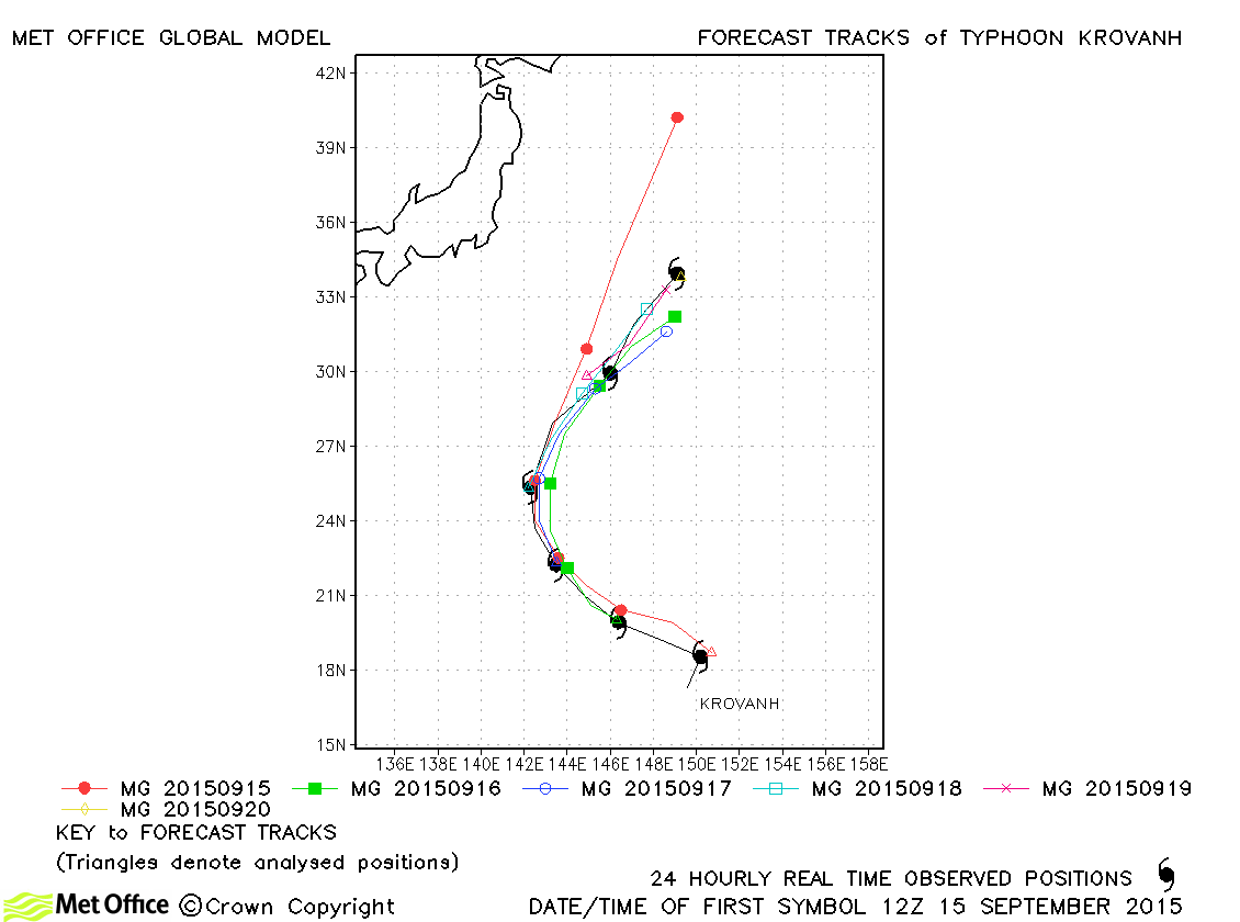
| Krovanh (20W) | 14-20 September | 945 mb, 105/85 knots | Track forecast errors were mixed, but generally the recurvature of the storm was well predicted. |
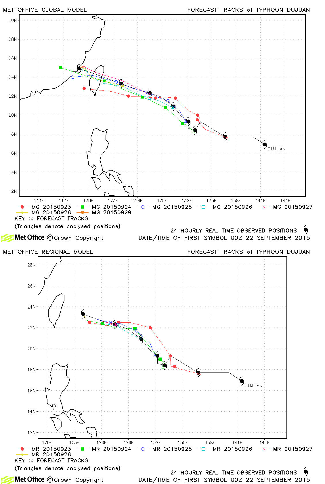
| Dujuan (21W) | 21-29 September | 925 mb, 125/100 knots | Track forecast errors were very low and skill scores very high for this typhoon. Landfall over Taiwan was mostly very well predicted. |
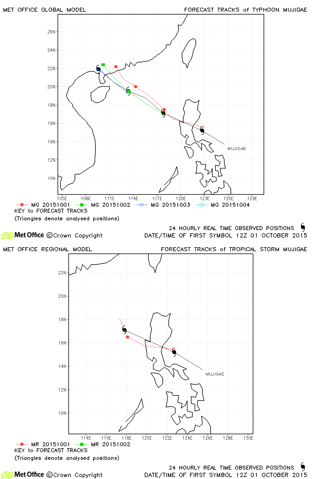
| Mujigae (22W) | 01-04 October | 965 mb, 115/70 knots | Track forecast errors were near to or below last season's average. Skill scores against CLIPER were high. There was a slight right-of-track bias in landfall predictions. |
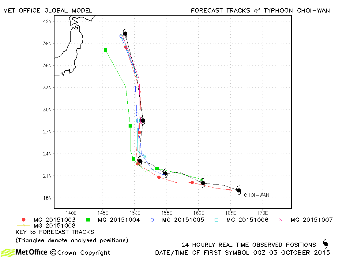
| Choi-wan (23W) | 02-08 October | 955 mb, 70/60 knots | Track forecast errors were low and skill scores high. The northwards turn and acceleration were well predicted. |
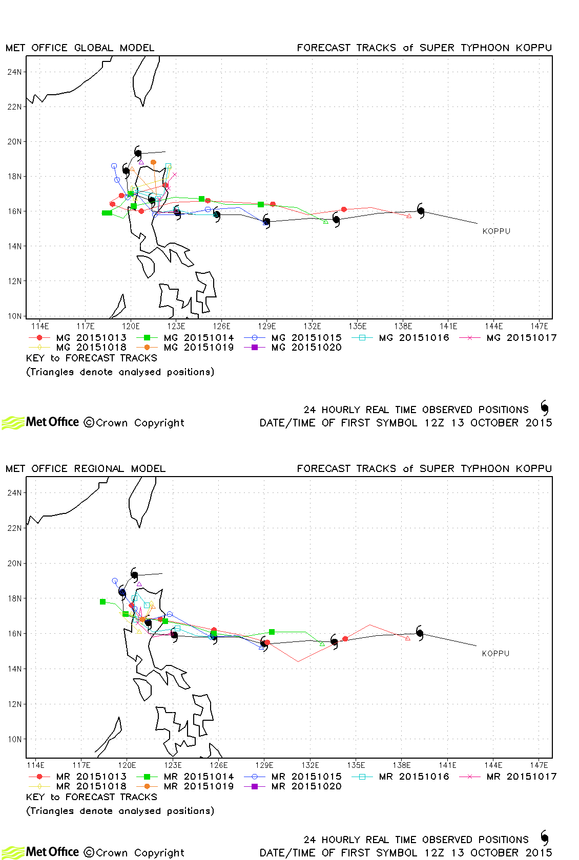
| Koppu (24W) | 13-21 October | 920 mb, 130/100 knots | Short lead time track forecast errors were above last season's average, but longer lead time errors were low. |
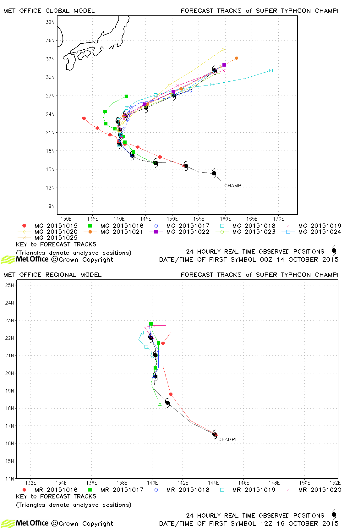
| Champi (25W) | 13-25 October | 940 mb, 130/90 knots | Track forecast errors were low and skill scores high for all but the longest lead times. |
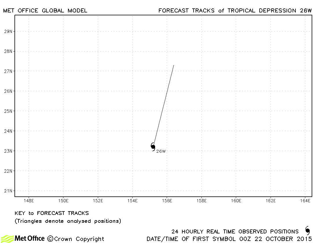
| 26W | 22 October | 1004 mb, 25/- knots | 26W did not attain tropical storm status and no forecasts are verified. |
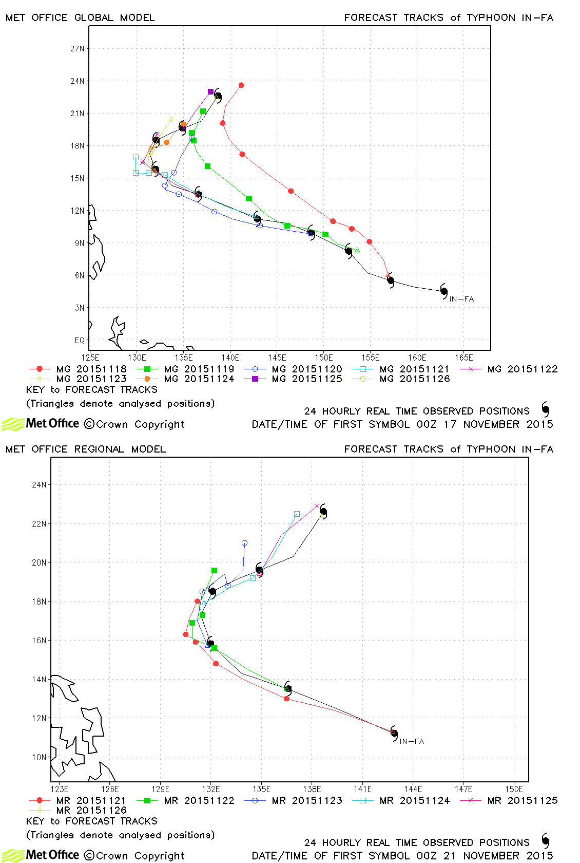
| In-fa (27W) | 17-26 November | 935 mb, 120/95 knots | Early forecasts had a right-of-track bias which resulted in errors well above last season's average overall. |
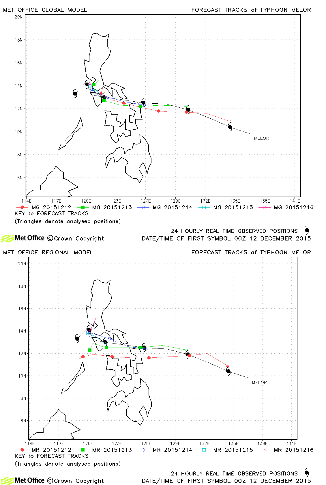
| Melor (28W) | 11-17 December | 935 mb, 125/95 knots | Track forecast errors were below last season's average for this storm. |
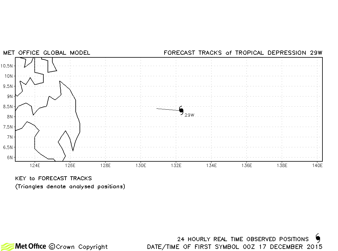
| 29W | 16-17 December | 1004 mb, 25/30 knots | No forecasts were verified for this tropical depression. |
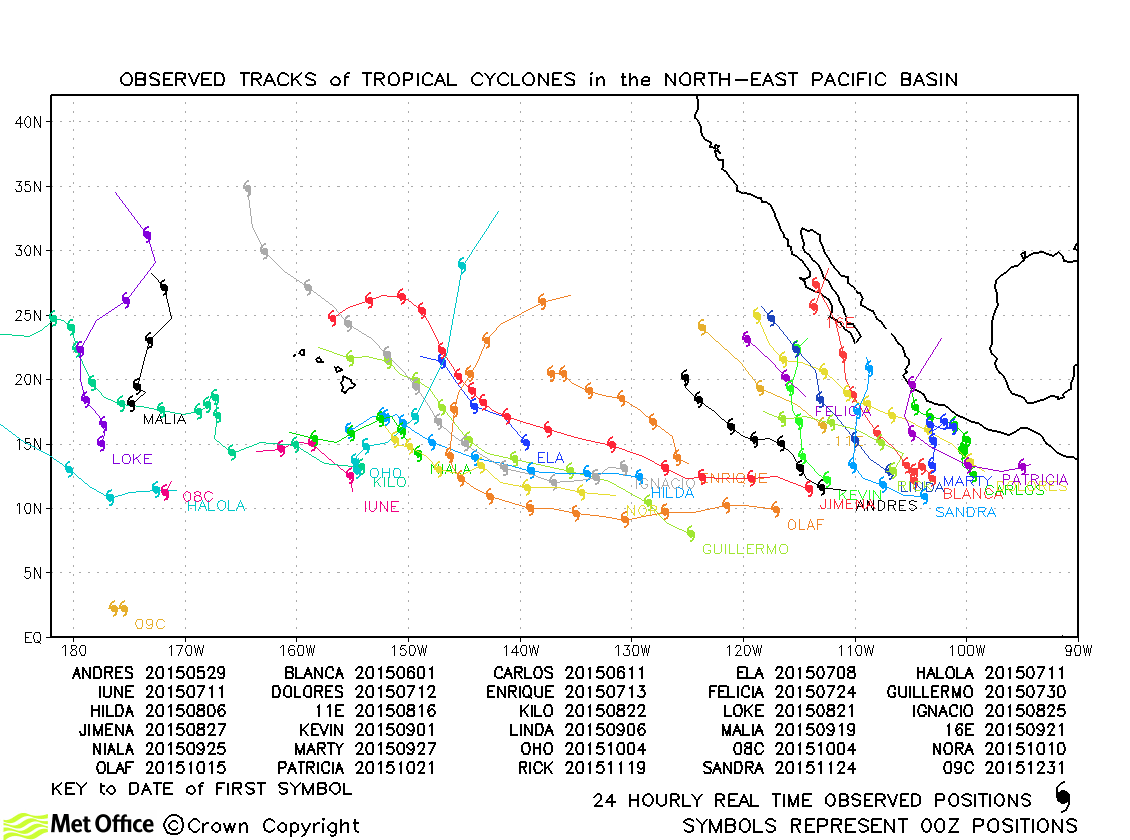
North-west Pacific observed tracks in 2015
Tropical cyclone names
| Name & ID | Start & end dates | Central pressure, 1-minute MSW | Comments on Met Office global model forecasts |
|---|---|---|---|
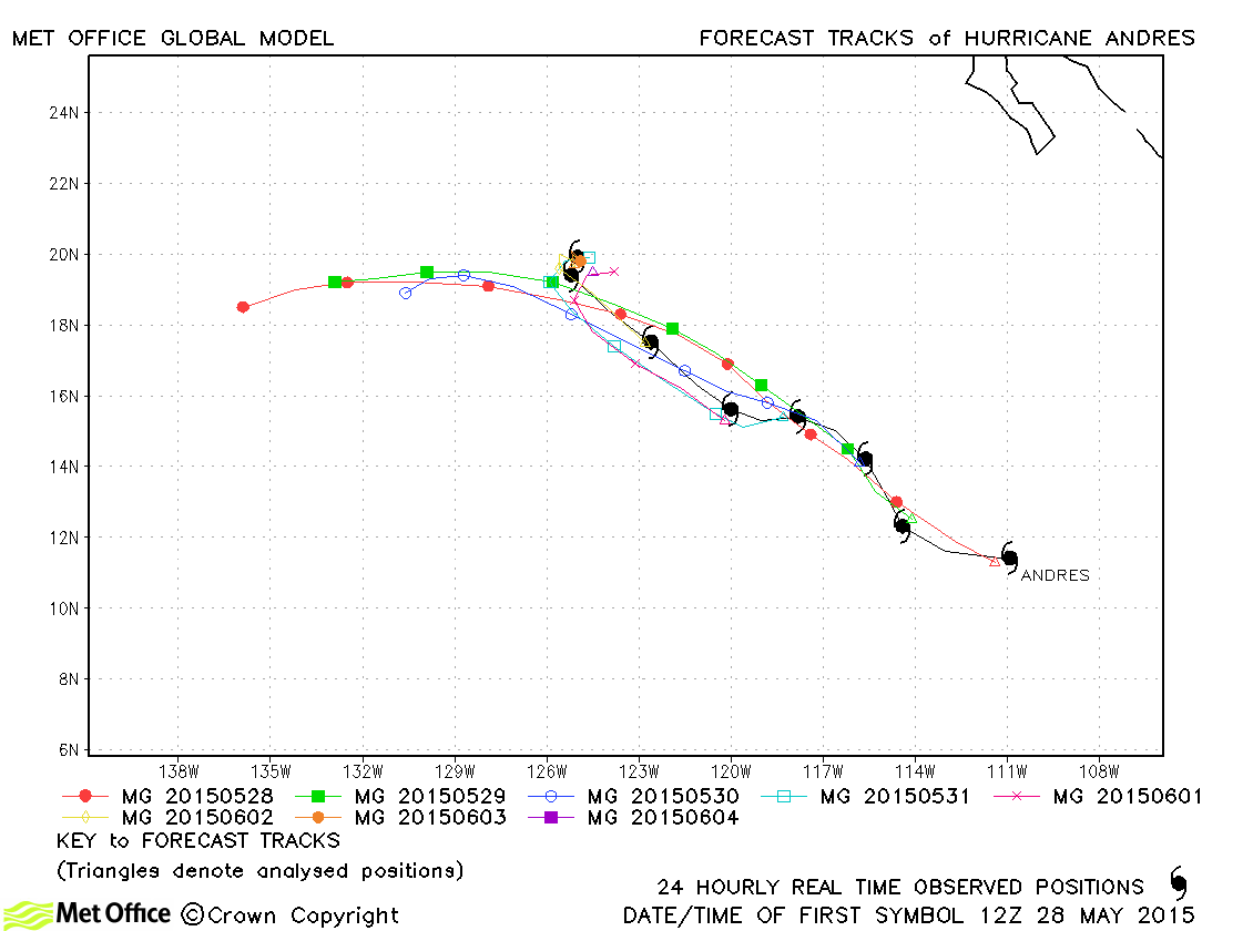
| Andres (01E) | 28 May-04 June | 938 mb, 125 knots | Track errors were mostly above last season's average due to a fast bias including a failure to slow the foreward motion prior to dissipation. However, skill scores against CLIPER were mostly positive. |
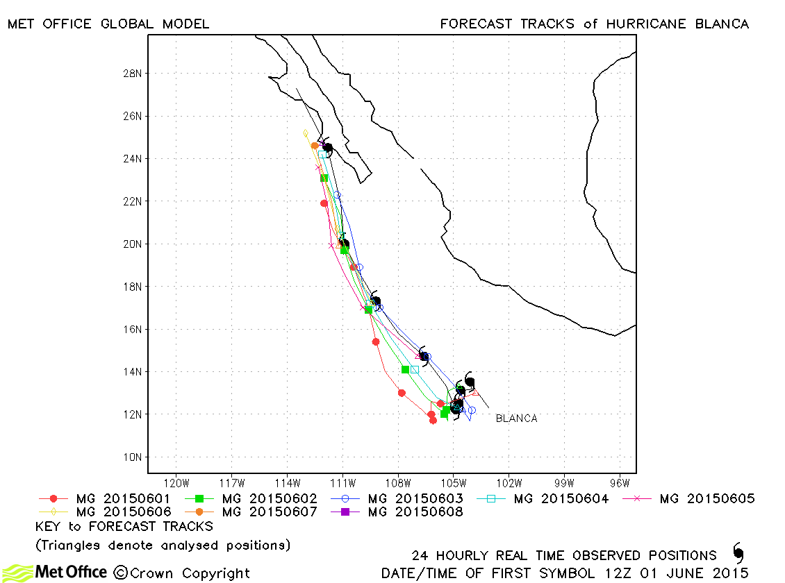
| Blanca (02E) | 31 May-09 June | 943 mb, 120 knots | Track forecast errors for this hurricane were very low and skill scores very high. |
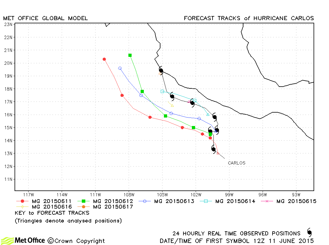
| Carlos (03E) | 10-17 June | 978 mb, 80 knots | Track forecast errors were above last season's average due to a left-of-track bias. |
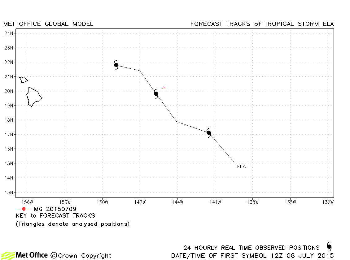
| Ela (04E) *1 | 08-10 July | 1003 mb, 35 knots | Ela only briefly reached tropical storm status and no forecasts were verified. |
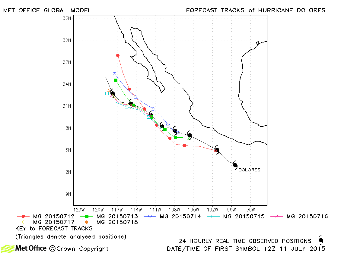
| Dolores (05E) | 11-19 July | 944 mb, 115 knots | Track forecast errors were well below last season's avlues for all but the longest lead times. |
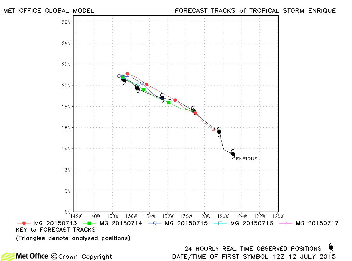
| Enrique (06E) | 12-18 July | 1000 mb, 45 knots | Track forecast errors were very low and skill scores very high for this storm. |
| Felicia (07E) | 23-25 July | 1004 mb, 35 knots | Felicia only briefly reached tropical storm status and no forecasts were verified. |
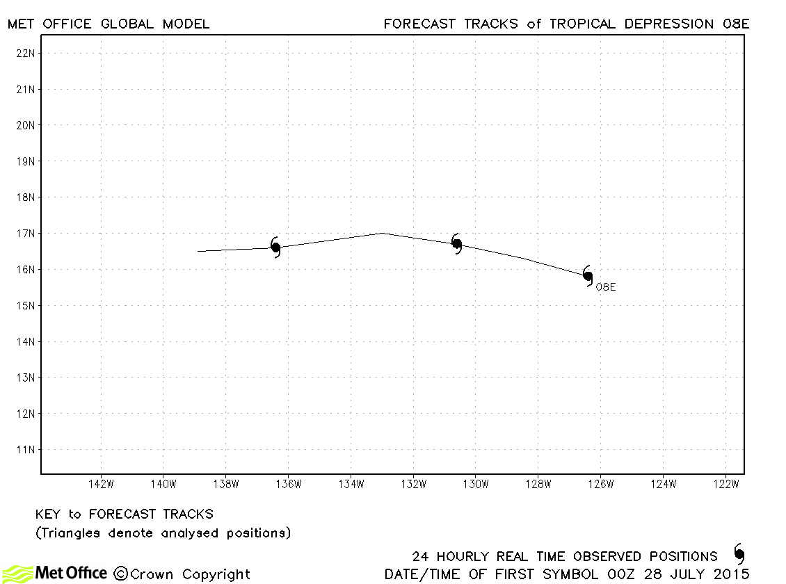
| 08E | 27-30 July | 1007 mb, 30 knots | No forecasts were verified for this depression. |
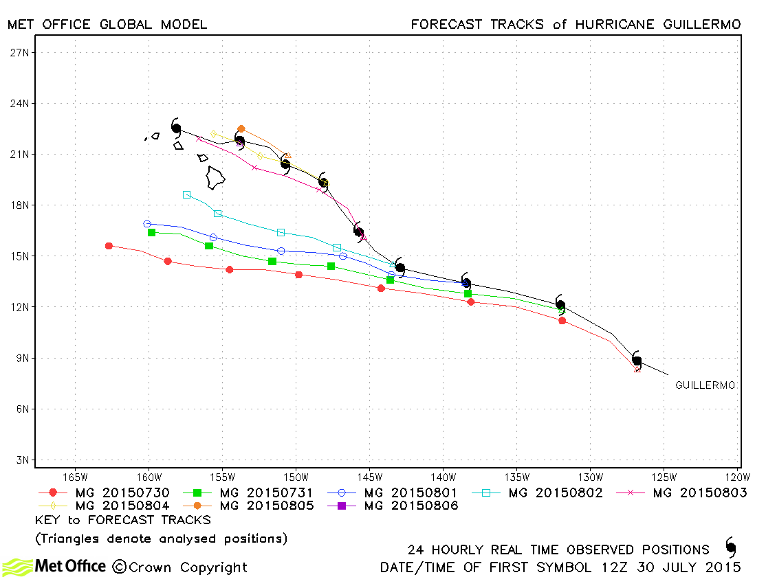
| Guillermo (09E) | 30 July - 07 August | 970 mb, 90 knots | Track forecast errors were large for this hurricane due to an early failure to predict the extent of the north-westwards turn, taking the hurricane north of Hawaii. |
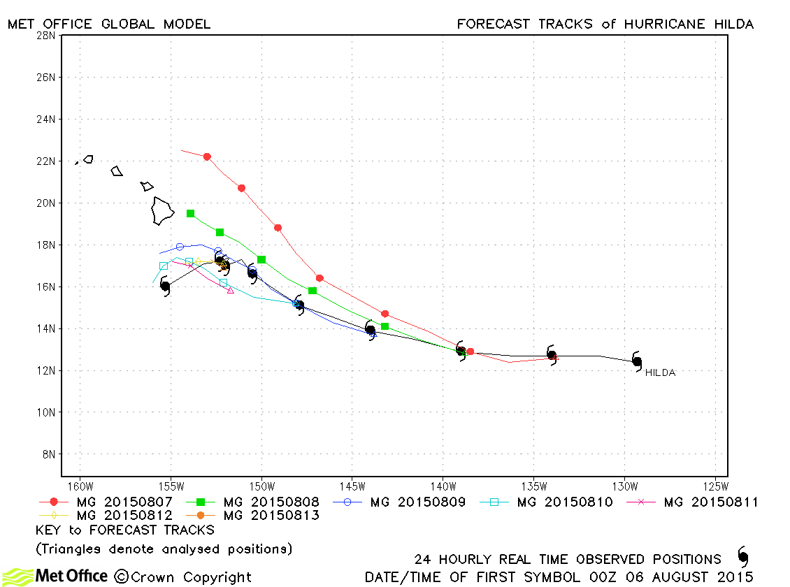
| Hilda (10E) | 06-14 August | 946 mb, 120 knots | Track forecast errors were close to last season's average. |
| 11E | 16-18 August | 1003 mb, 30 knots | No forecasts were verified for this depression. |
| Ignacio (12E) | 25 August-05 September | 942 mb, 125 knots | Apart from a couple of early forecasts which predicted landfall over Hawaii, track forecasts were very good with errors below average and high skill scores. |
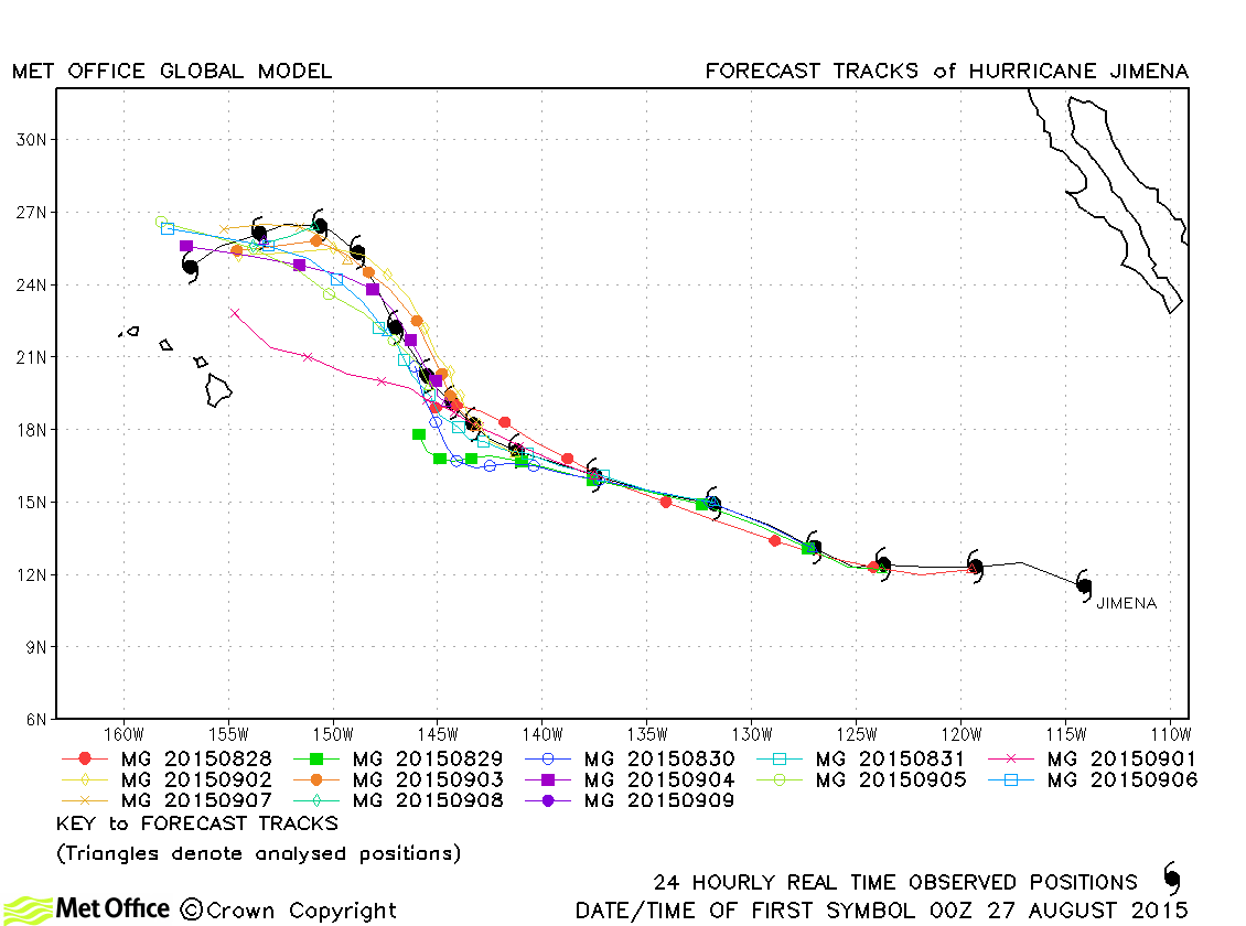
| Jimena (13E) | 26 August-10 September | 936 mb, 130 knots | Jimena was well predicted by the model. Track forecast errors were low and skill scores high. |
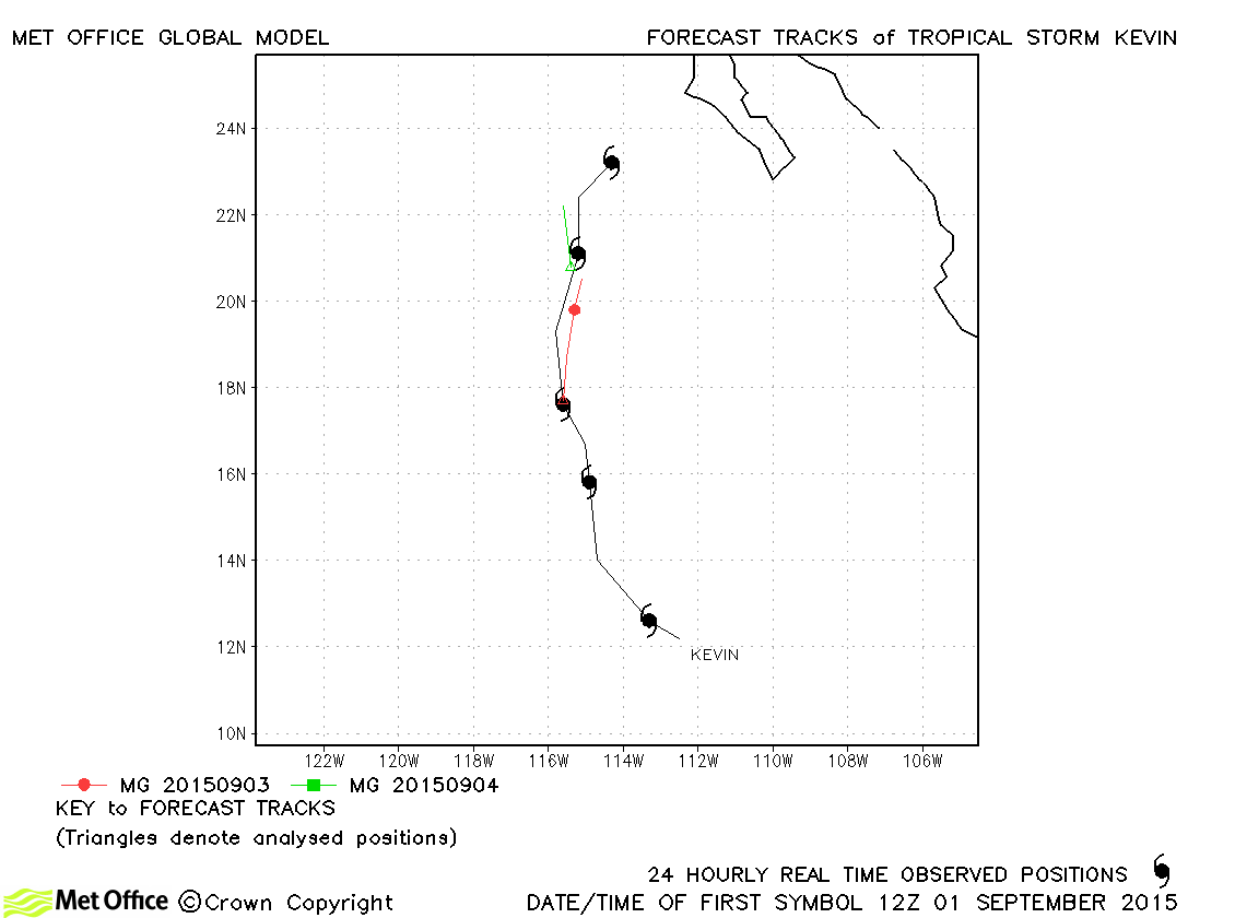
| Kevin (14E) | 31 August-05 September | 999 mb, 50 knots | Kevin was relatively short-lived and track forecast errors were above average due to a slow bias. |
| Linda (15E) | 06-10 September | 951 mb, 110 knots | Track forecast errors were lower than last season's average. There was a slight fast bias at some lead times. |
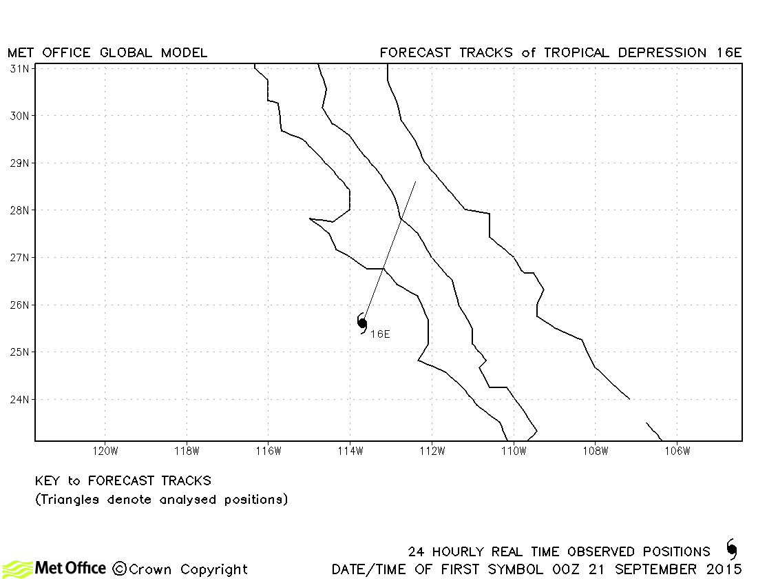
| 16E | 20-21 September | 1002 mb, 30 knots | 16E did not reach tropical storm status and no forecasts were verified. |
| Marty (17E) | 26 September-01 October | 987 mb, 70 knots | Track forecast errors were mostly below last season's average. |
| Nora (18E) | 09-15 October | 993 mb, 60 knots | Track forecast errors were larger than average for this storm due to a strong right-of-track bias. |
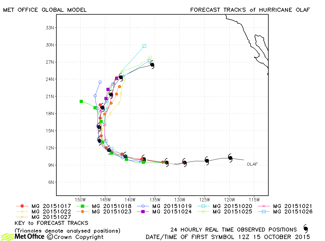
| Olaf (19E) | 15-27 October | 938 mb, 130 knots | Track forecast errors were near to last season's average at short lead times, but well below average at longer lead times. The recurvature was well predicted. |
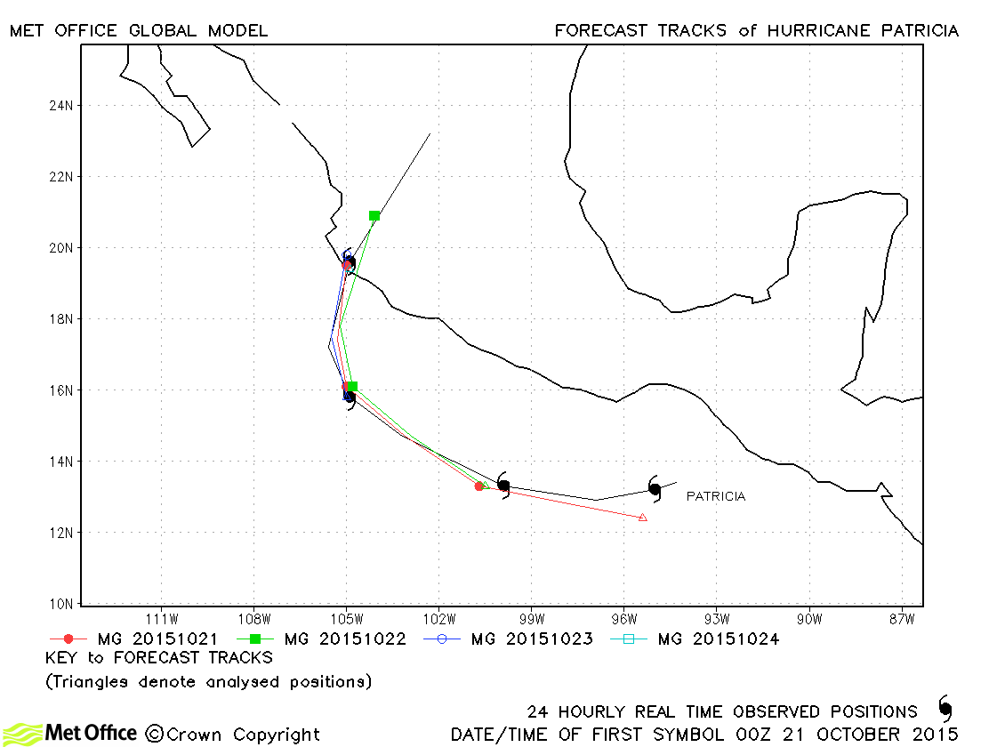
| Patricia (20E) | 20-24 October | 872 mb, 185 knots *2 | Although the global model was not able to predict the extreme intensity of Patricia, track forecasts were excellent. The 3-day forecast error for landfall was just 17 km. |
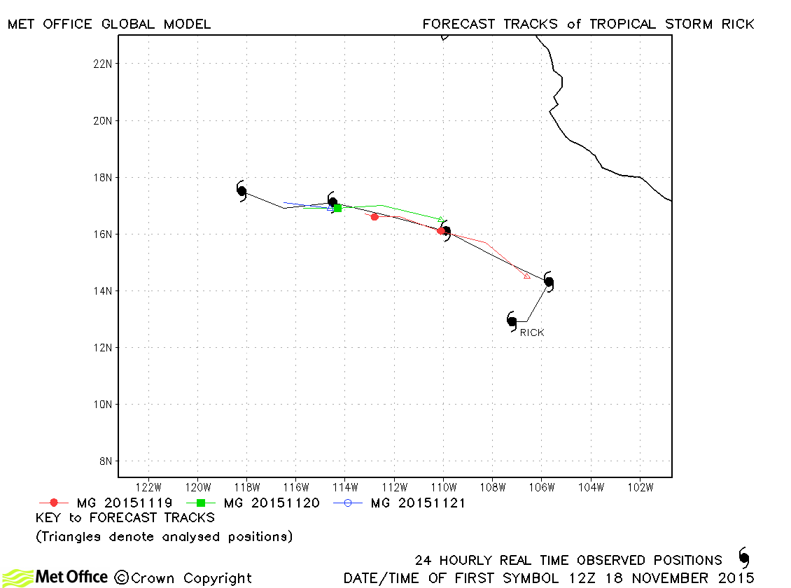
| Rick (21E) | 18-22 November | 1001 mb, 40 knots | Track forecast errors were mixed with a slow bias at longer lead times. |
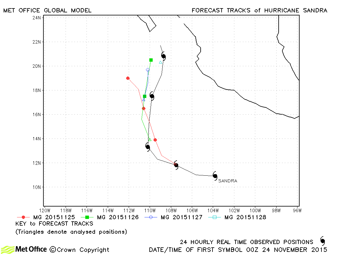
| Sandra (22E) | 23-28 November | 935 mb, 125 knots | Track forecast errors were above last season's average due to a slow and left-of-track bias. |
| Name & ID | Start & end dates | Central Pressure, 1-minute MSW | Comments on Met Office global model forecasts |
|---|---|---|---|
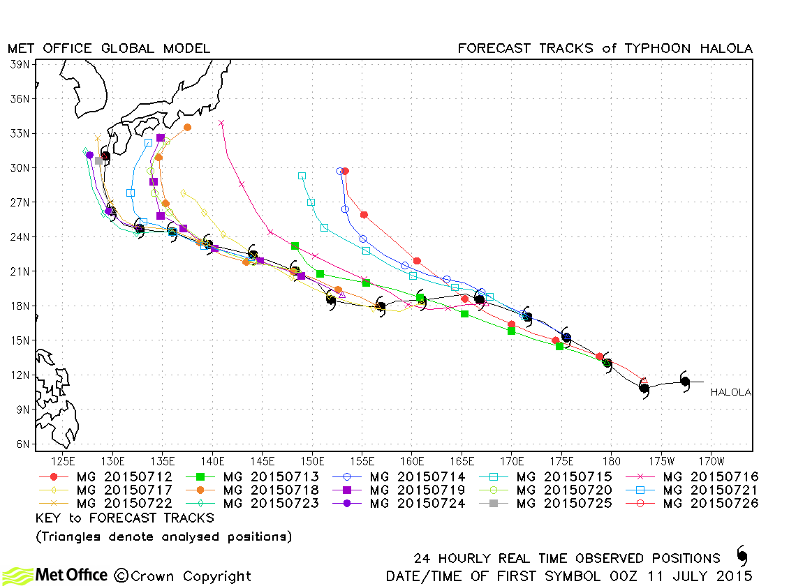
| Halola (01C) *3 | 10-26 July | 955 mb, 90/80 knots | Halola has track forecast errors near to last season's values in forecasts up to 120 hours. At longer lead times errors were larger due to a tendency to recurve the typhoon too soon. |
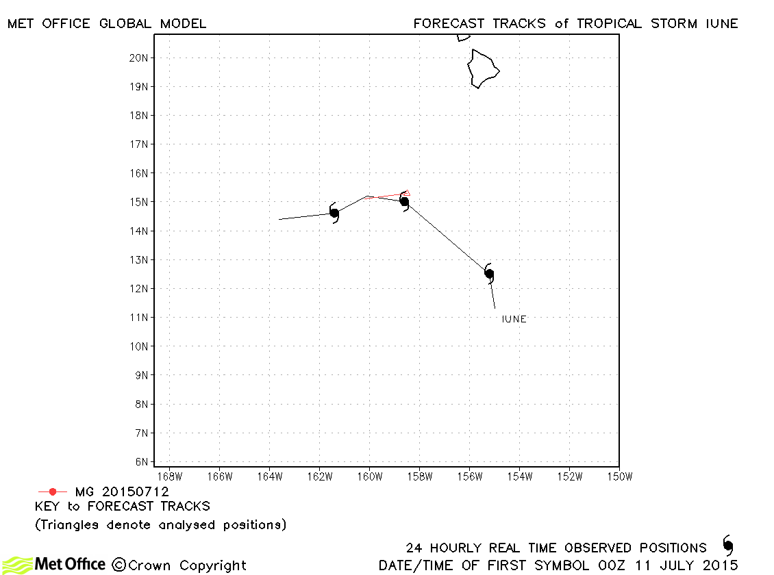
| Iune (02C) | 10-13 July | 1003 mb, 35 knots | Iune was a short-lived tropical storm. |
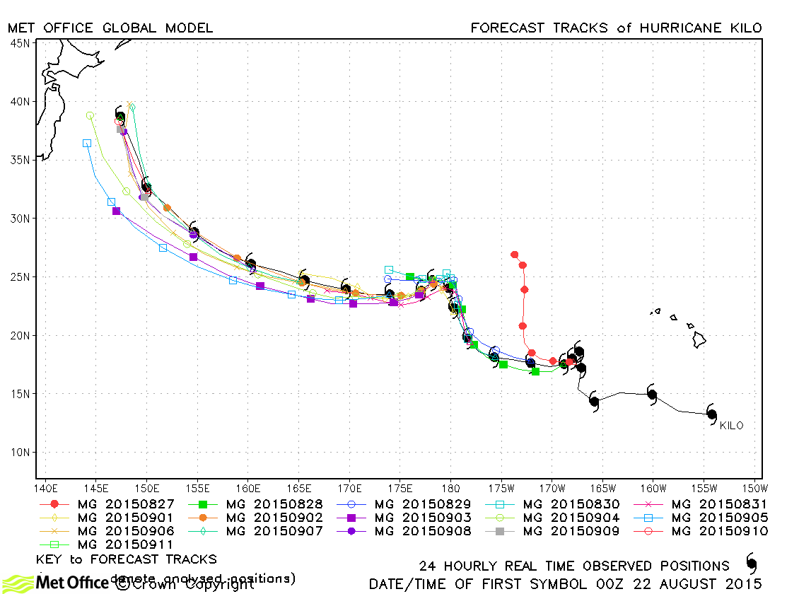
| Kilo (03C) *3 | 20 August-11 September | 940 mb, 120 knots | Kilo was long-lived, being active for three weeks. It passed from the Central North Pacific into the North-West Pacific region. Track forecast errors were lower than last season's average at all lead times and skill scores against CLIPER were high. |
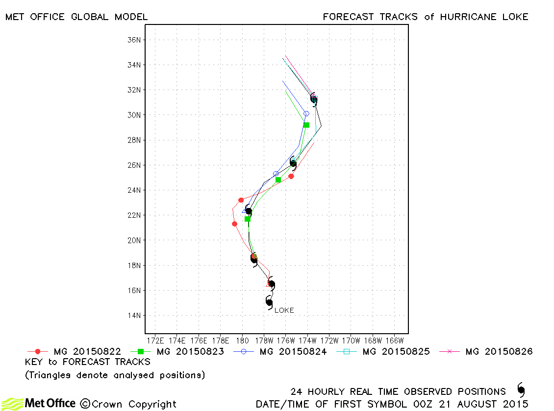
| Loke (04C) | 21-26 August | 986 mb, 65 knots | Track forecast errors were above last season's average due to a slow bias. |
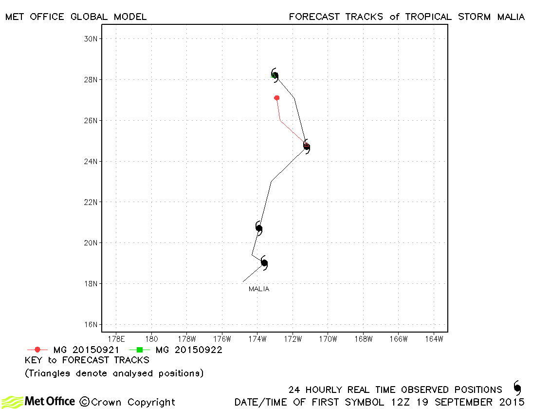
| Malia (05C) | 19-22 September | 1001 mb, 35 knots | Malia only briefly reached tropical storm status and track errors were above last season's average. |
| Niala (06C) | 25-29 September | 992 mb, 55 knots | Track forecast errors were close to last season's average for this storm. |
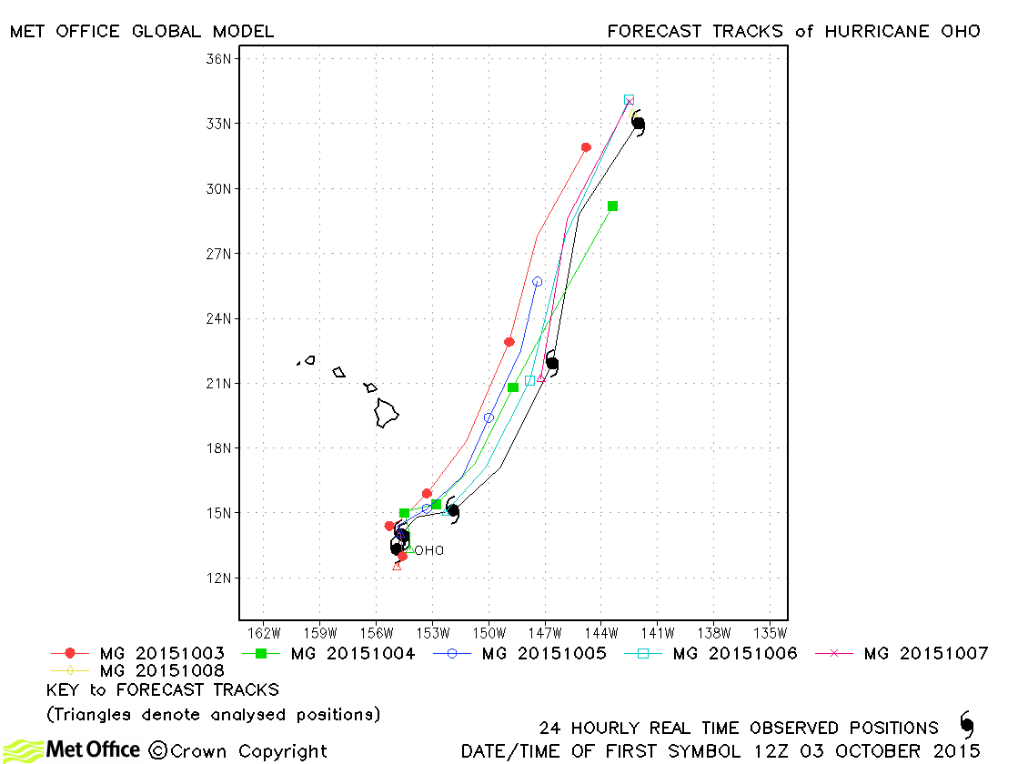
| Oho (07C) | 03-08 October | 957 mb, 95 knots | Track forecast errors were mostly above last season's average due to a slow bias. However, the direction of motion was well predicted. |
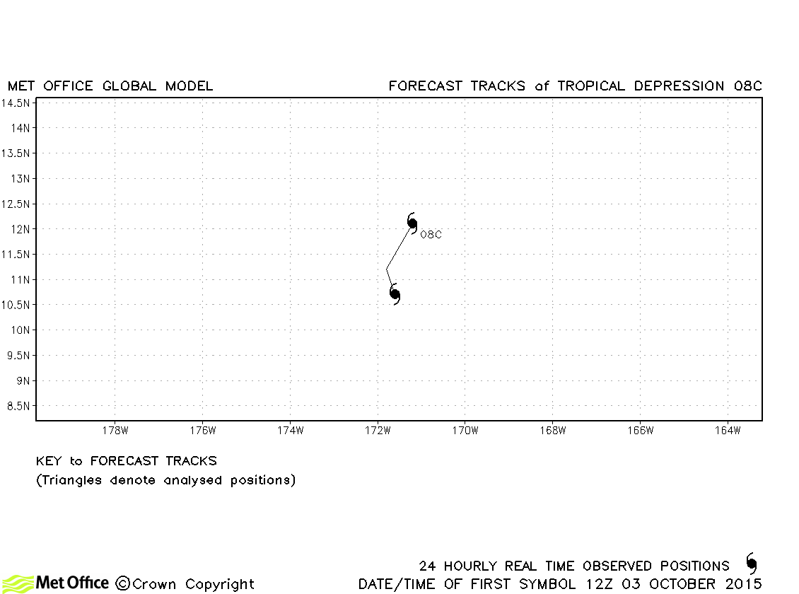
| 08C | 03-04 October | 1001 mb, 30 knots | No forecasts were verified for this tropical depression. |
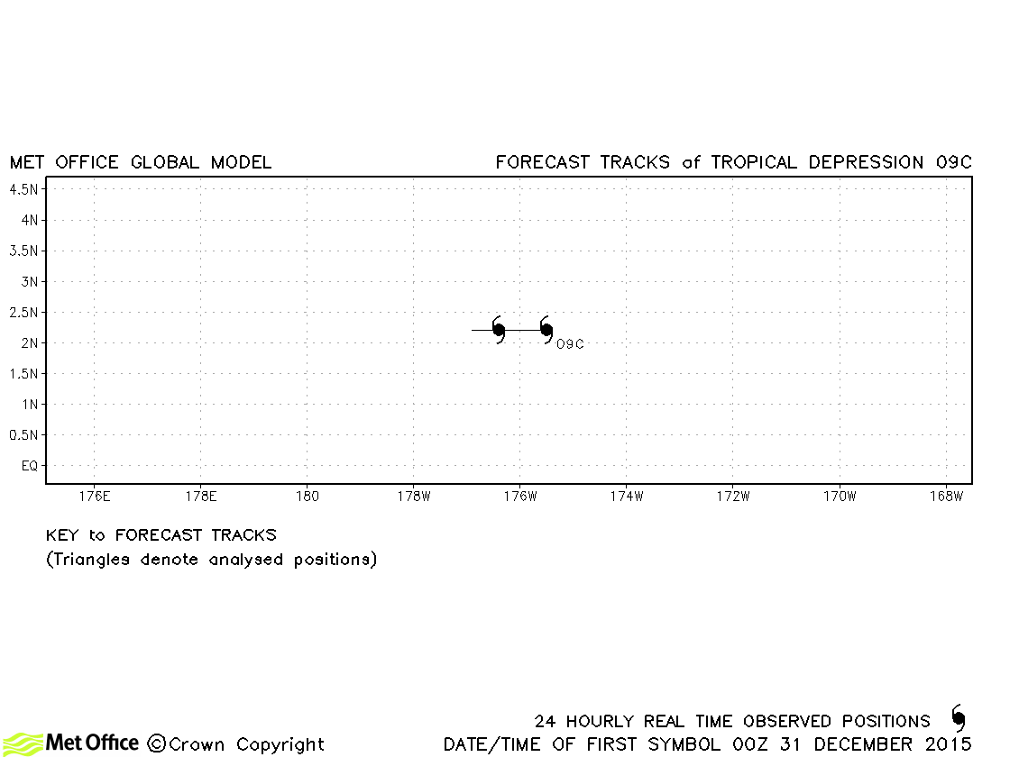
| 09C | 31 December-01 January | 1001 mb, 30 knots | No forecasts were verified for this tropical depression. |
*1 Ela originated in the North-East Pacific, but spent most of its life in the Central North Pacific.
*2 Updated with central pressure and wind speed values from post-event report.
*3 Halola and Kilo originated in the Central North Pacific, but spent most of their lives in the North-West Pacific.
North-east and Central North Pacific observed tracks in 2015
| Name & ID | Start & end dates | Central pressure, 1-minute MSW | Comments on Met Office global model forecasts |
|---|---|---|---|
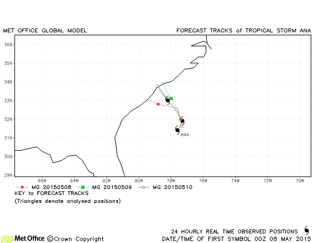
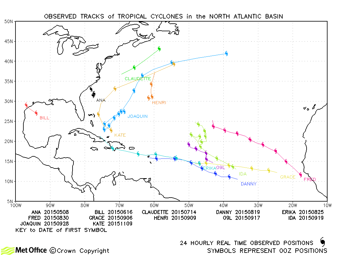
| Ana (01L) | 08-10 May | 998 mb, 50 knots | Ana was relatively short-lived, but track forecast errors were low. |
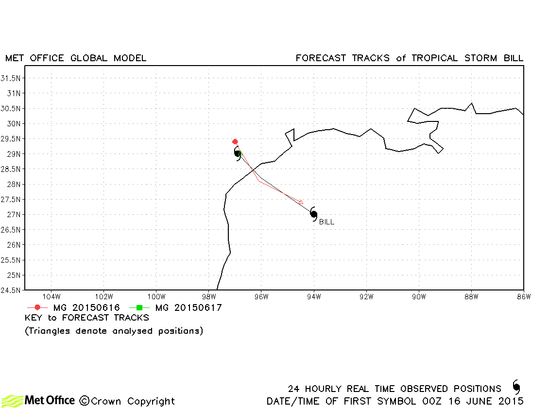
| Bill (02L) | 16-17 June | 997 mb, 50 knots | Bill only formed shortly before landfall, but its track forecast errors were low. |
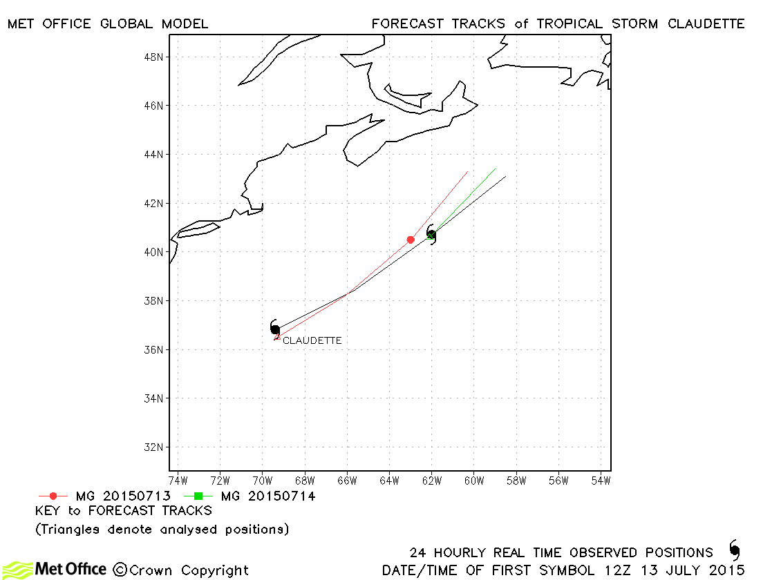
| Claudette (03L) | 13-15 July | 1004 mb, 45 knots | Claudette was short-lived and track forecast errors were near last season's average. |
| Danny (04L) | 18-24 August | 974 mb, 100 knots | Track forecast errors were near to or slightly above last season's average. |
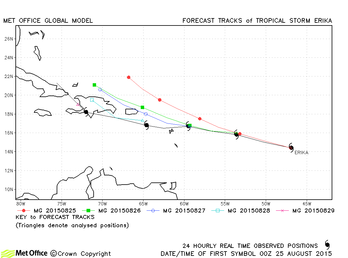
| Erika (05L) | 25-29 August | 1001 mb, 45 knots | Track forecast errors were above last season's average due to a right-of-track bias. |
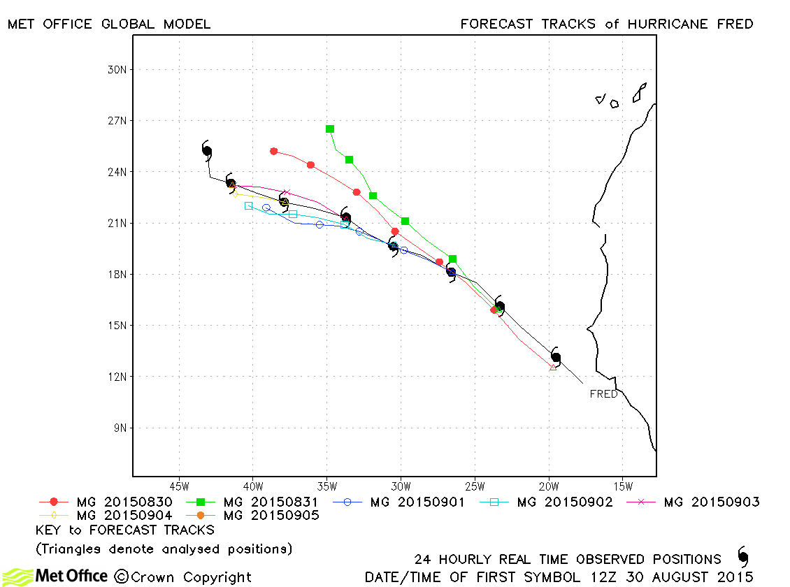
| Fred (06L) | 30 August-06 September | 989 mb, 70 knots | Short lead time forecasts had track forecast errors close to average, but errors at longer lead times were above average due to a slow and right-of-track bias. |
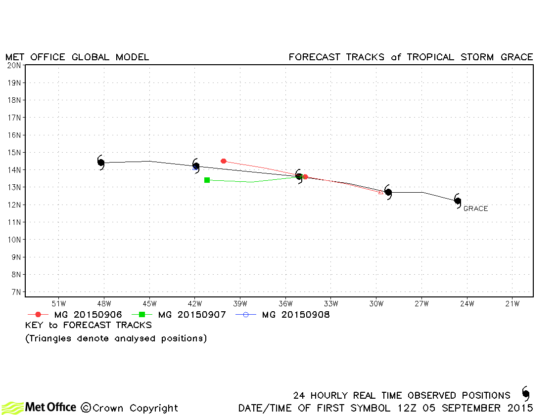
| Grace (07L) | 05-09 September | 1002 mb, 45 knots | Track forecast errors were near to or slightly above last season's average for this storm. |
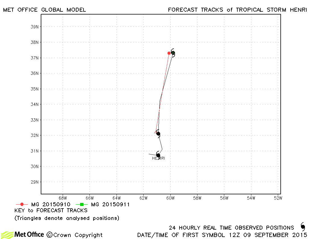
| Henri (08L) | 09-11 September | 1008 mb, 35 knots | Henri was short-lived and very few forecasts were verified. |
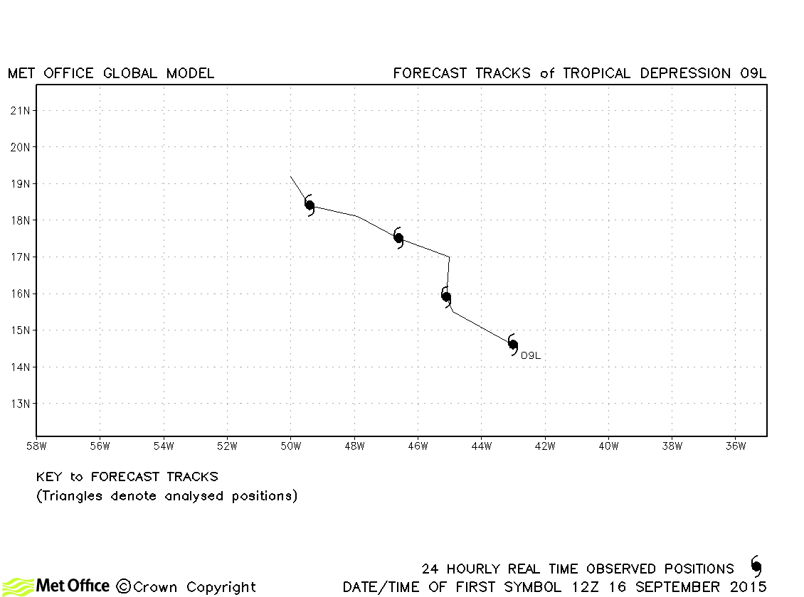
| 09L | 16-20 September | 1006 mb, 30 knots | 09L did not achieve tropical storm status. |
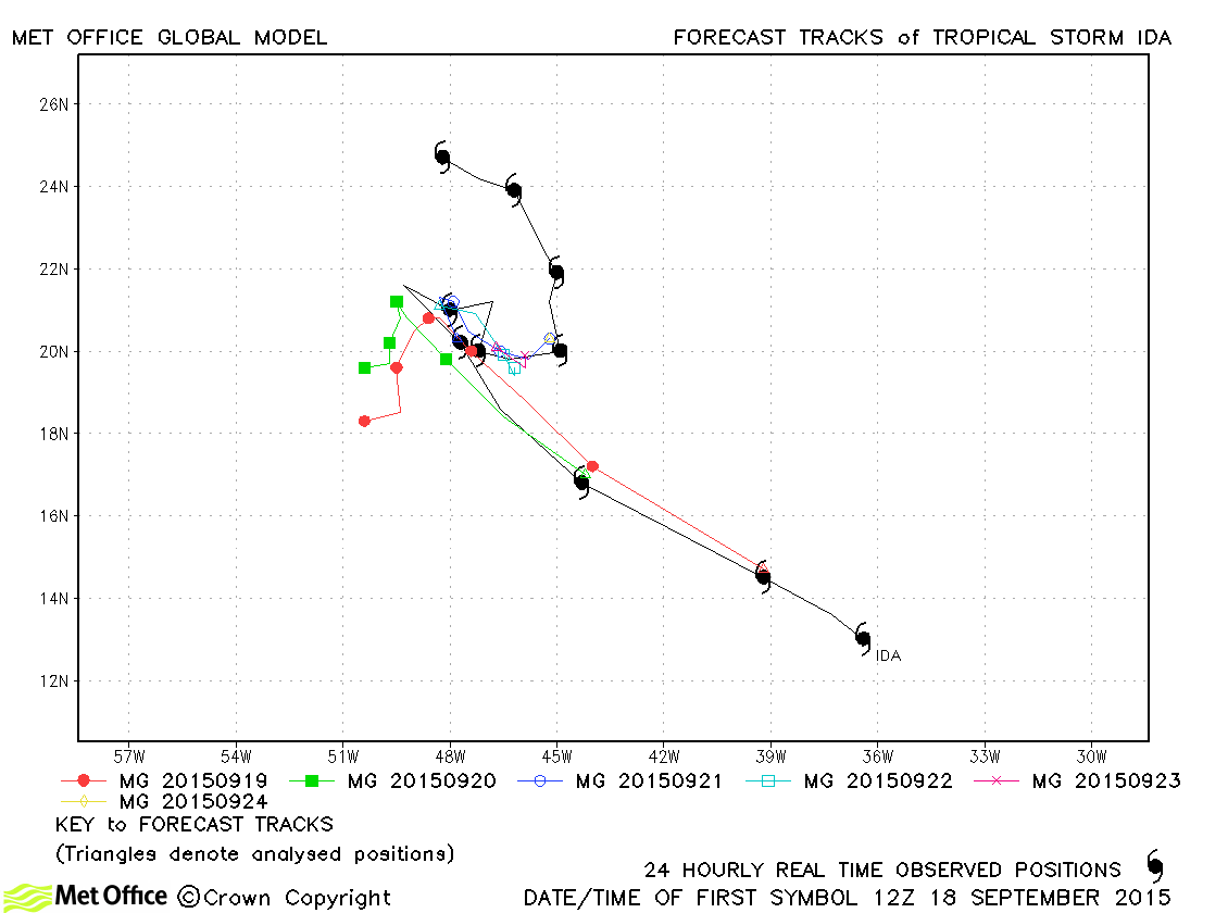
| Ida (10L) | 18-27 September | 1003 mb, 45 knots | Track forecast errors were near to or above last season's average. The slow down was well predicted, but the direction of motion after this time was not. |
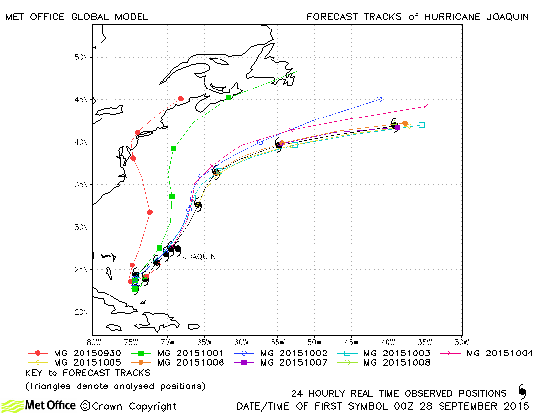
| Joaquin (11L) | 28 September-08 October | 931 mb, 135 knots | The model had a left-of-track bias resulting in longer lead time errors being very large. Whilst this bias was larger than the ECMWF model it was not as large as some other models. |
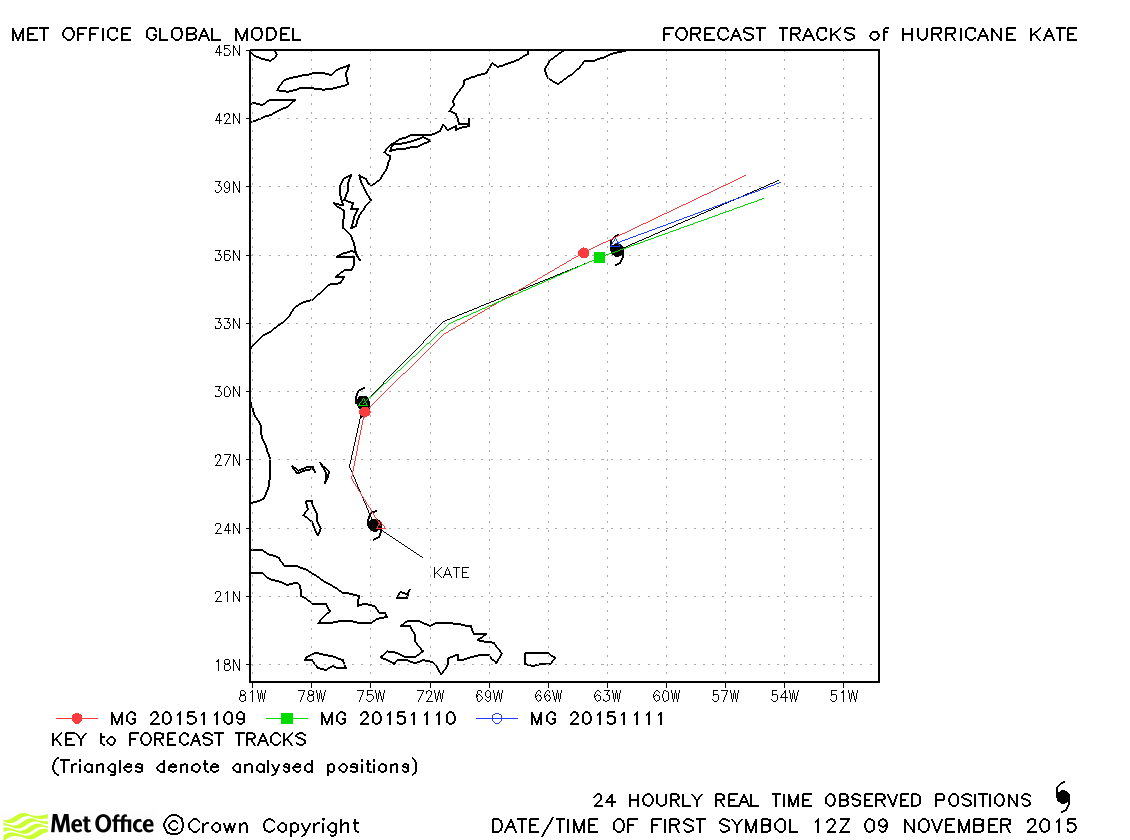
| Kate (12L) | 09-12 November | 983 mb, 65 knots | Track forecast errors were near average overall and the model predicted recurvature and extratropical transition well. |
North Atlantic observed tracks in 2015
| Name & ID | Start & end dates | Central pressure, 1-/10-minute MSW | Comments on Met Office global model forecasts |
|---|---|---|---|
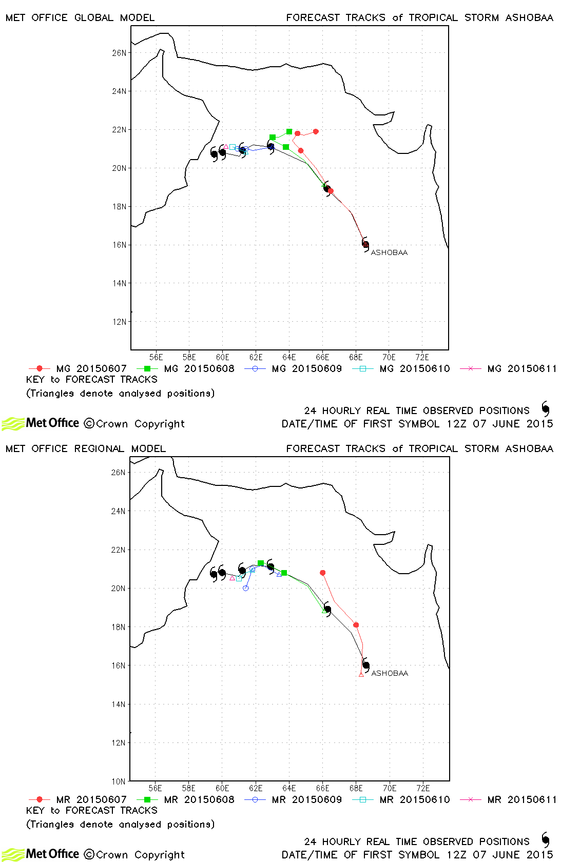
| Ashobaa (01A) | 07-12 June | 982 mb, 55/45 knots | Track forecast errors were above last season's average primarily due to a tendency to recurve the storm in early forecasts. Later forecasts predicted the slow movement towards Oman well. |
| Komen (02B) | 29-31 July | 986 mb, 40/40 knots | Only a few forecasts were verified for this storm, but track errors were near to last season's average. |
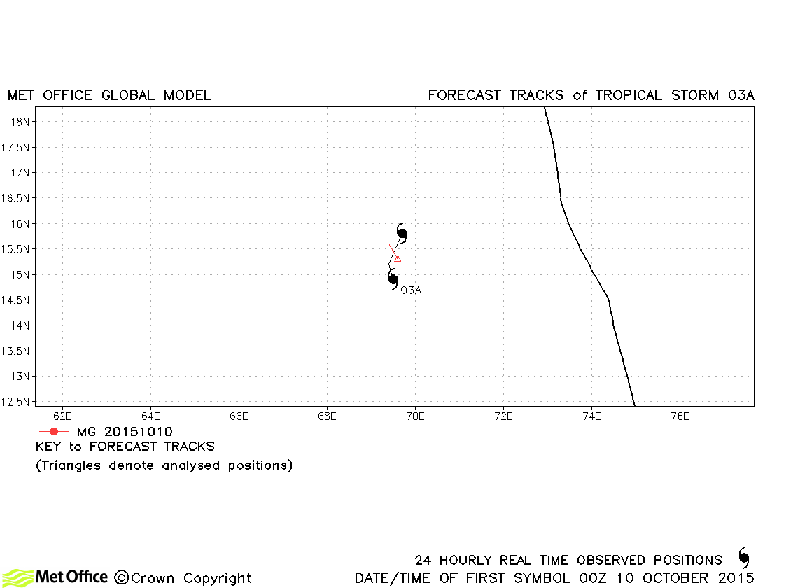
| 03A | 09-11 October | 996 mb, 35/30 knots | This was short-lived as a tropical storm. |
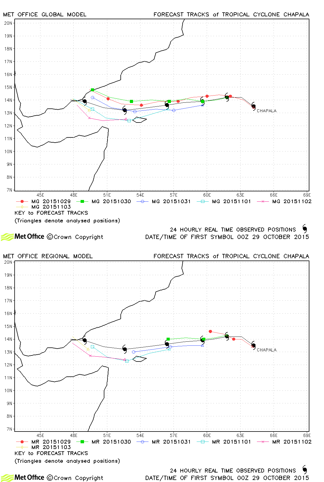
| Chapala (04A) | 28 October-04 November | 922 mb, 135/115 knots | Track forecast errors were well below last season's average for this cyclone which made landfall over Yemen. |
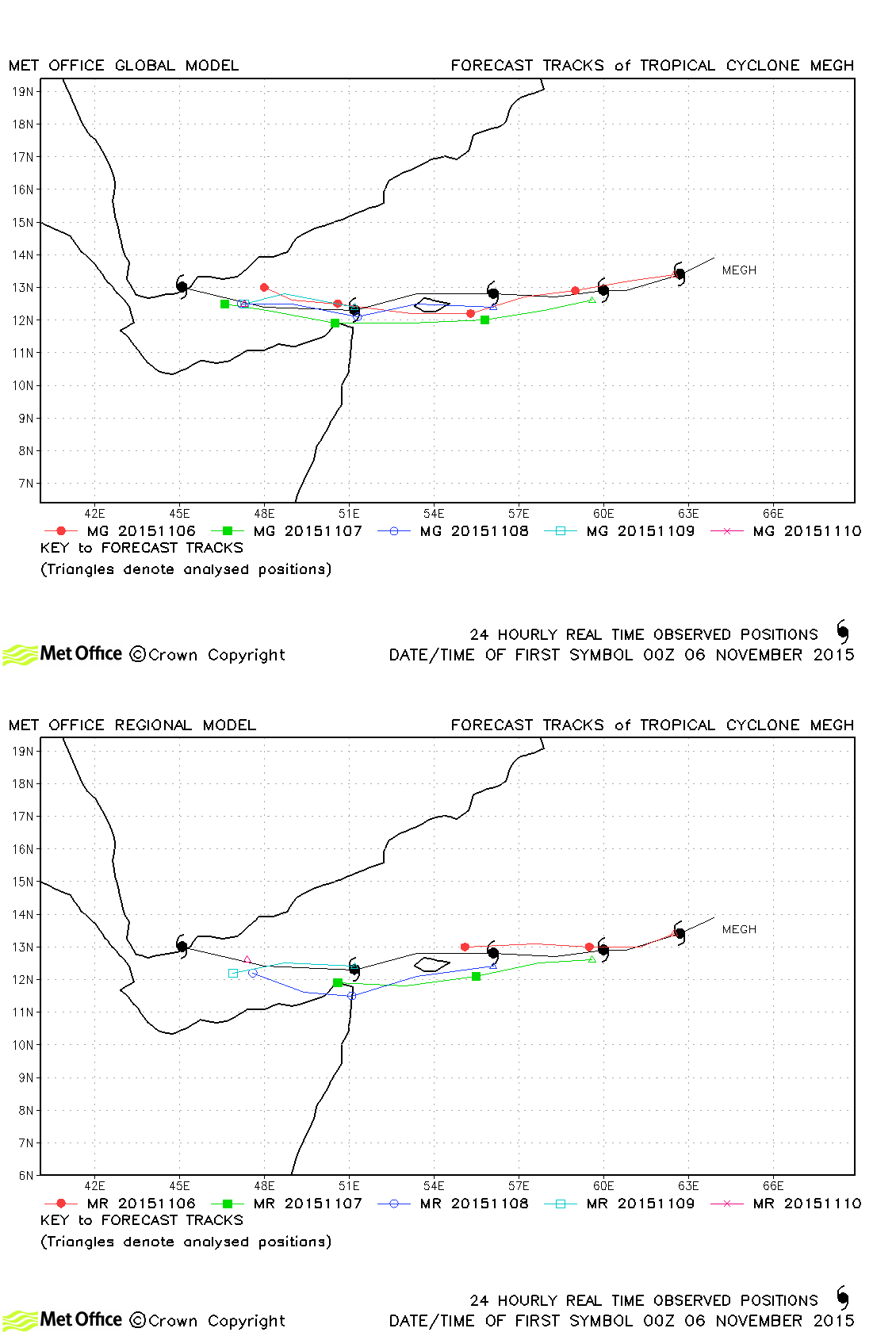
| Megh (05A) | 05-10 November | 941 mb, 110/95 knots | Track forecast errors were near to or below last season's average for this region. |
North Indian observed tracks in 2015
Note on estimated wind speeds
1-minute MSW: Maximum sustained wind (knots) averaged over 1 minute (JTWC Hawaii, NHC Miami, CPHC Hawaii)
10-minute MSW: Maximum sustained wind (knots) averaged over 10 minutes (JMA Japan, IMD New Delhi)
Note: Although 1-minute average winds should be stronger than 10-minute average, this may not be the case here since estimates are obtained from different warning centres.

