

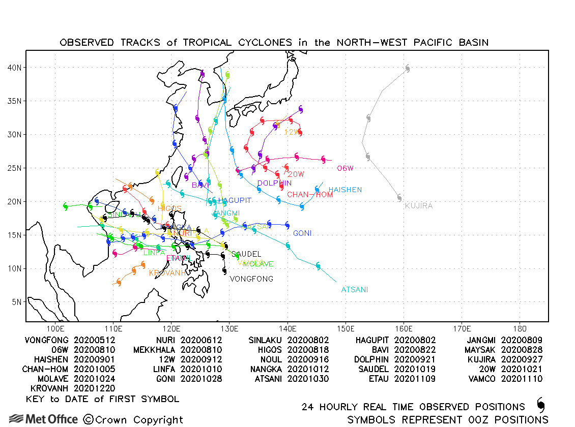
Observed and forecast tracks: northern hemisphere 2020
All tropical cyclones in the northern hemisphere season in 2020 are listed below including details of their start and end dates, lowest central pressure and maximum sustained wind (MSW).
Click on the name of the tropical cyclone to see a chart of the observed track and forecast tracks from the Met Office global model. Verification statistics on each tropical cyclone are available upon request from [email protected]. At the end of the season a verification report on the performance of the Met Office global model will be published.
| Name & ID | Start & end dates | Central pressure, 1-/10-minute MSW | Comments on Met Office global model forecasts |
|---|---|---|---|
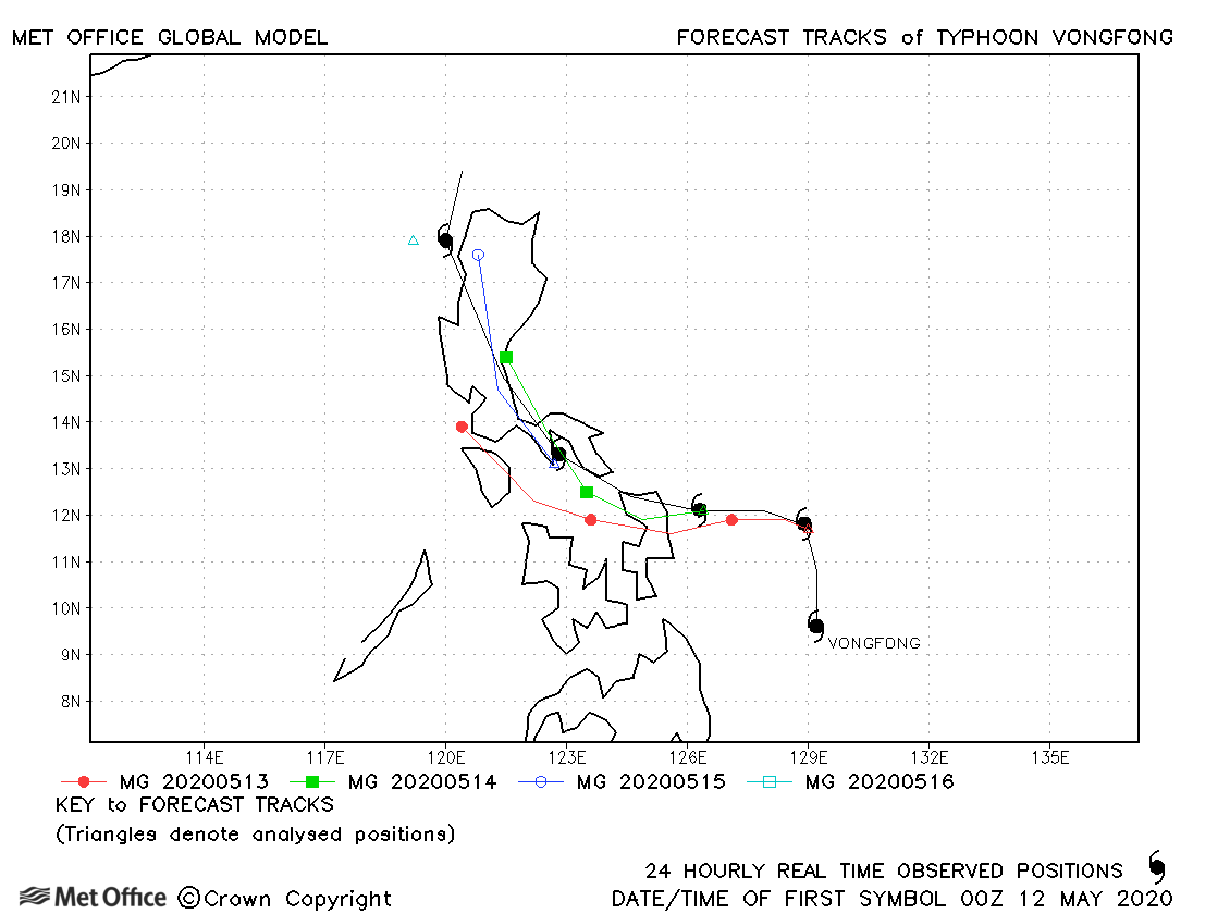
| 11-16 May | 965 mb, 105/80 knots |
Forecasts for Vongfong had a left-of-track and slow bias resulting in track errors above the recent running mean value. |
|
| 12-14 June | 996 mb, 35/40 knots |
Nuri only briefly reached tropical storm status. |
|
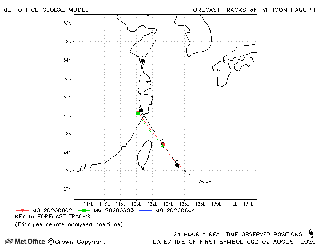
| Hagupit (03W) | 01-05 August | 975 mb, 75/70 knots | Track forecast errors were below the recent running mean. |
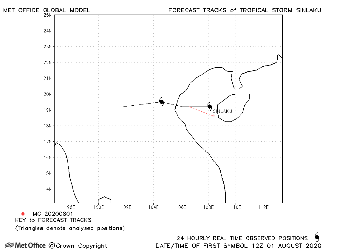
| Sinlaku (04W) | 01-03 August | 992 mb, 35/35 knots | Sinlaku was only briefly a tropical storm. |
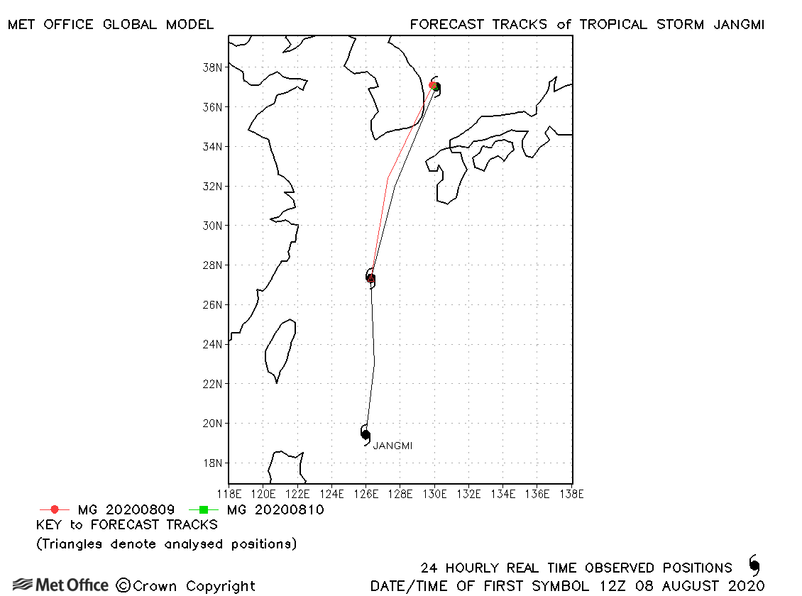
| Jangmi (05W) | 08-10 August | 996 mb, 40/45 knots | Track forecast errors were low for this storm. |
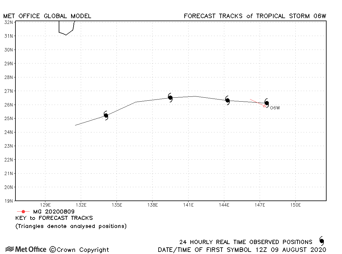
| 06W | 09-13 August | 1005 mb, 45/30 knots | 06W was only briefly a tropical storm according to JTWC only. |
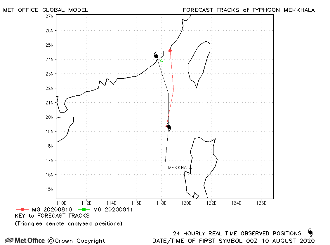
| Mekkhala (07W) | 09-11 August | 992 mb, 70/50 knots | Mekkhala was a tropical storm for only about 24 hours. |
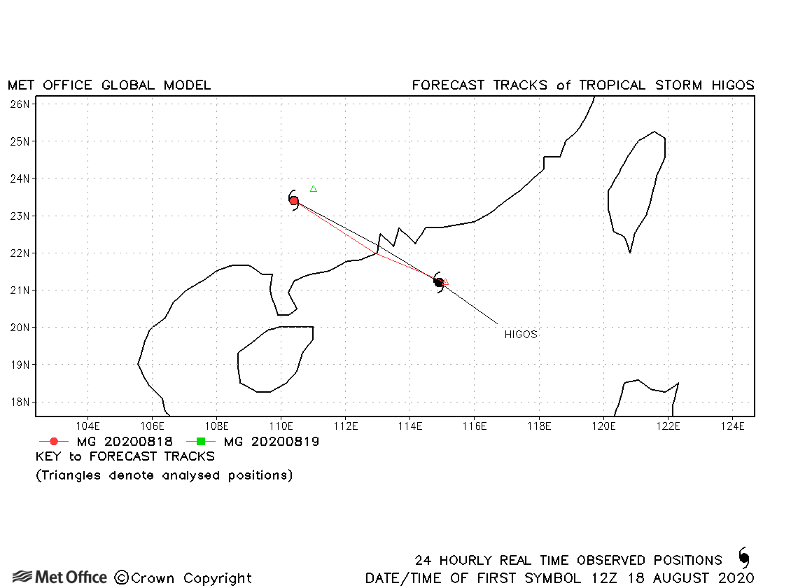
| Higos (08W) | 17-19 August | 992 mb, 55/55 knots | Higos was a tropical storm for only about 24 hours. |
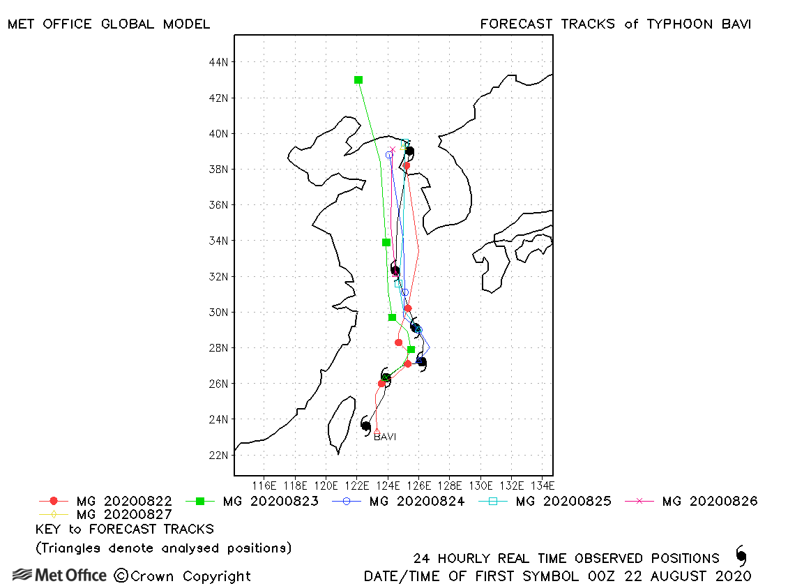
| Bavi (09W) | 21-27 August | 950 mb, 95/85 knots | Track forecast errors were mostly lower than the recent running mean error value. |
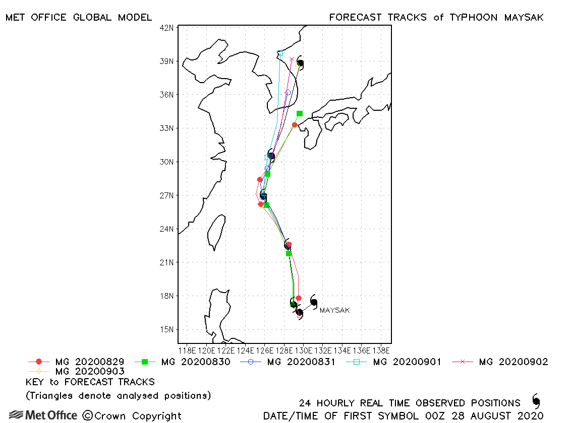
| Maysak (10W) | 28 August-02 September | 935 mb, 125/95 knots | Track forecast errors were mostly close to or below the recent running mean. |
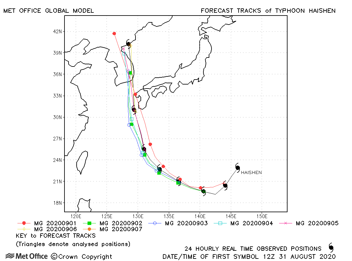
| Haishen (11W) | 31 August-07 September | 920 mb, 135/100 knots | Track forecast errors were mostly low and skill scores high for this typhoon. |
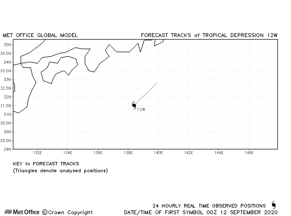
| 12W | 11-12 September | 1003 mb, 30/- knots | No forecasts were verified for this tropical depression. |
| Noul (13W) | 15-18 September | 992 mb, 45/45 knots | Track forecast errors were better at longer lead times than shorter for this storm. |
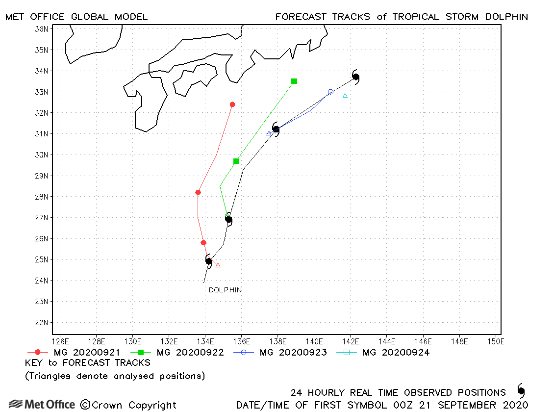
| Dolphin (14W) | 20-24 September | 975 mb, 60/60 knots | There was a left-of-track bias meaning track forecast errors were large. |
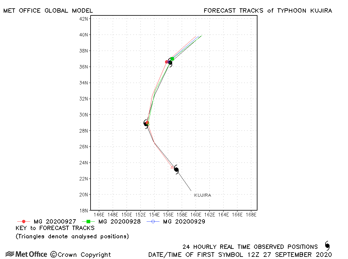
| Kujira (15W) | 26-30 September | 980 mb, 65/60 knots | Track forecasts were exceptionally good for this storm. |
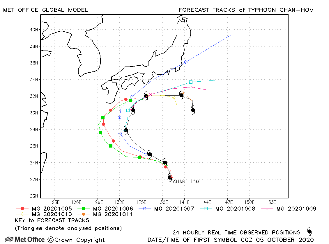
| Chan-hom (16W) | 04-12 October | 965 mb, 80/70 knots | There was a left-of-track bias resulting in errors above the recent mean. |
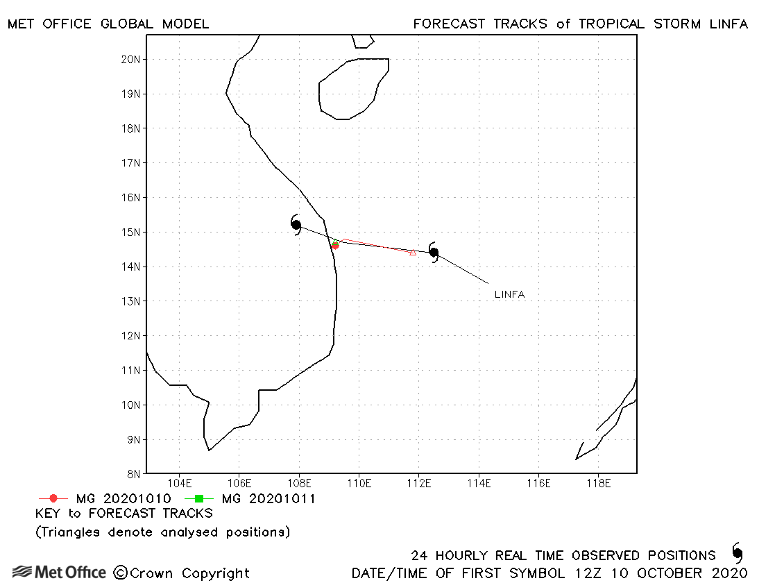
| Linfa (17W) | 10-11 October | 996 mb, 40/40 knots | Linfa was a short-lived storm and few forecasts were verified. |
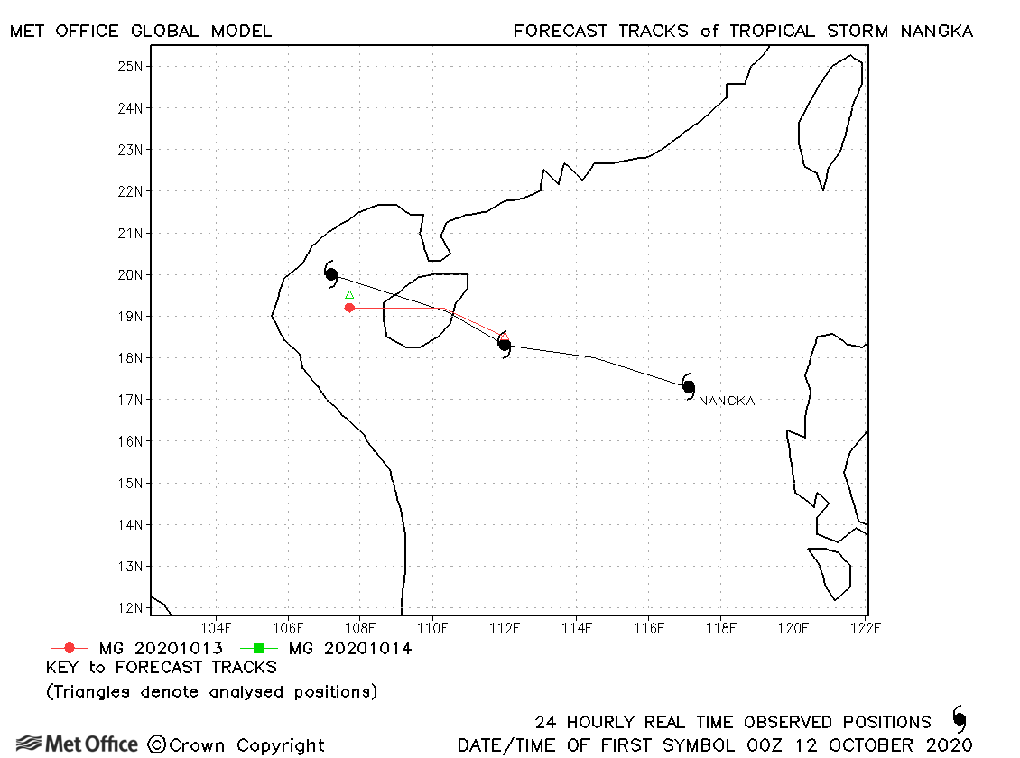
| Nangka (18W) | 11-14 October | 990 mb, 50/45 knots | Track forecast errors were near the recent mean. |
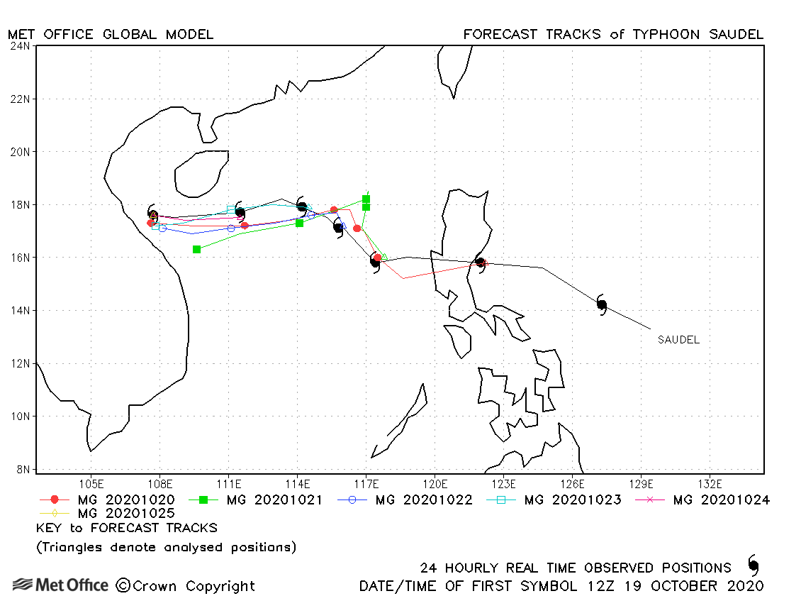
| Saudel (19W) | 19-25 October | 965 mb, 85/75 knots | Track forecast errors were low and skill scores high for this storm. |
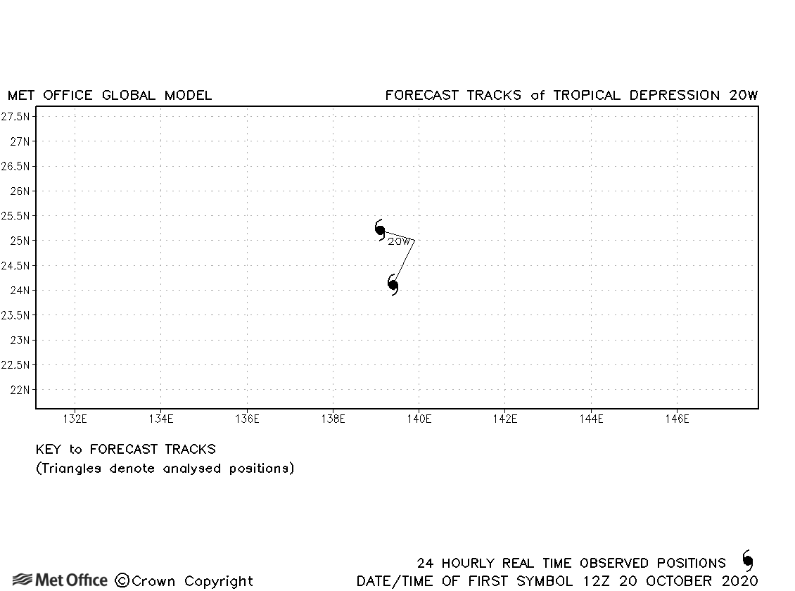
| 20W | 20-21 October | 1001 mb, 30/- knots | 20W did not achieve tropical storm status. |
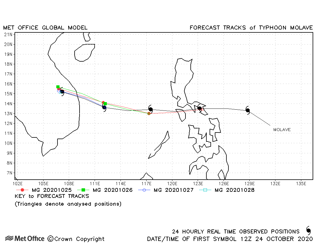
| Molave (21W) | 24-28 October | 950 mb, 110/85 knots | Track forecasts, including those for landfall, were excellent with very low forecast errors. |
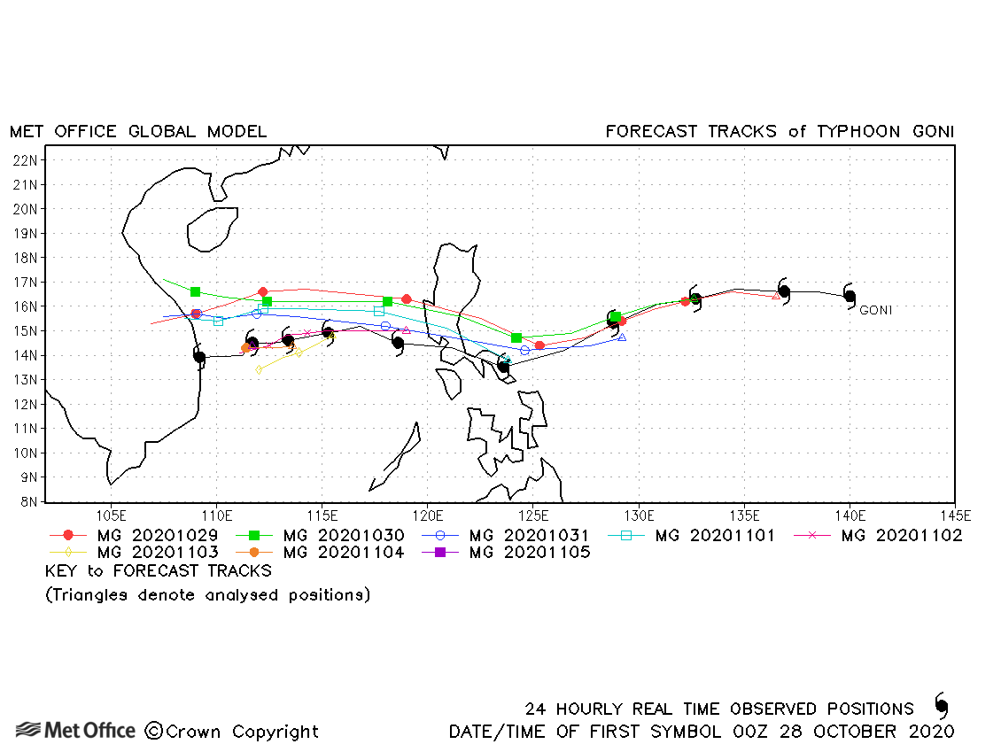
| Goni (22W) | 28 October-06 November | 905 mb, 170/120 knots | Track forecast errors were near to or below the recent mean for Goni, although there was a right-of-track and fast bias in forecasts. |
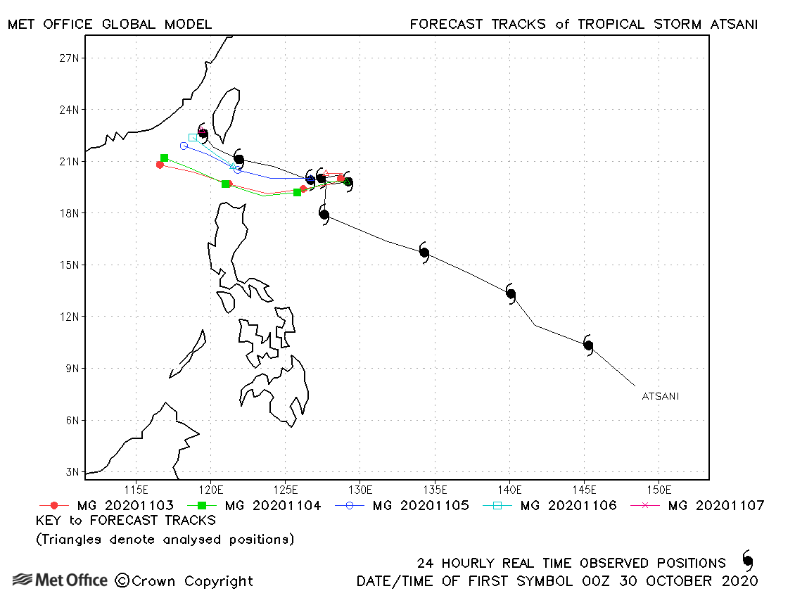
| Atsani (23W) | 29 October-07 November | 994 mb, 55/50 knots | Track forecast errors were close to or above the recent mean. There was a left-of-track bias in forecasts. |
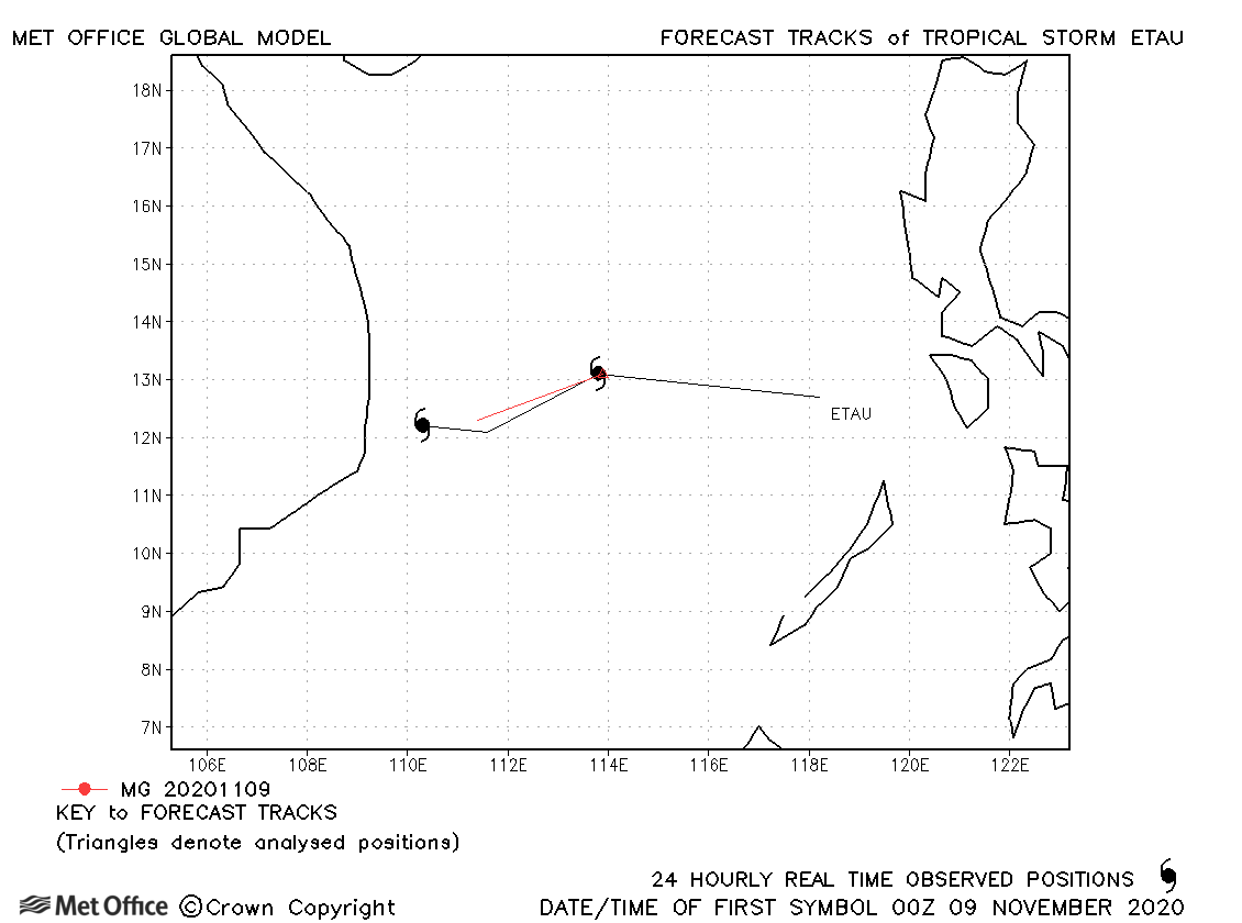
| Etau (24W) | 08-10 November | 992 mb, 40/45 knots | Etau was only briefly a tropical storm. |
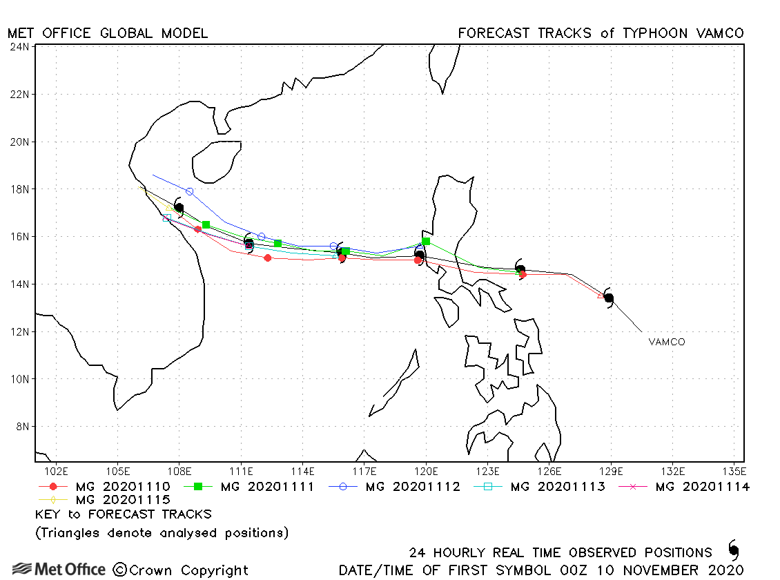
| Vamco (25W) | 08-15 November | 950 mb, 115/85 knots | Track forecast errors were low and skill scores high for this typhoon. |
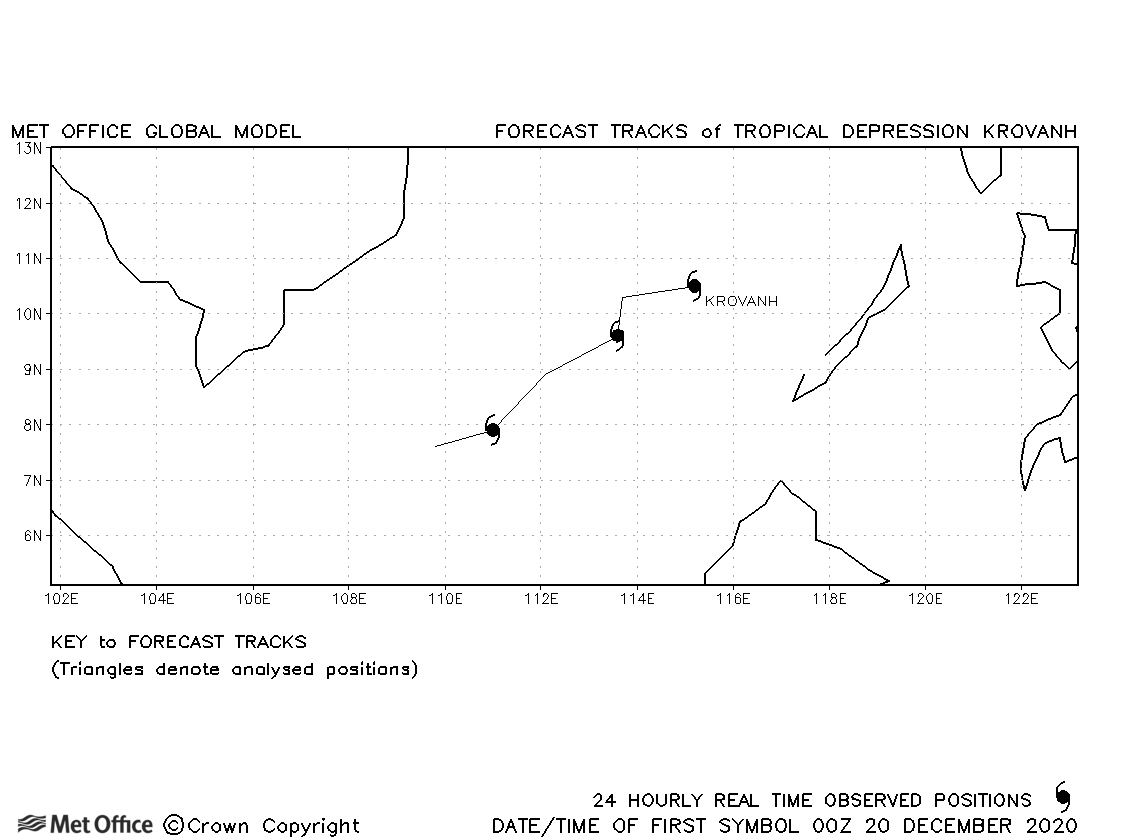
| Krovanh (26W) | 20-22 December | 1000 mb, 30/35 knots | No forecasts were verified for Krovanh since it was not designated a tropical storm based on 1-minute average winds. |
North-west observed tracks in 2020
| Name & ID | Start & end dates | Central pressure, 1-minute MSW | Comments on Met Office global model forecasts |
|---|---|---|---|
|
25-26 April |
1006 mb, 30 knots |
01E was the earliest tropical cyclone to form in this region in the modern record, but did not reach tropical storm status. |
|
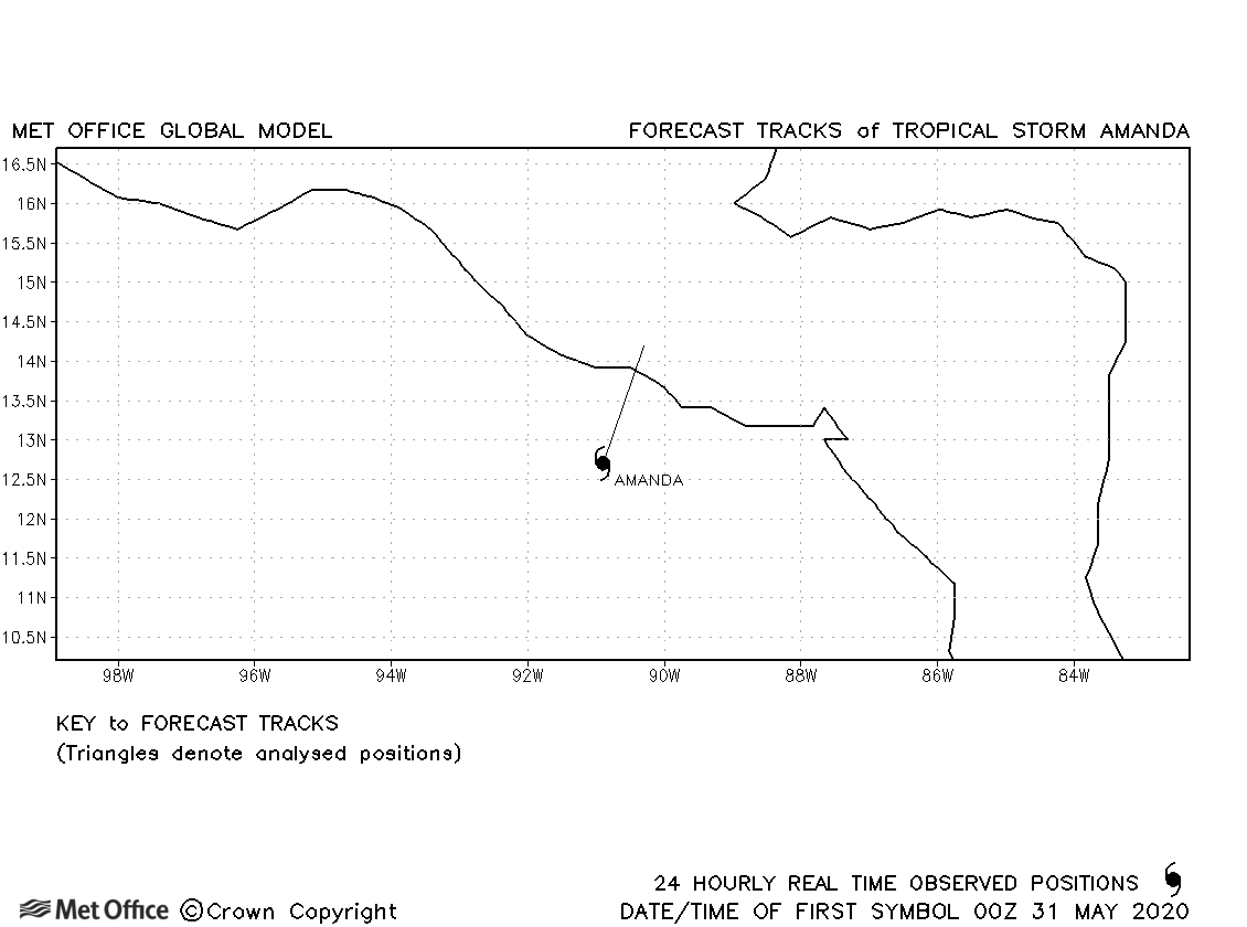
| 30-31 May | 1003 mb, 35 knots |
Amanda was only briefly a tropical storm and no forecasts were verified. |
|
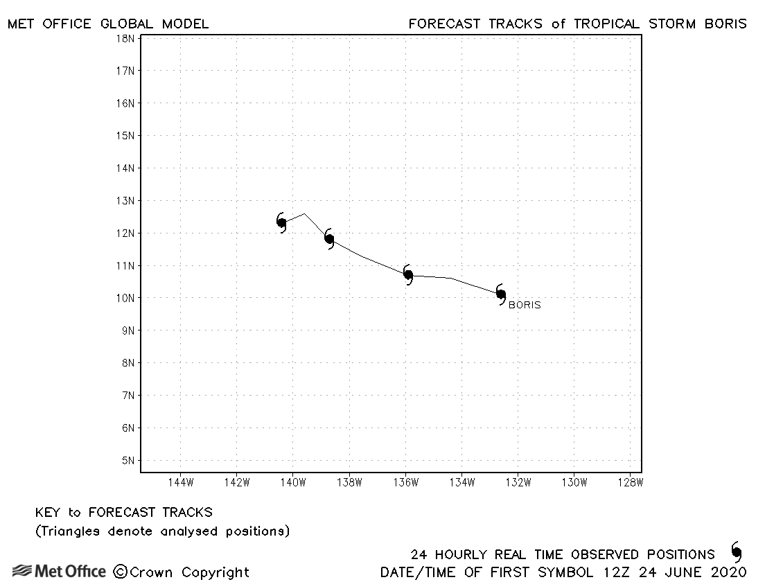
| 24-27 June | 1005 mb, 35 knots |
Boris was only briefly a tropical storm and no forecasts were verified. |
|
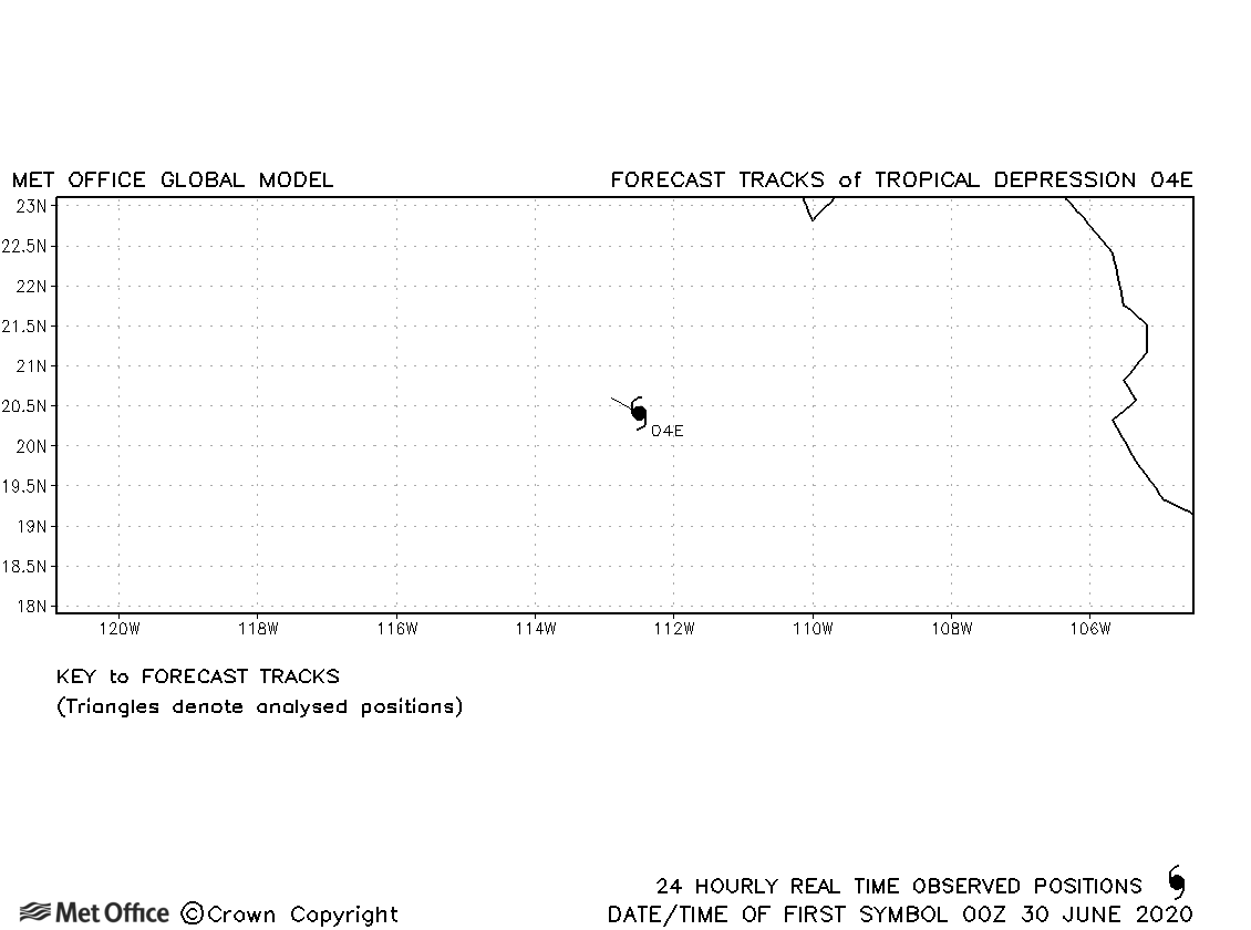
| 30 June | 1004 mb, 30 knots |
04E did not achieve tropical storm status. |
|
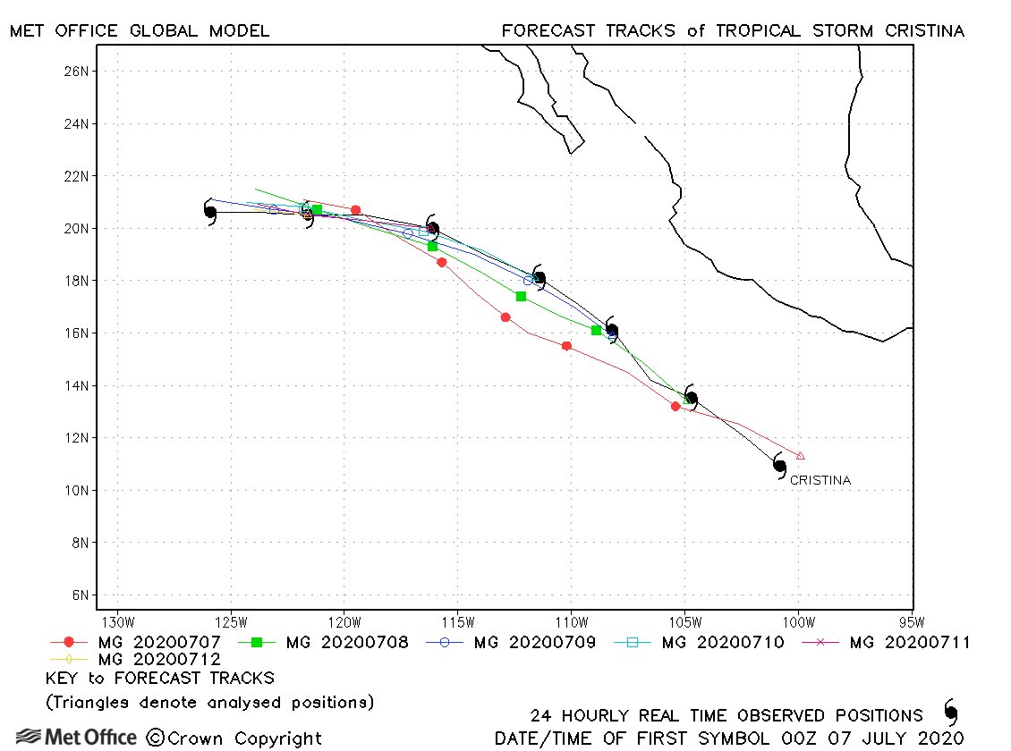
| 06-13 July | 993 mb, 60 knots |
No forecasts were verified for this tropical depression. |
|
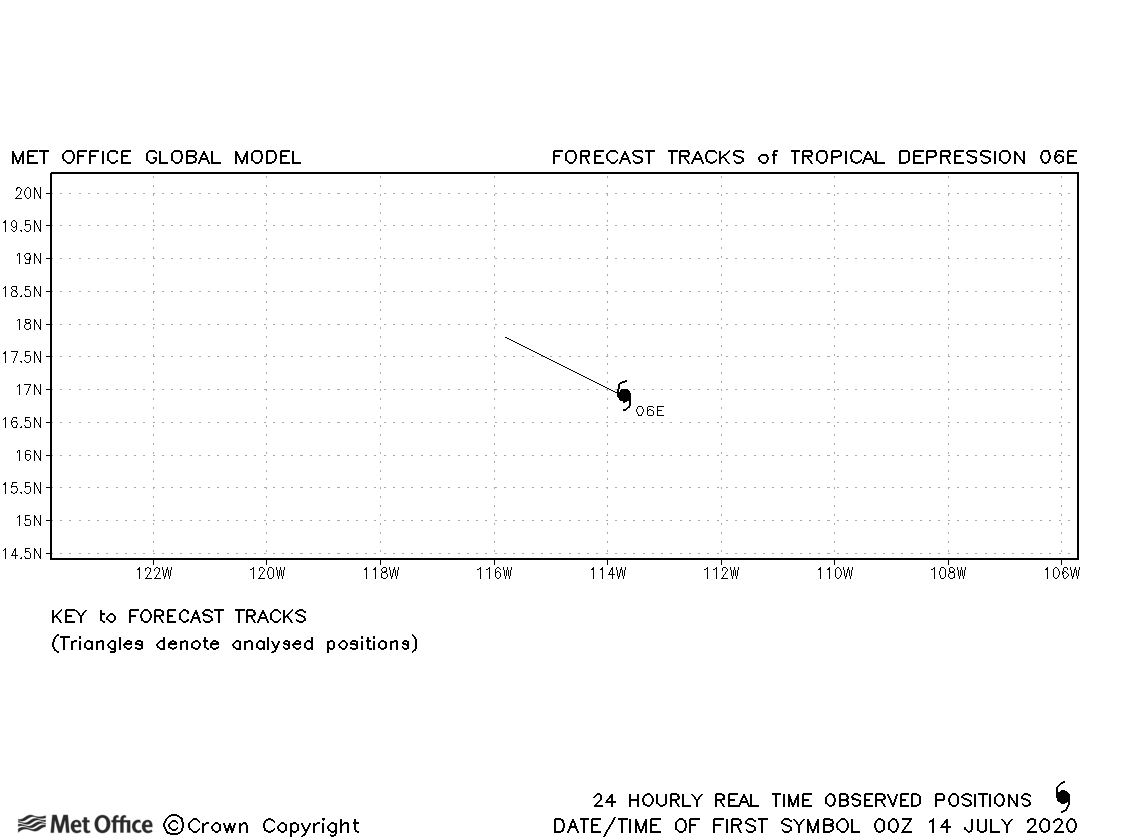
| 13-14 July | 1006 mb, 30 knots |
No forecasts were verified for this tropical depression. |
|
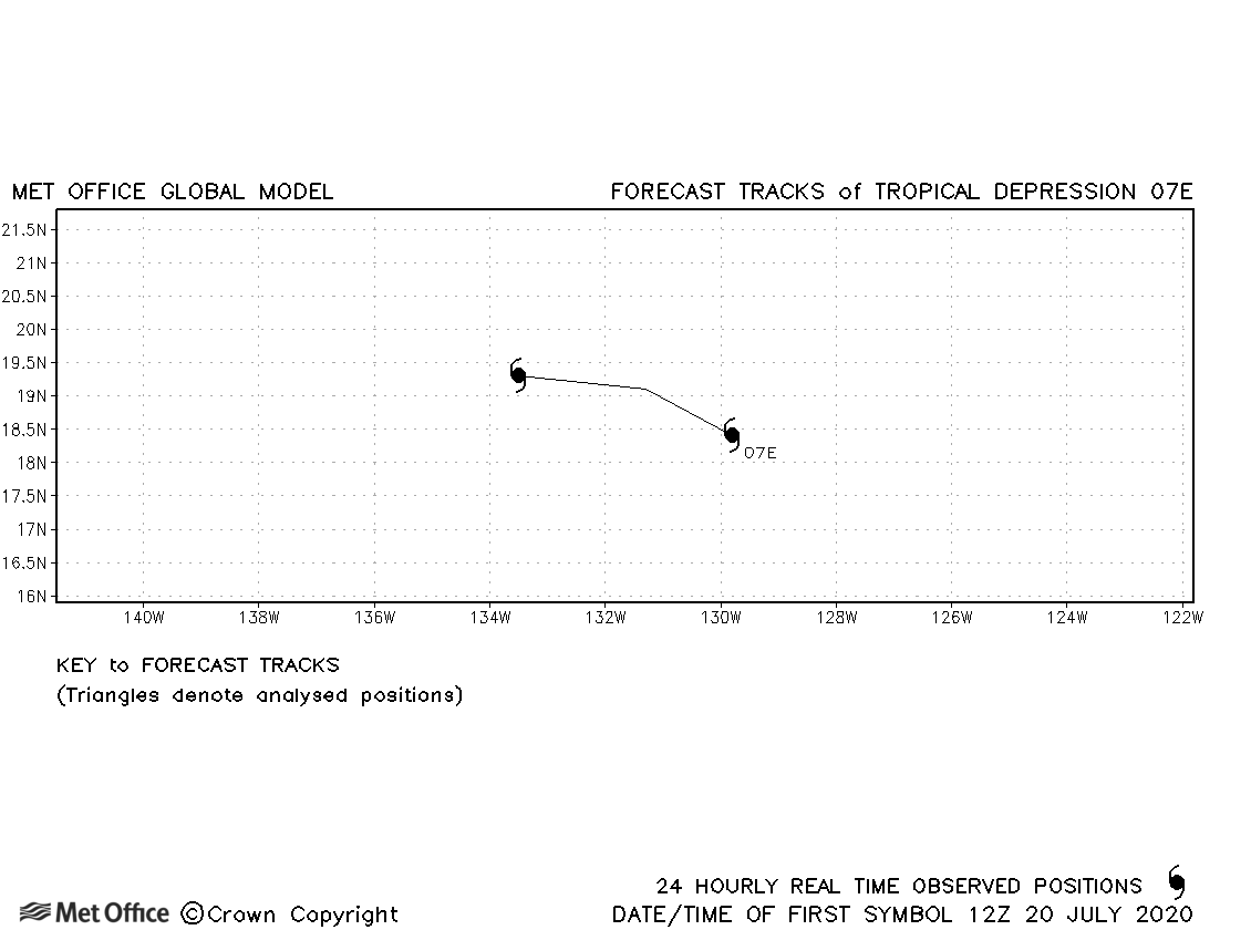
| 20-21 July | 1006 mb, 35 knots |
No forecasts were verified for what was classified as a tropical depression in real time. In post season reanalysis 07E was upgraded to a tropical storm. |
|
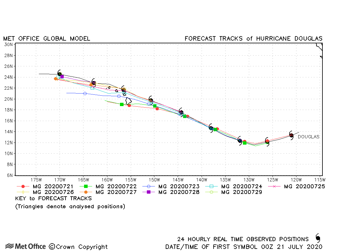
| 20-29 July | 954 mb, 115 knots |
Track forecast errors were very low for this hurricane, particularly at shorter lead times. For example, 3- and 4-day errors were less than half of the 5-year running mean for this basin. The period of rapid intensification was not well predicted, but the gradual weakening thereafter was well predicted. |
|
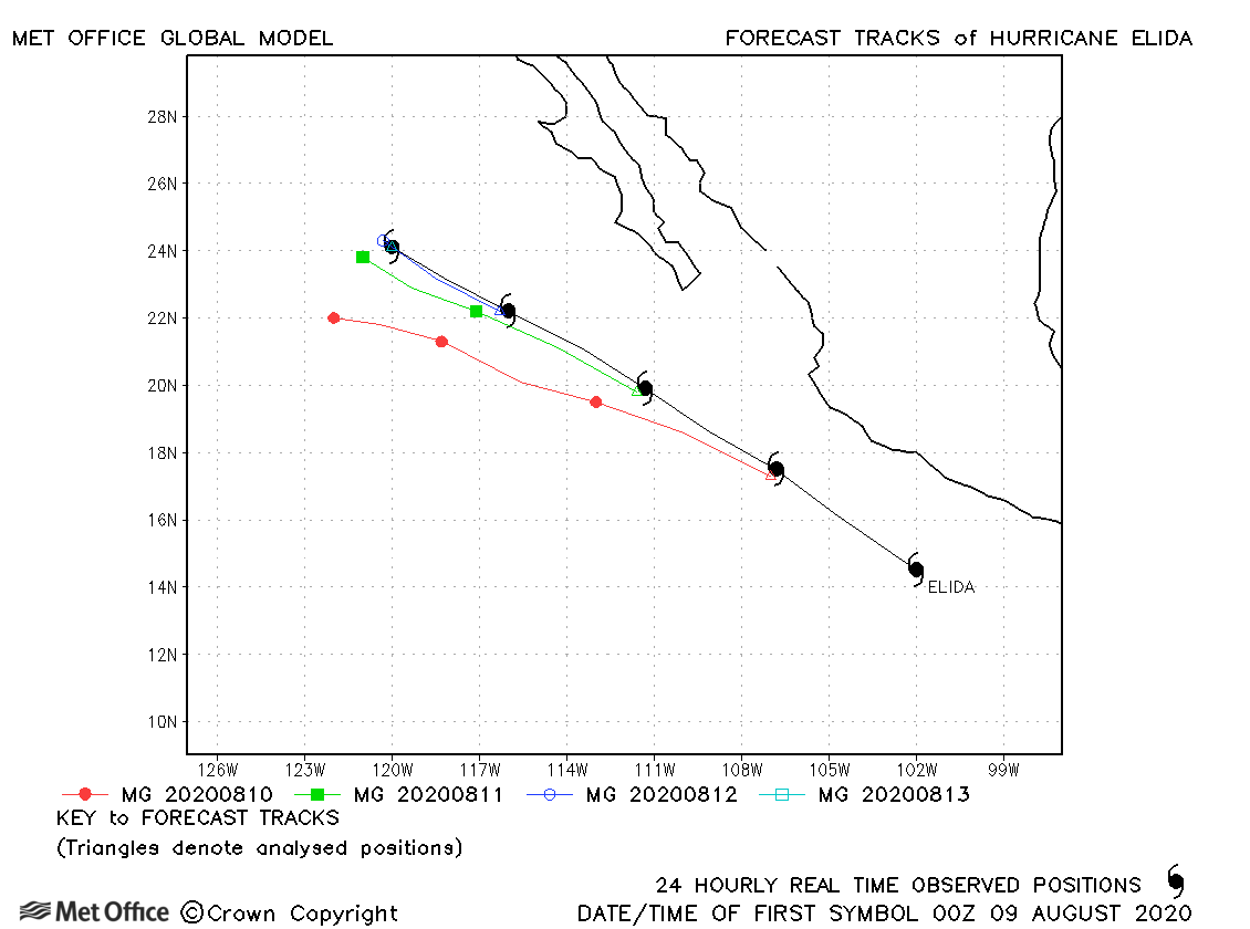
| Elida (09E) | 09-13 August | 975 mb, 85 knots | Track forecasts had a left-of-track bias resulting in errors a little above the recent running mean. |
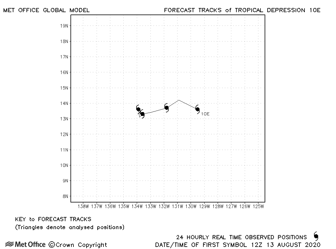
| 10E | 13-16 August | 1004 mb, 30 knots | No forecasts were verified for this tropical depression. |
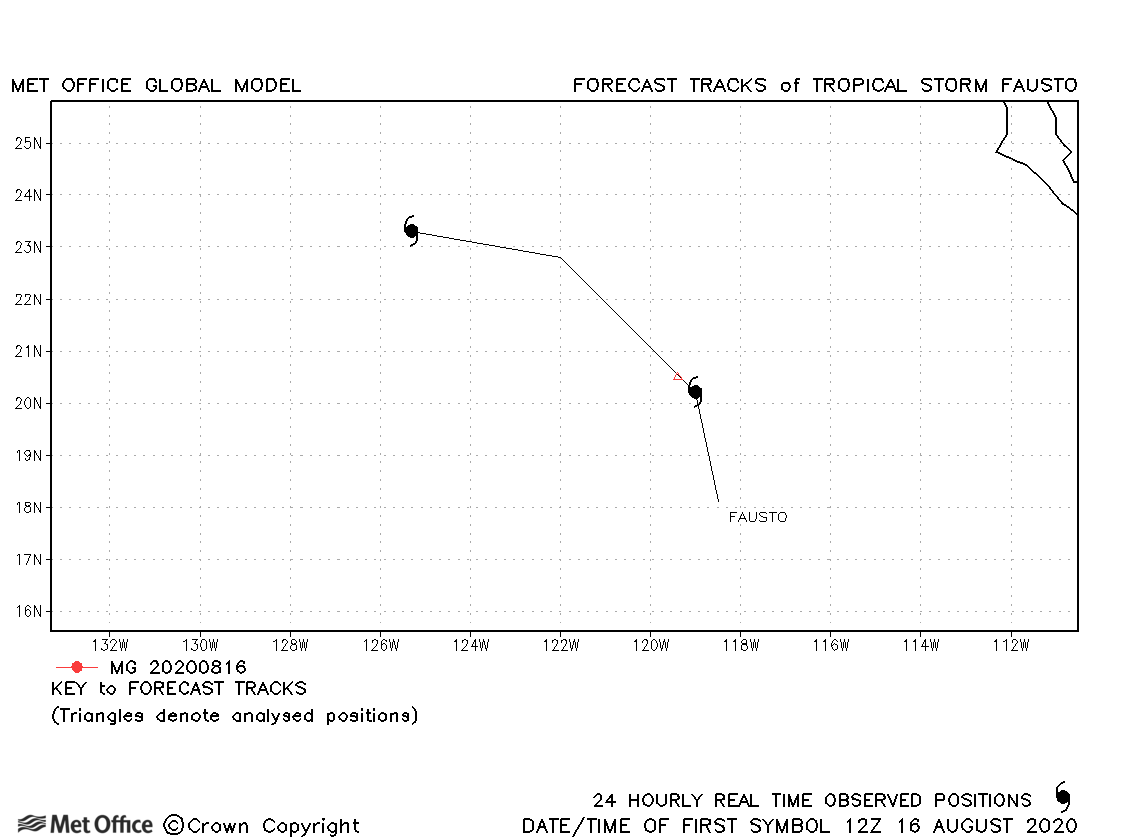
| Fausto (11E) | 16-17 August | 1004 mb, 35 knots | Fausto only briefly attained tropical storm status. |
| Genevieve (12E) | 16-21 August | 950 mb, 115 knots | There was a left-of-track bias resulting in errors above the recent running mean. |
| Hernan (13E) | 26-28 August | 1001 mb, 40 knots | Hernan was only a tropical storm for about 24 hours. |
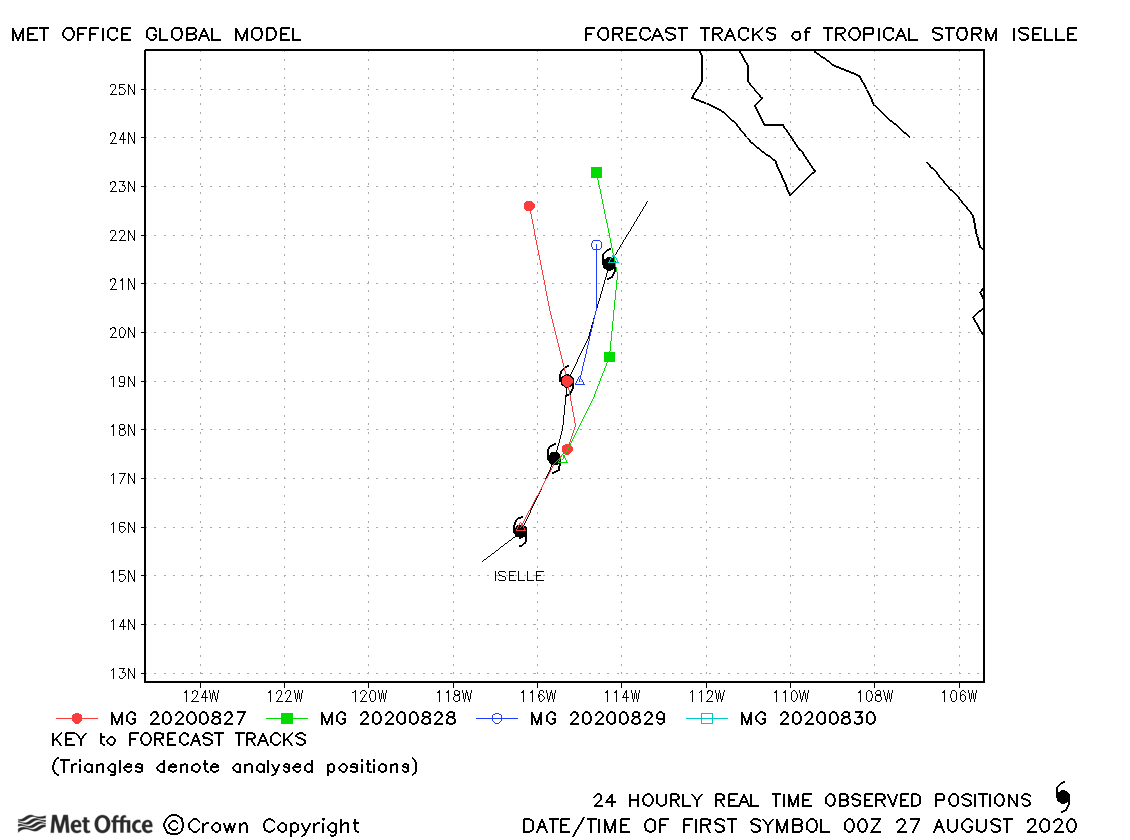
| Iselle (14E) | 26-30 August | 997 mb, 50 knots | Track forecast errors were mostly close to the recent running mean. |
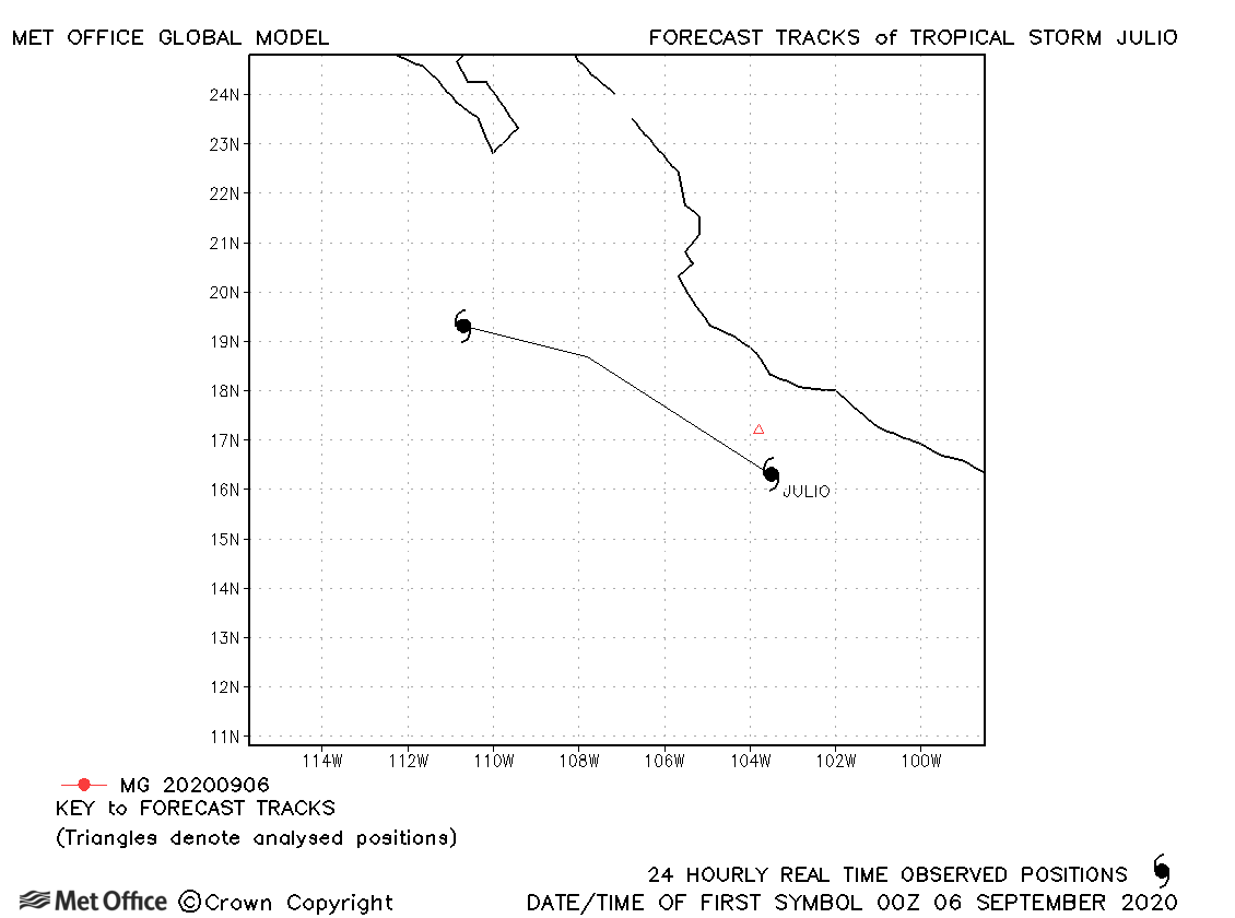
| Julio (15E) | 05-07 September | 1003 mb, 40 knots | Julio was short-lived and no forecasts were verified. |
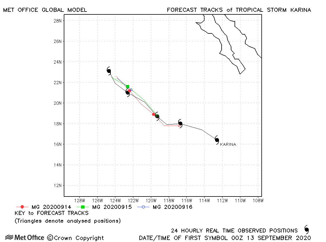
| Karina (16E) | 13-17 September | 996 mb, 50 knots | Karina's track was well forecast with low errors. |
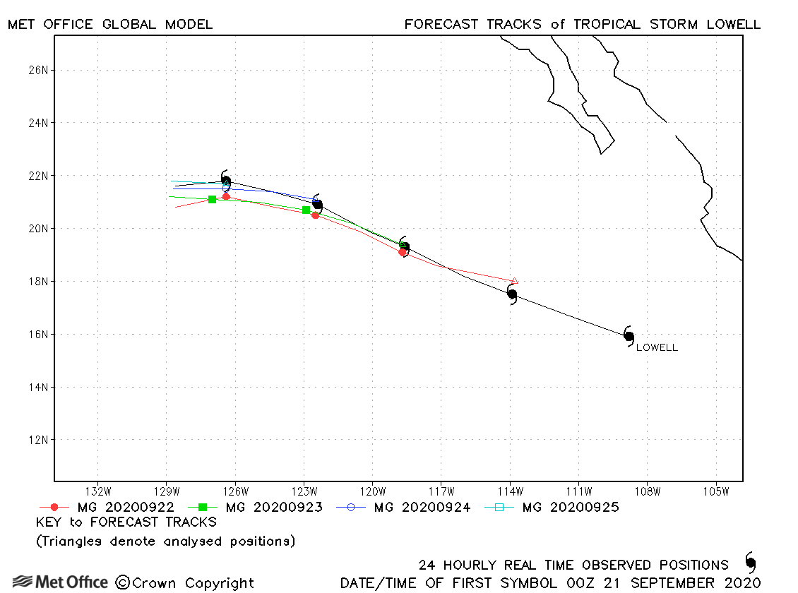
| Lowell (17E) | 20-25 September | 999 mb, 45 knots | Lowell's track was well forecast with low errors. |
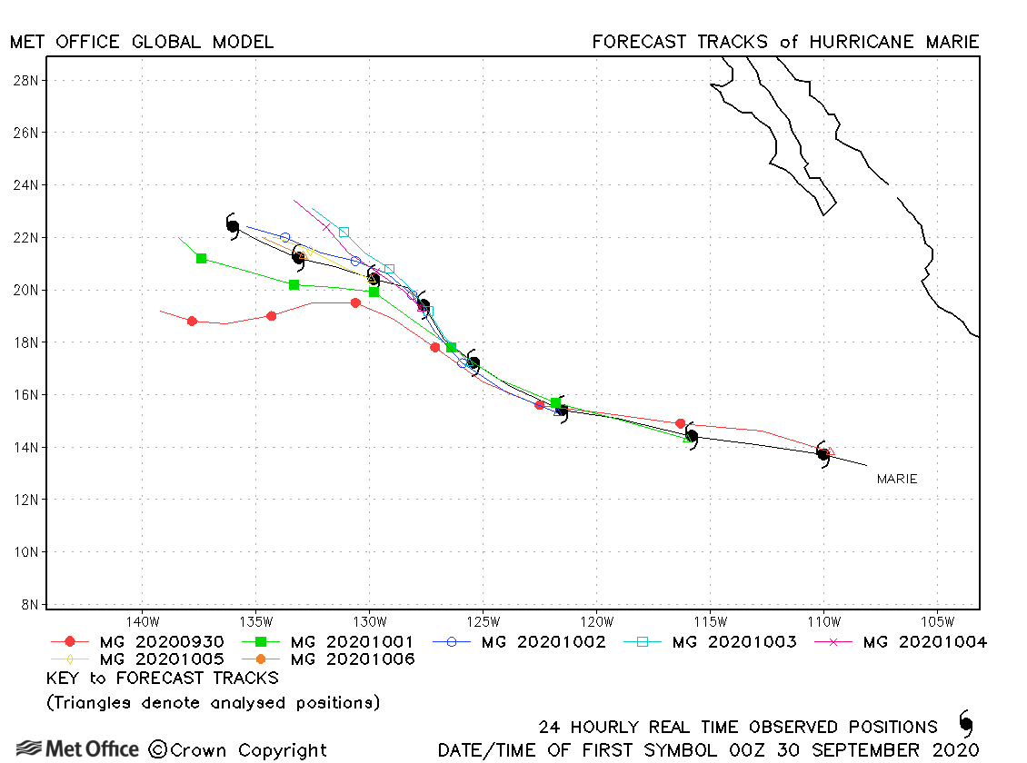
| Marie (18E) | 29 September-07 October | 948 mb, 115 knots | Track forecast errors were low at short lead times, but above the recent mean at longer lead times. |
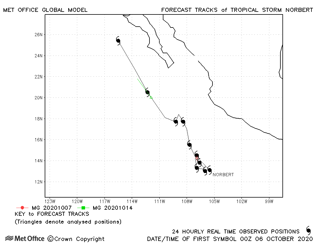
| Norbert (19E) | 05-15 October | 1001 mb, 45 knots | Norbert was short-lived with few forecasts verified. |
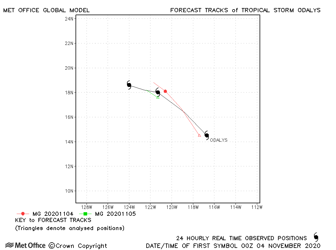
| Odalys (20E) | 03-06 November | 1000 mb, 45 knots | Odalys was a fairly short-lived storm. Track forecast errors were near to the recent mean. |
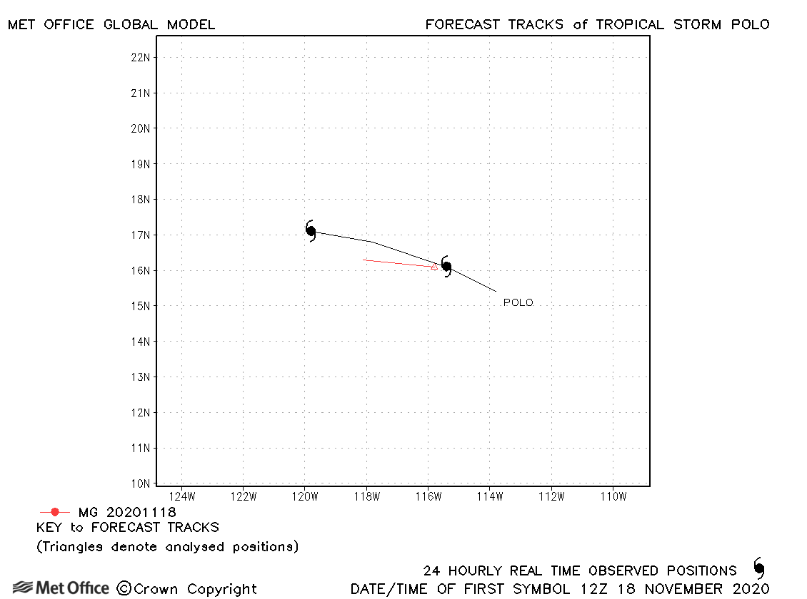
| Polo (21E) | 17-19 November | 1004 mb, 40 knots | Polo was only briefly a tropical storm. |
| Name & ID | Start & end dates | Central Pressure, 1-minute MSW | Comments on Met Office global model forecasts |
|---|---|---|---|
|
|
|
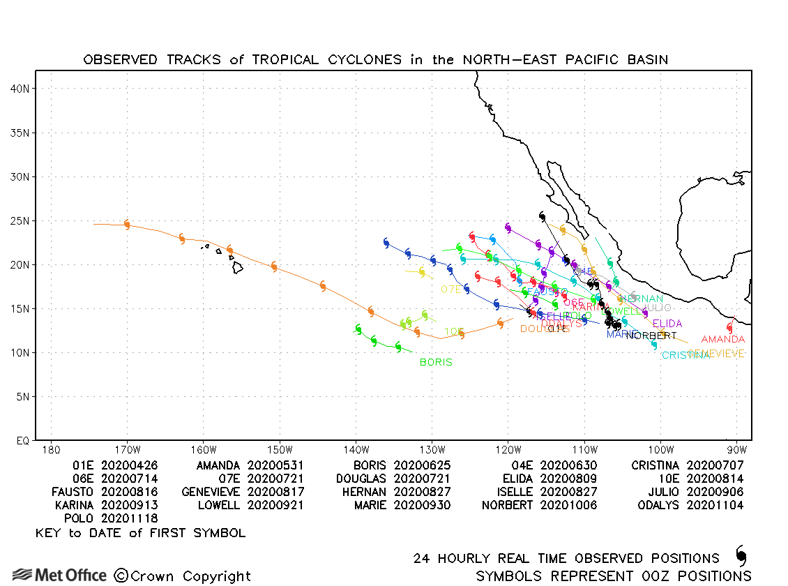
North-east and Central North Pacific observed tracks in 2020
Tropical cyclone names (North-east Pacific)
Tropical cyclone names (Central North Pacific)
| Name & ID | Start & end dates | Central pressure, 1-minute MSW | Comments on Met Office global model forecasts |
|---|---|---|---|
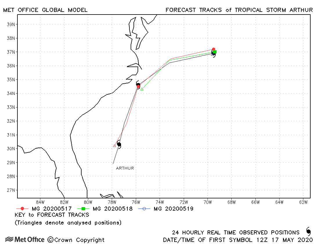
| 16-19 May | 989 mb, 55 knots |
Track forecasts for Arthur were very low. |
|
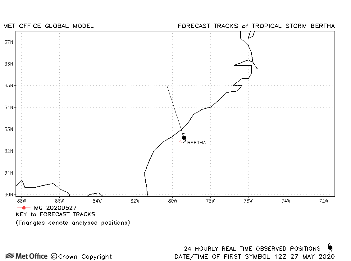
| 27-28 May | 1007 mb, 40 knots |
Bertha was only briefly a tropical storm and no forecasts were verified. |
|
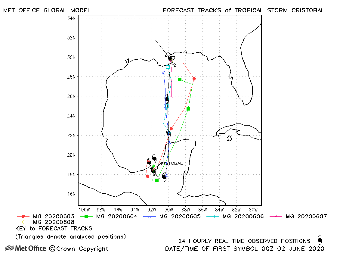
| 01-08 June | 994 mb, 50 knots |
Track forecast errors were variable. There was a slow bias an right-of-track bias at longer lead times. |
|
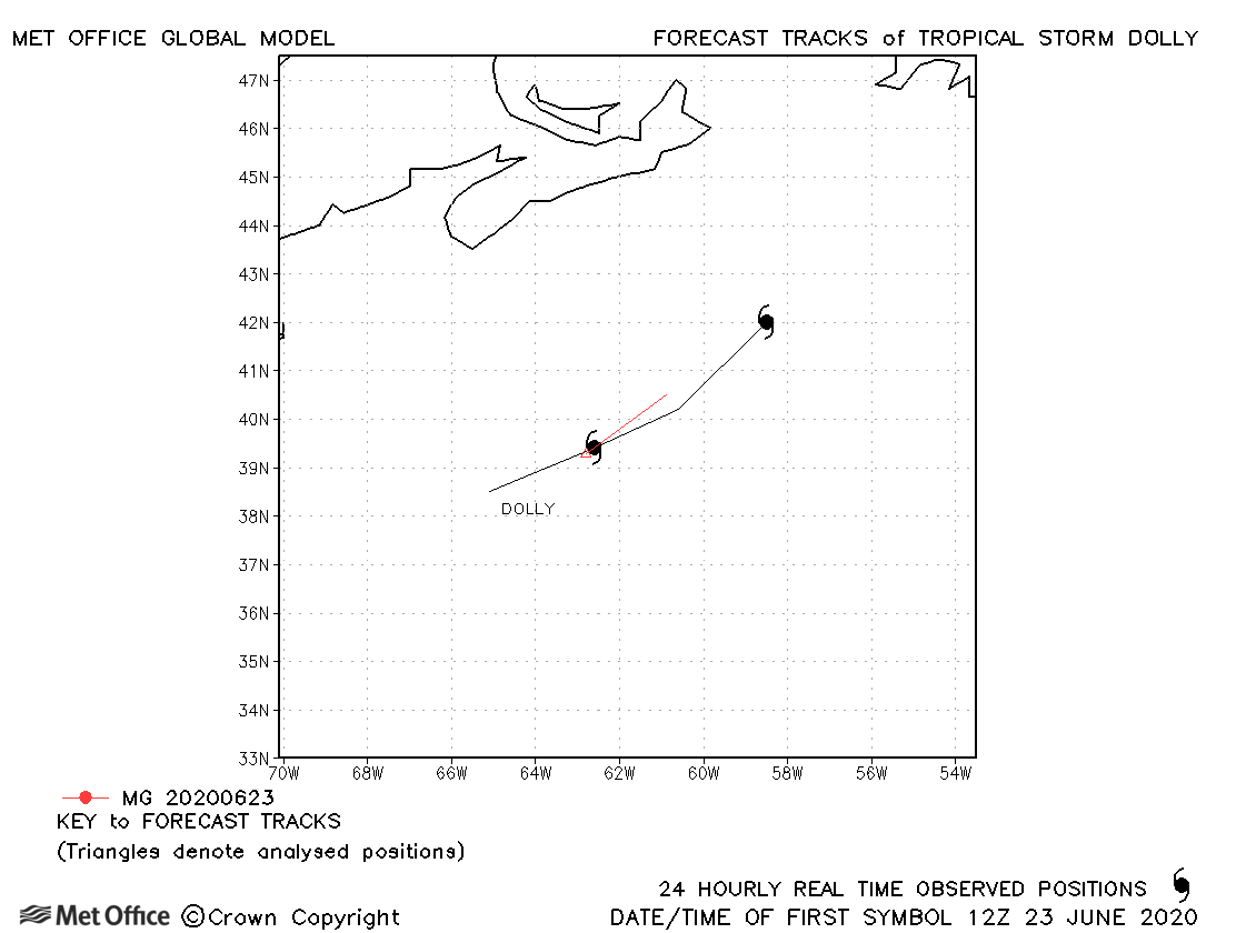
| 22-24 June | 1002 mb, 40 knots |
Dolly was only briefly a tropical storm. |
|
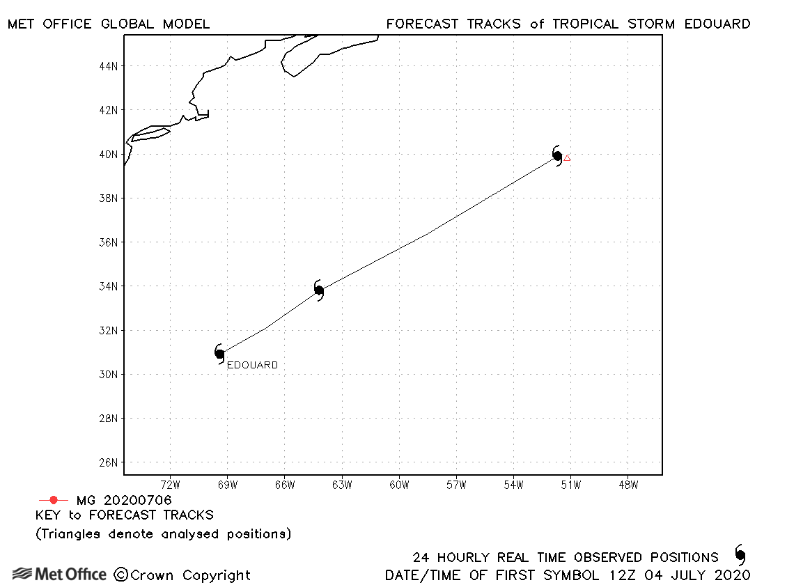
| 04-06 July | 1005 mb, 40 knots |
Edouard was short-lived as a storm and only one 12-hour forecast was verified. |
|
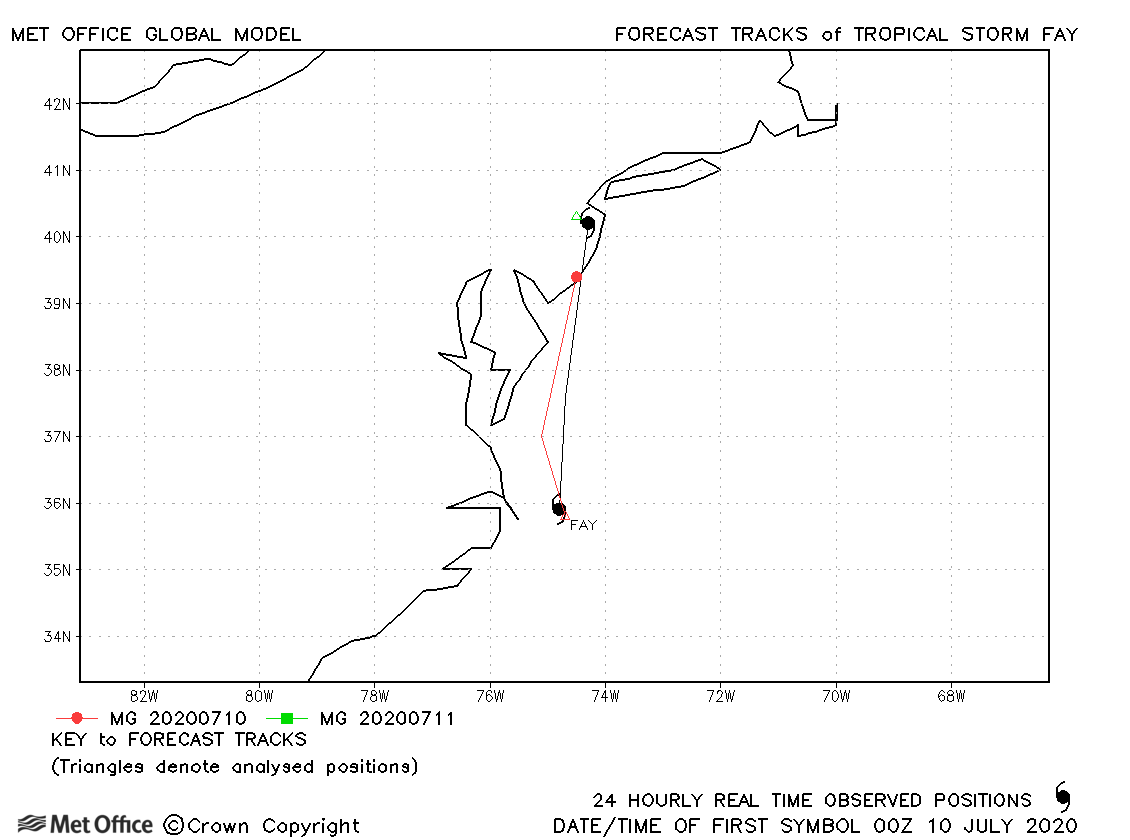
| 09-11 July | 998 mb, 50 knots |
Fay was relatively short-lived as a tropical storm. Track forecasts were a little slow. |
|
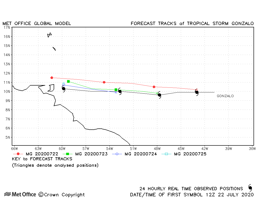
| 21-25 July | 997 mb, 55 knots |
Track forecast errors were near to or a little above the recent mean values. |
|
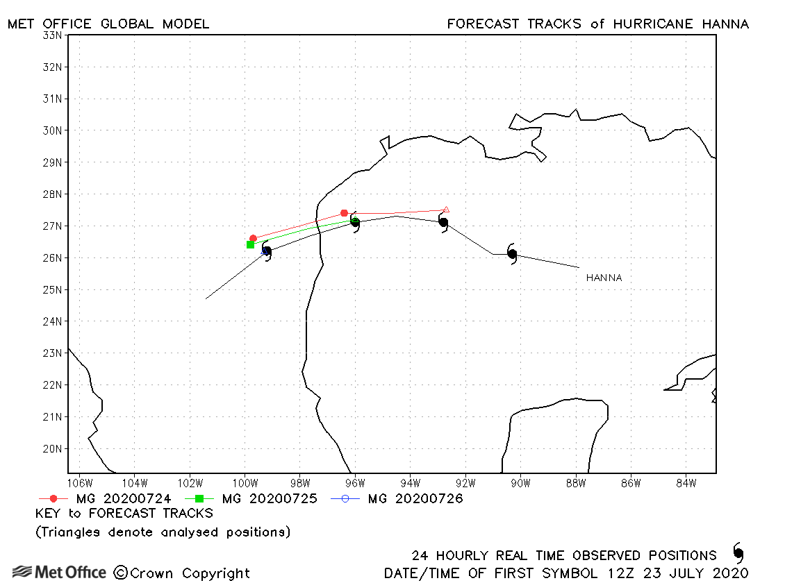
| 23-27 July | 973 mb, 75 knots |
Track forecast errors were low for this hurricane. The rate of intensification close to landfall was not captured. |
|
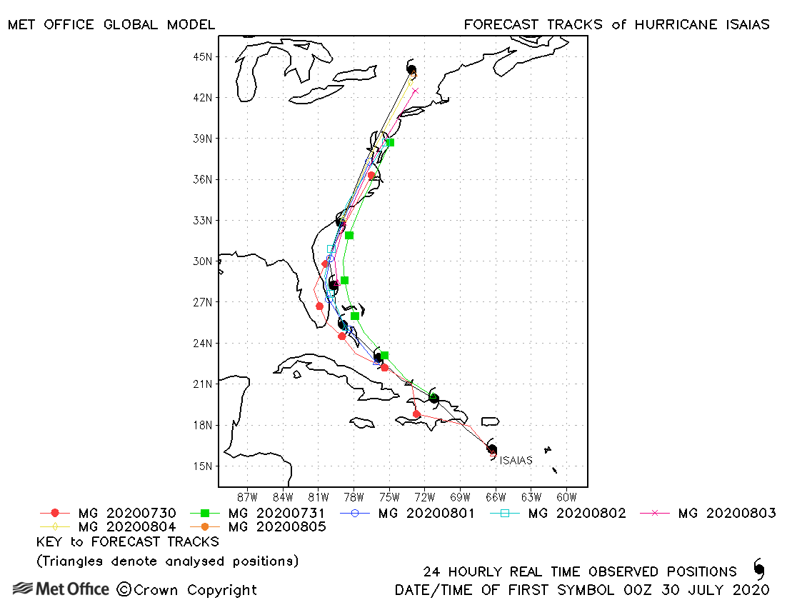
| Isaias (09L) | 30 July-05 August | 987 mb, 75 knots | Track forecast errors were above the recent running mean value due to a slow bias. |
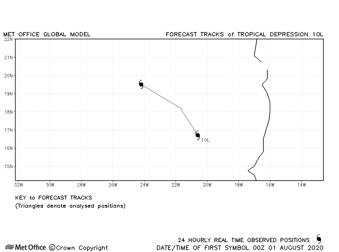
| 10L | 31 July-02 August | 1007 mb, 30 knots | No forecasts were verified for this tropical depression. |
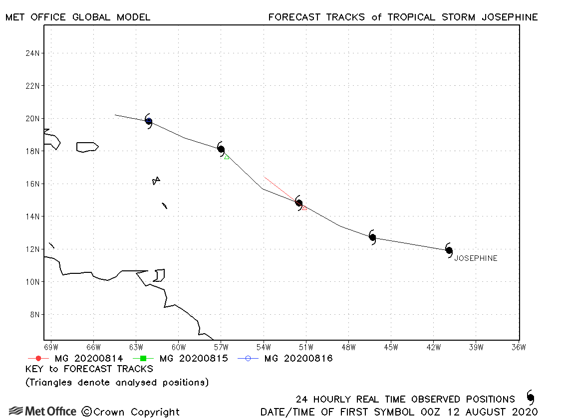
| Josephine (11L) | 12-16 August | 1005 mb, 40 knots | Forecasts were weak for Josephine and only a few were trackable in the model. |
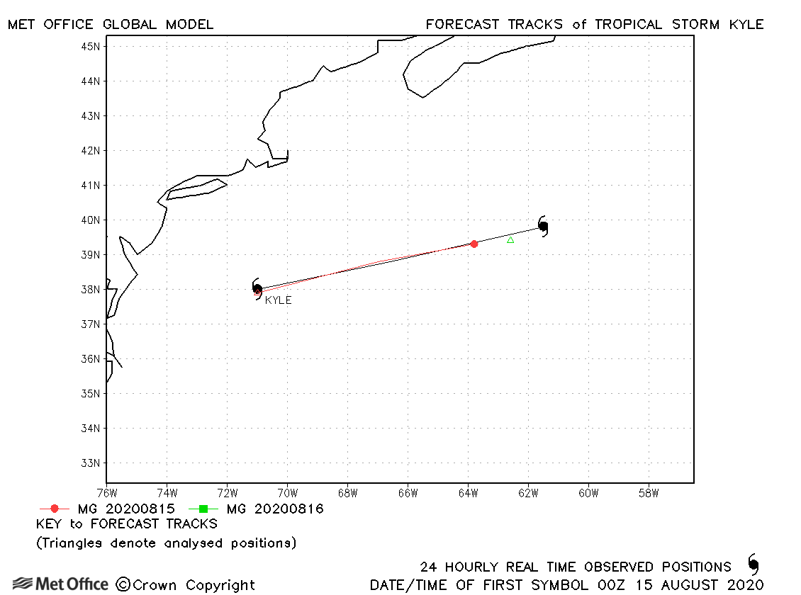
| Kyle (12L) | 14-16 August | 1000 mb, 45 knots | Kyle was a tropical storm for only about 24 hours. |
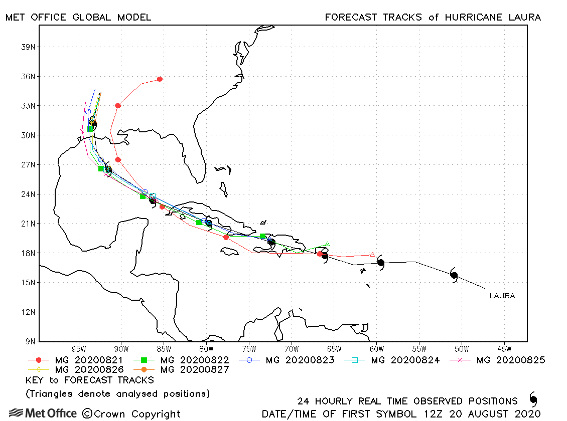
| Laura (13L) | 20-28 August | 938 mb, 130 knots | Track forecast errors were near to the recent running mean at short lead times, but below the mean at most longer lead times. There was a slight westward bias in landfall location, except for the earliest forecasts. |
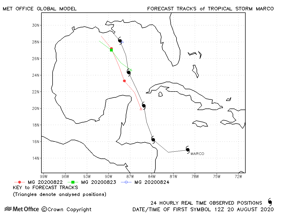
| Marco (14L) | 20-25 August | 991 mb, 65 knots | There was a left-of-track bias in forecasts resulting in errors larger than the recent running mean. However, the model predicted the weakening before landfall due to wind shear well. |
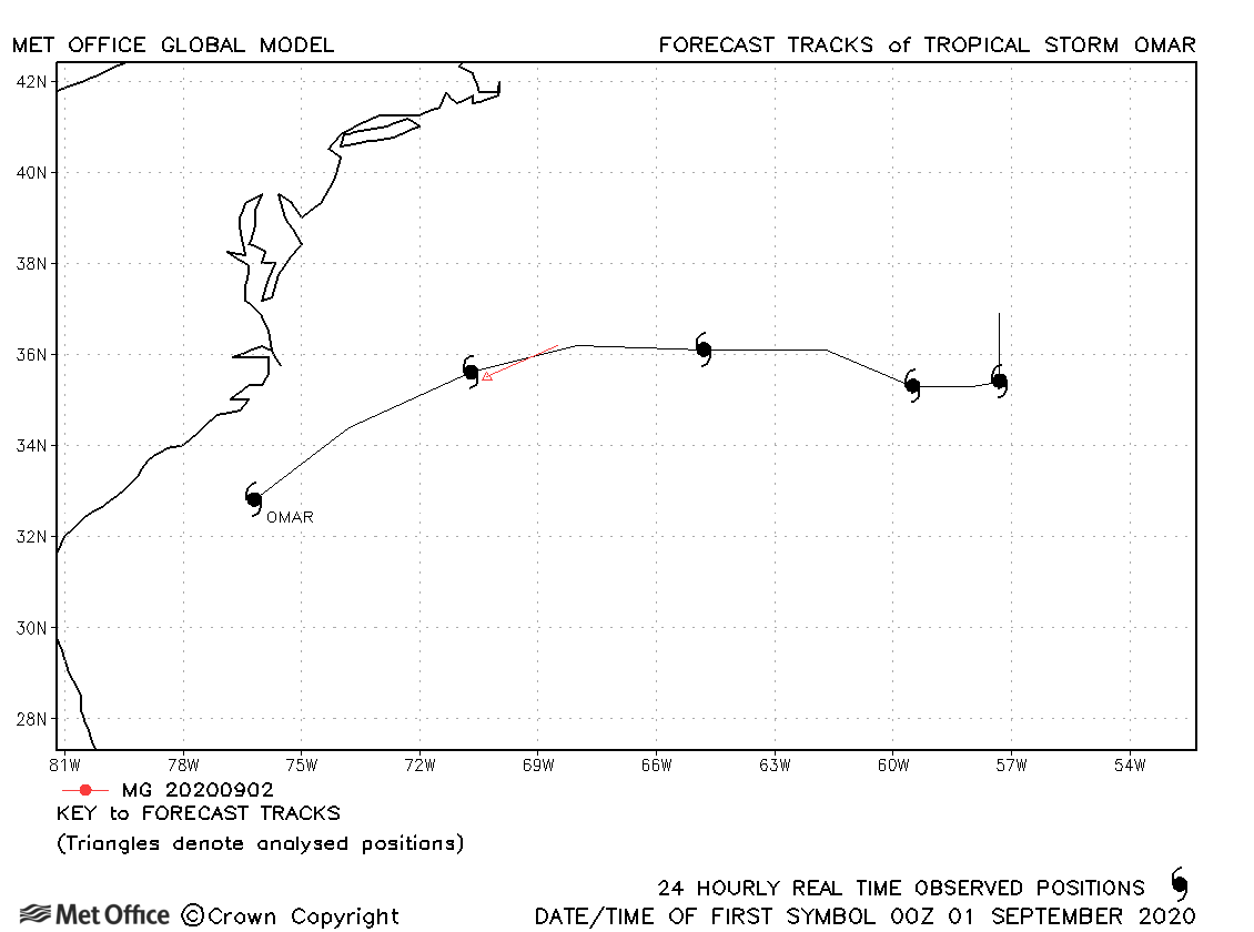
| Omar (15L) | 31 August-05 September | 1003 mb, 35 knots | Omar was a short-lived tropical storm and only one forecast was verified. |
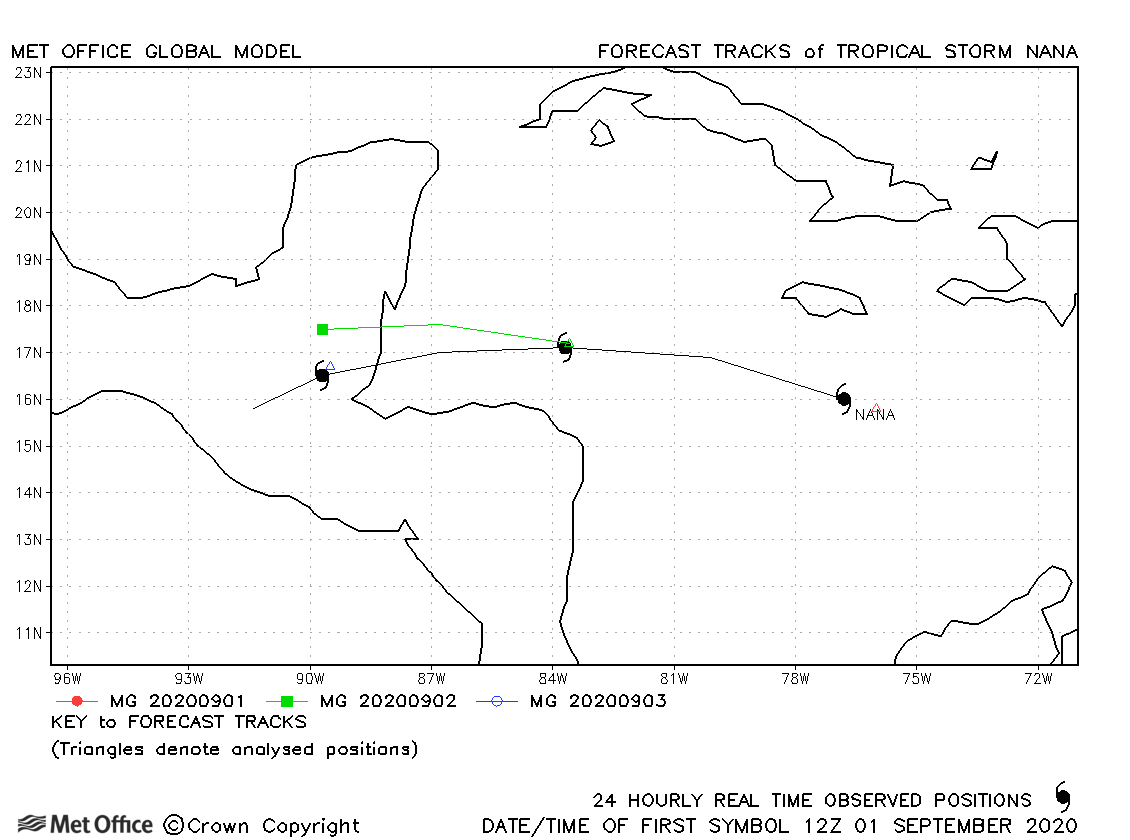
| Nana (16L) | 01-04 September | 994 mb, 65 knots | The model struggled to give a good representation of Nana, which was a small scale hurricane. |
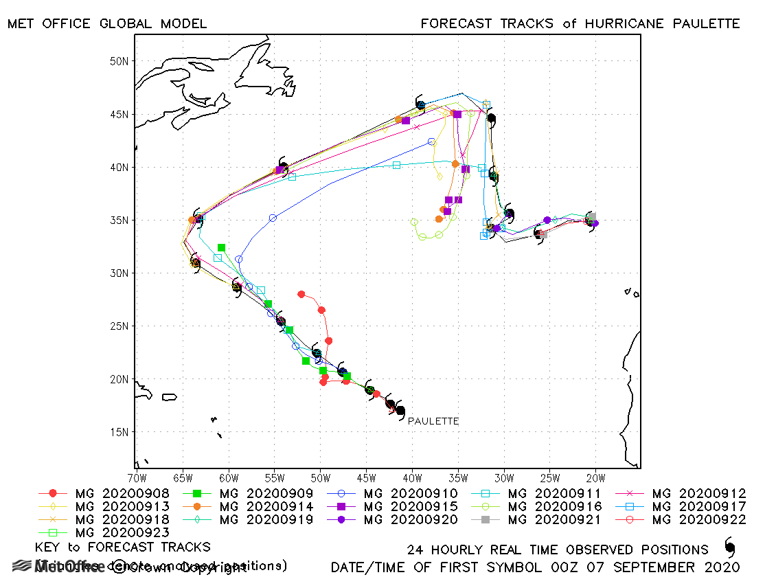
| Paulette (17L) | 07-23 September | 965 mb, 90 knots | Track forecast errors were above the recent running mean values, mostly due to a slow bias in forecasts. Skill scores at shorter lead times were high, though. |
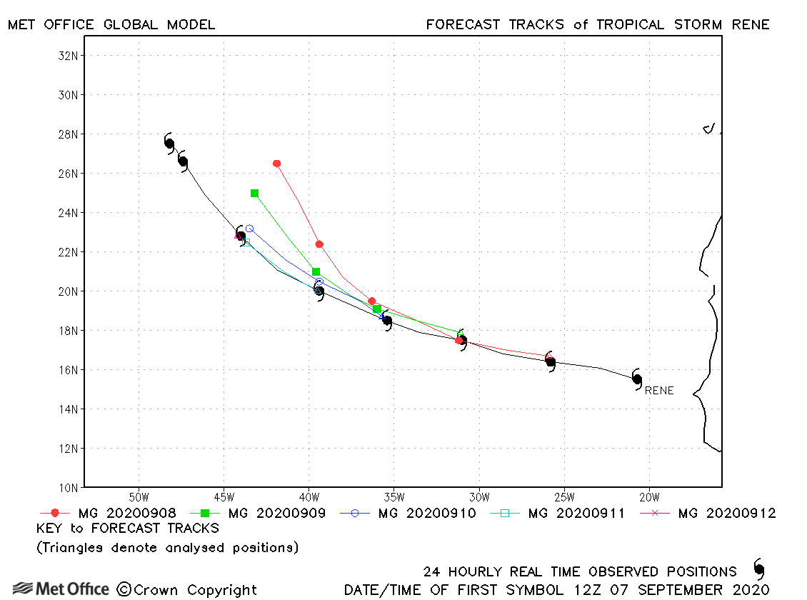
| Rene (18L) | 07-14 September | 1000 mb, 45 knots | Track forecast errors were low at short lead times, but larger at longer lead times due to a right-of-track bias. |
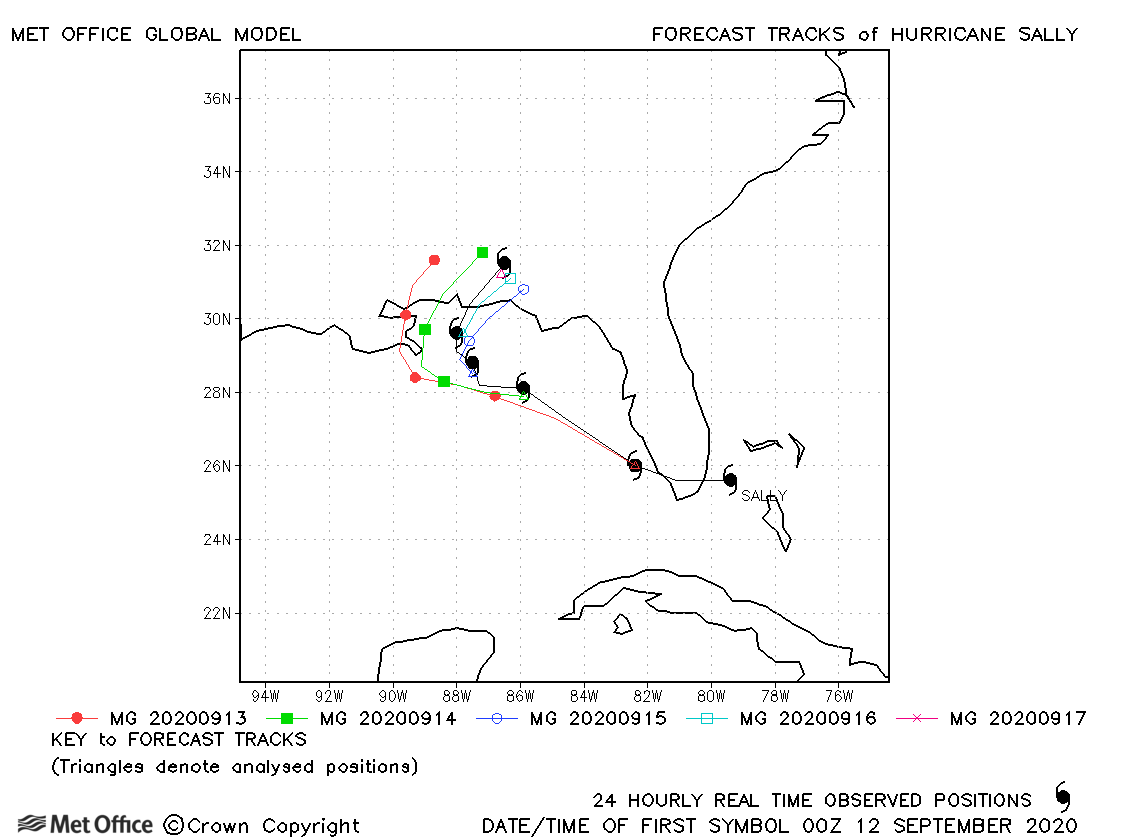
| Sally (19L) | 11-17 September | 967 mb, 90 knots | Although there was a left-of-track bias for some forecasts, the track forecast errors were lower than the recent running mean. |
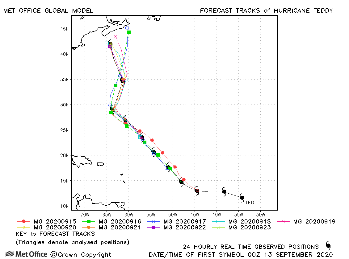
| Teddy (20L) | 12-23 September | 945 mb, 120 knots | Teddy was generally very well forecast with track forecast errors below the recent running mean. |
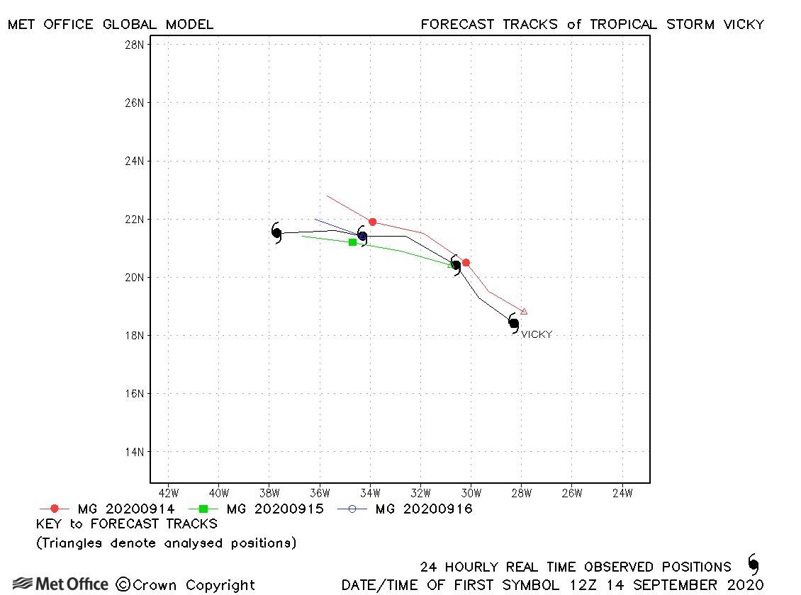
| Vicky (21L) | 14-17 September | 1002 mb, 45 knots | Track errors were low for this storm |
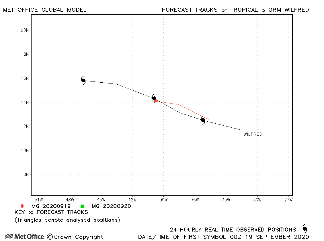
| Wilfred (23L) | 18-21 September | 1007 mb, 35 knots | Wilfred's track forecast errors were near the recent running mean errors. |
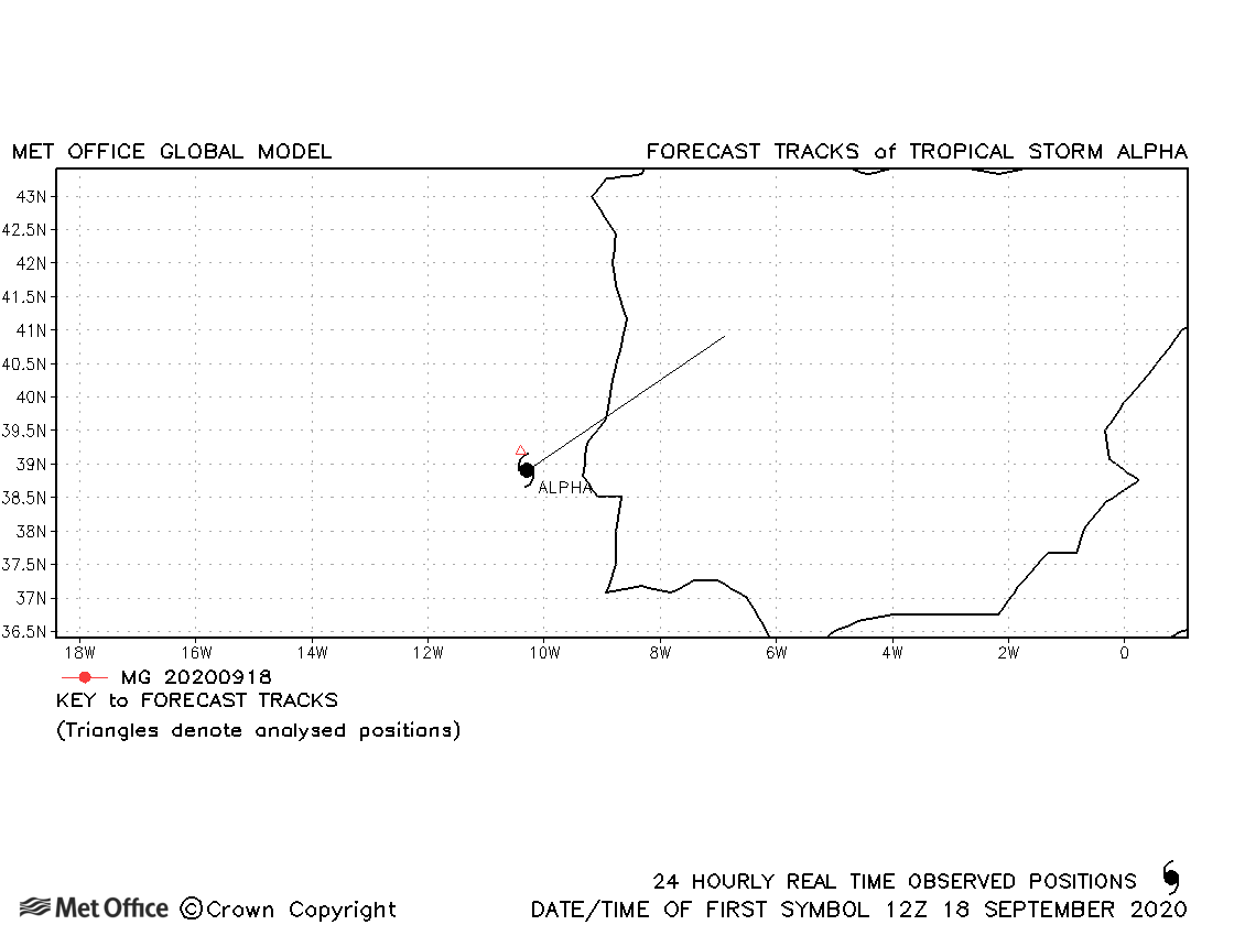
| Alpha (24L) | 18-19 September | 998 mb, 40 knots | Alpha was only named for a short while so no forecasts were verified. However, its development from a non-tropical depression system was well forecast. |
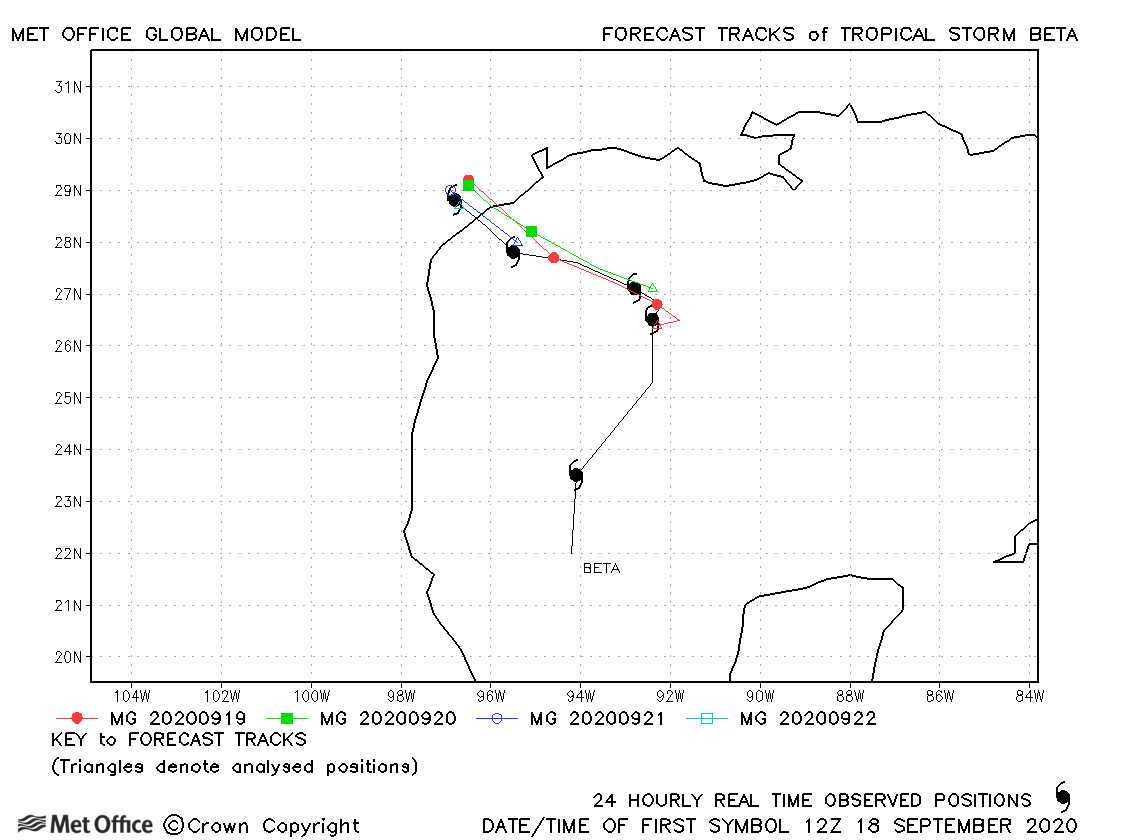
| Beta (22L) | 17-22 September | 994 mb, 50 knots | Track forecast errors were low and forecasts of landfall were mostly good. |
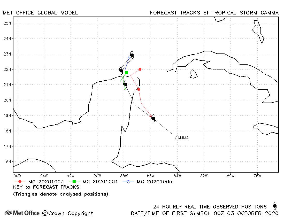
| Gamma (25L) | 02-06 October | 980 mb, 60 knots | Track forecast errors were mixed for this storm. |
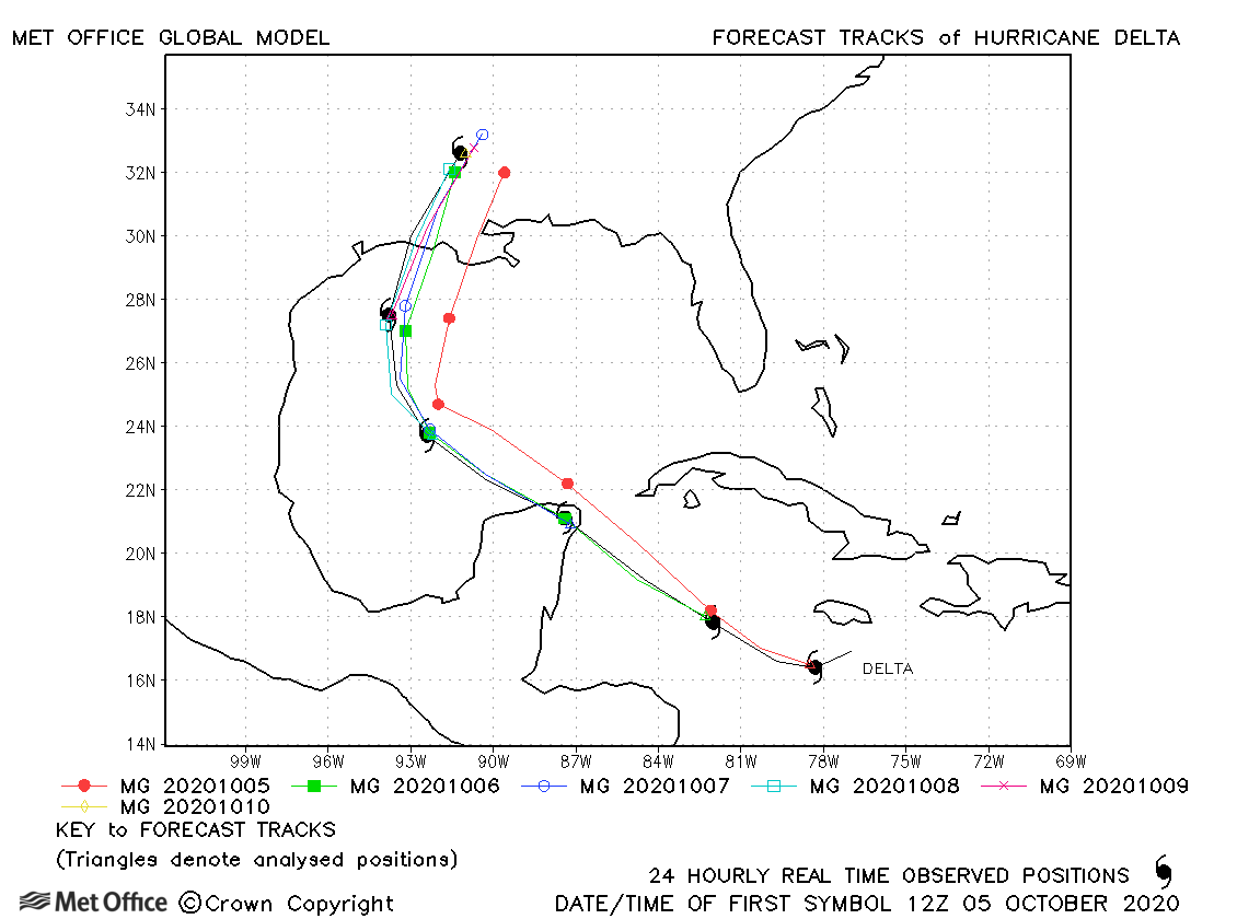
| Delta (26L) | 04-10 October | 956 mb, 120 knots | Track forecast errors were low and skill scores high. Landfall over the USA was well predicted. |
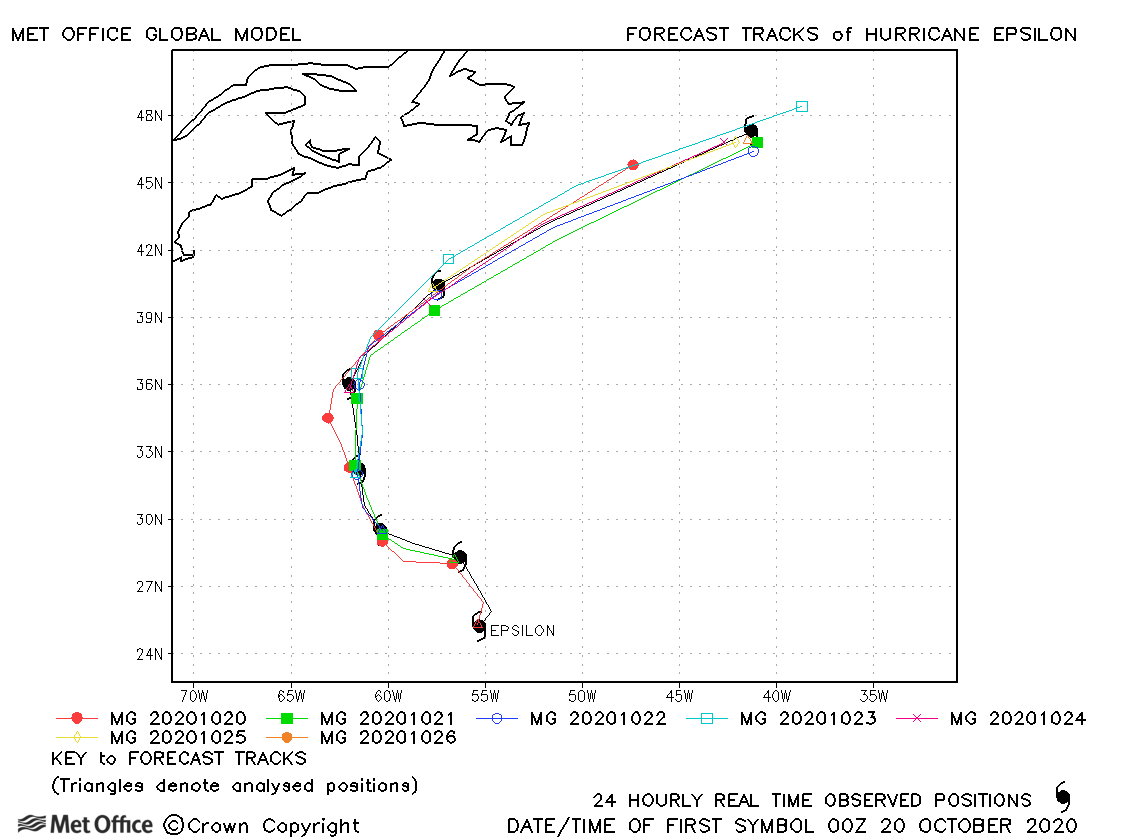
| Epsilon (27L) | 19-26 October | 952 mb, 100 knots | The track of Hurricane Epsilon was very well predicted. Track forecast errors were low, apart from at the longest lead times. |
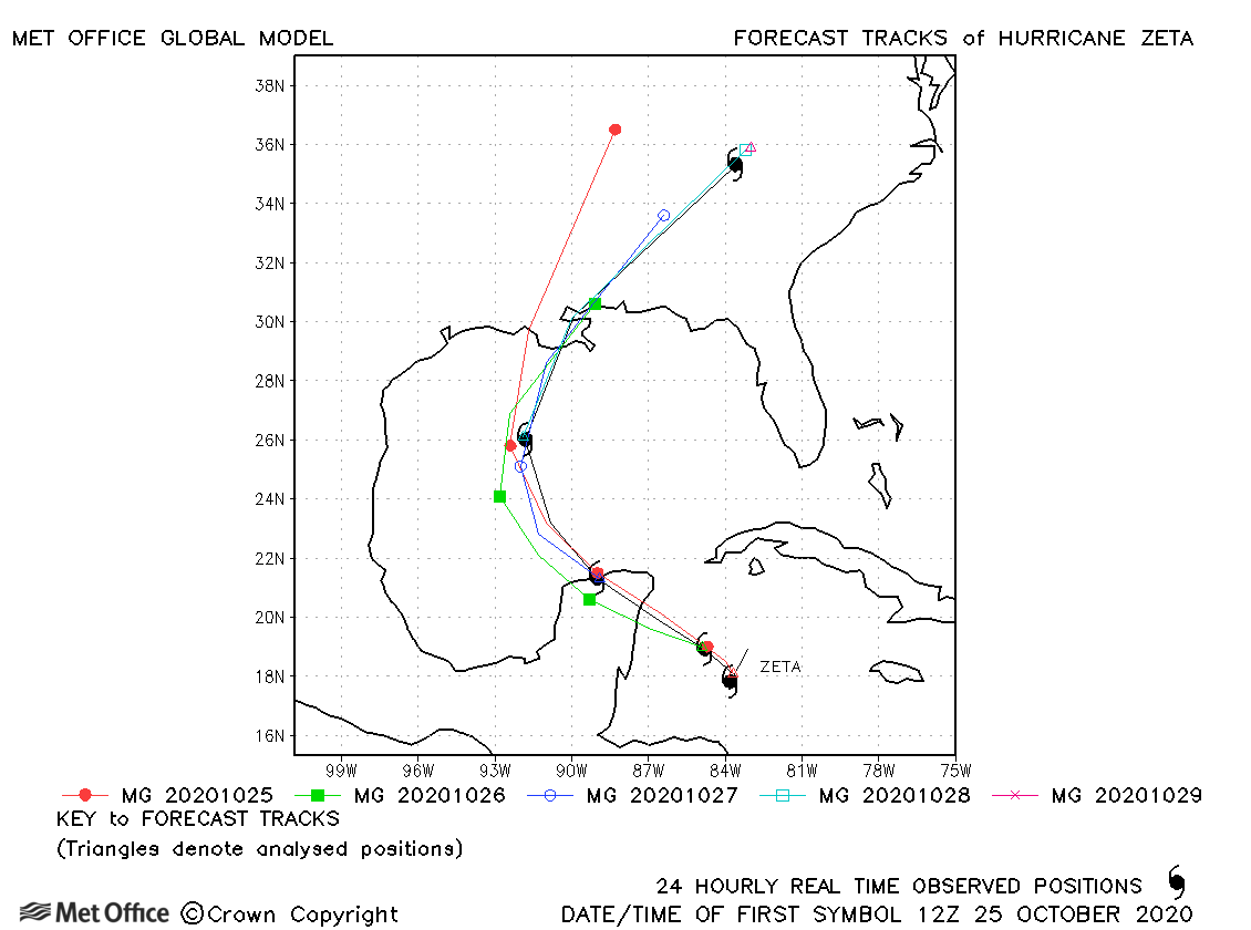
| Zeta (28L) | 24-29 October | 970 mb, 95 knots | There was a slow and slight left-of-track bias meaning track forecast errors were above the recent mean value. |
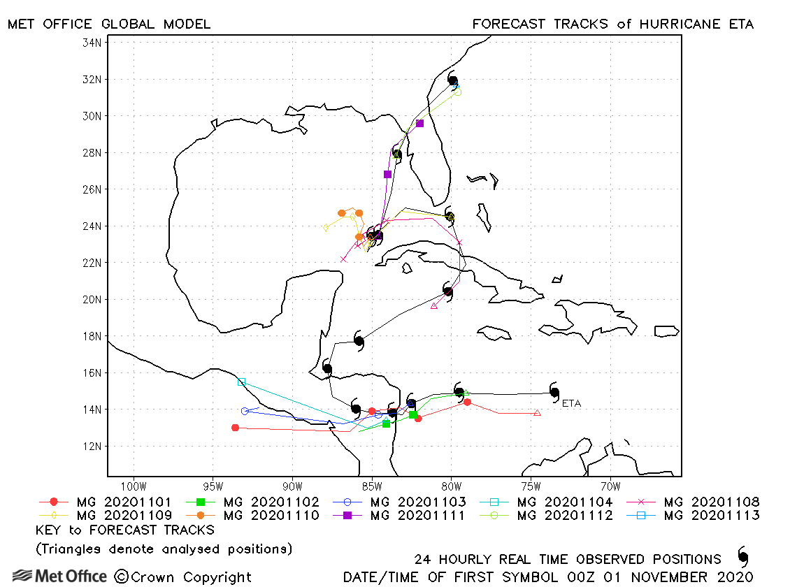
| Eta (29L) | 31 October-13 November | 923 mb, 130 knots | Track forecast errors for Eta were very large. This was due to two factors; the predicted westward movement after landfall over Central America and the slow movement over the Gulf of Mexico when Eta actually turned north-eastwards. Despite the large track errors up to 72-hours the track forecast skill scores were high. |
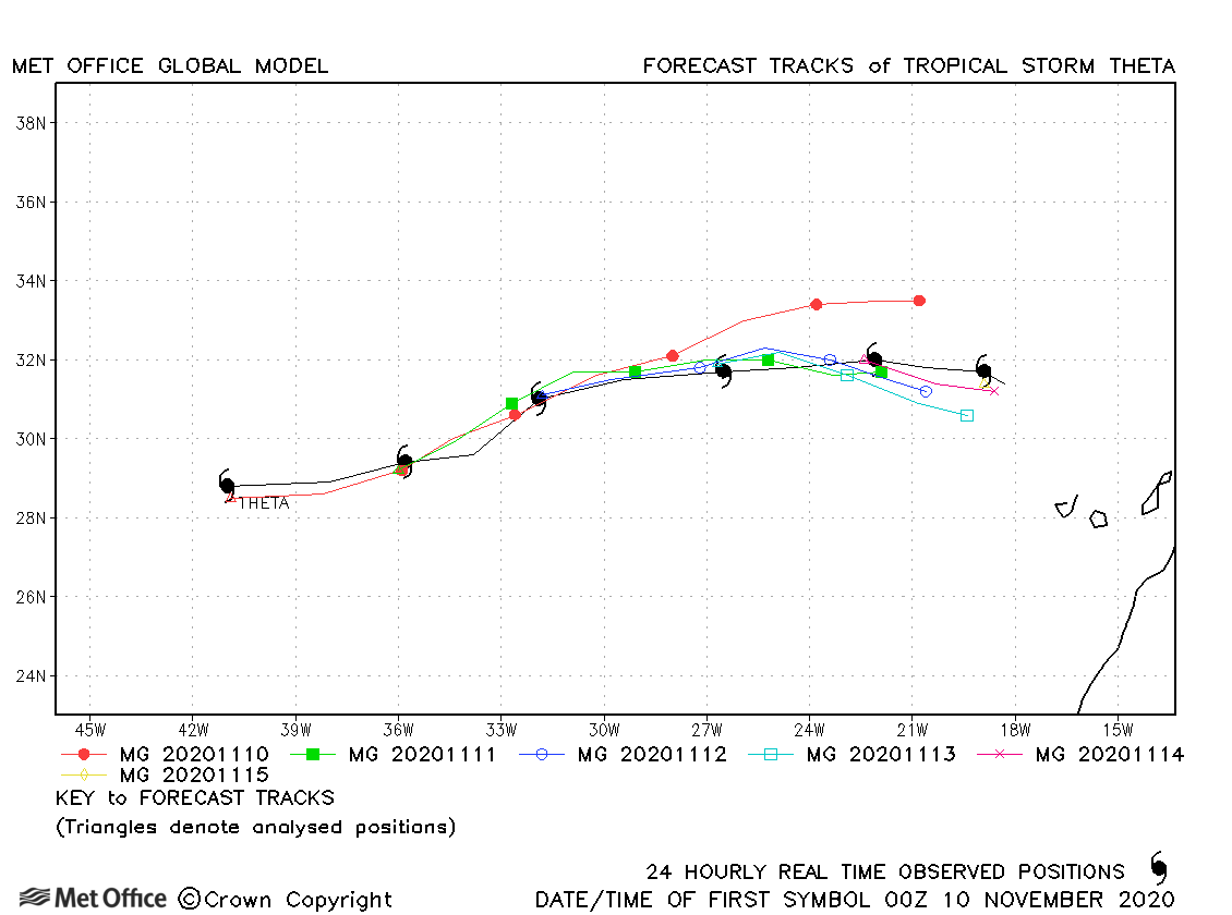
| Theta (30L) | 10-15 November | 989 mb, 60 knots | Track forecast errors were mostly a little above the recent mean due to a slow bias. |
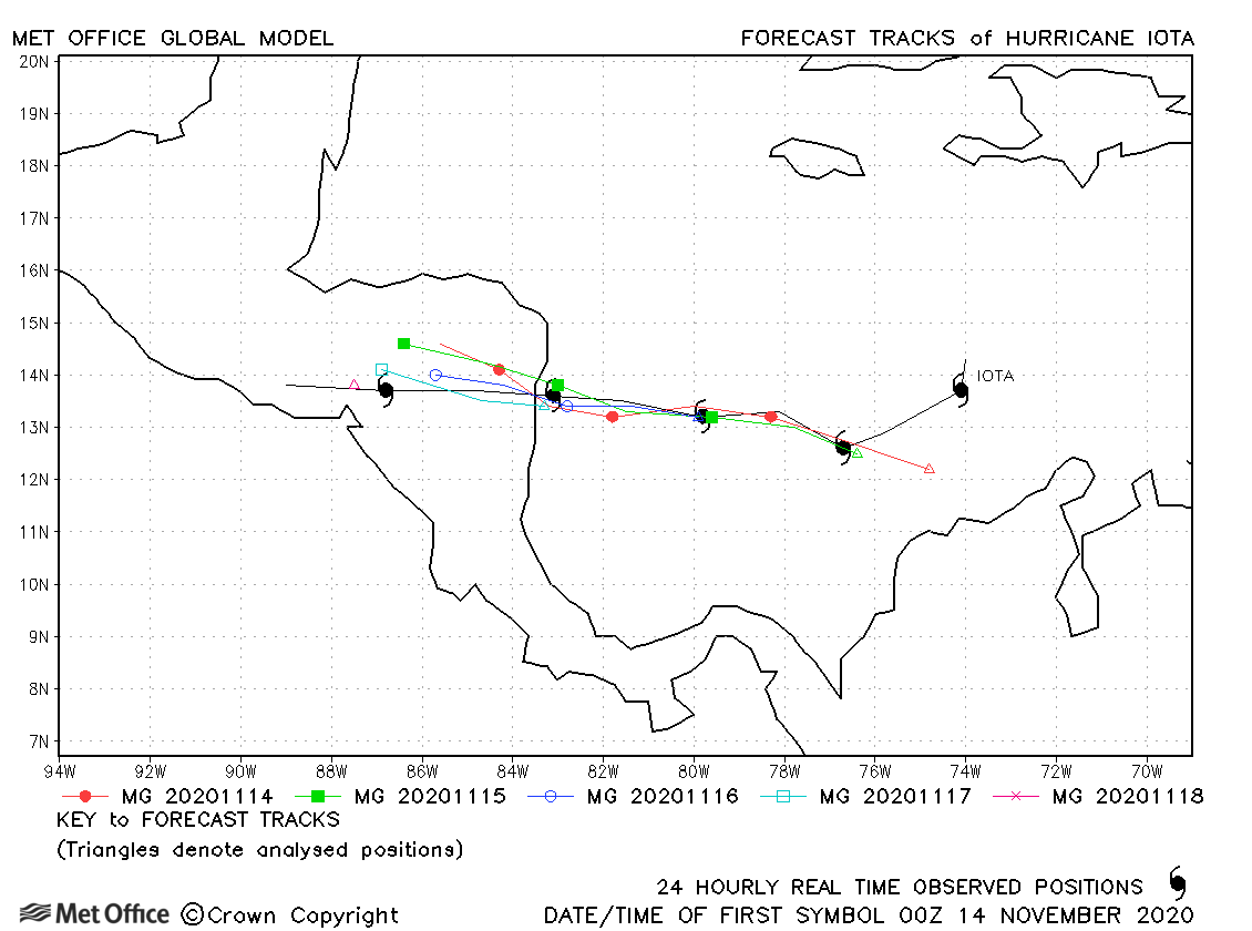
| Iota (31L) | 13-18 November | 917 mb, 140 knots | Track foecast errors were very low for Hurricane Iota. Moderate intensification was predicted, but the rapid intensification rate which occurred was not captured. |
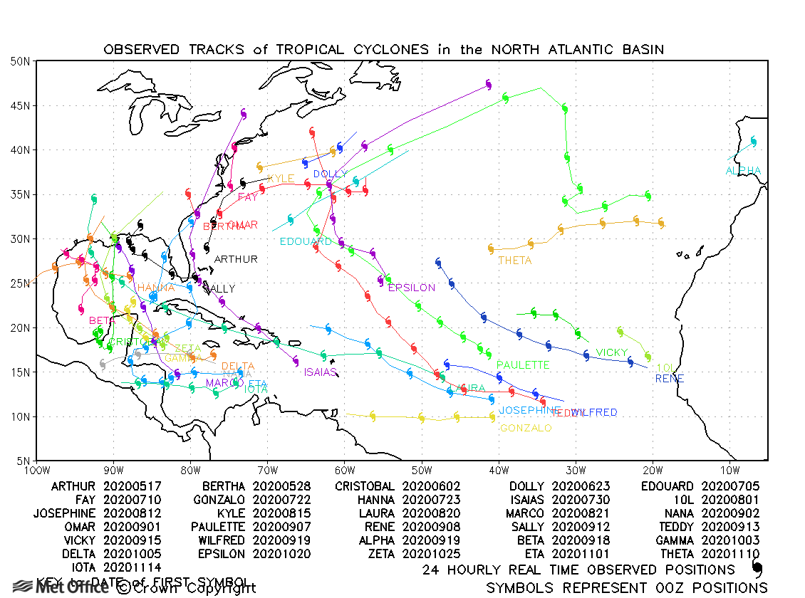
North Atlantic observed tracks in 2020
| Name & ID | Start & end dates | Central pressure, 1-/3-minute MSW | Comments on Met Office global model forecasts |
|---|---|---|---|
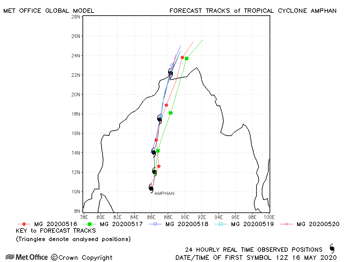
| 16-21 May | 901 mb, 145/125 knots |
Track forecasts were below the recent running mean for this storm. There was a slight fast bias. |
|
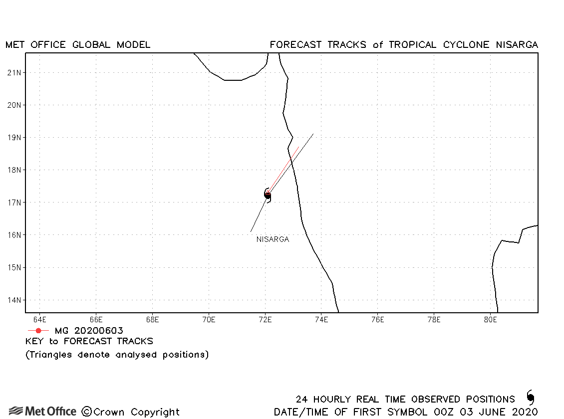
| 02-03 June | 975 mb, 75/55 knots |
Nisarga was only briefly classified as a tropical storm. |
|
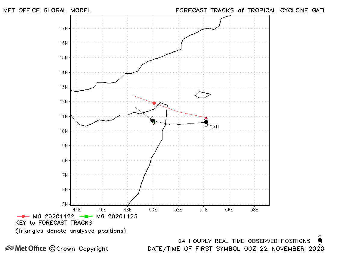
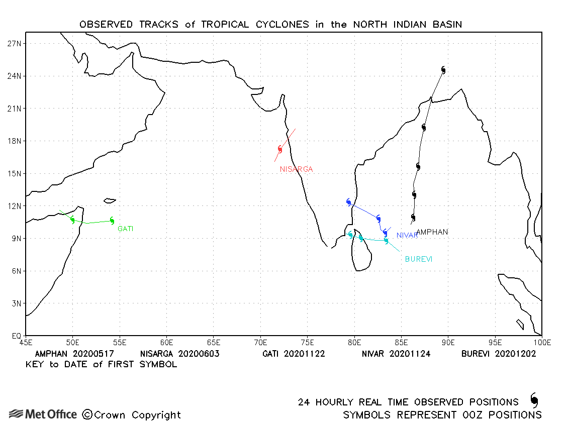
| Gati (03A) | 21-23 November | 967 mb, 100/75 knots | There was a right-of-track bias in forecasts for Gati and the extremely rapid intensification was completely missed by the global model. |
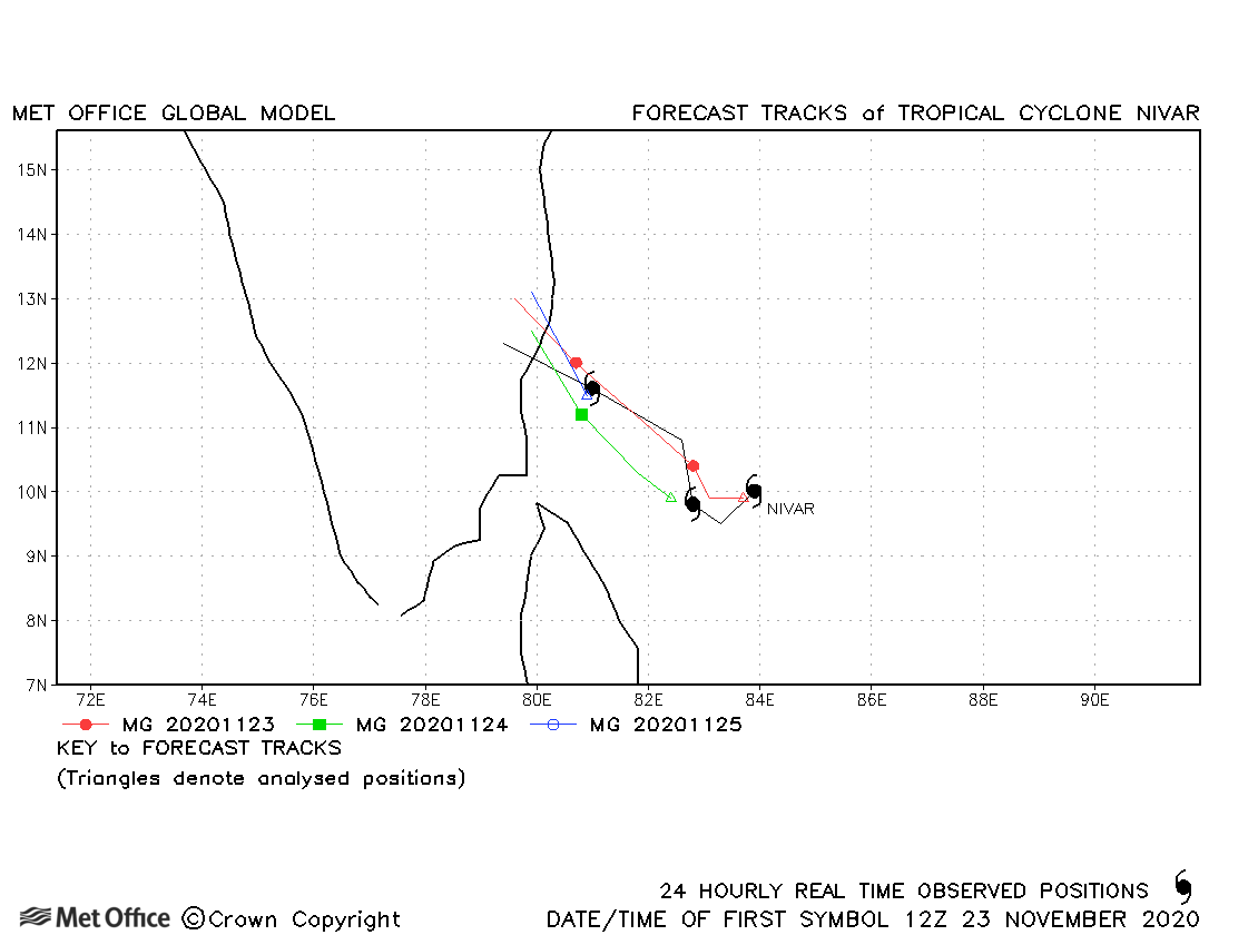
| Nivar (04B) | 23-26 November | 980 mb, 70/65 knots | Track forecast errors for Nivar were low. |
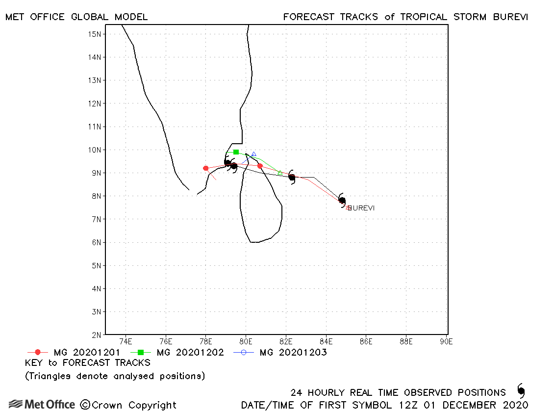
| Burevi (05B) | 01-04 December | 996 mb, 45/45 knots | Track forecast errors were near to the recent mean values. |
North Indian observed tracks in 2020
| Name & ID | Start & end dates | Central pressure, 1-/10-minute MSW | Comments on Met Office global model forecasts |
|---|---|---|---|
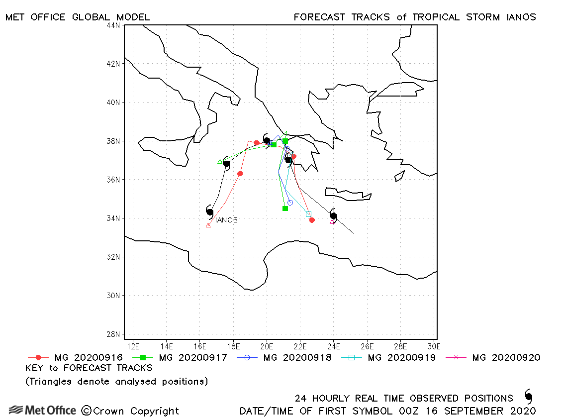
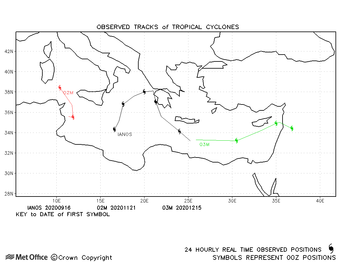
| Ianos (01M) | 15-20 September | 988 mb, 60 knots | The formation, development and track of this storm in the Mediterranean were mostly well predicted by the model. |
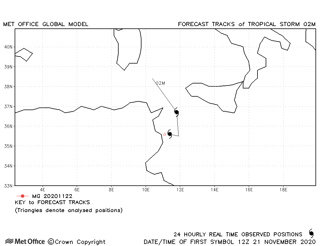
| 02M | 20-22 November | 1007 mb, 35 knots | This system in the Mediterranean only briefly attained a strength which would qualify it as a tropical or subtropical storm. |
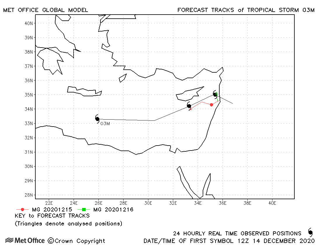
| 03M | 14-17 December | 999 mb, 50 knots | The formation and track of this storm was well predicted. |
Note, there is no official warning agency for Mediterranean tropical or subtropical cyclones, so identifiers are assigned by the Met Office to facilitate tracking and forecast verification.
Mediterranean observed tracks in 2020
Note on estimated wind speeds
1-minute MSW: Maximum sustained wind (knots) averaged over 1 minute (JTWC Hawaii, NHC Miami, CPHC Hawaii)
3-minute MSW: Maximum sustained wind (knots) averaged over 3 minutes (IMD New Delhi)
10-minute MSW: Maximum sustained wind (knots) averaged over 10 minutes (JMA Japan)
Note: Although 1-minute average winds should be stronger than 3-/10-minute averages, this may not be the case here since estimates are obtained from different warning centres using different analysis techniques.

