

Observed and forecast tracks: southern hemisphere 2012-13
All tropical cyclones in the southern hemisphere season in 2012-13 are listed below including details of their start and end dates and maximum sustained wind (MSW). Qualitative comments are included on the performance of the Met O
Click on the name of the tropical cyclone to see a chart of the observed track and forecast tracks from the Met Office global model. Verification statistics on each tropical cyclone are available upon request from [email protected]. At the end of the season a verification report on the performance of the Met Office global model will be published.
| Name & ID | Start & end dates | 1-/10-minute MSW | Comments on Met Office global model forecasts |
|---|---|---|---|
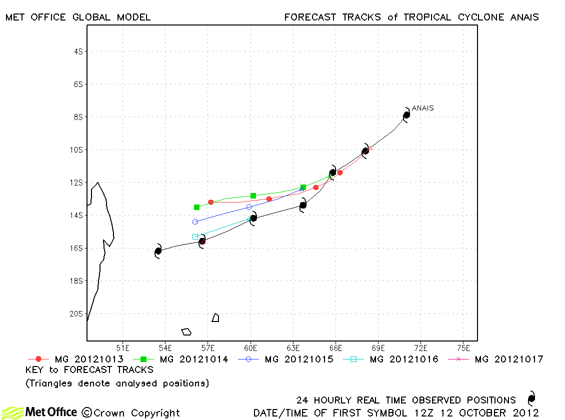
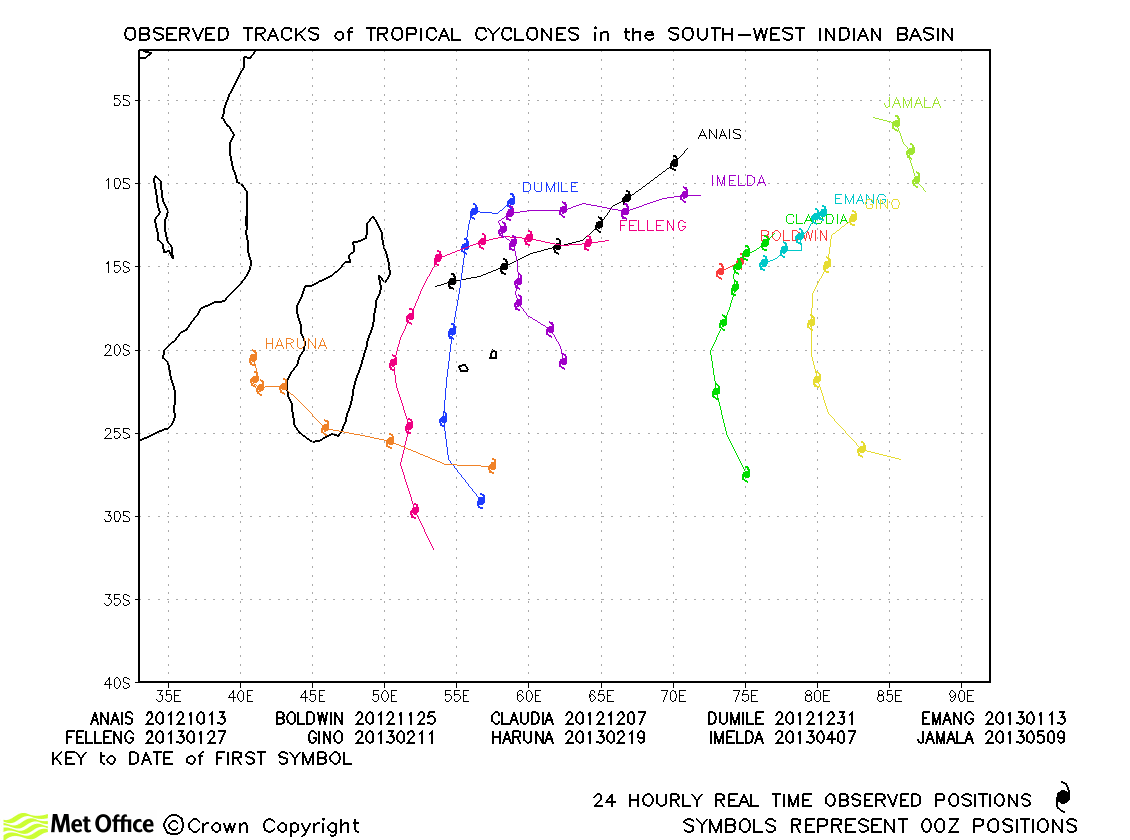
| Anais (01S) | 12-18 October | 100/105 knots | There was a slight right-of-track bias in forecasts, but track errors were below last season's average for this storm. |
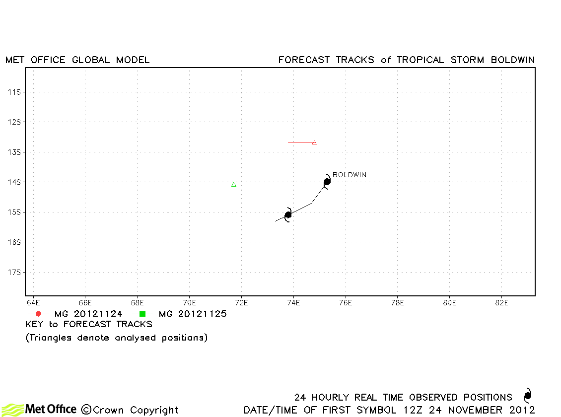
| Boldwin (02S) | 24-26 November | 55/55 knots | Boldwin was fairly short-lived and the model did not analyse or forecast it well. |
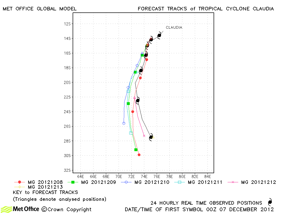
| Claudia (03S) | 06-13 December | 105/90 knots | Track forecast errors were below last season's average and skill scores high for this storm. |
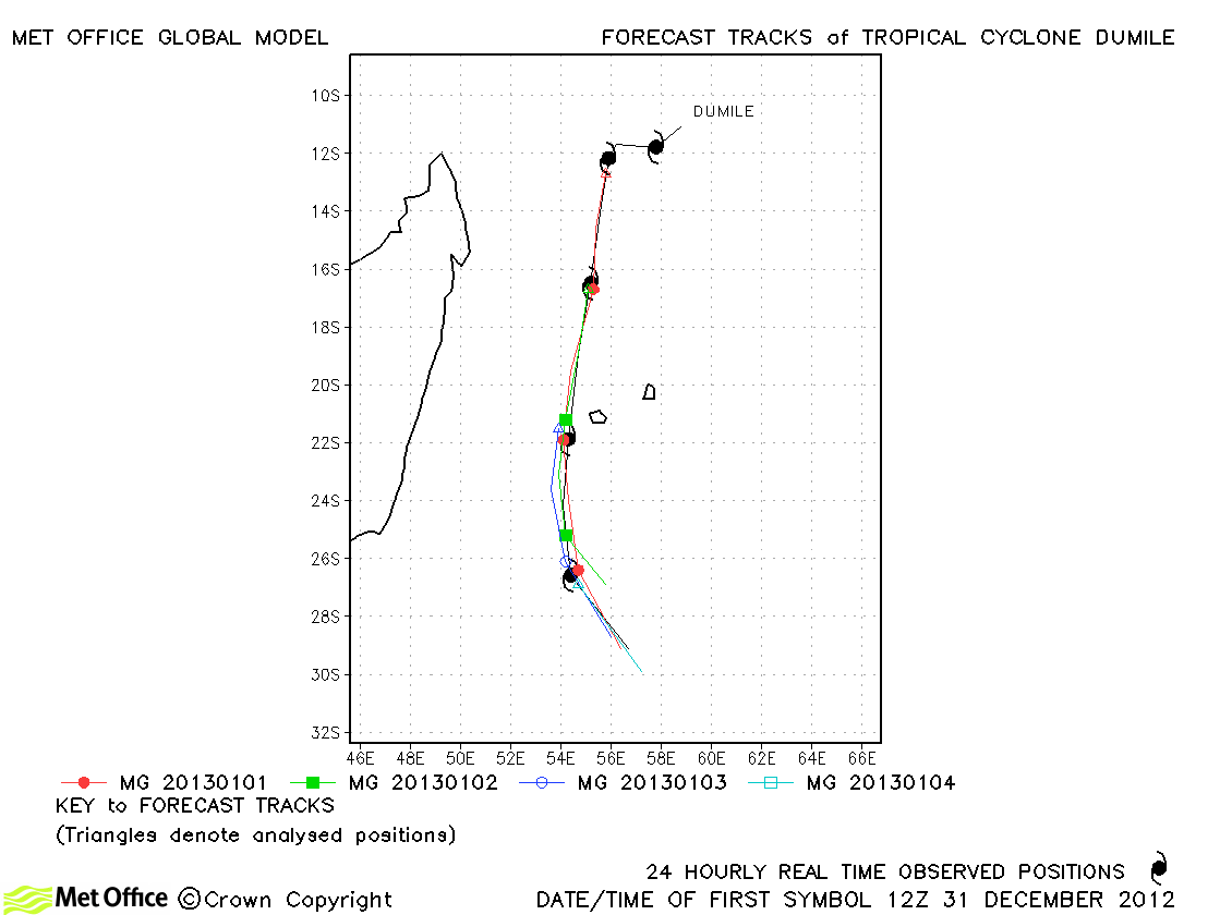
| Dumile (07S) | 30 December-05 January | 70/70 knots | Forecast for Dumile were very good with low track forecast errors and high skill scores. |
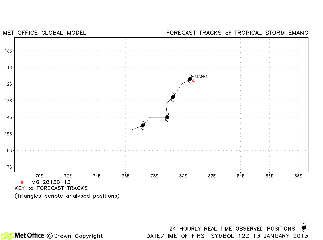
| Emang (09S) | 13-17 January | 35/35 knots | Emang only briefly reached tropical storm status and only one forecast was verified. |
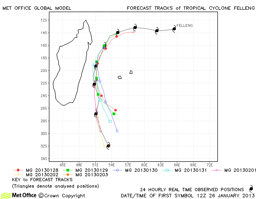
| Felleng (13S) | 26 January- 03 February | 115/90 knots | Felleng was well predicted by the global model. Track errors were lower than last season's average and skill scores positive. |
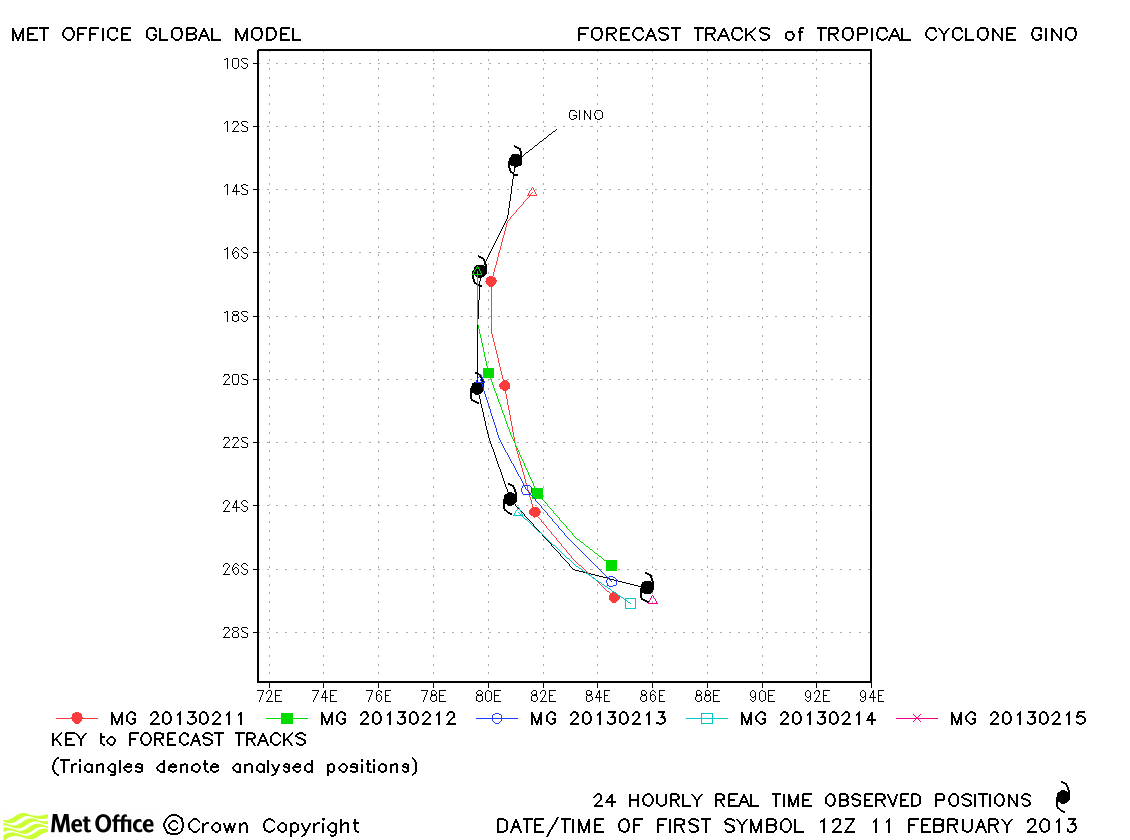
| Gino (15S) | 11-15 February | 85/75 knots | Track forecast errors for Gino were very low and skill scores very high. |
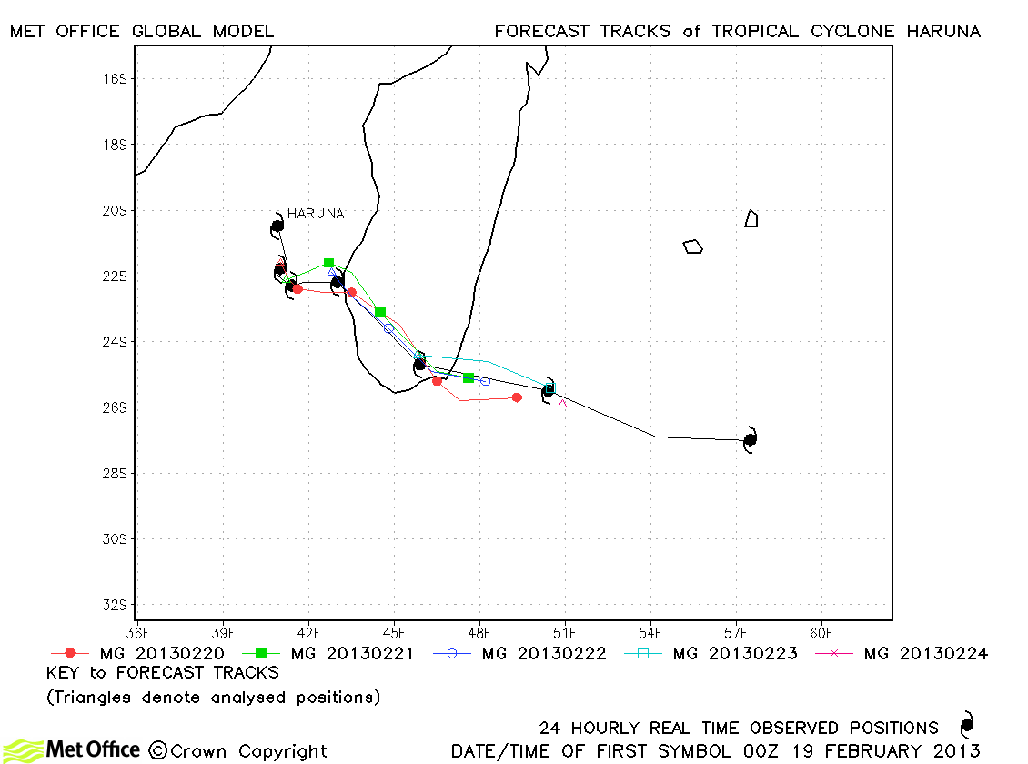
| Haruna (16S) | 19-25 February | 100/80 knots | The landfall of Haruna was well predicted. Track forecast errors were low. |
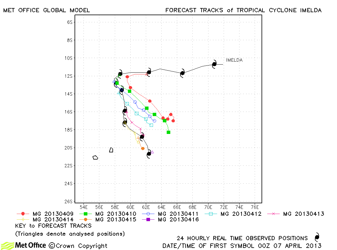
| Imelda (21S) | 06-16 April | 85/75 knots | Despite predicting too sharp a recurvature of this storm, track forecast errors were below last season's average and skill scores were positive. |
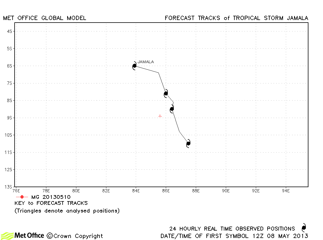
| Jamala (24S) | 08-11 May | 45/35 knots | Jamala was only briefly a tropical storm. |
South-West Indian observed tracks in 2012-13
| Name & ID | Start & end dates | 1-/10-minute MSW | Comments on Met Office global model forecasts |
|---|---|---|---|
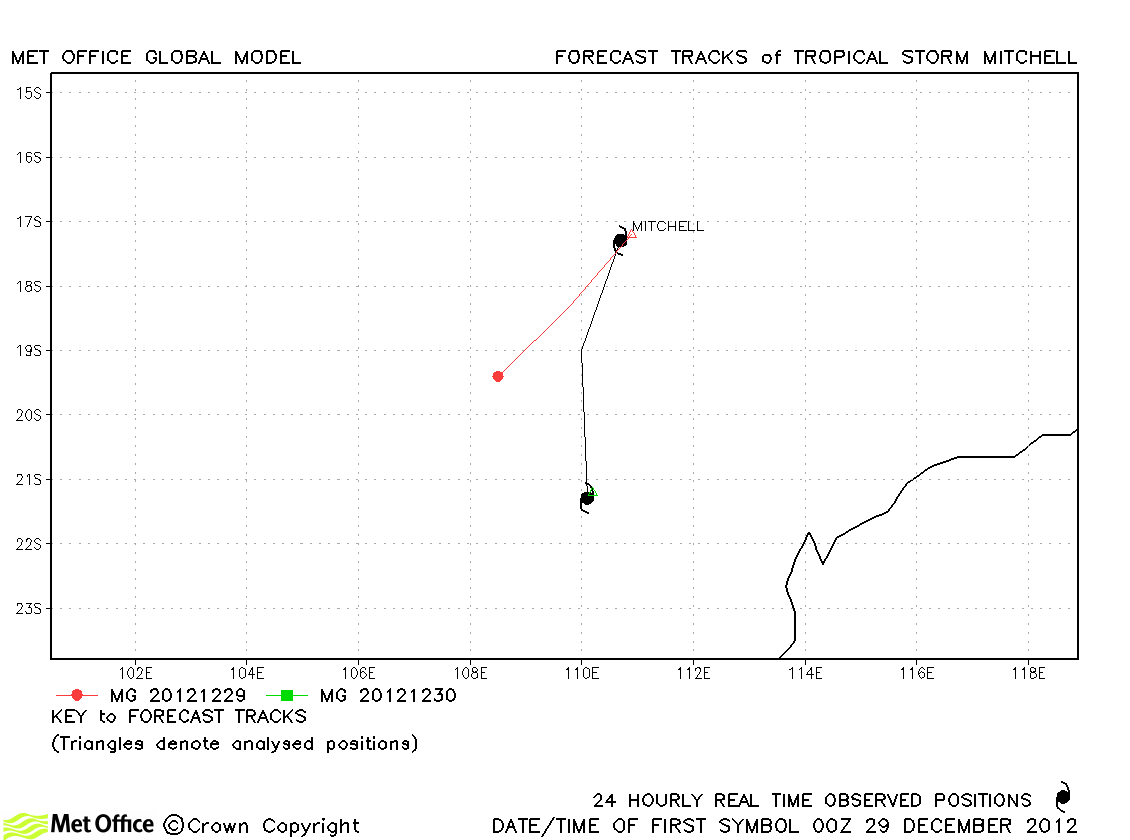
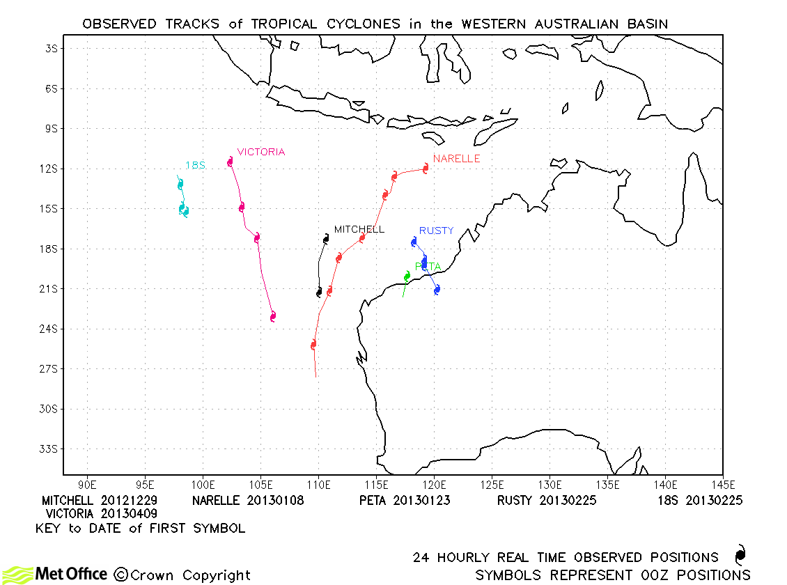
| Mitchell (06S) | 11-19 December | 45/40 knots | Mitchell was short-lived, but what few forecasts were verified had a right-of-track and slow bias. |
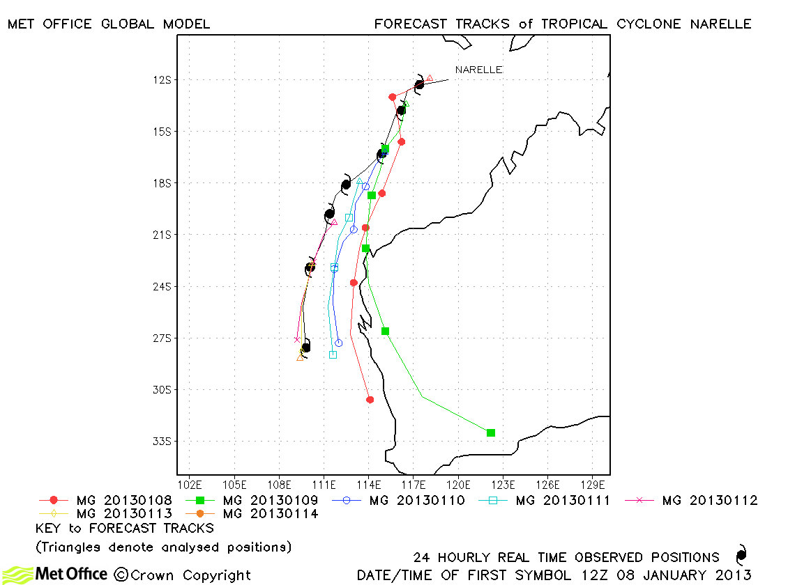
| Narelle (08S) | 07-14 January | 115/100 knots | There was a left of track bias in forecasts resulting in some predictions of landfall which did not occur. However, track forecast errors at short lead times were still below last season's average. |
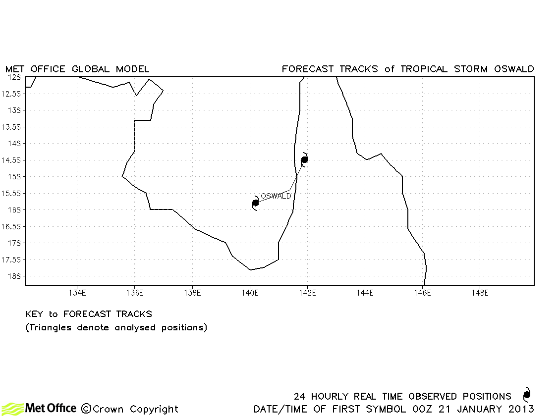
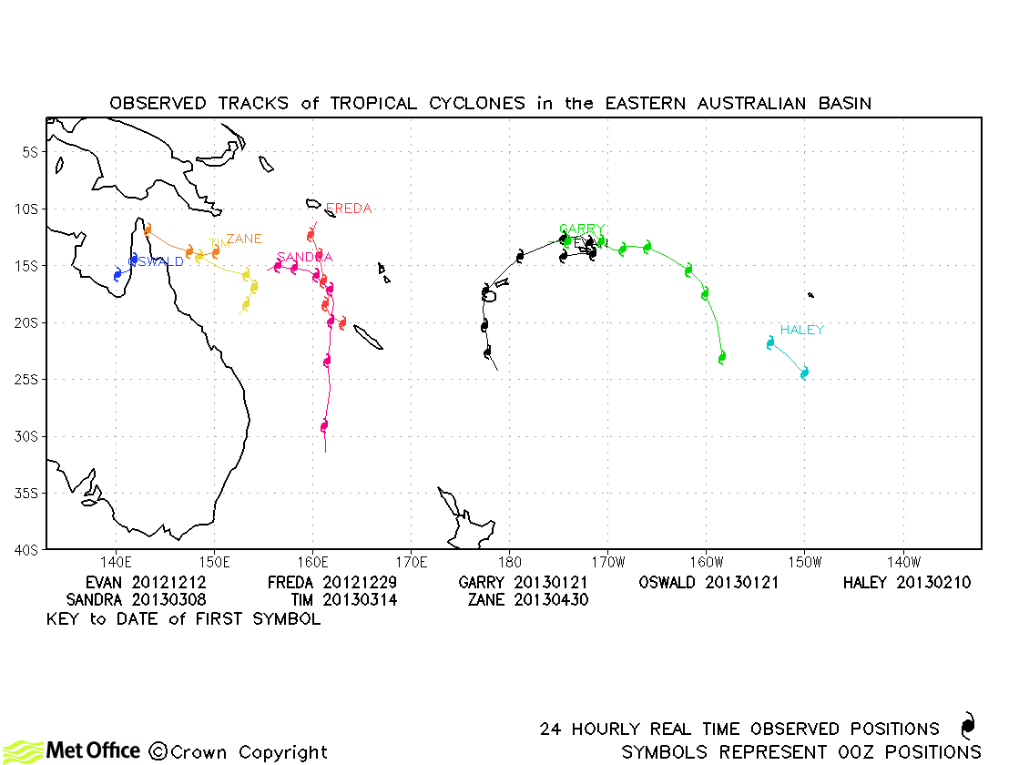
| Oswald (11P) | 21-22 January | 35/35 knots | Oswald was only briefly classified as a tropical storm and no forecasts were verified. However, the model predicted the movement of the remnant low down the Queensland coast very well - a track which resulted in heavy rain and flooding. |
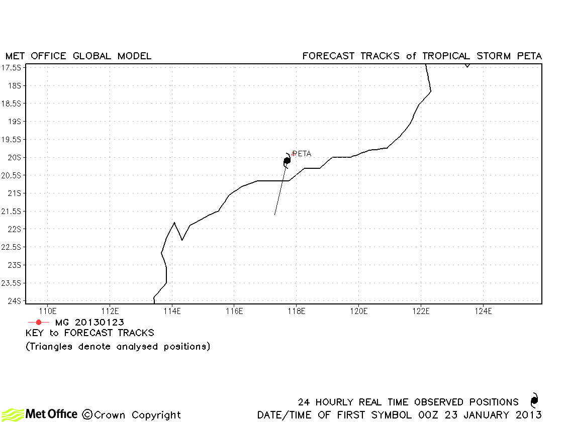
| Peta (12S) | 22-23 January | 35/35 knots | Peta was only briefly a tropical storm and no forecasts were verified. |
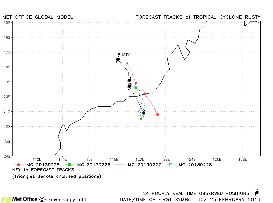
| Rusty (17S) | 23-28 February | 95/90 knots | Track forecast errors were very low and skill scores high for this storm. |
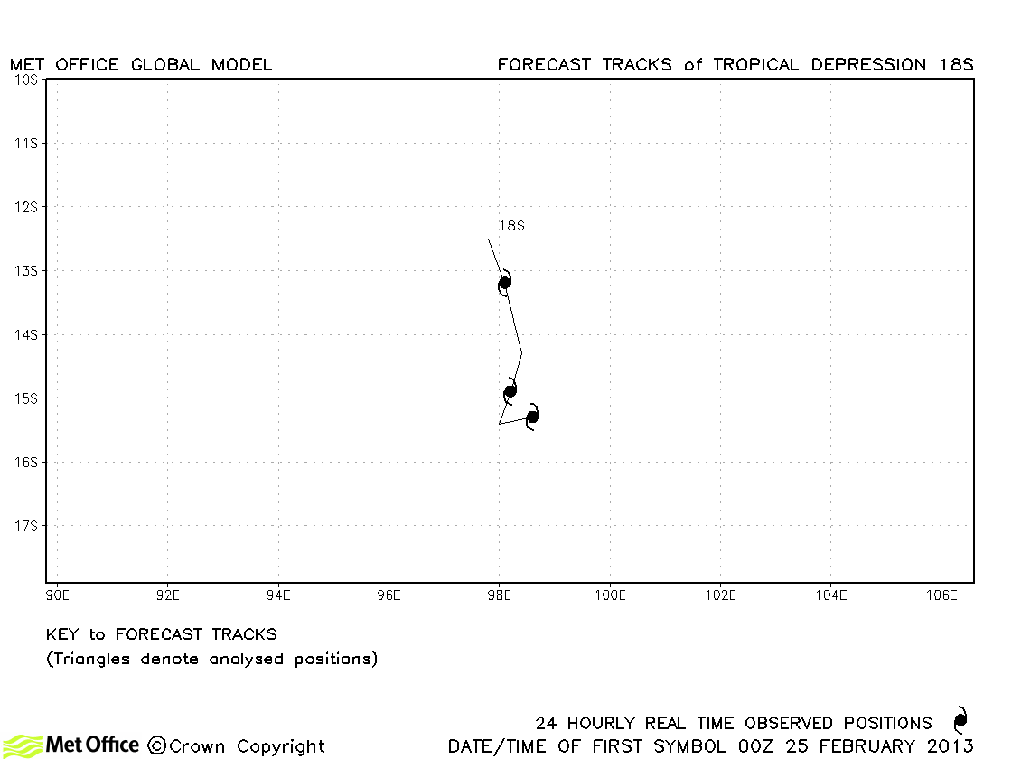
| 18S | 24-27 February | 40/30 knots | 18S did not reach tropical storm strength according to BoM Australia and no forecasts were verified. |
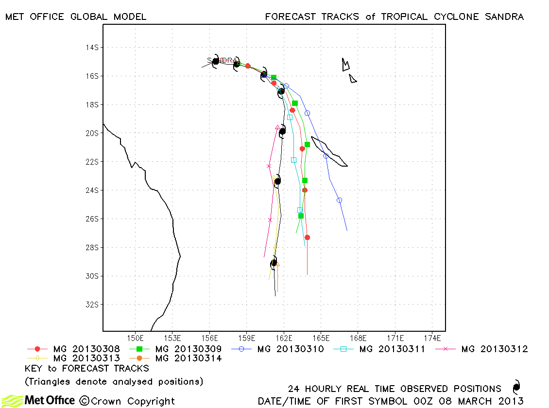
| Sandra (19P) | 07-14 March | 110/100 knots | Track forecast errors were below last season's average and skill scores high for this storm. There was a slight left-of-track bias. |
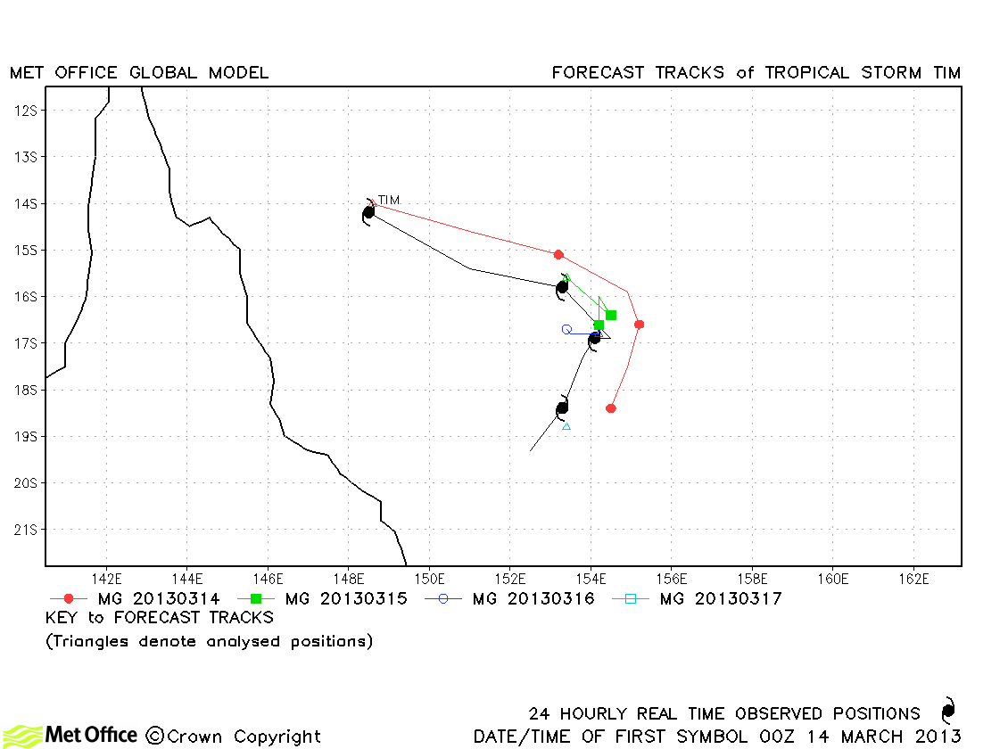
| Tim (20P) | 13-17 March | 55/50 knots | Track forecast errors were below last season's average and skill scores high for this storm. |
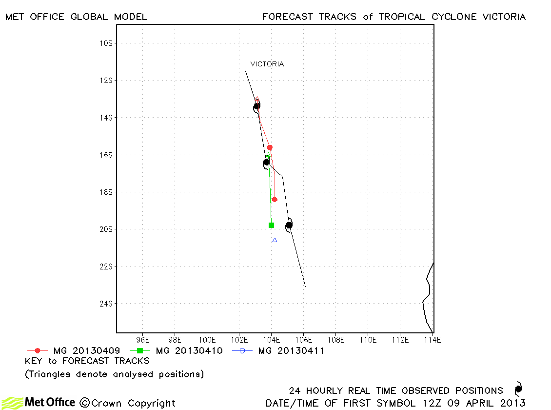
| Victoria (22S) | 09-12 April | 80/75 knots | Track forecast errors were near to last season's average for this straight-running storm. |
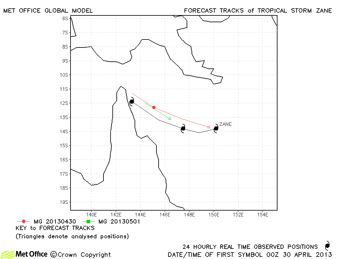
| Zane (23P) | 30 April-02 May | 60/60 knots | Track forecast errors were above last season's average for this storm. |
| Name & ID | Start & end dates | 1-/10-minute MSW | Comments on Met Office global model forecasts |
|---|---|---|---|
| Evan (04P) | 11-19 December | 115/100 knots | The global model did a good job in predicting Evan's track towards Samoa and its turn back towards Fiji. There was a right-of-track bias in later forecasts, but track errors were still below last season's average overall. |
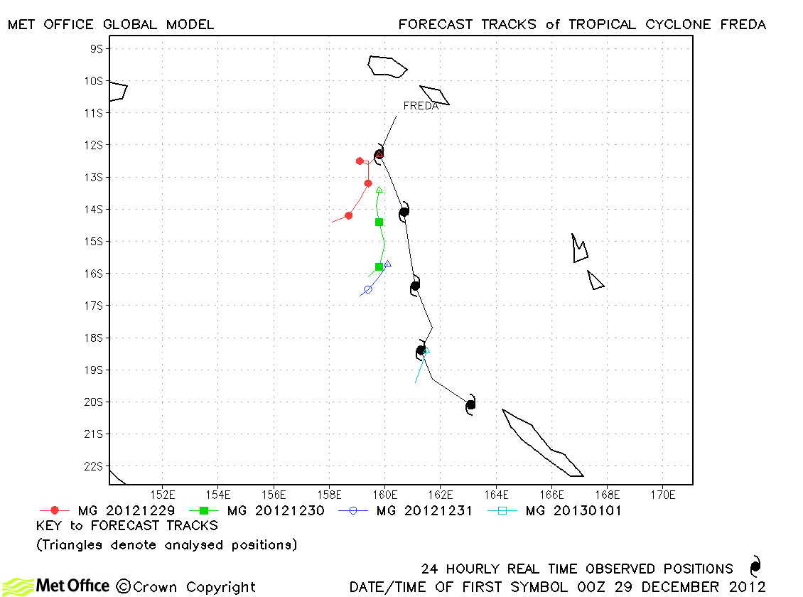
| Freda (05P) | 28 December-02 January | 105/100 knots | Forecasts had a marked slow and right-of-track bias resulting in large track forecast errors. |
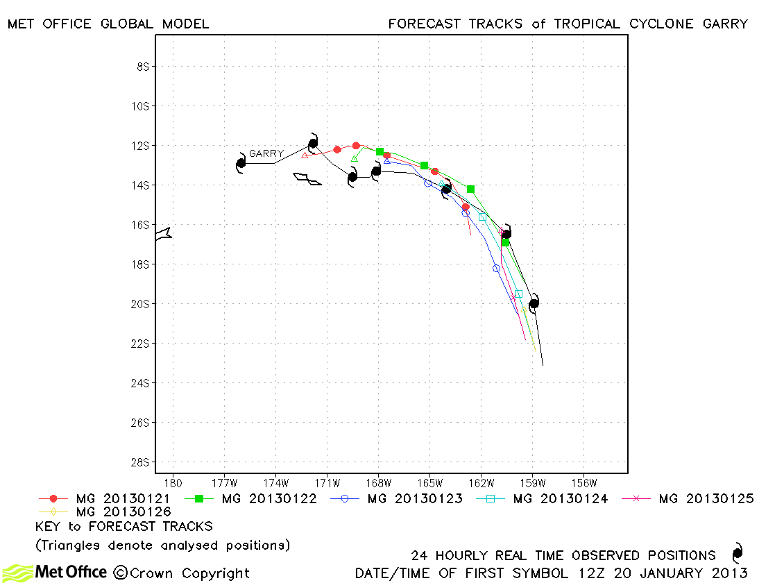
| Garry (10P) | 20-27 January | 85/80 knots | There was a slow bias in forecasts for Garry, but track forecast errors were near to or below last season's average. |
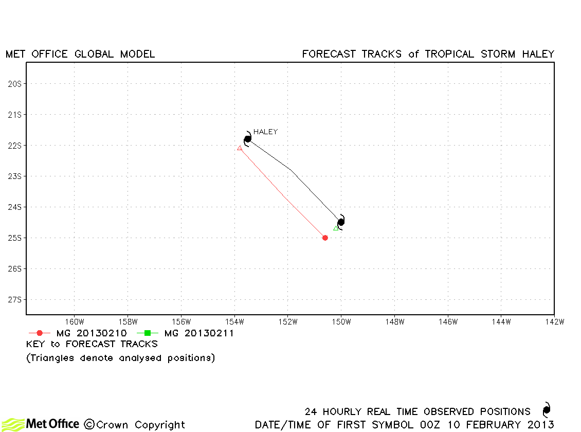
| Haley (14P) | 10-11 February | 45/40 knots | Haley was short-lived, but track forecast errors were low. |
Western Australian observed tracks in 2012-13
Eastern Australian observed tracks in 2012-13
Note on estimated wind speeds
1-minute MSW: Maximum sustained wind (knots) averaged over 1 minute (JTWC Hawaii)
10-minute MSW: Maximum sustained wind (knots) averaged over 10 minutes (Southern Hemisphere RSMCs and TCWCs)
Note: Although 1-minute average winds should be stronger than 10-minute average, this may not be the case here since estimates are obtained from different warning centres.

