

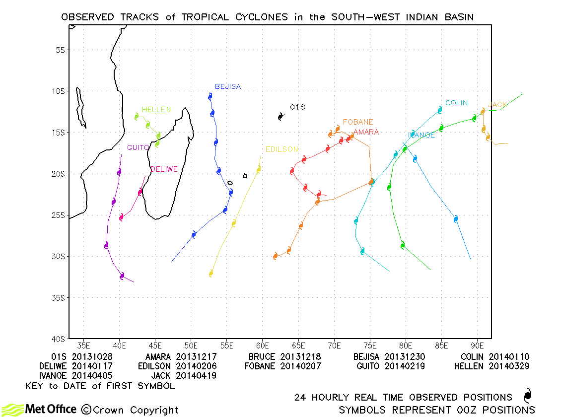
Observed and forecast tracks: southern hemisphere 2013-14
All tropical cyclones in the southern hemisphere season in 2013-14 are listed below including details of their start and end dates and maximum sustained wind (MSW). Qualitative comments are included on the performance of the Met O
Click on the name of the tropical cyclone to see a chart of the observed track and forecast tracks from the Met Office global model. Verification statistics on each tropical cyclone are available upon request from [email protected]. At the end of the season a verification report on the performance of the Met Office global model will be published.
| Name & ID | Start & end dates | 1-/10-minute MSW | Comments on Met Office global model forecasts |
|---|---|---|---|
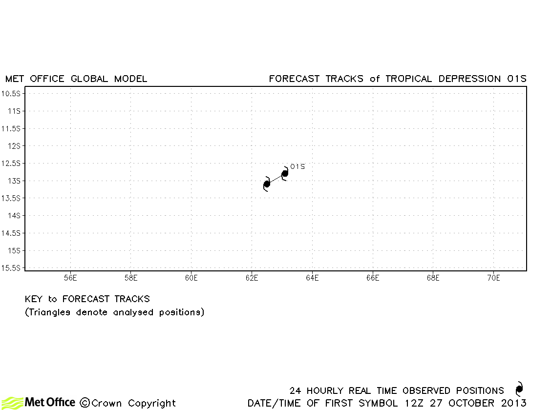
| 01S | 27-28 October | 30/30 knots | 01S did not attain tropical storm status. |
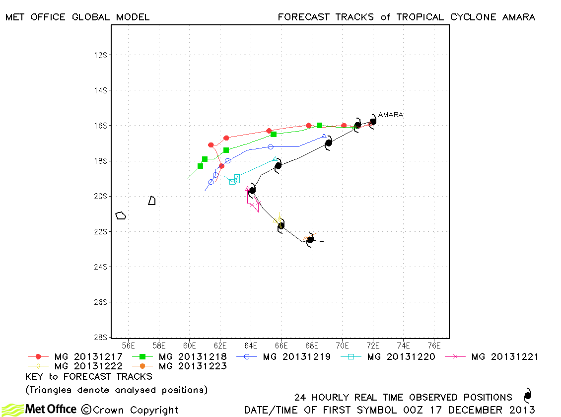
| Amara (03S) | 16-23 December | 130/110 knots | Track forecast errors were large due to a failure to predict the recurvature of this storm. |
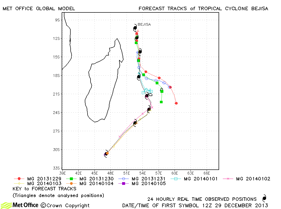
| Bejisa (06S) | 29 December-05 January | 110/90 knots | There was a slow and left-of-track bias for this storm which resulted in large track forecast errors. |
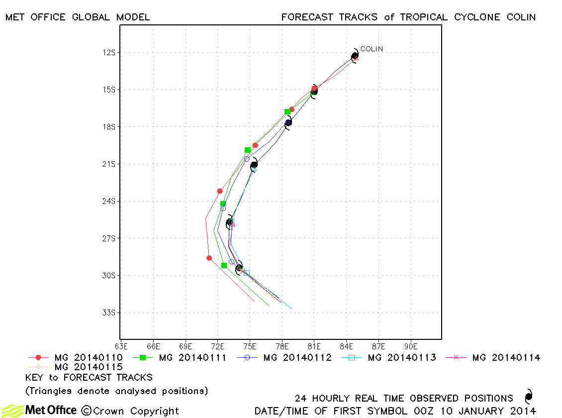
| Colin (08S) | 09-15 January | 115/100 knots | There was a slight right-of-track bias in forecasts, but errors were low for this storm. |
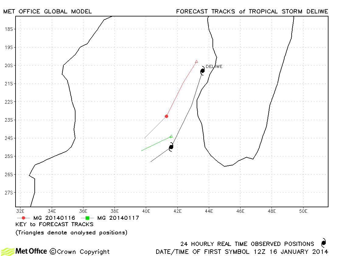
| Deliwe (09S) | 16-18 January | 45/45 knots | Deliwe was short-lived and track forecast errors were a little above last season's average. |
| Edilson (13S) | 05-08 February | 55/55 knots | Short period forecast tracks were good, but a slow bias resulted in large longer lead time errors. |
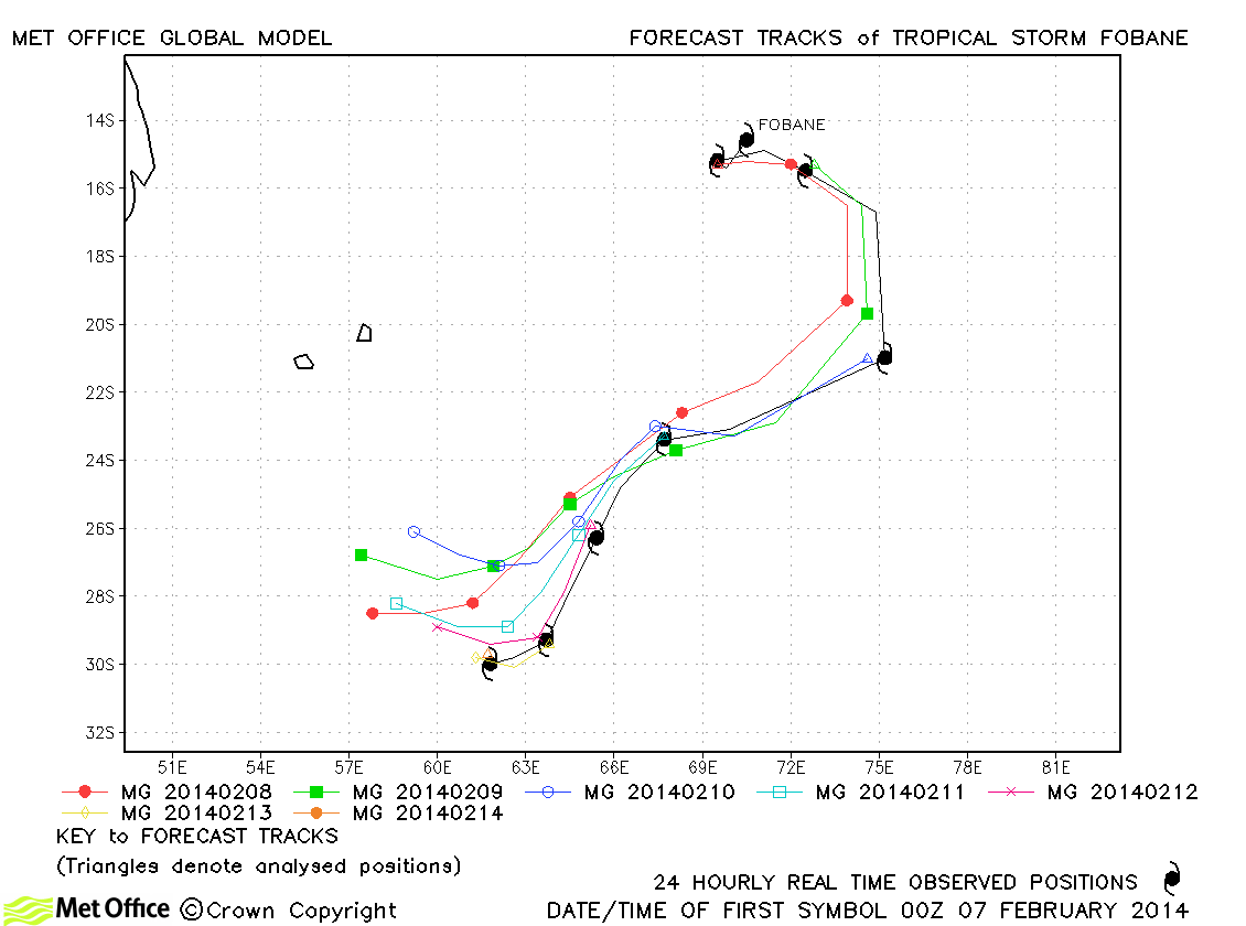
| Fobane (14S) | 06-14 February | 60/60 knots | Track forecast errors for this storm were low compared to last season's average. The various turns in the storm's motion were well predicted. |
| Guito (15S) | 18-22 February | 65/60 knots | Track forecast errors were mostly below last season's average for this storm. |
| Hellen (21S) | 28 March-01 April | 130/125 knots | Track forecast errors were above last season's average due to a northwards bias. |
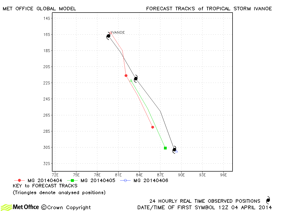
| Ivanoe (22S) | 04-06 April | 45/50 knots | Forecasts had a slow bias resulting in errors above last season's average. |
South-West Indian observed tracks in 2013-14
| Name & ID | Start & end dates | 1-/10-minute MSW | Comments on Met Office global model forecasts |
|---|---|---|---|
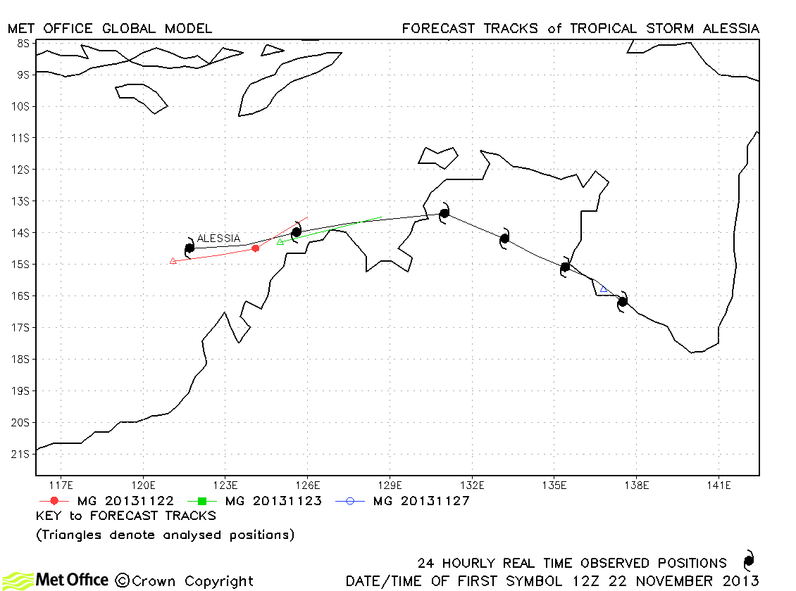
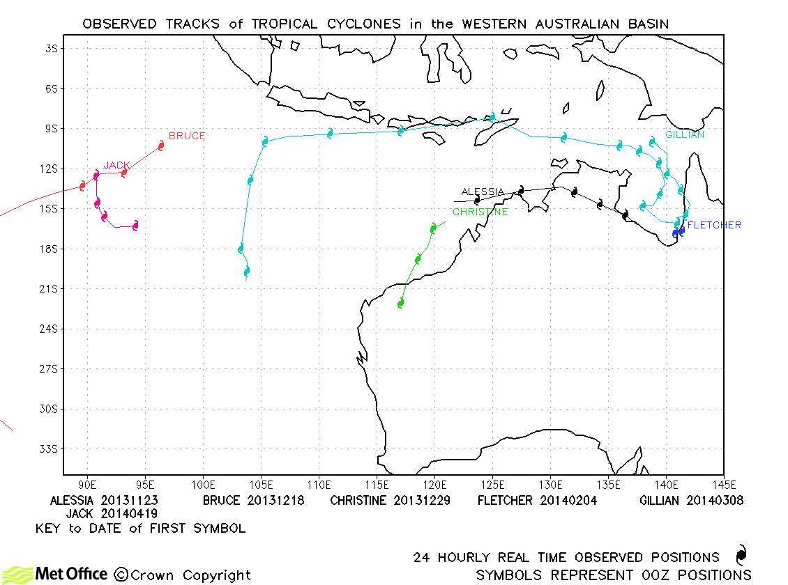
| Alessia (02S) | 22-27 November | 45/40 knots | Track forecast errors were near to last season's avelues for this storm. |
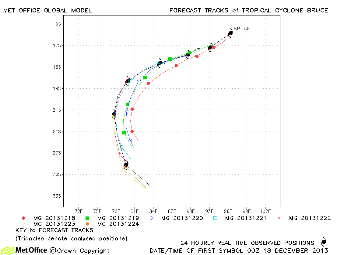
| Bruce (04S) | 17-24 December | 140/125 knots | Track errors were mostly quite close to to last season's average for this storm. There was a slight bias towards recurving the storm too soon. |
| Christine (05S) | 28-31 December | 85/85 knots | Christine only lasted a couple of days, but track forecast errors were low. |
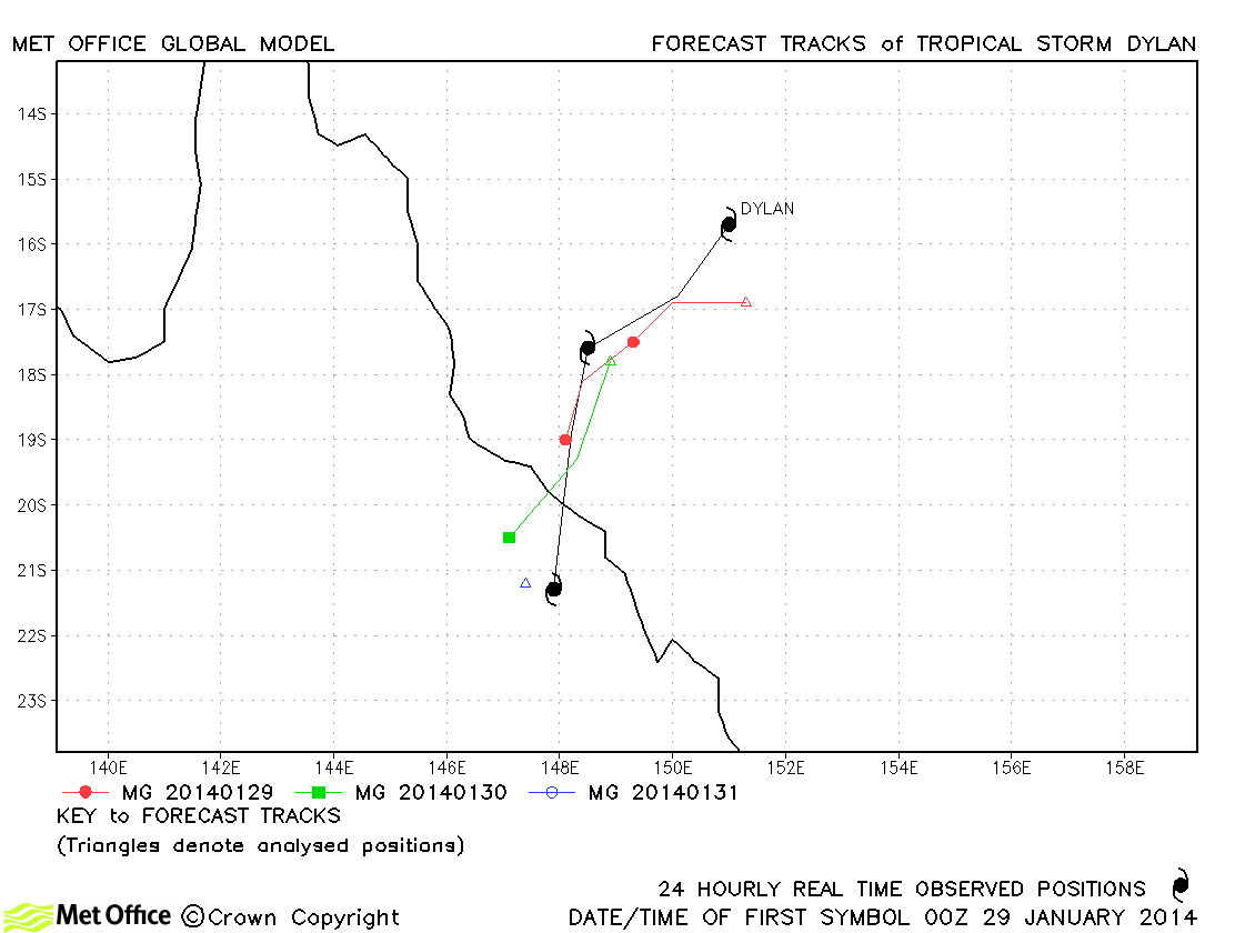
| Dylan (11P) | 29-31 January | 55/55 knots | Track forecast errors were mostly below last season's average for this storm |
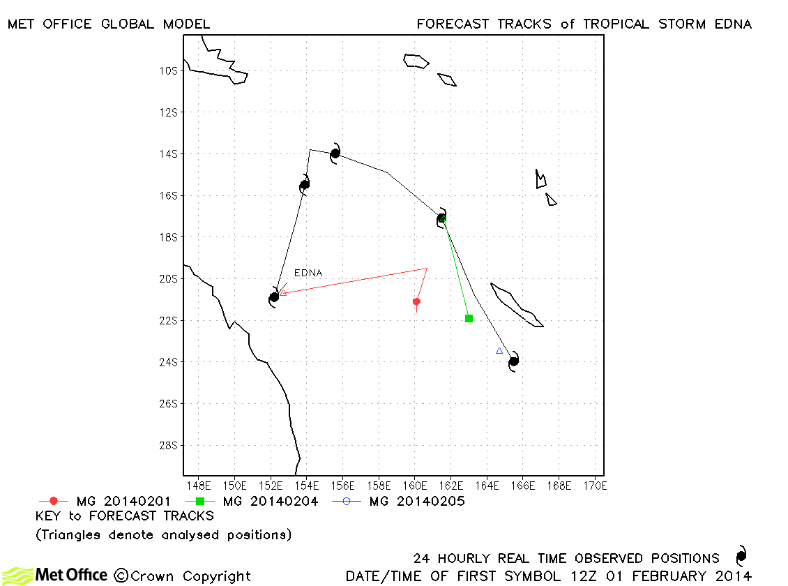
| Edna (12P) | 01-05 February | 50/50 knots | Edna was a tropical storm in two phases. Track forecast errors were mostly above last season's average. |
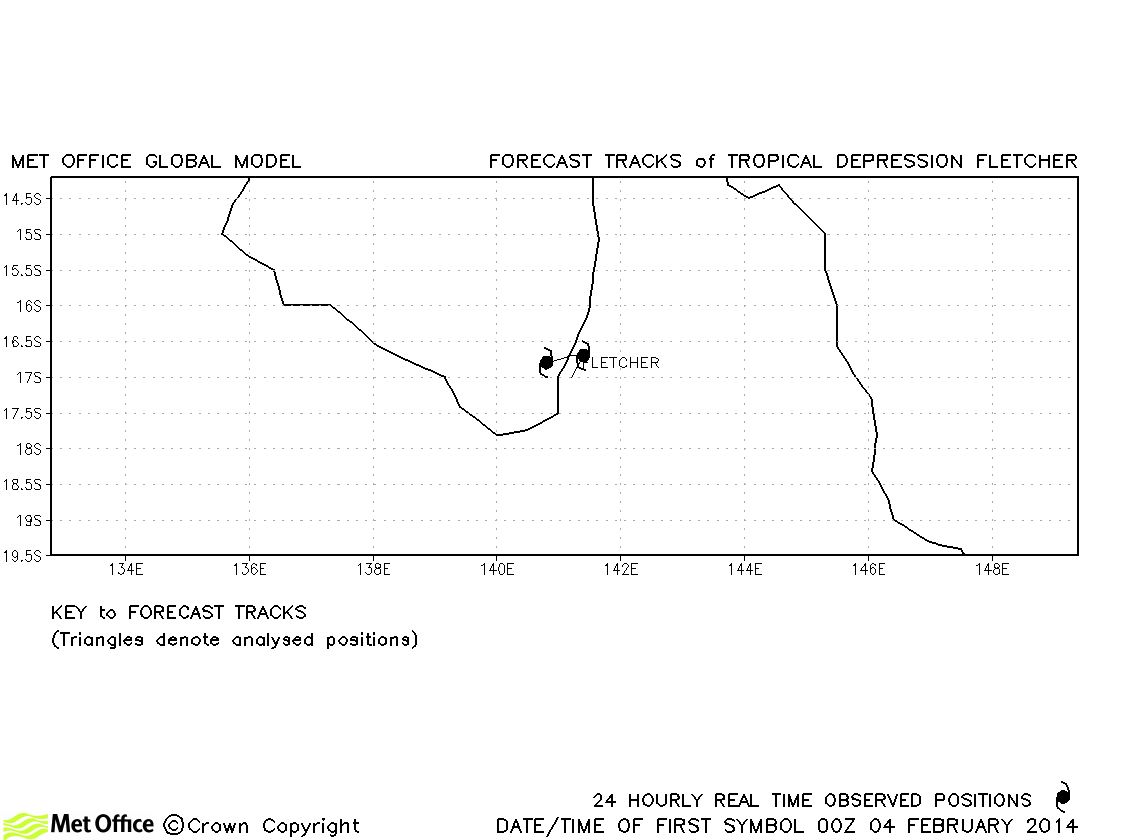
| Fletcher (-) | 03-05 February | -/35 knots | Fletcher was a minimal tropical storm according to the Bureau of Meteorology only and no forecasts were verified. |
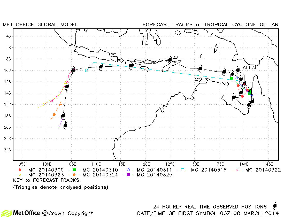
| Gillian (17P) | 08-25 March | 140/110 knots | Gillian formed in the Gulf of Carpentaria then weakened to a remnant low for many days before reforming in the South Indian Ocean. Track forecast errors were mixed. The reformation was well predicted, but there was a right of track bias in latter forecasts. |
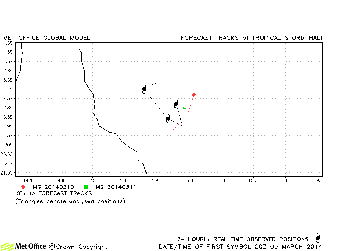
| Hadi (19P) | 09-11 March | 40/40 knots | Only a few forecasts were verified for this storm and track forecast errors were near to last season's average. |
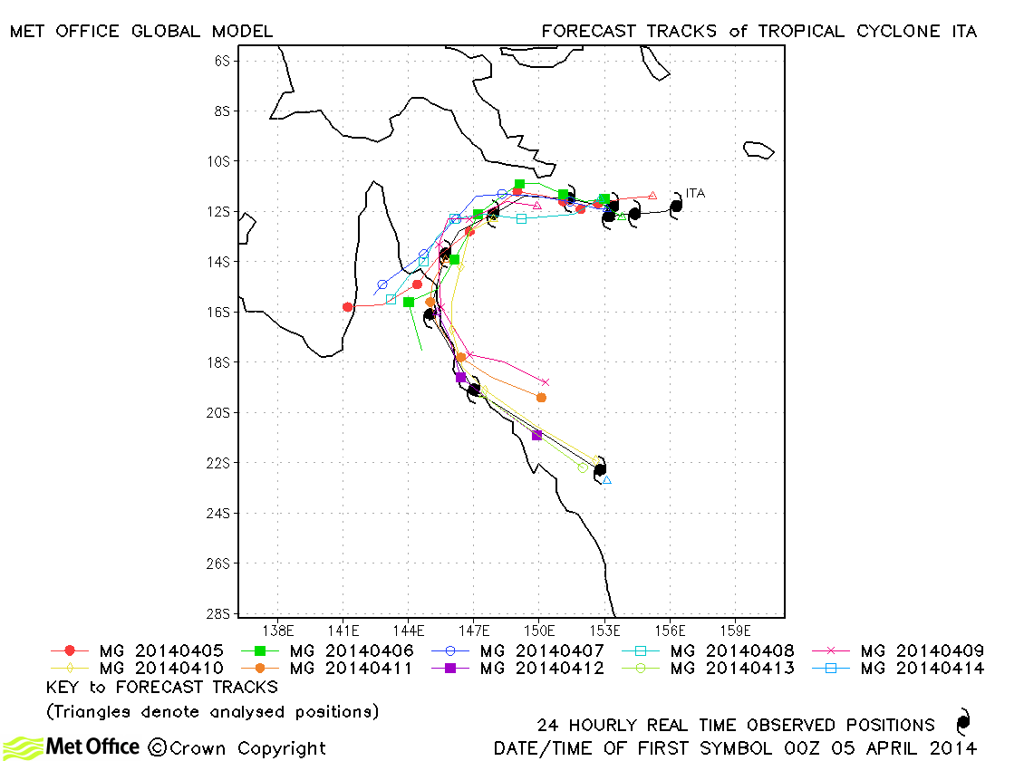
| Ita (23P) | 04-14 April | 135/115 knots | Although some forecasts did not fully recurve Cyclone Ita, the majority of forecasts handled the track and in particular landfall well. Thus track forecast errors were mostly below last season's average. Skill scores against CLIPER were high. |
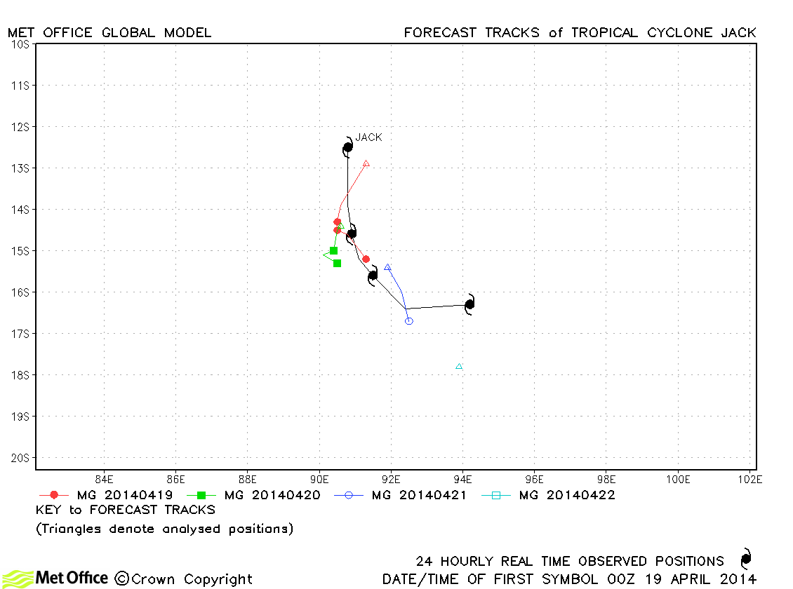
| Jack (24S) | 18-22 April | 90/80 knots | There was a slow bias in forecasts resulting in errors above last season's average. |
| Name & ID | Start & end dates | 1-/10-minute MSW | Comments on Met Office global model forecasts |
|---|---|---|---|
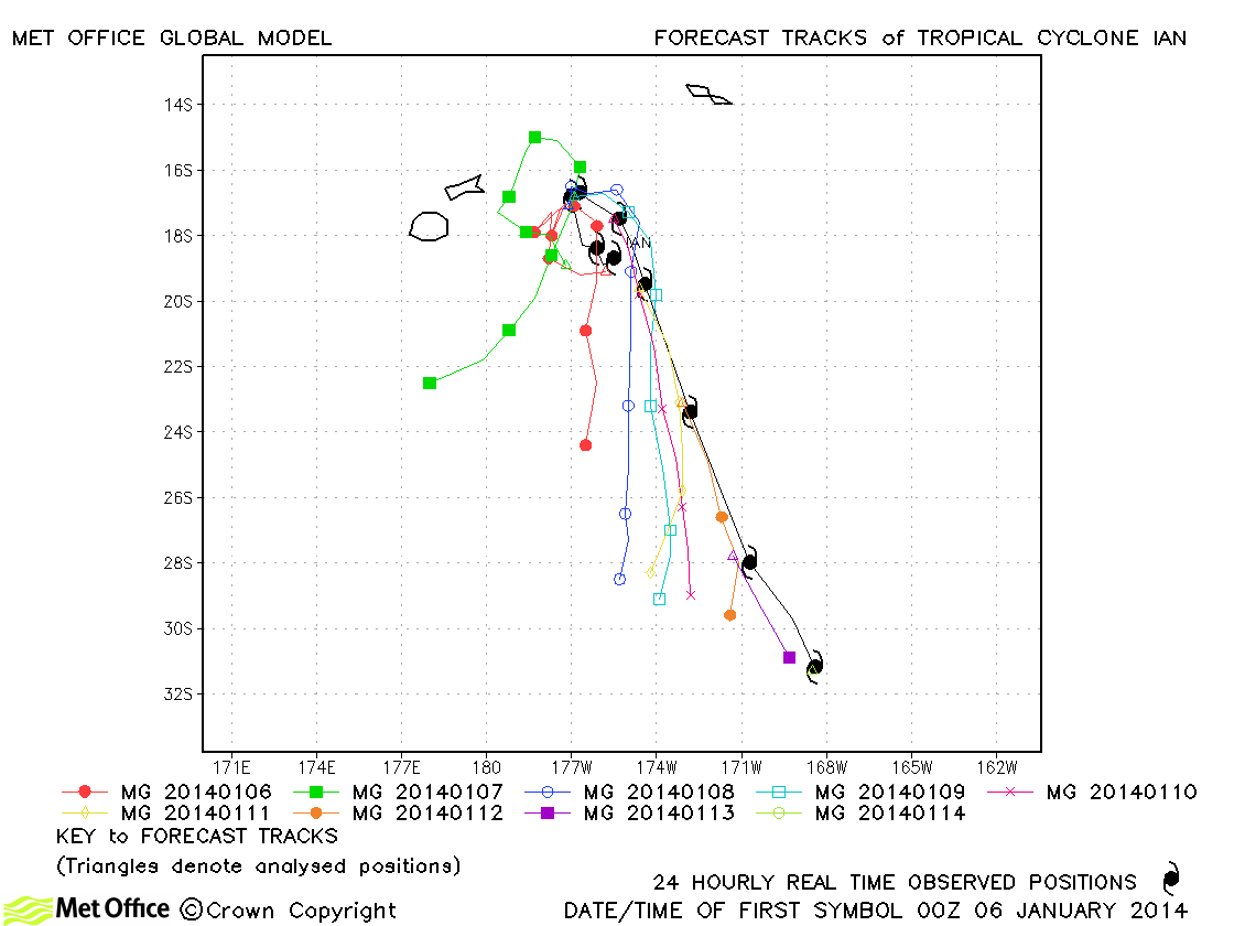
| Ian (07P) | 05-14 January | 125/110 knots | Track forecast errors at short lead times were near to or below last season's average. However, a failure to predict the rapid movement to higher latitudes in early forecasts resulted in large forecast errors at long lead times. |
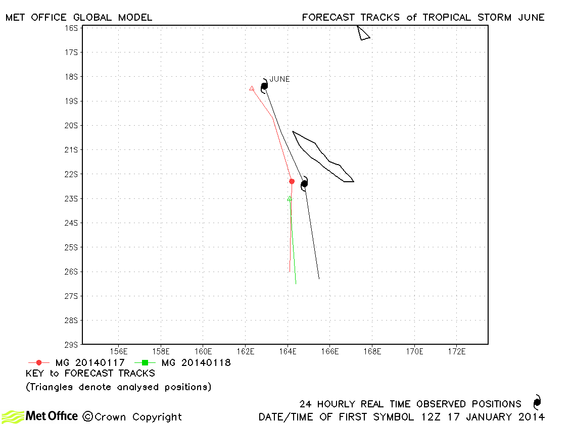
| June (10P) | 17-19 January | 40/40 knots | Track forecast errors were below last season's average for this storm. |
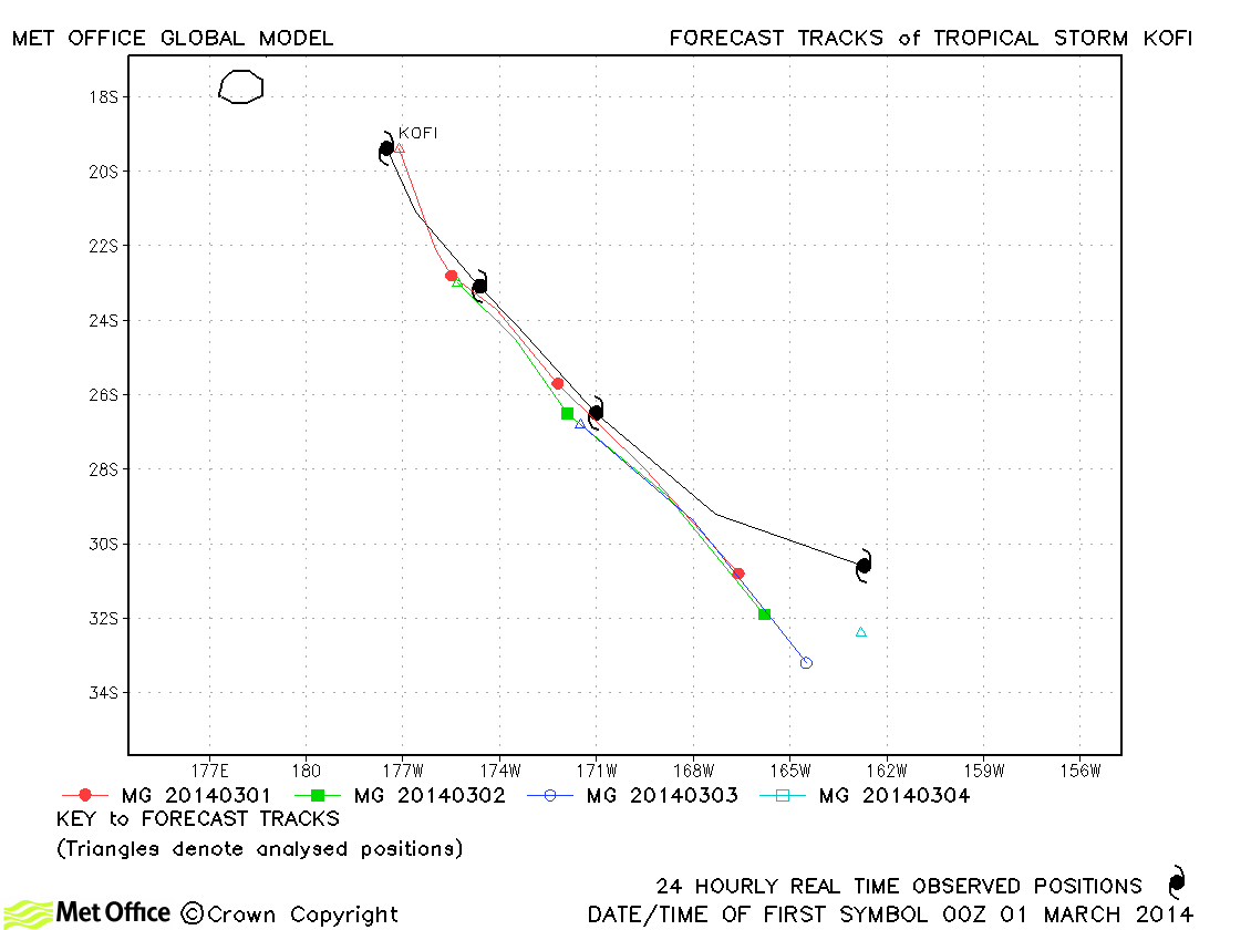
| Kofi (16P) | 28 February-04 March | 50/55 knots | The track of this storm was fairly well predicted although errors were a little above last season's average. |
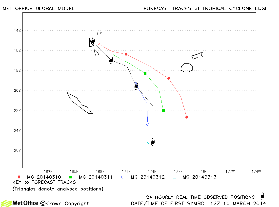
| Lusi (18P) | 09-13 March | 70/80 knots | There was a left of track bias in forecasts for this storm which resulted in errors above last season's average. |
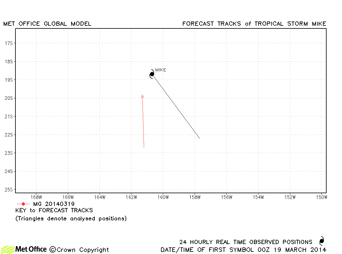
| Mike (20P) | 19 March | 35/35 knots | Mike was a short-lived storm and only one forecast was verified. |
Western Australian observed tracks in 2013-14
Eastern Australian observed tracks in 2013-14
Note on estimated wind speeds
1-minute MSW: Maximum sustained wind (knots) averaged over one minute (JTWC Hawaii)
10-minute MSW: Maximum sustained wind (knots) averaged over 10 minutes (Southern Hemisphere RSMCs and TCWCs)
Note: Although 1-minute average winds should be stronger than 10-minute average, this may not be the case here since estimates are obtained from different warning centres.

