

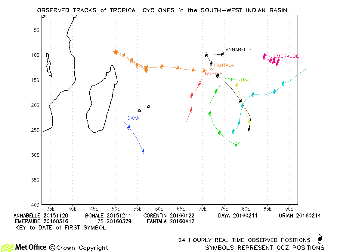
Observed and forecast tracks: southern hemisphere 2015-16
All tropical cyclones in the southern hemisphere season in 2015-16 are listed below including details of their start and end dates, lowest central pressure and maximum sustained wind (MSW).
Click on the name of the tropical cyclone to see a chart of the observed track and forecast tracks from the Met Office global model. Verification statistics on each tropical cyclone are available upon request from [email protected]. At the end of the season a verification report on the performance of the Met Office global model will be published.
| Name & ID | Start & end dates | Central pressure, 1-/10-minute MSW | Comments on Met Office global model forecasts |
|---|---|---|---|
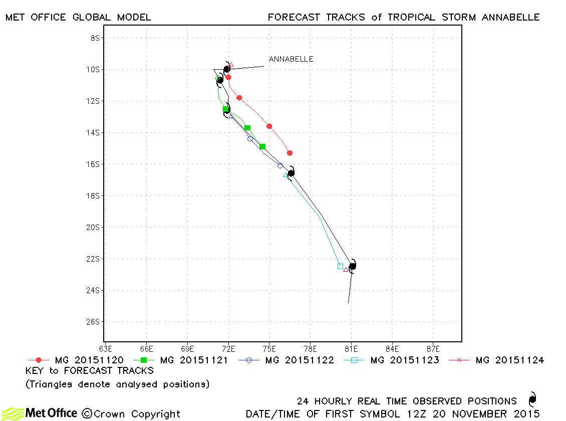
| Annabelle (03S) | 19-25 November | 986 mb, 60/55 knots | Track forecast errors were large due to a slow bias. |
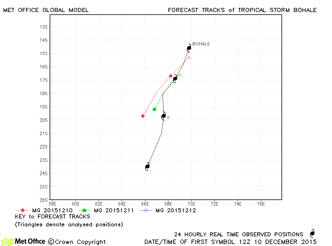
| Bohale (05S) | 10-13 December | 997 mb, 40/35 knots | Track forecast errors were mostly below last season's average. |
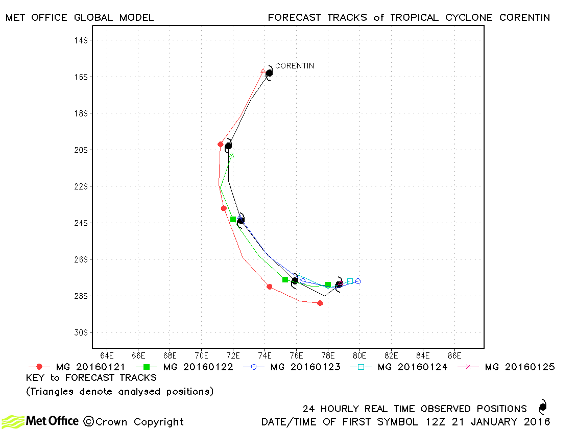
| Corentin (08S) | 21-25 January | 970 mb, 75/60 knots | Track forecast errors were well below last season's average and skill scores were high. |
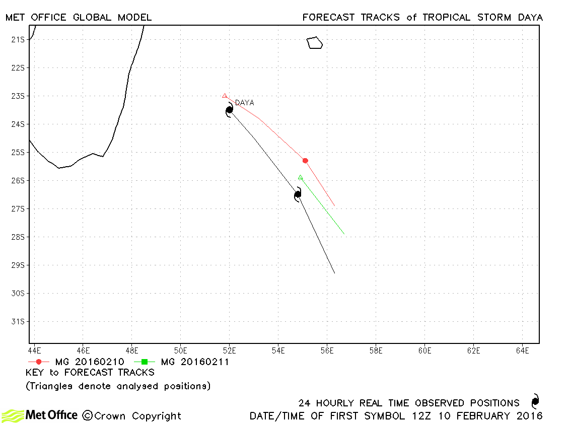
| Daya (10S) | 10-12 February | 992 mb, 45/40 knots | There was a slow bias in forecasts resulting in track errors above last season's average. |
| Emeraude (15S) | 15-22 March | 940 mb, 125/110 knots | Some early forecasts moved Emeraude to the south-east too quickly. This resulted in some large errors at long lead times. |
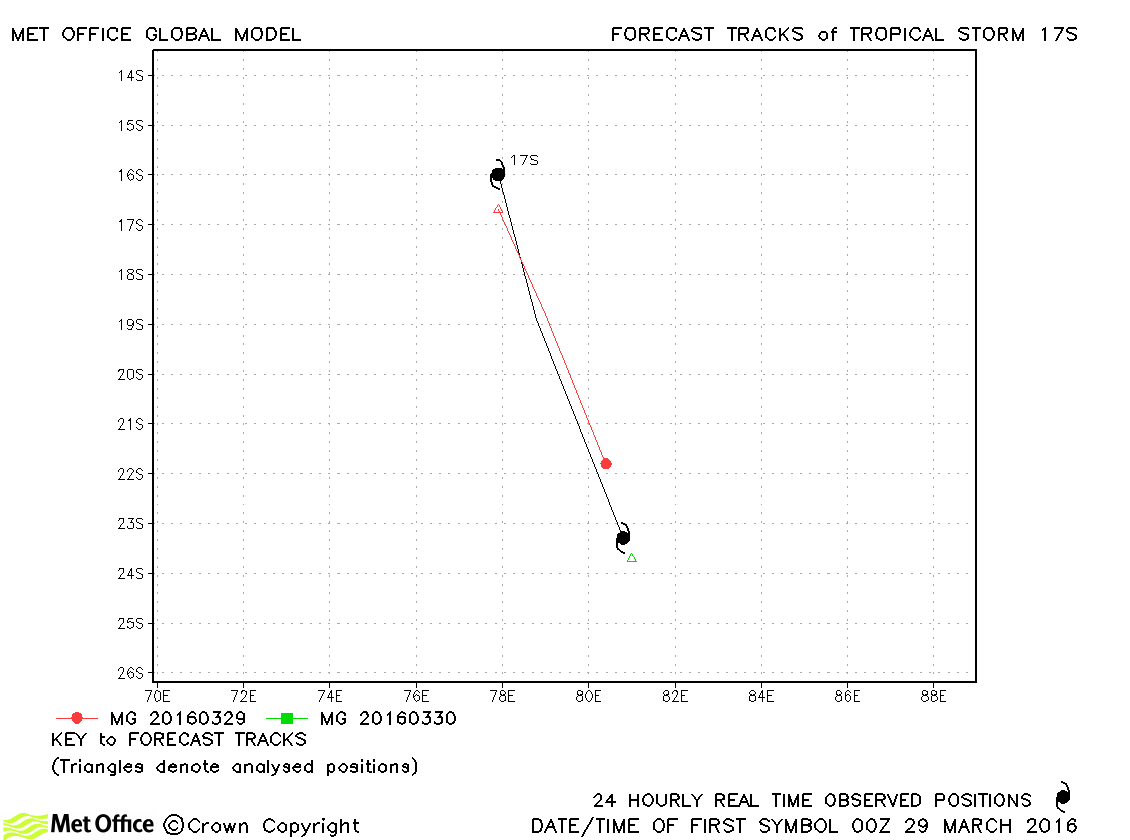
| 17S | 28-30 March | 996 mb, 40/30 knots | 17S only briefly reached tropical storm status according to JTWC only and few forecasts were verified. |
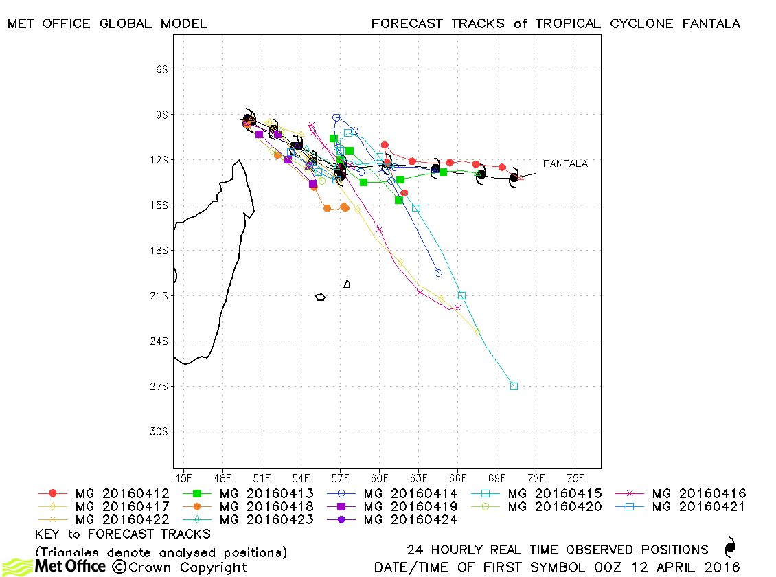
| Fantala (19S) | 11-24 April | 910 mb, 150/130 knots | Track forecast errors, particularly at long lead times, were very large for this cyclone. This was primarily as a result of several forecasts which predicted a sharp reversal in direction towards the south-east and extra-tropical transition. Although the turn did occur, it was much later and slower than in these forecasts. |
South-West Indian observed tracks in 2015-16
| Name & ID | Start & end dates | Central pressure, 1-/10-minute MSW | Comments on Met Office global model forecasts |
|---|---|---|---|
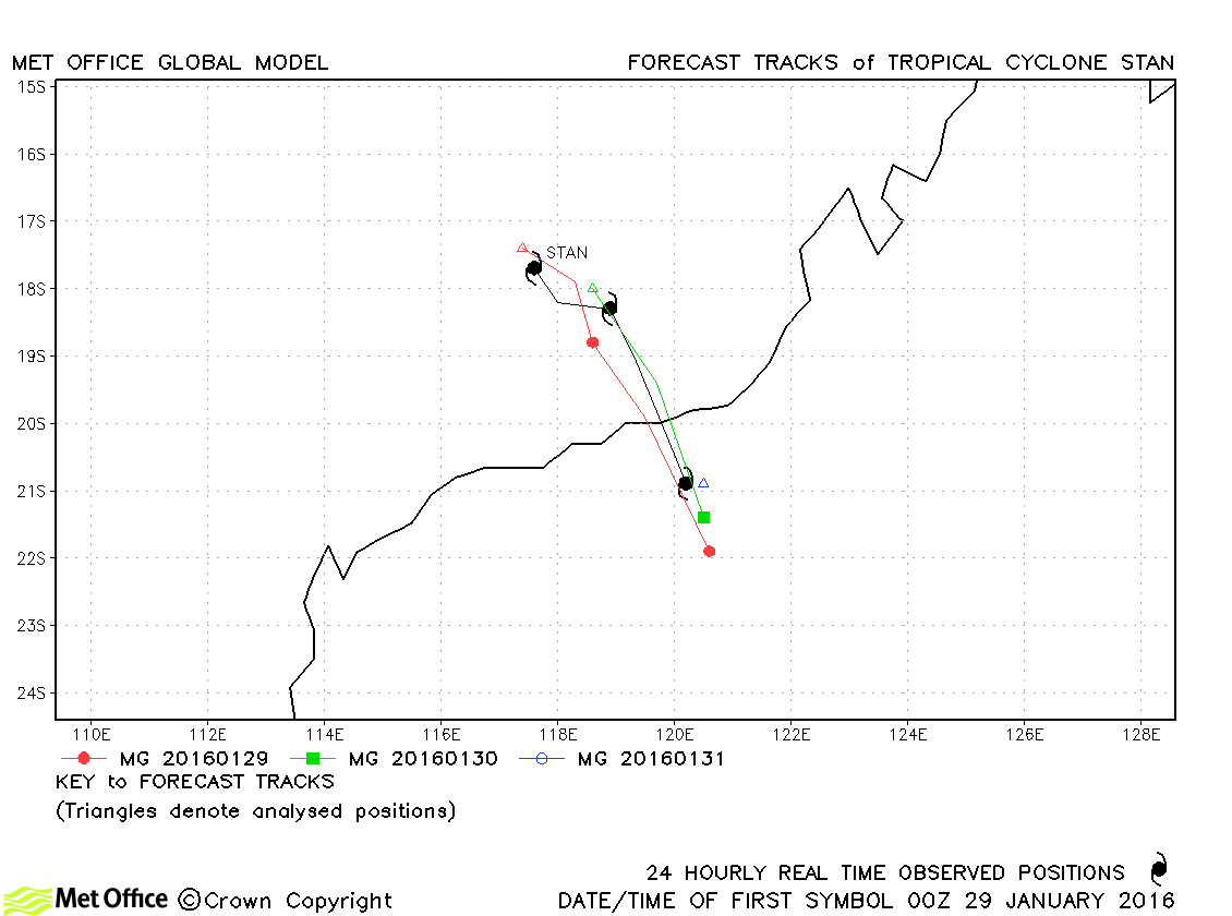
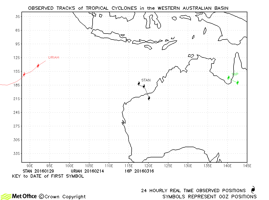
| Stan (09S) | 29-31 January | 973 mb, 65/60 knots | Track forecast errors were below last season's average. |
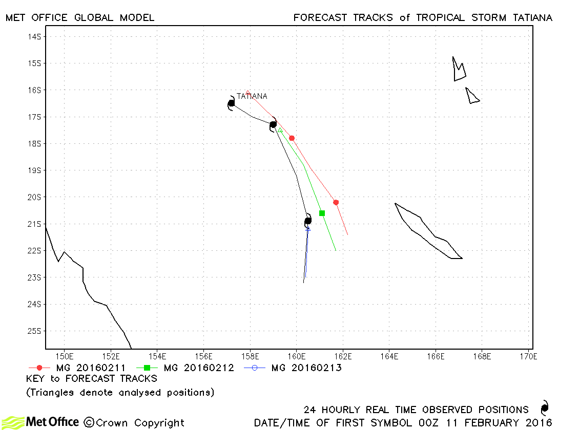
| Tatiana (12P) | 10-13 February | 983 mb, 55/50 knots | Short lead time forecasts had low track errors, but there was a slow bias at longer lead times. |
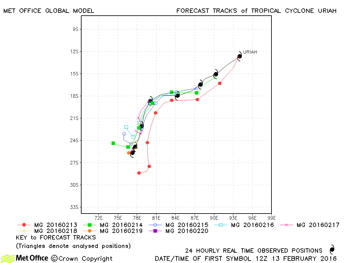
| Uriah (13S) | 13-20 February | 925 mb, 125/110 knots | Track forecast errors were below last season's average and skill scores against CLIPER high for this cyclone. |
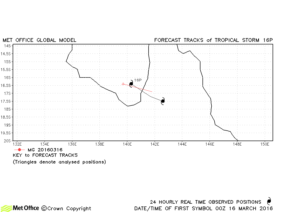
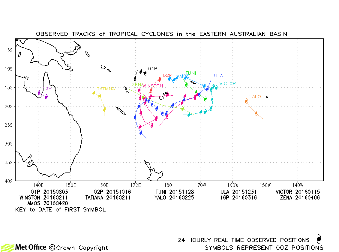
| 16P | 15-17 March | 995 mb, 35/30 knots | 16P only briefly reached tropical storm status according to JTWC only and few forecasts were verified. |
| Name & ID | Start & end dates | Central pressure, 1-/10-minute MSW | Comments on Met Office global model forecasts |
|---|---|---|---|
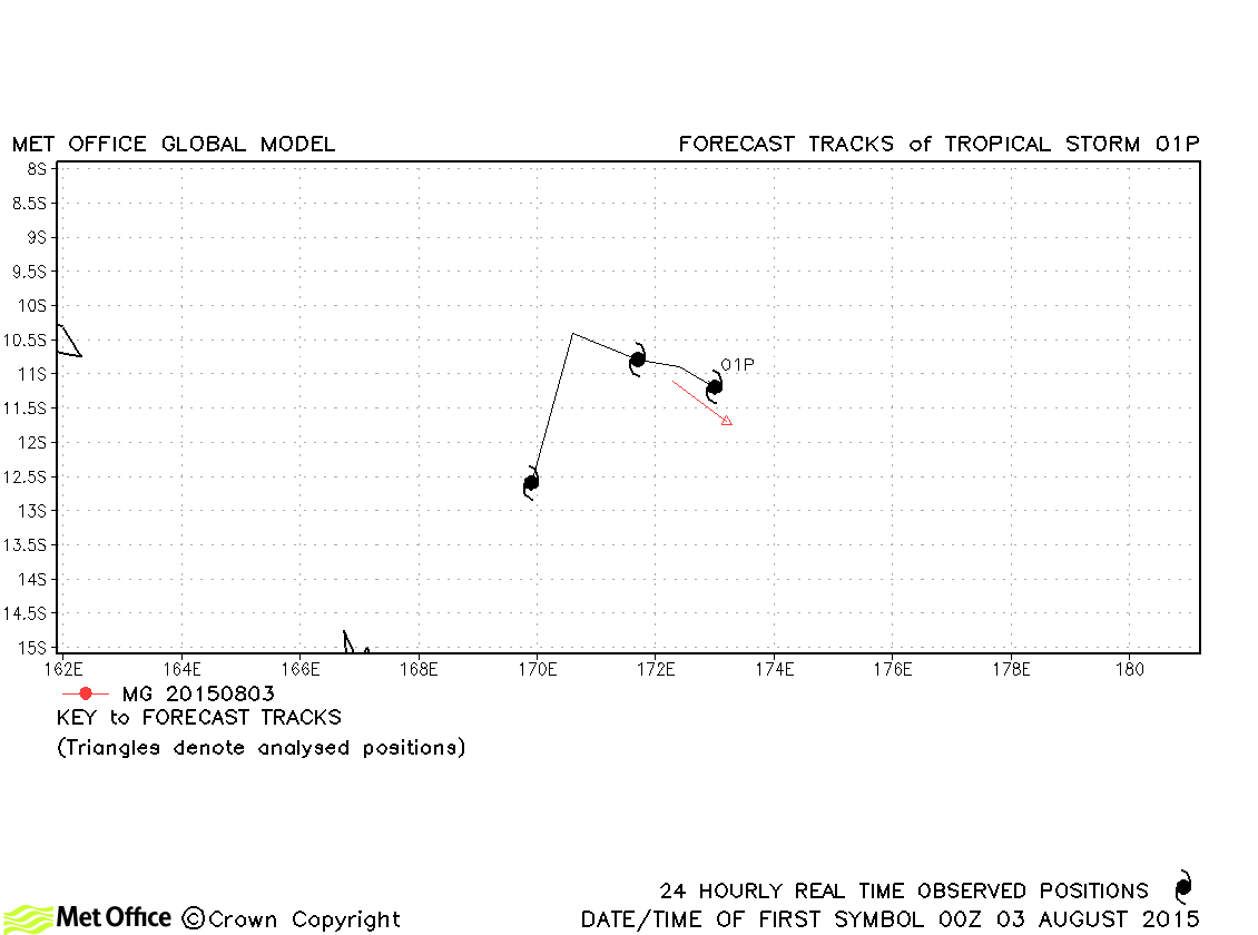
| 01P | 02-05 August | 996 mb, 35/30 knots | 01P was only briefly a tropical storm as measured by 1-minute average winds. |
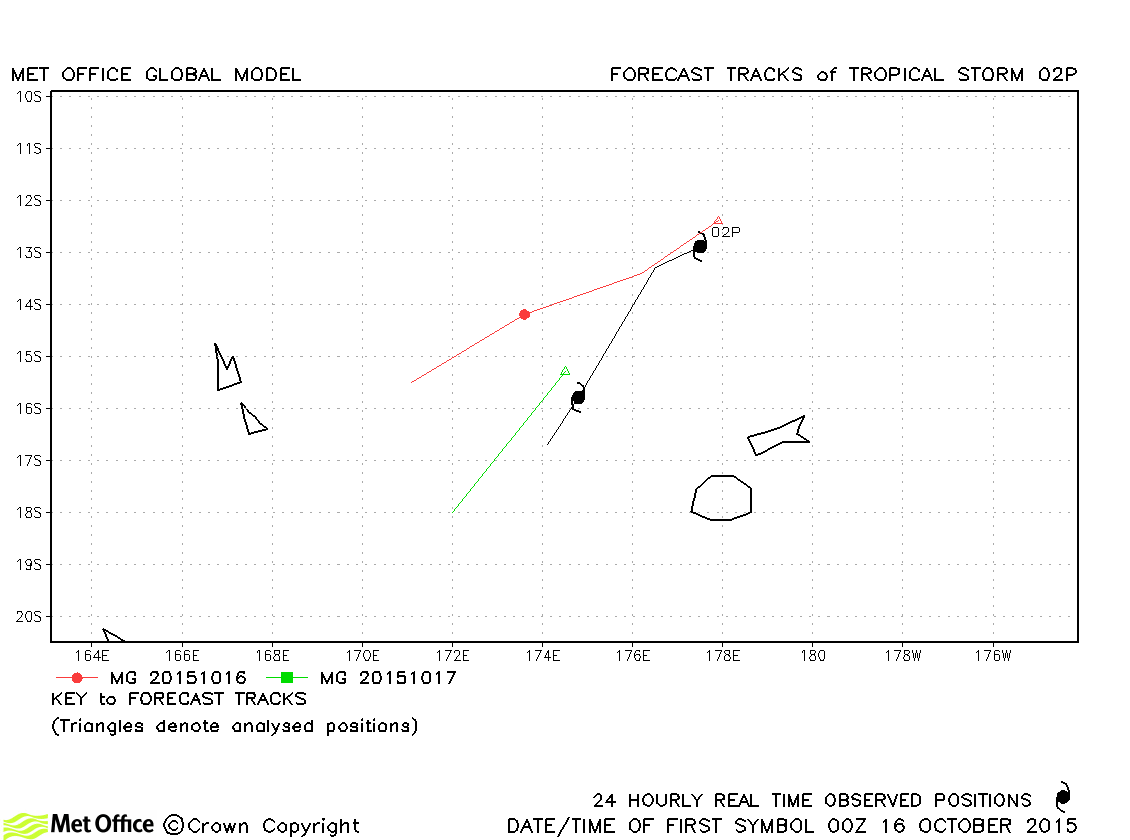
| 02P | 15-18 October | 993 mb, 40/30 knots | 02P was only a tropical storm as measured by 1-minute average winds. Track foecast errors were above last season's average. |
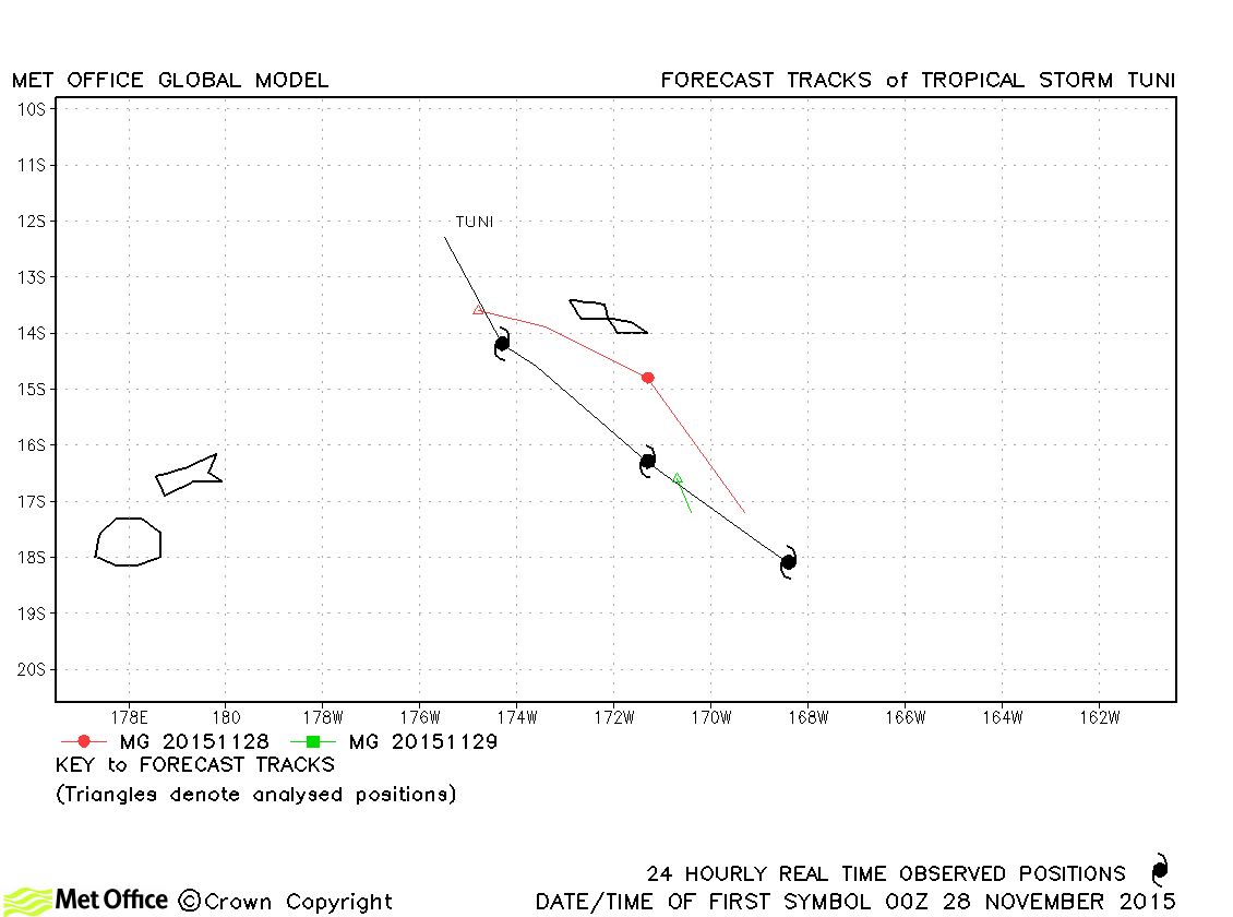
| Tuni (04P) | 27-30 November | 991 mb, 40/40 knots | Track forecast errors were near average overall. |
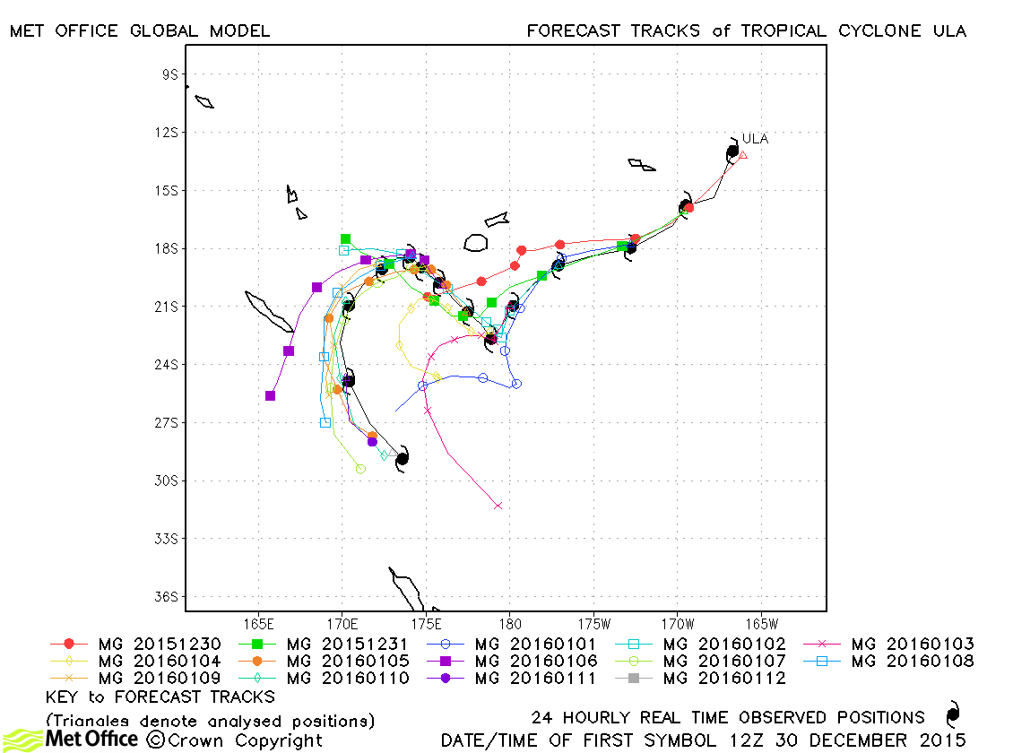
| Ula (06P) | 30 December-12 January | 945 mb, 120/100 knots | Track forecast errors were consistently below last season's average. The temporary turn north-westwards followed by recurvature was well predicted. |
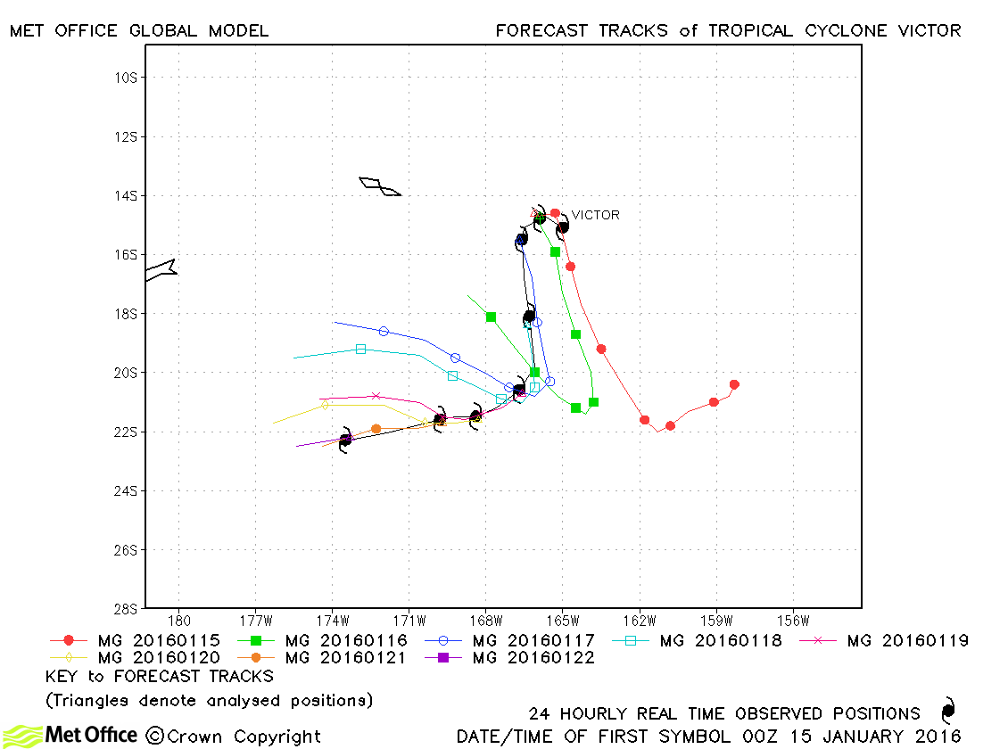
| Victor (07P) | 14-22 January | 960 mb, 90/80 knots | Track forecast errors were mostly slightly above last season's average. The turn westwards was mostly predicted to be too sharp. |
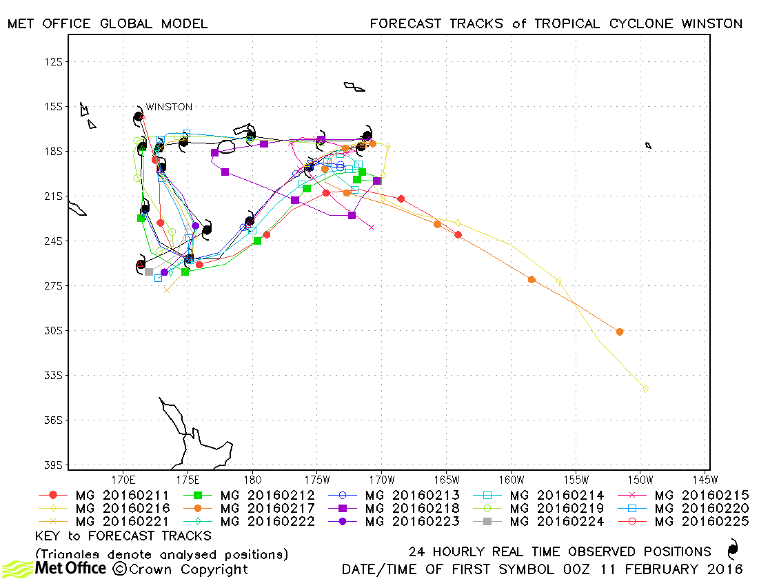
| Winston (11P) | 10-25 February | 915 mb, 160/125 knots | Winston was a long-lived tropical cyclone with many changes in direction. It was the strongest recorded cyclone to hit Fiji causing much destruction. Track forecast errors were near to or below last season's average up to 60 hours ahead. Skill scores up to 72 hours ahead were very high. Longer lead time forecast errors were above last season's average and very large at the longest lead time (168 hours). These large errors were primarily due to several model runs failing to predict the sharp reversal in direction of Winston prior to landfall over Fiji. This resulted in enormous errors for these few model runs. This was likely due to the model pushing Winston a little too far east and inducing erroneous interaction with another circulation around the time at which the reversal in direction started to happen. |
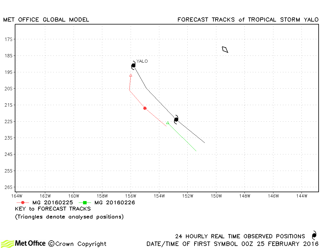
| Yalo (14P) | 25-26 February | 993 mb, 50/40 knots | Forecasts had a slow bias resulting in track forecast errors above last season's average. |
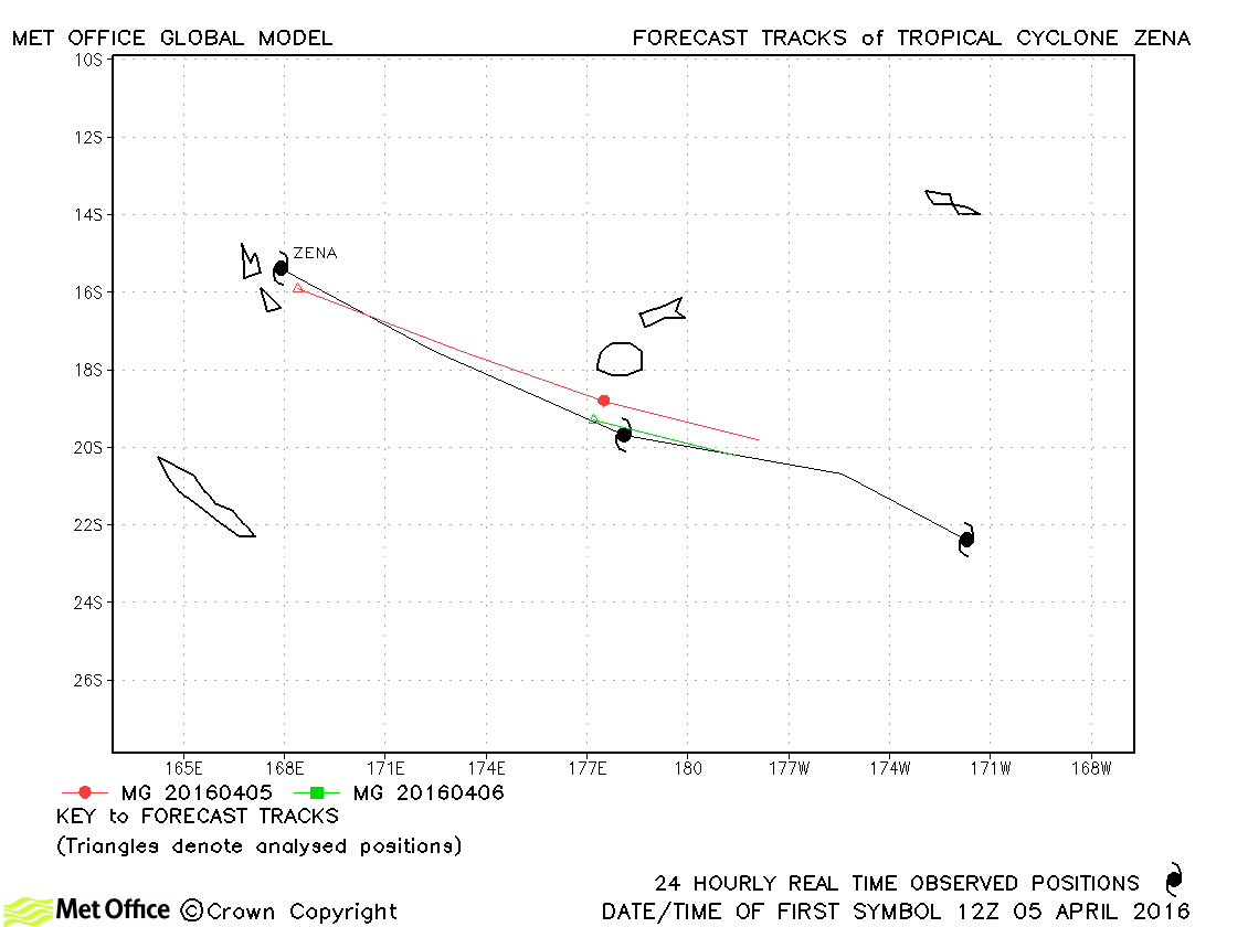
| Zena (18P) | 05-07 April | 975 mb, 90/65 knots | Track forecast errors were above last season's average for this storm. |
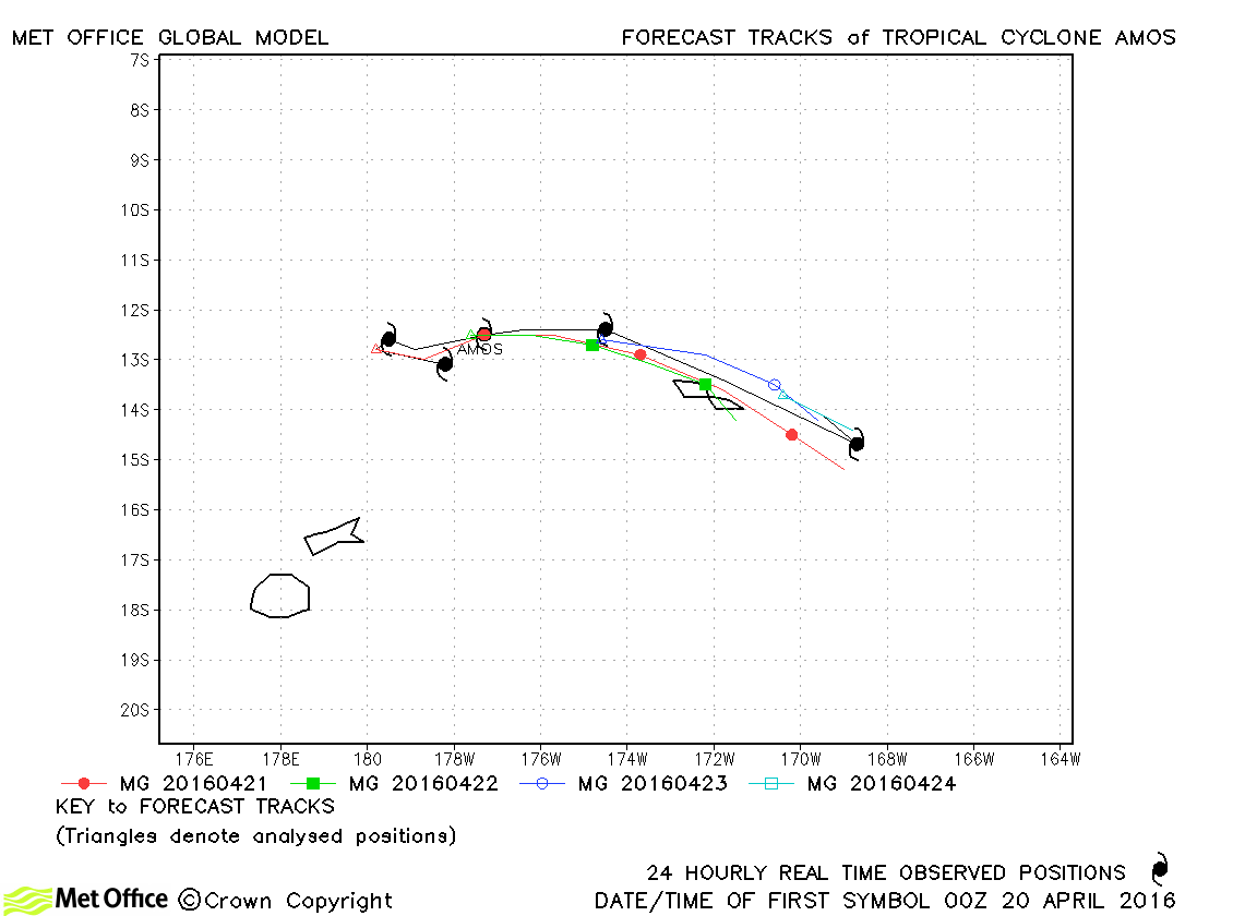
| Amos (20P) | 20-24 April | 965 mb, 90/80 knots | Track forecast errors were mostly below last season's average for this storm. |
Western Australian observed tracks in 2015-16
Eastern Australian observed tracks in 2015-16
| Name & ID | Start & end dates | Central pressure, 1-/10-minute MSW | Comments on Met Office global model forecasts |
|---|---|---|---|
Note on estimated wind speeds
1-minute MSW: Maximum sustained wind (knots) averaged over one minute (JTWC Hawaii)
10-minute MSW: Maximum sustained wind (knots) averaged over 10 minutes (Southern Hemisphere RSMCs and TCWCs)
Note: Although 1-minute average winds should be stronger than 10-minute average, this may not be the case here since estimates are obtained from different warning centres.

