
CBRN incident management
Services for Chemical, Biological, Radiological and Nuclear (CBRN) incident management
Chemical Meteorology (CHEMET)
CHEMET can be used to track the dispersion of a chemical release. Telephone advice is available on demand which will give a simple short-range prediction of the anticipated behaviour of the plume. CHEMET is accessed through Hazard Manager, our online portal for Cat 1 & 2 emergency responders.
Read more about CHEMET including a case study about how we helped during the Buncefield oil depot fire in 2005.
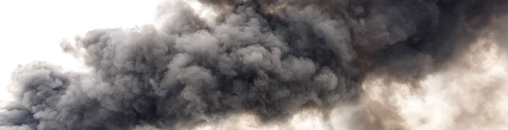
FireMet
FireMet is a weather system designed to provide fire and rescue service (FRS) responders with the latest weather information to help them identify a safe approach when dealing with a major incident.
Developed in collaboration with the Department for Communities and Local Government (DCLG), FireMet is a password-protected, web-based system available to all FRS Incident Command Units and mobilising centres, as well as the National Coordination Centre. This system is available through Hazard Manager and is for fire service personnel only.
Fire Severity Index
We work with Natural England and the Countryside Council for Wales to help them prepare against fire threat with the Met Office Fire Severity Index. The index provides an assessment of the current day's fire severity and a forecast of the fire severity over the coming five days.
RREMS – UK Radiation Monitoring System
Following the Chernobyl accident in 1986, the UK Government developed a National Response Plan to ensure that any future similar emergency could be effectively managed. Under the plan the UK has a multi departmental and agency response approach, where today DESNZ is nominated Lead Government Department for domestic and overseas nuclear response.
The Radiological Response and Emergency Management System (RREMS) application is a key response capability within our national response and over the years has developed – both as a multi response tool and as a platform for the effective coordination of emergency response for radiological events.
RREMS is managed by DESNZ, on behalf of all government departments and agencies who would be involved in a radiological/nuclear incident including the Met Office dispersion modelling capability. Through this modelling, the Met Office can provide a detailed picture of the potential dispersion of radioactive plumes over vulnerable areas such as cities and water sources. The maps are used by government and emergency planners via RREMS.
Joint Agency Modelling (JAM)
JAM is a Met Office-led, multi-agency modelling capability which estimates, forecasts and provides advice on radiation emergencies from incidents within the UK and overseas.
The JAM outputs are generated via an enhanced dispersion model and displayed as plume maps showing areas where thresholds for various impacts such as health, food restrictions and environmental contamination may be exceeded.
The plume maps and accompanying expert narrative from across the agencies provide the Government's Scientific Advisory Group for Emergencies (SAGE) with a single, coherent output to support decision making.
Procedures And Communications in the event of a release of Radioactive Material (PACRAM)
PACRAM is a rapid modelling service that predicts the trajectory of possible contamination plumes from UK nuclear power plants. The service is available to UK civil and military operators and the overseeing government bodies on request. The ultimate aim of PACRAM is to provide assessment quickly to enable the protection of the workforce and emergency services involved in initial response activities.
For more information about our services for Government, please email us or contact our Weather Desk.