

Observed and forecast tracks: northern hemisphere 2016
All tropical cyclones in the northern hemisphere season in 2016 are listed below including details of their start and end dates, lowest central pressure and maximum sustained wind (MSW).
Click on the name of the tropical cyclone to see a chart of the observed track and forecast tracks from the Met Office global model. Verification statistics on each tropical cyclone are available upon request from [email protected]. At the end of the season a verification report on the performance of the Met Office global model will be published.
| Name & ID | Start & end dates | Central pressure, 1-/10-minute MSW | Comments on Met Office global model forecasts |
|---|---|---|---|
| 01W | 26-27 May | 1004 mb, 30/- knots | 01W did not reach tropical storm status and no forecasts were verified. |
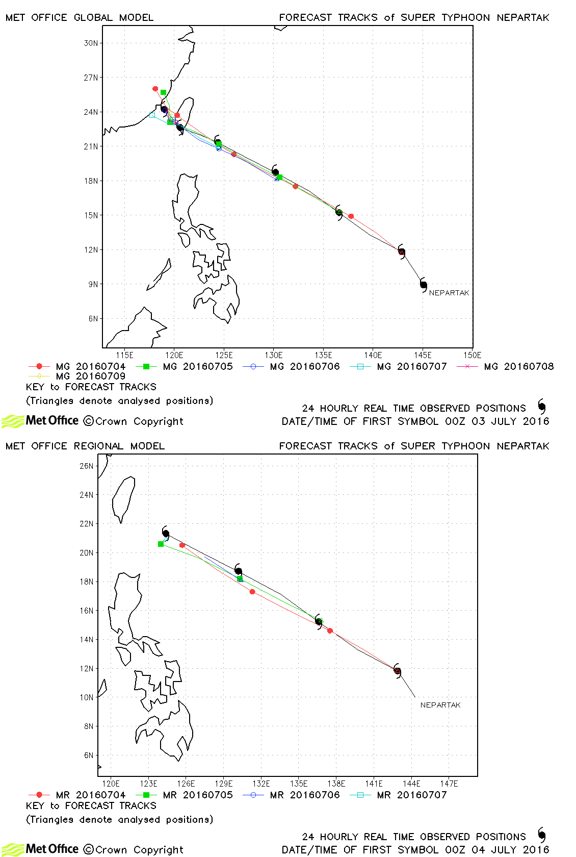
| Nepartak (02W) | 03-09 July | 897 mb, 150/115 knots | Track forecast errors were below last season's average and skill scores were high. |
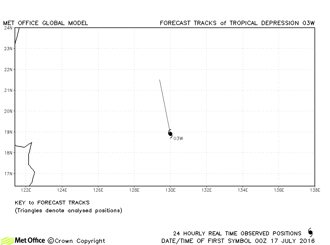
| 03W | 17 July | 1004 mb, 25/- knots | 03W did not reach tropical storm status and no forecasts were verified. |
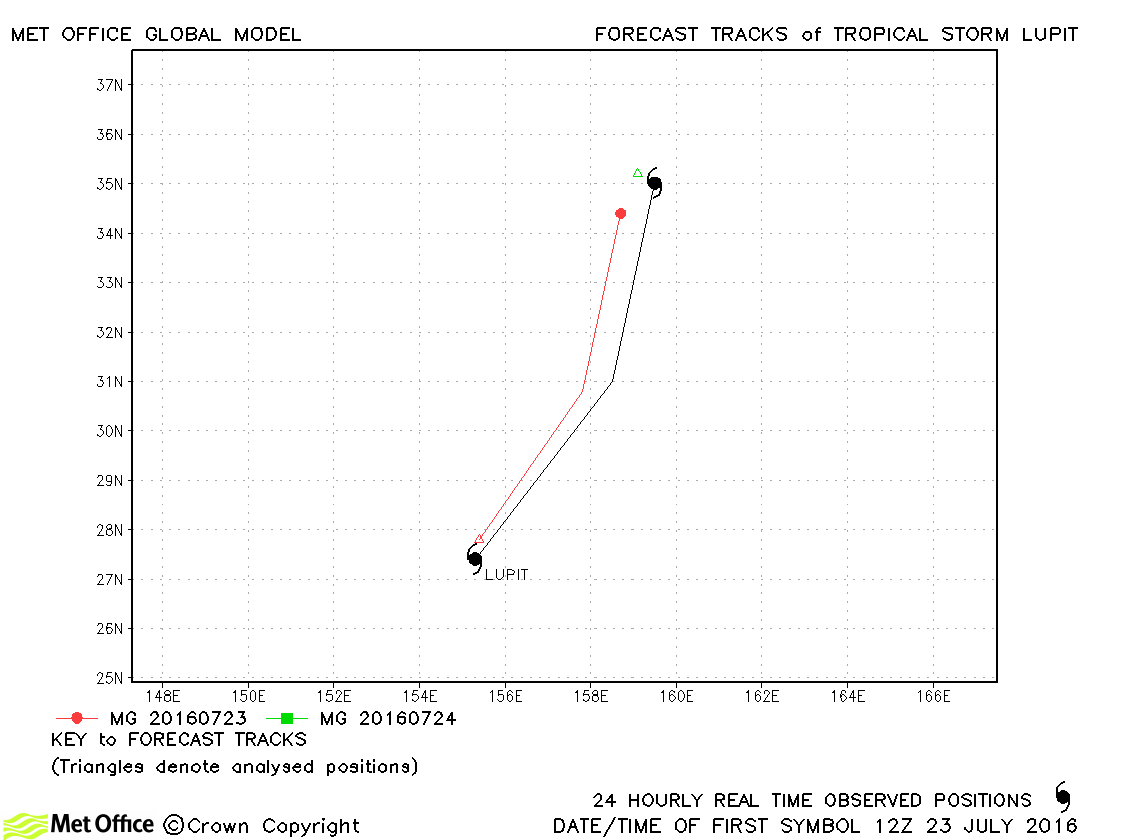
| Lupit (04W) | 23-24 July | 1000 mb, 40/40 knots | Lupit was short-lived and only a few forecasts were verified. |
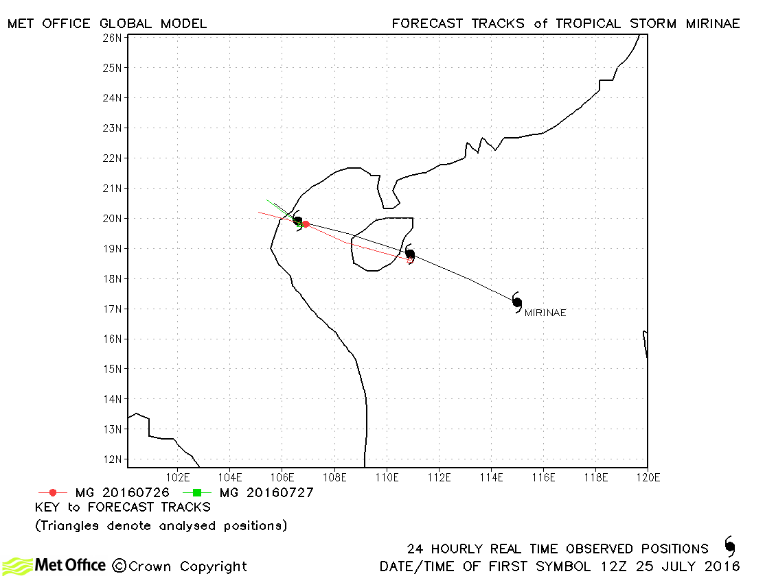
| Mirinae (05W) | 25-28 July | 985 mb, 45/50 knots | Track forecast errors were near to or below last season's average. |
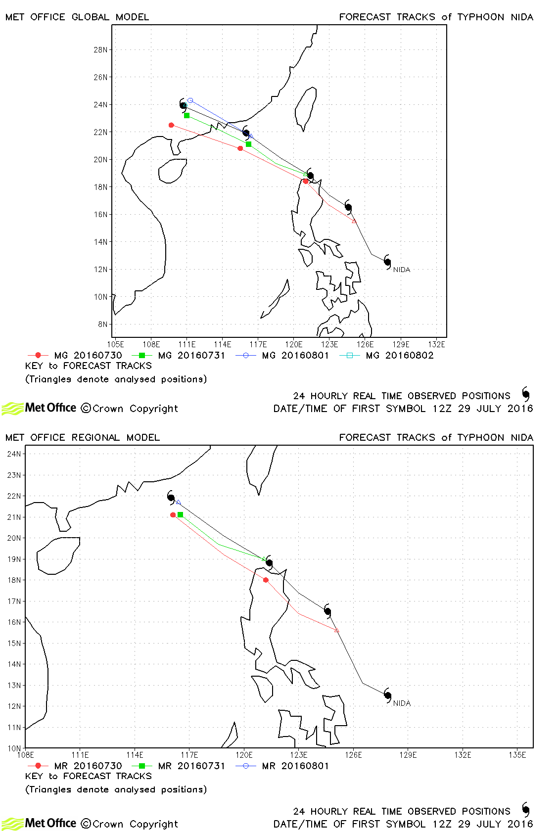
| Nida (06W) | 29 July-02 August | 970 mb, 80/65 knots | Track forecast errors were close to last season's average. There was a slight lefy of track bias. |
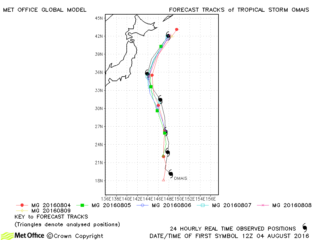
| Omais (07W) | 04-09 August | 975 mb, 60/60 knots | Track forecasts for Omais were very good with errors below last season's average. |
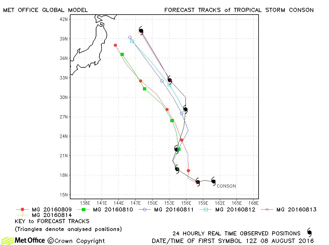
| Conson (08W) | 08-14 August | 985 mb, 50/50 knots | There was a left of track bias for this storm resulting in track forecast errors above last season's average. |
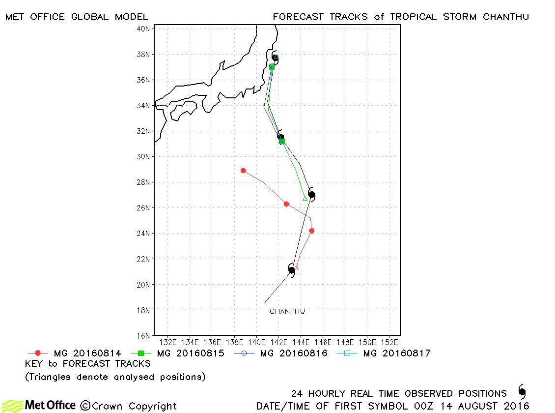
| Chanthu (09W) | 13-17 August | 980 mb, 45/55 knots | Track forecast errors were above average for this storm. |
| Mindulle (10W) | 17-23 August | 975 mb, 55/65 knots | Track forecast errors were high at longer lead times due to a slow bias. |
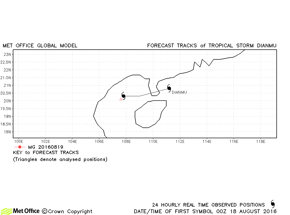
| Dianmu (11W) | 18-19 August | 985 mb, 40/40 knots | Dianmu only briefly reached tropical storm status. |
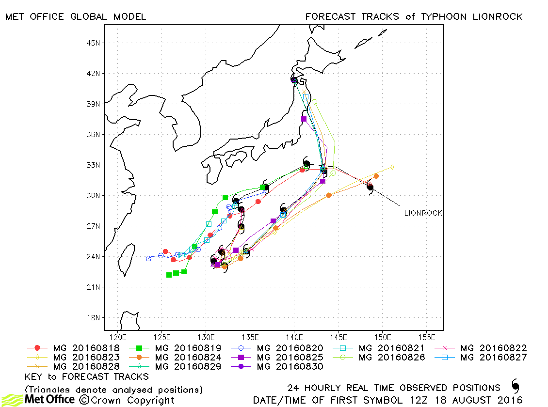
| Lionrock (12W) | 18-30 August | 940 mb, 115/90 knots | Track forecast errors were low at short lead times, but high at longer lead times. The large errors were as a result of several runs failing to predict the sharp turn back north-eastwards of the typhoon. |
| Kompasu (13W) | 19-21 August | 994 mb, 40/35 knots | Track forecast errors were low for this storm. |
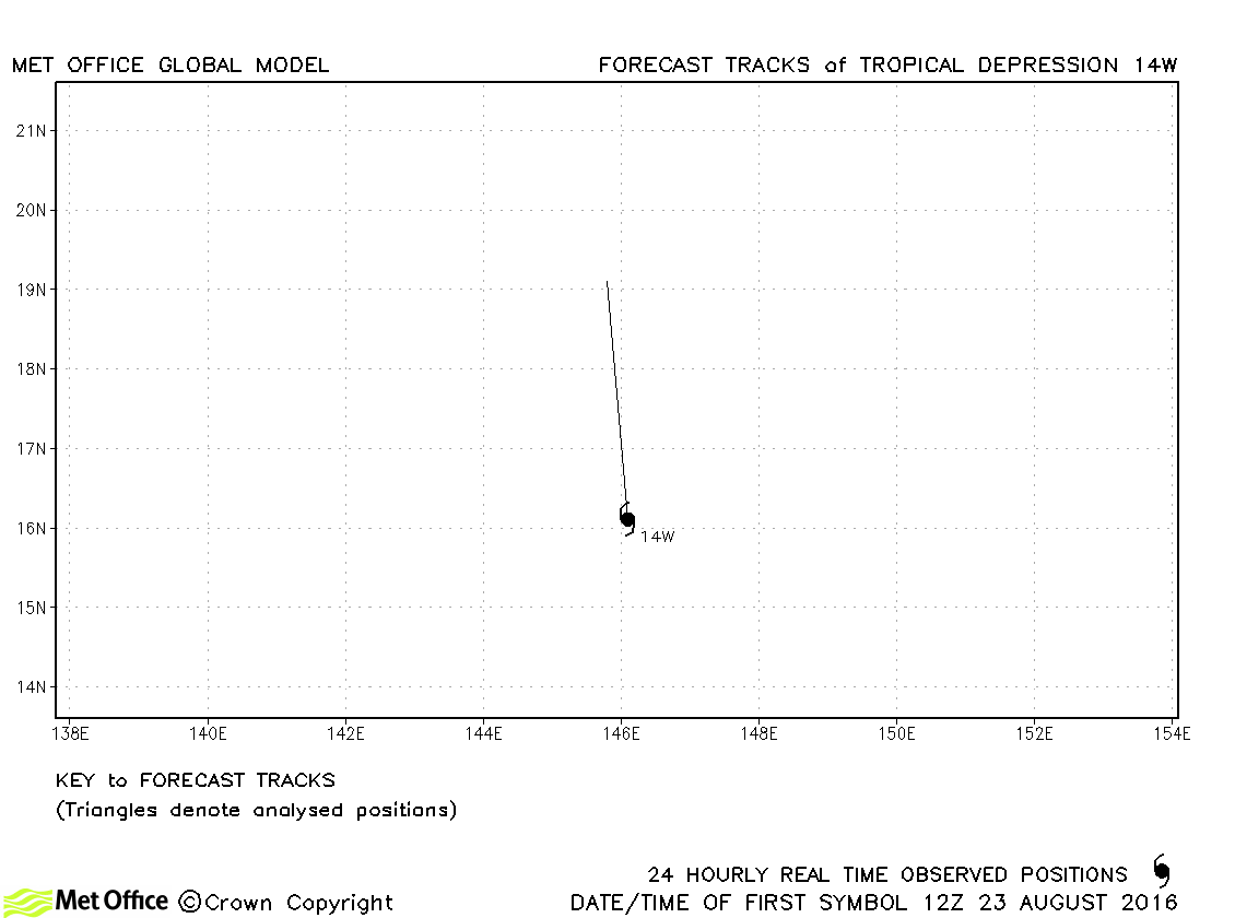
| 14W | 23-24 August | 1000 mb, 30/- knots | No forecasts were verified for 14W. |
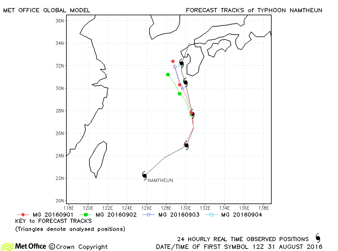
| Namtheun (15W) | 31 August-05 September | 955 mb, 100/75 knots | Track forecast errors were low and skill scores high for this storm. |
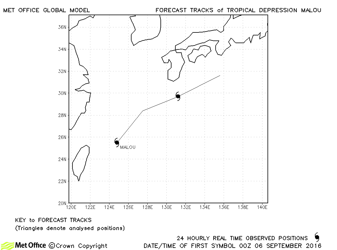
| Malou | 06-07 September | 1000 mb, 20/35 knots | Malou was only briefly designated a tropical storm by JMA and no forecasts were verified. |
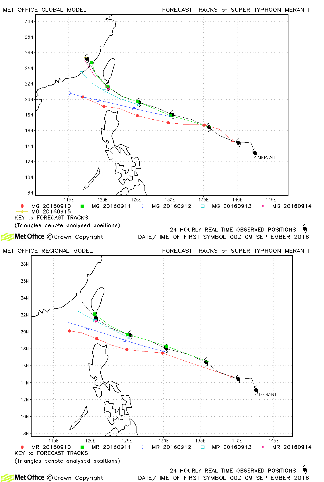
| Meranti (16W) | 08-15 September | 890 mb, 170/120 knots | There was a left-of-track bias to some forecasts for this typhoon which resulted in track forecast errors mostly above last season's average. |
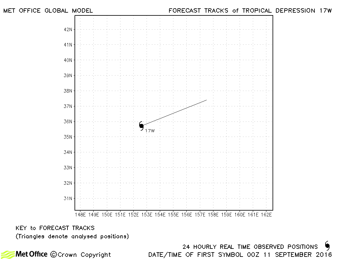
| 17W | 11 September | 1004 mb, 30/- knots | 17W did not attain tropical storm status. No forecasts were verified. |
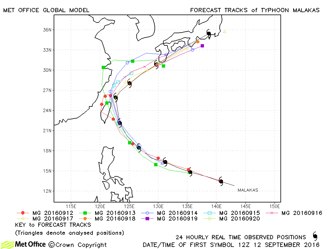
| Malakas (18W) | 11-20 September | 930 mb, 115/95 knots | Track forecasts for the period prior to recurvature were generally good. Beyond that there was a slow and left-of-track bias resulting in errors overall a little above last season's average. |
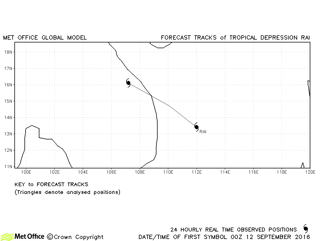
| Rai (19W) | 12-13 September | 996 mb, 30/35 knots | Rai was only briefly a tropical storm according to JMA and no forecasts were verified. |
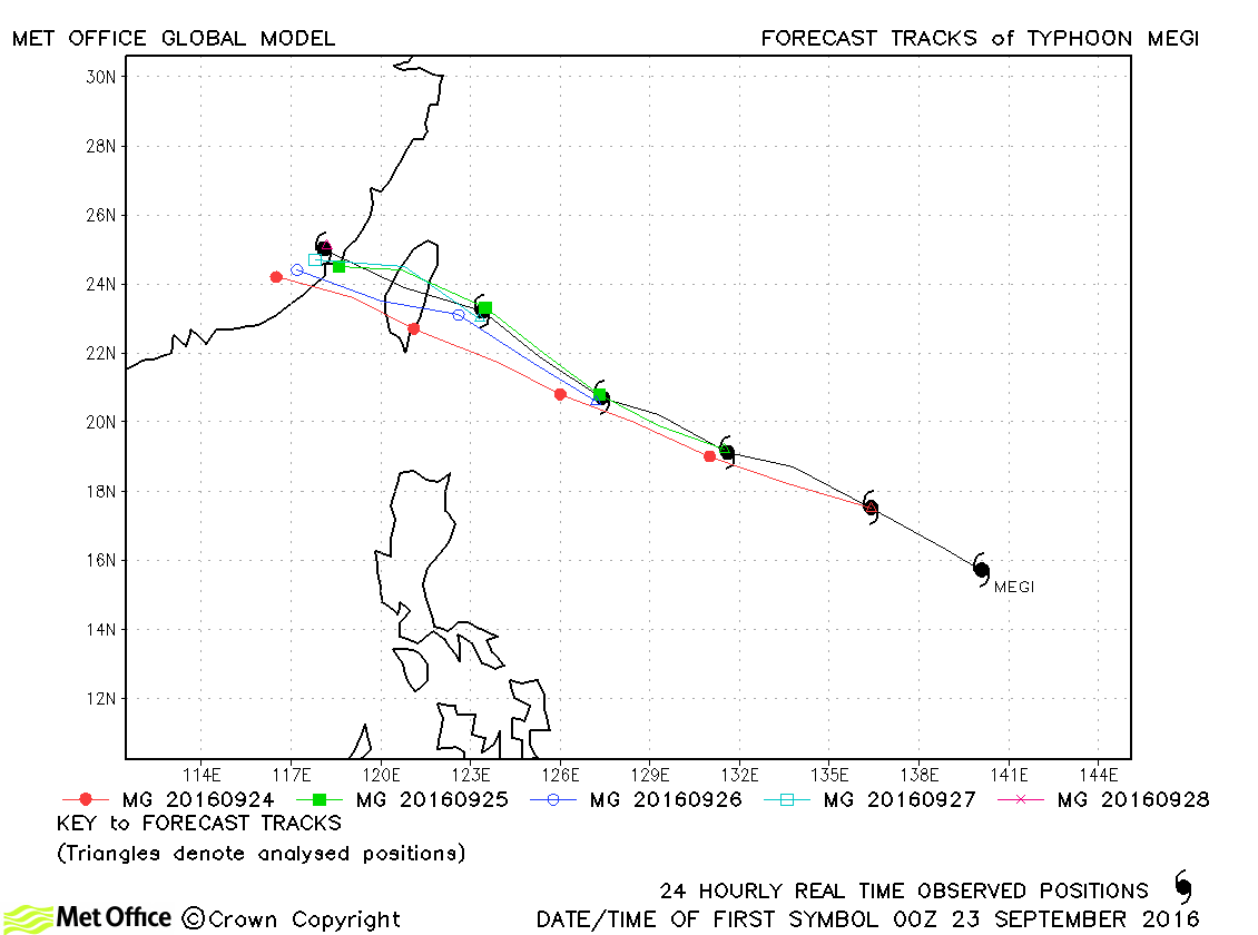
| Megi (20W) | 23-28 September | 940 mb, 115/85 knots | Although there was a slight left-of-track bias, forecast errors were below last season's average. |
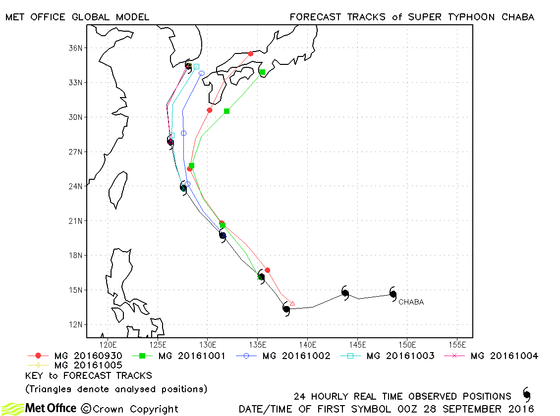
| Chaba (21W) | 27 September-05 October | 905 mb, 145/115 knots | Track forecast errors were above last season's average due to a tendency to recurve Chaba too soon. |
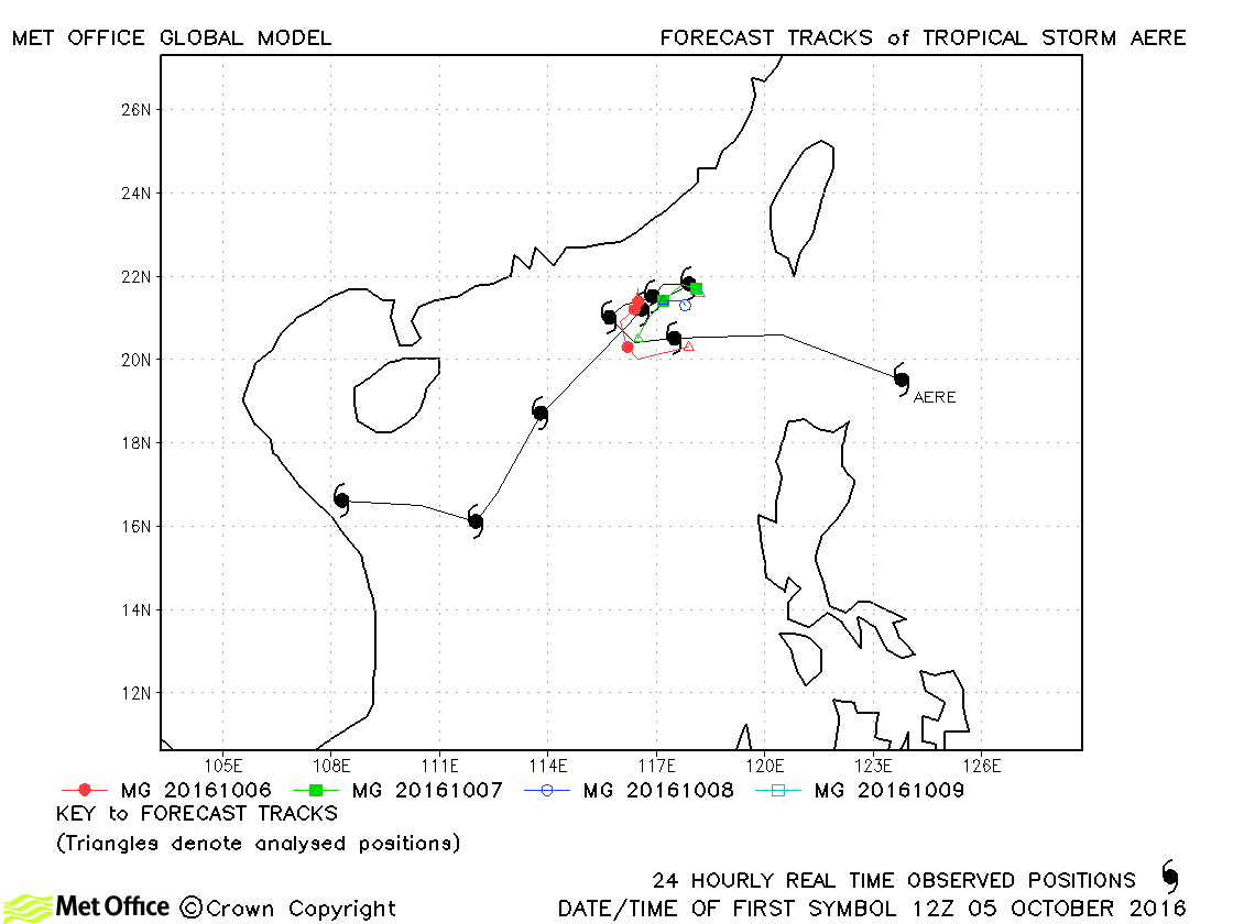
| Aere (22W) | 05-13 October | 975 mb, 55/60 knots | Track forecast errors were below last season's average for this storm. |
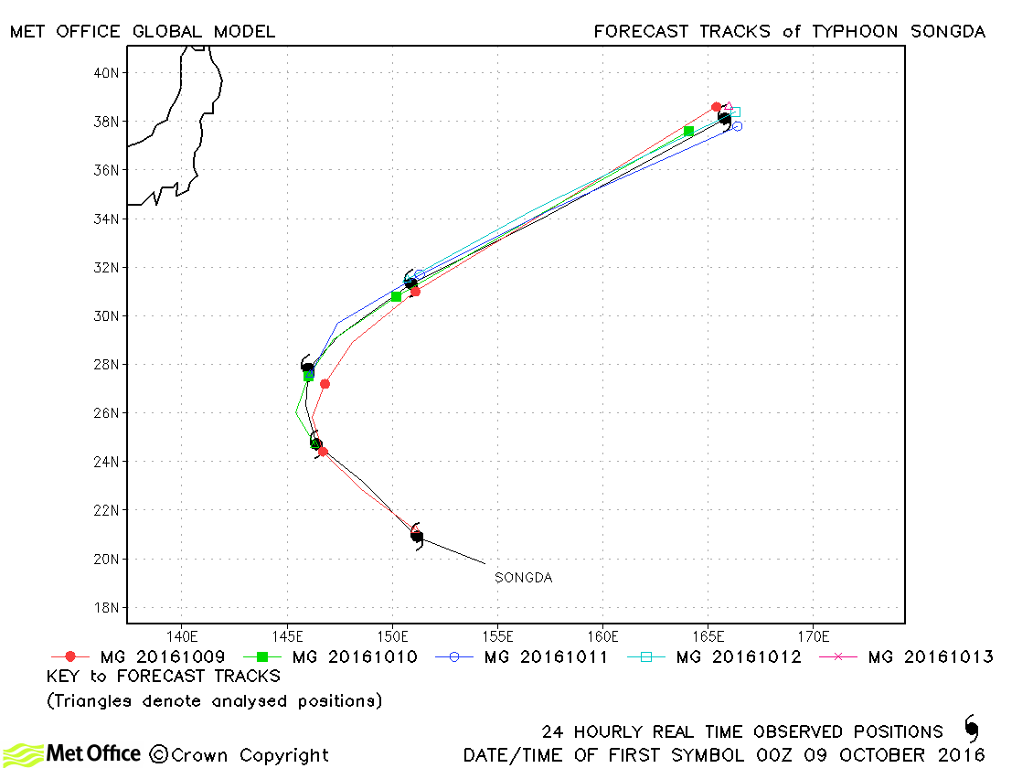
| Songda (23W) | 08-13 October | 925 mb, 130/100 knots | Track forecast errors were mostly low for this storm. Recurvature was well forecast. |
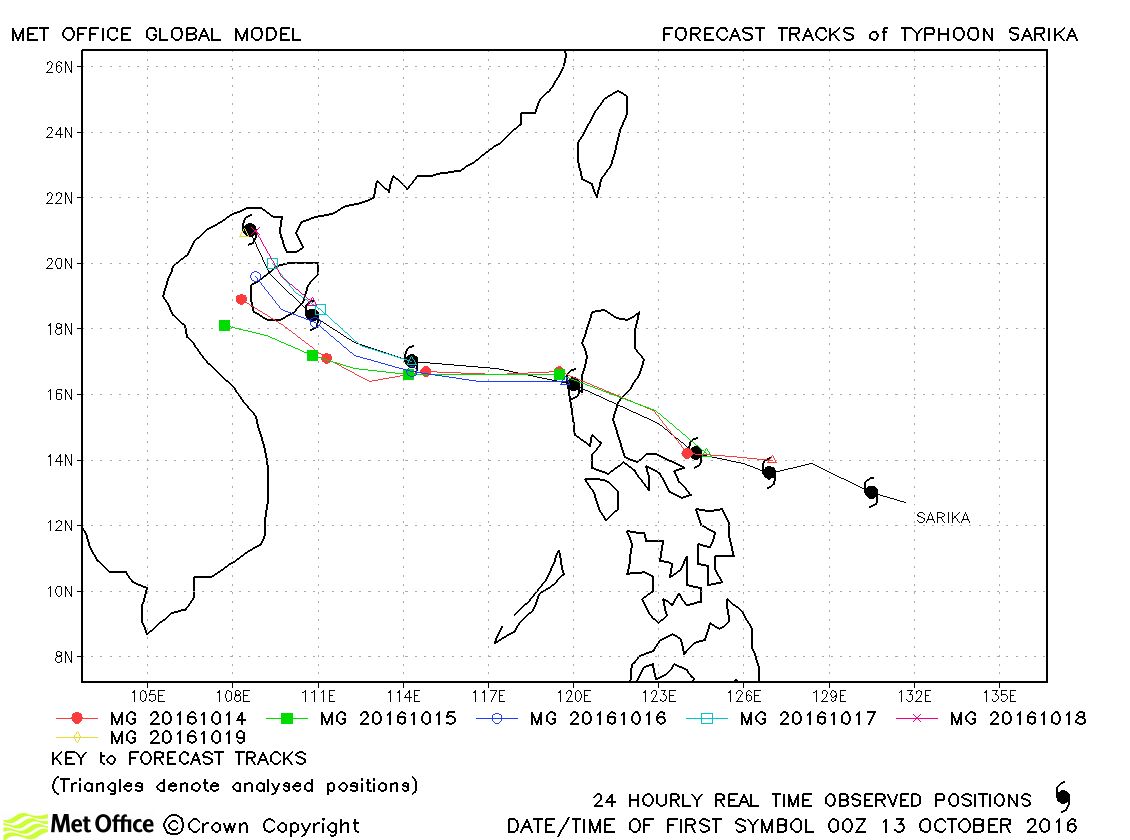
| Sarika (24W) | 12-19 October | 935 mb, 115/95 knots | Track forecast errors were below last season's average and skill scores high for this typhoon. |
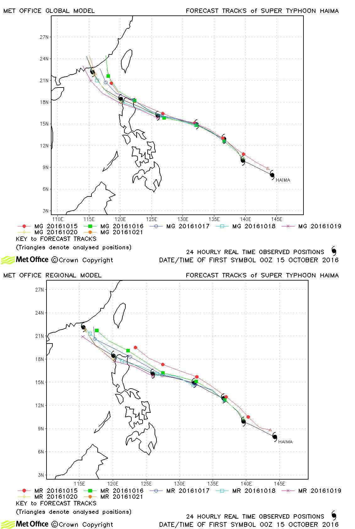
| Haima (25W) | 15-21 October | 900 mb, 145/115 knots | Whilst there were small errors in the timing and location of landfall some days out, track forecast errors for Haima were mostly low and skill scores very high. |
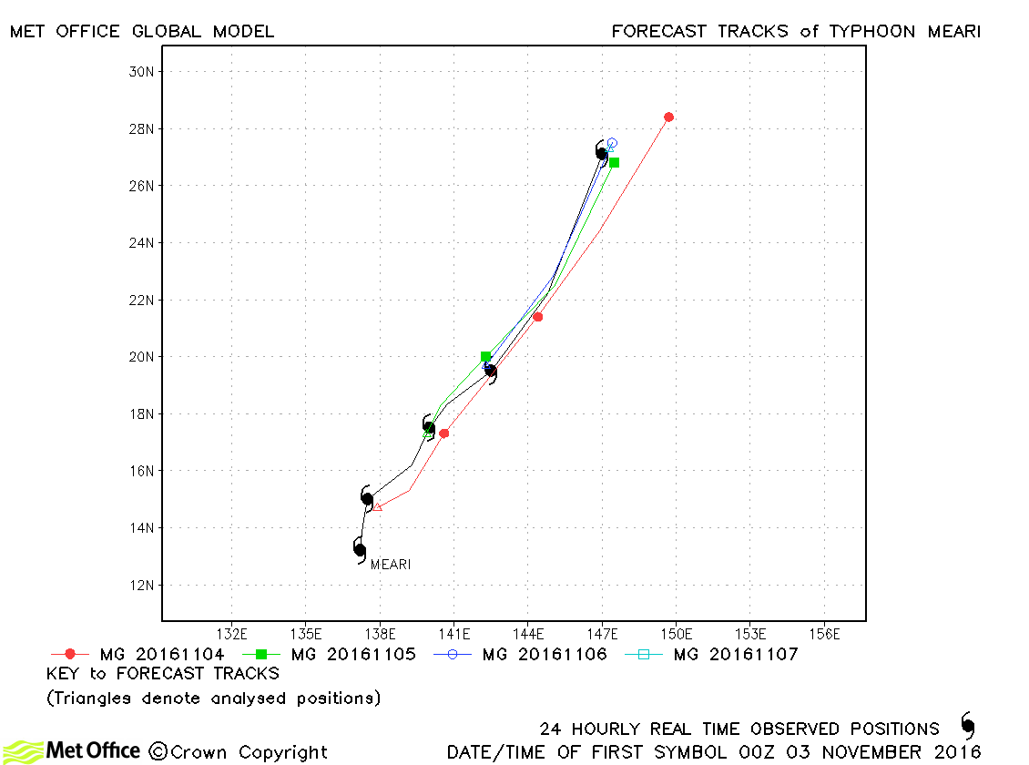
| Meari (26W) | 02-07 November | 955 mb, 90/80 knots | Track forecast errors were mostly above last season's average due to a fast bias. |
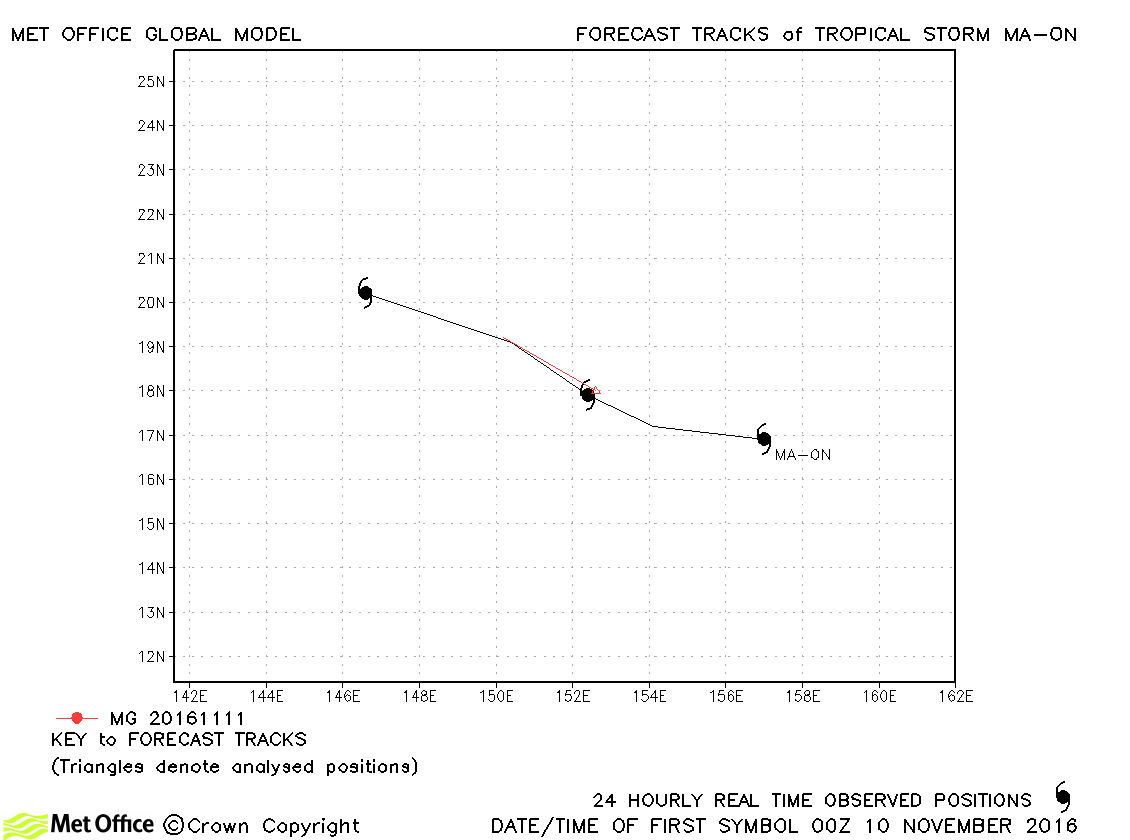
| Ma-on (27W) | 09-12 November | 998 mb, 35/40 knots | Ma-on was short-lived as a tropical storm. |
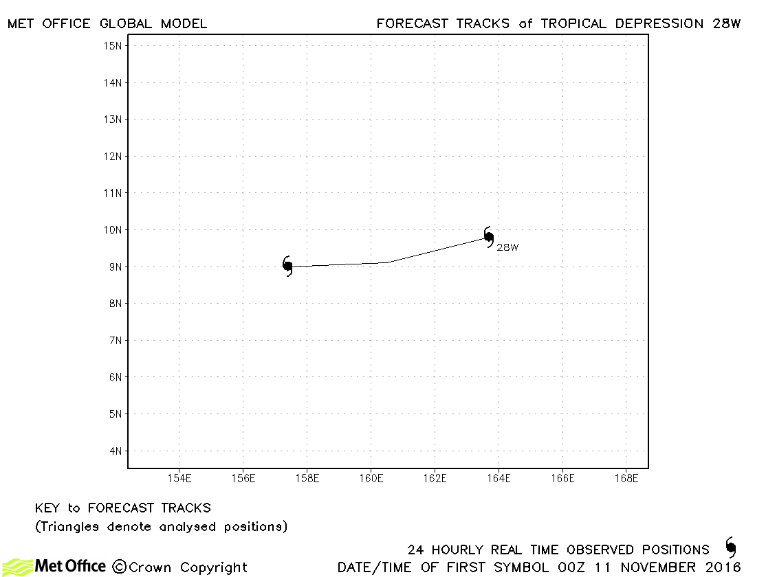
| 28W | 11-12 November | 1000 mb, 30/30 knots | This depression did not reach tropical storm status. |
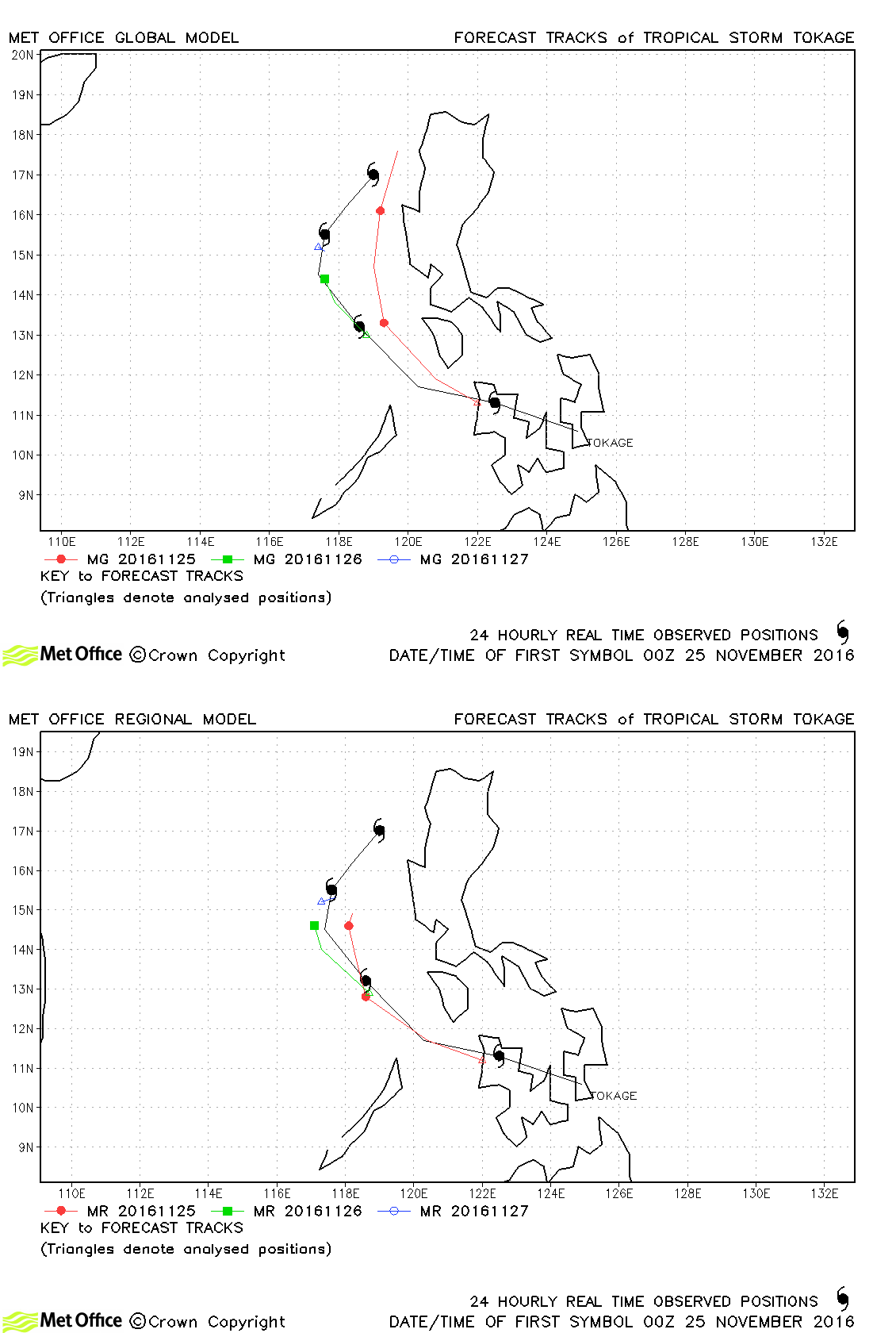
| Tokage (29W) | 24-28 November | 994 mb, 50/45 knots | Track forecast errors were a little above last season's average. |
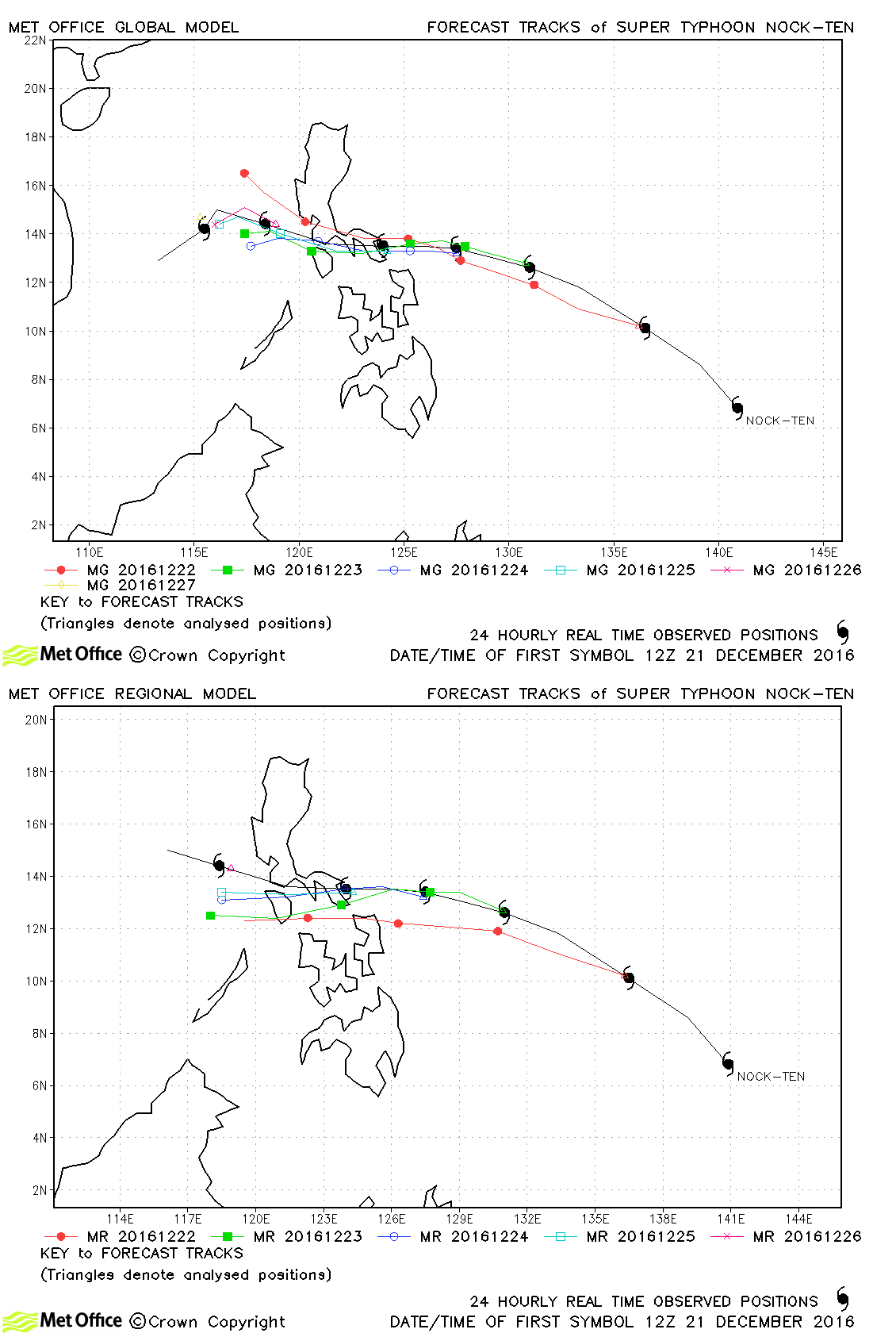
| Nock-ten (30W) | 21-28 December | 915 mb, 135/100 knots | Track forecast errors were above last season's average at short lead times, but below t longer lead times. the location of landfall was well predicted. |
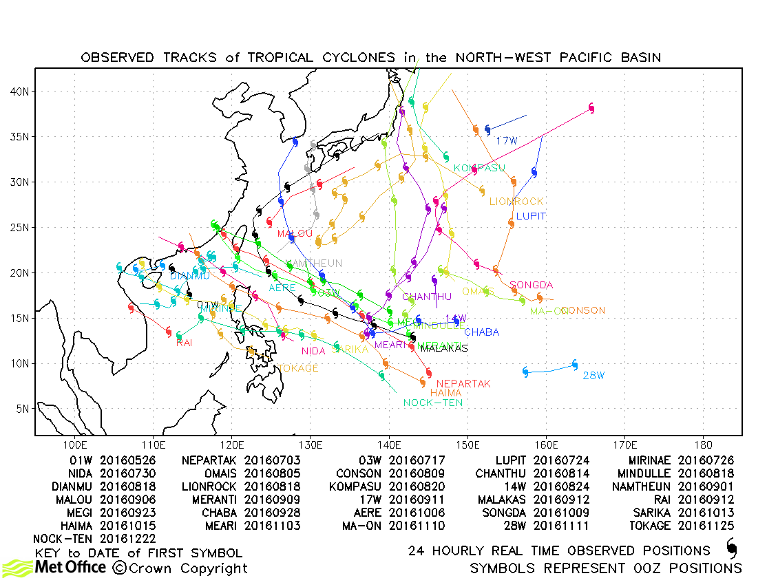
North-west observed tracks in 2016
North-west Pacific tropical cyclone names
| Name & ID | Start & end dates | Central pressure, 1-minute MSW | Comments on Met Office global model forecasts |
|---|---|---|---|
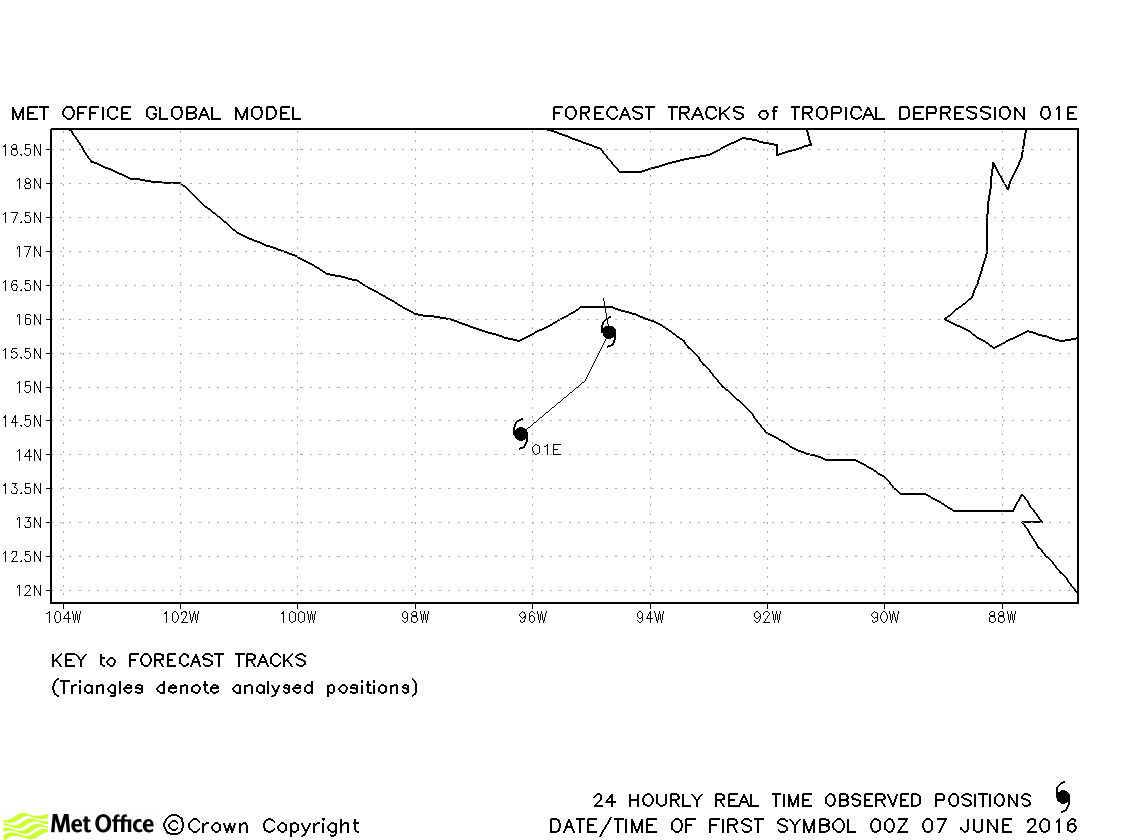
| 01E | 06-08 June | 1006 mb, 30 knots | 01E did not reach tropical storm status and no forecasts were verified. |
| Agatha (02E) | 02-05 July | 1003 mb, 40 knots | Agatha was a short-lived storm. Track forecast errors were below average. |
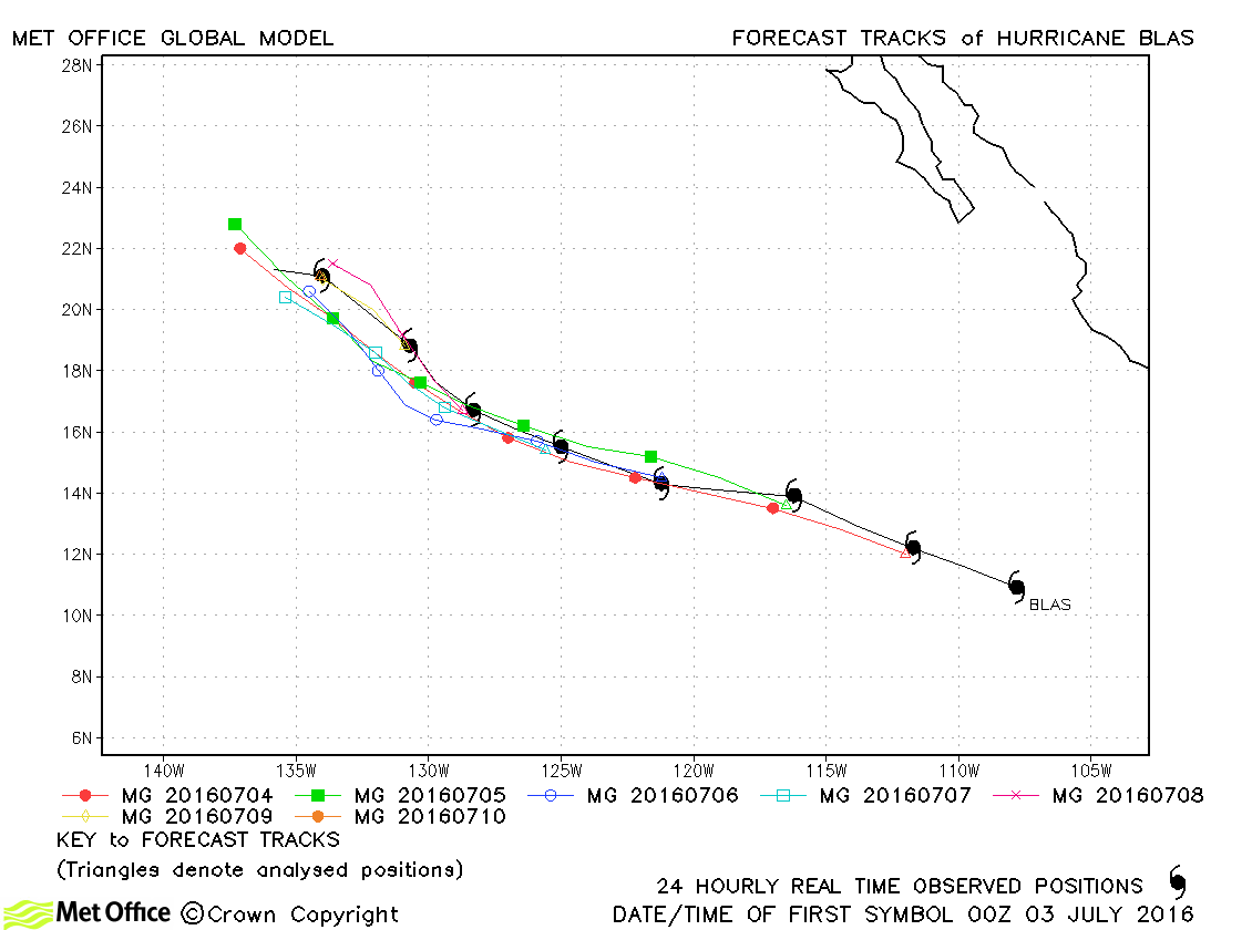
| Blas (03E) | 03-10 July | 951 mb, 115 knots | Track forecast errors were near to or below last season's average. |
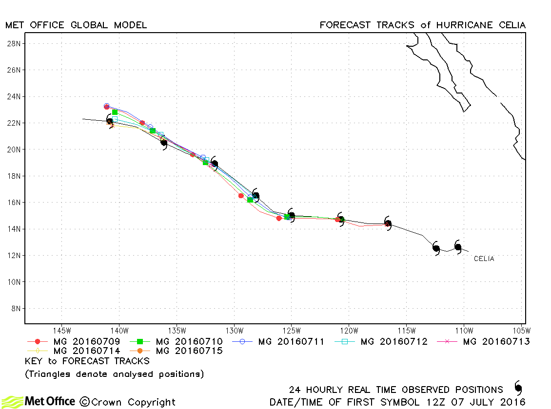
| Celia (04E) | 06-16 July | 972 mb, 85 knots | Celia's track was well predicted by the model. Track forecast errors were low and skill scores high. |
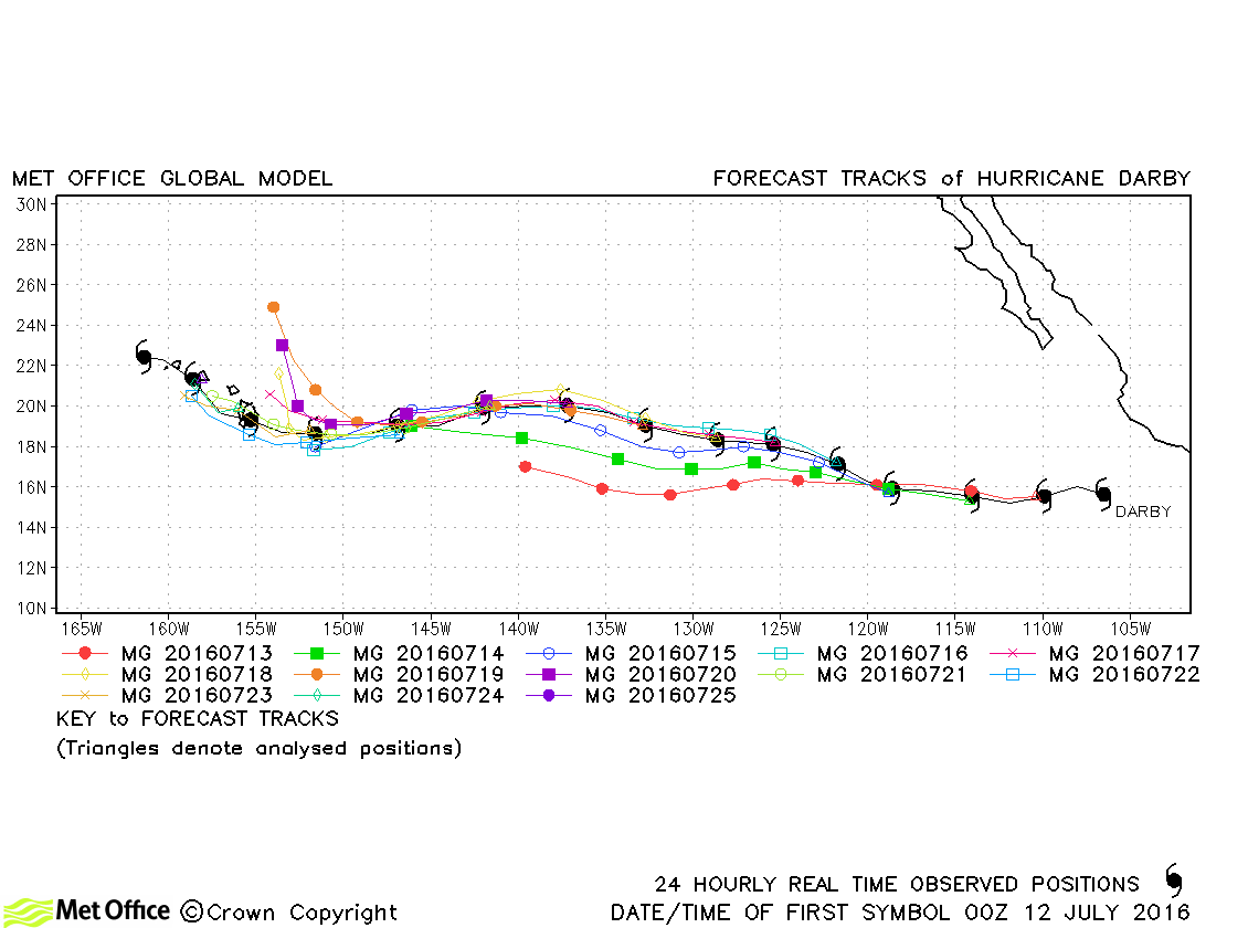
| Darby (05E) | 11-26 July | 963 mb, 100 knots | Darby was a long-lived storm. Track forecast errors were mostly well below last season's average and skill scores against CLIPER were high. |
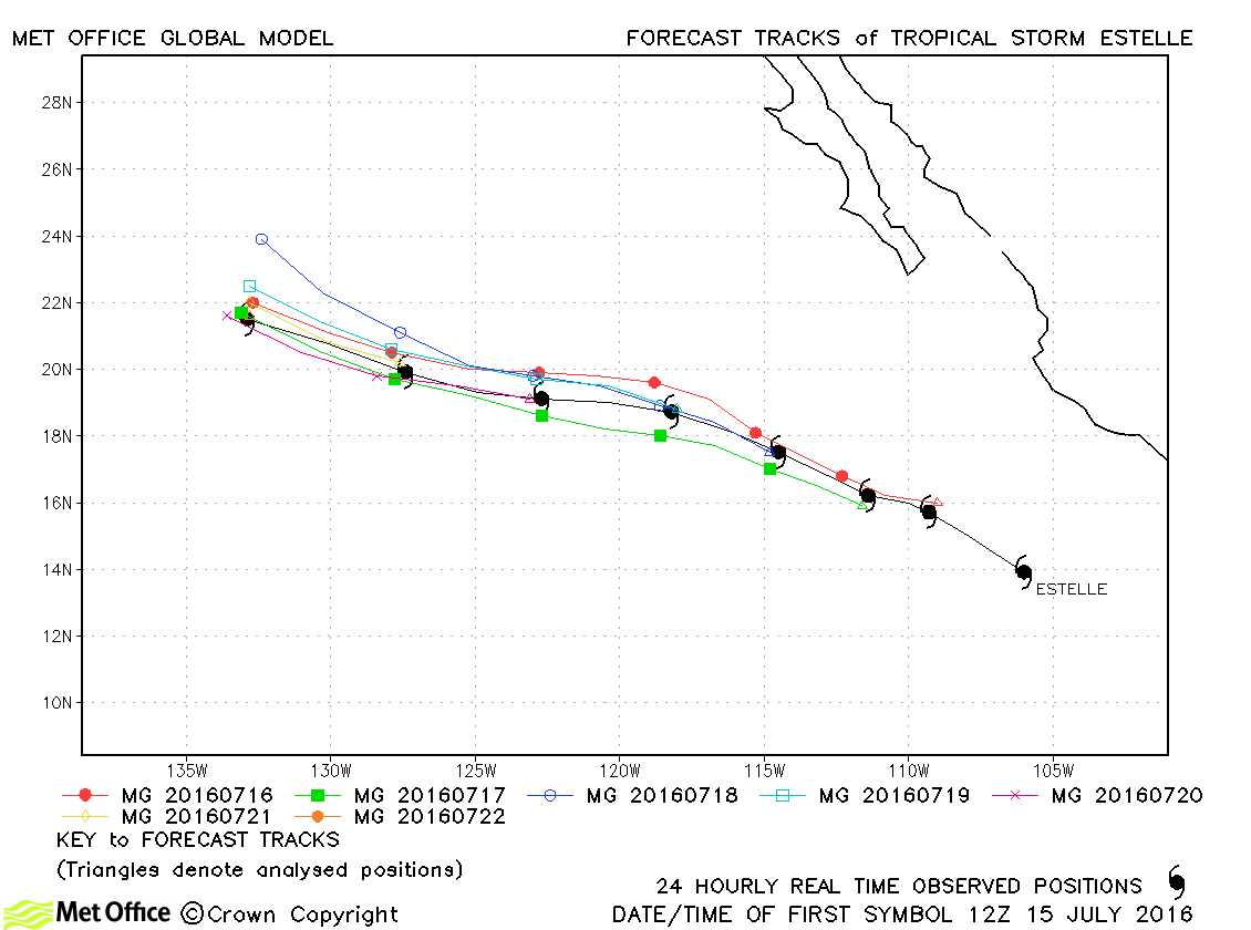
| Estelle (06E) | 15-22 July | 990 mb, 60 knots | Track forecast errors were very low for Estelle. |
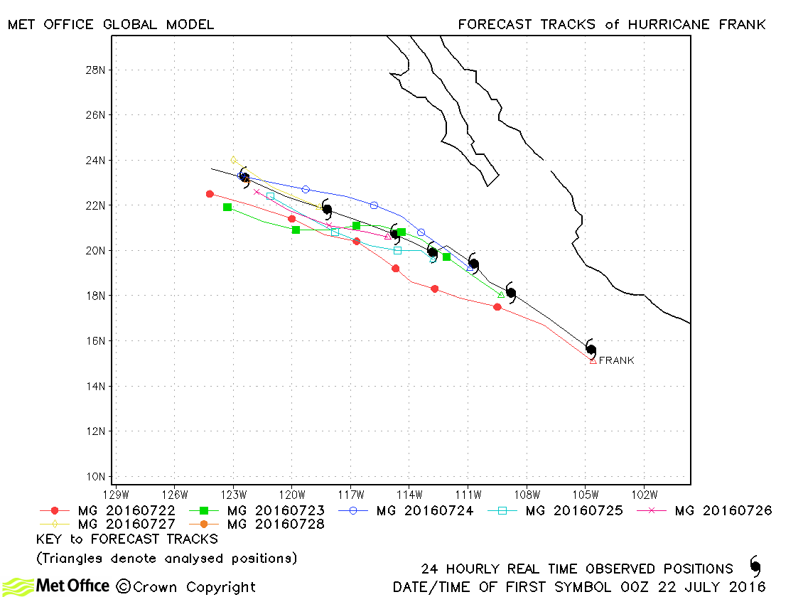
| Frank (07E) | 21-28 July | 979 mb, 75 knots | Track forecast errors were above last season's average at short lead times, but below at longer lead times. |
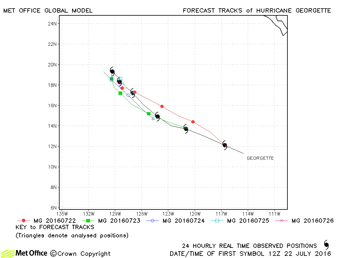
| Georgette (08E) | 21-27 July | 952 mb, 115 knots | Track forecast errors were above last season's average at short lead times, but below at longer lead times. |
| Howard (09E) | 31 July-03 August | 999 mb, 50 knots | Track forecast errors were below last season's average. |
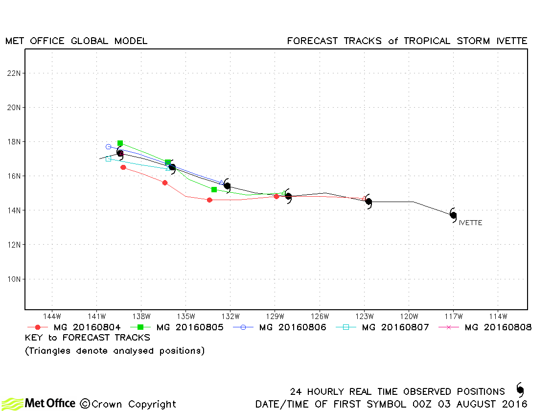
| Ivette (10E) | 02-08 August | 1000 mb, 50 knots | Track forecast errors were very low for this storm. |
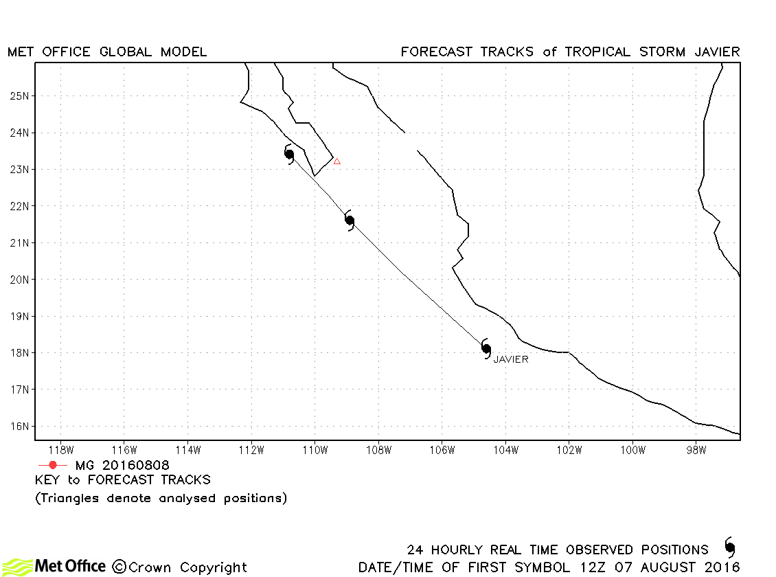
| Javier (11E) | 07-09 August | 998 mb, 55 knots | Javier only briefly reached tropical storm status. |
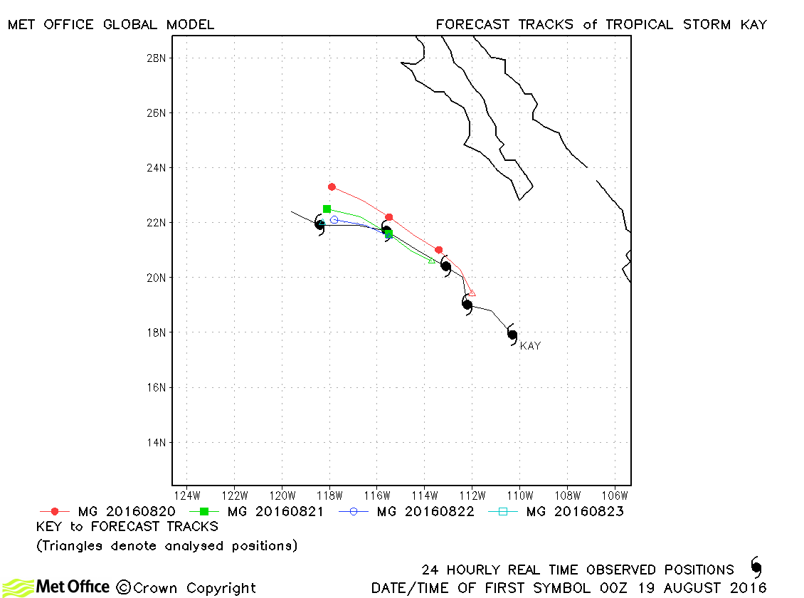
| Kay (12E) | 18-23 August | 1000 mb, 45 knots | Track forecast errors were low for this storm. |
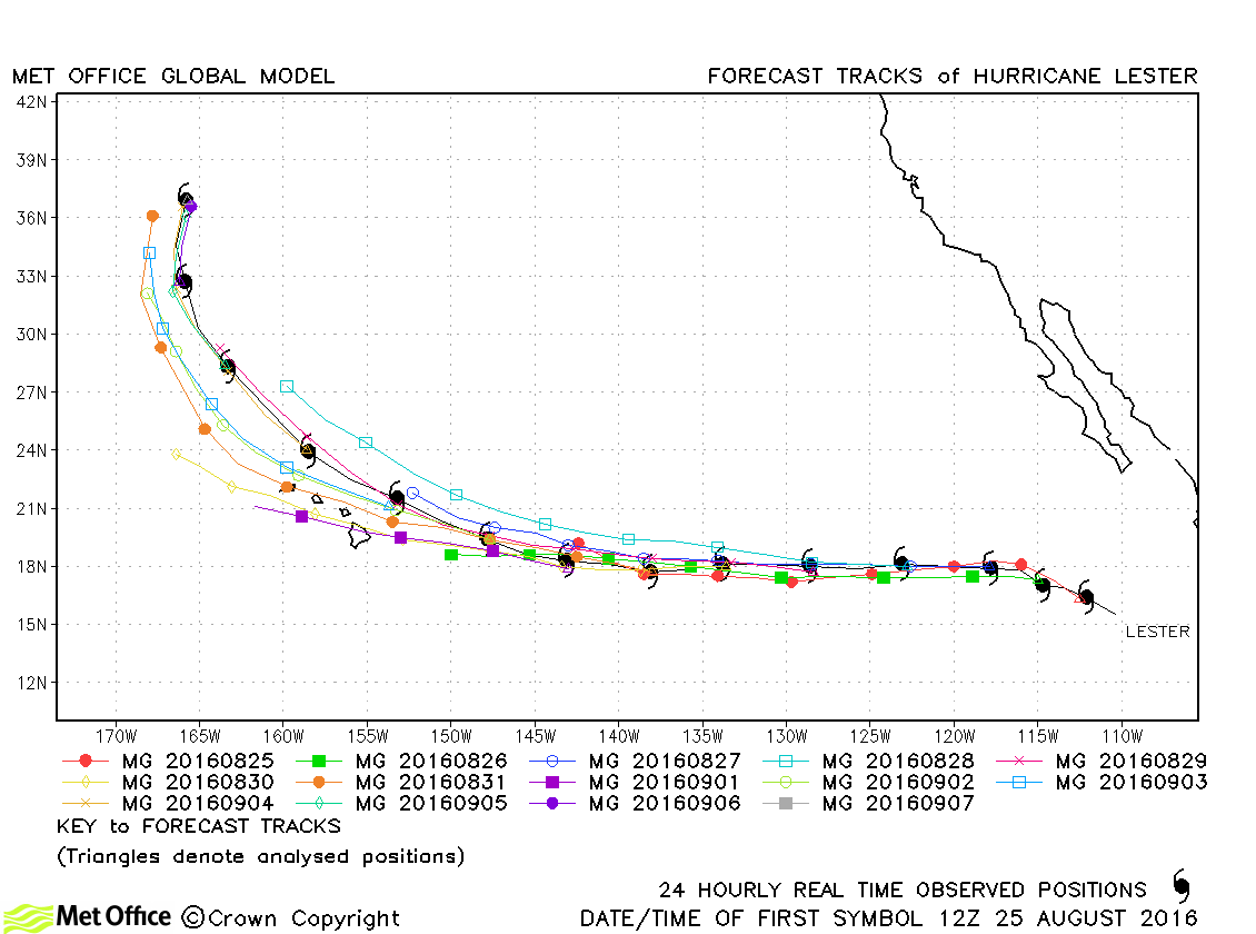
| Lester (13E) | 24 August-07 September | 947 mb, 120 knots | Track forecast errors were mostly below last season's average for this hurricane. There was a slight slow and left-of-track bias in forecasts overall. |
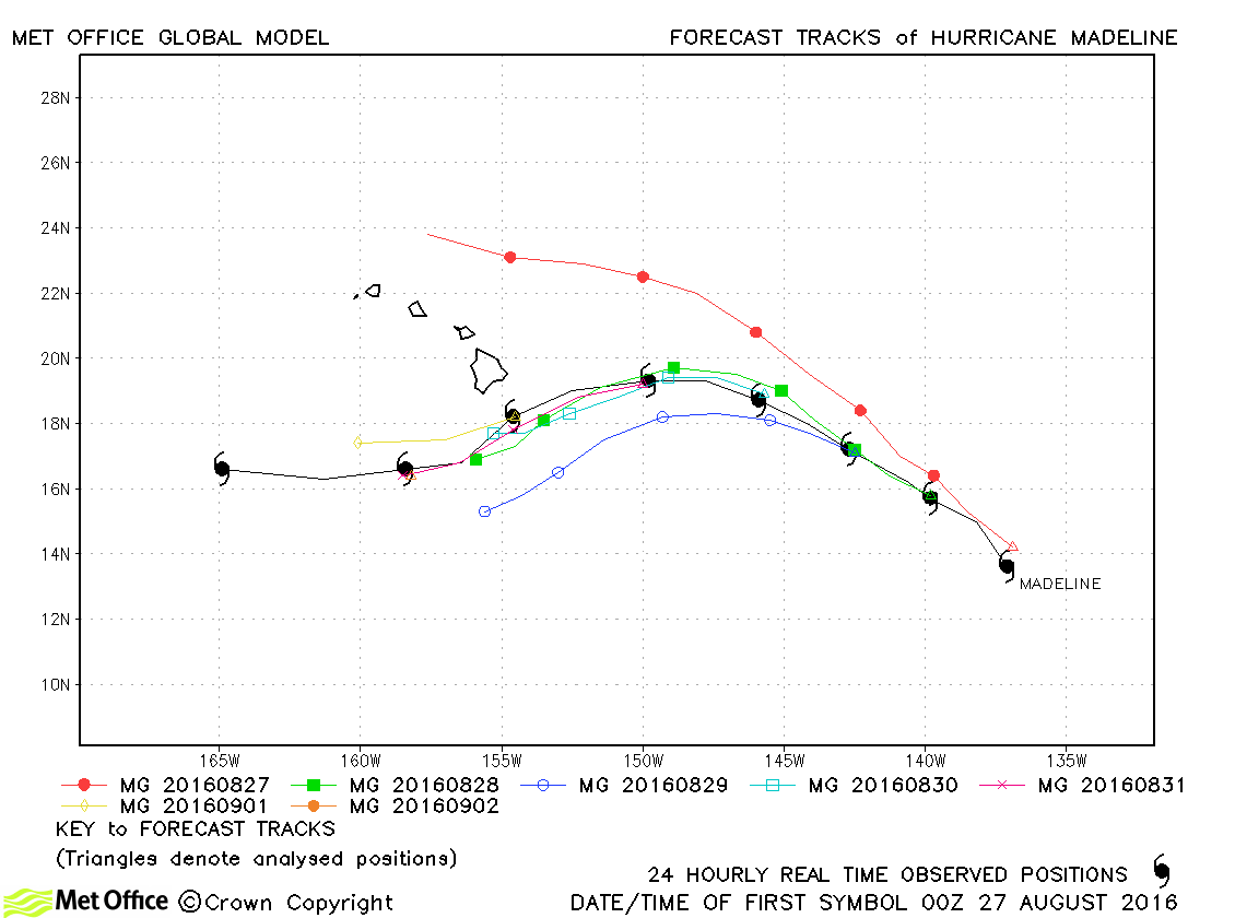
| Madeline (14E) | 26 August-03 September | 950 mb, 115 knots | Apart from a poor early forecast, track errors were low for this hurricane. |
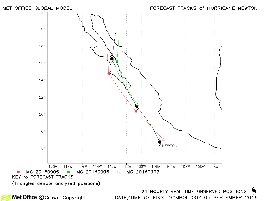
| Newton (15E) | 04-07 September | 979 mb, 80 knots | Track forecast errors were slightly above last season's average. |
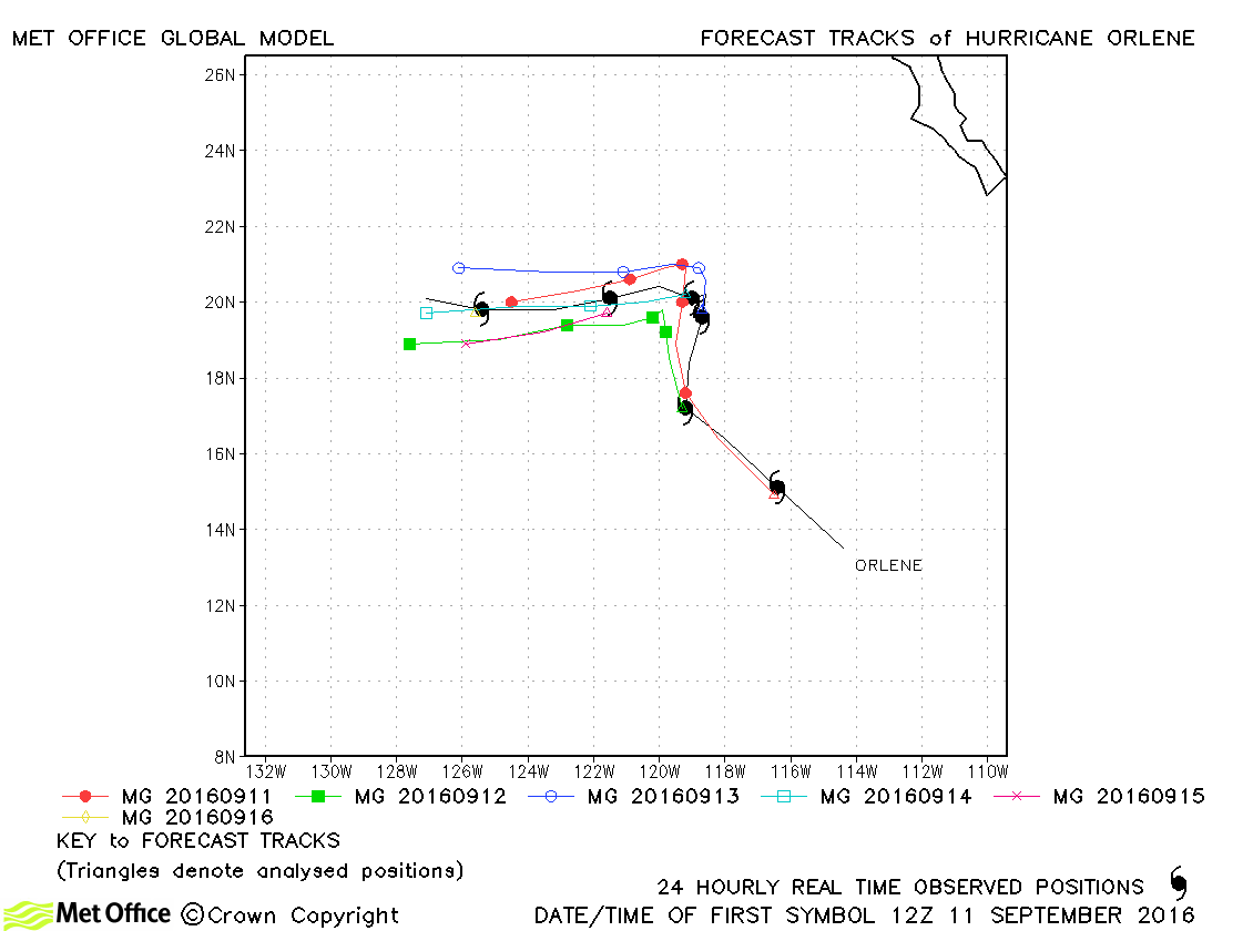
| Orlene (16E) | 11-17 September | 967 mb, 95 knots | Track forecast errors were very low and skill scores against CLIPER high for this hurricane. |
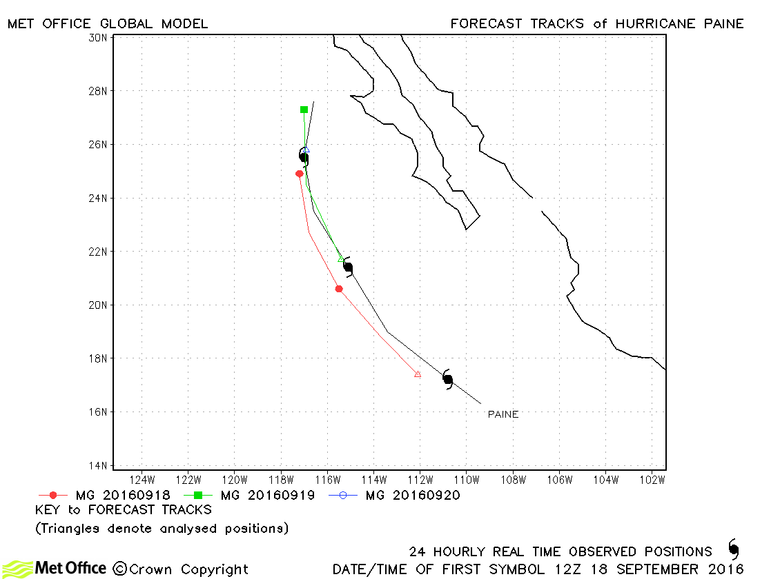
| Paine (17E) | 18-21 September | 979 mb, 80 knots | Only a few forecasts were verified for this hurricane and track forecast errors were mixed. |
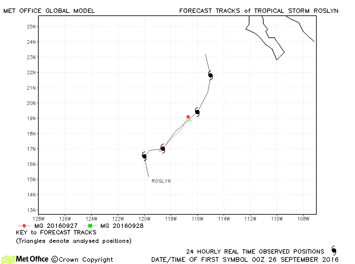
| Roslyn (18E) | 25-29 September | 1000 mb, 45 knots | Track forecast errors were above last season's average for this storm. |
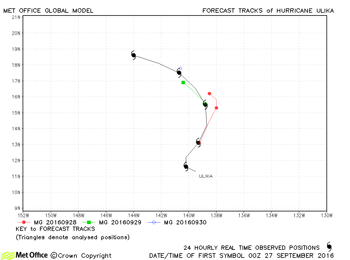
| 26 September-01 October | 992 mb, 65 knots | Track errors were slightly above last season's average. | |
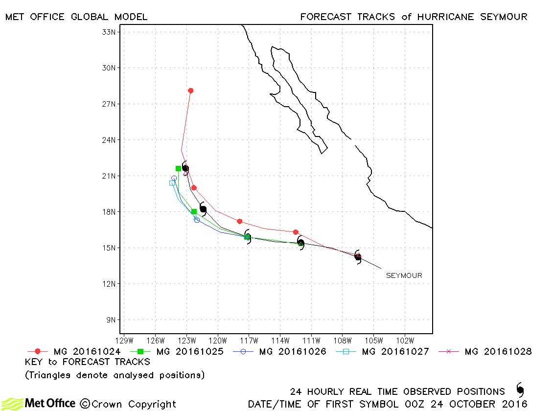
| Seymour (20E) | 23-28 October | 943 mb, 130 knots | Track forecast errors were all below last season's average except for the few forecasts beyond T+72. |
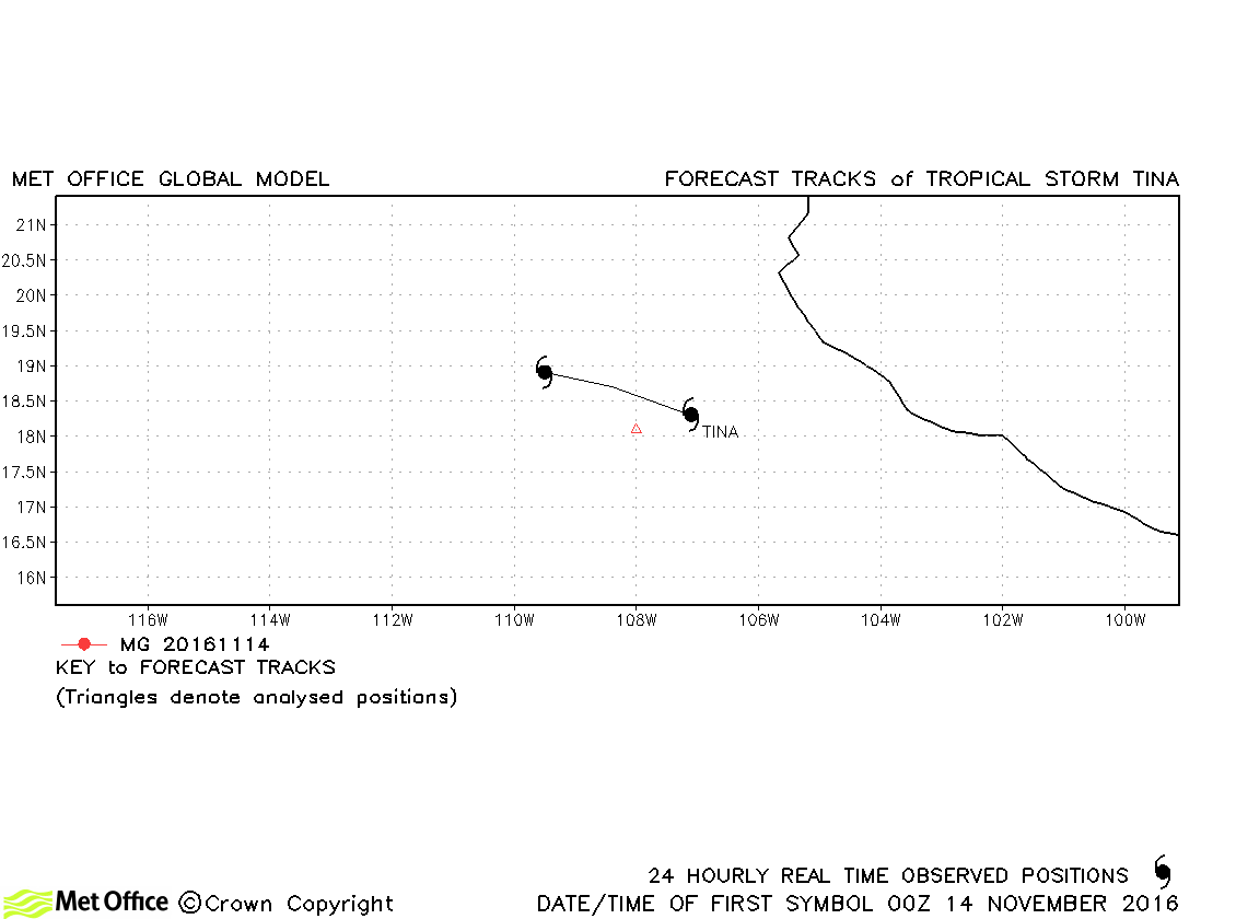
| Tina (21E) | 14-15 November | 1005 mb, 35 knots | Tina was only briefly a tropical storm. |
| Name & ID | Start & end dates | Central Pressure, 1-minute MSW | Comments on Met Office global model forecasts |
|---|---|---|---|
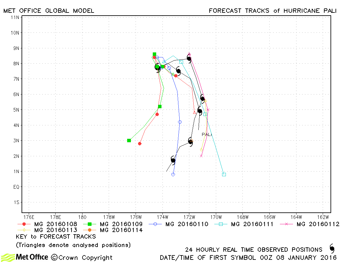
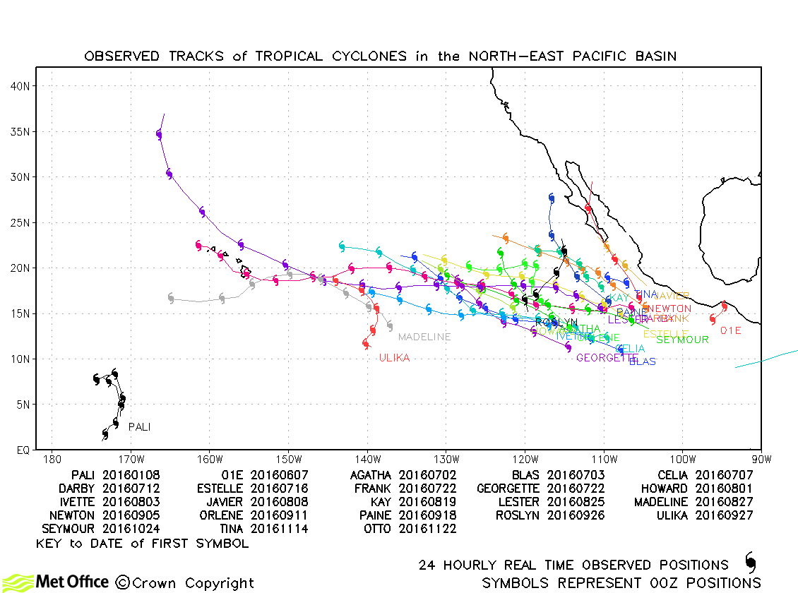
| Pali (01C) | 07-15 January | 977 mb, 85 knots | Track forecast errors were mostly above last season's average. However, skill scores against CLIPER were extremely high. |
North-east and Central North Pacific observed tracks in 2016
North-east Pacific tropical cyclone names
Central North Pacific tropical cyclone names
* Ulika formed in the North-east Pacific, but was named in the Central North Pacific
| Name & ID | Start & end dates | Central pressure, 1-minute MSW | Comments on Met Office global model forecasts |
|---|---|---|---|
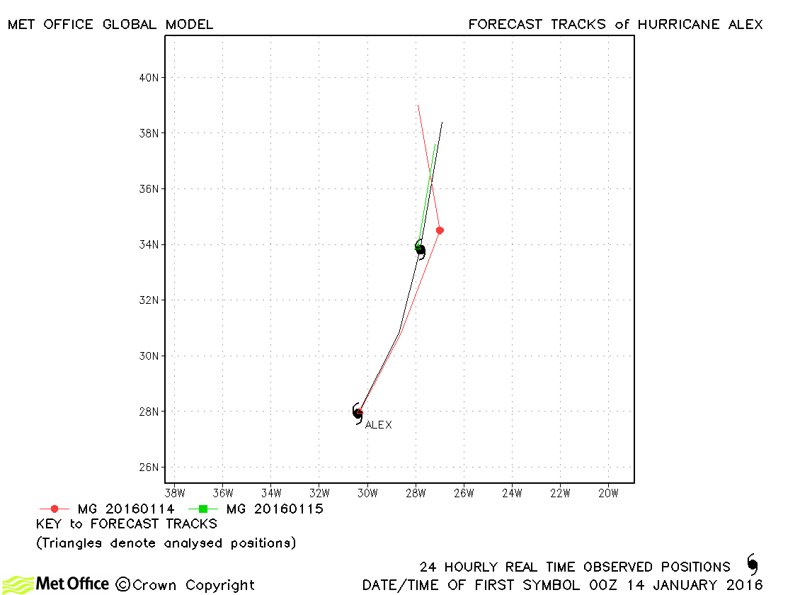
| Alex (01L) | 13-15 January | 981 mb, 75 knots | Alex was a tropical system for a relatively brief time. Track errors were close to last season's average. |
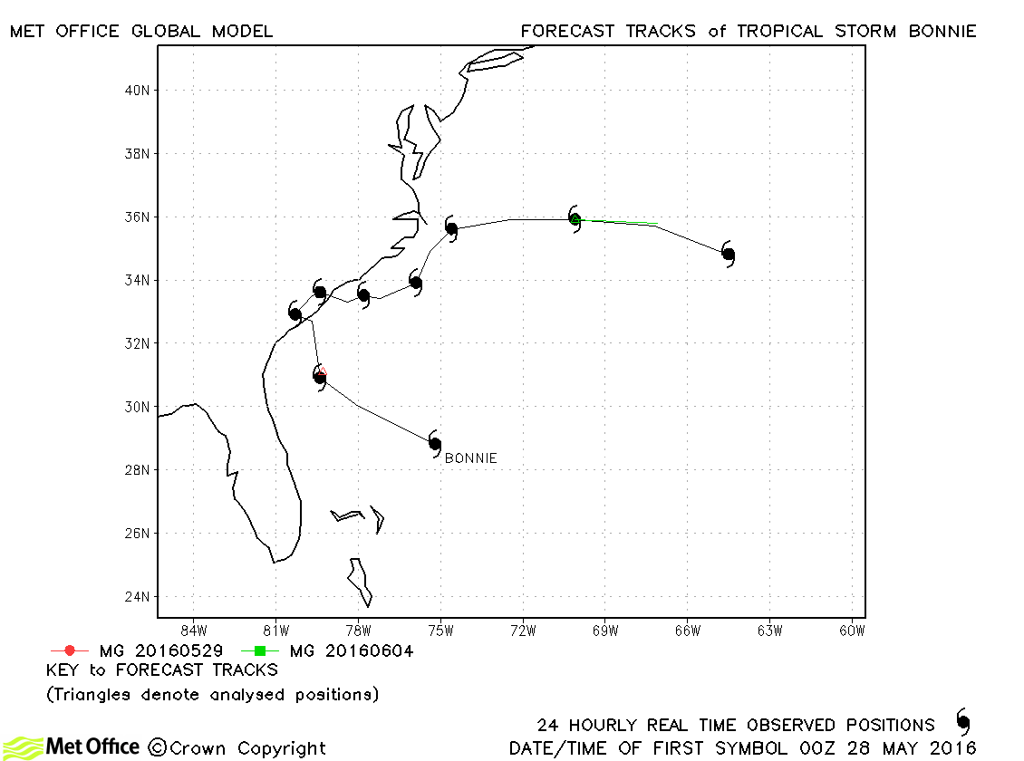
| Bonnie (02L) | 27-30 May | 1007 mb, 35 knots | Bonnie only briefly attained tropical storm status. |
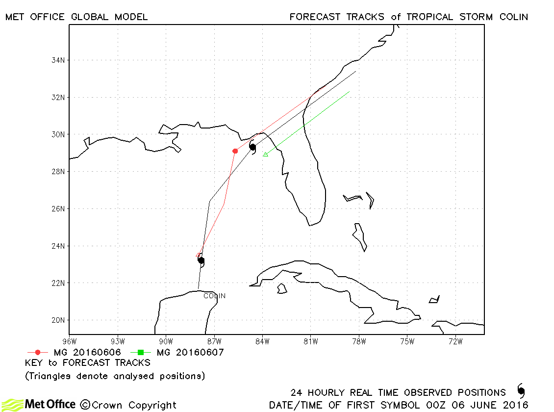
| Colin (03L) | 05-07 June | 1006 mb, 45 knots | Track forecast errors were a little above last season's average. There was a slow bias in forecasts. |
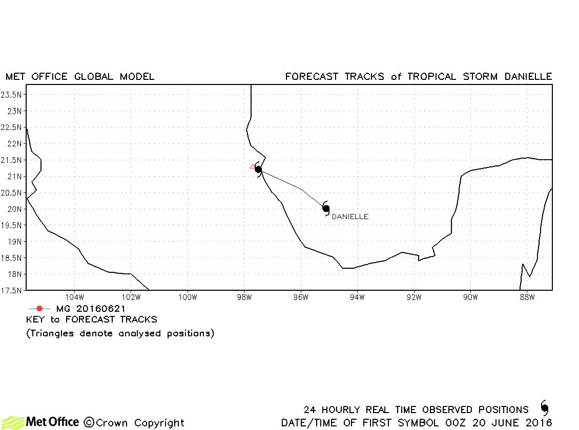
| Danielle (04L) | 19-21 June | 1007 mb, 40 knots | Danielle was only briefly a tropical storm and just one forecast was verified. |
| Earl (05L) | 02-06 August | 979 mb, 70 knots | Track forecast errors were near to last season's average for this hurricane. |
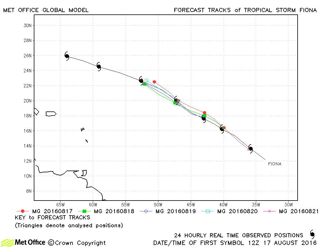
| Fiona (06L) | 17-23 August | 1006 mb, 40 knots | Fiona was well forecast and track forecast errors were low. |
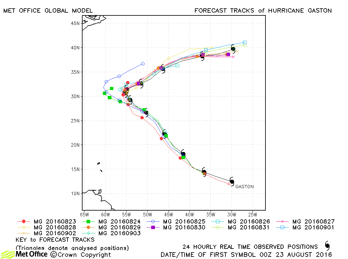
| Gaston (07L) | 22 August-03 September | 956 mb, 105 knots | Track forecast errors were below last season's average for this hurricane. The sharp turn was well predicted in most runs of the model. |
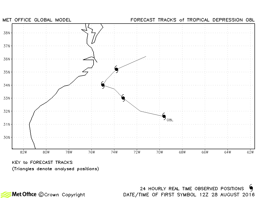
| 08L | 28 August-01 September | 1009 mb, 30 knots | No forecasts were verified for this tropical depression. |
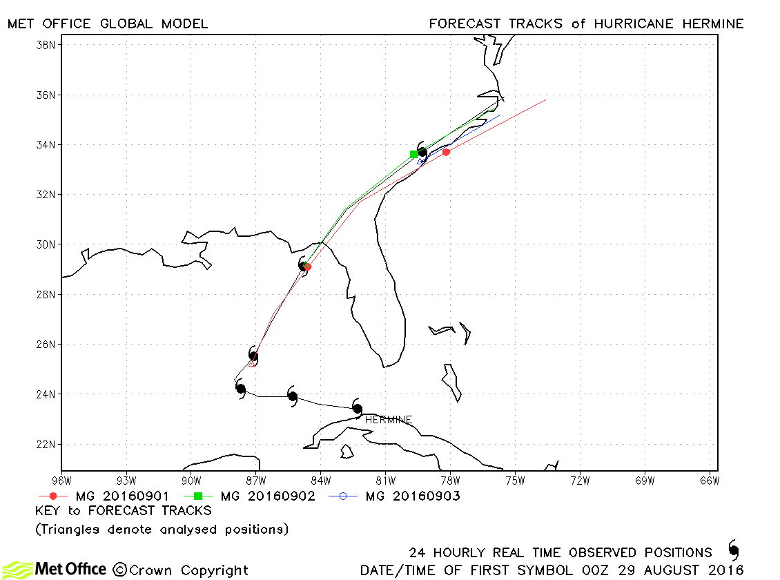
| Hermine (09L) | 28 August-03 September | 982 mb, 70 knots | Track forecast errors for Hermine were mostly very low. Landfall was well predicted. |
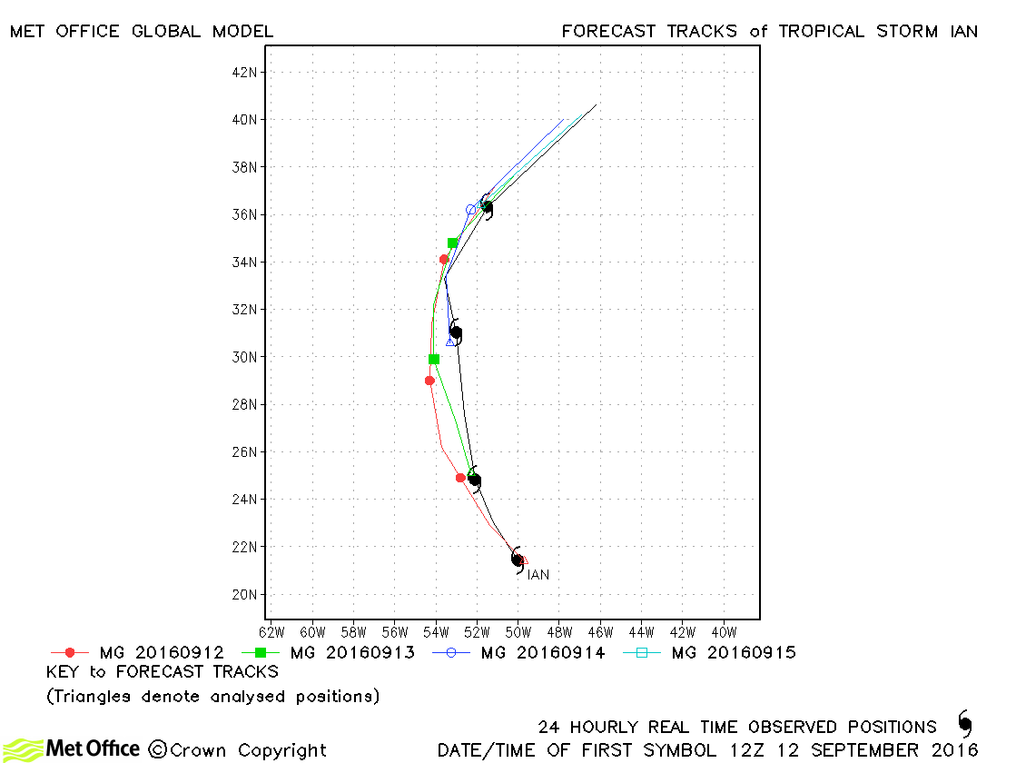
| Ian (10L) | 12-16 September | 996 mb, 50 knots | There was a slow bias in forecasts for this storm. |
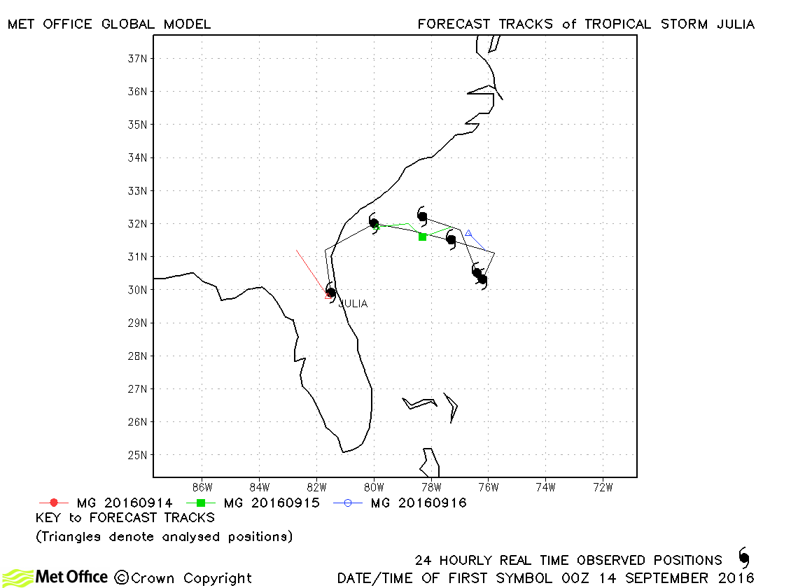
| Julia (11L) | 14-19 September | 1007 mb, 35 knots | Track forecast errors were above last season's average for this storm. |
| Karl (12L) | 14-25 September | 986 mb, 60 knots | Track forecast errors were below last season's average and skill scores high for this storm. The recurvature and acceleration north-east was generally well predicted. |
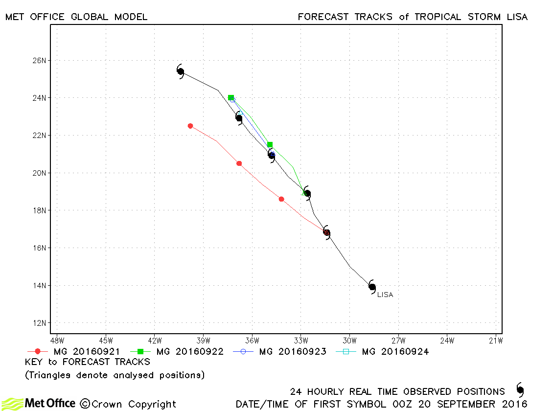
| Lisa (13L) | 19-25 September | 999 mb, 45 knots | Track forecast errors were a little above last season's average for this storm. |
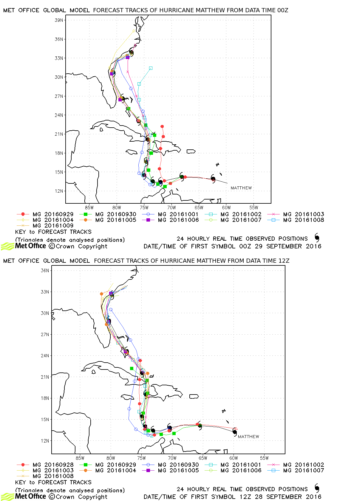
| Matthew (14L) | 28 September-09 October | 934 mb, 140 knots | Track forecast errors for Hurricane Matthew were very low and skill scores very high. Mean errors at 24, 72, 120 and 168 hours were 60, 106, 226 and 291 km. Landfall over Haiti and the track close to the USA were mostly very well predicted. Track forecast errors were lower than ECMWF overall and forecasts were amongst the best (if not actually the best) numerical model guidance available for this hurricane. |
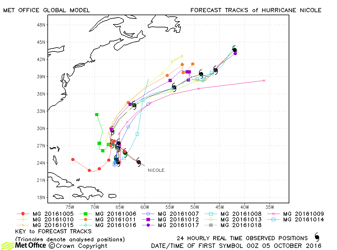
| Nicole (15L) | 04-18 October | 950 mb, 115 knots | Whilst a few early forecasts failed to predict the north-eastwards movement of Nicole, overall track forecast errors were below last season's average and skill scores against CLIPER were high. |
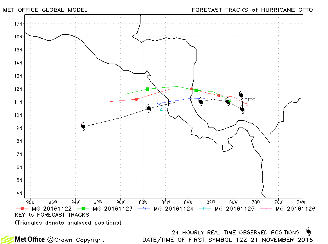
| Otto (16L) | 21-26 November | 975 mb, 95 knots | Despite having a small polewards bias, track forecast errors were below last season's average. |
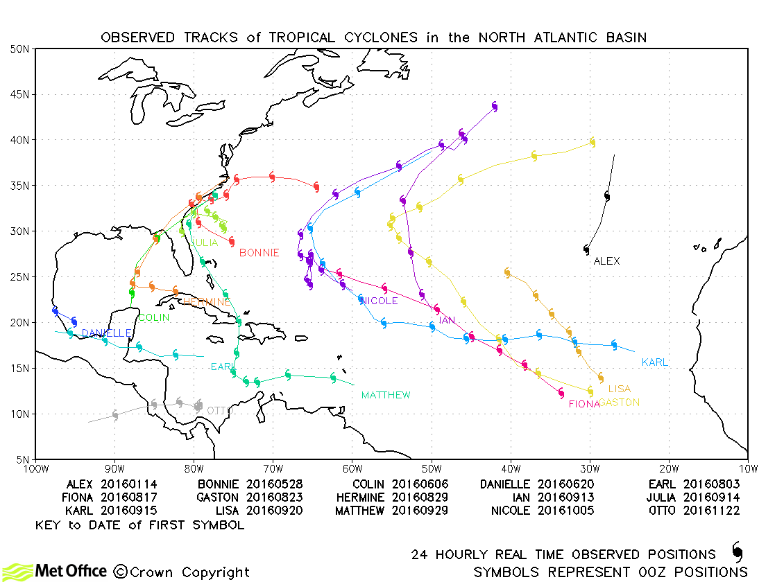
North Atlantic observed tracks in 2016
North Atlantic tropical cyclone names
| Name & ID | Start & end dates | Central pressure, 1-/10-minute MSW | Comments on Met Office global model forecasts |
|---|---|---|---|
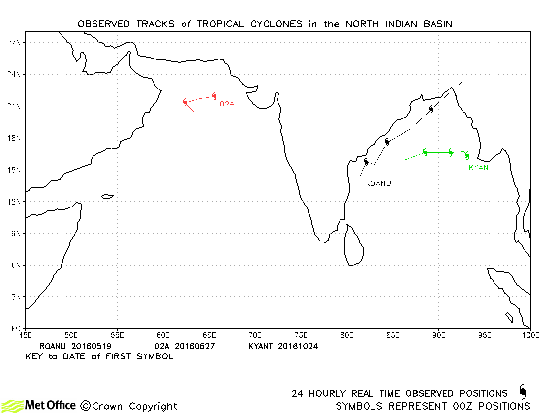
| Roanu (01B) | 27-30 May | 982 mb, 55/45 knots | Track forecast errors were near to average for this storm. |
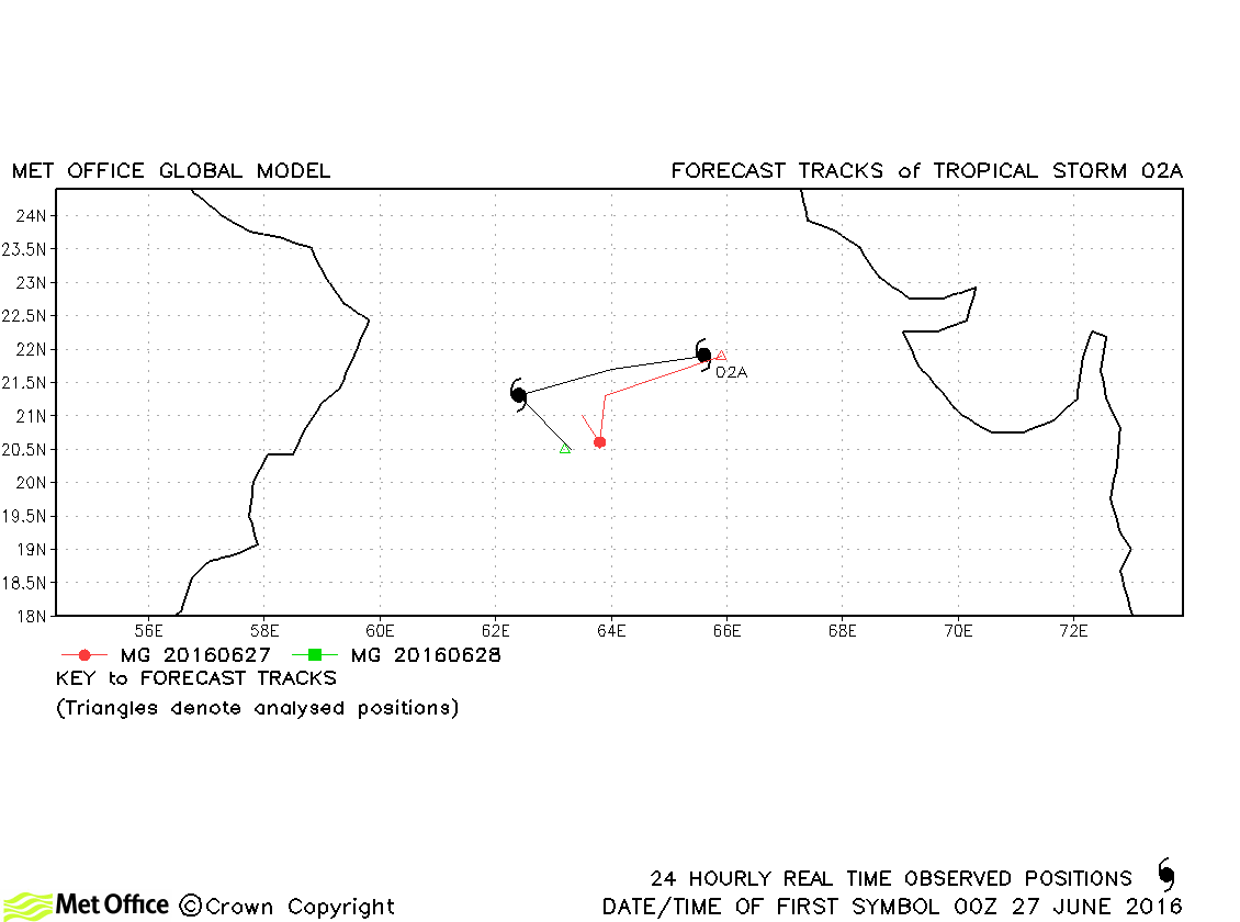
| 02A | 27-28 June | 996 mb, 35/30 knots | 02A was designated a storm by JTWC, but not by IMD. Few forecasts were verified. |
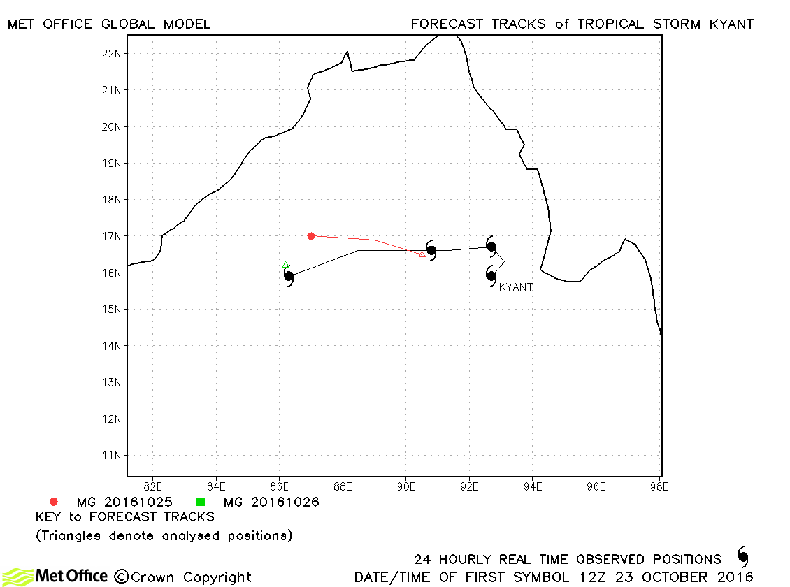
| Kyant (03B) | 23-26 October | 984 mb, 50/40 knots | Kyant was only briefly a storm and only a few forecasts were verified. However, the formation and track across the Bay of Bengal were well predicted. |
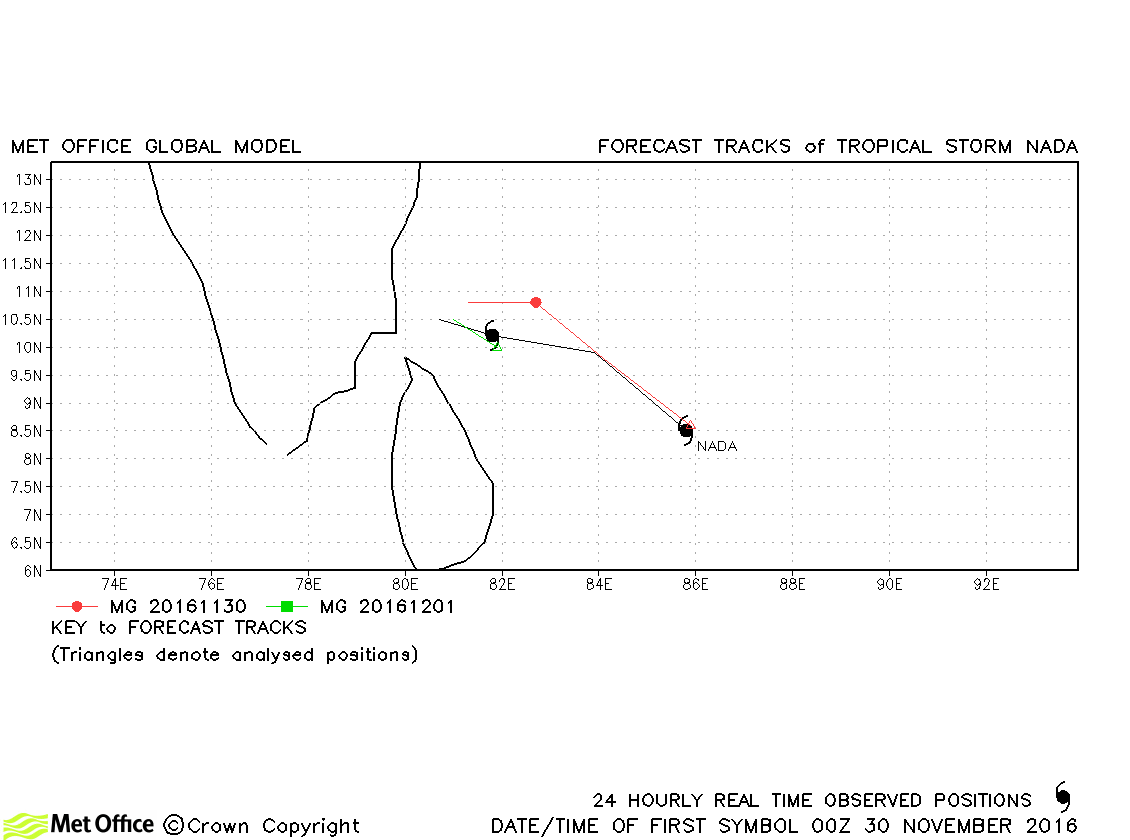
| Nada (04B) | 29 November-01 December | 993 mb, 45/40 knots | Track forecast errors were near to last seasons average. |
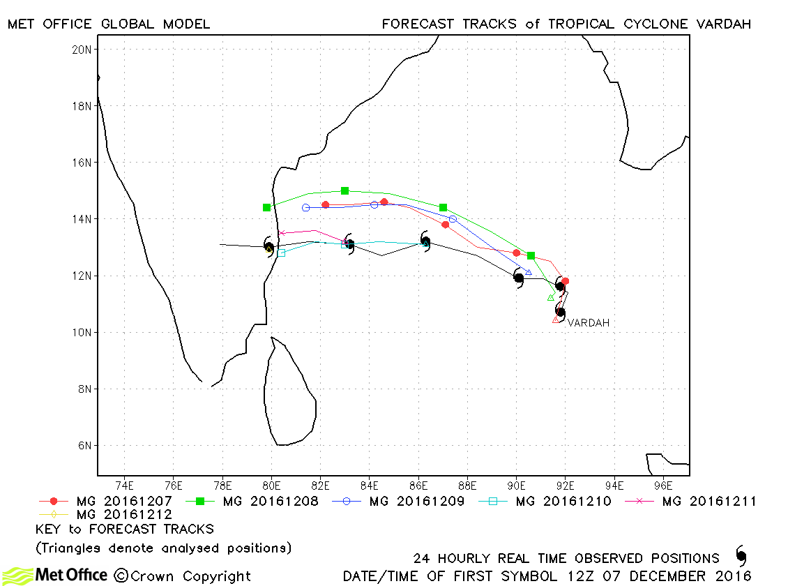
| Vardah (05B) | 07-13 December | 970 mb, 75/70 knots | There was a right-of-track bias in forecasts. Landfall location was predicted well from about two days in advance. |
North Indian observed tracks in 2016
North Indian tropical cyclone names
Note on estimated wind speeds
1-minute MSW: Maximum sustained wind (knots) averaged over 1 minute (JTWC Hawaii, NHC Miami, CPHC Hawaii)
10-minute MSW: Maximum sustained wind (knots) averaged over 10 minutes (JMA Japan, IMD New Delhi)
Note: Although 1-minute average winds should be stronger than 10-minute average, this may not be the case here since estimates are obtained from different warning centres.

