

Observed and forecast tracks: southern hemisphere 2017-18
All tropical cyclones in the southern hemisphere season in 2017-18 are listed below including details of their start and end dates, lowest central pressure and maximum sustained wind (MSW).
Click on the name of the tropical cyclone to see a chart of the observed track and forecast tracks from the Met Office global model. Verification statistics on each tropical cyclone are available upon request from [email protected]. At the end of the season a verification report on the performance of the Met Office global model will be published.
| Name & ID | Start & end dates | Central pressure, 1-/10-minute MSW | Comments on Met Office global model forecasts |
|---|---|---|---|
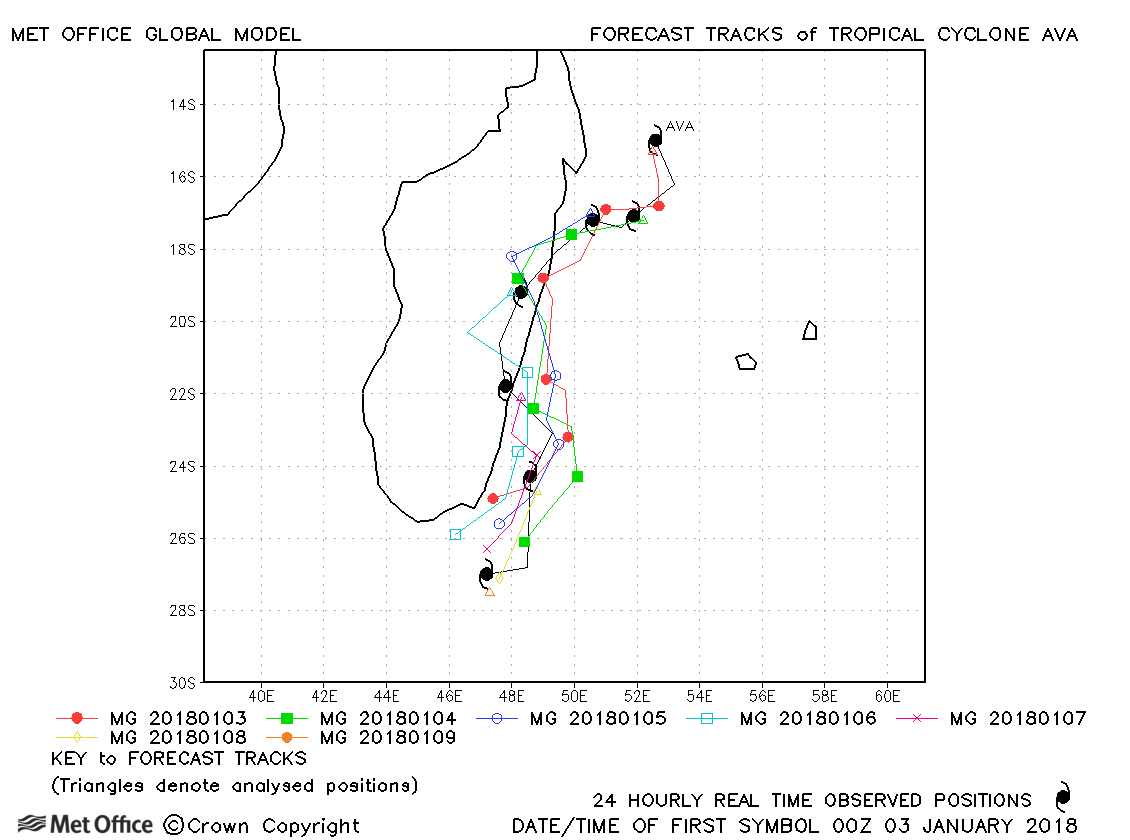
| Ava (03S) | 02-09 January | 958 mb, 95/85 knots | Landfall was well predicted and track forecast errors were below last season's average. |
| Berguitta (06S) | 12-29 January | 940 mb, 100/90 knots | Although early forecasts tracked Berguitta a little too far south of Mauritius, track errors were below last season's average and skill scores high. |
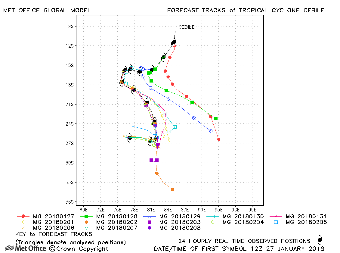
| Cebile (07S) | 27 January-08 February | 952 mb, 120/100 knots | Track forecast errors were low at short lead time, but large at long lead times due to the left-of-track bias early in the cyclone's life. |
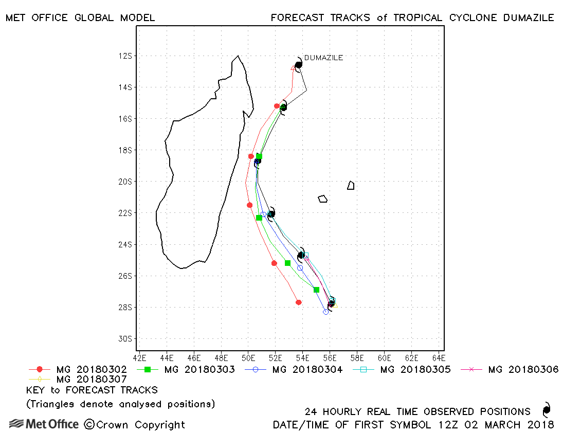
| Dumazile (11S) | 02-07 March | 954 mb, 105/85 knots | Track forecast errors were well below last season's average and skill scores were high. |
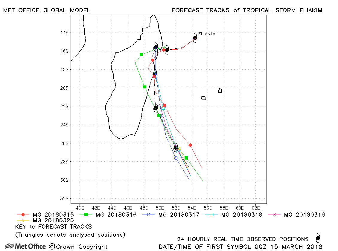
| Eliakim (14S) | 14-20 March | 980 mb, 55/55 knots | Track forecast errors were lower than last season's average - particularly at longer lead times. |
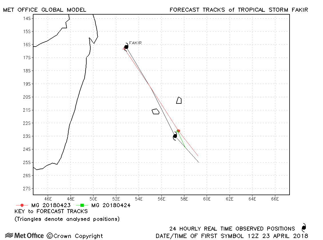
| Fakir (20S) | 23-25 April | 977 mb, 65/60 knots | Track forecast errors were below last season's average. |
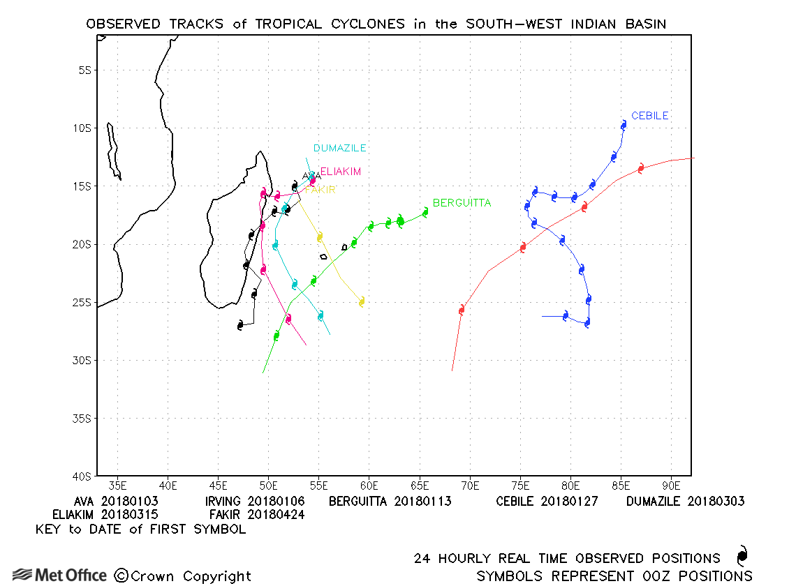
South-west Indian observed tracks in 2017-18
| Name & ID | Start & end dates | Central pressure, 1-/10-minute MSW | Comments on Met Office global model forecasts |
|---|---|---|---|
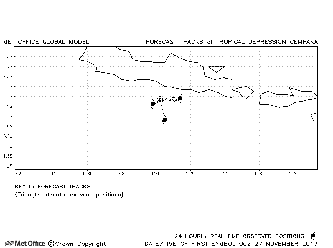
| Cempaka (-) | 27-29 November | 998 mb, 30/35 knots | Cempaka designated a tropical storm by BMKG, but not by JTWC. No forecasts were verified. |
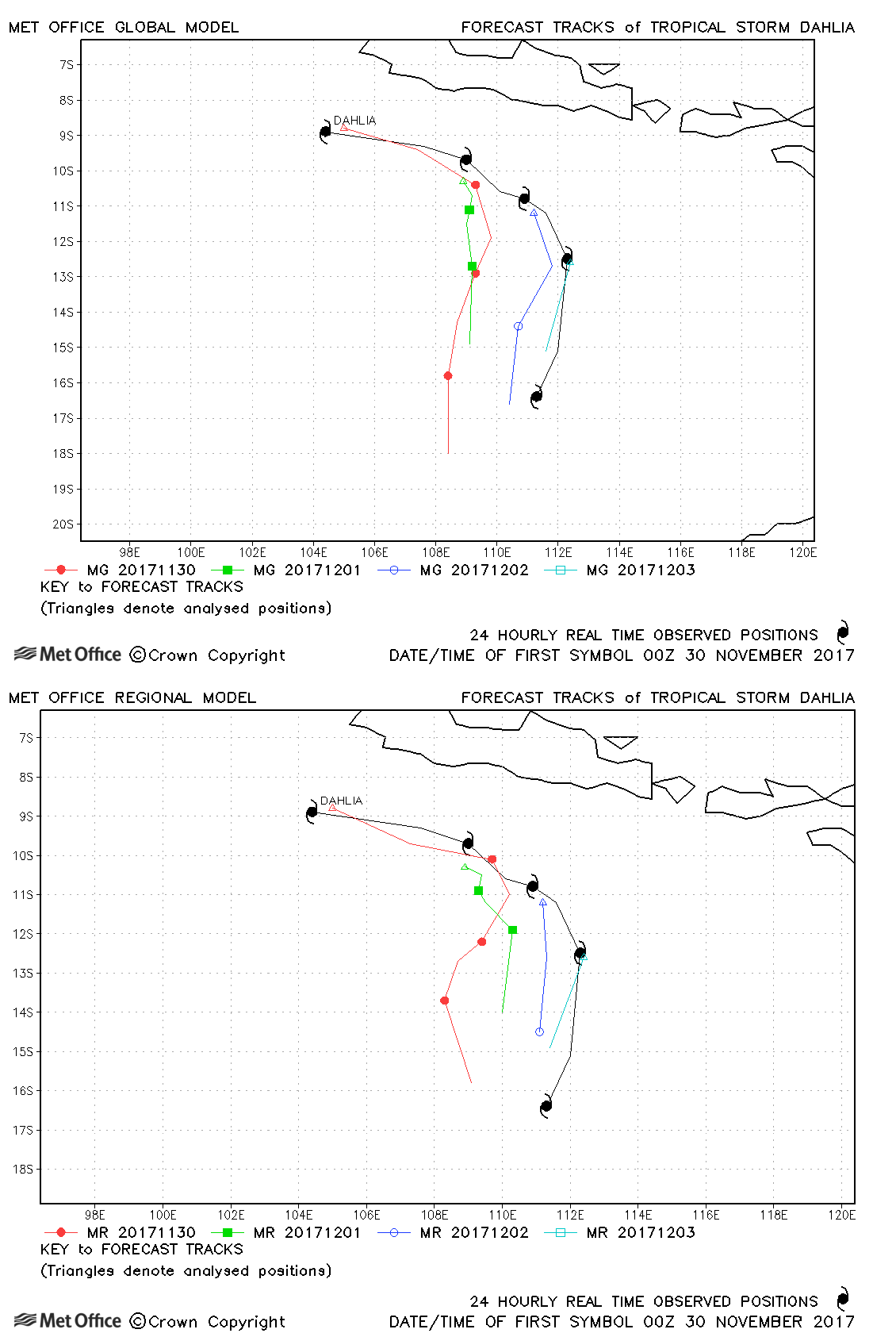
| Dahlia (01S) | 29 November-04 December | 985mb, 55/50 knots | Track forecast errors were above average for this storm. |
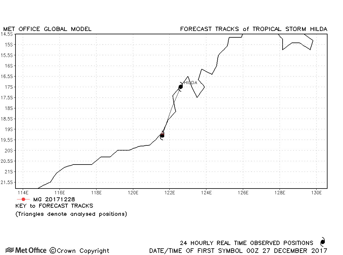
| Hilda (02S) | 27-28 December | 985 mb, 40/40 knots | Hilda was only briefly a tropical storm and no forecasts were verified. |
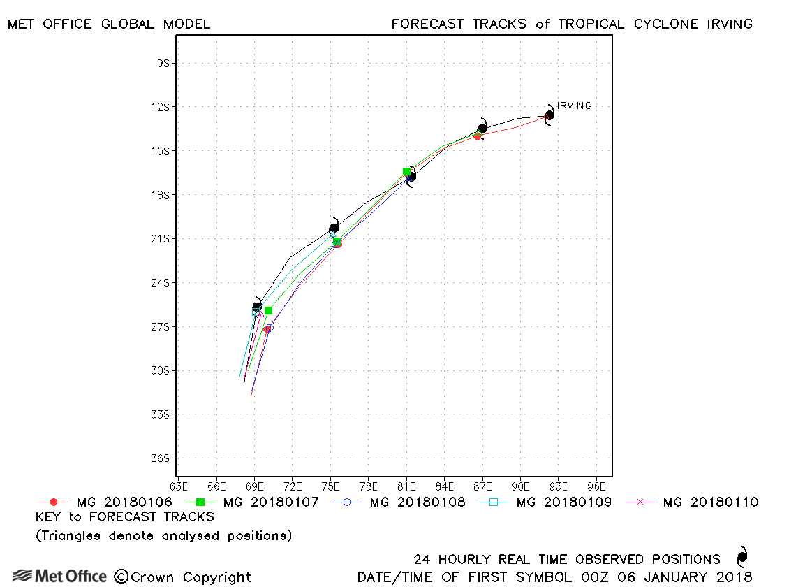
| Irving (04S) | 05-10 January | 964 mb, 90/80 knots | Track forecast errors were low and skill scores very high for this cyclone. |
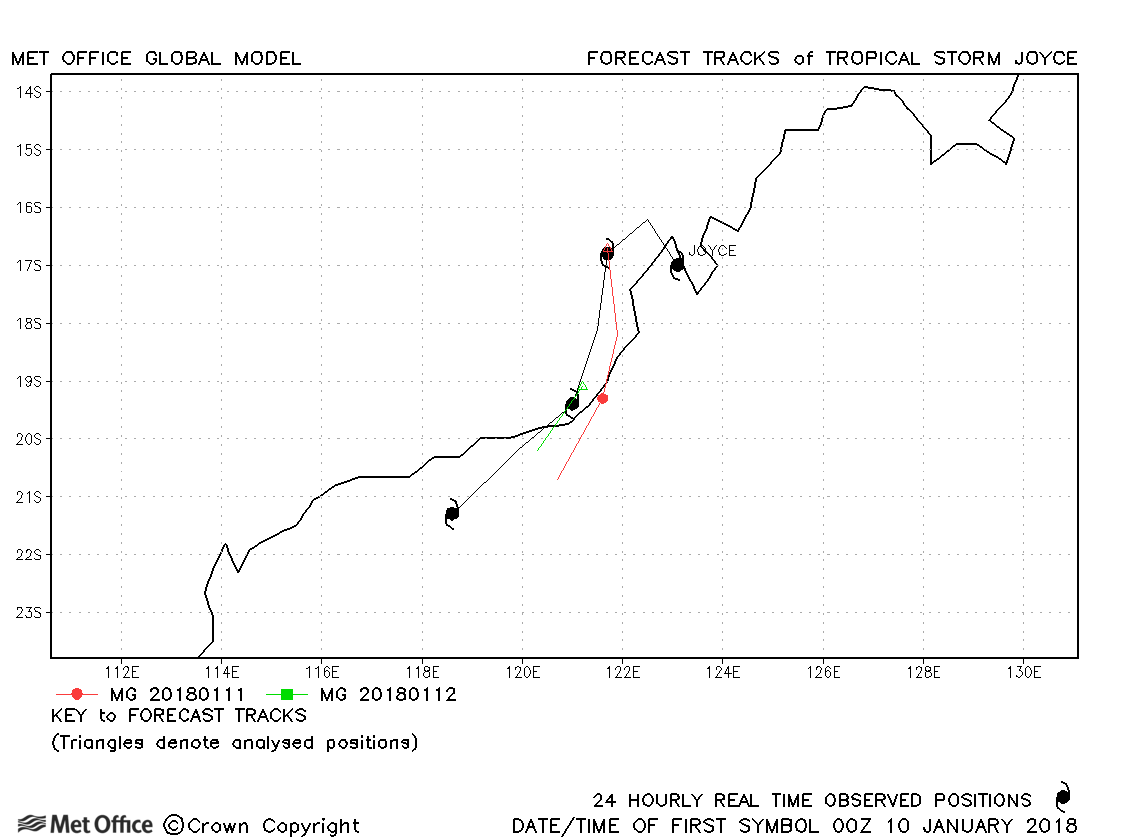
| Joyce (05S) | 09-13 January | 982 mb, 50/45 knots | Joyce was a tropical storm for less than two days, but in that time track forecasts were good. |
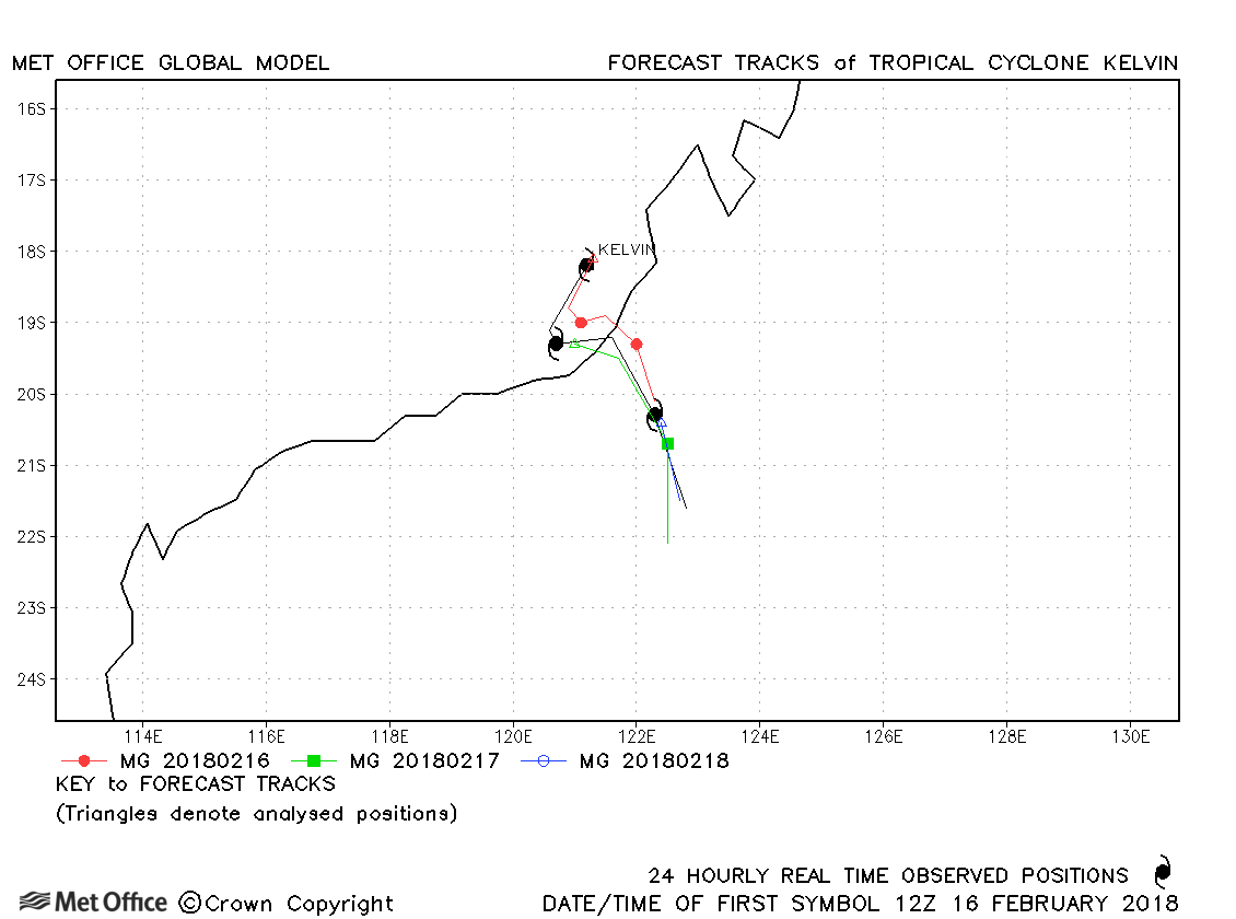
| Kelvin (10S) | 16-19 February | 975 mb, 80/60 knots | Track forecast errors were low, with landfall well predicted. |
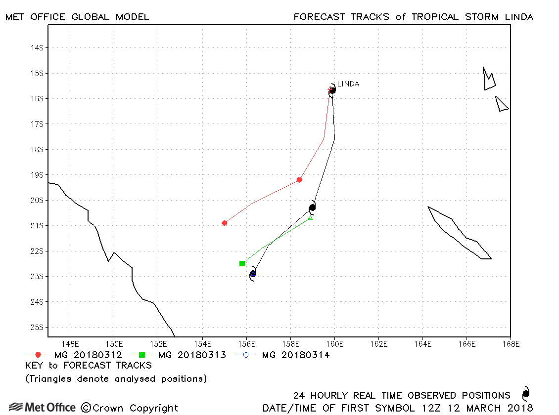
| Linda (13P) | 12-14 March | 991 mb, 50/40 knots | Linda was relatively short-lived, but track forecast errors were low. |
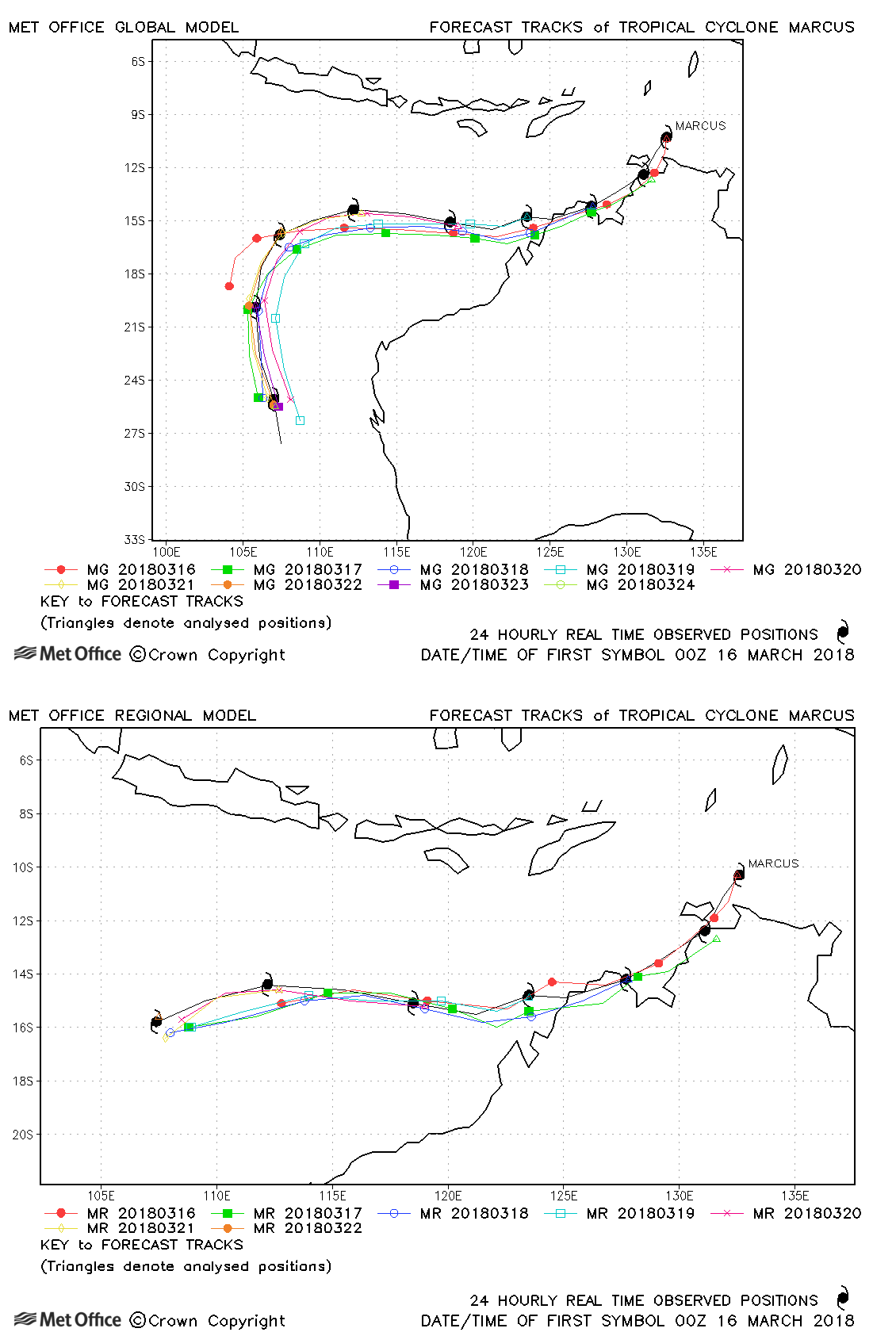
| Marcus (15S) | 15-24 March | 914 mb, 140/125 knots | The track of Marcus was well predicted with errors well below last season's average. |
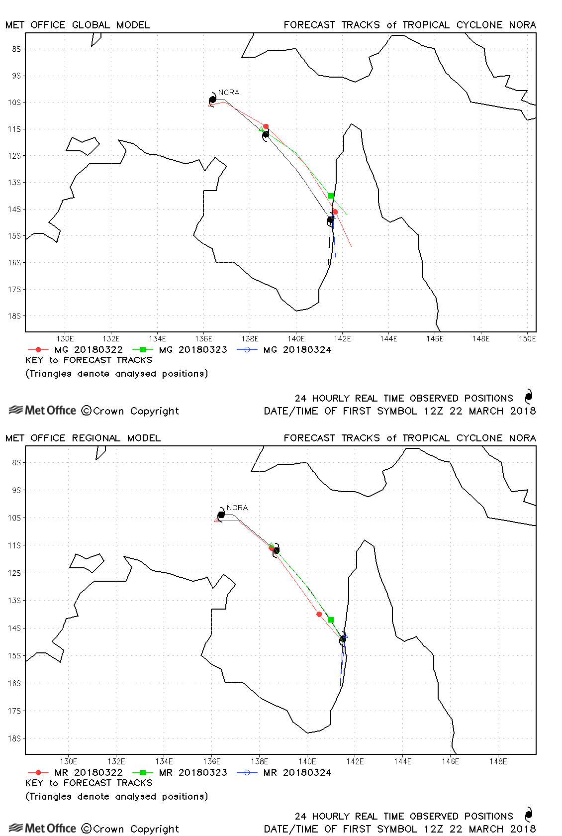
| Nora (16P) | 22-25 March | 959 mb, 95/85 knots | Track forecast errors were low. The Met Office Global Model performed better than other models in predicting an early landfall on the Cape York Peninsula. |
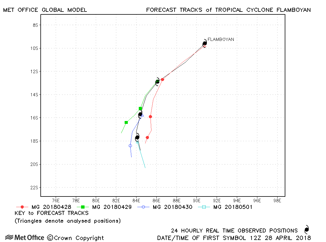
| Flamboyan (21S) * | 28 April-02 May | 983 mb, 70/60 knots | Track forecast errors were below last season's average. |
* For statistical purposes Flamboyan was considered a South-West Indian Ocean storm as it spent most of its lifetime in that basin.
| Name & ID | Start & end dates | Central pressure, 1-/10-minute MSW | Comments on Met Office global model forecasts |
|---|---|---|---|
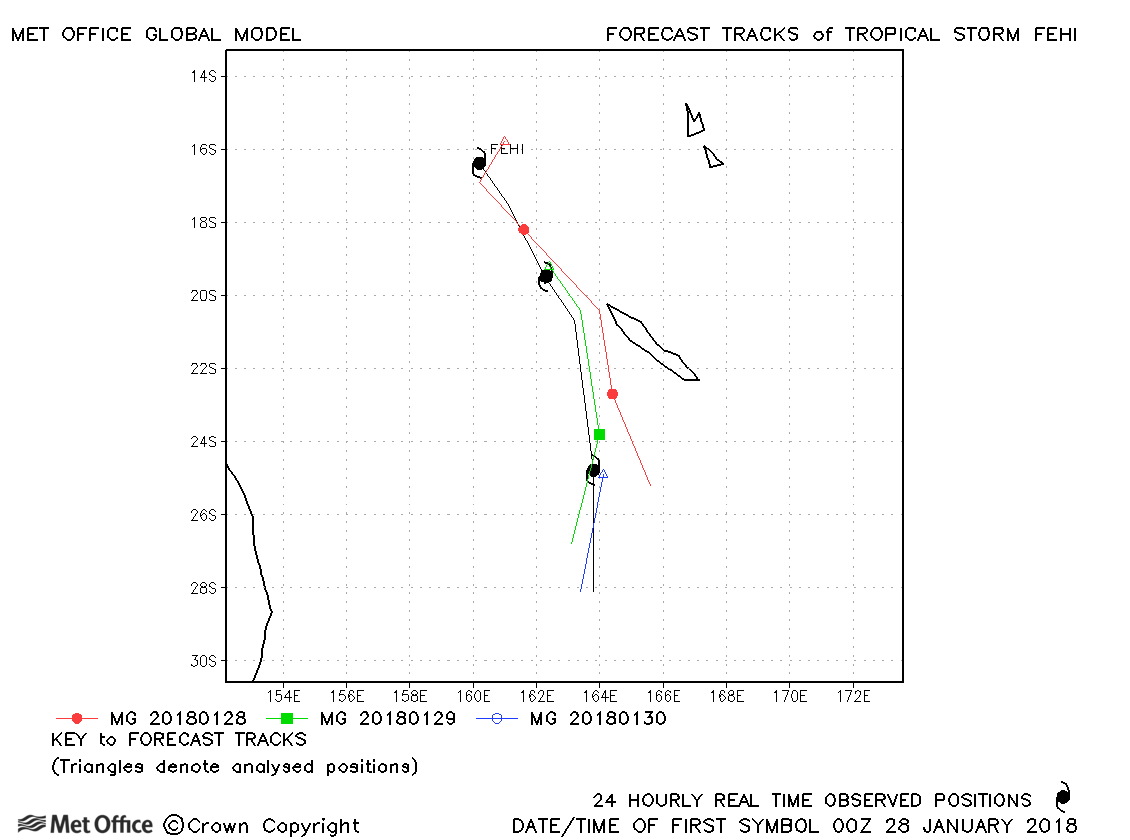
| Fehi (08P) | 28-30 January | 986 mb, 50/45 knots | Track forecast errors were a little above last season's average due to a slow bias. |
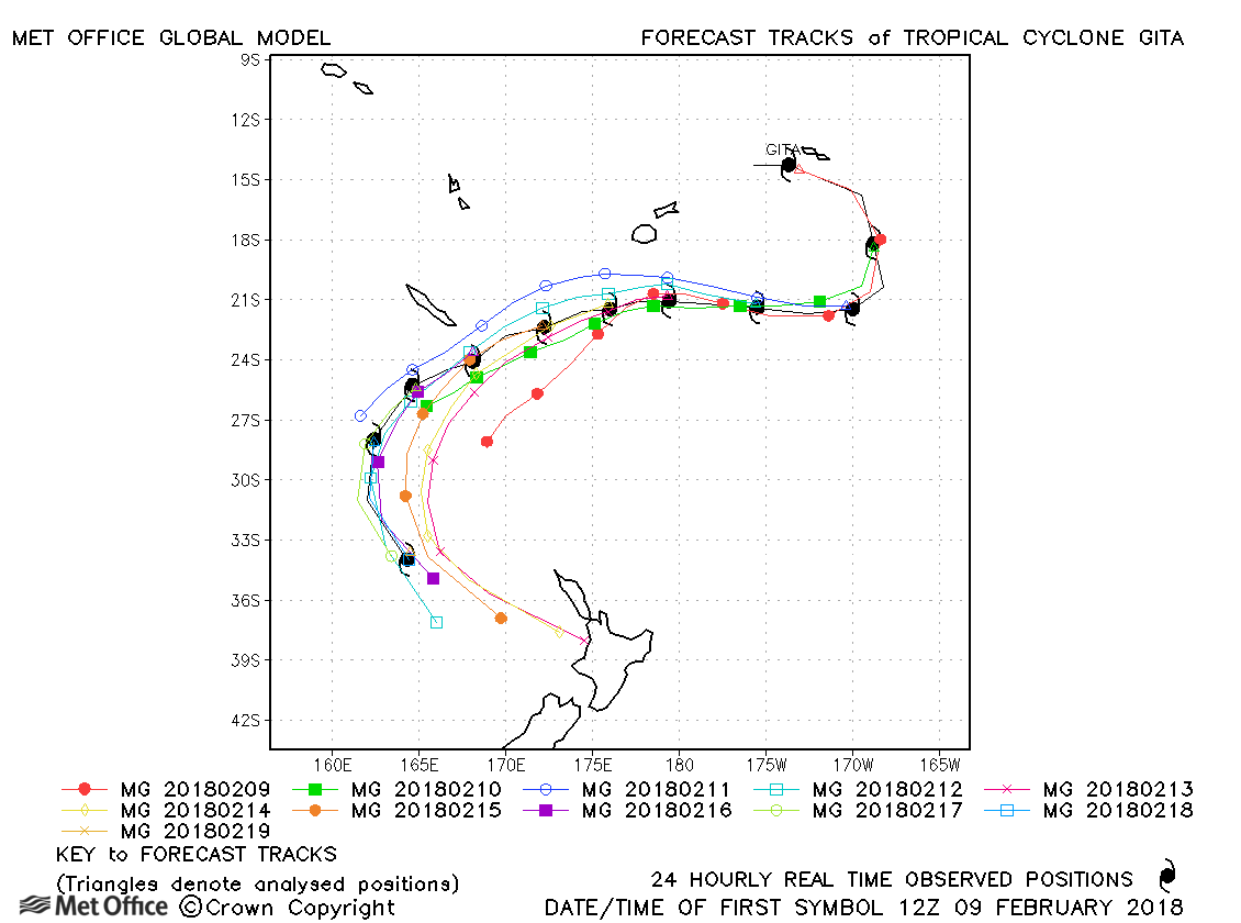
| Gita (09P) | 08-19 February | 927 mb, 125/105 knots | Track forecast errors were below last season's average with the turns in the track of Gita generally well predicted. |
| Hola (12P) | 06-11 March | 952 mb, 95/90 knots | Track forecast errors were a little high at short lead times, but low at longer lead times. |
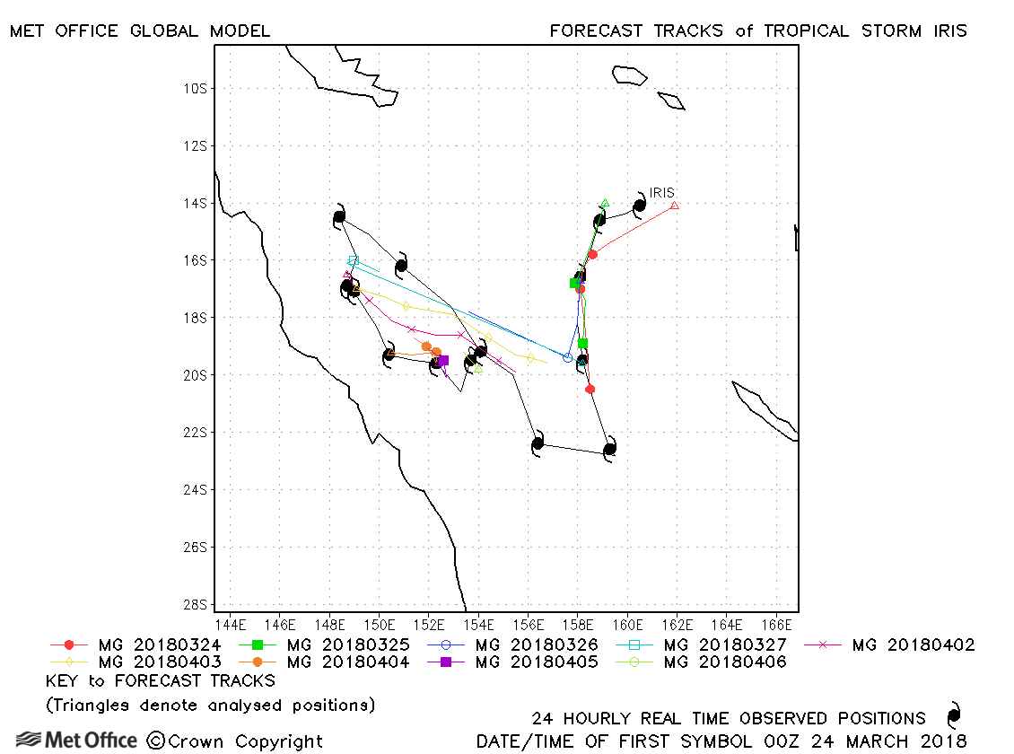
| Iris (17P) | 23 March-06 April | 987 mb, 55/45 knots | Iris has a meandering track and fell below tropical storm strength for a period in its lifetime. Track forecast errors were below last season's average. |
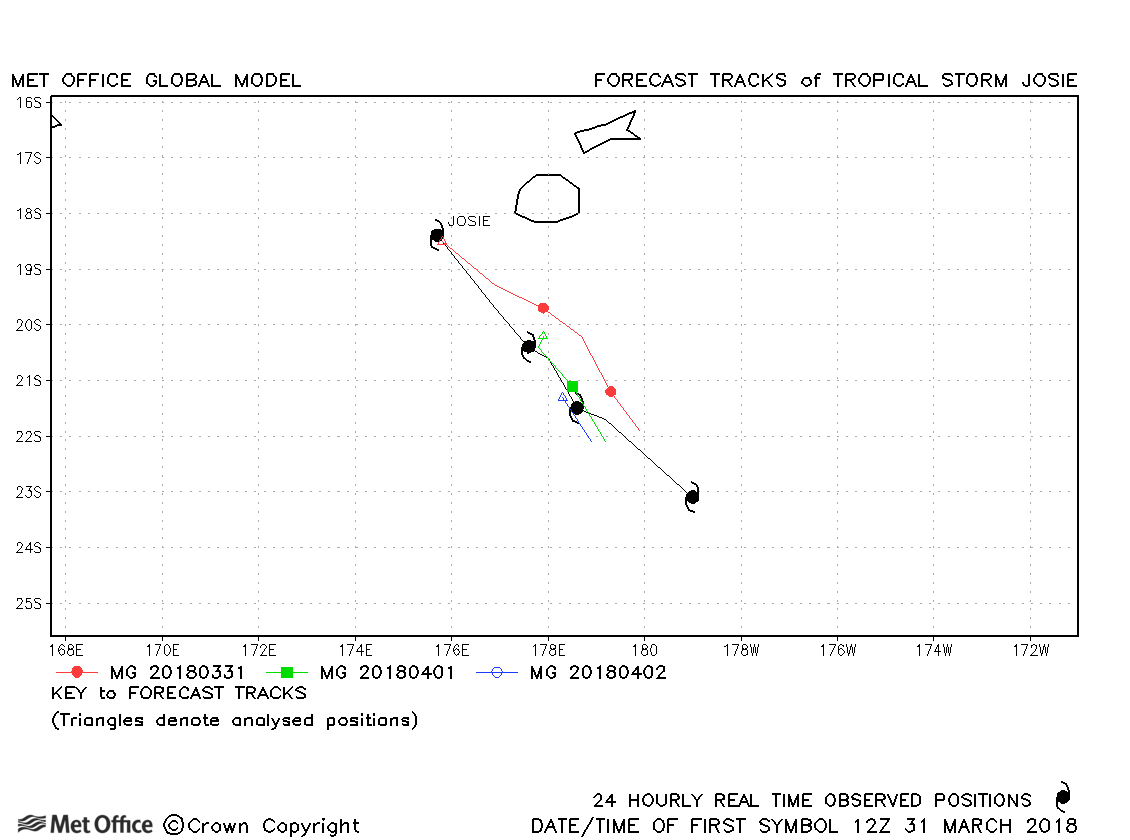
| Josie (18P) | 31 March-03 April | 993 mb, 45/35 knots | Track forecasts were consistently below last season's average. |
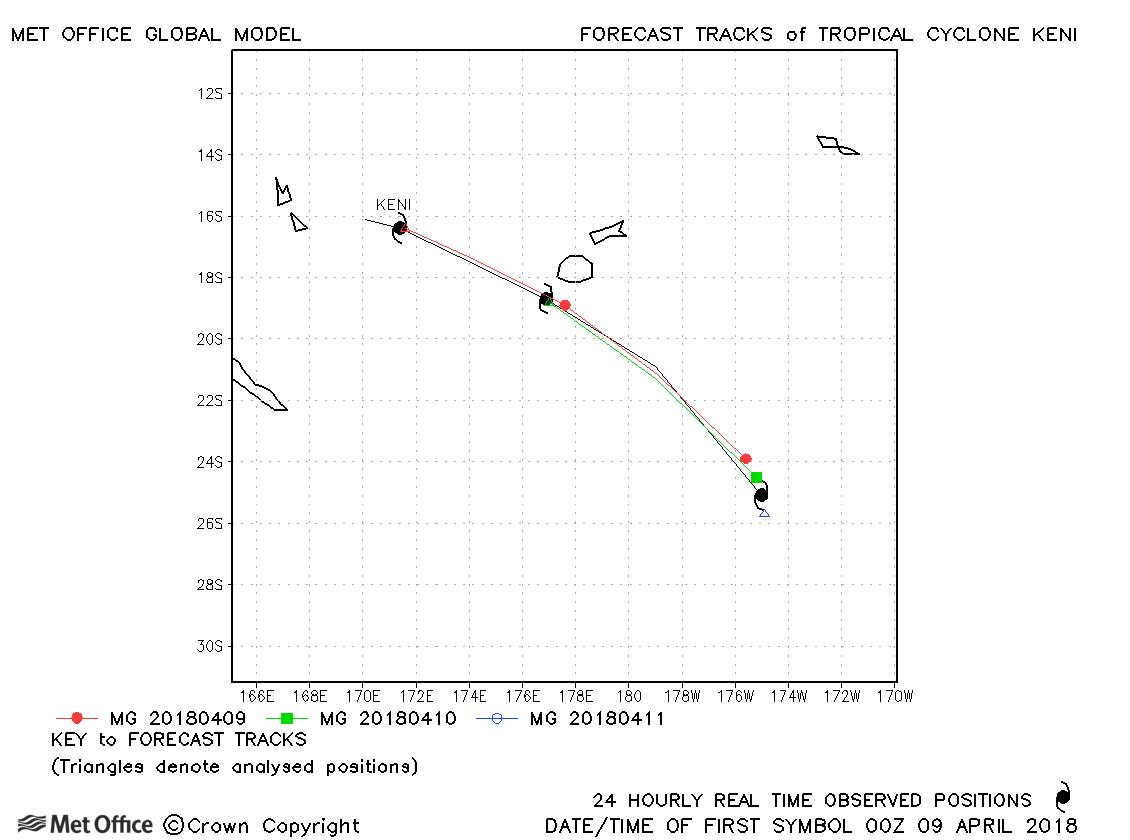
| Keni (19P) | 08-11 April | 970 mb, 85/75 knots | Track forecasts for Keni were very good. |
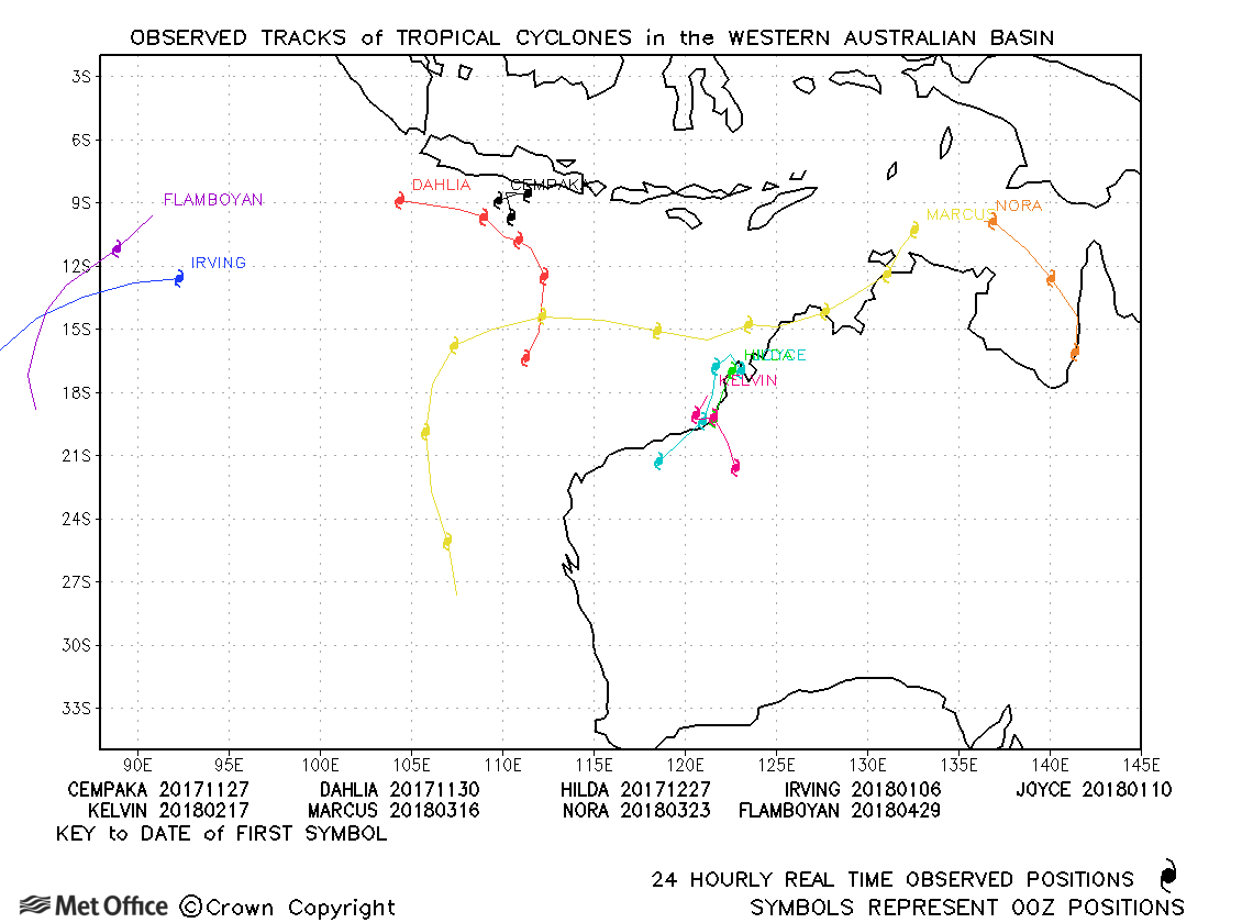
Western Australian observed tracks in 2017-18
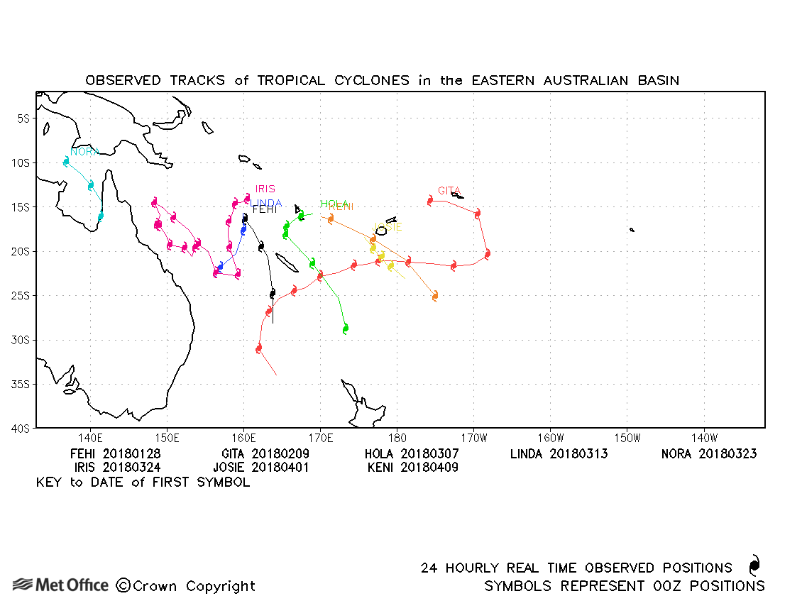
Eastern Australian observed tracks in 2017-18
| Name & ID | Start & end dates | Central pressure, 1-/10-minute MSW | Comments on Met Office global model forecasts |
|---|---|---|---|
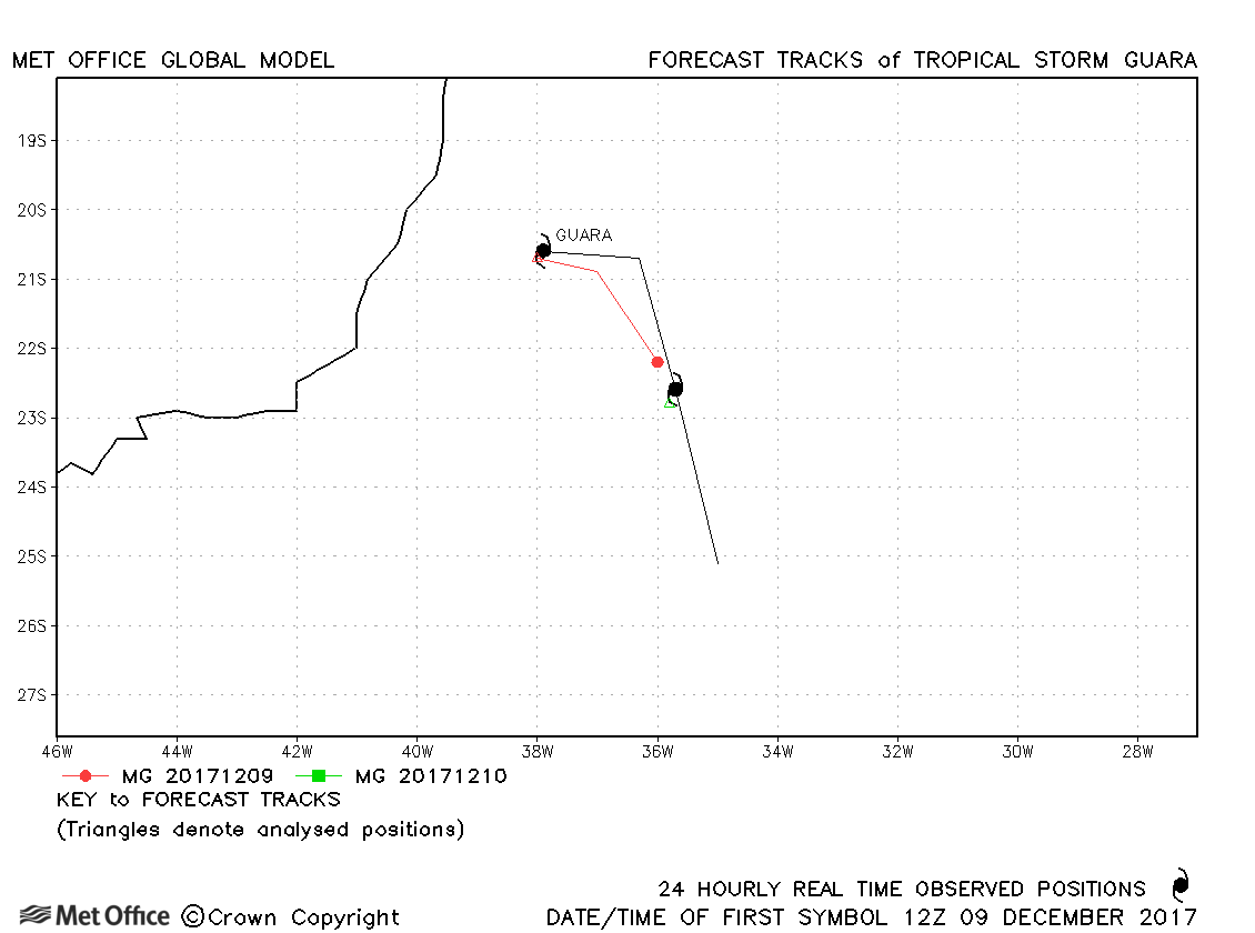
| 09-11 December | 998 mb, -/40 knots |
Guara was a short-lived subtropical storm. |
South Atlantic observed tracks in 2017-18
Note on estimated wind speeds
1-minute MSW: Maximum sustained wind (knots) averaged over one minute (JTWC Hawaii)
10-minute MSW: Maximum sustained wind (knots) averaged over 10 minutes (Southern Hemisphere RSMCs and TCWCs)
Note: Although 1-minute average winds should be stronger than 10-minute average, this may not be the case here since estimates are obtained from different warning centres.

