

Observed and forecast tracks: northern hemisphere 2017
All tropical cyclones in the northern hemisphere season in 2017 are listed below including details of their start and end dates, lowest central pressure and maximum sustained wind (MSW).
Click on the name of the tropical cyclone to see a chart of the observed track and forecast tracks from the Met Office global model. Verification statistics on each tropical cyclone are available upon request from [email protected]. At the end of the season a verification report on the performance of the Met Office global model will be published.
| Name & ID | Start & end dates | Central pressure, 1-/10-minute MSW | Comments on Met Office global model forecasts |
|---|---|---|---|
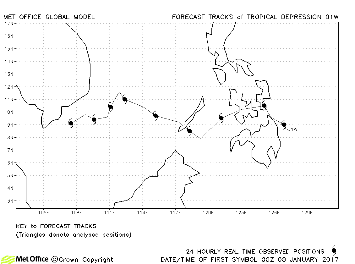
| 01W | 07-16 January | 1000 mb, 30/- knots | 01W did not reach tropical storm status and no forecasts were verified. |
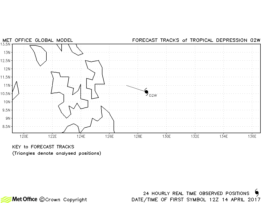
| 02W | 14-15 April | 1005 mb, 30/30 knots | No forecast verified for this tropical depression. |
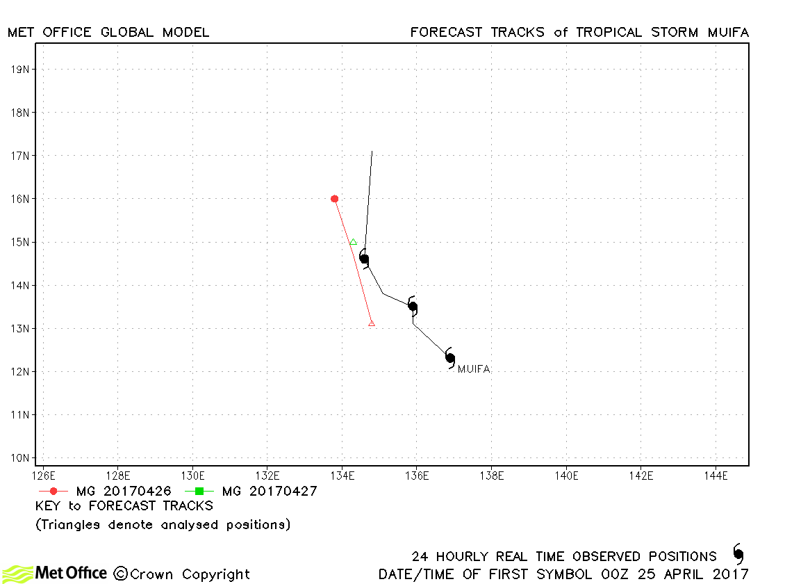
| Muifa (03W) | 24-27 April | 1002 mb, 40/35 knots | Track forecast errors were above last season's average for this short-lived storm. |
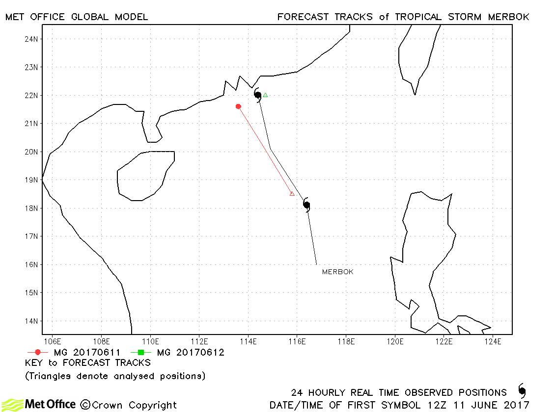
| Merbok (04W) | 11-12 June | 990 mb, 45/50 knots | Merbok was short-lived and track forecast errors were near to last season's average. |
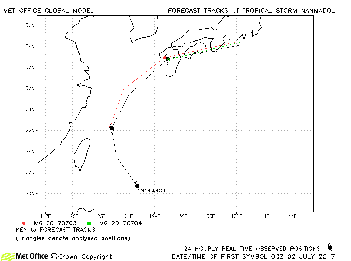
| Nanmadol (05W) | 02-04 July | 985 mb, 60/55 knots | Track forecast errors were near last season's average. |
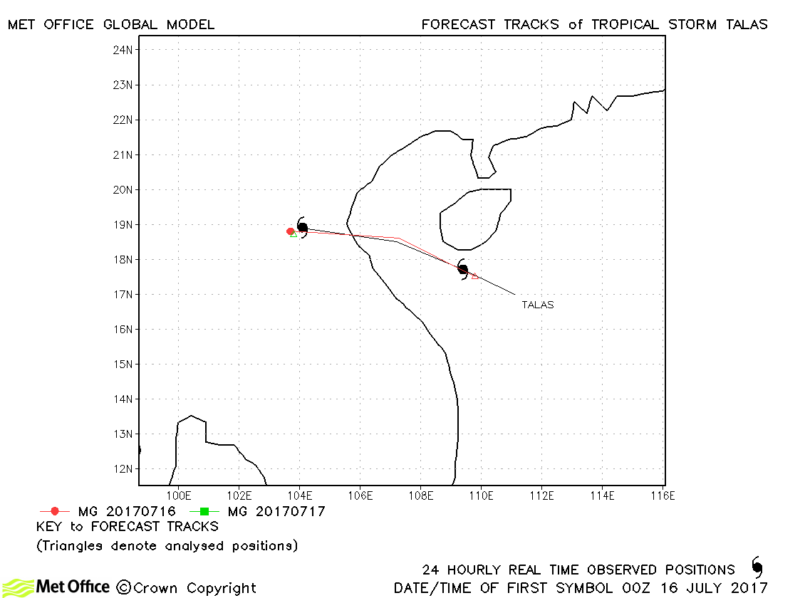
| Talas (06W) | 15-17 July | 990 mb, 50/50 knots | Talas was short-lived and track errors were below last season's average. |
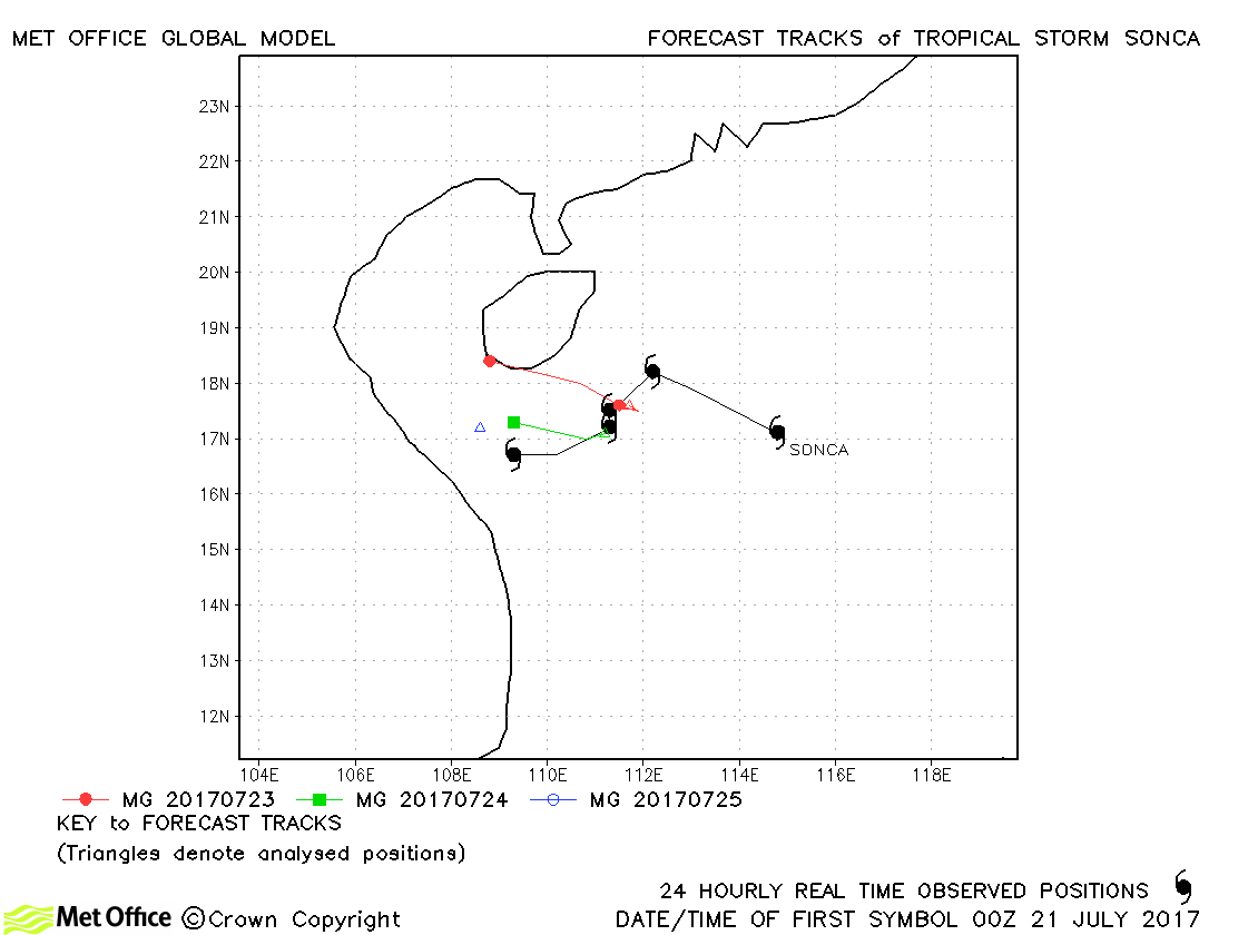
| Sonca (08W) | 21-25 July | 994 mb, 45/35 knots | Track forecast errors were mixed for this storm. |
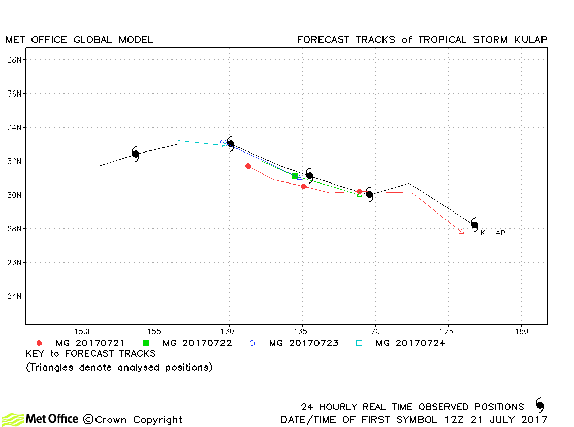
| Kulap (09W) | 21-26 July | 997 mb, 50/40 knots | Track forecast errors were mostly below last season's average for this storm. |
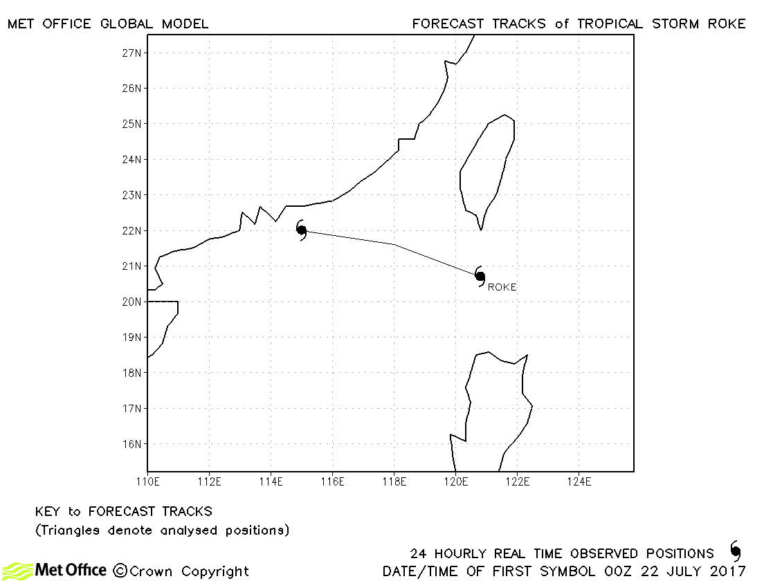
| Roke (10W) | 21-23 July | 1002 mb, 35/35 knots | Roke was briefly a tropical storm and no forecasts were verified. |
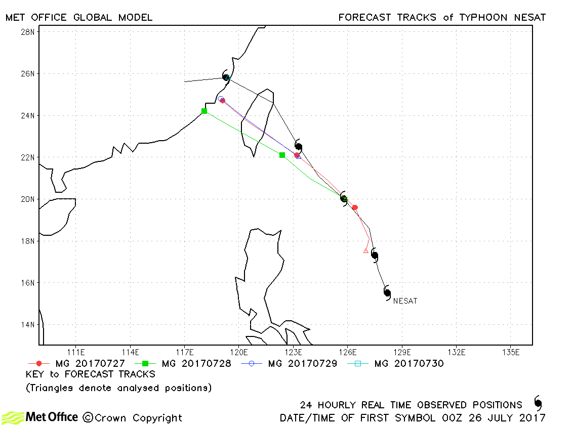
| Nesat (11W) | 26-30 July | 960 mb, 80/80 knots | Track forecast errors were a little above last season's average at short lead times. Errors were below average at longer lead times. |
| Haitang (12W) | 28-31 July | 960 mb, 80/80 knots | Track forecast errors were near to last season's average. |
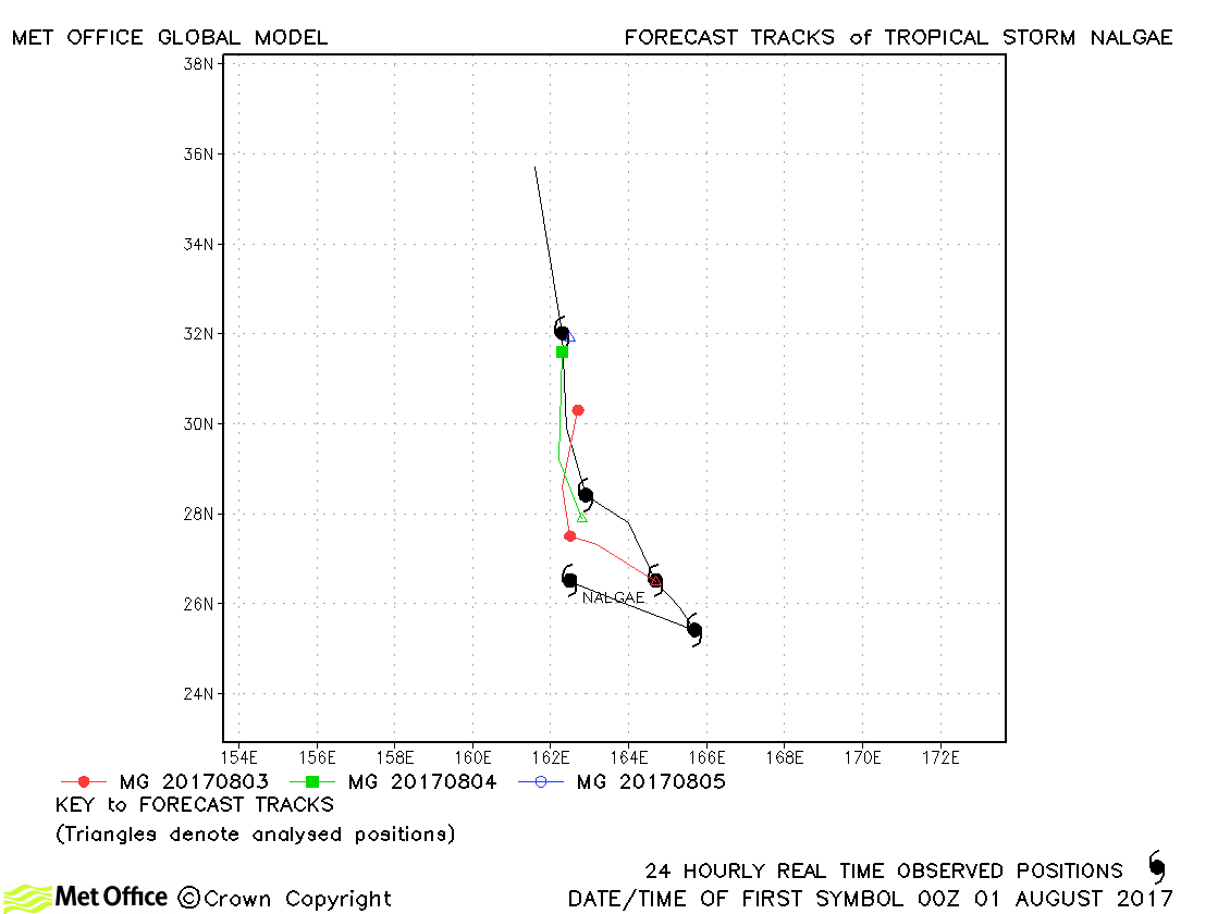
| Nalgae (13W) | 01-05 August | 990 mb, 40/45 knots | Track errors were a little above last season's average. |
| Banyan (14W) | 11-17 August | 970 mb, 90/75 knots | Track forecast errors were low for this typhoon. |
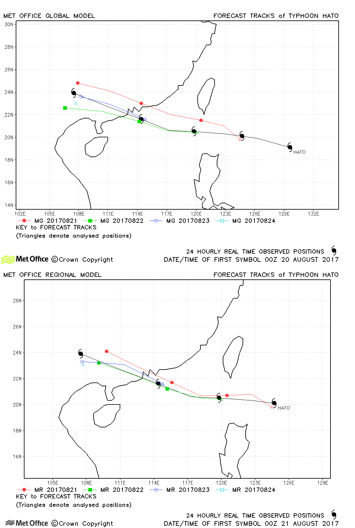
| Hato (15W) | 20-24 August | 960 mb, 90/60 knots | Track forecast errors were near or below average for this typhoon. |
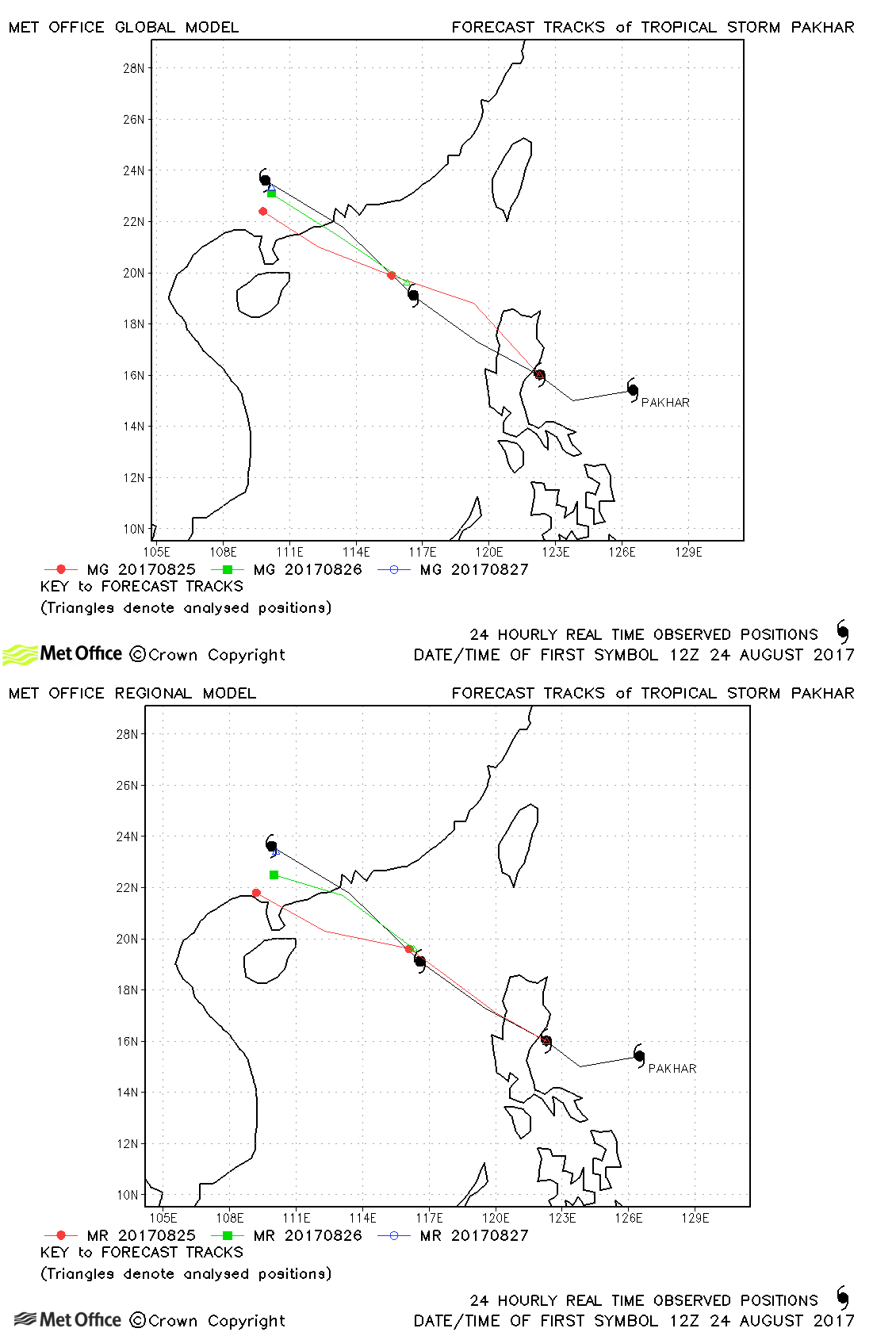
| Pakhar (16W) | 24-27 August | 985 mb, 55/55 knots | Landfall of Pakhar was predicted a couple of days in advance. |
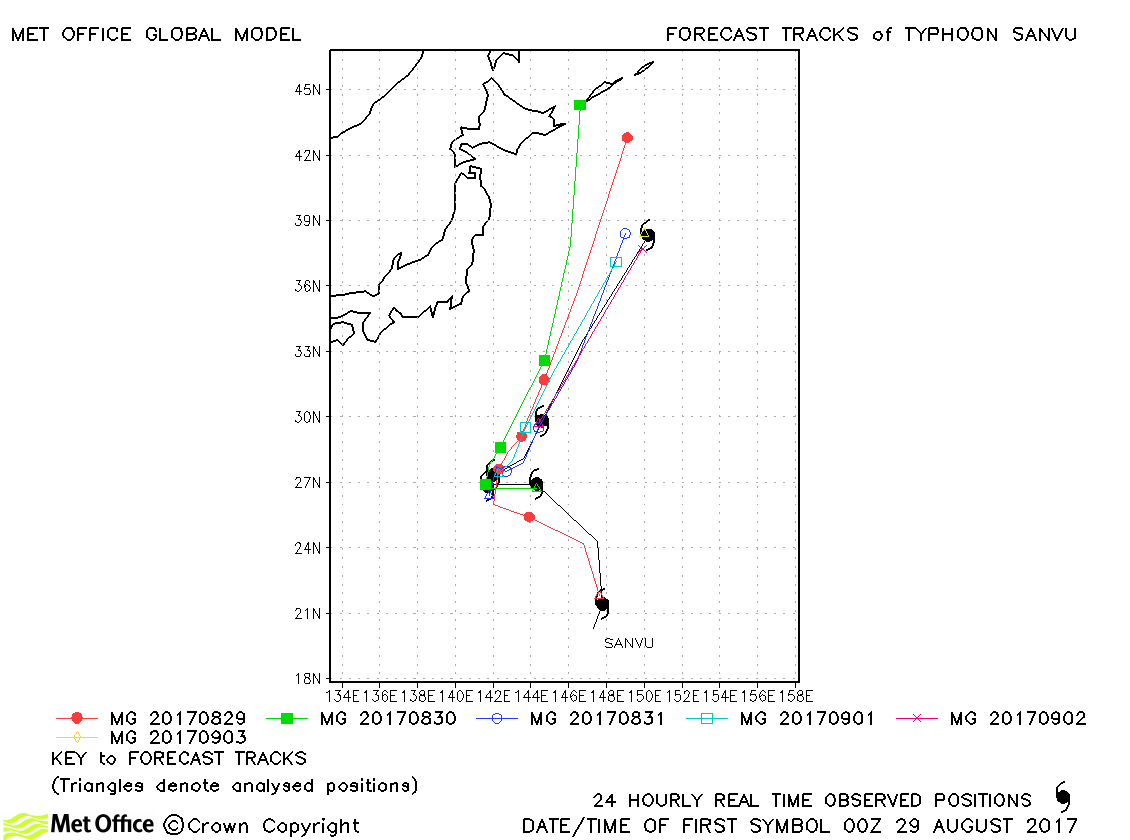
| Sanvu (17W) | 28 August-03 September | 955 mb, 90/80 knots | Track forecast errors were near average at short lead times, but above average at longer lead times. |
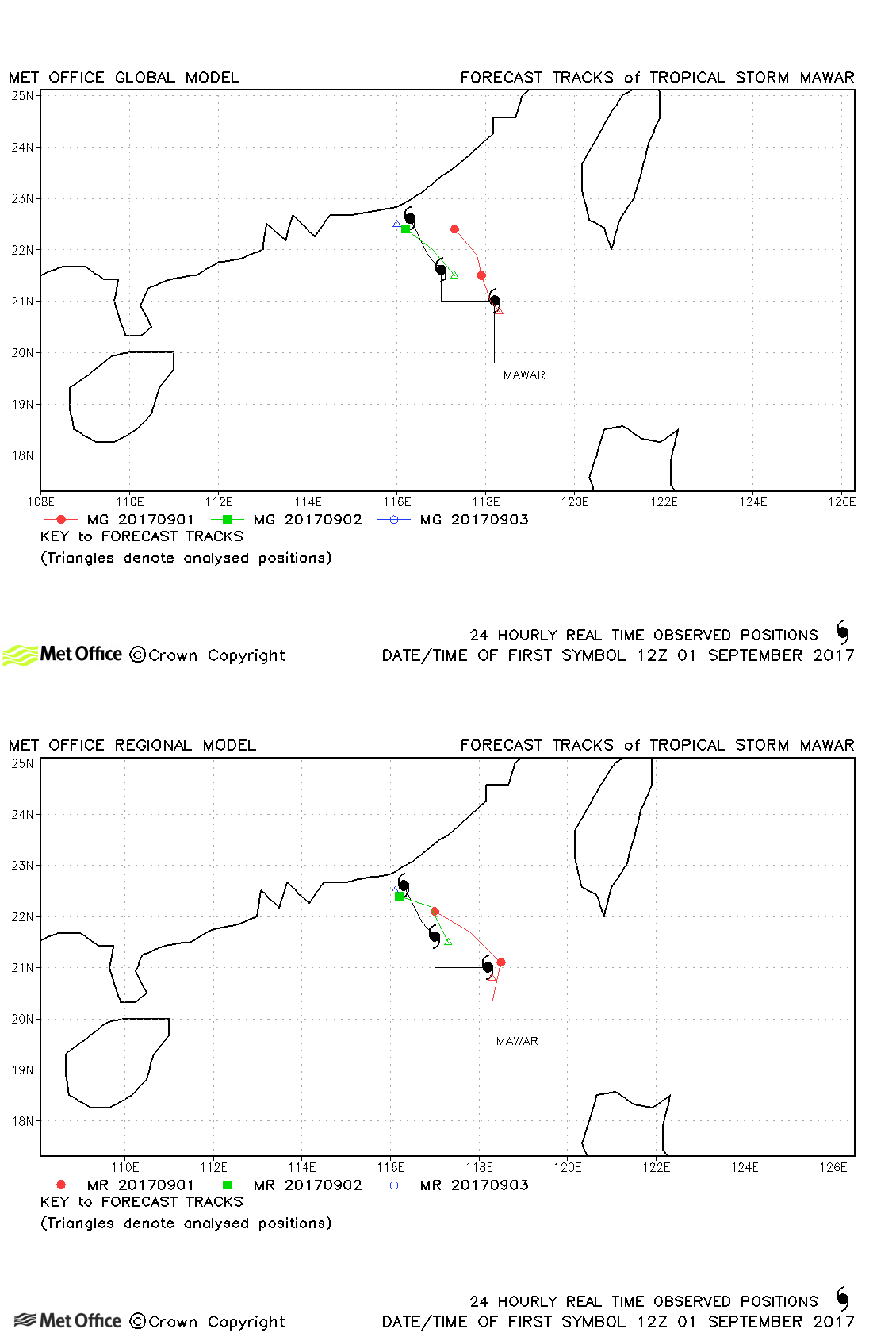
| Mawar (18W) | 31 August-03 September | 990 mb, 45/50 knots | Track forecast errors were low. |
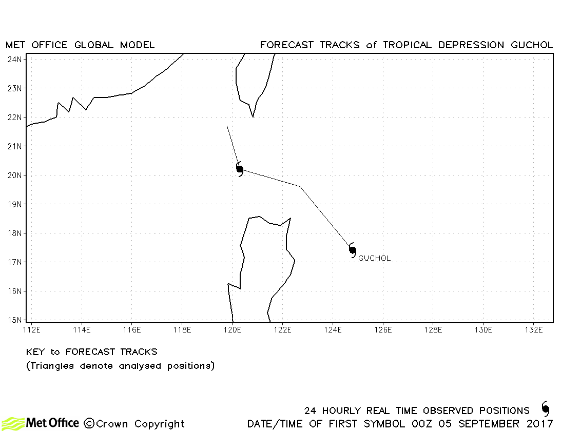
| Guchol (19W) | 04-06 September | 1000 mb, 30/35 knots | Guchol only briefly became a tropical storm according to JMA. |
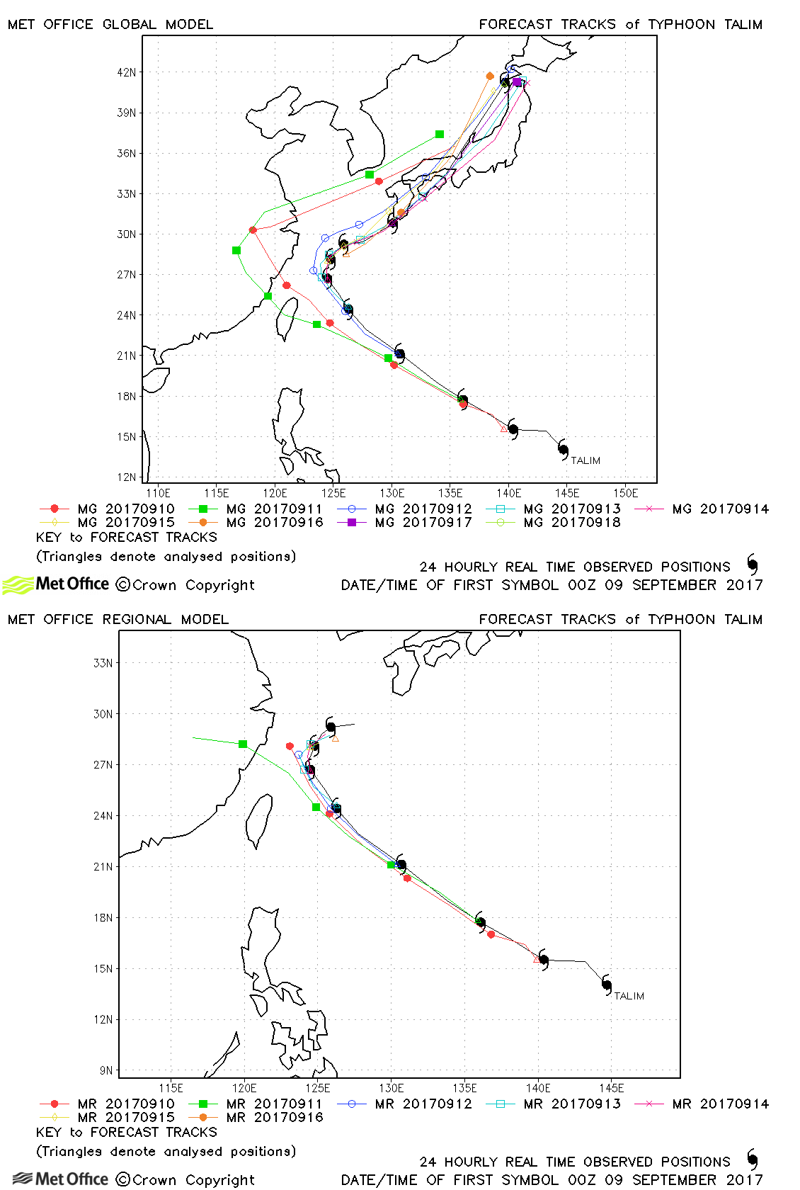
| Talim (20W) | 08-18 September | 935 mb, 120/95 knots | Track forecast errors were mostly above last season's average due to a left-of-track bias in some early forecasts. |
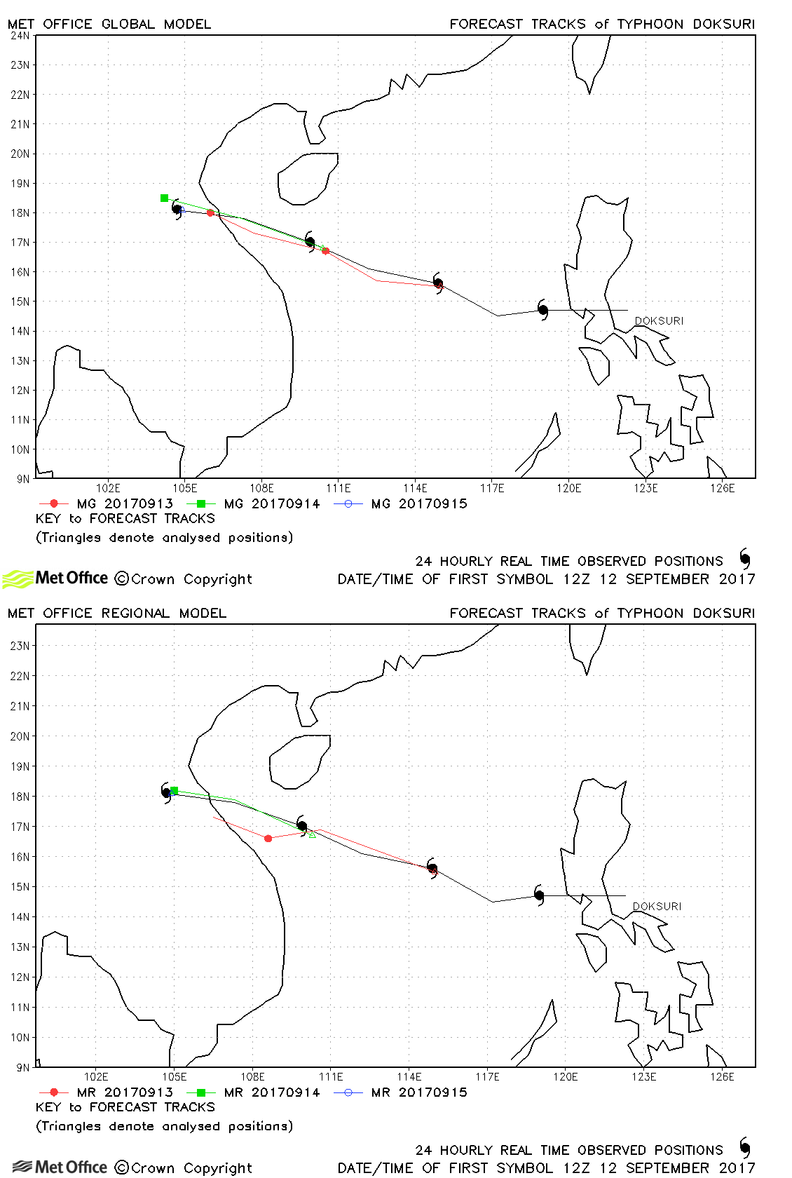
| Doksuri (21W) | 11-15 September | 955 mb, 100/80 knots | Track forecast errors were near to or below average for this storm. |
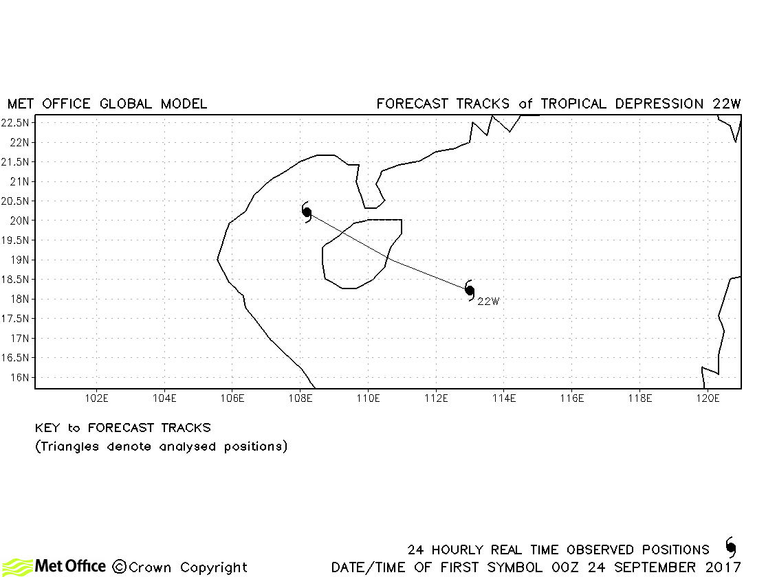
| 22W | 23-25 September | 1001 mb, 30/30 knots | No forecasts verified as this depression did not achieve tropical storm status. |
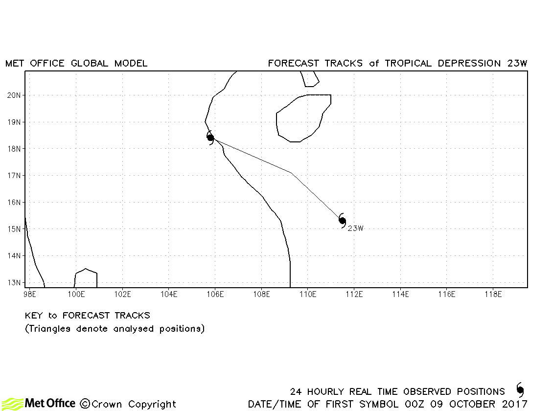
| 23W | 08-10 October | 1000 mb, 30/30 knots | No forecasts were verified for this depression. |
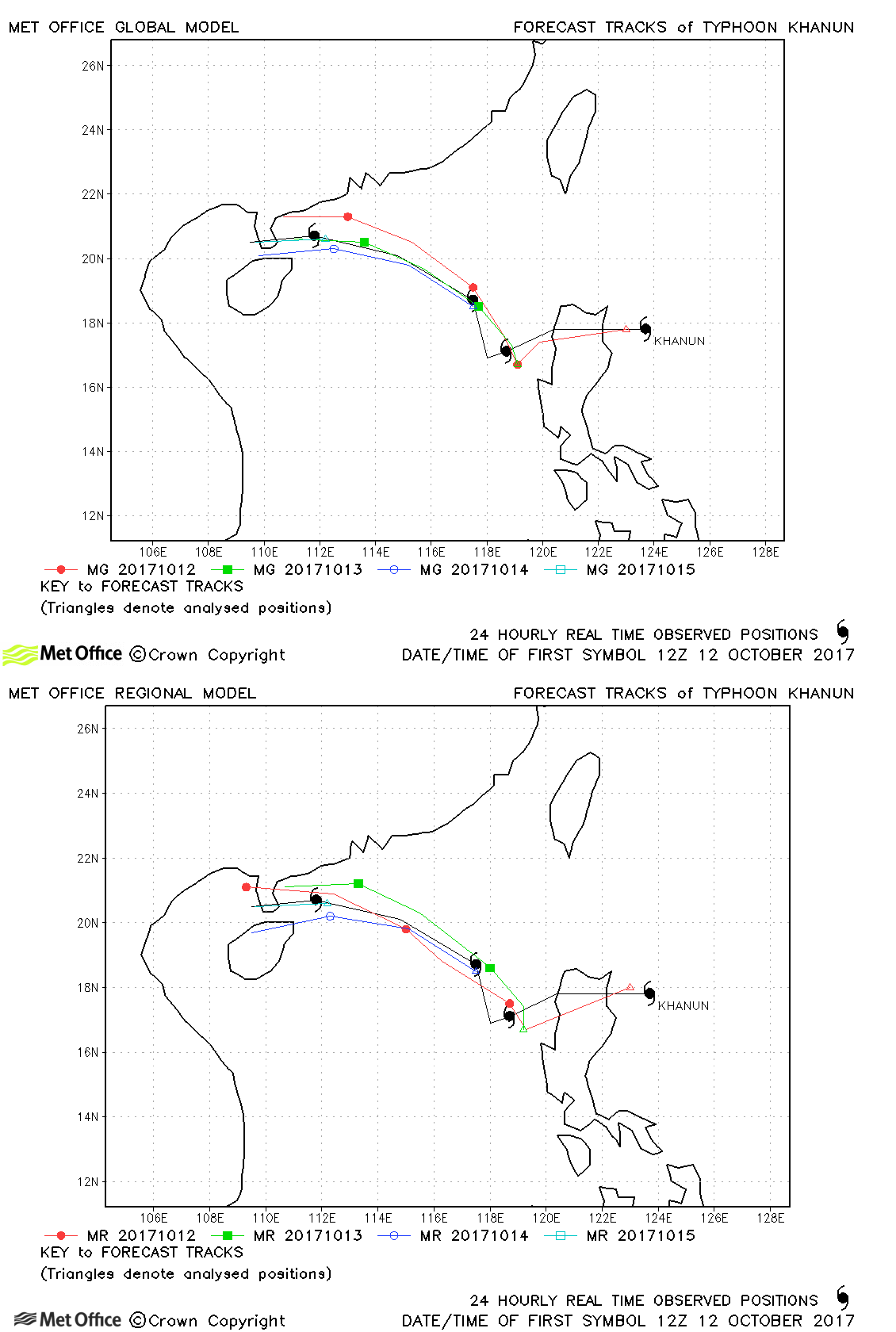
| Khanun (24W) | 12-16 October | 960 mb, 90/80 knots | Track forecast errors were low and skill scores high for this typhoon. Landfall predictions were good. |
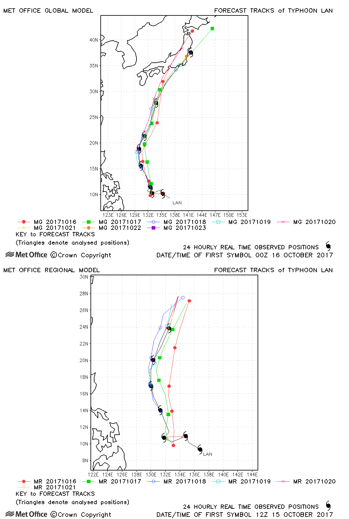
| Lan (25W) | 15-23 October | 925 mb, 135/95 knots | The track of Typhoon Lan was well predicted. Positional errors were low and skill scores high. Landfall over Japan was predicted over six days in advance. |
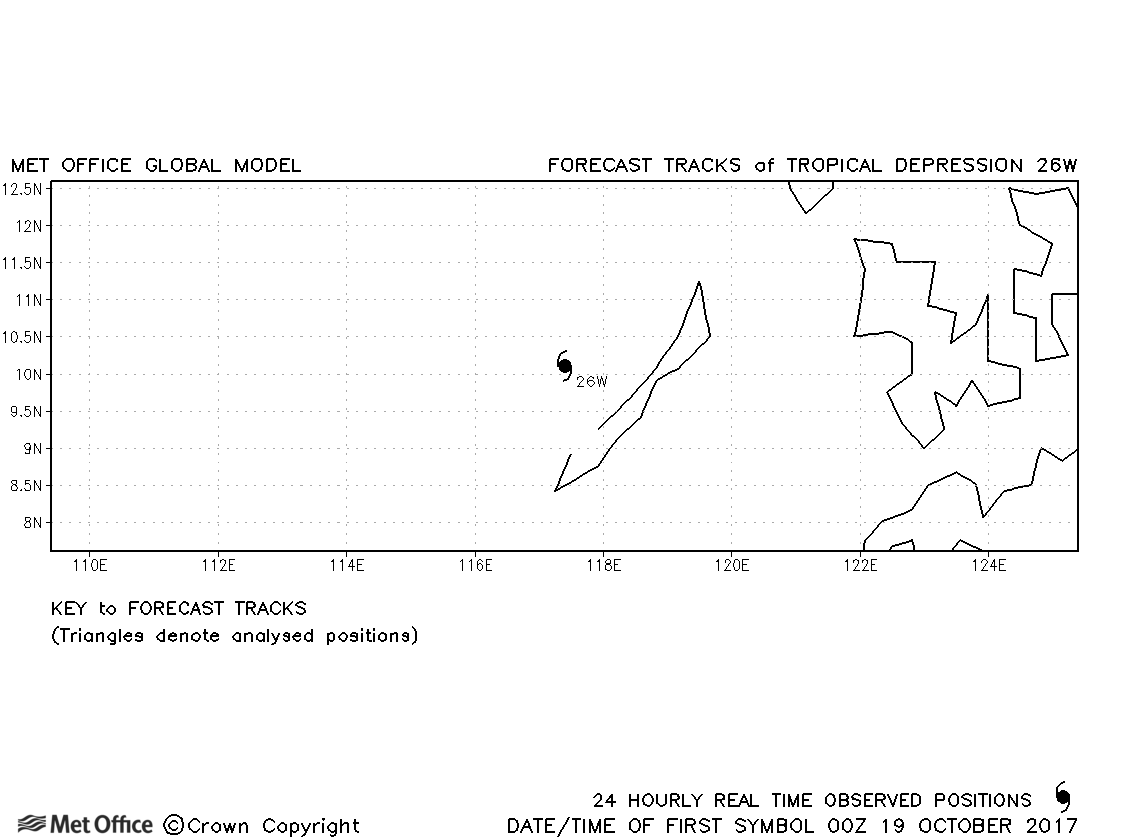
| 26W | 18-19 October | 1002 mb, 30/- knots | No forecasts were verified for this depression. |
| Saola (27W) | 19-29 October | 975 mb, 75/60 knots | Early forecasts had a irght-of-track bias resulting in track forecast errors above last season's average. However, later forecast predicted the recurvature and extratropical transition well. |
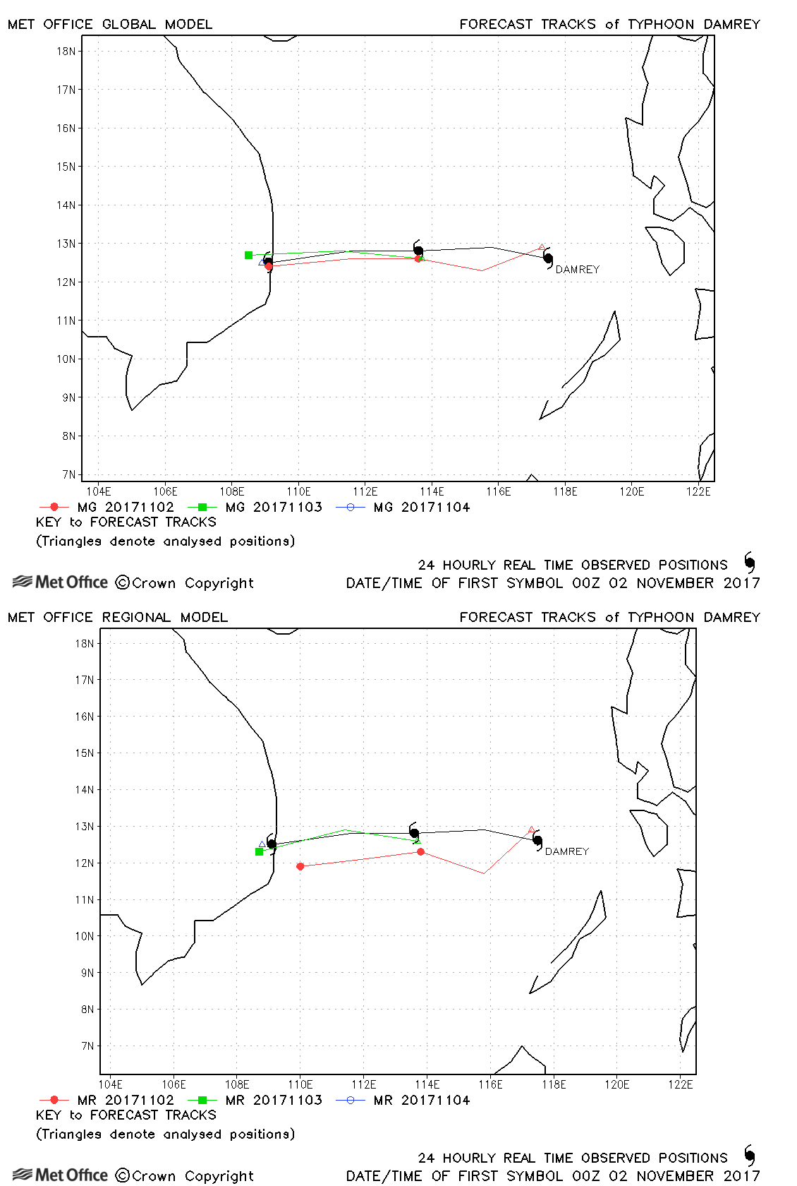
| Damrey (28W) | 01-04 November | 970 mb, 90/70 knots | Track forecast errors were low for this storm. |
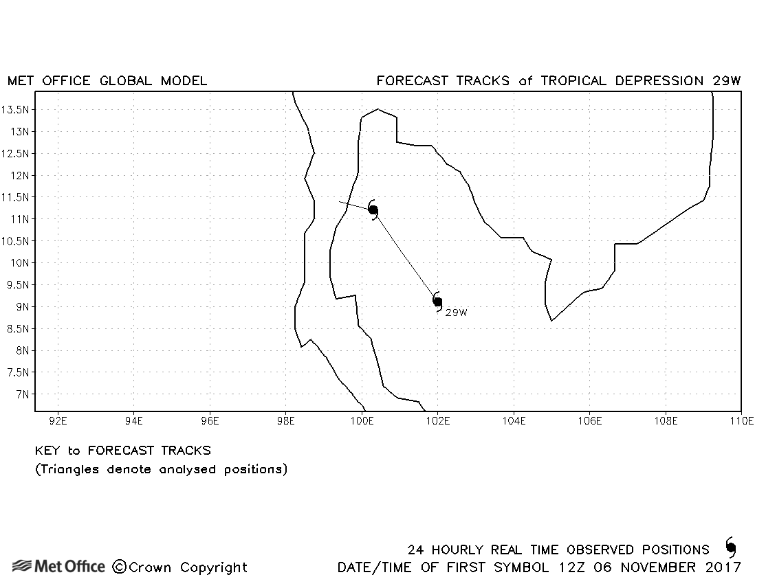
| 29W | 06-08 November | 1004 mb, 30/- knots | No forecasts verified for this depression. |
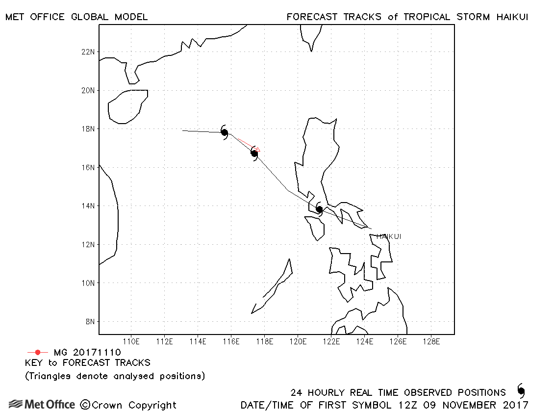
| Haikui (30W) | 09-12 November | 998 mb, 45/40 knots | Only one forecast was verified for this short-lived storm. |
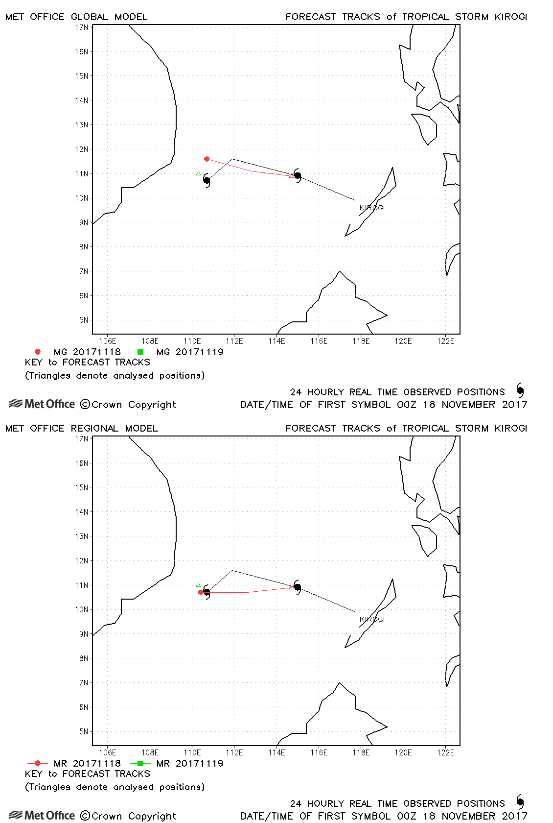
| Kirogi (31W) | 17-19 November | 1000 mb, 40/35 knots | Track forecast errors were near average. |
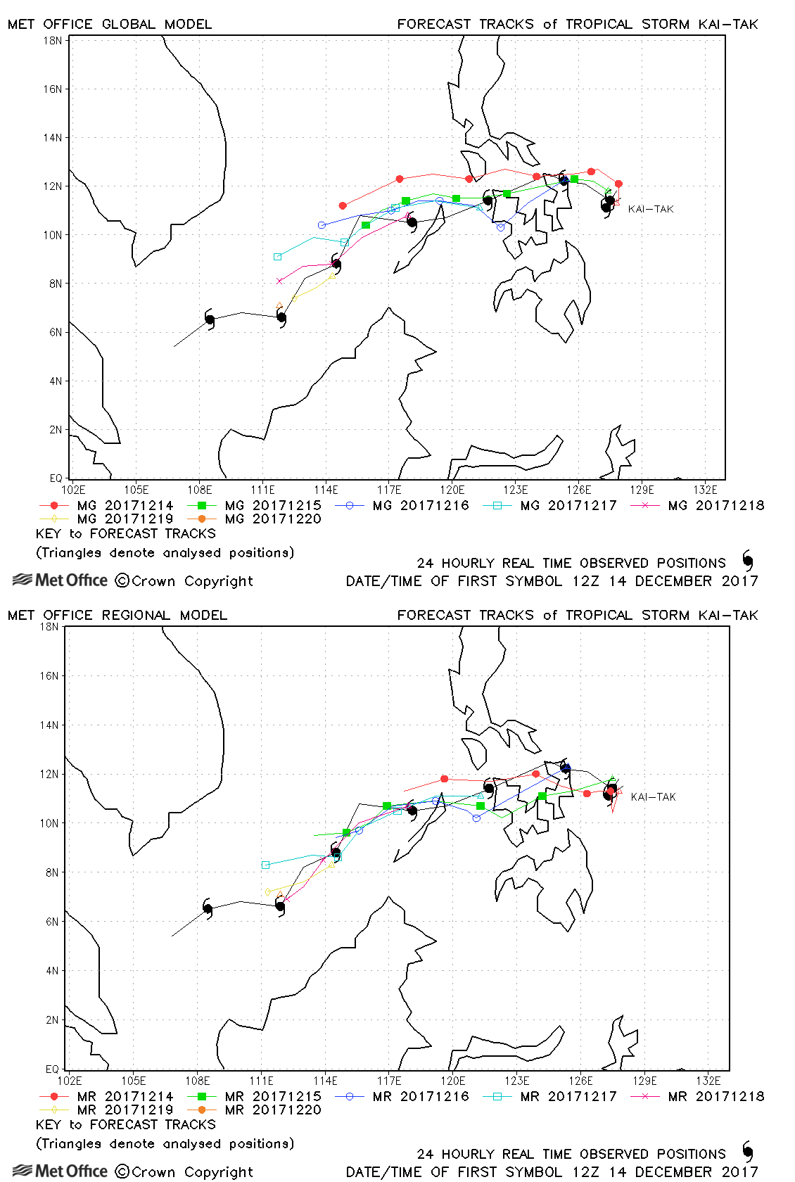
| Kai-tak (32W) | 13-21 December | 996 mb, 50/40 knots | Track forecast errors were a little above last season's average. |
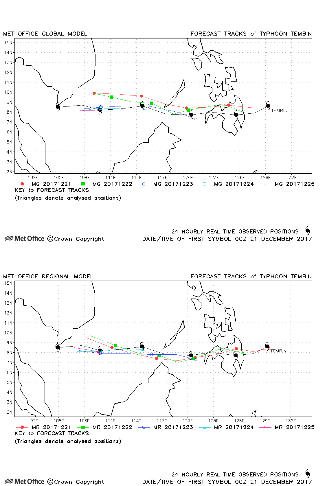
| Tembin (33W) | 20-26 December | 975 mb, 80/70 knots | Track forecast errors were below last season's average for this storm. |
North-west observed tracks in 2017
| Name & ID | Start & end dates | Central pressure, 1-minute MSW | Comments on Met Office global model forecasts |
|---|---|---|---|
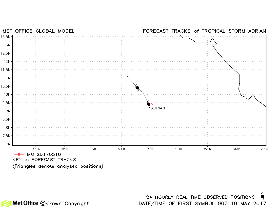
| Adrian (01E) | 09-11 May | 1004 mb, 40 knots | Adrian was only briefly a tropical storm and no forecasts were verified. The formation of this early season storm was well predicted. |
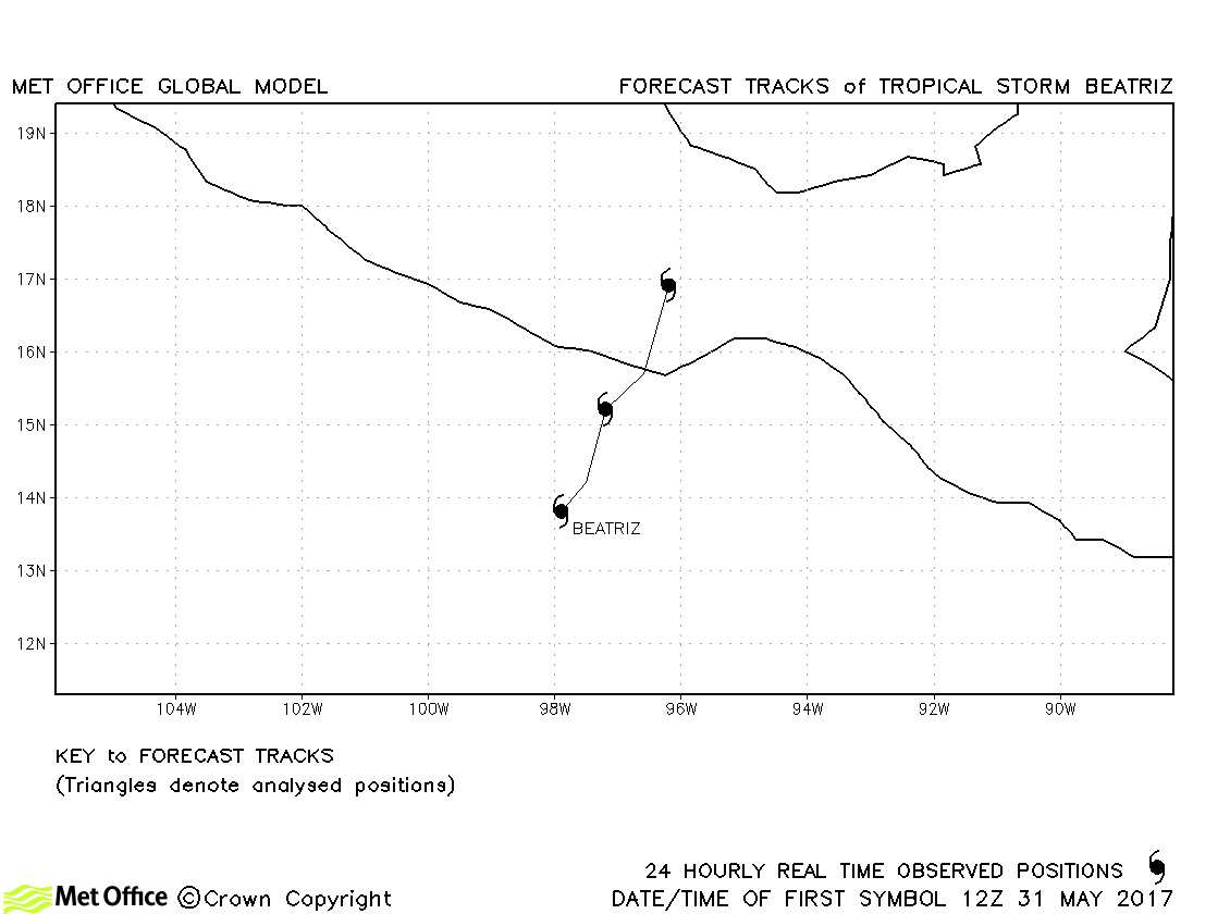
| Beatriz (02E) | 31 May-02 June | 1002 mb, 40 knots | Beatriz was only briefly a tropical storm and no forecasts were verified. |
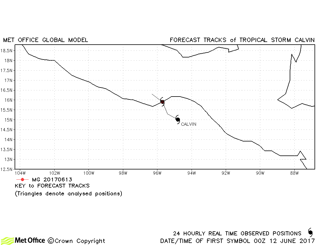
| Calvin (03E) | 11-13 June | 1005 mb, 35 knots | Calvin was only briefly a tropical storm and no forecasts were verified. |
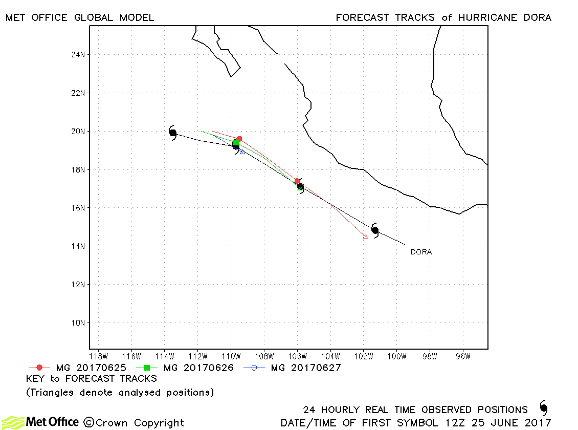
| Dora (04E) | 23-28 June | 981 mb, 80 knots | Track forecast errors were low compared to last season's average. |
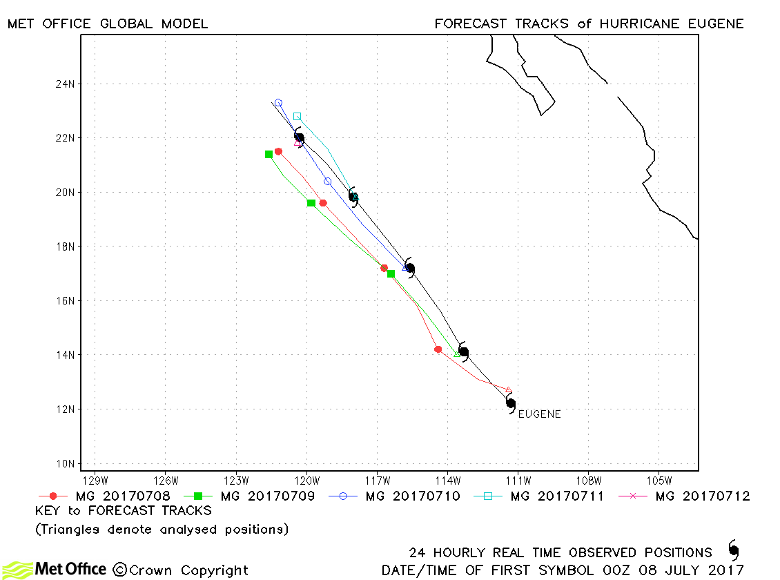
| Eugene (05E) | 07-12 July | 965 mb, 100 knots | Track forecast errors were above last season's average at short lead times. Errors were below average at longer lead times. |
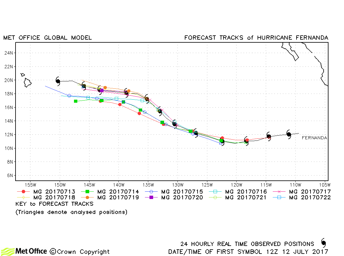
| Fernanda (06E) | 12-23 July | 948 mb, 125 knots | Track forecast errors were below last season's average at short lead times. Errors were above average at longer lead times. |
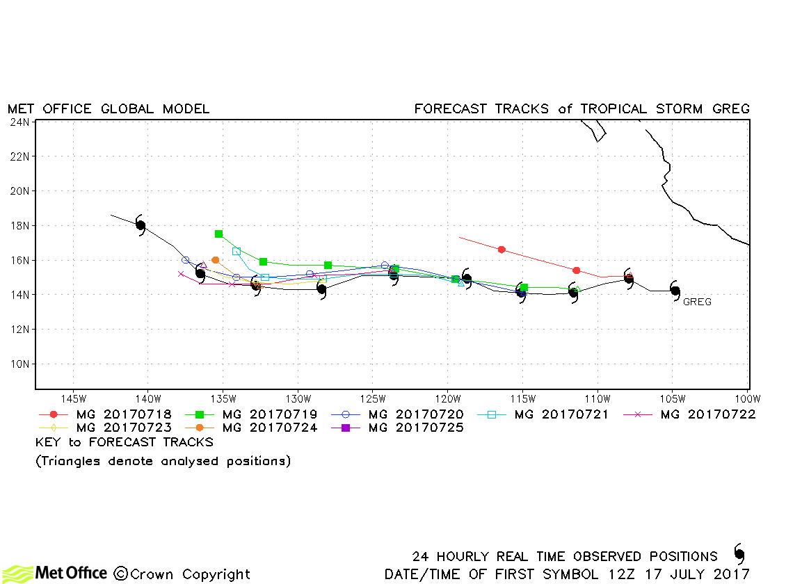
| Greg (07E) | 17-27 July | 1001 mb, 50 knots | Track forecast errors were mostly below last season's average. |
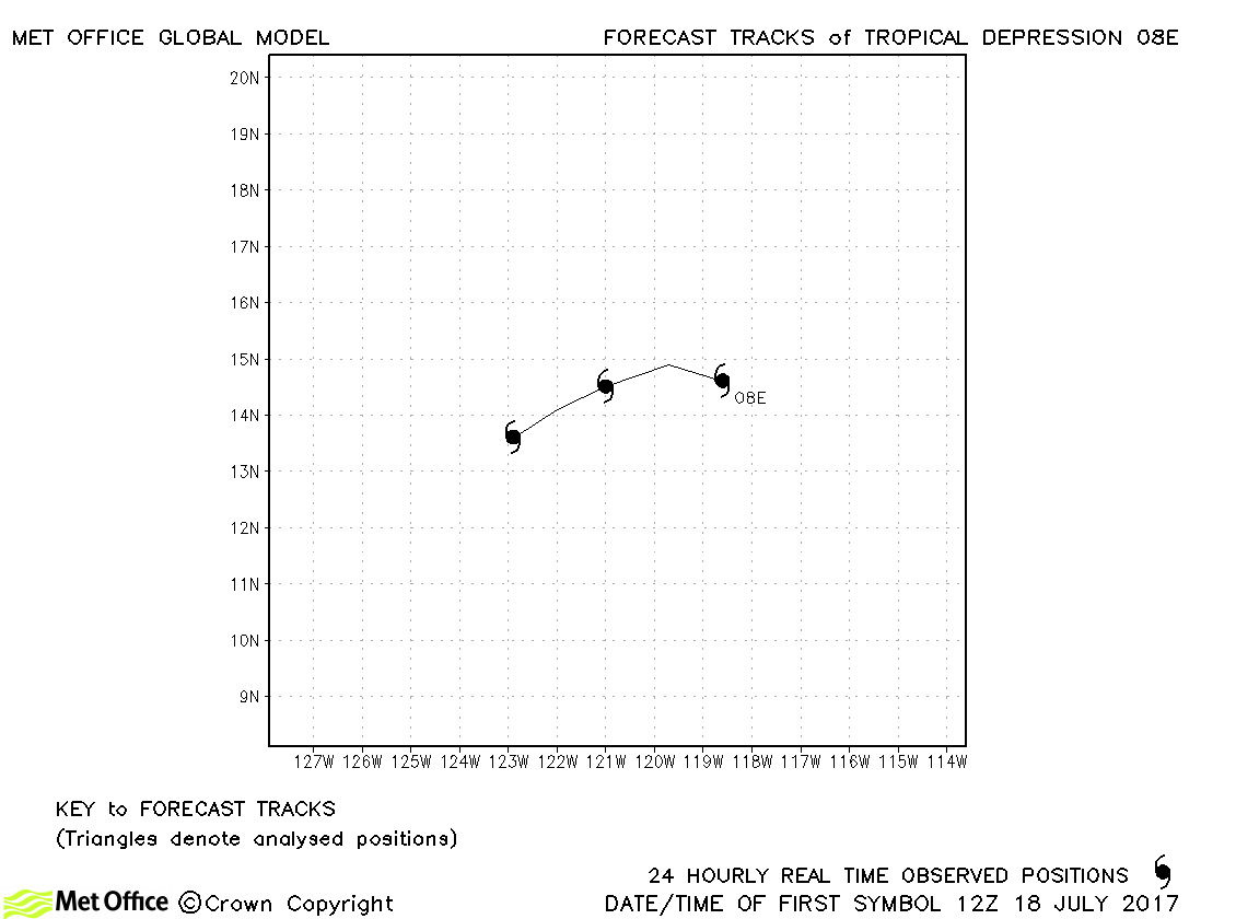
| 08E | 18-20 July | 1007 mb, 30 knots | No forecasts were verified for this tropical depression. |
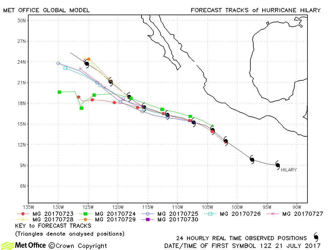
| Hilary (09E) | 21-31 July | 972 mb, 90 knots | Track forecast errors were mostly above last season's average. |
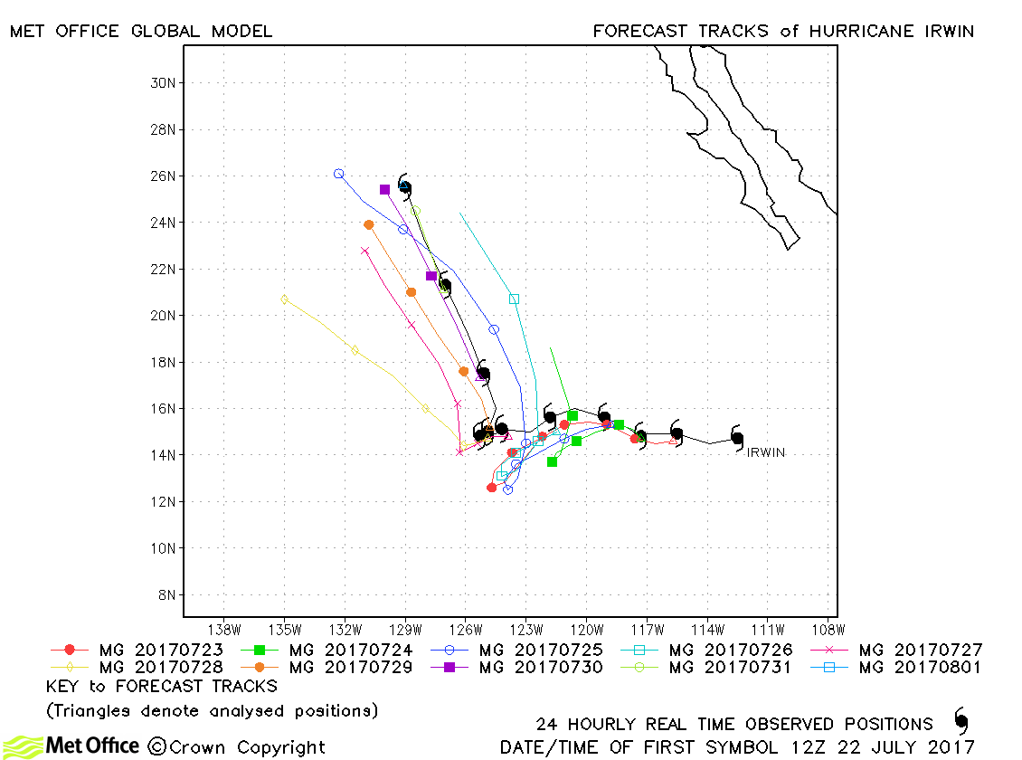
| Irwin (10E) | 22 July-01 August | 980 mb, 80 knots | Track forecast errors were above last season's average, although the sharp right turn by the hurricane was fairly well predicted. |
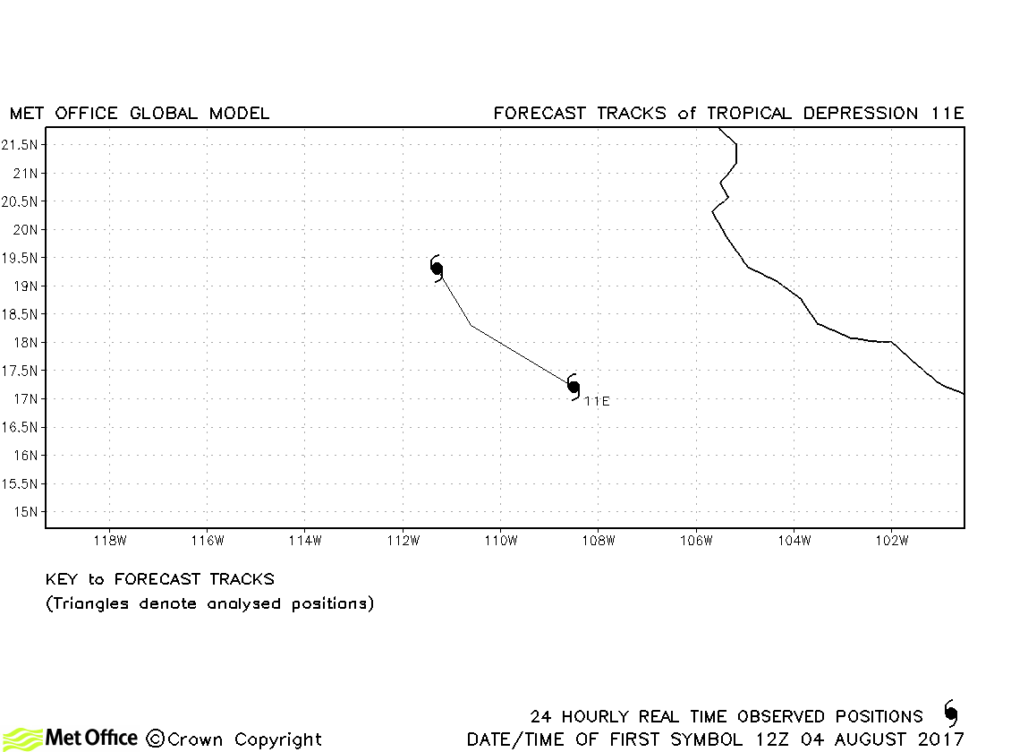
| 11E | 04-05 August | 1004 mb, 30 knots | No forecasts verified for this tropical depression. |
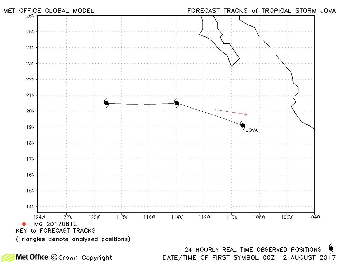
| Jova (12E) | 12-14 August | 1003 mb, 35 knots | Jova was only briefly a tropical storm. |
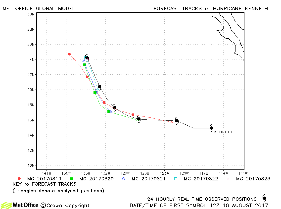
| Kenneth (13E) | 18-23 August | 952 mb, 115 knots | There was a left-of-track bias in forecasts,r esulting in track errors slightly above last season's average. |
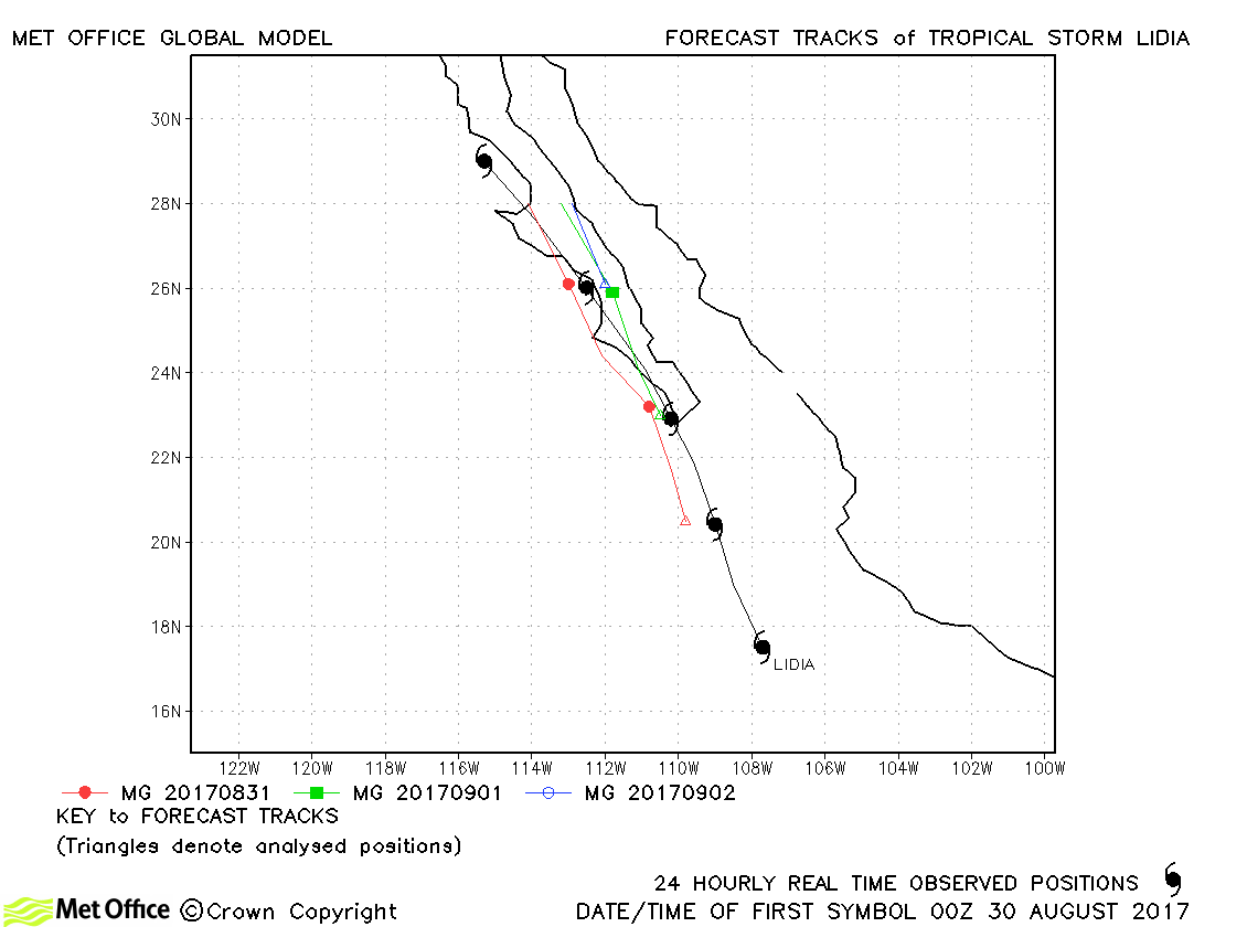
| Lidia (14E) | 29 August-03 September | 987 mb, 60 knots | Track forecast errors were low for this storm. |
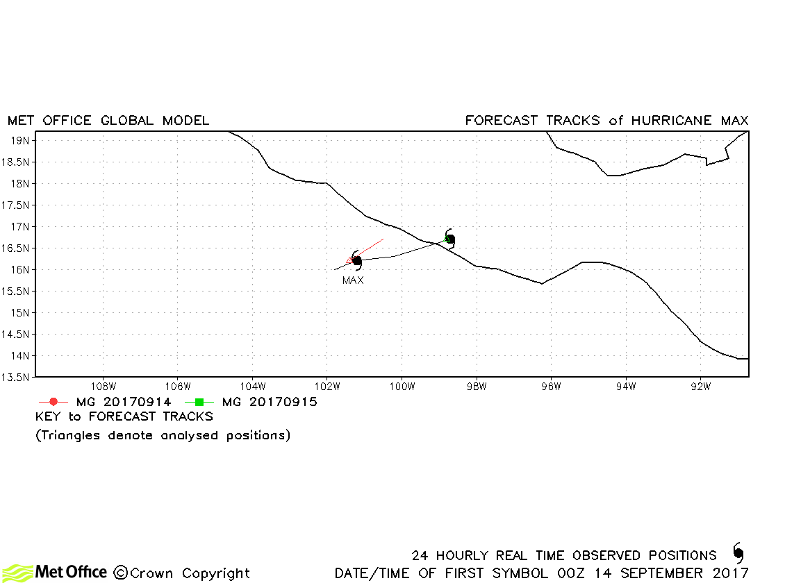
| Max (16E) | 13-15 September | 985 mb, 75 knots | This hurricane span up and made landfall very quickly so few forecasts were verified. |
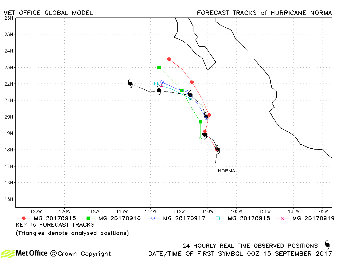
| Norma (17E) | 14-20 September | 987 mb, 65 knots | Track forecast errors were below last season's average for this storm. |
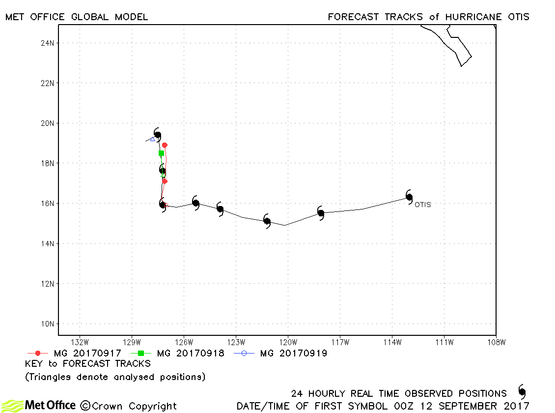
| Otis (15E) | 11-19 September | 965 mb, 100 knots | Otis was a tropical depression for a long time and a tropical storm and hurricane for a short time. Track forecast errors were lower than the recent average. |
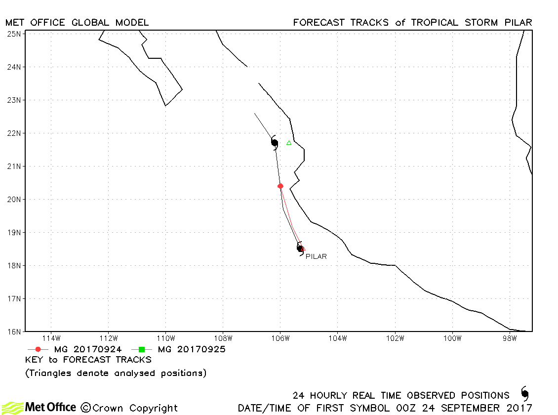
| Pilar (18E) | 23-25 September | 1002 mb, 40 knots | Pilar was only a tropical storm for a day. There was a slow bias in forecasts. |
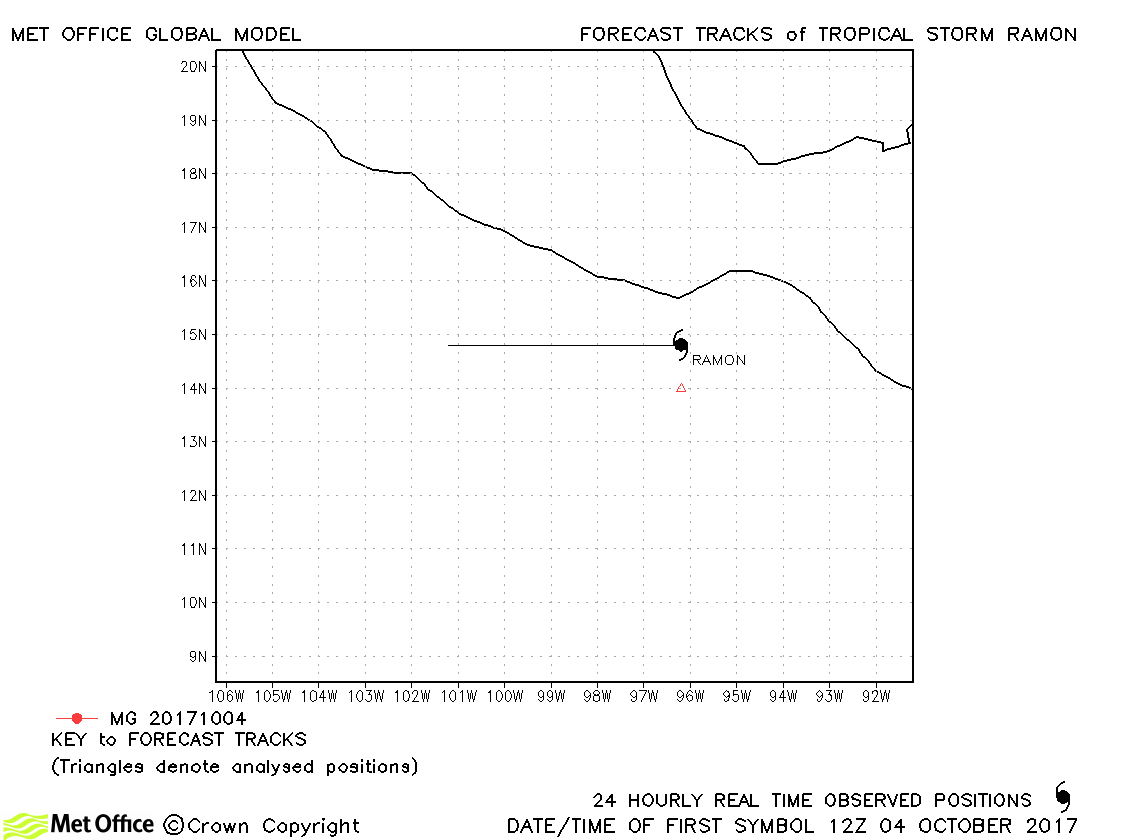
| Ramon (19E) | 04-05 October | 1002 mb, 40 knots | Ramon was only briefly a tropical storm and no forecasts were verified. |
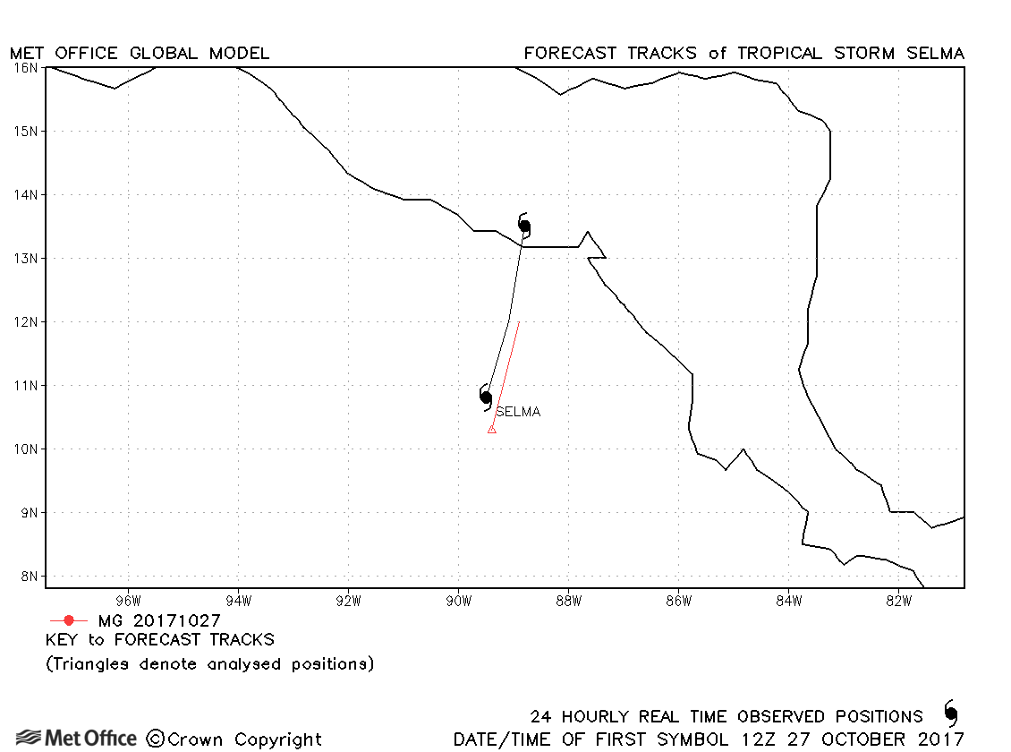
| Selma (20E) | 27-28 October | 1005 mb, 35 knots | Only one forecast was verified for short-lived Tropical Storm Selma, which became the first storm on record to form in the eastern Pacific and make landfall on El Salvador. |
| Name & ID | Start & end dates | Central Pressure, 1-minute MSW | Comments on Met Office global model forecasts |
|---|---|---|---|
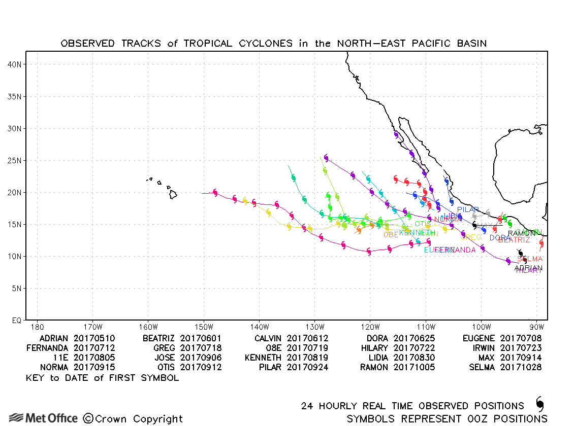
North-east and Central North Pacific observed tracks in 2017
| Name & ID | Start & end dates | Central pressure, 1-minute MSW | Comments on Met Office global model forecasts |
|---|---|---|---|
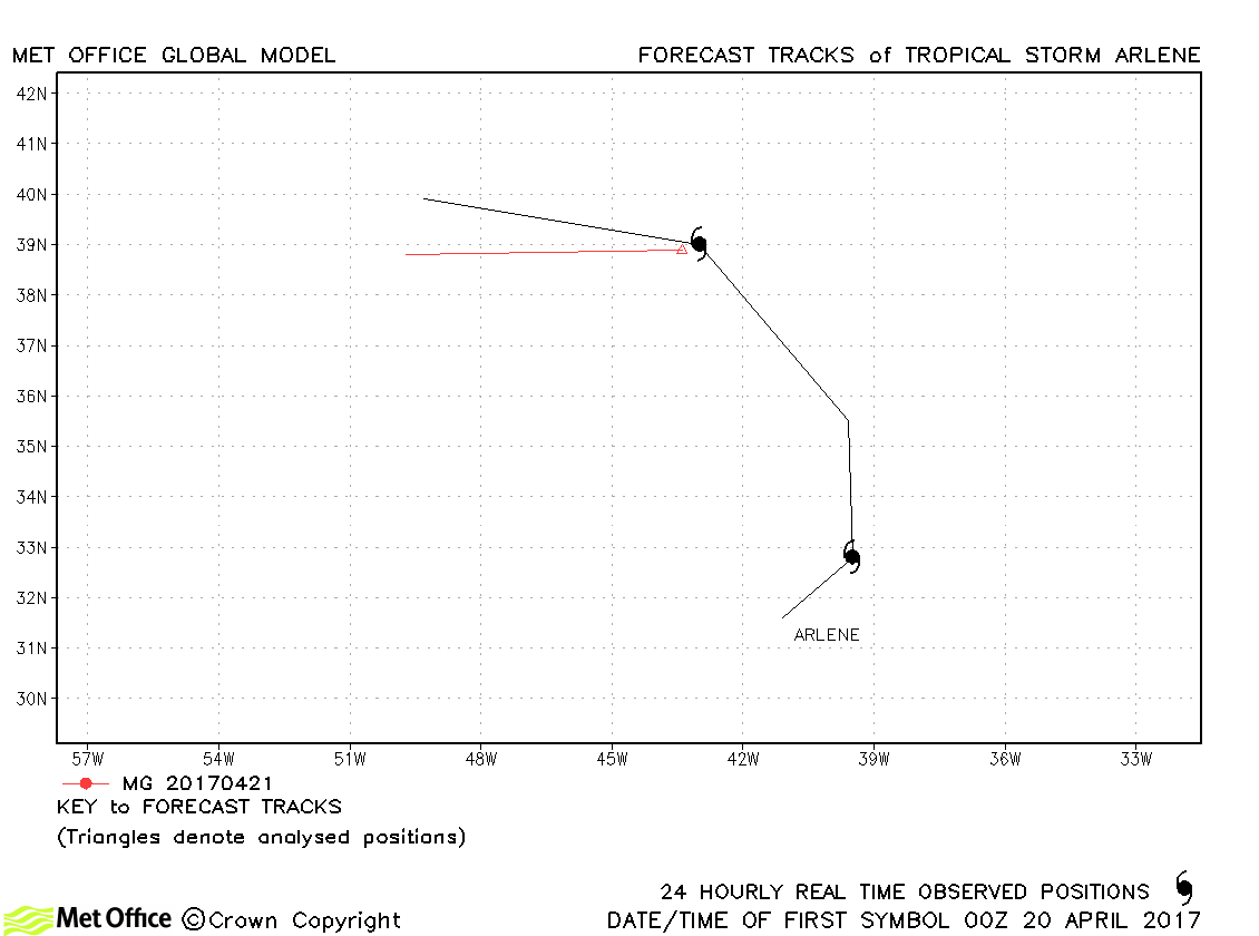
| Arlene (01L) | 19-21 April | 993 mb, 45 knots | Arlene was briefly a tropical storm. |
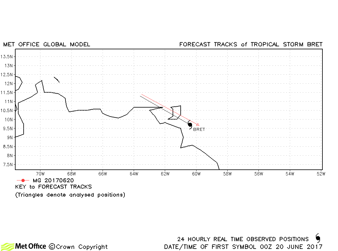
| Bret (02L) | 19-20 June | 1008 mb, 40 knots | Bret was short-lived as a tropical storm and track forecast errors were low compared to last season's average. |
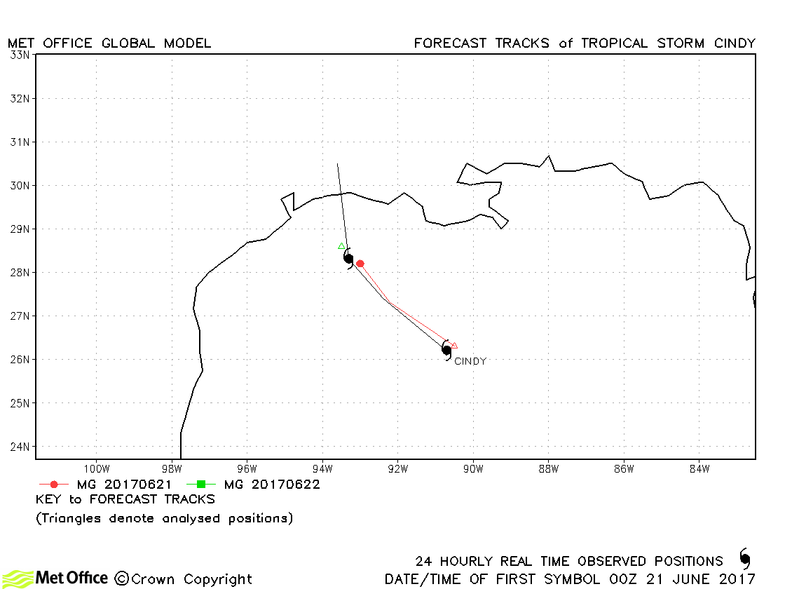
| Cindy (03L) | 20-22 June | 992 mb, 45 knots | Cindy was short-lived as a tropical storm and track forecast errors were low compared to last season's average. |
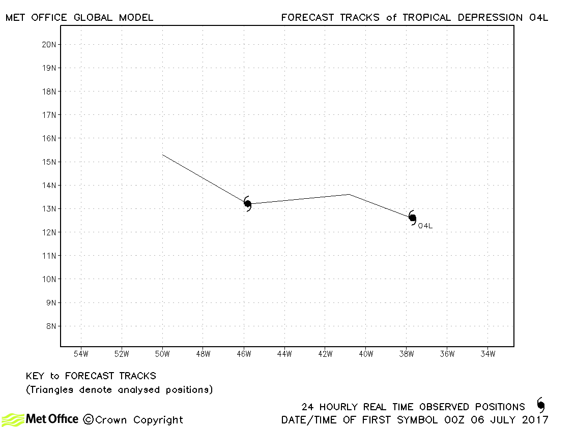
| 04L | 06-07 July | 1008 mb, 30 knots | 04L was a tropical depression. No forecasts were verified. |
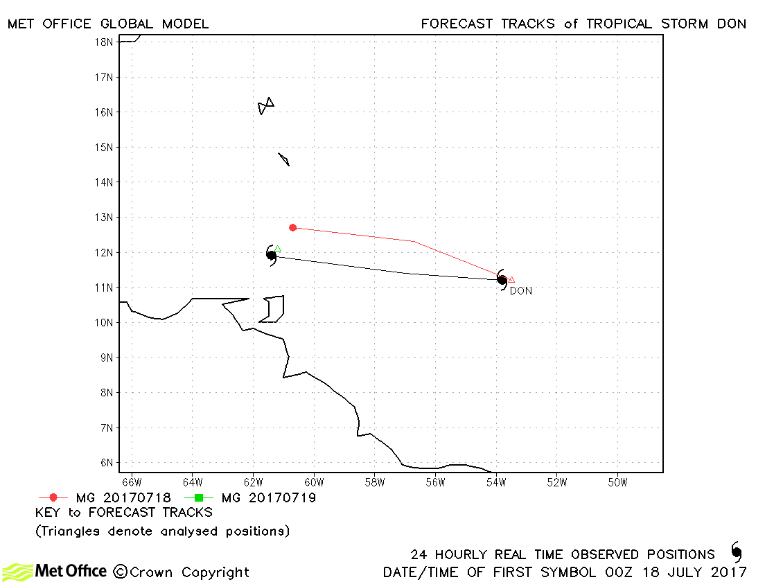
| Don (05L) | 17-18 July | 1007 mb, 45 knots | Don was a tropical storm for just a day and few forecasts were verified. |
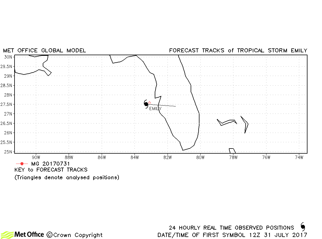
| Emily (06L) | 31 July-02 August | 1005 mb, 40 knots | Emily was briefly a tropical storm and no forecasts were verified. |
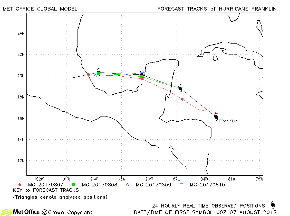
| Franklin (07L) | 07-10 August | 981 mb, 75 knots | Track forecast errors were low and skill scores high for forecasts for this hurricane. |
| Gert (08L) | 13-17 August | 967 mb, 90 knots | There was a slow bias in forecasts resulting in errors above last season's average. |
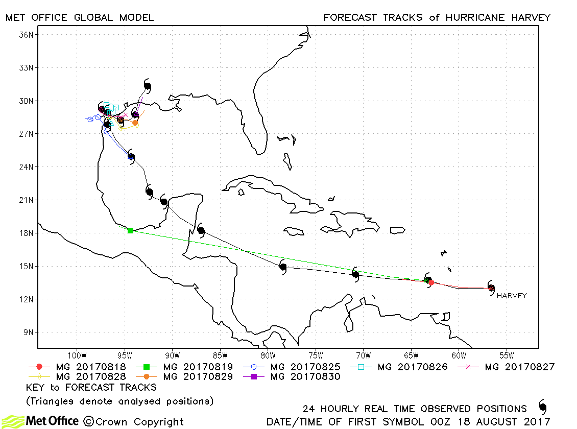
| Harvey (09L) | 17-31 August | 938 mb, 115 knots | Harvey initially became a tropical storm then dissipated in the Caribbean Sea before regenerating in the Gulf of Mexico. Long lead time forecasts had large errors due to predicting regeneration much further south than occurred. Once Harvey had regenerated, predictions of landfall and the slow movement close to the Texas coast were mostly well predicted with short lead time track errors very low. Model forecasts gave good indication of the exceptional rainfall totals which were experienced over Texas and western Louisiana. |
| Irma (11L) | 30 August-12 September | 914 mb, 155 knots | Early forecasts for Irma had a northwards bias for the passage across the north-eastern Leeward Islands. Predictions for the landfall on Cuba and the sharp turn north and landfall on the western side of the Florida peninsula were very good. However, although the direction of motion and landfall locations were well predicted there was a slow bias in forecasts. Thus, overall track forecast errors were close or or a little above last season's average. |
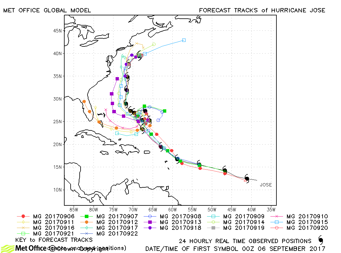
| Jose (12L) | 05-22 September | 938 mb, 130 knots | The early portion of the track of Jose was well predicted. The slow down and clockwise loop was predicted, but several model runs erroneously predicted a subsequent westerly track towards Florida. The model eventually captured the tight loop and resumption in northerly track. Despite the large errors part way through the hurricane's life, overall track forecast errors were mostly near to or below last season's average. This is testament to the good model predictions at the start and end of the hurricane's lifecycle. |
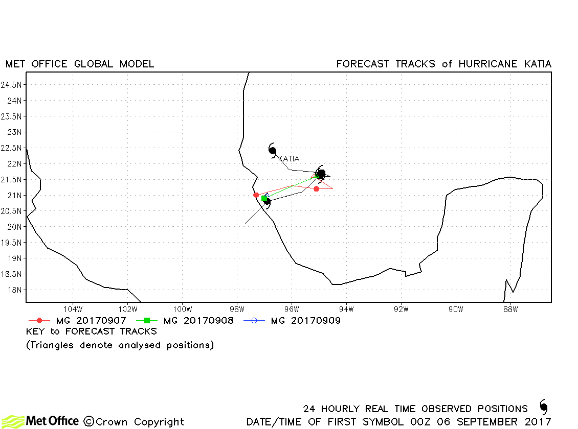
| Katia (13L) | 05-09 September | 977 mb, 90 knots | Track forecast errors were low and landfall well predicted. |
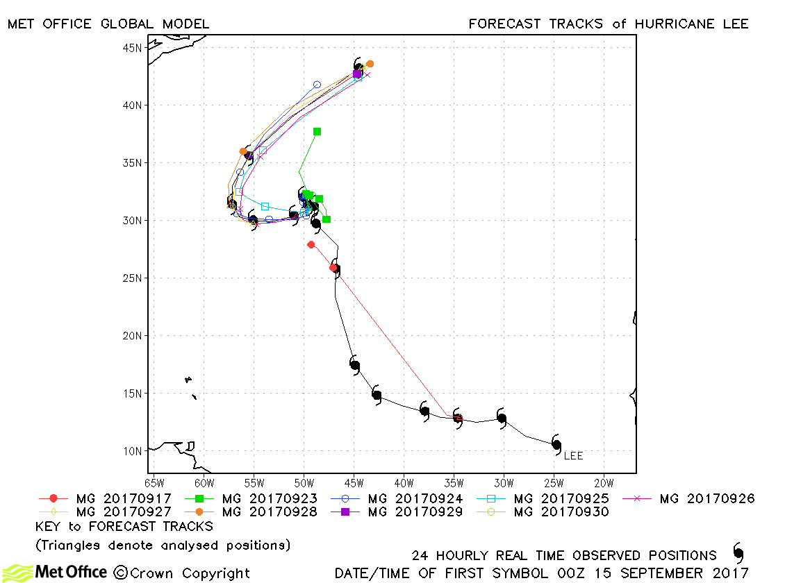
| Lee (14L) | 15-30 September | 962 mb, 100 knots | Track forecast errors were below last season's average for this storm and skill scores against CLIPER were high. |
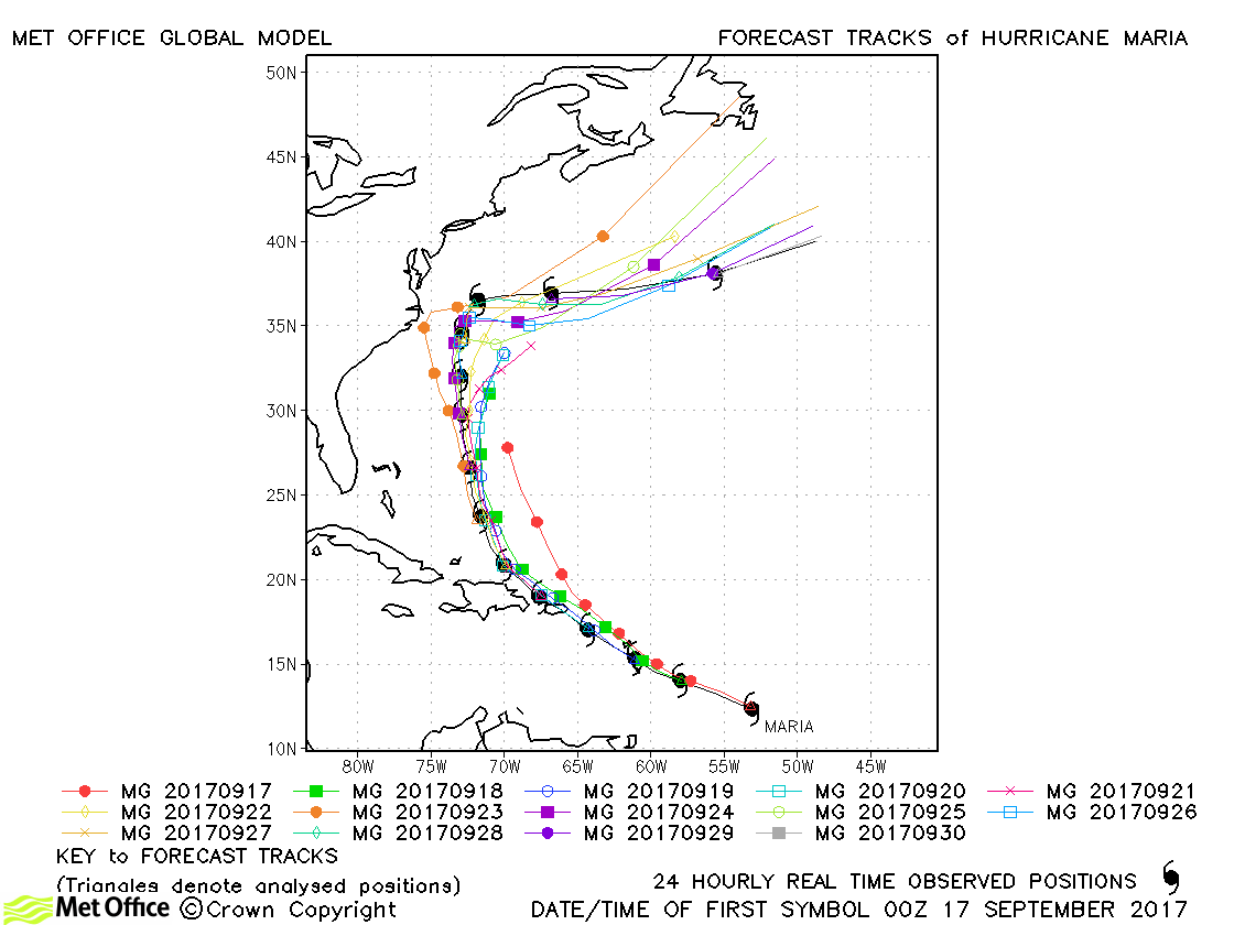
| Maria (15L) | 16-30 September | 908 mb, 150 knots | Track forecast errors for Hurricane Maria were below last season's average for this basin. There was a slight right-of-track bias in fotrecasts for the passage across the Caribbean, but overall biases were low. |
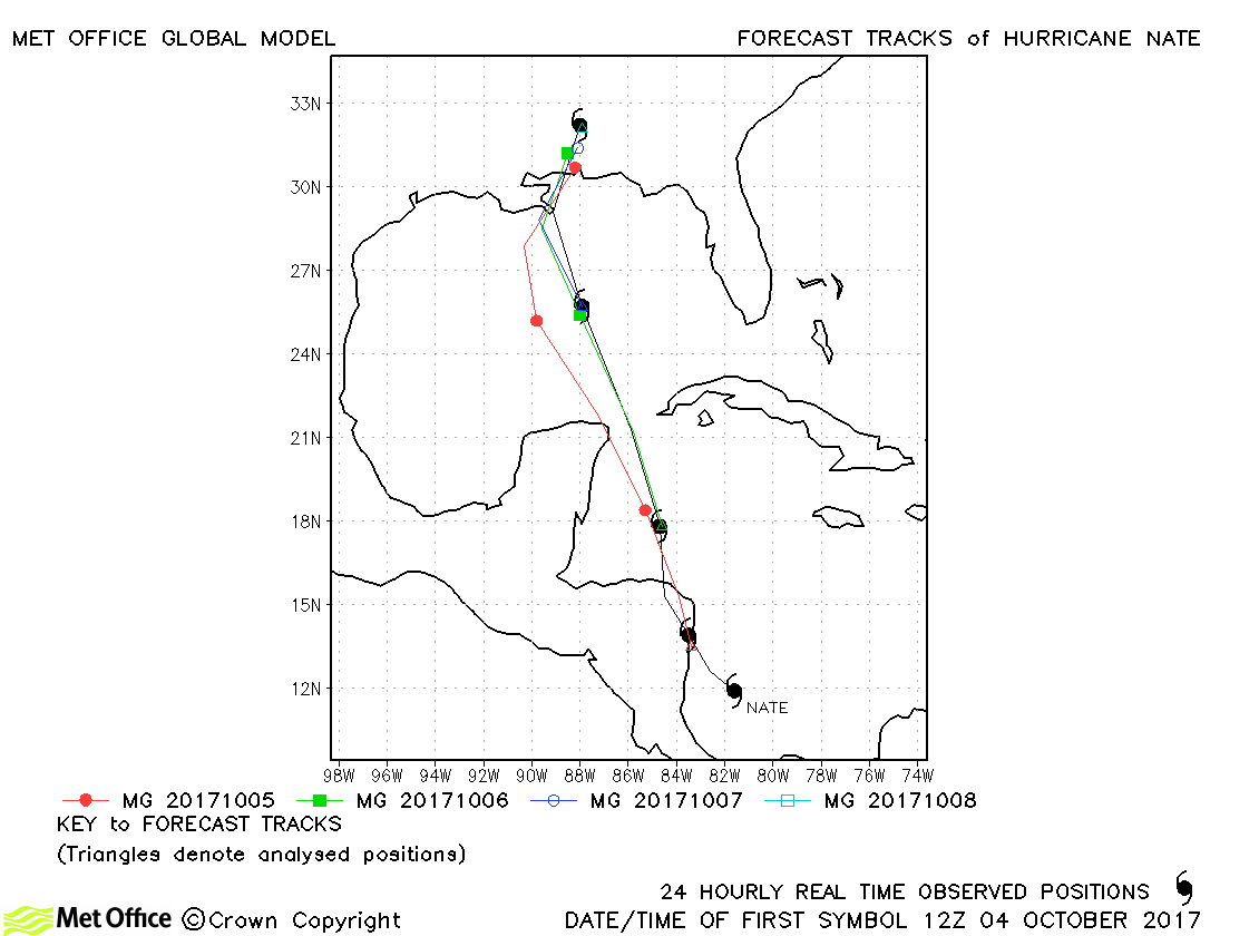
| Nate (16L) | 04-08 October | 981 mb, 80 knots | Track forecast errors were low and skill scores high for predictions of Nate. |
| Ophelia (17L) | 09-16 October | 960 mb, 100 knots | Long lead time forecasts for Ophelia had large track errors due to a failure to accelerate the hurricane into the mid-latitude flow. However, at shorter lead times (shorter than five days) this was well predicted and errors were low. The track across the west of Ireland as an extratropical cyclone was predicted well several days in advance. |
| Philippe (18L) | 28-29 October | 997 mb, 50 knots | Philippe was a short-lived tropical storm and only one forecast was verified. It's formation and absorption into a larger mid-latitude low pressure area were well predicted. |
| Rina (19L) | 06-09 November | 995 mb, 50 knots | Track forecast errors were low for this storm. |
North Atlantic observed tracks in 2017
| Name & ID | Start & end dates | Central pressure, 1-/10-minute MSW | Comments on Met Office global model forecasts |
|---|---|---|---|
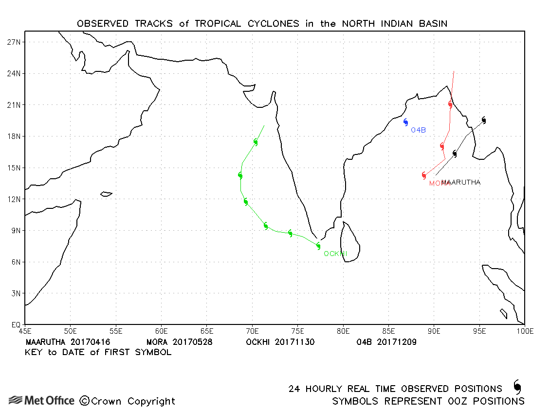
| Maarutha (01B) | 15-17 April | 994 mb, 45/40 knots | Track forecasts were above last season's average for this short-lived storm. |
| Mora (02B) | 27-30 May | 974 mb, 65/60 knots | The model had a right-of-track bias for this storm, but track forecast errors were mixed depending on lead time. |
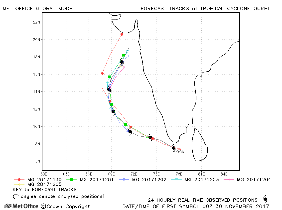
| Ockhi (03B) | 29 November-05 December | 961 mb, 100/85 knots | Track forecast errors were near to or below last season's average. |
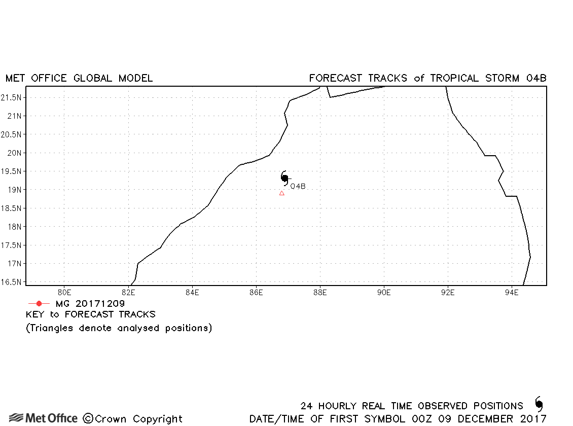
| 04B | 08-09 December | 999 mb, 40/30 knots | 04B was short-lived and no forecasts were verified. |
North Indian observed tracks in 2017
Note on estimated wind speeds
1-minute MSW: Maximum sustained wind (knots) averaged over 1 minute (JTWC Hawaii, NHC Miami, CPHC Hawaii)
10-minute MSW: Maximum sustained wind (knots) averaged over 10 minutes (JMA Japan, IMD New Delhi)
Note: Although 1-minute average winds should be stronger than 10-minute average, this may not be the case here since estimates are obtained from different warning centres.
