

Observed and forecast tracks: southern hemisphere 2018-19
All tropical cyclones in the southern hemisphere season in 2018-19 are listed below including details of their start and end dates, lowest central pressure and maximum sustained wind (MSW).
Click on the name of the tropical cyclone to see a chart of the observed track and forecast tracks from the Met Office global model. Verification statistics on each tropical cyclone are available upon request from [email protected]. At the end of the season a verification report on the performance of the Met Office global model will be published.
| Name & ID | Start & end dates | Central pressure, 1-/10-minute MSW | Comments on Met Office global model forecasts |
|---|---|---|---|
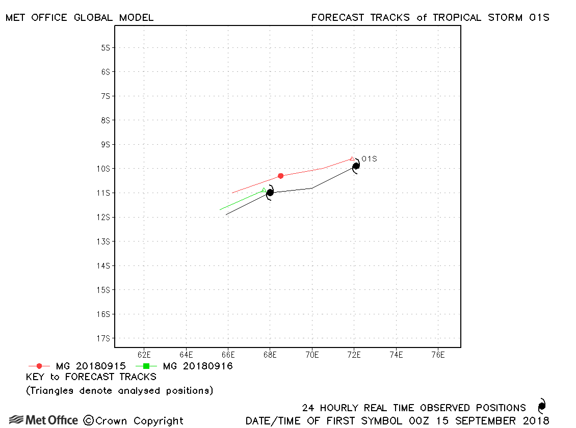
| 01S | 15-16 September | 1004 mb, 45/30 knots | Track forecast errors were near to last season's average. |
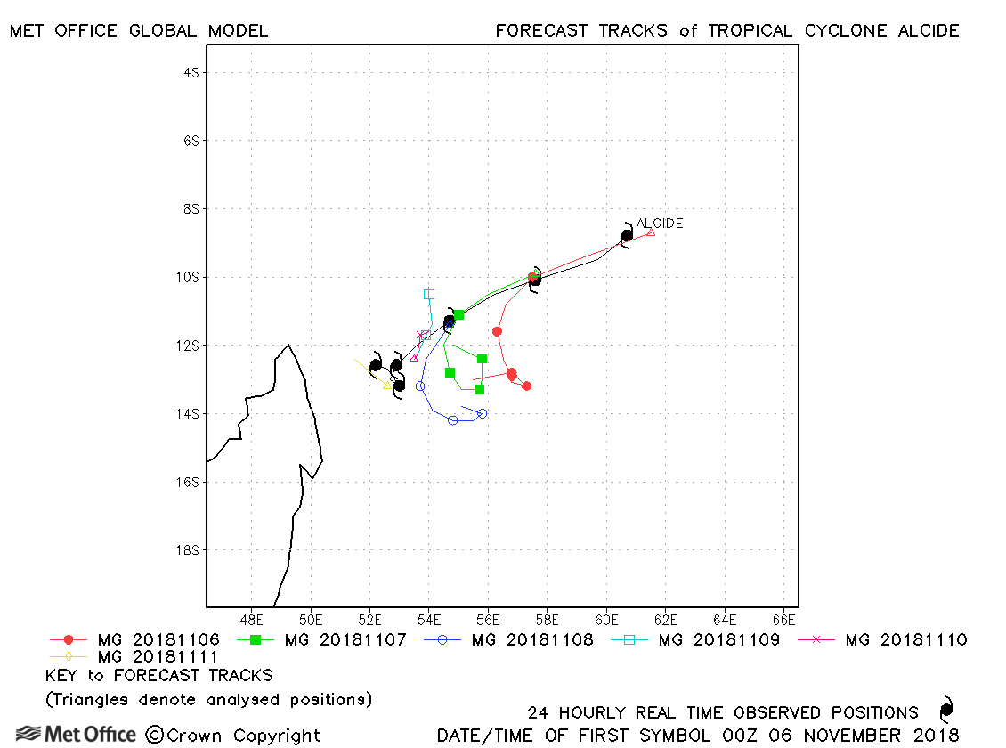
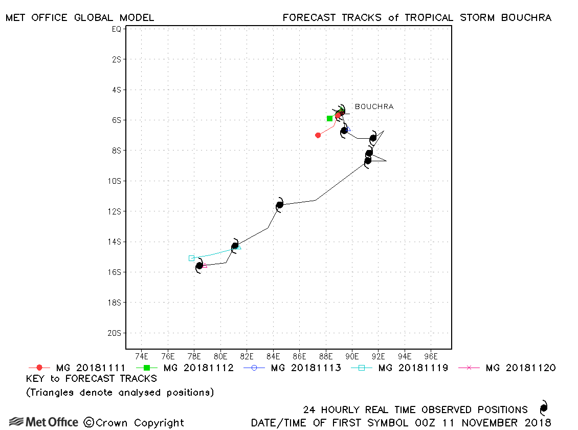
| 06-11 November | 965 mb, 100/90 knots |
Track forecast errors were above last season's average due to a slow bias. |
|
| 10-20 November | 990 mb, 55/50 knots |
Track forecast errors were a little above last season's average. |
|
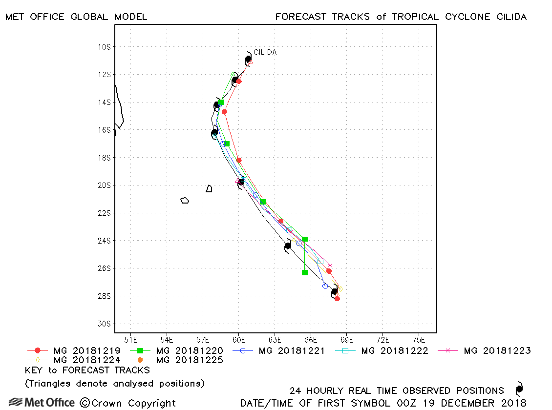
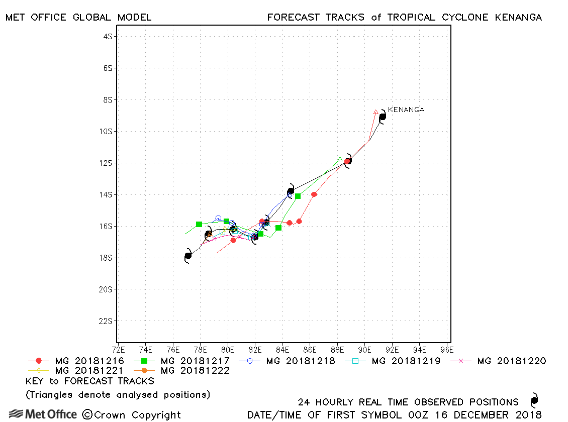
| 18-25 December | 940 mb, 135/115 knots |
Track forecast errors were slightly above last season's average at most lead times, although errors were low at long lead times. |
|
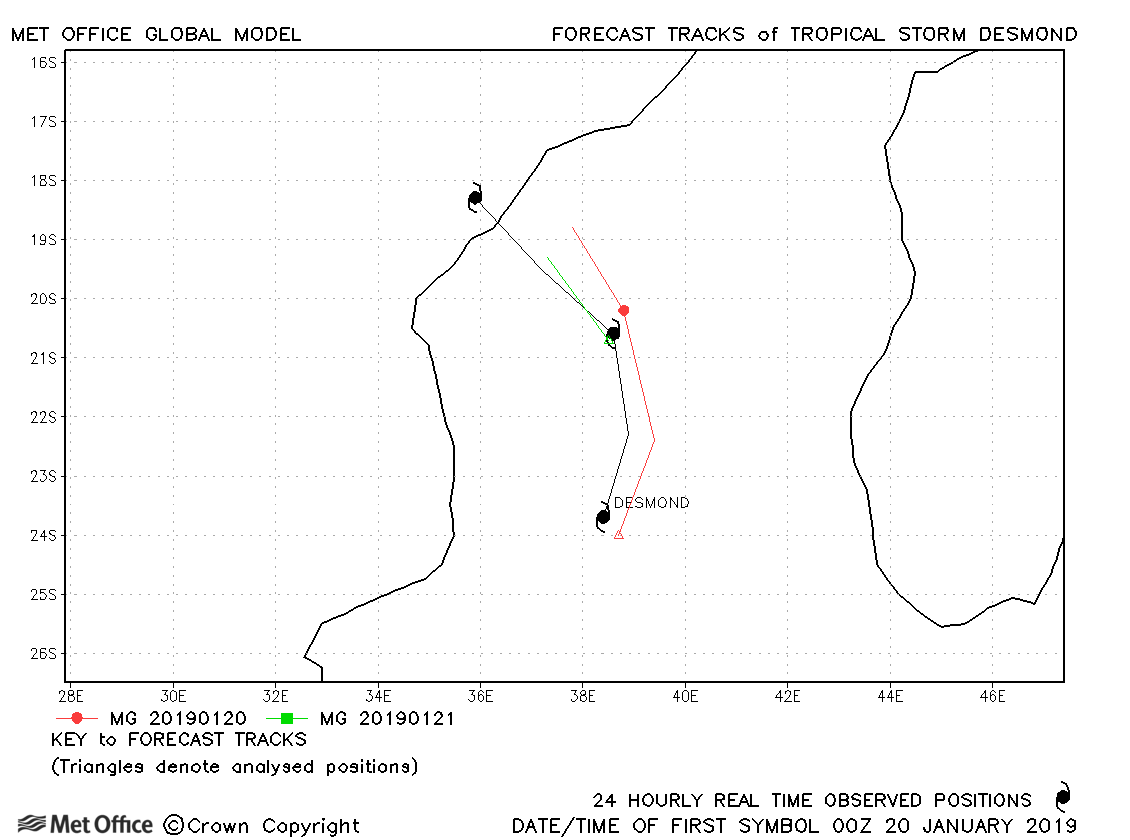
| 20-22 January | 995 mb, 45/35 knots |
Track errors were near last season's average. |
|
| 24-25 January | 992 mb, -/40 knots |
No forecasts were verified for this storm. |
|
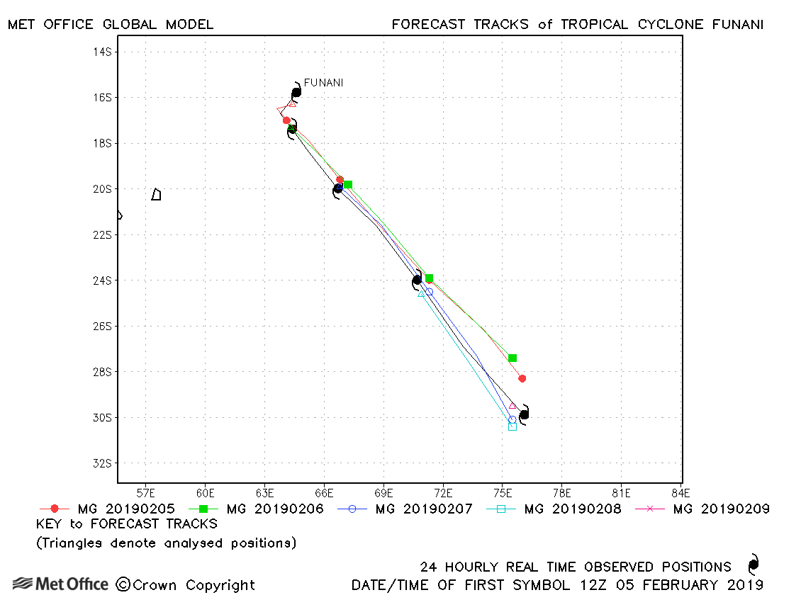
| 05-09 February | 940 mb, 115/105 knots |
Track forecast errors were below last season's average for this storm. |
|
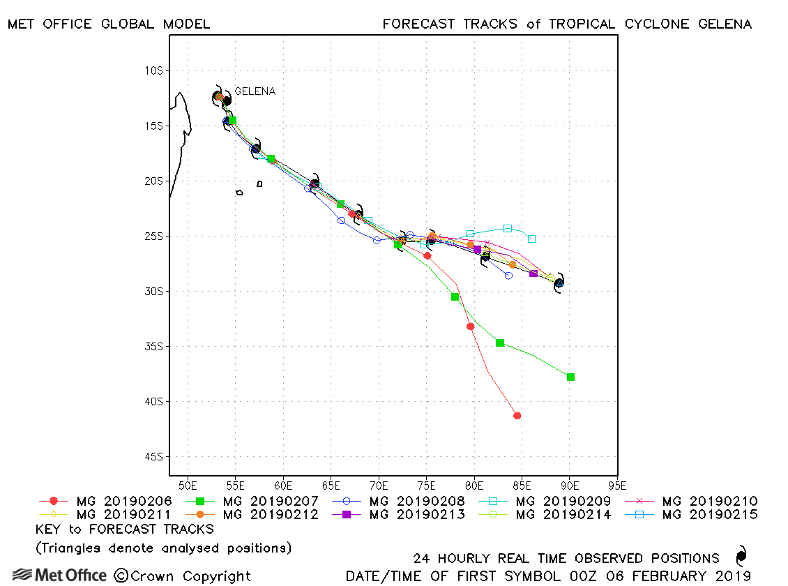
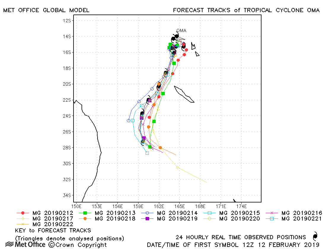
| 05-15 February | 942 mb, 120/110 knots |
Track forecast errors were above last season's average due to a fast and right-of-track bias, particularly at longer lead times. |
|
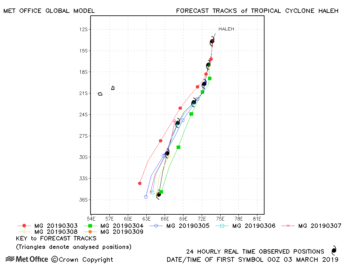
| 09 March | 945 mb, 115/95 knots |
Track forecast errors were close to last season's average. |
|
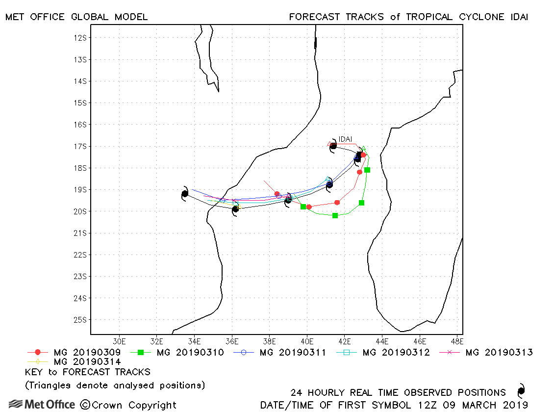
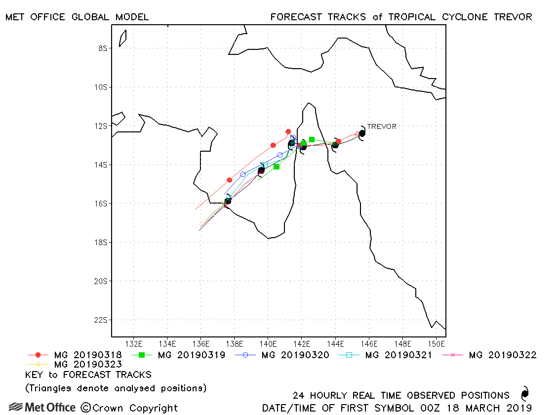
| 09-15 March | 940 mb, 105/105 knots |
Track forecast errors were below last season's average for all but a couple of lead times. Landfall was well predicted up to four days before it occurred. |
|
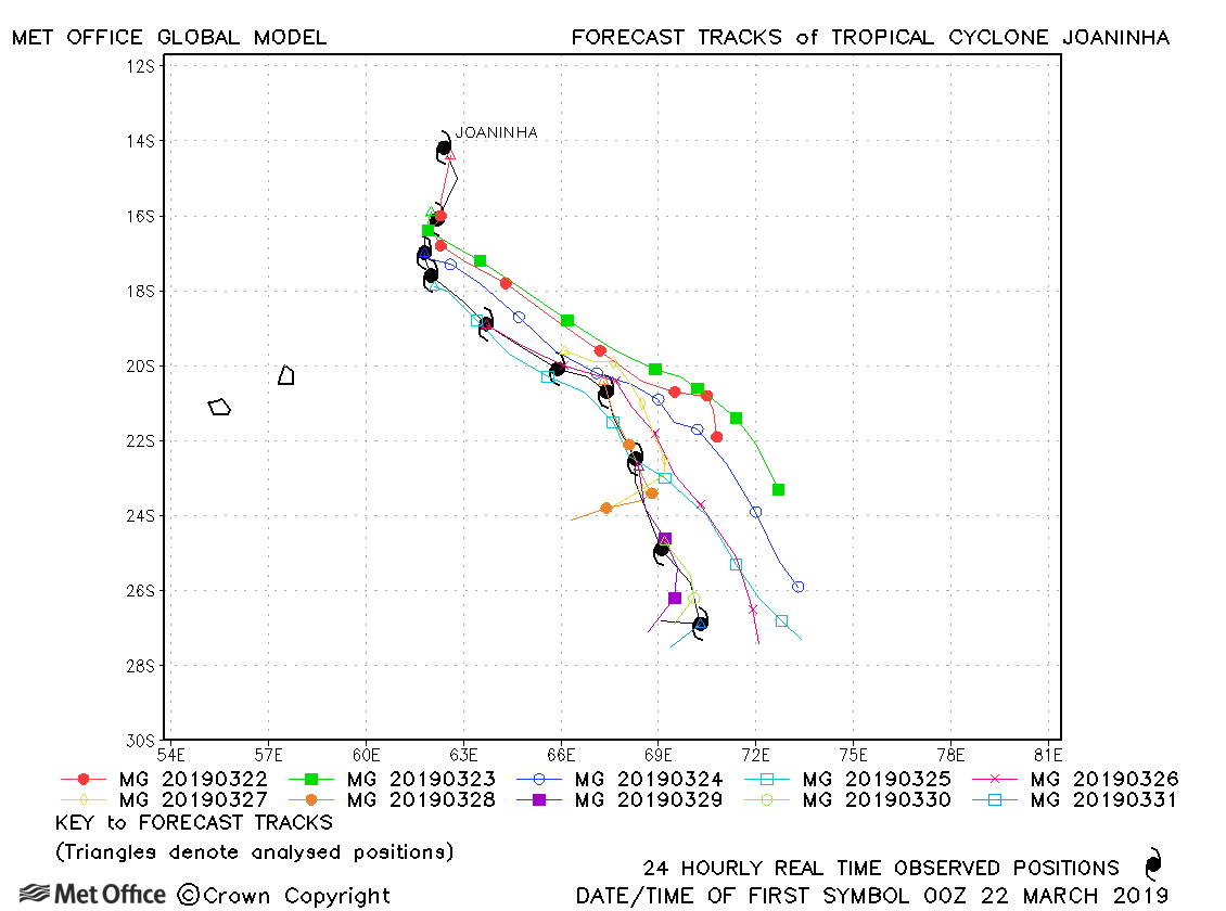
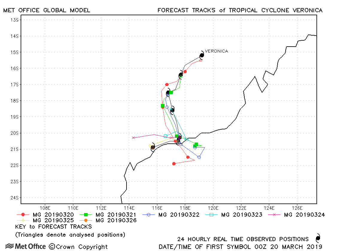
| 22-31 March | 939 mb, 115/95 knots |
Track forecast errors were above last season's average at some shorter lead times, but beyond day 4 errors were very low. There was a left-of-track bias in forecasts. |
|
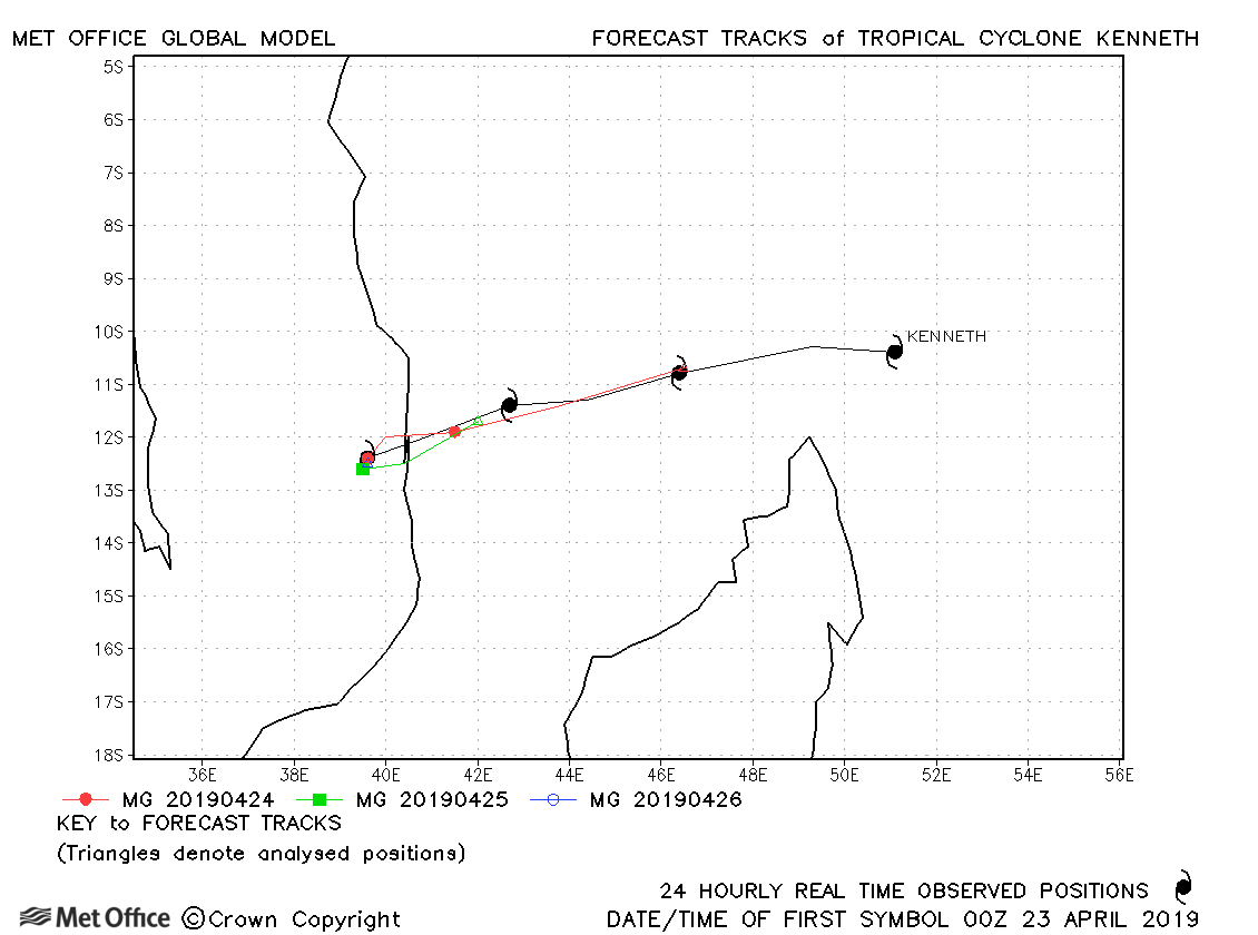
| 22-26 April | 934 mb, 125/115 knots |
The landfall location of Kenneth was well predicted, although the speed of movement was a little fast. |
|
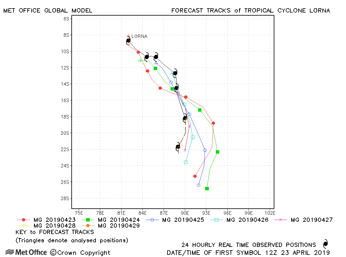
| 23-30 April | 964 mb, 75/80 knots |
Track forecast errors were above last season's average due to a fast and left-of-track bias in forecasts. |
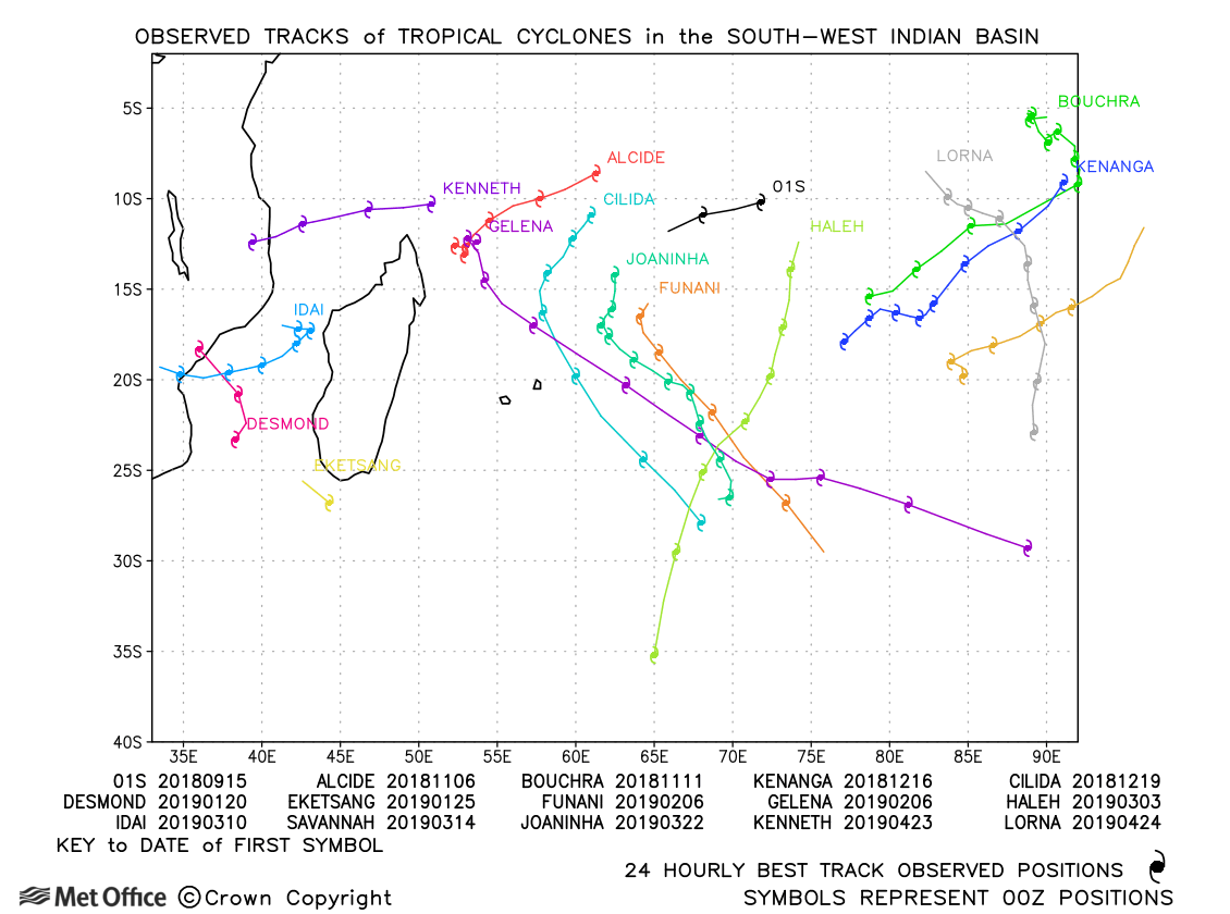
South-west Indian observed tracks in 2018-19
| Name & ID | Start & end dates | Central pressure, 1-/10-minute MSW | Comments on Met Office global model forecasts |
|---|---|---|---|
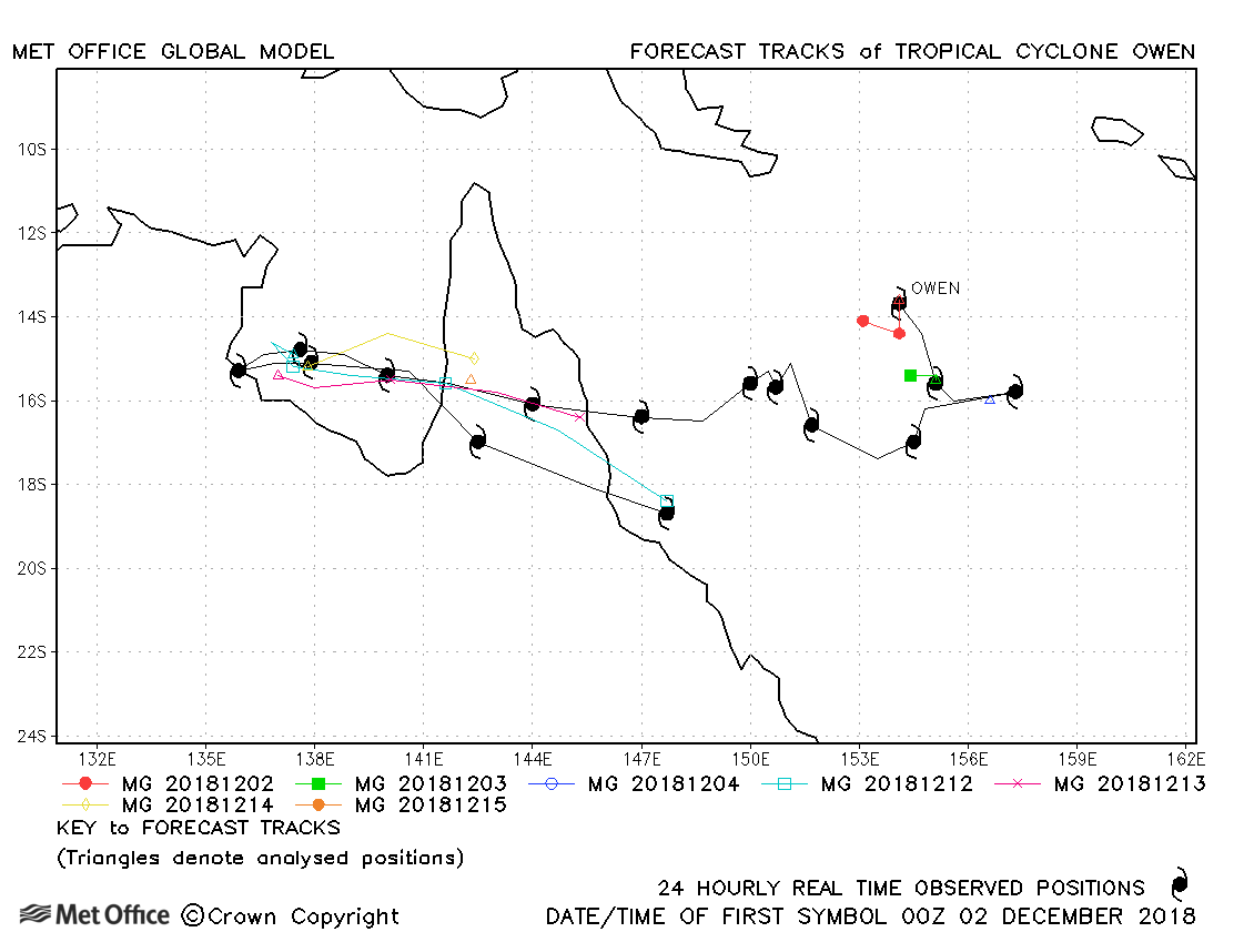
| 02-16 December | 960 mb, 80/80 knots |
There was a fast bias in model forecasts resulting in errors above last season's average. |
|
| 15-23 December | 942 mb, 115/100 knots |
Track forecast errors were very low for this cyclone. |
|
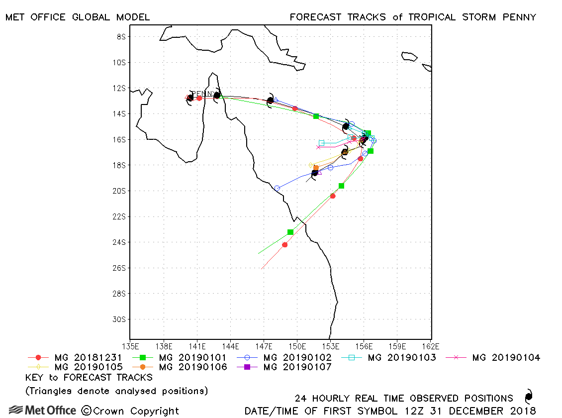
| 31 December-08 January | 987 mb, 55/50 knots |
Track forecast errors were low up to 120-h, but at longer lead times there was a large fast bias due to erroneous predictions of landfall. |
|
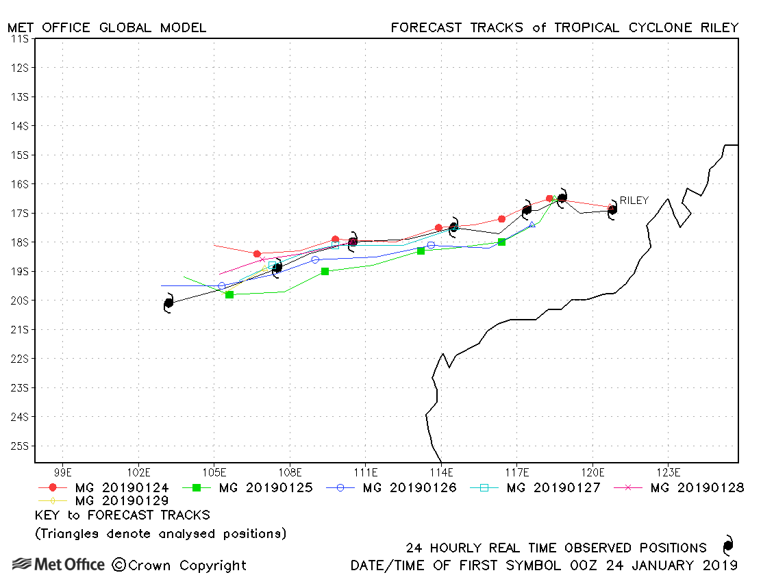
| 23-30 January | 977 mb, 70/60 knots |
Riley was well forecast with track errors well below the previous season's average. |
|
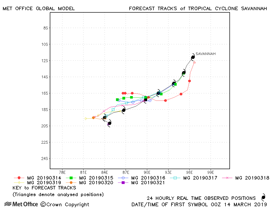
| 13-21 March | 956 mb, 100/95 knots |
Track forecast errors were mostly below last season's average for this cyclone. |
|
| 17-23 March | 950 mb, 105/95 knots |
There was a slow bias in forecasts overall, but track forecast errors were well below last season's average. |
|
| 19-26 March | 938 mb, 125/105 knots |
Track forecast errors were low and skill scores high for this cyclone. A few forecasts predicted landfall rather than the sharp turn near the coast. |
|
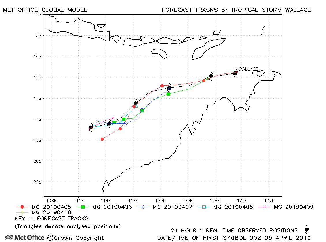
| 05-10 April | 980 mb, 65/65 knots |
Track forecast errors were below last season's average for this storm. |
|
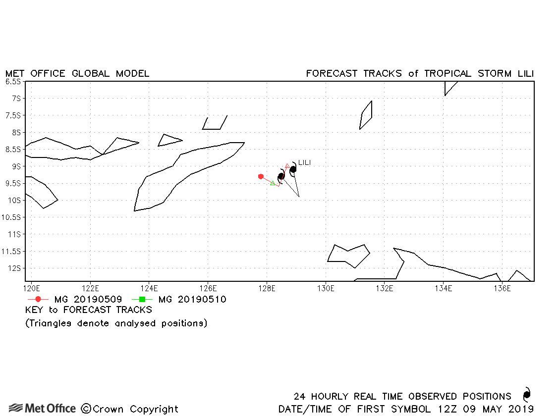
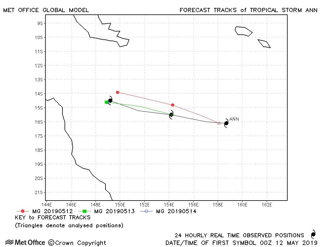
| 09-10 May | 1000 mb, 45/40 knots |
Track forecast errors were a little above last season's average. |
|
| 11-14 May | 993 mb, 55/50 knots |
Track forecast errors were mostly close to last season's average. |
* For statistical purposes Kenanga was considered a South-West Indian Ocean storm as it spent most of its lifetime in that basin.
| Name & ID | Start & end dates | Central pressure, 1-/10-minute MSW | Comments on Met Office global model forecasts |
|---|---|---|---|
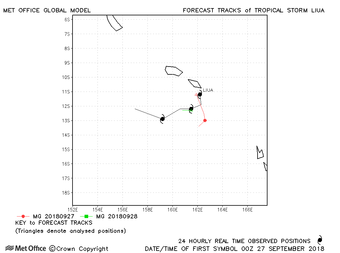
| Liua (02P) | 26-29 September | 994 mb, 40/40 knots | Track forecast errors were a little higher than last season's average. |
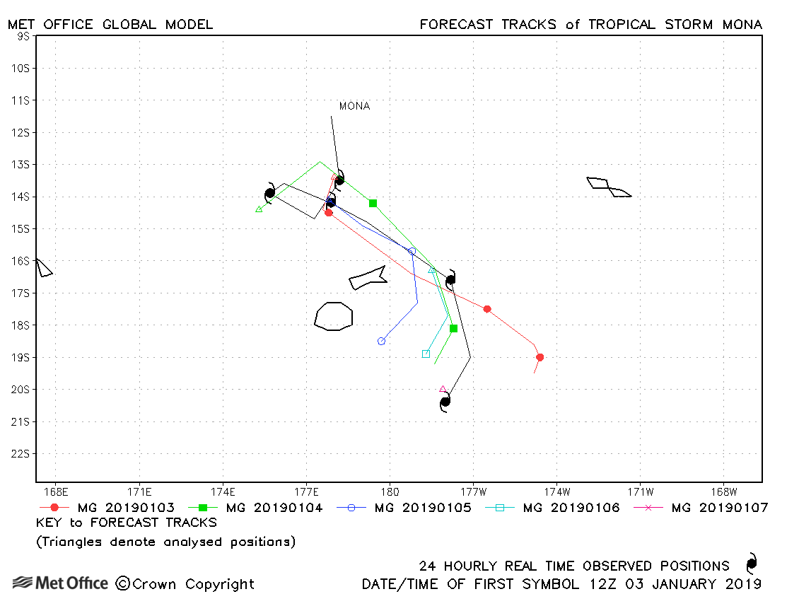
| 02-07 January | 985 mb, 50/50 knots |
Track forecast errors were large for Mona. |
|
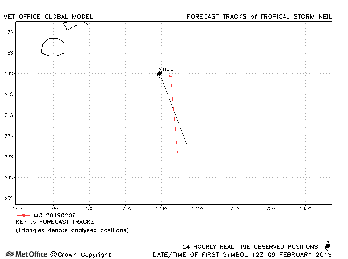
| 09-10 February | 996 mb, 35/35 knots |
Neil was short-lived and few forecasts were verified. |
|
| 12-23 February | 974 mb, 75/70 knots |
Oma was generally well forecast and track forecast errors were below last season's average. |
|
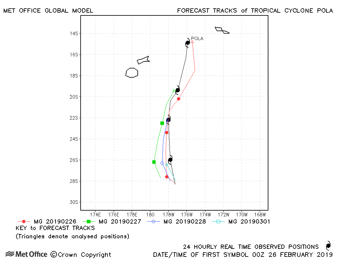
| 25 February-01 March | 950 mb, 95/90 knots |
Forecasts for this storm were very skilful, with low errors. |
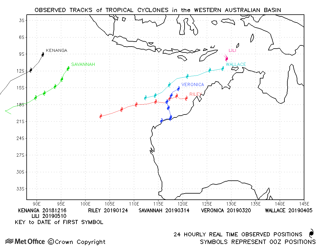
Western Australian observed tracks in 2018-19
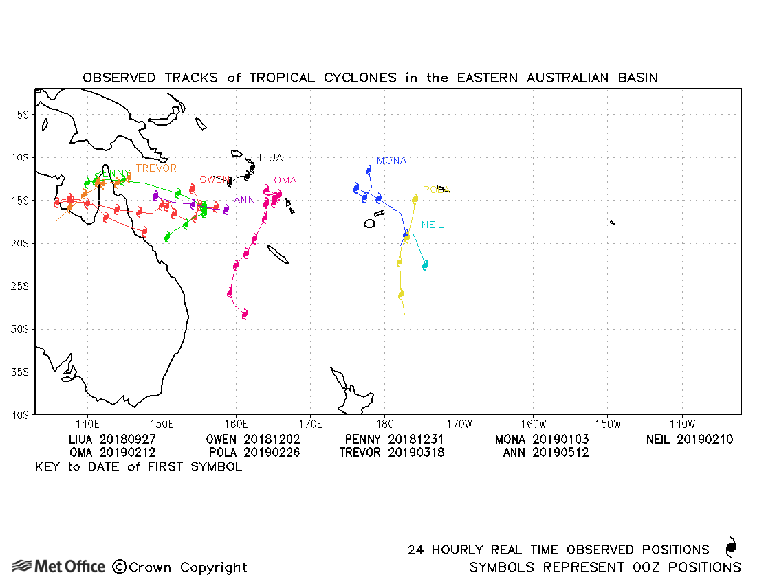
Eastern Australian observed tracks in 2018-19
| Name & ID | Start & end dates | Central pressure, 1-/10-minute MSW | Comments on Met Office global model forecasts |
|---|---|---|---|
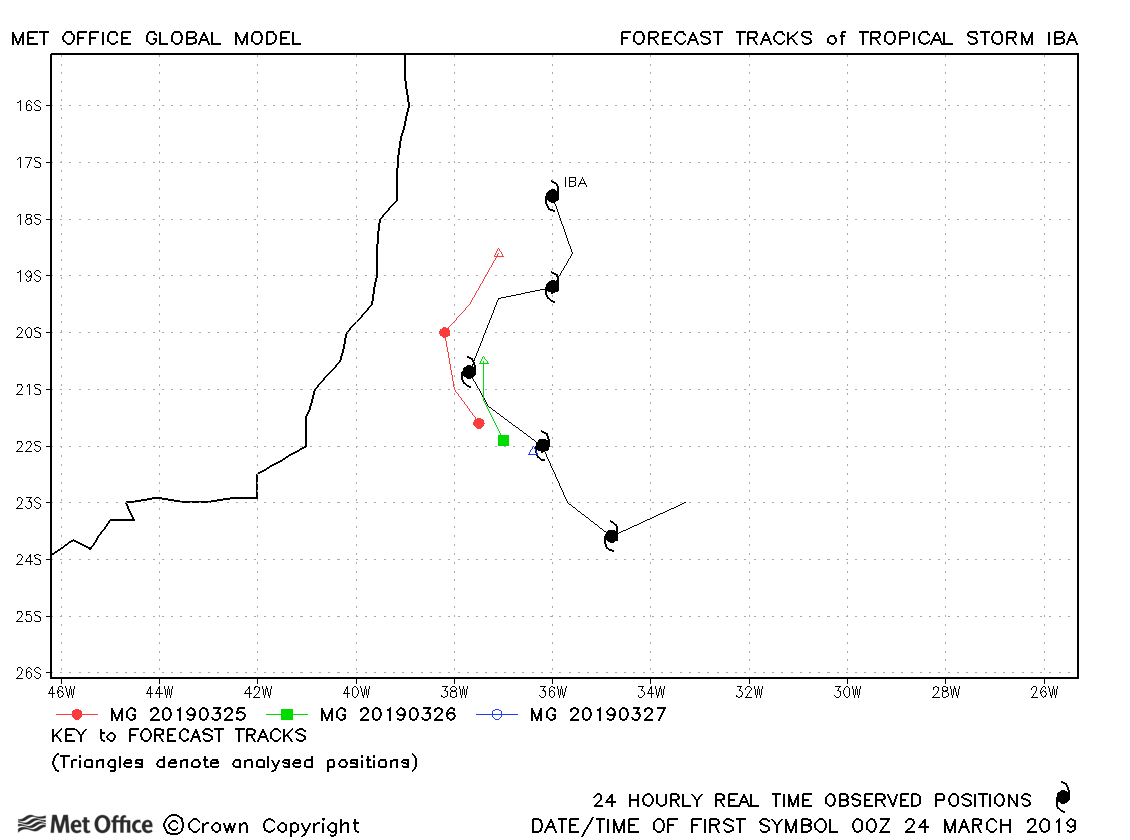
| 24-28 March | 1006 mb, 40/40 knots |
The development of this rare South Atlantic storm was well predicted by the model. Track forecast errors were low. |
|
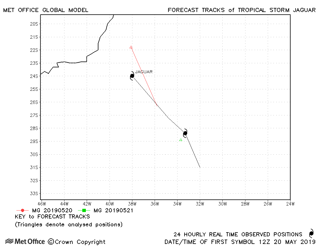
| 20-22 May | 1008 mb, -/35 knots |
Jaguar was a subtropical storm for only a brief time and few forecasts were verified. |
Note on estimated wind speeds
1-minute MSW: Maximum sustained wind (knots) averaged over one minute (JTWC Hawaii)
10-minute MSW: Maximum sustained wind (knots) averaged over 10 minutes (Southern Hemisphere RSMCs and TCWCs)
Note: Although 1-minute average winds should be stronger than 10-minute average, this may not be the case here since estimates are obtained from different warning centres.