
Beach forecast and tide times explained
A guide to Met Office beach forecasts and tide times
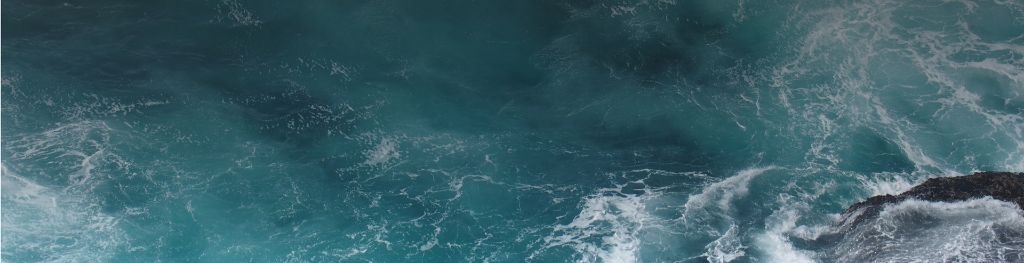
Understanding beach forecasts
Wind direction
The wind directions you can see are relative to the direction the shoreline of the beach faces. The arrow shows the compass direction of the wind (where up is north). If the arrow points from sea to land, the wind will be blowing from sea to land (‘onshore’). If the arrow points from land to sea, the wind will be blowing out to sea (‘offshore’). If the arrow points somewhere between the land and the sea, the wind will be blowing across the length of the beach (‘cross-shore’).
The number is the average wind speed in your chosen units.
What wind direction means for you
The relative wind direction indicates sea conditions at the beach. It also helps to show which beaches are most likely to be sheltered from the wind.
Offshore winds are when the wind blows from the land out to sea. Beware of offshore winds if you or your children use inflatables, paddle boards or kayaks. These winds can blow you out to sea. Get advice from a lifeguard if you’re planning to go into the water and look out for the RNLI flags.
Onshore winds are when the wind blows from the sea in towards the land. When onshore winds are strong the waves are likely to be rough. There will not be much shelter from the wind.
Cross-shore winds are when the wind blows parallel to the shoreline. When these winds are strong, waves can become increasingly choppy. If you’re in a kayak or on a paddleboard, it might be hard to paddle along the beach into the wind.
Wind can feel different when you’re on the beach compared to when you’re on or in the water. Depending on the wind direction, beaches can be protected from offshore and cross-shore winds by the surrounding landscape (like high cliffs). This isn’t the case when you’re on or in the water, so winds can be much stronger.
If you’re planning to go into the water, get a feel for how strong the wind is at the water’s edge before going in. Be aware that the wind may change when you are in the water. Always keep an eye on the beach to make sure you can get back to shore if the wind gets stronger or is blowing against you.
Wind direction and strength can often change during the day. The relative direction of the wind at two different beaches will vary depending on which direction the beaches face.
Height of waves offshore
The offshore wave forecast information represents wave conditions in open waters 1-2 miles from the beach. Individual waves vary in height, so we use a standard measure known as ‘significant wave height’. This represents the average height of the highest third of the waves. The highest individual waves that may be encountered have a height up to double the significant wave height. For example, if you’re at sea for several hours when offshore waves are forecasted to be 1m, there’s a good chance of encountering at least one wave in the 1.5-2m range. This is one of the most accurate forecasts of its type for the UK.
If you’re close to the water, keep an eye on the waves to stop you or your belongings being swept away.
Period of waves offshore
This is the average number of seconds between the crest (top) of one wave and the crest of the next, 1-2 miles out to sea. Waves vary in frequency, so we use a standard measure known as ‘peak period’, which represents the time between the most powerful waves.
Wave period indicates how many waves you might experience in a set time. For example, if you waded at the beach for 15 minutes when the period was 6 seconds, you might have to jump over 150 waves!
Wave period is also an indicator of the power of the waves. A ‘swell’ wave (10 seconds or more) is usually more powerful and will break with more force at the beach than a ‘choppy’ wave (6 seconds or less).
Lifeguards can give you advice on waves if you’re planning to go into the water.
Direction of waves offshore
The arrow shows the average direction that the waves are going 1-2 miles out to sea. It indicates how sheltered the beach will be from these waves. Waves vary in direction, so we use ‘mean direction’. This represents an average weighted toward the most energetic waves.
The direction of the waves offshore can be used together with the direction a beach faces to indicate how sheltered the beach will be from the waves further out to sea. If the wave direction is pointing towards the beach, nearly all the offshore wave energy will reach the beach. If wave direction is parallel to, or directed away from the coastline, then the height of the waves that reach the beach will be much lower than the offshore waves.
Lifeguards can give you advice on waves if you’re planning to go into the water.
Combining wave height, direction and period to give expected surf height
The difference between the height of waves offshore and the expected surf height at the beach is determined by 3 things:
-
the wave direction (if the offshore waves are directed towards the beach and the beach is not sheltered, the power of the offshore waves are more likely to reach the beach)
-
the wave period (longer period waves will increase the surf height)
-
the beach slope (waves will break more quickly and energetically on beaches with steep slopes)
If the offshore waves are directed away from the beach and have a short wave period (less than 6 seconds) then the wave height at a flat beach is likely to be smaller than the height of the waves offshore.
Higher waves, longer periods and strong winds can lead to high surf and potentially dangerous sea conditions. Whatever your level of expertise, we recommend you get advice from a lifeguard and stay within your limits.
Understanding the tide times
What are tides?
At some beaches, being aware of tide times and height is very important to avoid the risk of being stranded by the incoming tide.
Tides refer to the rise and fall of a body of water, most commonly seen in oceans. Tides are caused by the interaction between the Moon, Sun and Earth.
As the positions of Earth, Sun and Moon change in relation to each other, gravitational forces acting upon the oceans vary and it is these differences that cause fluctuations in the height of the sea. These changes in water level are often strongest at the coastline. On a beach, tides can be seen as the water comes up the beach on an incoming tide (flooding tide) or moves down the beach on a receding tide (ebbing tide).
In the UK we mostly experience two high tides and two low tides each day. The time at which the high and low tide occur will change day to day. For example, if the tide was at its highest at six o’clock today, the highest tide is likely to be later tomorrow. It’s important to check the tide times every day.
The amount that the tide rises (covering the beach) and falls (exposing the beach) changes every day. Large tides that create higher than average high tides, and lower than average low tides, are called ‘spring tides’. Spring tides can occur all year round and can be more dangerous as they lead to the tide coming in faster.
The height of the water can be very different from day to day, so do not expect the tide to be the same on different days when you visit the beach.
Don’t get stranded by the tide
Each year, lots of people get cut off by the tide and need to be rescued. The tide changes quickly and can take you by surprise.
It's important to be aware of tide times and heights each day to keep you and your family safe.
If you’re going in the water:
-
when the tide is rising, the water could get much deeper than when you went in
-
it could take longer to swim back to shore
If you’re walking along the beach or coastline:
-
the tide could come up so high that it blocks your way off the beach
-
walking further up the beach or back around a cove to safety may no longer be an option
How to keep safe
Before you go:
-
check the times of high and low tide, and the tide height for that day
-
be aware that your way back may get cut off if you go out at low tide or whilst the tide is rising
To avoid getting cut off by the tide, be aware that:
- the tide does not rise and fall at a steady rate
- the tide will cover the beach faster at the time midway between low and high tide
- you will need to keep an eye on the tide as it comes in and make sure you can still get to a way off the beach
When you arrive at the beach:
-
take note of key information by checking local safety signs
-
be aware of your surroundings and whether the tide is rising or falling
-
make sure you have enough time to get back before the tide comes in and blocks your route
If you get cut off, dial 999 and ask for the coastguard.
Understanding the tide times
- the tide times tell you when the water will be at its highest point (high tide) and lowest point (low tide)
- tide heights are shown in metres
- the height of high water and low water changes on each tide
- the highest and lowest tides, which expose and cover the largest areas of beach, are known as spring tides
- spring tides occur twice a month
- tide times and heights are from the nearest port with a tidal station
- the tidal station may not be very close to the beach
- tide changes at the beach may happen up to 30 minutes before or after the times shown
- whenever possible, consult lifeguards at the beach and remain vigilant to tide changes
- the tide times provided must not be used by vessels for navigation
Further information
For more information, visit RNLI (Royal National Lifeboat Institution) and Respect the Water.
You can also find out more information about tides in your area from:
- tourist information centres
- some seaside retail outlets
- weather news
- local websites
- the Harbour Master
Acknowledgements
Contains ADMIRALTY® tidal data: © Crown Copyright and database right.
The data is for the nearest port. This means that these values are not completely local to the beach.
The information should give a good reference for the tide when compared to the forecast, but you may prefer to use local tide tables.