Guide to marine forecasts
The guides below will provide you with a description of what you will see on the marine weather pages, with details of how to view or change your view of the content.
The Met Office provides a wide range of marine forecasts and warnings.
This guide will help you to understand the forecasts and warnings we provide.
There are four sets of forecasts and warnings:
How to view the forecasts
The example below shows the shipping forecasts and gale warnings page but the information applies to all four marine forecast pages.
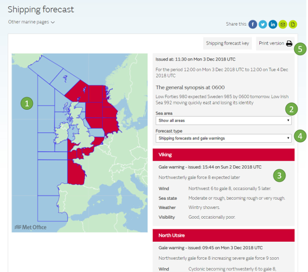
1. A clickable map is used to display the warnings. Areas of the map are coloured red when a warning is in force. Selecting an area on the map will display the forecast for that area in the table to the right of the map.
2. You can choose to select any individual area for display. Areas and type of forecast can be selected using the drop down boxes.
3. The details of the forecast or warning for your selected area will appear here.
4. Toggle between the type of forecasts you wish to display by using these buttons.
5. There is a printable view which contains the forecast for all areas.