Mountain safety
Conditions up in the hills are often very different to down in the valleys
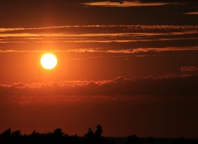
The weather up there can be extreme and change very quickly - a fine day can turn cold, wet and windy with rain, snow or fog setting in within minutes.
Be AdventureSmart
Before you set off, ask yourself 3 questions:
- Do I have the right gear?
- Do I know what the weather will be like?
- Am I confident I have the knowledge and skills for the day?
Use the weather forecast to choose an appropriate day and route for you and your party's skills and abilities. The Met Office issue a dedicated forecast for hill walkers and climbers twice a day for ten upland areas of the UK - Mountain weather forecast. Forecasts for individual locations and hill tops are also available from our forecasting homepage. In the winter season, check avalanche forecasts where available.
Take or wear appropriate clothing (including hat and gloves and extra layers), footwear suitable for the terrain, navigational equipment (including a map and compass), first aid kit, and enough food and drink. Do not just think about the current conditions but be prepared in case things change for the worse or the route takes longer than expected. Know when it will get dark and take a head torch and whistle.
Let someone know where you plan to go and what time you plan to be back, particularly if heading into the hills alone. That way, should the unexpected happen, mountain rescue will have some idea of where to find you. Do not forget to let the person know when you have returned!
When out in the hills:
- Be flexible with plans - think about alternative routes in advance and escape routes to low ground should the weather turn. If you or a member of the party does not feel happy to continue, or it is taking significantly longer than expected, be prepared to turn back and enjoy the route another day. The hills will always be there!
- Eat and drink well and keep warm (avoid overheating and keep hydrated on hot days).
- Be vigilant - stick together as a group and keep a close eye on any changes in weather and ground conditions. Are things as you expected? How are my party and I feeling, both physically and mentally? Are we ahead or behind schedule? How many hours of daylight are left?
- Know what to do in an emergency. If you require assistance on the hill, call 999 or 112 and ask for Police and Mountain Rescue. Guidance for the whole of the UK can be found here: Calling for help.
Find out more ...
A wealth of useful information and advice is available out there:
- Be AdventureSmart and make your good day better.
- Mountaineering Scotland - Skills and safety in the mountains - 'It's more than just keeping safe: learning the essential skills of hill walking and mountaineering means you will get so much more pleasure and satisfaction from your trips to the hills.'
- #ThinkWinter - how to plan and make good decisions in the winter months.
- The British Mountaineering Council (BMC) have produced a free booklet for new hill walkers plus an extensive series of 'How to' videos for hill walking and winter skills.
- SAIS -Be Avalanche Aware. Avalanche information from the Scottish mountains with daily reports provided during the winter season. Learn more about avalanches, assess the hazard and make better judgements.
- Mountain Rescue - advice on how to stay safe. Here is a transcript of an interview with Dave Rutledge, Training Officer for the Cairngorm Mountain Rescue team. He talks about working in mountain rescue, the challenges they face and gives advice to those heading into the hills.
Courses
Mountain Training provide a range of courses including two courses designed to equip you with some basic knowledge and safety skills so that you can participate in more hill and mountain walking in your own time: Hill Skills and Mountain Skills.
Mountaineering Scotland and the BMC also host a wider range of courses and events.
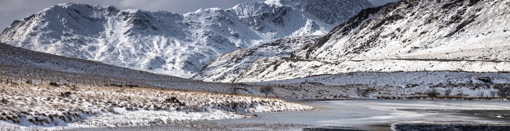
Mountain conditions
Here are some of the main weather elements to consider when planning a trip up the hills:
Wind
Winds strengthen as you gain height and accelerate over ridges and hill tops. When planning a route, wind speed and direction are very important as strong winds can seriously affect enjoyment and safety, literally stop you in your tracks or blow you over. This could cause severe injury or worse on rocky, exposed or steep terrain. Gusts over 30 or 40mph can affect your balance so it is advisable to avoid exposed ridge lines or getting too close to cliff edges in those conditions. In winds of over 50mph, it becomes difficult to walk and above 70mph any forward progress becomes almost impossible! Plan a route to make the best of a following wind when up high or, if conditions will change through the day, time the low-level part of the route to coincide with the stronger winds.
Low cloud and visibility
Low cloud often forms on hills due to air being forced to rise, cool to its dew point and condense into water droplets to form cloud. When the cloud base lowers onto the ground, visibility is usually less than 50 metres so it can be easy to lose all sense of direction and become lost. It is important to know how to navigate in those conditions by using map and compass. GPS is also useful but should be used with the correct map and not be relied upon entirely. Snow cover combined with low cloud or heavy snow can lead to dangerous whiteout conditions with effectively zero visibility and no distinction between the ground and sky. You could be standing right next to a cliff edge and not know it is there! Even expert navigators can struggle in those conditions.
Temperature
The air temperature usually decreases as height is gained, known as the lapse rate. It varies a lot, but is on average around 2°C of cooling per 300 metres of climb. On sunny days with little winds, it may not be too noticeable. However, the wind chill factor can make it feel much colder at height compared to down in the valleys, especially when winds combine with low cloud, rain, sleet or wet snow. It is important to keep any wind and dampness away from the skin by wearing wind-proof and waterproof clothing. Beware of the signs and symptoms of hypothermia.
Rain and snow
Precipitation often falls heavier in the UK hills and mountains due to orographic enhancement and can come and go very quickly. A good day out can still be enjoyed with the correct clothing and equipment if winds are light, especially on lower level routes. However, heavy and persistent rain or snow, very poor visibility and exposure to strong winds can make for difficult and dangerous conditions with a risk of hypothermia. Beware of streams and rivers rising through the day – an easy crossing on the way out may be impassable on the return.
Ground conditions
Deep and soft snow will dramatically slow down walking speed so must be taken into account when planning. Areas of frozen snow or ice can be impassable and dangerous; ice axes and crampons and being skilled in the proper use them is essential in those conditions. During the winter season Be Avalanche Aware and consult avalanche forecasts where available (SAIS). Lake District Fell Top Assessors also provide daily ground conditions reports in winter.
Mountain safety videos
The Met Office, in conjunction with the Welsh Government, British Mountaineering Council, Mountain Leader Training and Sports Wales, have produced a series of short videos on the skills you will need throughout the year and how to stay safe on the mountains.
General hill skills
Dealing with bad weather
Planning for winter conditions
What to do in an emergency
Planning for summer conditions
Support to Mountain Rescue
Mountain Rescue Teams (MRTs) carry out specialist search and rescues and are ready to respond to those in need 24 hours a day, 365 days a year. Callouts can range from rescuing climbers from precipitous crags, helping sick casualties off the hill, to rescuing dogs and other animals from inaccessible places.
MRTs rely on accurate mountain forecasts to safely carry out rescues and training operations. The Met Office provide direct support to RAF MRTs based at Lossiemouth, Leeming and Valley. We support the teams with text forecasts and tailored weather briefings as required for callouts and training. We also deliver presentations and training workshops to MRTs to help give them a good grounding in meteorology and mountain weather.
Support to Scottish Avalanche Information Service (SAIS)
SAIS publish daily forecasts of the avalanche hazard for the 6 most popular walking and climbing areas of Scotland during the winter season. This avalanche information, alongside mountain weather forecasts, enable people to make sensible and safe decisions when planning ahead and venturing into the hills in winter.
Weather forecasts written by Meteorologists in Aberdeen play a key role in the preparation of the avalanche forecasts. These are provided daily from around mid-December to late April for six mountain areas in Scotland: Northern Cairngorms, Southern Cairngorms, Creag Meagaidh, Glencoe, Lochaber and Torridon. SAIS forecasters go up into the hills to take daily snow observations and samples, then use the weather predictions and an expert knowledge on snow conditions to produce avalanche forecasts. SAIS also has access to weather observation data for high-level automatic weather stations installed by the Met Office.