Forecasting frost
Simply checking the weather forecast for temperatures below zero will not always reveal when there will be frosty surfaces outside. Read below to see how you can improve your frost forecasting skills.
What conditions are needed for frost to occur?
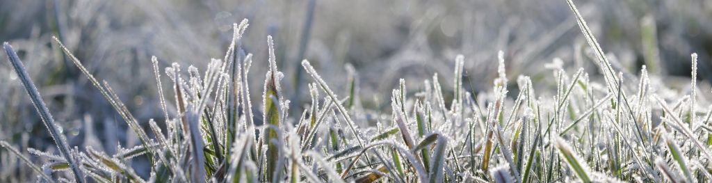
The most common type of frost (called hoar frost) occurs on clear winter nights when the temperature of a surface falls below zero and there is enough moisture in the air to form the frost.
As a general rule of thumb, if the air temperature is forecast to fall between 0 °C and 4 °C on a night with little or no cloud and light winds, then you need to bear in mind there may be a frost outside in the morning. The closer it is to zero, the greater the chance of seeing frost. If the air temperature is forecast to be below zero, then the risk of seeing frost is much higher.
Why is this?
When you look for overnight temperatures on your app or during a weather broadcast, these are for air temperatures. However, the temperature of the ground, or perhaps your car can often drop a few degrees below this on a clear night. This is because of surfaces (e.g. tarmac, grass, metal car) cooling first overnight, and these then cool the air above them. This means that the surfaces usually get to a lower temperature than the air by the morning and is why you may notice a frost on the windscreen even if the car thermometer (which measures air temperature) reads above zero.
Different surfaces lose heat at different rates overnight. You may have sometimes noticed a frost on your car but not on the ground, or frost on the grass but not on the pavement. The grass tends to lose more heat than tarmac and so it is quicker to fall below zero overnight. Weather forecasters sometimes refer to this as a ‘rural frost.’
You must bear in mind that even patchy cloud can affect whether the frost forms though, as the cloud acts ‘like a blanket’ to stop the surfaces losing heat so quickly, and so on cloudy nights, the surface temperatures are closer to the air temperature.
Can you get frost when it is not freezing?
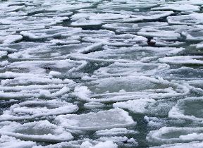
These situations aren’t that common but can occur when the air has a very low humidity (is too dry) and there is no moisture available to form the frost. However, if you decided to wash your car on a morning like this, you would soon see the water turning to ice! When the air has very high humidity, fog can form. If the temperature is below zero in the fog then it is called freezing fog, and forms rime ice as the fog touches surfaces, and this can be similar in appearance to hoar frost.
You can find out more about different types of frost and ice here.
To a meteorologist, a frost is simply the temperature falling below 0 °C. The two things are of course linked. During the day, the Sun puts energy into the ground, trees or your car and the ground then heats the air and temperatures rise. At night the same objects lose energy back into space, this cools the objects and then this cools the air. This is why temperatures usually drop overnight.
The ground leads in both warming and cooling. If the temperature of the ground falls below 0 °C then this is a ground frost. If the temperature of the air falls below 0 °C then this is an air frost. Ground frosts are common even when air temperatures are above 0 °C, however, it is very unusual for an air frost to occur when ground temperatures are above 0 °C.
Frosts are more common in winter because nights are longer, and the Sun is weaker, so there is more energy lost at night than there is going in during the day. The amount of energy lost is affected by other processes, such as the presence of cloud, which can help to ‘keep the heat in.’
Wind speed is another important factor. This is why you usually find that in winter, cloudy and windy nights are usually mild and frost free, whereas clear and calm nights are usually cold, with the risk of frost.
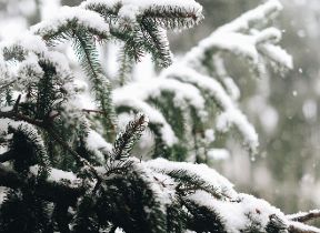
To get frost or ice forming on surfaces you need to have a combination of low temperatures and moisture either in the air as vapour or on the ground as liquid water. When vapour turns directly to ice crystals on a surface this is the white, or hoar frost, you see on grass and cars. If liquid water on the ground freezes then ice forms. Hoar frost on the ground can turn to ice when a car or pedestrian crushes the crystals underfoot. This slightly melts the crystal that will then refreeze as ice.
Due to the chaotic nature of the atmosphere, forecasting maximum and minimum temperature is a challenge. In the Met Office, we generate maximum and minimum temperature ranges for each day by running a range of weather models. This technique is known as an ensemble forecast. The maximum and minimum temperatures for the next five days are extracted from each weather model to produce a range of possible maximum and minimum temperature scenarios.