
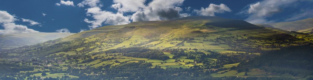
Mountain weather
Bannau Brycheiniog / Brecon Beacons Mountain weather forecast table
Confidence
High
Mountain weather forecast
Mainly dry and bright. Chilly over the summits.
| 06:00 | 09:00 | 12:00 | 15:00 | 18:00 | 21:00 | |
|---|---|---|---|---|---|---|
Weather (at 600m) |
|
|
|
|
|
|
Chance of precipitation (at 600m) |
20% | 10% | <05% | <05% | 00% | 00% |
Wind direction and speed (mph)
Altitude above mean sea level
| 06:00 | 09:00 | 12:00 | 15:00 | 18:00 | 21:00 | |
|---|---|---|---|---|---|---|
| 600m |
W
13
|
W
11
|
W
12
|
NW
10
|
N
6
|
NE
6
|
| 300m |
W
9
|
SW
5
|
W
8
|
NW
7
|
N
2
|
E
2
|
| Valley |
W
6
|
W
5
|
W
7
|
NW
6
|
N
3
|
N
2
|
Wind gust (mph)
Altitude above mean sea level
| 06:00 | 09:00 | 12:00 | 15:00 | 18:00 | 21:00 | |
|---|---|---|---|---|---|---|
| 600m | 22 | 16 | 16 | 14 | 9 | 8 |
| 300m | 22 | 13 | 14 | 12 | 6 | 4 |
| Valley | 19 | 13 | 14 | 12 | 7 | 4 |
Altitude above mean sea level
| 06:00 | 09:00 | 12:00 | 15:00 | 18:00 | 21:00 | |
|---|---|---|---|---|---|---|
| 600m |
2°
|
1°
|
3°
|
3°
|
1°
|
0°
|
| 300m |
3°
|
3°
|
6°
|
6°
|
2°
|
0°
|
| Valley |
3°
|
3°
|
6°
|
7°
|
2°
|
0°
|
| Freezing Level |
800m
|
700m
|
700m
|
700m
|
600m
|
600m
|
Altitude above mean sea level
| 06:00 | 09:00 | 12:00 | 15:00 | 18:00 | 21:00 | |
|---|---|---|---|---|---|---|
| 600m |
-4°
|
-3°
|
-2°
|
-1°
|
-2°
|
-3°
|
| 300m |
-1°
|
0°
|
3°
|
4°
|
0°
|
-2°
|
| Valley |
0°
|
1°
|
4°
|
5°
|
1°
|
-2°
|
Additional weather information
Meteorologist's view
Any showers falling as rain or sleet below 700m. Icy surfaces possible at height.
Weather
Any early isolated wintry showers quickly dissipating to give a bright day with sunny spells during the day. Mainly clear in the evening, perhaps some mist and freezing fog patches forming in the valleys.
Chance of cloud-free hill tops
90%
Low cloud and visibility
Occasional or patchy cloud around the summits early morning, otherwise mainly clear. Visibility very good or excellent, except in any summit cloud, wintry showers, mist or freezing fog.
Recent rainfall
Location: Neuadd (Near Pontsticill)
Altitude: 353m
| Last 24 hours | Last 48 hours | Last 72 hours |
|---|---|---|
| 8.8mm | 9.2mm | 9.2mm |
Measurement date:
Rainfall data provided by Natural Resources Wales. The Met Office is not responsible for content provided by third parties and may remove this data without warning.
Mountain weather information
Weather
Any low cloud, mist and freezing fog in the valleys will be slow to clear. Otherwise dry and sunny or clear.
Chance of cloud-free hill tops
90%
Maximum wind speed expected
East or SE 15 to 20mph with a significant wind chill at height.
Temperature
- At 600m Minus 2 Celsius rising to Plus 1 Celsius around the middle of the day.
- Valley Minus 3 rising to Plus 6 Celsius
- Freezing level All levels rising 600 to 800m around the middle of the day.
Low cloud and visibility
No significant low cloud. Visibility very good or excellent, other than valley mist and freezing fog.
Mountain weather information
Fri 7 Feb
Sunrise:
Sunset:
Early low cloud, mist and freezing fog possible in the valleys. Otherwise a mainly dry and bright start. However, a few snow flurries possible, perhaps occasional snow showers later. Freezing all levels, rising to around 400m around the middle of the day. Fresh to strong east or northeast winds at height with a severe wind chill.
Sat 8 Feb
Sunrise:
Sunset:
Cloudy or bright. Occasional sleet or snow showers. Moderate or fresh east or northeast winds at height with a significant wind chill. Freezing all levels, rising to around 600m during the day.
Sun 9 Feb
Sunrise:
Sunset:
Cloudy or bright. Occasional wintry showers. Freezing level 400 to 800m. Fresh or strong east or northeast winds at height with a significant wind chill.
Updated at:
Summit specific forecast
Mountain summit forecast map
Loading map…
Key
The Bannau Brycheiniog / Brecon Beacons is a mountain range in South Wales comprising six main peaks, with the highest peak, Pen y Fan, standing at 886 metres.