
Snow and gale force winds for parts of the UK
Author: Press Office
12:16 (UTC) on Thu 12 Jan 2017
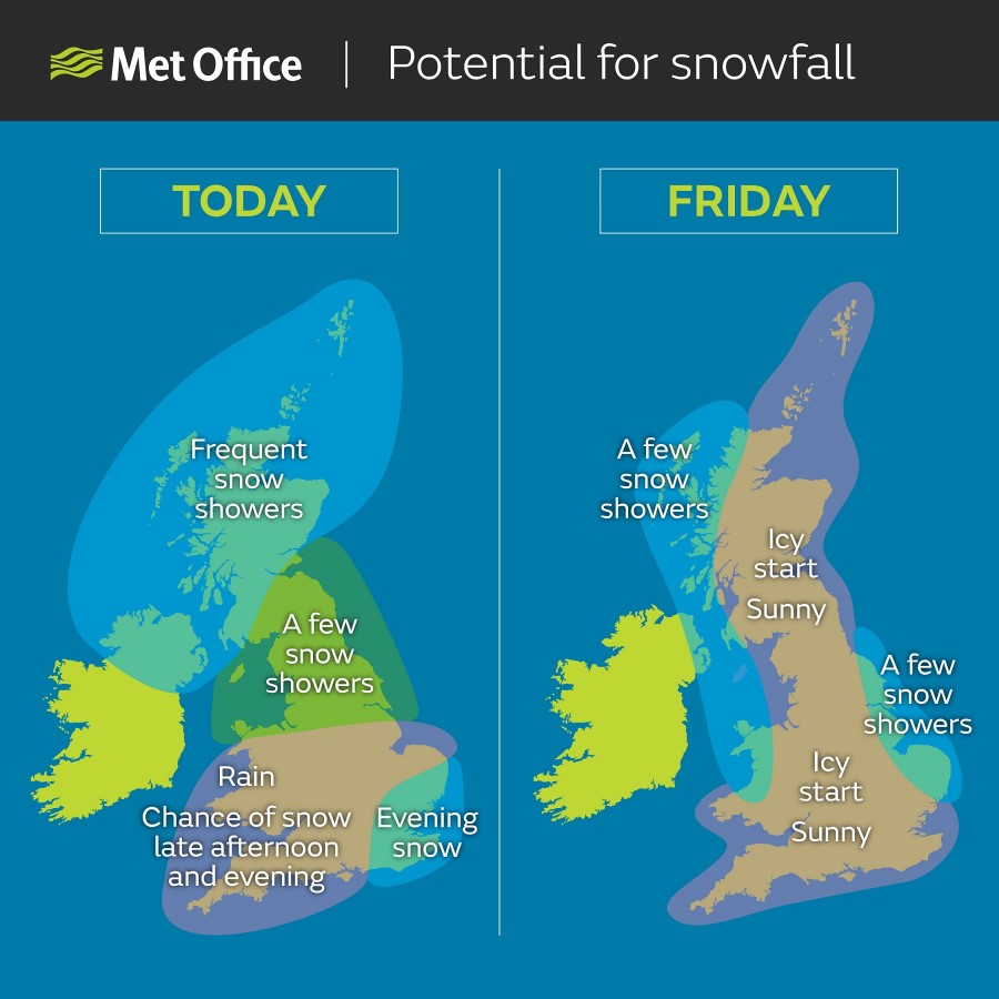
Many parts of the UK will see some snow showers and gale force winds today and tomorrow with some overnight frosts.
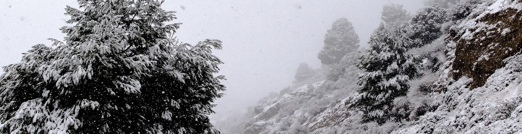
A cold and windy Polar maritime airmass, with its origins over northern Canada, has moved across the UK bringing a real taste of winter. A number of National Severe Weather Warnings have been issued for wind and snow. The heaviest and most frequent snow showers today are likely across northern and western Scotland, Northern Ireland and around Irish Sea coasts. The gales could mean there are temporary blizzard conditions as well as a risk of hail and thunder in some places.
Rain will affect the south today and may turn to sleet or snow as it crosses the south east and East Anglia this afternoon, and if it does it may well settle for a time. As skies clear tonight many may see ice on untreated surfaces particularly in the east, south east and Midlands.
The risk of snow continues tomorrow (Friday) particularly for eastern and western coastal areas, Northern Ireland and northern Scotland, and into Saturday for eastern coasts and northern Scotland.
Paul Gundersen, Chief Meteorologist said: “There’s a chance any snow that settles could be disruptive to transport and possibly lead to interruptions to power supplies. Another potential travel problem could be the ice risk ovrnight. You may find untreated surfaces such as pavements very slippery.
“Forecasting snow is always challenging and there’s often a fine line between whether it will rain or snow in a particular location depending on slight changes in air temperature. Keep an eye on the forecast and warnings for your area for the latest information.”
Daytime temperatures are likely to be around 2 to 5 °C, but the strong to gale force winds will make it feel much colder. Overnight, a frost and ice will develop in most places with some severe frost likely where there is snow on the ground in the north. Temperatures could dip below -10 °C over snow cover in rural areas.
RAC spokesman Simon Williams said: "Motorists all over the UK are facing very challenging driving conditions from the full array of winter weather. Driving in rain, snow and ice is a real danger so the best advice is to drive more slowly, leave far more space behind the car in front than normal, and expect the unexpected. If you are unlucky enough to find yourself slipping and sliding on the road, change to a higher gear to gain traction, be gentle with the accelerator and you should keep control. Also, remember to give yourself more time to brake and apply the pressure on the brake steadily. ”
As we head into the weekend it looks like the cold weather will continue although snow showers will become more isolated. Inland areas will be more sheltered and so may escape any snow altogether.
There are many ways you can ensure you and your family stay well this winter and, if you are travelling, to plan your journey and prepare your vehicle. There are many more hints, tips and advice on our Get Ready for Winter website.
Keep up to date with the weather using our forecast pages and by following us on Twitter and Facebook, as well as using our new mobile app which is available for iPhone from the App store and for Android from the Google Play store. Search for "Met Office" in store.