An improved picture for weather radar
Author: Press Office
06:15 (UTC) on Fri 9 Feb 2018
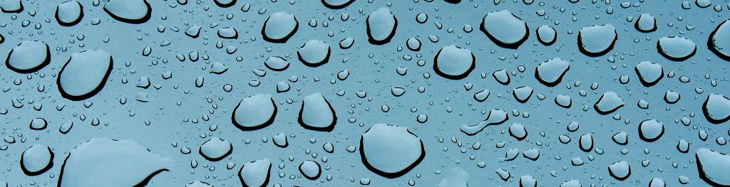
A completed multi-million pound upgrade to the UK’s rainfall radar network allows the size and shape of raindrops and snowflakes to be captured for the first time.
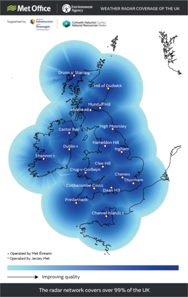
These new scientific advancements will ultimately lead to improvements in the accuracy of rainfall estimates, particularly during high-impact weather events, such as flooding, and they are of a complete upgrade of the Met Office Radar Network. The network is one of the longest established radar networks of its kind in the world and consists of 15 radar sites across the UK.
The £10 million pound upgrade was jointly funded by the Met Office and the Environment Agency. The Head of the Met Office Public Weather Service Derrick Ryall said: “Weather radar provides the only means of measuring the spatial extent and distribution of rainfall over a wide geographical area.
“The most intense rainfall events are often highly localised and can therefore be missed or under-sampled by rain gauge networks, and whilst their occurrence can be forecast with skill, it is often not currently possible to forecast their exact location. Radar therefore provides a crucial input to short-range weather forecasts (nowcasts) of precipitation rate, and improves the skill of weather forecasts when it is assimilated into numerical weather prediction models.”
The Met Office radar network includes 15 radar stations across the UK; the oldest at Hameldon Hill, near Burnley in Lancashire, has been operating since 1974. Our new radar deliver five times more data, with almost a terabyte being received from each radar over the course of a year. We now record 1.8 million rainfall observations per hour per radar and can identify swarms of insects or flocks of birds over 25 miles away.
Carol Holt, Deputy Director for the Environment Agency, said: “This joint project with the Met Office is just one of the many exciting ways the Environment Agency is making the most of new technology to prepare for and respond to floods.
“The quality and reliability of the data we are getting from the new radars is significantly improved and will help us to provide more accurate flood forecasts and issue flood warnings earlier. This means people have more time to prepare when flooding is expected – so please check whether your home is at risk and sign up to receive our free warnings.”
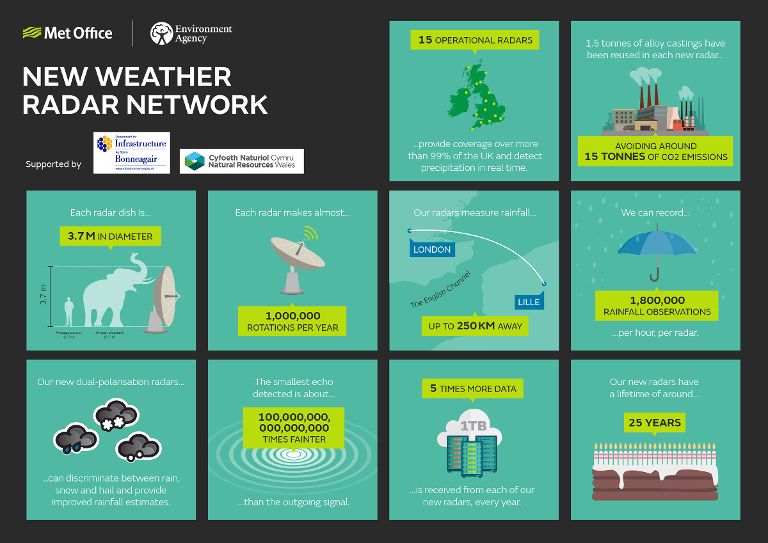 The new radar system was developed in-house by Met Office engineers using unparalleled levels of skill and expertise, meaning it has a number of unique capabilities not found on commercial radar. The new technology has not only improved radar coverage but also the accuracy of rainfall forecasts. The Met Office delivers 4.5 million forecasts every day supporting both the UK public and industry and this unique technology is helping us respond to present and future customer requirements.
As the skill of current weather forecasts improves society is becoming more and more dependent on them for a whole range of decision-making. The Met Office Weather Radar Network Renewal project has helped ensure we continue to play a vital role in providing governments, public and commercial customers with timely and essential weather forecast and real time weather information.
This new ‘state of the art’ radar technology is more efficient to operate than the previous network and is more flexible and adaptable making it easier to upgrade in the future as radar technology continues to develop.
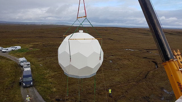
The installation of the radar dome at Stornoway on the Isle of Lewis in the Western Isles