Amber warning issued for Storm Babet
Author: Press Office
14:07 (UTC+1) on Tue 17 Oct 2023
The Met Office has issued an Amber warning as Storm Babet approaches and will bring disruptive rain and strong winds in the coming days.
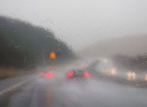
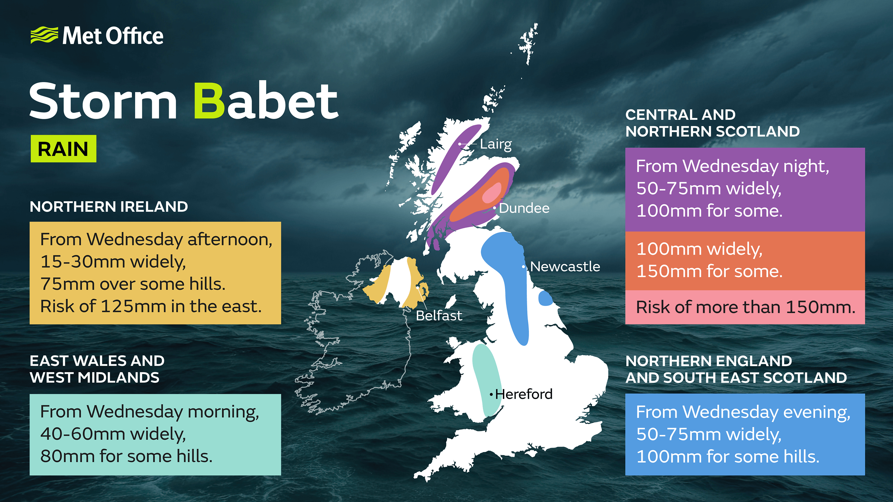
The influence of Storm Babet will begin to be felt late on Tuesday and into Wednesday as heavy and, in places, disruptive rainfall will move in from the south and west, impacting Northern Ireland and much of England and Wales.
As the rain moves northwards it will stall across central and eastern parts of Scotland where the rain will become heavy and persistent from Thursday through to Saturday. There is an Amber Severe Weather Warning for rain for this area where up to 150-200 mm of rain could accumulate in some areas of higher ground.
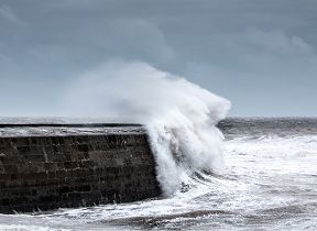
 Strong southeasterly winds will also create dangerous conditions along the east coast of the UK, with large waves an additional hazard.
A number of weather warnings are in force for Storm Babet, with heavy rain also likely for Northern Ireland, as well as large parts of England and Scotland.
Met Office Deputy Chief Meteorologist Tony Wardle said: “Storm Babet will bring disruption for parts of the UK in the coming days, with heavy rain and strong winds likely for many.
“Heavy and persistent rain will fall onto already saturated ground bringing a risk of flooding. It is important to stay up to date with warnings from your local flood warning agency as well as the local authorities.
“As well as heavy rain, Storm Babet will bring some very strong winds and large waves near some eastern coasts too. Gusts around 70 mph are possible in eastern and northern Scotland from Thursday. Met Office warnings will continue to be reviewed as the forecast develops.”
Be prepared for potential flooding
David Morgan, Flood Duty Manager for the Scottish Environment Protection Agency (SEPA), said: “Storm Babet will bring heavy rain and high winds across Scotland from Wednesday evening, starting in the southwest before moving across to the northeast through Thursday and into the weekend.
“Impacts from surface water and rivers are likely, and with catchments saturated from recent heavy rain and flooding, we’re urging people to be prepared for potential flooding. There is also concern that surface-water flooding may be exacerbated by debris blocking drainage, culverts, etc. as a result of the high winds.
“Flood Alerts and Warnings will be issued as required, and we continue to work with the Met Office to monitor the situation 24/7. People can check our Flood Updates for all the latest information and the three-day Scottish Flood Forecast to see what conditions are expected further ahead.
“If you live or work in an area that could be affected, consider any steps you need to take now to be prepared and stay safe, and to take extra care if you need to travel.
“If you have not already signed up to Floodline, you can do so now to receive free updates for where you live, or travel through, directly to your phone. Follow SEPA’s social media, especially @SEPAflood on X for the latest information.”
Stay safe near the coast
RNLI Water Safety Partner, Sam Hughes, said: “The forecasted strong winds along with heavy rain are likely to cause dangerous conditions for those visiting the coast around the UK and Ireland.
“The RNLI advises staying a safe distance away from the water and cliff edges as the conditions could knock you off your feet or wash you into the sea. It is not worth risking your life.
“If you see someone else in danger in the water, call 999 or 112 and ask for the Coastguard if by the coast, or the fire service if inland. If you have something that floats that they can hold on to, throw it to them. Don’t go in the water yourself – you may end up in difficulty too.”
The RNLI advice is:
- Stay well back from stormy, wintery seas and cliff edges
- Check the weather forecast and tide times before you go out
- Take a phone with you
- In an emergency call 999 or 112 and ask for the Coastguard
Do you know your flood risk?
Could your property be at risk of flooding? Follow this three point plan to check and be prepared: 1. Check if your property is at risk here. If you are at risk take the next two steps to protect your property when you need to, 2. preparing a flood plan, 3. Prepare an emergency flood kit.
Further ahead
Low pressure is forecast to remain in charge of the UK’s weather into the start of next week, with potential for further spells of wet and windy weather.
You can keep up to date with the latest forecast on our website, by following us on Twitter and Facebook, as well as on our mobile app which is available for iPhone from the App store and for Android from the Google Play store.