Storm Ciarán
Author: Press Office
12:35 (UTC) on Tue 31 Oct 2023
It will stay unsettled and, at times very windy, over the coming days. This unsettled period peaks with Storm Ciarán, which crosses southern UK on Thursday.
A number of Severe Weather Warnings have already been issued, with further updates and additions expected throughout the week.
Met Office Chief Meteorologist Dan Suri, said “Tomorrow, ahead of Storm Ciarán, a squally cold front will move eastwards across southern and southeast England bringing bursts of heavy rain and coastal gusts of 60-70mph, mainly from Dorset eastwards.
“Wind and rain warnings associated with Storm Ciarán are in force from Wednesday night onwards into Friday, with further updates possible on Wednesday. These include amber warning for winds for southwestern parts of England and Wales Thursday early hours and morning and the far south and southeast of England Thursday daytime and early evening. Storm Ciarán is expected to bring very strong along southern coastal areas of England in particular where gusts of 70 to 80mph are possible, gusts perhaps exceeding 85 mph in the most exposed locations. Further inland, gusts could reach up to 50 or 60mph.
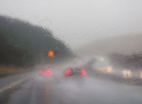
“As well as strong winds, this deep low pressure system will bring heavy rain to many parts of the UK. Much of southern England and south Wales, as well as parts of north Wales, northeast England, southeast Scotland and perhaps the east of Northern Ireland look to see the wettest conditions between Wednesday evening and Friday morning. 20-25 mm of rain may fall quite widely, with 40-60 mm possible over higher ground. Some parts of south Wales and southwest England may see 80 mm of rain. This rain will fall on already saturated ground, bringing the risk of flooding.
⚠️⚠️ Amber weather warnings issued ⚠️⚠️
— Met Office (@metoffice) October 31, 2023
Very strong and damaging winds associated with #StormCiarán bringing travel disruption. Large waves may also bring coastal impacts
Thursday 0300 – 2000
Latest info 👉 https://t.co/QwDLMfRBfs
Stay #WeatherAware ⚠️ pic.twitter.com/vZ6Z0PVNoU
Amy Shaw, National Network Manager at National Highways, said: “Gales and high winds can happen all year round, but are even more prevalent during the autumn and winter seasons, occuring most often during storms.
“It is important to plan ahead for your journey during Storm Ciaran, and if weather conditions become challenging, adjust your driving behaviour and take extra care. National Highways reminds motorists to keep TRIP in mind ahead of journeys at this time of year – Top-up: oil, water, screen wash; Rest: rest every two hours; Inspect: Inspect tyres and lights and Prepare: check your route and the weather forecast.”
Flooding possible
Kate Marks, flood duty manager at the Environment Agency, said: “Significant surface water flooding is possible but not expected in the South East of England today and minor river flooding impacts are probable. Further significant flooding impacts are possible from Wednesday through to Friday in response to rain from Storm Ciaran.”
“We advise people to stay away from swollen rivers and urge people not to drive through flood water as just 30cm of flowing water is enough to move your car.
“People should check their flood risk, sign up for free flood warnings and keep up to date with the latest situation at https://www.gov.uk/check-if-youre-at-risk-of-flooding and follow @EnvAgency on X, formerly known as Twitter, for the latest flood updates.”
With #StormCiarán bringing heavy rain and strong winds to the UK between Wednesday and Thursday evening, you should consider weatherproofing your home and garden 🌧️ 🏡
— Met Office (@metoffice) October 30, 2023
See below ⤵️
Be #WeatherReady pic.twitter.com/H2Jvqz9NF4
Met Office Deputy Chief Meteorologist, Steven Keates, said “Once Storm Ciarán has passed, the weather over the weekend continues to look unsettled for many with more showers and rain at times. Warnings will continue to be updated over the coming days, so it is important to stay up to date with the Met Office forecast and warnings in your area.”
You can keep up to date with the latest forecast on our website, by following us on Twitter and Facebook, as well as on our mobile app which is available for iPhone from the App store and for Android from the Google Play store.