Turning cold
Author: Press Office
11:55 (UTC) on Tue 28 Nov 2023
There is the chance of widespread overnight frosts for much of the UK in the coming days and a risk of snow to northern Scotland and parts of northeast England.
With the UK sitting in cold air from northern Scandinavia the weather is turning much colder for the rest of this week and the start of next with daytime temperatures struggling to get above single figures and overnight temperatures staying below freezing for much of the country.
⚠️ Yellow weather warning issued ⚠️
— Met Office (@metoffice) November 28, 2023
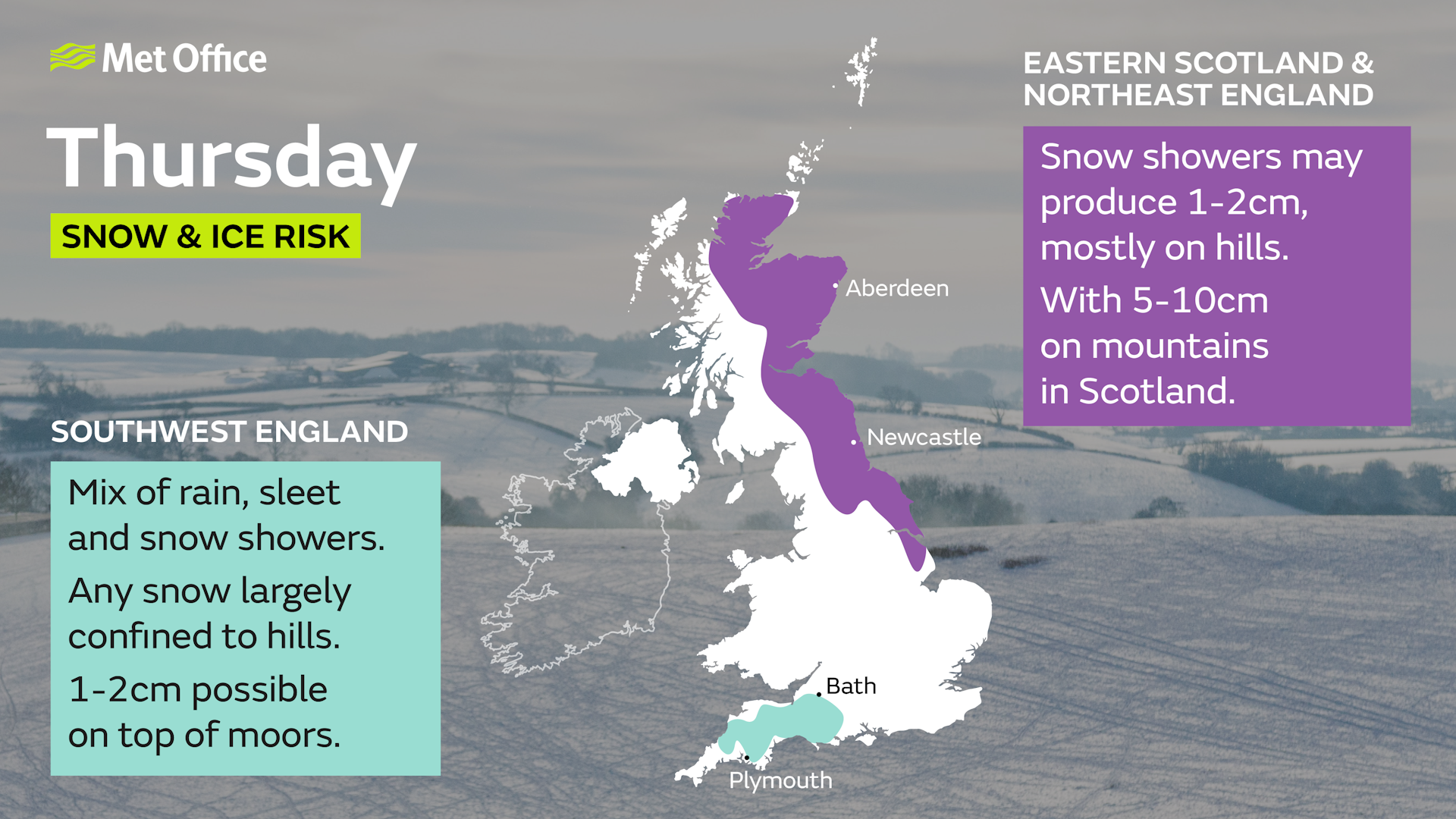
Snow and ice across parts of Scotland and northeast England
Tuesday 1700 – Wednesday 1100
Latest info 👉 https://t.co/QwDLMfRBfs
Stay #WeatherAware⚠️ pic.twitter.com/5HcTlMeHGC
Met Office Chief Meteorologist, Neil Armstrong, said: “There has been some uncertainty in the atmospheric weather patterns for the coming days, however, confidence in the forecast is improving and there is a reducing chance of snow for southern areas of the UK, although there is still a chance we may see some sleety wintry showers over higher ground in areas such as Dartmoor or Exmoor.
“Northern and northeastern areas of the UK in the moist north / northeasterly airflow continue to see a chance of snow or sleet and yellow snow and ice National Severe Weather Warnings have been issued.”
The cold regime looks likely to continue into next week, with a good deal of dry sunny weather for many. However, showers remain possible, particularly in eastern coastal areas, and these could be wintry at times.
The UKHSA has issued yellow and amber cold-health alerts for the health sector covering northern regions of England through until the 5th December.
Snowfall in late autumn or early winter doesn’t generally linger because ground temperatures broadly remain relatively high, especially compared with values in late winter, after the ground loses more of its warmth.
You can keep up to date with the latest forecast on our website, by following us on Twitter and Facebook, as well as on our mobile app which is available for iPhone from the App store and for Android from the Google Play store.