
Mountain weather
Northwest Highlands Mountain weather forecast table
Confidence
High confidence for high pressure to dominate from later Wednesday bringing largely settled conditions
This evening forecast
Clear spells and scattered showers, heavy at times with a small chance of hail and lightning, and wintry above 500m. Feeling cold in west to southwest winds 30-40mph at height.
Mountain weather hazards
Hazards apply at or above 300m, reflecting the more severe conditions which can occur at altitude.
 Severe Chill Effect
Wind significantly lowers the ‘feels-like’ temperature relative to the actual temperature, with even moderate winds significantly adding to the chilling effect. Strong winds can result in a severe and debilitating wind chill many degrees below the actual temperature. This effect will be enhanced in rain or wet snow. Without protection, prolonged exposure could result in frost nip or frostbite on exposed parts of the body and/or hypothermia.
Poor Visibility
Poor visibility presents challenging route finding conditions. Visibility could be significantly less than 50 metres in all directions with few or no visual references, especially on featureless moors or plateaux. Distances become hard to judge and cliff or cornice edges can be difficult to recognise. These conditions require good navigational skills. There is a risk of white-out conditions when mist or fog is combined with extensive snow cover.
Blizzards
Blizzards and whiteouts present challenging and serious conditions due to a combination of falling or blowing snow, strong winds and cold temperatures. They can be highly disorientating, often resulting in near-zero visibility with limited or no visual references and no distinction between ground and sky. Cliff edges and cornices may not be apparent, even close up. These conditions require very good navigational skills.
Heavy Persistent Snow
Heavy snow can lead to rapid changes in underfoot conditions and paths may become treacherous or hidden. It also brings very poor visibility and often makes navigation much more challenging. When deep snow accumulates progress is often time consuming and strenuous, significantly affecting the distance one can travel on foot. Deep drifts can develop if snow is combined with strong winds. A heightened avalanche risk is possible and avalanche reports should be consulted where available.

Mountain weather forecast
Occasional showers in morning, mostly dry by evening. Cold
| 00:00 | 03:00 | 06:00 | 09:00 | 12:00 | 15:00 | 18:00 | 21:00 | |
|---|---|---|---|---|---|---|---|---|
Weather (at 800m) |
|
|
|
|
|
|
|
|
Chance of precipitation (at 800m) |
80% | 70% | 60% | 60% | 40% | 20% | <05% | <05% |
Wind direction and speed (mph)
Altitude above mean sea level
| 00:00 | 03:00 | 06:00 | 09:00 | 12:00 | 15:00 | 18:00 | 21:00 | |
|---|---|---|---|---|---|---|---|---|
| 1000m |
SW
39
|
W
37
|
SW
33
|
SW
32
|
SW
29
|
SW
29
|
SW
31
|
SW
34
|
| 900m |
SW
37
|
W
34
|
SW
31
|
SW
30
|
SW
28
|
SW
27
|
SW
29
|
SW
33
|
| 600m |
SW
25
|
W
22
|
SW
20
|
SW
19
|
SW
20
|
SW
18
|
SW
17
|
SW
20
|
| 300m |
SW
8
|
W
6
|
W
6
|
SW
6
|
SW
8
|
SW
7
|
SW
6
|
SW
8
|
| Glen |
SW
13
|
W
11
|
W
8
|
SW
7
|
SW
11
|
SW
9
|
SW
9
|
SW
12
|
Wind gust (mph)
Altitude above mean sea level
| 00:00 | 03:00 | 06:00 | 09:00 | 12:00 | 15:00 | 18:00 | 21:00 | |
|---|---|---|---|---|---|---|---|---|
| 1000m | 48 | 45 | 41 | 40 | 38 | 38 | 39 | 45 |
| 900m | 46 | 42 | 39 | 38 | 36 | 36 | 38 | 43 |
| 600m | 34 | 31 | 28 | 27 | 28 | 26 | 26 | 31 |
| 300m | 33 | 29 | 26 | 25 | 26 | 24 | 25 | 29 |
| Glen | 28 | 24 | 18 | 19 | 22 | 21 | 23 | 27 |
Altitude above mean sea level
| 00:00 | 03:00 | 06:00 | 09:00 | 12:00 | 15:00 | 18:00 | 21:00 | |
|---|---|---|---|---|---|---|---|---|
| 1000m |
-3°
|
-4°
|
-4°
|
-3°
|
-3°
|
-2°
|
-1°
|
-1°
|
| 900m |
-2°
|
-3°
|
-3°
|
-3°
|
-2°
|
-1°
|
-1°
|
0°
|
| 600m |
0°
|
-1°
|
-1°
|
0°
|
0°
|
1°
|
2°
|
2°
|
| 300m |
1°
|
1°
|
1°
|
2°
|
3°
|
4°
|
3°
|
4°
|
| Glen |
4°
|
4°
|
4°
|
4°
|
6°
|
7°
|
6°
|
7°
|
| Freezing Level |
500m
|
400m
|
400m
|
500m
|
600m
|
700m
|
900m
|
1,000m
|
Altitude above mean sea level
| 00:00 | 03:00 | 06:00 | 09:00 | 12:00 | 15:00 | 18:00 | 21:00 | |
|---|---|---|---|---|---|---|---|---|
| 1000m |
-13°
|
-14°
|
-14°
|
-12°
|
-11°
|
-10°
|
-10°
|
-9°
|
| 900m |
-12°
|
-13°
|
-12°
|
-11°
|
-10°
|
-9°
|
-9°
|
-8°
|
| 600m |
-8°
|
-8°
|
-8°
|
-7°
|
-6°
|
-5°
|
-4°
|
-4°
|
| 300m |
-2°
|
-1°
|
-2°
|
-1°
|
-1°
|
1°
|
1°
|
1°
|
| Glen |
0°
|
0°
|
1°
|
2°
|
2°
|
4°
|
3°
|
4°
|
Additional weather information
Met Office Aberdeen meteorologist's view
Windy conditions at height will make for fairly arduous walking on exposed terrain with buffeting of clothing. Balance may be affected at times. Feeling cold with strong winds at height. Underfoot conditions with accumulating fresh snow, and poor visibilities in blizzard conditions in the morning will mean making progress is difficult.
Weather
Occasional showers through the morning, wintry down to 300-400m. Showers become increasingly isolated through the afternoon, leaving the area mostly dry by evening.
Chance of cloud-free hill tops
20% at first rising to 60% by the evening
Low cloud and visibility
Extensive cloud down to around 600-800m and visibilities falling poor in showers through the morning, becoming more broken through the day. Areas of cloud remaining through the evening.
Mountain weather information
Weather
Dry and sunny. Some low cloud at first.
Chance of cloud-free hill tops
60% rising 90% or more through the morning.
Maximum wind speed expected
Southwest backing south 25-35mph, gusting 35-50mph over the tops.
Temperature
- At 800m Minus 1 to plus 2 Celsius
- Glen Minus 1 rising to plus 4 Celsius
- Freezing level 700-900m
Low cloud and visibility
Areas of cloud down to around 600-800m in early morning, breaking through the day to leave clear summits and good visibilities.
Mountain weather information
Fri 7 Feb
Sunrise:
Sunset:
Dry and bright or sunny. Cold, with freezing level 300-500m. Fresh to strong south to southeast winds.
Sat 8 Feb
Sunrise:
Sunset:
Dry with bright or sunny spells and variable amounts of cloud. Cold, with freezing level 300-500m. Light to fresh southeast winds.
Sun 9 Feb
Sunrise:
Sunset:
Dry and mostly bright or sunny, with variable amounts of cloud. Cold, with freezing level 300-500m. Light winds.
Updated at:
Summit specific forecast
Mountain summit forecast map
Loading map…
Key
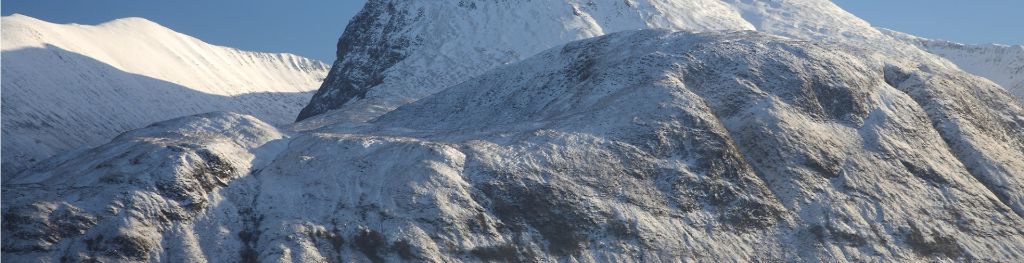
Separated from the Grampians by the Great Glen the weather forecast area includes Wester Ross, Assynt, Sutherland, Knoydart, Torridon, Glen Affric and the Cuillin Hills on the Isle of Skye.
For snow and avalanche hazard forecasts please visit Scottish Avalanche Information Service