
Mountain weather
Peak District Mountain weather forecast table
Confidence
High
This evening forecast
Cloudy or partly cloudy with occasional wintry showers. Strong west or southwest winds with a severe wind chill.
Mountain weather hazards
Hazards apply at or above 300m, reflecting the more severe conditions which can occur at altitude.
 Severe Chill Effect
Wind significantly lowers the ‘feels-like’ temperature relative to the actual temperature, with even moderate winds significantly adding to the chilling effect. Strong winds can result in a severe and debilitating wind chill many degrees below the actual temperature. This effect will be enhanced in rain or wet snow. Without protection, prolonged exposure could result in frost nip or frostbite on exposed parts of the body and/or hypothermia.
Mountain weather forecast
Mainly dry and bright. Cold with wind chill.
| 00:00 | 03:00 | 06:00 | 09:00 | 12:00 | 15:00 | 18:00 | 21:00 | |
|---|---|---|---|---|---|---|---|---|
Weather (at 600m) |
|
|
|
|
|
|
|
|
Chance of precipitation (at 600m) |
40% | 30% | 20% | 20% | 10% | 00% | 00% | 00% |
Wind direction and speed (mph)
Altitude above mean sea level
| 00:00 | 03:00 | 06:00 | 09:00 | 12:00 | 15:00 | 18:00 | 21:00 | |
|---|---|---|---|---|---|---|---|---|
| 600m |
SW
23
|
SW
20
|
SW
17
|
SW
14
|
W
14
|
W
14
|
W
10
|
W
8
|
| 300m |
SW
17
|
SW
14
|
SW
13
|
SW
11
|
W
11
|
W
10
|
W
6
|
SW
4
|
| Valley |
SW
10
|
SW
8
|
SW
6
|
SW
6
|
W
7
|
W
8
|
W
3
|
S
1
|
Wind gust (mph)
Altitude above mean sea level
| 00:00 | 03:00 | 06:00 | 09:00 | 12:00 | 15:00 | 18:00 | 21:00 | |
|---|---|---|---|---|---|---|---|---|
| 600m | 31 | 26 | 23 | 19 | 20 | 19 | 15 | 12 |
| 300m | 26 | 23 | 21 | 16 | 16 | 15 | 10 | 7 |
| Valley | 24 | 21 | 18 | 14 | 15 | 15 | 10 | 5 |
Altitude above mean sea level
| 00:00 | 03:00 | 06:00 | 09:00 | 12:00 | 15:00 | 18:00 | 21:00 | |
|---|---|---|---|---|---|---|---|---|
| 600m |
1°
|
0°
|
0°
|
0°
|
1°
|
2°
|
1°
|
0°
|
| 300m |
3°
|
2°
|
2°
|
2°
|
4°
|
4°
|
3°
|
2°
|
| Valley |
4°
|
3°
|
2°
|
2°
|
5°
|
5°
|
3°
|
1°
|
| Freezing Level |
700m
|
600m
|
600m
|
600m
|
700m
|
700m
|
700m
|
700m
|
Altitude above mean sea level
| 00:00 | 03:00 | 06:00 | 09:00 | 12:00 | 15:00 | 18:00 | 21:00 | |
|---|---|---|---|---|---|---|---|---|
| 600m |
-6°
|
-7°
|
-6°
|
-6°
|
-4°
|
-3°
|
-4°
|
-4°
|
| 300m |
-2°
|
-3°
|
-3°
|
-2°
|
0°
|
1°
|
0°
|
0°
|
| Valley |
0°
|
-1°
|
-1°
|
0°
|
2°
|
3°
|
1°
|
0°
|
Additional weather information
Meteorologist's view
Icy surfaces possible at height.
Weather
Partly cloudy overnight with a scattering of wintry showers, these isolated by dawn. Bright with sunny spells during the day, any isolated wintry showers soon dying out. Mainly clear in the evening, perhaps some mist and freezing fog patches forming in the valleys.
Chance of cloud-free hill tops
90% or more.
Low cloud and visibility
Occasional or patchy cloud around the summit overnight and early morning, otherwise mainly clear. Visibility very good or excellent, except in any summit cloud, wintry showers, mist and freezing fog.
Recent rainfall
Location: Cat & Fiddle (Midway between Buxton and Macclesfield)
Altitude: 511m
| Last 24 hours | Last 48 hours | Last 72 hours |
|---|---|---|
| 2.5mm | 3.1mm | 3.1mm |
Measurement date:
Rainfall data provided by the Environment Agency. The Met Office is not responsible for content provided by third parties and may remove this data without warning.
Mountain weather information
Weather
Any low cloud, mist and freezing fog in the valleys will be slow to clear. Otherwise dry and sunny or clear.
Chance of cloud-free hill tops
90% or more
Maximum wind speed expected
East or SE 5 to 10mph
Temperature
- At 600m Minus 2 Celsius rising to around Plus 1 Celsius around the middle of the day.
- Valley Minus 3 rising to Plus 4 Celsius
- Freezing level All levels rising 600 to 800m around the middle of the day.
Low cloud and visibility
No significant low cloud. Visibility very good or excellent, other than valley mist and freezing fog.
Mountain weather information
Fri 7 Feb
Sunrise:
Sunset:
Early low cloud, mist and freezing fog possible in the valleys. Otherwise mainly dry and bright, although a few wintry flurries possible and cloud expected to increase. Freezing all levels, rising to around 600m around the middle of the day. Fresh to strong east or northeast winds at height with a significant wind chill.
Sat 8 Feb
Sunrise:
Sunset:
Rather cloudy. Wintry showers. Moderate or fresh east or northeast winds at height with a significant wind chill. Freezing all levels, rising to around 600m during the day.
Sun 9 Feb
Sunrise:
Sunset:
Rather cloudy. Wintry showers. Freezing level 400 to 800m. Fresh to strong northeast winds at height with a significant wind chill.
Updated at:
Summit specific forecast
Mountain summit forecast map
Loading map…
Key
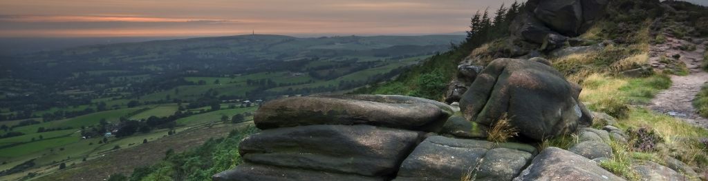
The Peak District is home to a wide variety of magnificent hills, moors, outcrops and gritstone edges.