
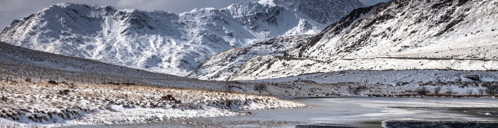
Mountain weather
Eryri / Snowdonia Mountain weather forecast table
Confidence
High
Mountain weather hazards
Hazards apply at or above 300m, reflecting the more severe conditions which can occur at altitude.
 Severe Chill Effect
Wind significantly lowers the ‘feels-like’ temperature relative to the actual temperature, with even moderate winds significantly adding to the chilling effect. Strong winds can result in a severe and debilitating wind chill many degrees below the actual temperature. This effect will be enhanced in rain or wet snow. Without protection, prolonged exposure could result in frost nip or frostbite on exposed parts of the body and/or hypothermia.
Mountain weather forecast
Mainly dry and bright. Cold with wind chill.
| 06:00 | 09:00 | 12:00 | 15:00 | 18:00 | 21:00 | |
|---|---|---|---|---|---|---|
Weather (at 800m) |
|
|
|
|
|
|
Chance of precipitation (at 800m) |
20% | 20% | 10% | 00% | 00% | 00% |
Wind direction and speed (mph)
Altitude above mean sea level
| 06:00 | 09:00 | 12:00 | 15:00 | 18:00 | 21:00 | |
|---|---|---|---|---|---|---|
| 900m |
W
26
|
W
20
|
W
16
|
W
12
|
NW
10
|
SW
5
|
| 600m |
W
17
|
W
12
|
W
12
|
W
10
|
W
5
|
SE
3
|
| 300m |
W
10
|
W
7
|
W
9
|
W
7
|
SW
1
|
SE
3
|
| Valley |
W
10
|
W
8
|
W
9
|
W
8
|
SW
2
|
S
3
|
Wind gust (mph)
Altitude above mean sea level
| 06:00 | 09:00 | 12:00 | 15:00 | 18:00 | 21:00 | |
|---|---|---|---|---|---|---|
| 900m | 31 | 25 | 21 | 16 | 12 | 7 |
| 600m | 21 | 17 | 16 | 13 | 6 | 4 |
| 300m | 20 | 16 | 14 | 12 | 4 | 4 |
| Valley | 20 | 16 | 15 | 12 | 4 | 5 |
Altitude above mean sea level
| 06:00 | 09:00 | 12:00 | 15:00 | 18:00 | 21:00 | |
|---|---|---|---|---|---|---|
| 900m |
-1°
|
-1°
|
-1°
|
0°
|
-1°
|
-1°
|
| 600m |
1°
|
1°
|
2°
|
2°
|
1°
|
1°
|
| 300m |
4°
|
3°
|
5°
|
5°
|
3°
|
3°
|
| Valley |
5°
|
5°
|
6°
|
7°
|
5°
|
4°
|
| Freezing Level |
700m
|
700m
|
700m
|
700m
|
700m
|
700m
|
Altitude above mean sea level
| 06:00 | 09:00 | 12:00 | 15:00 | 18:00 | 21:00 | |
|---|---|---|---|---|---|---|
| 900m |
-9°
|
-8°
|
-7°
|
-5°
|
-6°
|
-4°
|
| 600m |
-5°
|
-4°
|
-2°
|
-2°
|
-1°
|
-1°
|
| 300m |
0°
|
0°
|
2°
|
2°
|
2°
|
2°
|
| Valley |
1°
|
2°
|
4°
|
4°
|
4°
|
2°
|
Additional weather information
Meteorologist's view
Any showers falling as rain or sleet below 600m. Icy surfaces possible at height.
Weather
Bright with sunny spells, with any isolated early snow showers soon dying out. Mainly clear in the evening, perhaps some mist and freezing fog patches forming in the valleys.
Chance of cloud-free hill tops
80%
Low cloud and visibility
Occasional or patchy cloud around the summits overnight and early morning, otherwise mainly clear. Visibility very good or excellent, except in any summit cloud, snow showers, mist and freezing fog.
Ground conditions
Please see - https://yrwyddfa.live/
Mountain weather information
Weather
Any low cloud, mist and freezing fog in the valleys will be slow to clear. Otherwise dry and sunny or clear.
Chance of cloud-free hill tops
90%
Maximum wind speed expected
East or SE 15 to 20mph with a significant wind chill at height.
Temperature
- At 800m Minus 3 Celsius rising to Zero Celsius around the middle of the day.
- Valley Minus 3 rising to Plus 6 Celsius
- Freezing level All levels rising 600 to 800m around the middle of the day.
Low cloud and visibility
No significant low cloud. Visibility very good or excellent, other than valley mist and freezing fog.
Mountain weather information
Fri 7 Feb
Sunrise:
Sunset:
Early low cloud, mist and freezing fog possible in the valleys. Otherwise mainly dry and bright. However, a few snow flurries possible, perhaps scattered snow showers later. Freezing all levels, rising to around 600m around the middle of the day. Fresh to strong east or northeast winds at height with a severe wind chill.
Sat 8 Feb
Sunrise:
Sunset:
Bright or clear spells. Occasional snow showers. Moderate or fresh east or northeast winds at height with a significant wind chill. Freezing all levels, rising to 600m around the middle of the day.
Sun 9 Feb
Sunrise:
Sunset:
Cloudy or bright. Occasional wintry showers. Freezing level 400 to 800m. Fresh or strong east or northeast winds at height with a significant wind chill.
Updated at:
Summit specific forecast
Mountain summit forecast map
Loading map…
Key
The Eryri (Snowdonia) mountains are made up of 90 mountain peaks including the tallest mountain in Wales, Yr Wyddfa (Snowdon), standing at 1,085 metres.