
Mountain weather
Southwest Highlands Mountain weather forecast table
Confidence
High for wintry showers dying out on Tuesday, then drier, brighter weather on Wednesday and Thursday.
This evening forecast
Mainly cloudy this evening with some outbreaks of sleet and snow and rain at lower levels. Light east winds and feeling cold.
Mountain weather hazards
Hazards apply at or above 300m, reflecting the more severe conditions which can occur at altitude.
 Severe Chill Effect
Wind significantly lowers the ‘feels-like’ temperature relative to the actual temperature, with even moderate winds significantly adding to the chilling effect. Strong winds can result in a severe and debilitating wind chill many degrees below the actual temperature. This effect will be enhanced in rain or wet snow. Without protection, prolonged exposure could result in frost nip or frostbite on exposed parts of the body and/or hypothermia.
Poor Visibility
Poor visibility presents challenging route finding conditions. Visibility could be significantly less than 50 metres in all directions with few or no visual references, especially on featureless moors or plateaux. Distances become hard to judge and cliff or cornice edges can be difficult to recognise. These conditions require good navigational skills. There is a risk of white-out conditions when mist or fog is combined with extensive snow cover.

Mountain weather forecast
Rather cloudy with light sleet and snow showers dying out, then becoming brighter. Breezy on the tops and feeling very cold.
| 00:00 | 03:00 | 06:00 | 09:00 | 12:00 | 15:00 | 18:00 | 21:00 | |
|---|---|---|---|---|---|---|---|---|
Weather (at 800m) |
|
|
|
|
|
|
|
|
Chance of precipitation (at 800m) |
40% | 30% | 30% | 20% | 20% | 10% | 10% | 20% |
Wind direction and speed (mph)
Altitude above mean sea level
| 00:00 | 03:00 | 06:00 | 09:00 | 12:00 | 15:00 | 18:00 | 21:00 | |
|---|---|---|---|---|---|---|---|---|
| 1300m |
E
13
|
NE
23
|
NE
22
|
NE
23
|
N
22
|
NW
24
|
NW
25
|
NW
21
|
| 900m |
E
16
|
E
19
|
NE
16
|
N
13
|
N
11
|
NW
14
|
NW
13
|
NW
13
|
| 600m |
NE
15
|
NE
20
|
NE
20
|
NE
15
|
E
12
|
NW
18
|
W
14
|
NW
16
|
| 300m |
N
6
|
N
9
|
N
11
|
N
8
|
NW
6
|
NW
9
|
NW
9
|
NW
9
|
| Glen |
NE
8
|
NE
9
|
NE
8
|
N
6
|
NW
6
|
NW
7
|
NW
6
|
NW
7
|
Wind gust (mph)
Altitude above mean sea level
| 00:00 | 03:00 | 06:00 | 09:00 | 12:00 | 15:00 | 18:00 | 21:00 | |
|---|---|---|---|---|---|---|---|---|
| 1300m | 17 | 29 | 29 | 28 | 26 | 29 | 30 | 26 |
| 900m | 21 | 26 | 24 | 19 | 16 | 20 | 18 | 18 |
| 600m | 20 | 25 | 26 | 19 | 16 | 23 | 18 | 20 |
| 300m | 9 | 14 | 19 | 14 | 11 | 14 | 14 | 14 |
| Glen | 19 | 20 | 19 | 13 | 13 | 16 | 14 | 17 |
Altitude above mean sea level
| 00:00 | 03:00 | 06:00 | 09:00 | 12:00 | 15:00 | 18:00 | 21:00 | |
|---|---|---|---|---|---|---|---|---|
| 1300m |
-3°
|
-3°
|
-3°
|
-4°
|
-3°
|
-3°
|
-3°
|
-4°
|
| 900m |
-1°
|
-2°
|
-1°
|
-1°
|
-1°
|
0°
|
-1°
|
-1°
|
| 600m |
1°
|
1°
|
1°
|
1°
|
1°
|
2°
|
1°
|
1°
|
| 300m |
2°
|
2°
|
3°
|
3°
|
4°
|
4°
|
3°
|
3°
|
| Glen |
4°
|
4°
|
4°
|
4°
|
6°
|
6°
|
5°
|
5°
|
| Freezing Level |
800m
|
700m
|
700m
|
700m
|
800m
|
800m
|
800m
|
800m
|
Altitude above mean sea level
| 00:00 | 03:00 | 06:00 | 09:00 | 12:00 | 15:00 | 18:00 | 21:00 | |
|---|---|---|---|---|---|---|---|---|
| 1300m |
-8°
|
-11°
|
-11°
|
-11°
|
-11°
|
-11°
|
-11°
|
-11°
|
| 900m |
-7°
|
-8°
|
-8°
|
-7°
|
-6°
|
-6°
|
-6°
|
-6°
|
| 600m |
-4°
|
-5°
|
-6°
|
-4°
|
-3°
|
-4°
|
-4°
|
-4°
|
| 300m |
0°
|
-1°
|
-2°
|
0°
|
1°
|
1°
|
0°
|
0°
|
| Glen |
1°
|
1°
|
1°
|
2°
|
4°
|
4°
|
3°
|
2°
|
Additional weather information
Met Office Aberdeen meteorologist's view
Some difficult walking conditions over higher ridges and summits with icy surfaces. And even with lighter breezes on the tops, it will still feel very cold.
Weather
Rather cloudy with still some light sleet and snow showers at first, mostly dying out in the morning. Then mainly dry with some bright spells in the afternoon. Still a few wintry showers during the evening.
Chance of cloud-free hill tops
70%.
Low cloud and visibility
Generally good visibility with occasional cloud cover above 800 to 900m with some patches lower down.
Mountain weather information
Weather
A mostly dry and brighter day with sunny periods developing, just a few light wintry showers at first.
Chance of cloud-free hill tops
80%.
Maximum wind speed expected
Fresh northwest winds, strong on higher summits, average speeds 25mph with gusts 40mph on the tops.
Temperature
- At 800m Minus 2 Celsius.
- Glen Plus 1 Celsius rising to 7 Celsius.
- Freezing level 600m.
Low cloud and visibility
Good visibility with patchy cloud cover above about 800m.
Mountain weather information
Thu 30 Jan
Sunrise:
Sunset:
A dry day across all ranges with clear or sunny periods. Winds will become lighter too but it will feel cold with freezing level about 500m.
Fri 31 Jan
Sunrise:
Sunset:
Cloudy with sleet and snow at first, then mainly dry with sunny spells developing. Strong northwest winds. Feeling bitterly cold.
Sat 1 Feb
Sunrise:
Sunset:
Cloudy with outbreaks of rain and extensive hill fog. Turning milder with freezing level lifting above the summits. Strong southwest winds with gales on the tops.
Updated at:
Summit specific forecast
Mountain summit forecast map
Loading map…
Key
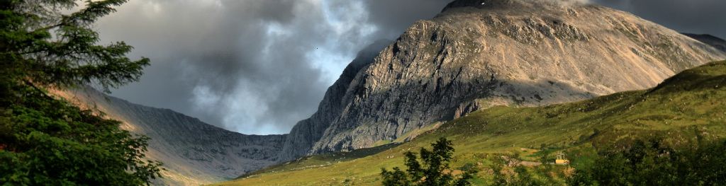
Including Ben Nevis, Glen Coe and the rest of Lochaber, Argyll including the Isles, Loch Lomond, Trossachs and Arran
For snow and avalanche hazard forecasts please visit Scottish Avalanche Information Service